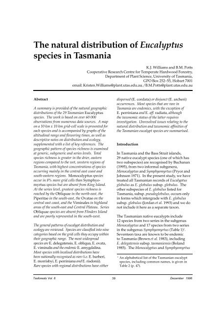
The natural distribution of Eucalyptus species in Tasmania - Forestry ...
The natural distribution of Eucalyptus species in Tasmania - Forestry ...
The natural distribution of Eucalyptus species in Tasmania - Forestry ...

You also want an ePaper? Increase the reach of your titles
YUMPU automatically turns print PDFs into web optimized ePapers that Google loves.
<strong>The</strong> <strong>natural</strong> <strong>distribution</strong> <strong>of</strong> <strong>Eucalyptus</strong><br />
<strong>species</strong> <strong>in</strong> <strong>Tasmania</strong><br />
K.J. Williams and B.M. Potts<br />
Cooperative Research Centre for Temperate Hardwood <strong>Forestry</strong>,<br />
Department <strong>of</strong> Plant Science, University <strong>of</strong> <strong>Tasmania</strong>,<br />
GPO Box 252–55, Hobart 7001<br />
email: Kristen.Williams@plant.utas.edu.au./B.M.Potts@plant.utas.edu.au<br />
Abstract<br />
A summary is provided <strong>of</strong> the <strong>natural</strong> geographic<br />
<strong>distribution</strong>s <strong>of</strong> the 29 <strong>Tasmania</strong>n <strong>Eucalyptus</strong><br />
<strong>species</strong>. <strong>The</strong> work is based on over 60 000<br />
observations from numerous data sources. A map<br />
on a 10 km x 10 km grid-cell scale is presented for<br />
each <strong>species</strong> and is accompanied by graphs <strong>of</strong> the<br />
altitud<strong>in</strong>al range and flower<strong>in</strong>g times, as well as<br />
descriptive notes on <strong>distribution</strong> and ecology,<br />
supplemented with a list <strong>of</strong> key references. <strong>The</strong><br />
geographic pattern <strong>of</strong> <strong>species</strong> richness is exam<strong>in</strong>ed<br />
at generic, subgeneric and series levels. Total<br />
<strong>species</strong> richness is greater <strong>in</strong> the drier, eastern<br />
regions compared to the wet, western regions <strong>of</strong><br />
<strong>Tasmania</strong>, with highest concentrations <strong>of</strong> <strong>species</strong><br />
occurr<strong>in</strong>g ma<strong>in</strong>ly <strong>in</strong> the central east coast and<br />
south-eastern regions. Monocalyptus <strong>species</strong><br />
occur <strong>in</strong> 8% more grid cells than Symphyomyrtus<br />
<strong>species</strong> but are absent from K<strong>in</strong>g Island.<br />
At the series level, greatest <strong>species</strong> richness is<br />
reached by the Obliquae <strong>in</strong> the north-east, the<br />
Piperitae <strong>in</strong> the south-east, the Ovatae on the<br />
central east coast, and the Vim<strong>in</strong>ales <strong>in</strong> highland<br />
areas <strong>of</strong> the south-east and Central Plateau. Series<br />
Obliquae <strong>species</strong> are absent from Fl<strong>in</strong>ders Island<br />
and are poorly represented <strong>in</strong> the south-west.<br />
<strong>The</strong> general patterns <strong>of</strong> eucalypt <strong>distribution</strong> and<br />
ecology are reviewed. Species are classified <strong>in</strong>to n<strong>in</strong>e<br />
categories based on the grid cells they occupy with<strong>in</strong><br />
their geographic range. <strong>The</strong> most widespread<br />
<strong>species</strong> are E. delegatensis, E. obliqua, E. ovata,<br />
E. vim<strong>in</strong>alis and the endemic E. amygdal<strong>in</strong>a.<br />
Most <strong>species</strong> with localised <strong>distribution</strong>s have<br />
been nationally recognised as rare (i.e. E. barberi,<br />
E. morrisbyi, E. perr<strong>in</strong>iana and E. risdonii).<br />
Rare <strong>species</strong> with regional <strong>distribution</strong>s have either<br />
dispersed (E. cordata) or disjunct (E. archeri)<br />
occurrences. Most <strong>species</strong> that are rare <strong>in</strong><br />
<strong>Tasmania</strong> are endemics, with the exception <strong>of</strong><br />
E. perr<strong>in</strong>iana and E. aff. radiata, although<br />
the taxonomic status <strong>of</strong> the latter requires<br />
<strong>in</strong>vestigation. Unresolved issues relat<strong>in</strong>g to the<br />
<strong>natural</strong> <strong>distribution</strong> and taxonomic aff<strong>in</strong>ities <strong>of</strong><br />
the <strong>Tasmania</strong>n eucalypt <strong>species</strong> are summarised.<br />
Introduction<br />
In <strong>Tasmania</strong> and the Bass Strait islands,<br />
29 native eucalypt <strong>species</strong> (one <strong>of</strong> which has<br />
two sub<strong>species</strong>) are recognised by Buchanan<br />
(1995), from two <strong>in</strong>formal subgenera,<br />
Monocalyptus and Symphyomyrtus (Pryor and<br />
Johnson 1971). In the present study, we have<br />
treated all <strong>Tasmania</strong>n records <strong>of</strong> <strong>Eucalyptus</strong><br />
globulus as E. globulus subsp. globulus. <strong>The</strong><br />
other sub<strong>species</strong> <strong>of</strong> E. globulus listed for<br />
<strong>Tasmania</strong>, subsp. pseudoglobulus, occurs only<br />
<strong>in</strong> forms which <strong>in</strong>tergrade with E. globulus<br />
subsp. globulus (Jordan et al. 1993) and we do<br />
not <strong>in</strong>clude it here as a separate taxon.<br />
<strong>The</strong> <strong>Tasmania</strong>n native eucalypts <strong>in</strong>clude<br />
12 <strong>species</strong> from two series <strong>in</strong> the subgenus<br />
Monocalyptus and 17 <strong>species</strong> from two series<br />
<strong>in</strong> the subgenus Symphyomyrtus (Table 1) 1 .<br />
Seventeen taxa are known to be endemic<br />
to <strong>Tasmania</strong> (Brown et al. 1983), <strong>in</strong>clud<strong>in</strong>g<br />
E. delegatensis subsp. tasmaniensis (Boland<br />
1985). <strong>The</strong> Monocalyptus and Symphyomyrtus<br />
1<br />
An alphabetical list <strong>of</strong> the <strong>Tasmania</strong>n eucalypt<br />
<strong>species</strong>, <strong>in</strong>clud<strong>in</strong>g common names, is given <strong>in</strong><br />
Table 2 (p. 47).<br />
Tasforests Vol. 8 39<br />
December 1996
Table 1. Taxonomic classification <strong>of</strong> the <strong>Tasmania</strong>n <strong>Eucalyptus</strong> <strong>species</strong> (after the <strong>in</strong>formal classification <strong>of</strong> Pryor and<br />
Johnson 1971). Authorities for nomenclature follow Chippendale (1988). Subgroup<strong>in</strong>gs <strong>of</strong> the series Vim<strong>in</strong>ales<br />
generally follow Jackson (1965) and Duncan (1989) except E. cordata which has closest aff<strong>in</strong>ities with the alp<strong>in</strong>e<br />
white gum subgroup (Pryor and Johnson 1971). Common names for series groups follow Duncan (1989; see also<br />
Jackson 1965). <strong>Eucalyptus</strong> globulus subsp. globulus <strong>in</strong>cludes forms which <strong>in</strong>tergrade morphologically with the<br />
ma<strong>in</strong>land taxon E. globulus subsp. pseudoglobulus (Jordan et al. 1993). (* = <strong>Tasmania</strong>n endemic)<br />
SUBGENUS Monocalyptus<br />
Series Obliquae (Ash Group)<br />
* E. delegatensis R.T. Baker subsp. tasmaniensis Boland<br />
E. obliqua L’Hér.<br />
E. pauciflora Sieber ex Sprengel subsp. pauciflora<br />
E. regnans F. Muell.<br />
E. sieberi L. Johnson<br />
Series Piperitae (Pepperm<strong>in</strong>t Group)<br />
* E. amygdal<strong>in</strong>a Labill.<br />
* E. coccifera J.D. Hook.<br />
* E. nitida J.D. Hook.<br />
* E. pulchella Desf.<br />
E. aff. radiata Sieber ex DC.<br />
* E. risdonii J.D. Hook.<br />
* E. tenuiramis Miq.<br />
SUBGENUS Symphyomyrtus<br />
Series Ovatae (Black Gum Group)<br />
* E. barberi L. Johnson & Blaxell<br />
E. brookeriana A.M. Gray<br />
E. ovata Labill.<br />
* E. rodwayi R. Baker & H.G. Smith<br />
Series Vim<strong>in</strong>ales (White Gum Group)<br />
White gum subgroup<br />
E. dalrympleana Maiden subsp. dalrympleana<br />
E. rubida Deane & Maiden<br />
E. vim<strong>in</strong>alis Labill. subsp. vim<strong>in</strong>alis<br />
Yellow gum subgroup<br />
* E. johnstonii Maiden<br />
* E. subcrenulata Maiden & Blakely<br />
* E. vernicosa J.D. Hook.<br />
Blue gum subgroup<br />
E. globulus Labill. subsp. globulus<br />
Alp<strong>in</strong>e white gum subgroup<br />
* E. archeri Maiden & Blakely<br />
* E. cordata Labill.<br />
* E. gunnii J.D. Hook.<br />
* E. morrisbyi Brett<br />
E. perr<strong>in</strong>iana F. Muell.<br />
* E. urnigera J.D. Hook.<br />
subgenera are reproductively isolated (Ellis<br />
et al. 1991) but, with<strong>in</strong> subgenera, extensive<br />
hybridisation and <strong>in</strong>tergradation may occur<br />
(Griff<strong>in</strong> et al. 1988). Recognised cases <strong>of</strong><br />
hybridisation and cl<strong>in</strong>al variation amongst<br />
the <strong>Tasmania</strong>n eucalypts are summarised<br />
by Duncan (1989; Figure 1). A field key for<br />
the identification <strong>of</strong> <strong>Tasmania</strong>n eucalypts,<br />
which caters for the complex variation<br />
with<strong>in</strong> and between <strong>species</strong>, is given by<br />
Duncan (1996).<br />
This atlas <strong>of</strong> the <strong>natural</strong> geographic and<br />
altitud<strong>in</strong>al <strong>distribution</strong> <strong>of</strong> the <strong>Tasmania</strong>n<br />
<strong>Eucalyptus</strong> <strong>species</strong> is a compendium <strong>of</strong><br />
annotated maps on a 10 km x 10 km grid-cell<br />
scale, collated from diverse <strong>in</strong>formation<br />
sources. Mapp<strong>in</strong>g has been the first stage<br />
<strong>in</strong> screen<strong>in</strong>g for errors <strong>in</strong> a database that will<br />
ultimately be used for predictive analyses,<br />
contribute to land management decisions and<br />
assist ecological research. <strong>The</strong> ma<strong>in</strong> impetus<br />
for publish<strong>in</strong>g these <strong>distribution</strong>al data is to<br />
Tasforests Vol. 8 40<br />
December 1996
Figure 1. Species <strong>of</strong> <strong>Eucalyptus</strong> native to <strong>Tasmania</strong>, show<strong>in</strong>g <strong>species</strong> which form cl<strong>in</strong>es and <strong>natural</strong> hybrids. Hybrids<br />
only occur with<strong>in</strong> subgenera. For each <strong>species</strong>, follow horizontal and vertical axes. For example, E. barberi is known<br />
to hybridise with E. brookeriana and E. ovata (horizontal axis) and possibly with E. globulus, E. gunnii and<br />
E. cordata (vertical axis). † E. delegatensis is represented <strong>in</strong> <strong>Tasmania</strong> by an endemic sub<strong>species</strong>. (Figure adapted<br />
from Duncan 1989)<br />
quantify current knowledge, to stimulate the<br />
collection <strong>of</strong> herbarium voucher specimens<br />
from new localities, and to encourage the<br />
verification <strong>of</strong> outliers. It is important to<br />
clarify the <strong>natural</strong> <strong>distribution</strong> <strong>of</strong> <strong>Eucalyptus</strong><br />
<strong>species</strong> <strong>in</strong> <strong>Tasmania</strong> as land clear<strong>in</strong>g and<br />
plant<strong>in</strong>gs for ornamental and forestry<br />
purposes will eventually confuse <strong>natural</strong> and<br />
artificial occurrences. <strong>The</strong> maps and graphs<br />
presented should allow clear assessment <strong>of</strong><br />
whether an occurrence is novel and represents<br />
an extension <strong>of</strong> the geographic or altitude<br />
range <strong>of</strong> a <strong>species</strong>, or whether it represents a<br />
poorly verified or well-known location.<br />
Previously published data on eucalypts<br />
Several previous studies have published<br />
maps <strong>of</strong> eucalypt <strong>distribution</strong>s at the level<br />
<strong>of</strong> <strong>species</strong> or vegetation type. <strong>The</strong> maps <strong>of</strong><br />
Jackson (1965) are still the ma<strong>in</strong> overall source<br />
<strong>of</strong> <strong>in</strong>formation on the <strong>distribution</strong> <strong>of</strong> eucalypt<br />
<strong>species</strong> <strong>in</strong> <strong>Tasmania</strong> (e.g. Davidson et al. 1981;<br />
Forest Resources 1995). Other publications<br />
such as Boland et al. (1984) and Chippendale<br />
(1988) <strong>in</strong>clude broad-scale maps <strong>of</strong> <strong>Tasmania</strong>n<br />
eucalypt <strong>species</strong> <strong>in</strong> the context <strong>of</strong> Australiawide<br />
eucalypt occurrences. Local texts such<br />
as Kirkpatrick and Backhouse (1985) and the<br />
atlas <strong>of</strong> <strong>Tasmania</strong>n endemics (Brown et al.<br />
1983) <strong>in</strong>clude eucalypts <strong>in</strong> the context <strong>of</strong> other<br />
<strong>Tasmania</strong>n plant <strong>species</strong>. Mapp<strong>in</strong>g at higher<br />
resolutions, such as the 1:500 000 <strong>distribution</strong><br />
maps <strong>of</strong> vegetation types (Kirkpatrick and<br />
Dick<strong>in</strong>son 1984), tall eucalypt forest types<br />
(<strong>Forestry</strong> Commission 1988), and the specific<br />
studies <strong>of</strong> wet and dry eucalypt forests by<br />
Wells (1989) and Williams (1989) display the<br />
predom<strong>in</strong>ance <strong>of</strong> eucalypts <strong>in</strong> the landscape<br />
(cf. Pryor and Johnson 1981). Regional and<br />
Tasforests Vol. 8 41<br />
December 1996
local vegetation mapp<strong>in</strong>g has also contributed<br />
significantly to our knowledge <strong>of</strong> eucalypt<br />
occurrences. For example, Brown and Bayly-<br />
Stark (1979a) mapped the vegetation <strong>of</strong> Maria<br />
Island, Duncan (1983) mapped communities<br />
<strong>in</strong> the Douglas River region, Brown and<br />
Duncan (1989) mapped the vegetation <strong>of</strong><br />
Tasman Pen<strong>in</strong>sula, Fensham (1989)<br />
reconstructed the vegetation patterns for<br />
the Midlands from extant and remnant<br />
community <strong>distribution</strong>s, and Kirkpatrick and<br />
Balmer (1991) mapped the northern portion <strong>of</strong><br />
the Cradle Mounta<strong>in</strong> – Lake St Clair National<br />
Park (see also Corbett and Mackie 1994).<br />
Geo-coded flora <strong>in</strong>ventory surveys with<br />
well-designed sampl<strong>in</strong>g strategies provide<br />
a last<strong>in</strong>g contribution to our knowledge <strong>of</strong><br />
the <strong>distribution</strong> patterns <strong>of</strong> eucalypts. Such<br />
<strong>in</strong>ventories <strong>in</strong>clude, for example, the broadscale<br />
vegetation surveys <strong>of</strong> heathlands<br />
(Kirkpatrick 1977), dry sclerophyll forests<br />
(Duncan and Brown 1985), grassy woodlands<br />
(Kirkpatrick and Duncan 1987; Kirkpatrick<br />
et al. 1988a), wet eucalypt forests (Neyland<br />
1986; Kirkpatrick et al. 1988b), swamp forests<br />
(Pannell 1992), ra<strong>in</strong>forest (Jarman et al. 1984,<br />
1991), riparian vegetation (Askey-Doran<br />
1993), buttongrass moorlands (Jarman et al.<br />
1988), and alp<strong>in</strong>e vegetation (e.g. Kirkpatrick<br />
1980, 1984a, b; Kirkpatrick and Harwood<br />
1980; Kirkpatrick and Wh<strong>in</strong>am 1988). Other<br />
purpose-specific flora <strong>in</strong>ventory surveys<br />
encompass many local areas <strong>in</strong> particular<br />
regions throughout <strong>Tasmania</strong>; for example,<br />
the non-allocated Crown land surveys (e.g.<br />
Duncan 1986; Neyland 1988a, b; Neyland and<br />
Duncan 1988a, b; Slater 1988; Cullen 1990;<br />
Mendel 1991), the land system surveys (Richley<br />
1978, 1984; P<strong>in</strong>kard 1980; P<strong>in</strong>kard and Richley<br />
1984; Pemberton 1986, 1991; Davies 1988), and<br />
the numerous unpublished environmental<br />
impact and <strong>in</strong>vestigation surveys <strong>of</strong> Crown and<br />
private land areas by management agencies<br />
such as <strong>Forestry</strong> <strong>Tasmania</strong>, the Department<br />
<strong>of</strong> Environment and Land Management,<br />
the Department <strong>of</strong> Primary Industry and<br />
Fisheries, Works <strong>Tasmania</strong>, and local councils.<br />
For reasons <strong>of</strong> <strong>in</strong>herent <strong>in</strong>terest, or for<br />
management-orientated research and academic<br />
study, many <strong>in</strong>dividuals have also under-<br />
Photo 1. <strong>The</strong> first <strong>distribution</strong> maps <strong>of</strong> <strong>Tasmania</strong>n eucalypts were published by Pr<strong>of</strong>. W.D. Jackson (right)<br />
<strong>in</strong> 1965. He is shown with Pr<strong>of</strong>. L.D. Pryor exam<strong>in</strong><strong>in</strong>g a specimen <strong>of</strong> E. globulus.<br />
Tasforests Vol. 8 42<br />
December 1996
taken flora surveys <strong>of</strong> local land areas such<br />
as the Rheban Spit (Bowden and Kirkpatrick<br />
1974), Cape Raoul (Kirkpatrick 1975c), Mount<br />
Well<strong>in</strong>gton Range (Ratkowsky and Ratkowsky<br />
1976, 1977, 1982), East Risdon Nature Reserve<br />
(Brown and Bayly-Stark 1979b), Hellfire<br />
Bluff (Harris and Brown 1980), Rocka Rivulet<br />
(Duncan et al. 1981), Cherry Tree Hill (Duncan<br />
and Duncan 1984), Ben Lomond National Park<br />
(Davies and Davies 1989), Table Cape (Willis<br />
1991) and Hummocky Hills (Ratkowsky et al.<br />
1993c). Details <strong>of</strong> the <strong>distribution</strong> <strong>of</strong> some<br />
<strong>species</strong> have become known follow<strong>in</strong>g studies<br />
<strong>of</strong> the genetic structure <strong>of</strong> populations such as<br />
E. barberi (McEntee et al. 1994), E. cordata (Potts<br />
1989), E. globulus (Kirkpatrick 1974, 1975b;<br />
Jordan et al. 1993, 1994), E. gunnii and<br />
E. archeri (Potts 1985; Potts and Reid 1985a, b),<br />
E. morrisbyi (Wiltshire et al. 1991b), E. perr<strong>in</strong>iana<br />
(Wiltshire and Reid 1987), E. risdonii and<br />
E. tenuiramis (Wiltshire et al. 1991a, 1992) and<br />
E. vernicosa, E. subcrenulata and E. johnstonii<br />
(Jackson 1960). Information on <strong>distribution</strong>s<br />
has also been derived from ecological studies<br />
such as those on <strong>in</strong>teractive effects <strong>of</strong> drought,<br />
frost and waterlogg<strong>in</strong>g (e.g. Davidson and Reid<br />
1985, 1987, 1989), <strong>in</strong>solation (e.g. Kirkpatrick<br />
and Nunez 1980), fire regime (e.g. Neyland<br />
and Askey-Doran 1994), and the nature <strong>of</strong> an<br />
<strong>in</strong>verted tree-l<strong>in</strong>e (e.g. Gilfedder 1988).<br />
Collectively, these diverse studies have<br />
assisted <strong>in</strong> formulat<strong>in</strong>g the conservation<br />
status <strong>of</strong> <strong>in</strong>dividual <strong>species</strong> (e.g. Brown et al.<br />
1983; Briggs and Leigh 1988; Kirkpatrick et al.<br />
1991a, b) and communities (e.g. Kirkpatrick<br />
et al. 1994), enabl<strong>in</strong>g priorities to be identified<br />
for management and research (e.g. Wiltshire<br />
et al. 1989). Collation <strong>of</strong> the <strong>distribution</strong><br />
<strong>in</strong>formation from these and other studies<br />
is summarised here for eucalypts.<br />
Methods<br />
Species nomenclature<br />
Sub<strong>species</strong> have been abbreviated to their<br />
<strong>species</strong> name wherever appropriate, provid<strong>in</strong>g<br />
this leads to no ambiguity <strong>in</strong> a <strong>Tasmania</strong>n<br />
context, and no loss <strong>of</strong> clarity <strong>in</strong> the discussion.<br />
Data collation<br />
A generalised 10 km x 10 km map scale,<br />
correspond<strong>in</strong>g to the Australian Map Grid<br />
(AMG) system, has been widely used <strong>in</strong><br />
<strong>Tasmania</strong> for present<strong>in</strong>g the <strong>distribution</strong>s <strong>of</strong><br />
native plant and animal communities or taxa<br />
(e.g. Thomas 1979; Brook 1979; Brown et al.<br />
1983; Kirkpatrick et al. 1988a, b). <strong>The</strong> eucalypt<br />
<strong>distribution</strong> maps are based on over 60 000<br />
records collated from the published literature<br />
(7%), unpublished reports (7%) and exist<strong>in</strong>g<br />
databases (86%), where these could at least<br />
be located with<strong>in</strong> a 10 km x 10 km grid cell.<br />
Literature from which records were derived<br />
is <strong>in</strong>dicated <strong>in</strong> the Bibliography (see p. 150).<br />
<strong>The</strong> exist<strong>in</strong>g databases were contributed by<br />
<strong>Forestry</strong> <strong>Tasmania</strong> (CFI, Lawrence 1978;<br />
floristic data, Orr and Manson 1994), the<br />
<strong>Tasmania</strong>n Department <strong>of</strong> Environment and<br />
Land Management (TASPAWS/TASFORHAB<br />
databases, Peters 1983), and CSIRO Division<br />
<strong>of</strong> Plant Industry (EUCALIST, Chippendale<br />
and Wolf 1984). Extensive <strong>distribution</strong><br />
data held <strong>in</strong> collections at the <strong>Tasmania</strong>n<br />
Herbarium were accessed via EUCALIST<br />
prior to 1984, or directly from the Herbarium<br />
for later collect<strong>in</strong>g dates. <strong>The</strong> unpublished<br />
reports <strong>of</strong> <strong>Forestry</strong> <strong>Tasmania</strong> were derived<br />
largely from the botanical surveys <strong>of</strong> Forest<br />
Reserves, Recommended Areas for Protection<br />
(RAPs) and forest coupes prior to logg<strong>in</strong>g.<br />
<strong>The</strong> unpublished reports <strong>of</strong> the Department<br />
<strong>of</strong> Environment and Land Management<br />
comprised <strong>in</strong>vestigation surveys and specific<br />
research projects. Other unpublished records<br />
were generously provided by <strong>in</strong>dividuals<br />
<strong>of</strong> these Government agencies and the<br />
University <strong>of</strong> <strong>Tasmania</strong>, or unaffiliated<br />
field botanists. <strong>The</strong> published literature<br />
was generally derived from <strong>Tasmania</strong>n and<br />
Australian journals on botany, forestry and<br />
ecology, and locally produced reports.<br />
Data verification<br />
A conservative approach to data verification<br />
was undertaken to encourage the future<br />
accurate location <strong>of</strong> suspect records. Draft<br />
maps <strong>of</strong> the <strong>distribution</strong> <strong>of</strong> each <strong>species</strong> were<br />
reviewed for obvious errors, outliers and<br />
Tasforests Vol. 8 43<br />
December 1996
s<strong>in</strong>gle records <strong>in</strong> a grid cell on the marg<strong>in</strong>s <strong>of</strong><br />
a <strong>distribution</strong>. Such occurrences that were<br />
considered possible, albeit unlikely, were<br />
usually deleted from the <strong>distribution</strong> maps<br />
and discussed <strong>in</strong> the text for each <strong>species</strong> as<br />
unverified outliers. Particular attention was<br />
also paid to <strong>in</strong>consistencies with the orig<strong>in</strong>al<br />
maps <strong>of</strong> Jackson (1965) and locations <strong>in</strong><br />
Brown et al. (1983) which were unverified.<br />
Collated occurrences which were clearly <strong>in</strong><br />
error were omitted from the maps. <strong>The</strong>se<br />
errors <strong>in</strong>cluded clear misidentifications for<br />
historic or accidental reasons and mis-read<br />
or mis-typed grid references. In some cases,<br />
errors arose <strong>in</strong> conversion <strong>of</strong> locations from<br />
m<strong>in</strong>utes <strong>of</strong> latitude and longitude to AMG.<br />
<strong>The</strong> conversion frequently placed the record <strong>in</strong><br />
an adjacent and <strong>in</strong>correct 10 km x 10 km grid<br />
cell. For example, records <strong>of</strong> E. coccifera with<br />
a location given as 'Herr<strong>in</strong>gback' appeared <strong>in</strong><br />
grid cell 5023 follow<strong>in</strong>g conversion <strong>of</strong> latitude<br />
and longitude to AMG, but the location<br />
actually refers to cell 5123. In other cases,<br />
earlier collectors, <strong>in</strong> the absence <strong>of</strong> accurate<br />
maps, gave descriptions with reference to the<br />
nearest landmarks and named places which,<br />
when converted to latitude and longitude,<br />
lead to some spurious locations due to the<br />
existence <strong>of</strong> several places by the same name<br />
or the same place by different names. For<br />
example, Mount Well<strong>in</strong>gton <strong>in</strong> southern<br />
<strong>Tasmania</strong> was referred to previously as<br />
Plateau Mounta<strong>in</strong> or Table Mounta<strong>in</strong>, and<br />
when Robert Brown collected E. globulus <strong>in</strong><br />
1804 from the 'Derwent River Table' or 'Table<br />
Mounta<strong>in</strong>', it was <strong>in</strong>correctly attributed to<br />
Table Mounta<strong>in</strong> <strong>in</strong> the Midlands. Other causes<br />
<strong>of</strong> error are outdated nomenclature <strong>in</strong> some<br />
<strong>species</strong> or the difficulties <strong>of</strong> dist<strong>in</strong>guish<strong>in</strong>g<br />
morphologically similar <strong>species</strong> and their<br />
<strong>in</strong>tergrad<strong>in</strong>g forms. For example, the f<strong>in</strong>eleaved<br />
pepperm<strong>in</strong>ts E. amygdal<strong>in</strong>a and<br />
E. nitida may appear superficially similar when<br />
adult leaves, fruits and buds are compared,<br />
but are more readily dist<strong>in</strong>guished on bark<br />
and habitat. In the case <strong>of</strong> their <strong>in</strong>tergrad<strong>in</strong>g<br />
forms, the nam<strong>in</strong>g preferences <strong>of</strong> different<br />
recorders are expressed. Overlapp<strong>in</strong>g<br />
nomenclature is particularly apparent for<br />
data collated from numerous sources.<br />
Some other <strong>in</strong>advertent errors have arisen<br />
<strong>in</strong> the database follow<strong>in</strong>g the collation <strong>of</strong><br />
published <strong>distribution</strong>s where these are based<br />
upon floristic classifications and summarised<br />
data (e.g. Kirkpatrick et al. 1988a, b; Askey-<br />
Doran 1993). In such cases, the community<br />
nomenclature which is frequently derived<br />
from the dom<strong>in</strong>ant tree <strong>species</strong> and<br />
vegetation type does not necessarily reflect<br />
a verifiable presence for that <strong>species</strong>.<br />
Errors <strong>of</strong> these types <strong>in</strong> the <strong>distribution</strong> data<br />
accounted for approximately 5% <strong>of</strong> the <strong>in</strong>itial<br />
63 567 records, leav<strong>in</strong>g 60 412 records<br />
available for mapp<strong>in</strong>g 2 .<br />
Sampl<strong>in</strong>g bias due to duplicated and<br />
replicated data may have masked some records<br />
that would otherwise have been reviewed<br />
for potential error. For example, duplication<br />
<strong>in</strong> the data arises where field records <strong>of</strong><br />
some collectors have been used <strong>in</strong> several<br />
publications, collated <strong>in</strong> several databases,<br />
and voucher specimens simultaneously<br />
lodged with different herbaria, giv<strong>in</strong>g a<br />
perception <strong>of</strong> several separate sources.<br />
Intensive sampl<strong>in</strong>g <strong>in</strong> some locations relative<br />
to others (replication) may also contribute to<br />
enhanced perceptions <strong>of</strong> record validity. <strong>The</strong><br />
degree <strong>of</strong> multiple occurrences <strong>of</strong> data or<br />
sources <strong>in</strong> each 10 km x 10 km grid cell results<br />
<strong>in</strong> considerable redundancy at this scale. <strong>The</strong><br />
raw data have a redundancy <strong>of</strong> approximately<br />
75% and the sources themselves have a<br />
redundancy <strong>of</strong> approximately 40%. To overcome<br />
some <strong>of</strong> these problems <strong>of</strong> sampl<strong>in</strong>g<br />
bias, an <strong>in</strong>dication is provided for each grid<br />
cell <strong>of</strong> the the number <strong>of</strong> separate sources<br />
record<strong>in</strong>g the presence <strong>of</strong> a <strong>species</strong>. It was felt<br />
that display<strong>in</strong>g separate sources, rather than<br />
the number <strong>of</strong> records per cell gave a better<br />
<strong>in</strong>dication <strong>of</strong> <strong>in</strong>dependent identifications and<br />
thus the reliability <strong>of</strong> the presence <strong>of</strong> a <strong>species</strong>.<br />
In the context <strong>of</strong> the number <strong>of</strong> sources per<br />
grid cell per <strong>species</strong>, the overall rate <strong>of</strong><br />
2<br />
In the ORACLE database 'EUCDATA' at the<br />
University <strong>of</strong> <strong>Tasmania</strong>, all data up to 'INDEX –<br />
NUM = 63 672' have been used <strong>in</strong> this atlas <strong>of</strong><br />
<strong>distribution</strong>s.<br />
Tasforests Vol. 8 44<br />
December 1996
obvious error and unverified observations<br />
accounts for approximately 14% <strong>of</strong> the <strong>in</strong>itial<br />
16 523 observations from the condensed<br />
set <strong>of</strong> data, leav<strong>in</strong>g 14 185 <strong>in</strong>dependent<br />
identifications available for mapp<strong>in</strong>g. <strong>The</strong><br />
verified data are derived from 441 different<br />
sources and the unverified data derive from<br />
89 sources. Together, the data comprise 455<br />
dist<strong>in</strong>ct sources.<br />
Altitude occurrences and flower<strong>in</strong>g time<br />
Altitude occurrences <strong>in</strong> 100 m classes and<br />
monthly flower<strong>in</strong>g <strong>in</strong>cidence for each <strong>species</strong><br />
accompany the <strong>distribution</strong> maps. <strong>The</strong><br />
altitude data were collated with <strong>distribution</strong><br />
records. Obvious errors <strong>in</strong> the altitude records<br />
were screened by consider<strong>in</strong>g outliers <strong>in</strong> the<br />
context <strong>of</strong> the predom<strong>in</strong>ant habitat for each<br />
<strong>species</strong> and the upper and lower limits <strong>of</strong> the<br />
particular response curve. Sampl<strong>in</strong>g bias<br />
among the altitude records for each <strong>species</strong><br />
was reduced by comb<strong>in</strong><strong>in</strong>g, <strong>in</strong>to a s<strong>in</strong>gle<br />
observation, replicates from the same grid cell<br />
which differed by less than 10 m. This left<br />
20 169 records for def<strong>in</strong><strong>in</strong>g the response curves.<br />
<strong>The</strong> flower<strong>in</strong>g-time records were separately<br />
collated from EUCALIST (Chippendale and<br />
Wolf 1984), with additional records from the<br />
<strong>Tasmania</strong>n Herbarium (up to 1992), field notes<br />
(BMP) and published data (E. gunnii Potts<br />
and Reid 1985a, b; E. urnigera Savva et al.<br />
1988; E. cordata Potts 1989). Flower<strong>in</strong>g times<br />
are given for a 15-month period start<strong>in</strong>g from<br />
May (autumn) to produce an optimal display<br />
<strong>of</strong> the response curves for most <strong>species</strong>. In<br />
several cases, the flower<strong>in</strong>g <strong>in</strong>formation will<br />
be biased by extensive records from specific<br />
studies, <strong>in</strong>volv<strong>in</strong>g specific years or specific<br />
localities or, conversely, by <strong>in</strong>adequate data.<br />
Response curves for flower<strong>in</strong>g times are<br />
def<strong>in</strong>ed by a mov<strong>in</strong>g average (summed<br />
weights <strong>of</strong> 0.5 to the observation and 0.25 to<br />
each adjacent record), where each observation<br />
represents the middle <strong>of</strong> the respective<br />
month. Absence data were not available for<br />
either flower<strong>in</strong>g times or altitude responses.<br />
Thus, the documented responses (see relevant<br />
Figures on pp. 49–121) are conditional<br />
probabilities which reflect the <strong>distribution</strong><br />
<strong>of</strong> occurrences <strong>in</strong> the specified classes.<br />
Distribution types and conservation status<br />
<strong>The</strong> collated data were used to explore<br />
some attributes <strong>of</strong> <strong>species</strong>' <strong>distribution</strong>s (see<br />
Rab<strong>in</strong>owitz 1981). <strong>The</strong> geographic range <strong>of</strong><br />
each <strong>species</strong> with<strong>in</strong> <strong>Tasmania</strong> was estimated<br />
by connect<strong>in</strong>g occupied grid cells from the<br />
outer marg<strong>in</strong>al extremes <strong>of</strong> a core <strong>distribution</strong>,<br />
or from the coast, to outliers by straight l<strong>in</strong>es<br />
and <strong>in</strong>terpolat<strong>in</strong>g the number <strong>of</strong> cells with<strong>in</strong><br />
the result<strong>in</strong>g envelope (e.g. see 'extent' <strong>in</strong><br />
Gaston 1996). <strong>The</strong> aggregation <strong>of</strong> <strong>species</strong><br />
occurrences with<strong>in</strong> their range was estimated<br />
as a percentage <strong>of</strong> the occupied grid cells and<br />
the geographic range. <strong>The</strong> cont<strong>in</strong>uous<br />
variation <strong>in</strong> the <strong>distribution</strong> <strong>of</strong> the <strong>Tasmania</strong>n<br />
eucalypts is categorised <strong>in</strong>to n<strong>in</strong>e types based<br />
on the geographic range and aggregation <strong>of</strong><br />
occurrences for each <strong>species</strong>.<br />
Distribution maps, habitat descriptions and<br />
community classifications<br />
Distribution, altitude pr<strong>of</strong>iles and flower<strong>in</strong>g<br />
times for the 29 eucalypt <strong>species</strong>, <strong>in</strong><br />
alphabetical order, are given <strong>in</strong> the follow<strong>in</strong>g<br />
atlas <strong>of</strong> maps and figures. <strong>The</strong> presence <strong>of</strong><br />
a <strong>species</strong> <strong>in</strong> a grid cell is represented by a<br />
dot, the size <strong>of</strong> which reflects the number <strong>of</strong><br />
separate sources record<strong>in</strong>g a presence (Legend,<br />
p. 47). <strong>The</strong> annotated text summarises<br />
<strong>distribution</strong>, taxonomic aff<strong>in</strong>ities and ecology<br />
for each <strong>species</strong>. Specific occurrences and<br />
outliers <strong>of</strong> particular note are discussed, <strong>of</strong>ten<br />
<strong>in</strong> the context <strong>of</strong> cl<strong>in</strong>al <strong>in</strong>tergradation and<br />
hybridisation. Taxonomic notes were derived<br />
from Boland et al. (1984), Chippendale (1988)<br />
and Curtis and Morris (1975), as well as from<br />
specific studies referenced <strong>in</strong> each case.<br />
Similarly, broad habitat and community<br />
descriptions were <strong>in</strong>tegrated with assistance<br />
from the floristic classifications <strong>of</strong> dry<br />
sclerophyll forest (Duncan and Brown 1985),<br />
grassy woodlands (Kirkpatrick et al. 1988a),<br />
and wet eucalypt forest (Kirkpatrick et al.<br />
1988b), and the habitat descriptions given<br />
<strong>in</strong> Davidson et al. (1981). To avoid excessive<br />
repetition, these sources are generally not<br />
Tasforests Vol. 8 45<br />
December 1996
cited <strong>in</strong> the annotated text for each <strong>species</strong>.<br />
Other specific sources used are <strong>in</strong>dicated <strong>in</strong><br />
the text for each <strong>species</strong>. Key references on<br />
the biology <strong>of</strong> a particular <strong>species</strong> are listed<br />
<strong>in</strong> alphabetical order. Locations mentioned<br />
when comment<strong>in</strong>g on the <strong>distribution</strong> <strong>of</strong> a<br />
<strong>species</strong> are referenced to 10 km x 10 km<br />
grid cells which are directly related to the<br />
<strong>Tasmania</strong>n TASMAP series (Department <strong>of</strong><br />
Environment and Land Management).<br />
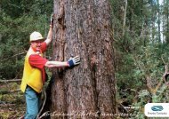
Photo 2. Very tall specimens <strong>of</strong> E. vim<strong>in</strong>alis, exceed<strong>in</strong>g 85 m <strong>in</strong> height and known as the 'White Knights',<br />
occur <strong>in</strong> wet forest at Evercreech <strong>in</strong> the F<strong>in</strong>gal Valley.<br />
Tasforests Vol. 8 46<br />
December 1996
Atlas <strong>of</strong> <strong>distribution</strong>s <strong>of</strong> <strong>Tasmania</strong>n eucalypts<br />
Legend to <strong>distribution</strong> maps: Dot size reflects the number <strong>of</strong> separate sources record<strong>in</strong>g<br />
presence <strong>in</strong> a grid cell (see p. 45). = 1, 2 = 3–5 = > 5<br />
Table 2. Index to <strong>species</strong> <strong>in</strong> the atlas <strong>of</strong> <strong>Tasmania</strong>n eucalypts. Common names for <strong>species</strong> mostly follow, or are based<br />
on,Curtis and Morris (1975).Those <strong>of</strong>E. archeri and E. brookeriana are taken from Boland et al. (1984), and<br />
E. aff. radiata has unclarified taxonomic aff<strong>in</strong>ities <strong>in</strong> <strong>Tasmania</strong>. In a few cases, common names have been changed to<br />
more accurately reflect relationships between <strong>species</strong> at the level <strong>of</strong> the ash, pepperm<strong>in</strong>t or gum groups. Where this has<br />
occurred, old common names are shown <strong>in</strong> brackets.<br />
Species Common name <strong>in</strong> <strong>Tasmania</strong> page<br />
E. amygdal<strong>in</strong>a black pepperm<strong>in</strong>t 48<br />
E. archeri Archer's gum, alp<strong>in</strong>e cider gum 51<br />
E. barberi Barber's gum 53<br />
E. brookeriana Brooker's gum 55<br />
E. coccifera snow pepperm<strong>in</strong>t (snow gum) 58<br />
E. cordata heart-leaved silver gum 61<br />
E. dalrympleana subsp. dalrympleana mounta<strong>in</strong> white gum 64<br />
E. delegatensis subsp. tasmaniensis gum-topped str<strong>in</strong>gy bark, white-top 66<br />
E. globulus subsp. globulus blue gum 69<br />
E. gunnii cider gum 72<br />
E. johnstonii yellow gum 75<br />
E. morrisbyi Morrisby's gum 77<br />
E. nitida Smithton pepperm<strong>in</strong>t 79<br />
E. obliqua str<strong>in</strong>gy bark, brown-top 82<br />
E. ovata swamp gum, black gum 85<br />
E. pauciflora subsp. pauciflora cabbage ash, weep<strong>in</strong>g ash (cabbage gum, weep<strong>in</strong>g gum) 88<br />
E. perr<strong>in</strong>iana sp<strong>in</strong>n<strong>in</strong>g gum 91<br />
E. pulchella white pepperm<strong>in</strong>t 93<br />
E. aff. radiata 96<br />
E. regnans giant ash (swamp gum) 99<br />
E. risdonii Risdon pepperm<strong>in</strong>t 102<br />
E. rodwayi black swamp gum (swamp pepperm<strong>in</strong>t) 104<br />
E. rubida candlebark 106<br />
E. sieberi ironbark 108<br />
E. subcrenulata alp<strong>in</strong>e yellow gum 110<br />
E. tenuiramis silver pepperm<strong>in</strong>t 112<br />
E. urnigera urn gum 115<br />
E. vernicosa varnished gum 118<br />
E. vim<strong>in</strong>alis subsp. vim<strong>in</strong>alis white gum, manna gum 120<br />
New records<br />
<strong>The</strong> authors welcome new locations for <strong>Tasmania</strong>n eucalypts, and <strong>in</strong>formation on the unverified or<br />
doubtful records discussed <strong>in</strong> this atlas. All records should be <strong>in</strong> writ<strong>in</strong>g, stat<strong>in</strong>g location <strong>of</strong> the plant,<br />
date <strong>of</strong> observation/collection, and name <strong>of</strong> the collector and/or person provid<strong>in</strong>g the <strong>in</strong>formation. It is<br />
important that range extensions (geographic or altitud<strong>in</strong>al) are supported by the collection <strong>of</strong> herbarium<br />
material (provid<strong>in</strong>g it causes m<strong>in</strong>imal damage to the plant), s<strong>in</strong>ce voucher specimens provide the best level<br />
<strong>of</strong> verification <strong>of</strong> a <strong>species</strong> (see Duncan 1996, this volume).<br />
Tasforests Vol. 8 47<br />
December 1996
<strong>Eucalyptus</strong> amygdal<strong>in</strong>a<br />
SUBGENUS: Monocalyptus<br />
SERIES: Piperitae<br />
Common name:<br />
black pepperm<strong>in</strong>t<br />
Figure 2. Distribution <strong>of</strong><br />
E. amygdal<strong>in</strong>a <strong>in</strong> <strong>Tasmania</strong>.<br />
<strong>Eucalyptus</strong> amygdal<strong>in</strong>a is a widespread and<br />
common endemic <strong>species</strong> <strong>of</strong> eastern coastal<br />
regions and <strong>in</strong>land tiers and plateaux<br />
(Figure 2). It occurs on undulat<strong>in</strong>g or steep<br />
terra<strong>in</strong> across a wide range <strong>of</strong> substrates that<br />
are generally <strong>in</strong>fertile, comparatively sunny<br />
and periodically drought prone. It is<br />
generally absent from the wetter regions <strong>of</strong><br />
western <strong>Tasmania</strong>, and the upland regions<br />
<strong>of</strong> the Central Plateau and north-east. It<br />
<strong>in</strong>tergrades with E. nitida <strong>in</strong> the north-western<br />
coastal region and towards the south-west<br />
along the western marg<strong>in</strong>s <strong>of</strong> its <strong>distribution</strong>,<br />
and with E. pulchella towards the east coast<br />
and throughout the Eastern Tiers on dolerite<br />
substrates.<br />
<strong>Eucalyptus</strong> amygdal<strong>in</strong>a is predom<strong>in</strong>antly a<br />
lowland <strong>species</strong>, generally occurr<strong>in</strong>g from<br />
near sea-level to 600 m but occasionally up<br />
to 800 m, with rare, scattered occurrences<br />
up to 1020 m (Figure 3). <strong>The</strong> higher altitude<br />
occurrences are known from the Eastern<br />
Tiers near Snow Hill and Mount Foster, and<br />
from the south-eastern Central Plateau and<br />
Western Tiers. Its ma<strong>in</strong> flower<strong>in</strong>g period is<br />
Tasforests Vol. 8 48<br />
December 1996
August to January, peak<strong>in</strong>g around October<br />
to November (Figure 4).<br />
<strong>Eucalyptus</strong> amygdal<strong>in</strong>a (Figure 5) is a typical<br />
dom<strong>in</strong>ant <strong>of</strong> dry sclerophyll forests and<br />
woodlands, usually occurr<strong>in</strong>g <strong>in</strong> mixed stands<br />
with other eucalypt <strong>species</strong>. Sharp ecotonal<br />
transitions between the three lowland<br />
pepperm<strong>in</strong>ts E. pulchella, E. amygdal<strong>in</strong>a and<br />
E. tenuiramis are most notable <strong>in</strong> southeastern<br />
<strong>Tasmania</strong> <strong>in</strong> association with the<br />
geological contact zones between dolerite,<br />
sandstone and mudstone respectively.<br />
Elsewhere, E. amygdal<strong>in</strong>a occupies a range<br />
<strong>of</strong> sites, and the tree form and understorey<br />
type reflect an <strong>in</strong>teraction between substrate,<br />
climate and fire frequency. For example, on<br />
predom<strong>in</strong>antly siliceous substrates deposited<br />
after erosive processes, the understorey is<br />
Figure 3. Altitude <strong>distribution</strong> <strong>of</strong> E. amygdal<strong>in</strong>a.<br />
n = 216<br />
Figure 4. Flower<strong>in</strong>g times for E. amygal<strong>in</strong>a.<br />
n = 2600<br />
heathy where dra<strong>in</strong>age is rapid (e.g. deep<br />
sands and granitic slopes), grassy on alluvial<br />
flats with medium dra<strong>in</strong>age and a relatively<br />
high fire frequency, and sedgey on the<br />
marg<strong>in</strong>s <strong>of</strong> hollows with seasonally poor<br />
dra<strong>in</strong>age. Alternatively, on dolerite and granite<br />
substrate-types, heathy understoreys develop<br />
<strong>in</strong> well-dra<strong>in</strong>ed, undulat<strong>in</strong>g terra<strong>in</strong>, grassy<br />
woodlands develop on the stoney flats <strong>of</strong><br />
<strong>in</strong>land tiers and plateaux with slightly impeded<br />
dra<strong>in</strong>age, and shrubby communities develop<br />
on the more <strong>in</strong>solated rocky slopes and ridges.<br />
Wet sclerophyll understoreys occur locally <strong>in</strong><br />
northern <strong>in</strong>land regions, and on the protected<br />
slopes and aspects <strong>of</strong> mounta<strong>in</strong>ous and hilly<br />
terra<strong>in</strong> elsewhere. <strong>Eucalyptus</strong> obliqua frequently<br />
co-exists with E. amygdal<strong>in</strong>a <strong>in</strong> these ecotonal<br />
situations <strong>of</strong> <strong>in</strong>creased moisture availability<br />
and substrate fertility. <strong>Eucalyptus</strong> vim<strong>in</strong>alis is a<br />
common subdom<strong>in</strong>ant or m<strong>in</strong>or <strong>species</strong> which<br />
may be replaced by E. dalrympleana <strong>in</strong> upland<br />
situations. Other <strong>species</strong> which may occur with<br />
E. amygdal<strong>in</strong>a <strong>in</strong>clude E. globulus <strong>in</strong> shaded<br />
gullies, or E. ovata on poorly dra<strong>in</strong>ed sites.<br />
COMMENTS: <strong>The</strong>re are several unverified<br />
outliers on the west coast from north <strong>of</strong> West<br />
Po<strong>in</strong>t to Macquarie Harbour (cells 2946, 3044,<br />
3046, 3141, 3532, 3533, 3633, 3830), and south<br />
to Cox Bight (cells 4020, 4120, 4318). Other<br />
unverified outliers or unverified marg<strong>in</strong>al<br />
occurrences are recorded from western and<br />
north-western <strong>in</strong>land regions (cells 3544, 3545,<br />
3637, 3931) or adjacent to the Lyell Highway<br />
and the Gordon–Serpent<strong>in</strong>e impoundments<br />
(cells 4033, 4134, 4233, 4234, 4235, 4324, 4327,<br />
4328, 4426, 4429, 4527). Some <strong>of</strong> these may<br />
be actual occurrences <strong>of</strong> E. amygdal<strong>in</strong>a, but<br />
others may represent forms <strong>in</strong>tergrad<strong>in</strong>g with<br />
E. nitida or misidentifications <strong>of</strong> E. nitida. A<br />
similar westward extension <strong>of</strong> E. amygdal<strong>in</strong>a<br />
between Savage River and Guildford <strong>in</strong> the<br />
north-west (cells 3540, 3640, 3641, 3740, 3741,<br />
3840, 3841) and near Tullah (cell 3838)<br />
appears well verified and has been mapped.<br />
<strong>Eucalyptus</strong> amygdal<strong>in</strong>a may also <strong>in</strong>tergrade<br />
with E. nitida <strong>in</strong> the far south-east, such as <strong>in</strong><br />
the vic<strong>in</strong>ity <strong>of</strong> Exit Cave (cell 4819).<br />
On dolerite <strong>in</strong> the Eastern Tiers, the<br />
dist<strong>in</strong>ction between E. amygdal<strong>in</strong>a and<br />
Tasforests Vol. 8 49<br />
December 1996
E. pulchella is unclear and field identification<br />
as either <strong>species</strong> has generally followed the<br />
preference <strong>of</strong> the surveyor. <strong>The</strong> genetic<br />
aff<strong>in</strong>ities <strong>of</strong> the south-eastern and Midland<br />
forms <strong>of</strong> these 'half-barked' E. amygdal<strong>in</strong>a<br />
were <strong>in</strong>vestigated by Kirkpatrick and Potts<br />
(1987) and found to be most comparable with<br />
E. amygdal<strong>in</strong>a. Occurrences <strong>of</strong> E. amygdal<strong>in</strong>a <strong>in</strong><br />
the eastern regions were therefore unqueried,<br />
although it is likely that the same ecotype<br />
may be identified by separate sources as<br />
either E. pulchella or E. amygdal<strong>in</strong>a. <strong>Eucalyptus</strong><br />
amygdal<strong>in</strong>a has not been verified from<br />
Fl<strong>in</strong>ders Island, and all such putative<br />
occurrences were treated as misidentifications<br />
<strong>of</strong> E. nitida (i.e. cells 5658, 5758, 5856, 5857,<br />
5953, 5954, 5956, 6052, 6054, 6057).<br />
KEY REFERENCES: Duncan and Brown<br />
(1985); Kirkpatrick and Nunez (1980);<br />
Kirkpatrick and Potts (1987); Ladiges et al.<br />
(1983); Potts (1986, 1990a); Potts and Reid<br />
(1985c, 1988); Shaw et al. (1984); Whitham<br />
et al. (1994).<br />
Figure 5. <strong>Eucalyptus</strong> amygdal<strong>in</strong>a.<br />
Tasforests Vol. 8 50<br />
December 1996
<strong>Eucalyptus</strong> archeri<br />
SUBGENUS: Symphyomyrtus<br />
SERIES: Vim<strong>in</strong>ales<br />
Common name:<br />
Archer's gum<br />
alp<strong>in</strong>e cider gum<br />
Figure 6. Distribution <strong>of</strong><br />
E. archeri <strong>in</strong> <strong>Tasmania</strong>.<br />
<strong>Eucalyptus</strong> archeri is a localised endemic<br />
<strong>species</strong> associated with cold, relatively<br />
poorly dra<strong>in</strong>ed, shallow, peaty soils <strong>of</strong> rocky<br />
outcrops at, or immediately below, tier and<br />
plateau escarpments along the northern edge<br />
<strong>of</strong> the Central Plateau and mounta<strong>in</strong>s <strong>of</strong> the<br />
north-east (Figure 6). It has been treated as<br />
a sub<strong>species</strong> <strong>of</strong> E. gunnii by some authors<br />
(Pryor and Johnson 1971; Potts and Reid 1985<br />
a, b) but is treated as a separate <strong>species</strong> by<br />
Curtis and Morris (1975) and Chippendale<br />
(1988). It <strong>in</strong>tergrades cl<strong>in</strong>ally with E. gunnii<br />
follow<strong>in</strong>g a gradient <strong>of</strong> decreas<strong>in</strong>g ra<strong>in</strong>fall<br />
and <strong>in</strong>creas<strong>in</strong>g frost severity on the Central<br />
Plateau but, <strong>in</strong> the north-east, the habitats<br />
<strong>of</strong> these two <strong>species</strong> are geographically<br />
separated (Potts 1985; Potts and Reid 1985a, b).<br />
<strong>Eucalyptus</strong> archeri occurs at altitudes above<br />
980 m but is predom<strong>in</strong>ant between 1100 m to<br />
1200 m throughout its range (Figure 7), and<br />
extends to 1350 m <strong>in</strong> the north-east on Ben<br />
Lomond. <strong>The</strong> lowest altitude site occurs<br />
on Mount Foster on F<strong>in</strong>gal Tier. <strong>The</strong> ma<strong>in</strong><br />
flower<strong>in</strong>g period is January to April, peak<strong>in</strong>g<br />
<strong>in</strong> February and March (Figure 8).<br />
Tasforests Vol. 8 51<br />
December 1996
<strong>Eucalyptus</strong> archeri occurs locally <strong>in</strong> alp<strong>in</strong>e<br />
scrub and subalp<strong>in</strong>e open woodland as a<br />
mallee-form shrub or straggly small tree,<br />
or with other subalp<strong>in</strong>e eucalypts such as<br />
E. dalrympleana <strong>in</strong> the north-east, or<br />
E. coccifera on the Central Plateau. On<br />
the Central Plateau, E. archeri <strong>in</strong>tergrades<br />
cont<strong>in</strong>uously with E. gunnii follow<strong>in</strong>g the<br />
transition <strong>in</strong> habitat from the subalp<strong>in</strong>e<br />
mixed eucalypt/ra<strong>in</strong>forest and closed scrub<br />
on the northern scarp <strong>of</strong> the Western Tiers to<br />
the open woodland border<strong>in</strong>g the extensive<br />
frost hollows around Great Lake (Potts 1985).<br />
<strong>Eucalyptus</strong> archeri is largely found on the talus<br />
slopes at or above the altitud<strong>in</strong>al limit <strong>of</strong> the<br />
subalp<strong>in</strong>e E. delegatensis/E. dalrympleana<br />
forests. It is conf<strong>in</strong>ed to high-ra<strong>in</strong>fall areas<br />
and may extend <strong>in</strong>to closed, subalp<strong>in</strong>e mixed<br />
forest with temperate ra<strong>in</strong>forest <strong>species</strong> (Potts<br />
and Reid 1985a). In contrast to E. gunnii,<br />
which frequently occurs on the <strong>in</strong>verted treel<strong>in</strong>e<br />
surround<strong>in</strong>g frost hollows, E. archeri<br />
occurs at the tree-l<strong>in</strong>e on the north-eastern<br />
mounta<strong>in</strong>s (where E. coccifera is absent) and<br />
near the tree-l<strong>in</strong>e on the Western Tiers (Potts<br />
and Reid 1985a). <strong>Eucalyptus</strong> gunnii and<br />
E. archeri are two subalp<strong>in</strong>e <strong>species</strong> which<br />
transcend habitat disjunctions between<br />
highland areas <strong>in</strong> the centre, north-east, east<br />
and south-east that are isolated by major<br />
fault grabens.<br />
Figure 7. Altitude <strong>distribution</strong> <strong>of</strong> E. archeri.<br />
Figure 8. Flower<strong>in</strong>g times for E. archeri.<br />
n = 162<br />
n = 34<br />
COMMENTS: <strong>Eucalyptus</strong> archeri is more<br />
restricted <strong>in</strong> its <strong>distribution</strong> than E. gunnii,<br />
and outlier occurrences are generally<br />
attributed to misidentifications <strong>of</strong> E. gunnii<br />
or <strong>in</strong>termediates that are treated here as<br />
E. gunnii (e.g. cells 4136, 4138, 4139, 4240,<br />
4334, 4736, 4935, 5033, 5035). In the northeastern<br />
highlands, E. archeri occurs on Ben<br />
Lomond (cells 5539, 5540), Ben Nevis (cell<br />
5541), Mount Barrow (cell 5341), Mount<br />
Maurice (cell 5442) and Mount Saddleback<br />
(5640). Across the F<strong>in</strong>gal Valley at Mount<br />
Foster (cell 5737), E. archeri is recorded as<br />
a small mallee tree amongst the shrubby,<br />
subalp<strong>in</strong>e understorey <strong>of</strong> E. delegatensis<br />
forest on the plateau escarpments (F. Duncan,<br />
pers. comm. 1989). This latter location<br />
requires further verification as it represents<br />
a major range extension across the F<strong>in</strong>gal –<br />
South Esk Valley system, with biogeographic<br />
implications. An outlier for<br />
E. archeri on Millers Bluff (cell 5135) has<br />
been <strong>in</strong>cluded <strong>in</strong> the <strong>distribution</strong> map<br />
because it is with<strong>in</strong> the expected geographic<br />
and habitat range.<br />
KEY REFERENCES: Barber (1955); Jackson<br />
(1973); Potts (1985); Potts and Jackson (1986);<br />
Potts and Reid (1985a, b); Pryor and Briggs<br />
(1981).<br />
Tasforests Vol. 8 52<br />
December 1996
<strong>Eucalyptus</strong> barberi<br />
SUBGENUS: Symphyomyrtus<br />
SERIES: Ovatae<br />
Common name:<br />
Barber's gum<br />
Figure 9. Distribution <strong>of</strong><br />
E. barberi <strong>in</strong> <strong>Tasmania</strong>.<br />
<strong>Eucalyptus</strong> barberi (Photo 3) is a rare endemic<br />
<strong>species</strong> which occurs locally as small, disjunct<br />
populations on highly <strong>in</strong>solated, dry, rocky,<br />
dolerite ridges and drought-prone, northwest<br />
fac<strong>in</strong>g slopes <strong>of</strong> the Eastern Tiers and<br />
associated seaward foothills (Figure 9). <strong>The</strong>re<br />
is a m<strong>in</strong>or geographic discont<strong>in</strong>uity <strong>in</strong> the<br />
range <strong>of</strong> this <strong>species</strong> <strong>in</strong> the vic<strong>in</strong>ity <strong>of</strong> the<br />
Prosser River valley. <strong>The</strong> morphological<br />
dist<strong>in</strong>ction between northern and southern<br />
populations <strong>of</strong> E. barberi does not correspond<br />
with this geographic disjunction. Rather, the<br />
high level <strong>of</strong> genetic variability is typical <strong>of</strong> a<br />
<strong>species</strong> distributed as a series <strong>of</strong> small<br />
isolated populations (McEntee et al. 1994).<br />
<strong>Eucalyptus</strong> barberi is predom<strong>in</strong>ant <strong>in</strong> the<br />
altitude range from 200 m to 400 m, with a<br />
few occurrences down to 130 m or up to<br />
500 m (Figure 10). <strong>The</strong> lowest known<br />
altitude occurrence is from Cherry Tree Hill,<br />
north-east <strong>of</strong> Cranbrook, and the highest is<br />
from near Organ Hill, south <strong>of</strong> the Douglas<br />
River. <strong>The</strong> ma<strong>in</strong> flower<strong>in</strong>g period appears to<br />
be from March to August, broadly peak<strong>in</strong>g<br />
between April and July (Figure 11).<br />
Tasforests Vol. 8 53<br />
December 1996
Although E. barberi occurs as a mallee shrub<br />
or small tree <strong>in</strong> patches form<strong>in</strong>g pure stands,<br />
it occurs more frequently as an understorey<br />
shrub <strong>in</strong> E. pulchella low, open woodlands. On<br />
these sites, E. globulus may also be present as a<br />
m<strong>in</strong>or <strong>species</strong>, or E. ovata as dra<strong>in</strong>age becomes<br />
slightly impeded. <strong>Eucalyptus</strong> barberi appears to<br />
be a relict <strong>species</strong> that may have been displaced<br />
from <strong>in</strong>terven<strong>in</strong>g wetter sites by competition<br />
from faster grow<strong>in</strong>g <strong>species</strong> (McEntee et al.<br />
1994). <strong>The</strong> northern populations <strong>of</strong> E. barberi<br />
tend to be relatively large, but southern ones<br />
are particularly small and disjunct, and<br />
exhibit the greatest range <strong>in</strong> phenotypic<br />
variation. Many <strong>of</strong> these latter populations<br />
are <strong>of</strong> scientific <strong>in</strong>terest (McEntee et al. 1994).<br />
COMMENTS: <strong>The</strong> disjunction <strong>in</strong> the<br />
geographic <strong>distribution</strong> <strong>of</strong> E. barberi may be<br />
Figure 10. Altitude <strong>distribution</strong> <strong>of</strong> E. barberi.<br />
n = 79<br />
an artefact <strong>of</strong> the paucity <strong>of</strong> sampl<strong>in</strong>g due<br />
to small population sizes and relative<br />
<strong>in</strong>accessibility (McEntee et al. 1994) rather than<br />
the absence <strong>of</strong> a suitable habitat. Several<br />
altitud<strong>in</strong>al outliers on the western marg<strong>in</strong>s <strong>of</strong><br />
the ma<strong>in</strong> population need field verification.<br />
For example, occurrences at altitudes above<br />
600 m are recorded from the upper catchments<br />
<strong>of</strong> the Brushy River (cell 5735) and the Douglas<br />
and Apsley Rivers (cell 5737). A low-altitude<br />
outlier (c. 100 m) to the north-west <strong>of</strong> the<br />
Grange Hills near Cranbrook (cell 5934) is also<br />
unverified. Other doubtful records <strong>in</strong>clude<br />
grid cells 5630, 5633 and 5634. Putative<br />
occurrences south <strong>of</strong> Bicheno (cell 6035) were<br />
not verified. However, a record for E. barberi<br />
from the vic<strong>in</strong>ity <strong>of</strong> Donkeys Track Po<strong>in</strong>t near<br />
Three Thumbs (cell 5628) extends the southern<br />
population range (A. Gray, pers. comm. 1995).<br />
Other recent records <strong>in</strong> the Wielangta forests<br />
(cell 5727) have also extended the known range<br />
<strong>of</strong> the disjunct E. barberi populations <strong>in</strong> this<br />
region (F. Duncan and F. Coates, pers. comm.<br />
1992). <strong>The</strong> populations on Meredith Tier<br />
(cell 5732) represent a hybrid swarm but are<br />
considered to be genetically closer to E. barberi<br />
than to any other s<strong>in</strong>gle <strong>species</strong> (McEntee et<br />
al. 1994). Additional field verification <strong>of</strong> the<br />
northern and western range limits <strong>of</strong> E. barberi<br />
is needed to clarify its <strong>distribution</strong> and habitat.<br />
KEY REFERENCES: Barber (1954); Gray<br />
(1974); Johnson and Blaxell (1972); Ladiges<br />
et al. (1981, 1984); McEntee et al. (1994); Pryor<br />
and Briggs (1981).<br />
n = 40<br />
Figure 11. Flower<strong>in</strong>g times for E. barberi.<br />
Photo 3. Buds <strong>of</strong> E. barberi (pressed material).<br />
Tasforests Vol. 8 54<br />
December 1996
<strong>Eucalyptus</strong> brookeriana<br />
SUBGENUS: Symphyomyrtus<br />
SERIES: Ovatae<br />
Common name:<br />
Brooker's gum<br />
Figure 12. Distribution <strong>of</strong><br />
E. brookeriana <strong>in</strong> <strong>Tasmania</strong>.<br />
Inset map: Distribution<br />
on ma<strong>in</strong>land Australia.<br />
<strong>Eucalyptus</strong> brookeriana has a broad geographic<br />
range and occurs locally <strong>in</strong> the warm, wet<br />
regions <strong>of</strong> the north-west, K<strong>in</strong>g Island and the<br />
east coast (Figure 12). It is usually located on<br />
well-dra<strong>in</strong>ed, rocky soils <strong>of</strong> dolerite slopes<br />
and ridges, on alluvial deposits adjacent to<br />
streams, or on the marg<strong>in</strong>s <strong>of</strong> blackwoodswamp<br />
forest. Small, scattered, isolated<br />
populations exist between the two large,<br />
disjunct centres <strong>in</strong> eastern and western<br />
<strong>Tasmania</strong>. Many additional occurrences <strong>in</strong><br />
pockets <strong>of</strong> suitable habitat between these<br />
population centres may be discovered.<br />
<strong>Eucalyptus</strong> brookeriana (Photos 4, 5) is the most<br />
recently described <strong>Tasmania</strong>n <strong>species</strong> (Gray<br />
1979), and previous occurrences were classified<br />
as E. ovata. Jackson (1965) dist<strong>in</strong>guished a<br />
western variant <strong>of</strong> E. ovata which may <strong>in</strong>clude<br />
forms currently classified as E. brookeriana.<br />
However, forms with aff<strong>in</strong>ities to E. ovata are<br />
also likely to occur <strong>in</strong> these western regions<br />
and E. brookeriana appears to <strong>in</strong>tergrade with<br />
E. ovata across its range, further confus<strong>in</strong>g<br />
the dist<strong>in</strong>ction between these two <strong>species</strong>.<br />
<strong>The</strong> two taxa are not well differentiated on<br />
reproductive traits, but the adult and juvenile<br />
Tasforests Vol. 8 55<br />
December 1996
leaves <strong>of</strong> E. brookeriana have a higher density<br />
<strong>of</strong> oil glands and the juvenile foliage has<br />
crenulate marg<strong>in</strong>s (Brooker and Lassak 1981).<br />
In wet forest habitats, particularly <strong>in</strong> the west,<br />
field dist<strong>in</strong>ction <strong>of</strong> either <strong>species</strong> may also be<br />
difficult due to the similarity <strong>of</strong> the mature<br />
tree habit and the frequent absence <strong>of</strong><br />
juvenile material <strong>in</strong> the understorey.<br />
<strong>The</strong> morphological and ecological dist<strong>in</strong>ction<br />
between E. brookeriana and E. ovata is clearest<br />
<strong>in</strong> eastern regions, but rema<strong>in</strong>s unresolved<br />
<strong>in</strong> the northern, western and K<strong>in</strong>g Island<br />
regions. In the east, E. brookeriana is readily<br />
dist<strong>in</strong>guished <strong>in</strong> habitat from E. ovata as a tall<br />
tree amongst wet forest on protected, welldra<strong>in</strong>ed,<br />
rocky slopes and ridges at middle<br />
altitudes, whilst E. ovata is a low woodland<br />
tree associated with poorly dra<strong>in</strong>ed flats and<br />
n = 125<br />
hollows. However, E. aff. ovata may occupy<br />
habitats more similar to E. brookeriana <strong>in</strong> the<br />
northern and western regions (e.g. Western<br />
Tiers; F. Duncan, pers. comm. 1995).<br />
<strong>The</strong> eastern and western populations <strong>of</strong><br />
E. brookeriana appear to have dist<strong>in</strong>ct altitud<strong>in</strong>al<br />
ranges. <strong>The</strong> western and north-western<br />
populations are generally found below 100 m<br />
altitude, and occasionally up to 200 m. <strong>The</strong><br />
eastern populations, however, range from<br />
approximately 200 m to 700 m, with rare<br />
occurrences down to 100 m (Figure 13). <strong>The</strong><br />
highest altitude record (720 m) is from the<br />
vic<strong>in</strong>ity <strong>of</strong> Mount Punter <strong>in</strong> the Eastern Tiers,<br />
and the lowest (10 m) is from flats adjacent<br />
to Hibbs Lagoon <strong>in</strong> the south-west. <strong>The</strong><br />
flower<strong>in</strong>g time <strong>of</strong> E. brookeriana is poorly<br />
known, but current data are bimodal, with the<br />
ma<strong>in</strong> flower<strong>in</strong>g periods be<strong>in</strong>g September to<br />
December (peak<strong>in</strong>g <strong>in</strong> Spr<strong>in</strong>g) and March to<br />
May (Figure 14). <strong>The</strong> bimodality <strong>of</strong> flower<strong>in</strong>g<br />
time may be related to the different climatic<br />
regimes experienced by the disjunct eastern<br />
Figure 13. Altitude <strong>distribution</strong> <strong>of</strong> E. brookeriana.<br />
n = 23<br />
Figure 14. Flower<strong>in</strong>g times for E. brookeriana.<br />
Photo 4. Typical juvenile leaves (pressed) <strong>of</strong><br />
E. brookeriana show<strong>in</strong>g the crenulate leaf marg<strong>in</strong>s.<br />
Tasforests Vol. 8 56<br />
December 1996
and western populations, but may also be<br />
due to misidentification <strong>of</strong> E. ovata given the<br />
correspondence between their respective peaks<br />
<strong>in</strong> spr<strong>in</strong>g flower<strong>in</strong>g time (cf. Figures 14, 49).<br />
COMMENTS: <strong>The</strong> disjunct <strong>distribution</strong> <strong>of</strong><br />
E. brookeriana requires clearer ecological and<br />
taxonomic def<strong>in</strong>ition, considered <strong>in</strong> context<br />
with the <strong>distribution</strong> <strong>of</strong> E. ovata, particularly<br />
<strong>in</strong> western regions. In ambiguous cases,<br />
botanists <strong>in</strong> the field have probably classified<br />
populations conservatively as the more widespread<br />
E. ovata. This predilection is reflected<br />
<strong>in</strong> the small number <strong>of</strong> verified, outlier<br />
occurrences <strong>of</strong> E. brookeriana between the<br />
eastern and western population centres. For<br />
example, E. brookeriana has been verified south<br />
<strong>of</strong> Delora<strong>in</strong>e at Golden Valley (cells 4739, 4740;<br />
M.I.H. Brooker, pers. comm. 1996), and other<br />
locations with<strong>in</strong> this region require verification<br />
(cells 4638, 5035). Recent records from southwestern<br />
coastal regions (e.g. cell 5628) also<br />
suggest a more extensive <strong>distribution</strong> than<br />
is shown here. In the south-east, unverified<br />
outliers for E. brookeriana are recorded from<br />
the vic<strong>in</strong>ity <strong>of</strong> Woodbridge Hill (cell 5122),<br />
Snug Tiers (cell 5123) and Forestier Pen<strong>in</strong>sula<br />
(cell 5724). In the north-east, voucher records<br />
<strong>in</strong> the vic<strong>in</strong>ity <strong>of</strong> Mount Barrow (cell 5342)<br />
add credence to the unverified outlier east <strong>of</strong><br />
Goulds Country (cell 5943).<br />
KEY REFERENCES: Brooker and Lassak<br />
(1981); Gray (1979); Ladiges et al. (1981, 1984).<br />
Photo 5. A young tree <strong>of</strong> E. brookeriana, raised from seed taken from the<br />
holotype and now grow<strong>in</strong>g <strong>in</strong> the grounds <strong>of</strong> the University <strong>of</strong> <strong>Tasmania</strong>.<br />
Tasforests Vol. 8 57<br />
December 1996
<strong>Eucalyptus</strong> coccifera<br />
SUBGENUS: Monocalyptus<br />
SERIES: Piperitae<br />
Common name:<br />
snow pepperm<strong>in</strong>t<br />
Figure 15. Distribution <strong>of</strong><br />
E. coccifera <strong>in</strong> <strong>Tasmania</strong>.<br />
<strong>Eucalyptus</strong> coccifera is an endemic subalp<strong>in</strong>e<br />
<strong>species</strong> occurr<strong>in</strong>g with a disjunct <strong>distribution</strong><br />
at the tree-l<strong>in</strong>e on most exposed, rocky,<br />
dolerite-capped mounta<strong>in</strong>s <strong>of</strong> the south-east<br />
and Central Plateau (Figure 15). It is absent<br />
from the north-eastern dolerite mounta<strong>in</strong>s<br />
where it is replaced by E. archeri as the treel<strong>in</strong>e<br />
eucalypt. Localised stands <strong>of</strong> E. coccifera<br />
occur throughout the eastern highlands and<br />
isolated mounta<strong>in</strong>s <strong>of</strong> the south-east.<br />
Towards the western quartzite mounta<strong>in</strong>s,<br />
E. coccifera <strong>in</strong>tergrades with, and is eventually<br />
replaced by, E. nitida as the tree-l<strong>in</strong>e eucalypt.<br />
Shaw et al. (1984) studied the phenetic<br />
cont<strong>in</strong>uum <strong>in</strong> adult and seedl<strong>in</strong>g morphology<br />
between E. coccifera and E. nitida on several<br />
mounta<strong>in</strong>s <strong>in</strong> central south-western <strong>Tasmania</strong>.<br />
On these mounta<strong>in</strong>s (e.g. Tim Shea, <strong>The</strong><br />
Thumbs, Clear Hill), there is a transition <strong>in</strong><br />
adult form from stands typical <strong>of</strong> E. nitida at<br />
the base to forms approximat<strong>in</strong>g E. coccifera<br />
at the summit. <strong>The</strong> high-altitude populations<br />
develop waxy glaucousness on the stems and<br />
foliage, characteristic <strong>of</strong> E. coccifera. Although<br />
these cl<strong>in</strong>es were not marked <strong>in</strong> the seedl<strong>in</strong>g<br />
characters studied, E. coccifera exhibited a<br />
Tasforests Vol. 8 58<br />
December 1996
comparatively high level <strong>of</strong> <strong>in</strong>traspecific<br />
variation, and Shaw et al. (1984) suggest that<br />
populations tend<strong>in</strong>g towards E. coccifera on<br />
mounta<strong>in</strong>s with<strong>in</strong> the range <strong>of</strong> E. nitida are<br />
probably remnants <strong>of</strong> upslope migration<br />
s<strong>in</strong>ce the last glacial. <strong>The</strong>y suggest that the<br />
restricted <strong>distribution</strong> <strong>of</strong> E. coccifera <strong>in</strong> the<br />
west may be due to limited migration s<strong>in</strong>ce<br />
that time from a south-eastern refuge.<br />
On the Central Plateau, Eastern Tiers and<br />
mounta<strong>in</strong>s <strong>of</strong> the south, E. coccifera generally<br />
occurs above 800 m to the tree-l<strong>in</strong>e (up to<br />
1290 m at Drys Bluff). On isolated mounta<strong>in</strong>s<br />
<strong>of</strong> the south-east, it occurs at the lower<br />
altitude range <strong>of</strong> 390 m to 800 m (cf. Figure 16).<br />
It is also found at these lower altitudes along<br />
the western marg<strong>in</strong>s <strong>of</strong> its range where it<br />
<strong>in</strong>tergrades with E. nitida. <strong>The</strong> ma<strong>in</strong> flower<strong>in</strong>g<br />
Figure 16. Altitude <strong>distribution</strong> <strong>of</strong> E. coccifera.<br />
n = 56<br />
Figure 17. Flower<strong>in</strong>g times for E. coccifera.<br />
n = 326<br />
period is November to February, peak<strong>in</strong>g<br />
through December and January (Figure 17).<br />
<strong>Eucalyptus</strong> coccifera is a widespread dom<strong>in</strong>ant<br />
<strong>of</strong> low, shrubby forests and woodlands <strong>in</strong><br />
subalp<strong>in</strong>e environments (Photo 6). <strong>The</strong> form<br />
is generally poor, rang<strong>in</strong>g from a forest tree<br />
with low, spread<strong>in</strong>g branches to a twisted and<br />
gnarled mallee with attractively red-streaked<br />
bark as exposure <strong>in</strong>creases. It frequently<br />
forms pure stands, but a <strong>species</strong> from the<br />
series Vim<strong>in</strong>ales (i.e. E. dalrympleana, E. rubida,<br />
E. archeri, E. gunnii, E. urnigera, E. subcrenulata<br />
or E. johnstonii) may sometimes be present and<br />
subdom<strong>in</strong>ant, depend<strong>in</strong>g upon the geographic<br />
location. In topographic situations that are<br />
generally protected from the climatic<br />
extremes, E. coccifera shrubby woodlands<br />
merge <strong>in</strong>to E. delegatensis open forest.<br />
COMMENTS: Apart from the <strong>in</strong>tergradation<br />
between E. coccifera and E. nitida along the<br />
western geological divide, isolated stands<br />
<strong>of</strong> E. coccifera <strong>in</strong> the east may hybridise or<br />
<strong>in</strong>tergrade with the lowland pepperm<strong>in</strong>ts<br />
E. pulchella, E. amygdal<strong>in</strong>a and E. tenuiramis. For<br />
example, the population <strong>in</strong>cluded here from<br />
Alma Tier (cell 5033) is <strong>in</strong>termediate between<br />
E. tenuiramis and E. coccifera (Shaw et al. 1984;<br />
Wiltshire et al. 1991a, 1992) and, on Snug<br />
Pla<strong>in</strong>s (cell 5122), hybrids between E. pulchella<br />
and E. coccifera result from an unusual juxtaposition<br />
<strong>of</strong> these <strong>species</strong> (Davidson et al.<br />
1987). Intermediates between E. coccifera<br />
and E. tenuiramis have been reported from<br />
exposed coastal situations on Tasman<br />
Pen<strong>in</strong>sula (e.g. cells 5722, 5723, 5822),<br />
Cape Deslacs (Kitchener 1985), and <strong>in</strong> some<br />
populations on Bruny Island (Wiltshire et al.<br />
1991a). A putative record for E. coccifera<br />
on McGregor Peak (cell 5724) needs field<br />
verification to determ<strong>in</strong>e whether a pure<br />
population <strong>of</strong> E. coccifera does actually exist<br />
<strong>in</strong> the Forestier – Tasman Pen<strong>in</strong>sula region.<br />
However, recent work on the relationships<br />
among the pepperm<strong>in</strong>ts by analysis <strong>of</strong> leaf<br />
oils (Li et al. 1995) suggests that 'typical'<br />
E. coccifera has closer aff<strong>in</strong>ities with E. nitida<br />
than with E. tenuiramis. Similarly, a record for<br />
E. coccifera from Freyc<strong>in</strong>et Pen<strong>in</strong>sula (cell 6033)<br />
is also likely to represent a misidentification<br />
Tasforests Vol. 8 59<br />
December 1996
<strong>of</strong> E. tenuiramis. Other relatively low altitude,<br />
localised occurrences <strong>of</strong> E. coccifera from the<br />
south-east <strong>in</strong>clude Mount Ponsonby (cell<br />
5429), Snow Hill (cell 5636), Middle Peak (cell<br />
5627), Quo<strong>in</strong> Mounta<strong>in</strong> (cell 5228) and Mount<br />
Seymour (cell 5330).<br />
Several unverified outliers have been<br />
recorded around the marg<strong>in</strong>s <strong>of</strong> the ma<strong>in</strong><br />
E. coccifera <strong>distribution</strong>. Along the western<br />
marg<strong>in</strong>s <strong>of</strong> its range, unverified records for<br />
the occurrence <strong>of</strong> E. coccifera were treated as<br />
misidentifications <strong>of</strong> E. nitida (i.e. cells 3841,<br />
3939, 4041, 4126, 4240, 4329). However, recent<br />
reports <strong>of</strong> E. coccifera on Companion Hill (cell<br />
3942) and Mount Pearse (cell 3840) (F. Duncan,<br />
M. Brown, A. North, pers. comm. 1996)<br />
suggest that this <strong>species</strong> extends further <strong>in</strong>to<br />
the far north-west than shown <strong>in</strong> Figure 15.<br />
In the north-east at Mount Barrow (cell 5341),<br />
an herbarium voucher specimen has never<br />
been verified, although there are ornamental<br />
plant<strong>in</strong>gs on Ben Lomond (cell 5540, see<br />
Davies and Davies 1989). In the far south,<br />
Mount La Perouse (cell 4718) represents an<br />
unlikely disjunct population on a sandstone<br />
substrate and, at Grass Tree Hill (cell 5226),<br />
the very low altitude suggests a misidentification<br />
or some form <strong>of</strong> hybrid with<br />
E. tenuiramis. Some very low altitude records<br />
for E. coccifera <strong>in</strong> the east (< 200 m, e.g. cells<br />
5631, 5533) are also expected to be misidentifications<br />
<strong>of</strong> E. tenuiramis or <strong>in</strong>termediates<br />
between E. coccifera and E. tenuiramis.<br />
KEY REFERENCES: Davidson and Reid<br />
(1987, 1989); Davidson et al. (1987); Davies<br />
and Davies (1989); Gilfedder (1988); Jackson<br />
(1973); Ladiges et al. (1983); Potts (1990a);<br />
Shaw et al. (1984).<br />
Photo 6. <strong>Eucalyptus</strong> coccifera grow<strong>in</strong>g amongst dolerite boulders <strong>in</strong> subalp<strong>in</strong>e forest.<br />
Tasforests Vol. 8 60<br />
December 1996
<strong>Eucalyptus</strong> cordata<br />
SUBGENUS: Symphyomyrtus<br />
SERIES: Vim<strong>in</strong>ales<br />
Common name:<br />
heart-leaved silver gum<br />
Figure 18. Distribution <strong>of</strong><br />
E. cordata <strong>in</strong> <strong>Tasmania</strong>.<br />
<strong>Eucalyptus</strong> cordata is a rare endemic <strong>species</strong><br />
conf<strong>in</strong>ed to south-eastern <strong>Tasmania</strong> (Figure 18).<br />
Small populations are scattered <strong>in</strong> two<br />
disjunct areas represent<strong>in</strong>g relatively dist<strong>in</strong>ct<br />
morphs (Potts 1989) (Photo 7). <strong>The</strong>y are centred<br />
around the Well<strong>in</strong>gton Range to the west and<br />
the general vic<strong>in</strong>ity <strong>of</strong> Prossers Sugarloaf <strong>in</strong><br />
the east. Potts (1989) undertook a population<br />
survey to evaluate the genetic diversity <strong>of</strong> the<br />
<strong>species</strong> over its full ecological and geographic<br />
range as a basis for the development <strong>of</strong> a<br />
conservation strategy. Its <strong>distribution</strong> closely<br />
follows the south-eastern glacial refuge (sensu<br />
Davies 1974) and the small, scattered, <strong>in</strong>sular<br />
populations, frequently compris<strong>in</strong>g suppressed<br />
<strong>in</strong>dividuals, are consistent with this relict<br />
pattern and are vulnerable to disturbance.<br />
<strong>Eucalyptus</strong> cordata is usually associated with<br />
medium to deep clay-loam soils derived from<br />
Jurassic dolerite bedrock. In the west (with<br />
<strong>in</strong>creas<strong>in</strong>g altitude), there is a trend towards<br />
occurrence on the poorer dra<strong>in</strong>ed sites and, <strong>in</strong><br />
the east (with decreas<strong>in</strong>g ra<strong>in</strong>fall and altitude),<br />
there is a shift to the drier micro-habitats and<br />
higher rock cover.<br />
Tasforests Vol. 8 61<br />
December 1996
Photo 7. <strong>The</strong> eastern, round-stemmed morph (left) and western, square-stemmed morph (right) <strong>of</strong> E. cordata.<br />
Figure 19. Altitude <strong>distribution</strong> <strong>of</strong> E. cordata.<br />
n = 193<br />
Figure 20. Flower<strong>in</strong>g times for E. cordata.<br />
n = 67<br />
<strong>Eucalyptus</strong> cordata occurs from near sea-level<br />
to 680 m but is most <strong>of</strong>ten found between<br />
200 m and 600 m (Figure 19). <strong>The</strong> eastern<br />
morph generally occurs at the lower altitudes<br />
(100–400 m) and the western morph is<br />
associated with subalp<strong>in</strong>e habitats (400–<br />
680 m). <strong>The</strong> highest altitude occurrences<br />
are known from Herr<strong>in</strong>gback and Mundys<br />
Hills, east <strong>of</strong> Huonville. <strong>Eucalyptus</strong> cordata<br />
generally flowers from May to November<br />
(Figure 20) and exhibits a bimodal pattern<br />
which appears to be associated with the two<br />
morphs. <strong>The</strong> ma<strong>in</strong> flower<strong>in</strong>g period <strong>of</strong> the<br />
eastern morph appears to be April to July<br />
(peak<strong>in</strong>g <strong>in</strong> autumn) and, for the western<br />
morph, from September to November.<br />
However, more population-specific data<br />
are required to clarify this pattern.<br />
<strong>Eucalyptus</strong> cordata rarely forms pure stands,<br />
known exceptions be<strong>in</strong>g found at the summit<br />
<strong>of</strong> Perpendicular Mounta<strong>in</strong> on Maria Island<br />
<strong>in</strong> the east, on the exposed, dry cliff scarp on<br />
Cape Queen Elizabeth and Pengu<strong>in</strong> Island<br />
<strong>of</strong>f Fluted Cape (Bruny Island), and <strong>in</strong> wet<br />
forest at Moogara to the west. In the east,<br />
E. cordata usually occurs as a stunted mallee<br />
shrub, scattered <strong>in</strong> the understorey <strong>of</strong> dry,<br />
open, lowland woodland dom<strong>in</strong>ated by<br />
E. pulchella, with occasional E. globulus.<br />
Tasforests Vol. 8 62<br />
December 1996
Photo 8. Regeneration <strong>of</strong> E. cordata (western morph) locally dom<strong>in</strong>at<strong>in</strong>g a site adjacent to E. delegatensis forest.<br />
However, with <strong>in</strong>creas<strong>in</strong>g altitude and<br />
ra<strong>in</strong>fall to the west <strong>of</strong> its range, there is a shift<br />
towards greater cover and site dom<strong>in</strong>ance by<br />
E. cordata, and co-occurrence with <strong>species</strong><br />
more commonly associated with wetter (e.g.<br />
E. obliqua, E. regnans) or subalp<strong>in</strong>e habitats<br />
(e.g. E. delegatensis, E. coccifera, E. johnstonii,<br />
E. urnigera) (Photo 8). In these wetter<br />
regions, E. cordata can achieve a tree habit<br />
and frequently replaces the surround<strong>in</strong>g<br />
eucalypt <strong>species</strong> on the poorer dra<strong>in</strong>ed sites<br />
dom<strong>in</strong>ated by the sedge Gahnia grandis. <strong>The</strong><br />
persistent, highly glaucous, cordate juvenile<br />
foliage <strong>of</strong> E. cordata is a dist<strong>in</strong>ctive feature<br />
for which the <strong>species</strong> is widely planted as an<br />
ornamental.<br />
COMMENTS: <strong>The</strong> <strong>distribution</strong> <strong>of</strong> E. cordata<br />
was verified by Potts (1988, 1989), and<br />
locations that were more recently discovered<br />
fall with<strong>in</strong> this doma<strong>in</strong>. Putative locations <strong>of</strong><br />
the eastern morph (cells 5427, 5527) suggested<br />
by Brown et al. (1983) were not verified. A<br />
hybrid swarm <strong>in</strong> the vic<strong>in</strong>ity <strong>of</strong> Meredith Tier<br />
(cells 5732, 5733) was believed to <strong>in</strong>volve<br />
E. cordata, but a recent study (McEntee et al.<br />
1994) <strong>in</strong>dicates that glaucous morphs <strong>in</strong><br />
this population may be related to E. gunnii.<br />
Persistent reports <strong>of</strong> E. cordata on Big Marsh<br />
near Platform Peak (cell 5027) and on Tasman<br />
Pen<strong>in</strong>sula (cells 5622, 5721) also need field<br />
check<strong>in</strong>g. <strong>The</strong> herbarium specimen from the<br />
former location may be juvenile E. urnigera.<br />
<strong>The</strong>re is a verified population <strong>of</strong> E. cordata<br />
on Pengu<strong>in</strong> Island (cell 5320, Potts 1988) <strong>of</strong>f<br />
Fluted Cape, which is the type locality and<br />
represents the lowest altitude record (20–<br />
40 m) for the <strong>species</strong>. A large stand <strong>of</strong> tall<br />
trees <strong>of</strong> the western morph <strong>of</strong> E. cordata,<br />
occurr<strong>in</strong>g with E. regnans, has recently been<br />
found near Moogara (cell 4926; C. Mitchell,<br />
pers. comm.). <strong>The</strong>re are also reports from the<br />
northern foothills <strong>of</strong> Mount Well<strong>in</strong>gton near<br />
Glenorchy (cells 5225, 5125, D. Ziegler,<br />
J. Kirkpatrick, pers. comm. 1996).<br />
KEY REFERENCES: McEntee et al. (1994);<br />
Potts (1988, 1989).<br />
Tasforests Vol. 8 63<br />
December 1996
<strong>Eucalyptus</strong> dalrympleana subsp. dalrympleana<br />
SUBGENUS: Symphyomyrtus<br />
SERIES: Vim<strong>in</strong>ales<br />
Common name:<br />
mounta<strong>in</strong> white gum<br />
Figure 21. Distribution <strong>of</strong><br />
E. dalrympleana <strong>in</strong> <strong>Tasmania</strong>.<br />
Inset map: Distribution<br />
on ma<strong>in</strong>land Australia.<br />
<strong>Eucalyptus</strong> dalrympleana is widespread and<br />
common on well-dra<strong>in</strong>ed, upland slopes <strong>of</strong><br />
the dolerite mounta<strong>in</strong>s and plateaux <strong>in</strong><br />
northern, central, eastern and south-eastern<br />
regions (Figure 21). It <strong>in</strong>tergrades cl<strong>in</strong>ally at<br />
lower altitudes with E. vim<strong>in</strong>alis on the more<br />
fertile substrates such as Jurassic dolerite, and<br />
with E. rubida on dry, comparatively <strong>in</strong>fertile,<br />
sedimentary substrates exposed to cold-air<br />
dra<strong>in</strong>age. Intergradation with E. vim<strong>in</strong>alis is<br />
more frequent than with E. rubida and has<br />
been studied by Phillips and Reid (1980).<br />
<strong>The</strong>y found that cl<strong>in</strong>al <strong>in</strong>termediates were<br />
the most common form, with genetically<br />
based, cont<strong>in</strong>uous variation <strong>in</strong> several<br />
characters occurr<strong>in</strong>g between morphs known<br />
as E. vim<strong>in</strong>alis or E. dalrympleana. This<br />
variation is most noticeable <strong>in</strong> the juvenile<br />
leaf shape which grades from long, th<strong>in</strong>,<br />
lanceolate leaves typical <strong>of</strong> south-eastern<br />
coastal E. vim<strong>in</strong>alis, to broad, cordate<br />
leaves characteristic <strong>of</strong> <strong>in</strong>land, subalp<strong>in</strong>e<br />
E. dalrympleana. <strong>The</strong> morphs become more<br />
dist<strong>in</strong>ct (fewer <strong>in</strong>termediates) with the<br />
northward trend <strong>in</strong> latitude and steeper<br />
environmental gradients.<br />
Tasforests Vol. 8 64<br />
December 1996
<strong>Eucalyptus</strong> dalrympleana is a mid- to highaltitude<br />
<strong>species</strong> generally occupy<strong>in</strong>g sites<br />
between 400 m and 800 m, and occasionally<br />
up to 1170 m (Figure 22). <strong>The</strong> lower altitude<br />
occurrences (150–400 m) are associated with<br />
cool, moist habitats, generally along the<br />
northern marg<strong>in</strong>s <strong>of</strong> its range, where<br />
<strong>in</strong>termediate forms become blurred <strong>in</strong><br />
identity with E. vim<strong>in</strong>alis. <strong>The</strong> highest<br />
altitude records are known from the Lake<br />
River catchment, east <strong>of</strong> Arthurs Lake on the<br />
Central Plateau. <strong>The</strong> ma<strong>in</strong> flower<strong>in</strong>g period<br />
is from March to May, peak<strong>in</strong>g <strong>in</strong> March and<br />
April (Figure 23).<br />
<strong>Eucalyptus</strong> dalrympleana rarely forms pure<br />
stands but is known to dom<strong>in</strong>ate small<br />
Figure 22. Altitude <strong>distribution</strong> <strong>of</strong> E. dalrympleana.<br />
n = 18<br />
Figure 23. Flower<strong>in</strong>g times for E. dalrympleana.<br />
n = 596<br />
patches <strong>of</strong> forest <strong>in</strong> the north-eastern highlands.<br />
It is more commonly a subdom<strong>in</strong>ant<br />
or m<strong>in</strong>or <strong>species</strong> <strong>in</strong> upland shrubby, wet and<br />
dry sclerophyll forests. In the wet forests, it<br />
usually occurs with E. delegatensis and, <strong>in</strong> the<br />
dry forests, E. pauciflora or E. amygdal<strong>in</strong>a are<br />
frequent dom<strong>in</strong>ants.<br />
COMMENTS: In <strong>Tasmania</strong>, E. dalrympleana<br />
is known to be phenotypically dist<strong>in</strong>ct from<br />
its ma<strong>in</strong>land counterpart (Barber 1955; Pryor<br />
and Johnson 1971), and Barber (1955) applied<br />
the term 'vim-dal' to refer to <strong>in</strong>termediates<br />
between E. dalrympleana <strong>of</strong> the Australian<br />
ma<strong>in</strong>land and E. vim<strong>in</strong>alis (Phillips and Reid<br />
1980). However, the term is widely applied<br />
by <strong>Tasmania</strong>n observers <strong>in</strong> reference to the<br />
uncerta<strong>in</strong> identity <strong>of</strong> the frequent cl<strong>in</strong>al<br />
<strong>in</strong>termediates between E. vim<strong>in</strong>alis and<br />
E. dalrympleana.<br />
<strong>The</strong> dist<strong>in</strong>ction between E. vim<strong>in</strong>alis,<br />
E. dalrympleana and E. rubida becomes obscure<br />
at altitudes between 200 m and 600 m, where<br />
the various cl<strong>in</strong>al <strong>in</strong>termediates are not easy<br />
to classify. Low-altitude outliers (i.e. < 150 m)<br />
that were not verified were considered<br />
misidentifications <strong>of</strong> <strong>in</strong>tergrad<strong>in</strong>g forms <strong>of</strong><br />
E. vim<strong>in</strong>alis (e.g. cell 4343). In the west,<br />
unverified outliers <strong>of</strong> E. dalrympleana are<br />
recorded near Strahan (cell 3633) and<br />
Waterfall Creek (cell 3830), and these same<br />
populations appear to have been ascribed to<br />
E. vim<strong>in</strong>alis by some observers. In the northeast,<br />
unverified outliers are recorded for<br />
Mount Cameron (cells 5746, 5846), west <strong>of</strong><br />
Mount Horror (cell 5545) and near Goulds<br />
Country (cell 5944). No verified occurrences<br />
are recorded on Maria Island, although<br />
Jackson (1965) <strong>in</strong>dicates the presence <strong>of</strong><br />
E. dalrympleana there (e.g. cell 5927). In the<br />
south-east, unverified outliers are recorded<br />
from near Balts Spur (cell 5723) and elsewhere<br />
on Tasman Pen<strong>in</strong>sula (cells 5523, 5622). Other<br />
unverified outliers <strong>in</strong> southern <strong>Tasmania</strong><br />
(cells 4918, 5019) are more doubtful.<br />
KEY REFERENCES: Aust<strong>in</strong> et al. (1983);<br />
Battaglia (1990b); Phillips and Reid (1980);<br />
Valent<strong>in</strong>i et al. (1990).<br />
Tasforests Vol. 8 65<br />
December 1996
<strong>Eucalyptus</strong> delegatensis subsp. tasmaniensis<br />
SUBGENUS: Monocalyptus<br />
SERIES: Piperitae<br />
Common name:<br />
gum-topped str<strong>in</strong>gy bark,<br />
white-top<br />
Figure 24. Distribution <strong>of</strong><br />
E. delegatensis <strong>in</strong> <strong>Tasmania</strong>.<br />
<strong>Eucalyptus</strong> delegatensis subsp. tasmaniensis is a<br />
widespread and common endemic sub<strong>species</strong><br />
found throughout <strong>Tasmania</strong> (Figure 24),<br />
replac<strong>in</strong>g E. obliqua and E. regnans <strong>in</strong> the<br />
highland regions on comparatively fertile,<br />
moist, well-dra<strong>in</strong>ed sites. It is generally<br />
absent from the oligotrophic environments<br />
<strong>of</strong> the far west and south-west, and it is not<br />
known from the Bass Strait islands.<br />
<strong>Eucalyptus</strong> delegatensis most typically occurs at<br />
altitudes between 400 m and 900 m (Figure 25),<br />
the upper and lower limits depend<strong>in</strong>g on the<br />
particular geographic region. For example, <strong>in</strong><br />
southern and western <strong>Tasmania</strong>, it is recorded<br />
from mounta<strong>in</strong> slopes and valleys as low as<br />
100 m to 200 m where exposure to frost and<br />
cool grow<strong>in</strong>g-season temperatures is<br />
comparable with <strong>in</strong>land sites at higher<br />
altitudes. In the vic<strong>in</strong>ity <strong>of</strong> the Central<br />
Plateau and Great Western Tiers, it has a<br />
lower altitude limit <strong>of</strong> around 400 m, while<br />
<strong>in</strong> the north-eastern highlands this is closer<br />
to 600 m. <strong>The</strong> highest altitude records known<br />
for E. delegatensis (up to 1240 m) are from the<br />
north-east, on Ben Lomond. <strong>The</strong> south-west<br />
Tasforests Vol. 8 66<br />
December 1996
to north-east trend <strong>in</strong> the upper and lower<br />
altitude limits <strong>of</strong> E. delegatensis parallels<br />
the observations for the alp<strong>in</strong>e tree-l<strong>in</strong>e <strong>in</strong><br />
<strong>Tasmania</strong> (see Kirkpatrick 1982). However,<br />
E. delegatensis is also recorded at relatively<br />
low altitudes (150–400 m) along the northern<br />
marg<strong>in</strong>s <strong>of</strong> its range, consistent with similar<br />
low altitude occurrences <strong>of</strong> E. dalrympleana.<br />
<strong>The</strong> ma<strong>in</strong> flower<strong>in</strong>g period is from January<br />
to March, peak<strong>in</strong>g <strong>in</strong> January and February<br />
(Figure 26).<br />
<strong>Eucalyptus</strong> delegatensis (Figure 27) dom<strong>in</strong>ates<br />
a range <strong>of</strong> community types and is strongly<br />
associated with substrates derived from<br />
Jurassic dolerite, which are typically freedra<strong>in</strong><strong>in</strong>g<br />
and have a high surface-rock cover.<br />
In upland tall, wet forest, such as <strong>in</strong> the northeastern<br />
highlands and Western Tiers, under-<br />
Figure 25. Altitude <strong>distribution</strong> <strong>of</strong> E. delegatensis.<br />
n = 65<br />
Figure 26. Flower<strong>in</strong>g times for E. delegatensis.<br />
n = 2744<br />
storeys vary from ra<strong>in</strong>forest to mesophytic<br />
shrubs. On the moist ridges, plateaux and<br />
slopes <strong>of</strong> the Eastern Tiers and south-eastern<br />
Central Plateau, a shrubby or grassy dry<br />
sclerophyll understorey develops <strong>in</strong> open<br />
forest. Open forest gives way to woodland <strong>in</strong><br />
subalp<strong>in</strong>e climates and <strong>in</strong> the drier regions <strong>of</strong><br />
undulat<strong>in</strong>g country on the upland marg<strong>in</strong>s <strong>of</strong><br />
the Midlands and Derwent Valley. <strong>Eucalyptus</strong><br />
delegatensis frequently forms pure stands <strong>in</strong><br />
wet forests but may co-exist ecotonally with<br />
E. obliqua at lower altitudes, with E. regnans<br />
on the more fertile sites, or with E. amygdal<strong>in</strong>a<br />
as moisture availability decreases. In subalp<strong>in</strong>e<br />
situations closer to the tree-l<strong>in</strong>e, it may coexist<br />
with E. coccifera, or with E. pauciflora <strong>in</strong><br />
the <strong>in</strong>verted tree-l<strong>in</strong>e near the marg<strong>in</strong> <strong>of</strong> frost<br />
hollows (Jackson 1973). Typical m<strong>in</strong>or or<br />
subdom<strong>in</strong>ant <strong>species</strong> which co-occur with<br />
E. delegatensis <strong>in</strong>clude E. dalrympleana at higher<br />
altitudes or E. vim<strong>in</strong>alis at lower altitudes.<br />
COMMENTS: In the far north-west, scattered<br />
records <strong>of</strong> E. delegatensis (i.e. cells 3143, 3341,<br />
3344, 3442) may be <strong>in</strong>dicative <strong>of</strong> other western<br />
locations that are currently considered<br />
unverified outliers (i.e. cells 3548, 3631, 3633,<br />
3724). Western, low-altitude occurrences are<br />
recorded from the Heemskirk River region<br />
(cells 3536, 3537) and Cumberland Hill (cell<br />
3435), and eastern, low-altitude occurrences<br />
are known from Mount Pearson near<br />
St Helens (373 m, cell 6043), which is exposed<br />
to the prevail<strong>in</strong>g weather <strong>of</strong> the north-east.<br />
Many <strong>of</strong> the southern coastal forms <strong>of</strong> E. obliqua<br />
(e.g. see cells 4517, 4717 <strong>in</strong> Figure 43) appear<br />
similar to E. delegatensis, with rough stem<br />
bark and smooth branches but are otherwise<br />
morphologically true to E. obliqua (F. Duncan,<br />
pers. comm. 1994). Occasional hybrids<br />
between E. obliqua and E. regnans <strong>in</strong> the<br />
Southern Forests (e.g. Lune River to Cockle<br />
Creek, cells 4818, 4819) and Tasman Pen<strong>in</strong>sula<br />
(e.g. cell 5722) are sometimes <strong>in</strong>correctly<br />
ascribed to E. delegatensis (M.J. Brown, pers.<br />
comm. 1994). Such hybrids may also account<br />
for some <strong>of</strong> the low-altitude, unverified<br />
outliers <strong>in</strong> the north (e.g. cell 3945, 5145) and<br />
other low-altitude occurrences recorded here<br />
for E. delegatensis (Figure 25).<br />
Tasforests Vol. 8 67<br />
December 1996
KEY REFERENCES: Battaglia (1990a, 1993a,<br />
b); Battaglia and Reid (1993a, b); Battaglia and<br />
Wilson (1990); Boland (1985); Boland and<br />
Dunn (1985); Bowman (1986); Bowman and<br />
Kirkpatrick (1984, 1986a, b, c); Davidson and<br />
Reid (1985, 1987, 1989); Davidson et al. (1987);<br />
Ellis et al. (1985, 1987); Grose (1963); Hallam<br />
and Reid (1989); Hallam et al. (1989); Keenan<br />
and Candy (1983); Moran and Brown (1980);<br />
Moran et al. (1990); Nunez and Bowman<br />
(1986); Ohmart et al. (1984); Pederick (1990);<br />
Raymond (1994).<br />
Figure 27. Buds, flowers and fruits <strong>of</strong> E. delegatensis.<br />
Tasforests Vol. 8 68<br />
December 1996