REPORT OF MAJOR RESEARCH PROJECT - Center of Excellence
REPORT OF MAJOR RESEARCH PROJECT - Center of Excellence
REPORT OF MAJOR RESEARCH PROJECT - Center of Excellence

Create successful ePaper yourself
Turn your PDF publications into a flip-book with our unique Google optimized e-Paper software.
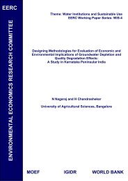
EERC<br />
Theme: Wetlands and Biodiversity<br />
EERC Working Paper Series: WB-4<br />
Economics <strong>of</strong> Protected Area:<br />
A Case Study <strong>of</strong> Pench National Park<br />
Anjali Kulkarni and V M Vaidya<br />
Nagpur University, Nagpur<br />
Mrunalini Phadanavis<br />
Mahila Mahavidyalaya, Nagpur<br />
MOEF IGIDR WORLD BANK
ECONOMICS <strong>OF</strong> PROTECTED AREA – A CASE STUDY <strong>OF</strong> PENCH<br />
NATIONAL PARK<br />
FINAL <strong>REPORT</strong><br />
SPONSORED BY<br />
INDIRA GANDHI INSTITUTE FOR DEVELOPMENT AND <strong>RESEARCH</strong><br />
(MUMBAI)<br />
UNDER WORLD BANK CAPACITY BUILDING PROGRAMME<br />
Dr. V. M. Vaidya<br />
Retired Pr<strong>of</strong>essor and Head<br />
Department <strong>of</strong> Economics<br />
Nagpur University, Nagpur<br />
Mr. Sarang Bhakre<br />
Mr. Babarao<br />
Principal Investigator<br />
Dr. A. P. Kulkarni<br />
Head,<br />
Department <strong>of</strong> Economics<br />
Nagpur University, Nagpur<br />
Co- Investigators<br />
Research Team<br />
Dr. Mrunalini Phadanavis<br />
Head,<br />
Department <strong>of</strong> Economics<br />
Mahila Mahavidyalya<br />
Nandanvan, Nagpur<br />
Mr. Prashant Tambe<br />
Mr. Milind Narnaware<br />
P. G. T. D. Of Economics, Nagpur University Campus, Nagpur, 2002
PREFACE<br />
Sustainable economic development and environmental protection are the key<br />
aspects <strong>of</strong> modern economic development. Importance <strong>of</strong> biodiversity conservation<br />
through environmental protection and policy <strong>of</strong> creating protected areas has received<br />
worldwide attention as manifested in various conventions on bio-diversity. Biodiversity<br />
conservation has not only ethical and aesthetic implications but also have<br />
various economic and social dimensions. These concerns are being increasingly<br />
reflected at National and International levels through research and policy<br />
programmes as well as related activities undertaken by NGO’s.<br />
The present study endeavours to estimate the benefits and cost <strong>of</strong> P.A. <strong>of</strong> Pench<br />
National Park (PNP) located in central India. This study focuses on rational for<br />
creation <strong>of</strong> protected areas and its direct as well as indirect benefits and costs. It is<br />
also an exercise in research methodology where internationally accepted methods<br />
like IFRI, TCM etc. have been used for estimation <strong>of</strong> costs and benefits <strong>of</strong> PNP.<br />
This project has been awarded by IGIDR (Mumbai) under The World Bank Capacity<br />
Building Programme. Hon. Chairperson Pr<strong>of</strong>. Jyoti Parikh deserves sincere thank for<br />
her valuable feedback at various stages <strong>of</strong> the project. Our sincere thank also due to<br />
Dr. Sudarshan Iyangar who was a guiding sprit behind this work. Dr. Raghu Ram<br />
Tata from IGIDR also helped from time to time in the completing this project.<br />
The authors acknowledges the facilities extended by the Nagpur University and are<br />
grateful to the Hon. Vice-chancellor Dr. A. S. Satputaley, Registrar Mr. S. T. Belsare,<br />
Finance Officer Mr. W. S. Kalode and Deputy Registrar (Development) Mr. Puran<br />
Meshram and his staff.<br />
Our special thanks are due to Shri Ram Indurkar Retd. CCF wildlife, Shri Muzumdar<br />
CCF wildlife, Shri Bhagawan, CF wildlife, Shri Chowdhari Deputy CF Wild Life. We<br />
are highly indebted to them for their valuable guidance and providing vital<br />
information regarding Pench Tiger Project. Deputy C. F. Wildlife, Dr. Jafri, Director<br />
Forest Survey <strong>of</strong> India Nagpur, also deserves special thanks for his willing<br />
cooperation and providing valuable information about Pench National Park- Shri. A.<br />
R. Khan Dy. Conservator <strong>of</strong> Forest Research Wing, and Shri B. S. Giri R.F.O.<br />
extensively helped during entire project work. We fall short <strong>of</strong> suitable words to<br />
express our deep sense <strong>of</strong> gratitude for their valuable help. Dr. S. Dwivedi from<br />
i
Maharashtra Fisheries Development Corporation also willingly extended his help for<br />
providing statistical data.<br />
‘SHODH’ the research institute, deserves special thanks for <strong>of</strong>fering consultancy<br />
services. The secretary <strong>of</strong> the institute Dr. Rucha Ghate <strong>of</strong>fered her constructive<br />
comments which helped to enrich the quality <strong>of</strong> work.<br />
Our colleagues in the department have been very co-operative in extending all<br />
possible help in completion <strong>of</strong> this project. Dr. Mahore, Dr. Deshpande, Dr. Ghate,<br />
deserve sincere thanks for their valuable comments on the research methodology <strong>of</strong><br />
the project.<br />
The research team <strong>of</strong> the project, Mr. Sarang Bhakre, Mr Milind Narnaware, Mr.<br />
Bhushan Lanjewar and Mr. Prashant Tambe spared no pains in bringing this project<br />
to the final stage. They need special thanks from us.<br />
The non-teaching staff <strong>of</strong> the department had been very co-operative in extending<br />
their helps at various stages on the project.<br />
One debt we have to acknowledge, which runs all through this efforts, is that to our<br />
family members, who were compelled to bear inconvenience because <strong>of</strong> our non<br />
availability at home and providing us a moral support in completion <strong>of</strong> the work.<br />
They were also a constant source <strong>of</strong> inspiration to us.<br />
Vijay Vaidya<br />
ii<br />
Anjali Kulkarni<br />
Mrinalini Fadnavis
1.1 Prologue<br />
CHAPTER I<br />
Protected Areas have received a special attention from the cross section <strong>of</strong> the<br />
population for their unique role in biodiversity conservation. Increasingly more<br />
geographical areas are being reserved for conservation <strong>of</strong> natural resources and<br />
biodiversity. Bio-diversity represents the very foundation <strong>of</strong> human existence and a<br />
rich source <strong>of</strong> resources. The loss <strong>of</strong> biological diversity is causing a major concern<br />
all over the world. However, population explosion and changing character <strong>of</strong><br />
human wants are eroding this very essential capital at an alarming rate. Today, the<br />
biological wealth is threatened by an overexploitation <strong>of</strong> natural resources, resulting<br />
in devastation <strong>of</strong> habitat and ecosystem. In this situational matrix, conservation <strong>of</strong><br />
biodiversity has rightfully received an impetus in the form <strong>of</strong> coming into force the<br />
Convention on Biodiversity in December 1992.<br />
The current debate is centered around demonstrating the economic values <strong>of</strong><br />
biological resources in the contexts where the values are <strong>of</strong>ten not reflected in<br />
market process. There is also a need to explain why despite those economic<br />
values, biodiversity continues to be threatened. The debate is also concerned<br />
about the ways to capture or realize economic value.<br />
1.2 Private & Social Costs <strong>of</strong> Biodiversity Use:<br />
Private costs and benefits refer to those losses or gains as perceived by the<br />
immediate user <strong>of</strong> the environment: the farmer, the industrialist, the consumer.<br />
Social costs and benefits refer to the losses and gains that accrue to the society as<br />
a whole. Social and private interest <strong>of</strong>ten do not coincide. What is good for one as<br />
an individual, may impose costs on the rest <strong>of</strong> the society (externalities).<br />
Sometimes what is good for the world as a whole is also good for a person as an<br />
individual. But no institution exists to capture the “global value”.<br />
1.3 Biodiversity & Market:<br />
The need to declare certain areas as protected areas arises out <strong>of</strong> the need to<br />
conserve valuable natural resources or to prevent loss <strong>of</strong> biodiversity. Since<br />
markets may fail to reflect the benefits and costs <strong>of</strong> protected area, the need arises<br />
to highlight the issues associated with creation <strong>of</strong> Protected Areas- National Parks<br />
or Tiger Projects.
1.4 THE PRESENT STUDY:<br />
The present study has been undertaken to focus the benefits as well as costs and<br />
other issues related to Pench National Park (PNP) arising from the conservation <strong>of</strong><br />
its rich natural resources. PNP is considered as a custodian <strong>of</strong> the valuable flora<br />
and fauna, which is representative <strong>of</strong> this region.<br />
‘It is argued that creation <strong>of</strong> network <strong>of</strong> national parks or Tiger Project is a transition<br />
from Anthropocentric (human centered) to bio-centric (human as only one element<br />
in the ecosystem) philosophy’. Emerging from this philosophy are some radical<br />
conclusions drawn by the deep ecologists that intervention in nature should be<br />
guided primarily by the need to preserve biotic integrity rather than need <strong>of</strong><br />
humans. i<br />
It is also argued that the Project Tiger, hailed by the International Conservation<br />
Community as an example <strong>of</strong> outstanding success, sharply protects the interests <strong>of</strong><br />
the tiger against those <strong>of</strong> the poor peasants living in and around the reserves. This<br />
exclusive concept <strong>of</strong> management <strong>of</strong> PAs does not take into account the livelihood<br />
implications <strong>of</strong> wild-lands/life preservation. Until recently wild-land/life preservation<br />
has been identified with environmentalism by the state and conservation elite. As a<br />
result <strong>of</strong> which the problems which impinge far more directly on the lives <strong>of</strong> poorfuel,<br />
fodder, soil erosion, air and water pollution have not been adequately<br />
addressed.<br />
1.5 Forest <strong>of</strong> Pench:<br />
Pench in Maharashtra was declared as 25 th Tiger Project in 1999. It is a<br />
magnificent forest and it boasts a healthy population <strong>of</strong> predators and prey.<br />
Previously in 1975, it was declared as a protected area entitled ‘Pench National<br />
Park’. Years <strong>of</strong> protection have paid <strong>of</strong>f and ultimately it was included in the<br />
Network <strong>of</strong> Project Tiger. Project Tiger is committed to the philosophy <strong>of</strong> total<br />
habitat protection, with management practices restricted to reamelioration <strong>of</strong> the<br />
land and selective repair <strong>of</strong> damage caused by past biotic interference.<br />
The Pench Tiger Reserve (blessed with National Park Status <strong>of</strong> 257.26 sq. km.)<br />
derived its name from the river Pench that flows through the reserve in a northsouth<br />
direction. It is about 67 Km from Nagpur by road on Nagpur Jabalpur<br />
National Highway No. 7.<br />
2
The rich diversity <strong>of</strong> flora and fauna has already found it a deserving place in<br />
literature dating as far back as 17 th century. The track has been mentioned by<br />
several famous naturalists like Captain J Forsythas the high lands <strong>of</strong> Central India,<br />
A.A. D. Brander Wild Animals in Central India and even the famous Rudyard<br />
Kipling, author <strong>of</strong> ‘The Jungle book’. An exceedingly vital ecological zone, Pench is<br />
fortunate to be blessed with contiguous forests extending east, north and<br />
southwards.<br />
The general physiognomy and floristic <strong>of</strong> the tiger reserve are indicative <strong>of</strong> two main<br />
types <strong>of</strong> forests- southern tropical dry deciduous teak, and southern tropical mixed<br />
deciduous forests. There are, <strong>of</strong> course, numerous other co-dominants and<br />
associates <strong>of</strong> teak, along with many other species <strong>of</strong> trees, shrubs and climbers.<br />
There is also a great variety <strong>of</strong> herbs and palatable grasses for the wild ungulates<br />
to subsist on. The park supports a high density <strong>of</strong> mammalian prey-species such<br />
as chital, Nilgai, Wild pig and Languor. Tiger scats and tracks are found plenty but<br />
sightings are always a matter <strong>of</strong> luck.<br />
As with most natural forests, Pench is bird watcher’s paradise. There are over 175<br />
species listed from within the reserve and surely more await. Bulbul, tailor birds<br />
etc.<br />
1.6 GEOLOGY ROCK & SOIL<br />
1.6.1 GEOLOGY: The area falls in North West fringe <strong>of</strong> Sausar-meta Sedimentary<br />
belt <strong>of</strong> Central India with intensely folded and faulted structurally disturbed rocks.<br />
1.6.2 ROCK: Metamorphic rocks <strong>of</strong> archaen age. They are comprised <strong>of</strong> schist’s,<br />
gneisses, marble and quartzite. Rocks are with deep and sleep cut across the river<br />
and are folded into major syncline and Anticline with mansar formation at core <strong>of</strong><br />
syncline and Kadbikheda member at the core <strong>of</strong> anticline. Granulites and marble<br />
bands repeated due to folding.<br />
1.6.2 SOIL: The metamorphic rocks from sandy loose soil with patches <strong>of</strong> lateritic<br />
soil at places. Soil is well suited for teak and miscellaneous trees growth.<br />
1 Sandy Loam: The soil derived from the weathering <strong>of</strong> granitic gneisses and<br />
biotic gneisses is dark brown loamy soil. Most <strong>of</strong> the area inside the park is<br />
covered with this type <strong>of</strong> soil. These soil are fairly fertile on gentle slopes & very<br />
fertile in deep valleys.<br />
3
2 Red Soil: Some parts have red soil derived from rapid disintegration <strong>of</strong> the<br />
present rocks due to excessive folding and faulting with steep dips.<br />
3 Kankar and saline soil: In some areas kankar and saline soils are found. These<br />
can be seen in compartment 568, 567 etc. Obviously these areas generally with<br />
sparse growth.<br />
4 Alluvial soil: The Alluvium is confined to the banks <strong>of</strong> major streams and Pench<br />
river. Alluvial soil consists mostly <strong>of</strong> the siliceous debris, washed down from the<br />
nearest hills, mixed with humus. Alluvium derived from the trap rocks in the<br />
upper reaches <strong>of</strong> Pench river is deposited by the river in a narrow belt along its<br />
bank. Due to steep gradient <strong>of</strong> the river, no sand deposits and also mollusks are<br />
seen.<br />
Soil and vegetation are mutually dependent on each other. The soil influences<br />
growth <strong>of</strong> vegetation which in turn enriches the soil.<br />
1.6.3 TERRAIN: The Park is located in the southern lower reaches <strong>of</strong> the Satpura<br />
hill ranges, which form the catchment for river Pench National Park. The Pench<br />
river flows almost through the centre <strong>of</strong> the Park in North-South direction. The<br />
folding and upheavals in the past resulted in formation <strong>of</strong> a series <strong>of</strong> hills and<br />
valleys.<br />
In West Pench range areas the land from river Pench gradually rises towards west<br />
forming a plateau between Lamandoh to Gawalioghat. After gradually sloping down<br />
towards Narhar, the land again rises forming a series <strong>of</strong> undulating hills. Again the<br />
land rises and continues as highly undulating plateau upto Totladoh. Most <strong>of</strong> the<br />
low lying lands on eastern side <strong>of</strong> river Pench have come under submergence area<br />
<strong>of</strong> the Pench Hydro Electric Project.<br />
Terrain <strong>of</strong> whole <strong>of</strong> the West Pench National Park range area has a slope on<br />
eastern side to form a major watershed for the Pench river. Whereas, nearly half <strong>of</strong><br />
the East Pench range along North – south line slopes towards Pench river to West<br />
while the eastern fringes <strong>of</strong> the Park has slopes towards east.<br />
The highest peak in East Pench is located in compartment no. 525 with a height <strong>of</strong><br />
583 m. while that on the West Pench side is located in compartment no.685 with a<br />
height <strong>of</strong> 574 m.<br />
4
A marked species preference towards certain topography is observed in that,<br />
herbivores like Sambar prefer hilly, undulating terrain with valleys while Chital and<br />
Gaurs prefer moderate undulating terrain with gentle slope, through Chital has<br />
preference for flatter areas. Nilgai and four horned antelope also seem to prefer<br />
flatter areas.<br />
The hilly and undulating terrain <strong>of</strong> the Park poses various problems in its<br />
management. Due to steep slopes and resulting flash floods, cross drainage works<br />
and roads are washed away. Roads are in need <strong>of</strong> frequent repairs. This in turn<br />
adversely affects the communication and thus the protection aspect.<br />
Effective fire control is hampered as remote to be made accessible by climbing up<br />
& down the hills. The fire is deliberately lighted on scattered hilltops, which then<br />
soon advances downwards to join and cover a large area.<br />
In drains and steams, water does not remain for long and building a series <strong>of</strong><br />
closely spaced check dams becomes essential. Soil erosion in the form <strong>of</strong> rill and<br />
gully erosion on slopes and sheet erosion in plains is also enhanced.<br />
1.6.4 HABITAT ii : Sufficient data regarding the various habitats one comes across in<br />
the P.A. and its classification is not available at present for proper prescriptions.<br />
However, the area can be broadly classified as under.<br />
1.6.4.1 CLASSIFICATION <strong>OF</strong> HABITAT:<br />
Actual delineation <strong>of</strong> the various habitat types and covers has not so far been done<br />
to prepare distinctive cover maps. Similarly, help from aerial photographs or<br />
satellite imagery has not been taken. Nevertheless based on the field observations<br />
in relation to various plant assemblages, crop density and other features, habitats<br />
<strong>of</strong> the conservation unit have been roughly classified as follows:<br />
1 Very dense forest with good ground cover<br />
2 Moderately open forest with good ground<br />
3 Cover<br />
4 Sparse forest with ground cover<br />
5 Open forest with weed cover<br />
6 Meadows<br />
5
7 Riparian habitat<br />
8 Aquatic habitat<br />
1.7 Importance Of Pench National Park<br />
The Pench National Park contributes significantly to such tangible and intangible<br />
benefits to the mankind which have local to global values. It has such potential<br />
values so as to perceive the real worth <strong>of</strong> this beautiful treasure house <strong>of</strong> nature<br />
which must be protected as a part <strong>of</strong> our national heritage.<br />
1 Ecological Values: The National Park, in its Biogeographic Location is a true<br />
representative <strong>of</strong> the Central Highland which comes under the Deccan Peninsula.<br />
The bio geographic subdivision or region which it represents is Satpuda Maikal<br />
division.<br />
2 Faunal Value: Pench National Park is so rich in its faunal representation that<br />
most <strong>of</strong> the wild animals which identity with this area, have taken shelter here. It<br />
is home <strong>of</strong> many endangered species including tiger. The Pench National Park is<br />
the abode <strong>of</strong> innumerable invertebrates including insects. A significant diversity<br />
<strong>of</strong> butterflies, moths, beetles, spiders etc. also exist here. A lot <strong>of</strong> nature’s<br />
treasure is hidden in the PA which still needs to be explored to its hilt to become<br />
aware <strong>of</strong> the faunal richness <strong>of</strong> this area.<br />
3 Floral Value: The Pench National Park is very rich in floral diversity pertaining to<br />
this area. The forest type is “Southern Tropical Dry Deciduous Forest” and is<br />
grouped as 5Ac3 under revised classification <strong>of</strong> the forest by Champion and Seth.<br />
The diverse vegetation type ranges from such climax forests as Dry Teak forest<br />
and Southern dry deciduous mixed forests to edaphic type as Boswellia forest,<br />
Mowai forest, Garari forest and primary stages like dry tropical Riparian forests.<br />
The PA serves a living repository <strong>of</strong> various economical, medical, aromatic,<br />
ornamental plant species diversity.<br />
4 Value as a Conservation Unit: The expanse <strong>of</strong> the forest <strong>of</strong> Pench National Pak<br />
is contiguous to the forest <strong>of</strong> Pench National Park, M.P. all along is northern<br />
boundary adjoining to Chhindwra and Seoni district <strong>of</strong> M.P. It provides an<br />
unfragmented habitat to the fauna thriving in this part <strong>of</strong> central part so as it form<br />
a “Maharashtra-Madhya Pradesh joint Conservation Unit”.<br />
6
5 Value <strong>of</strong> Catchments Area: The Pench River, which emerges from Mahdeo hills<br />
<strong>of</strong> Satpura range and the various nallas and streams which bear the forests <strong>of</strong> the<br />
PA act as excellent watershed area for the Totladoh as well as lower Pench<br />
reservoirs.<br />
6 Role in Irrigation Projects: The network <strong>of</strong> root systems <strong>of</strong> the vegetation and<br />
geological formation functions as a sponge for conservation <strong>of</strong> moisture and also<br />
restrict the silt from being deposited in the Totladoh as well as Navegaon Khairy<br />
reservoirs. The PA thus plays a vital role in helping to maintain the life<br />
expectancy <strong>of</strong> these reservoirs.<br />
The Totladoh reservoir located on northern boundary <strong>of</strong> the PA helps in generation<br />
<strong>of</strong> electricity for supply to both MP and Maharashtra and also in maintaining water<br />
level for the lower Pench reservoir located at Navegaon Khairy on the Southern<br />
boundary <strong>of</strong> the P.A. This reservoir helps in irrigation as well as supply <strong>of</strong> drinking<br />
water to Nagpur city. It also supplies water for electricity generation to Koradi and<br />
Khaparkheda thermal power stations. Therefore, the P.A. plays a significant role in<br />
being the “Life Line” <strong>of</strong> Nagpur city and other benefited areas by ensuring life<br />
expectancy <strong>of</strong> the reservoir and improvement <strong>of</strong> catchment capability.<br />
1 Value in employment generation: All these contributions made by the PA in<br />
ensuring water supply to the related activities, industries etc. for a longer period<br />
has helped indirectly in generation <strong>of</strong> employment to a lot <strong>of</strong> people. Fishing<br />
activity in lower Pench also generates a major employment for the local people.<br />
2 Environmental Value: Role <strong>of</strong> P.A. in maintaining vital environmental attributes<br />
is important. It acts as sponge for the population and other hazardous fumes,<br />
works as a storehouse <strong>of</strong> moisture. This way it acts as a “Green Lung” for the<br />
surrounding human settlement and helps in maintaining the environmental<br />
balance.<br />
3 Educational And Research Value: Proximity <strong>of</strong> the P.A. to a metropolitan city<br />
Nagpur has resulted into a number <strong>of</strong> people visiting the park to seek solace<br />
from the hustle-bustle <strong>of</strong> city life into the serene tranquillity <strong>of</strong> the deep woods.<br />
The mainly day visitors through their preferred sites mostly on weekends and<br />
holidays. This is because the P.A. has tremendous recreational values in its<br />
hilly undulating terrain with gentle slopes and forest rich with activities <strong>of</strong> nature.<br />
7
Recreation along with education and awareness about nature conservation is<br />
brought about by observing and interpreting the forest and wildlife.<br />
1.8 Wildlife<br />
In the following paragraphs a birds eyeview about the wildlife <strong>of</strong> the PNP is<br />
presented.<br />
Range Of Wildlife iii<br />
Pench national Park is quite diverse in its faunal and also floral wealth. This<br />
includes a number <strong>of</strong> endangered species. The faunal range is as given below in<br />
brief.<br />
1 Invertibrates: The P.A. harbours a wide range <strong>of</strong> insects including beetles and<br />
species. Butterflies and moths belonging to a wide range also occur here. A<br />
host <strong>of</strong> Arachnids have taken shelter here. Appendix No. XV gives a list <strong>of</strong><br />
Butterflies found in the Park. It includes Danaid egg fly which is a Schedule I<br />
(Part IV) species listed in Wildlife (Protection) Act, 1972.<br />
2 Mammals: About 33 species <strong>of</strong> mammals are observed in the Park, a sizeable<br />
number <strong>of</strong> which are <strong>of</strong> endangered status, namely, Tiger, Panther, Jungle Cat,<br />
small Indian Cievet, Palm Civet, Jackal, Sloth bear, Ratel, Common Giant,<br />
Flying Squirrel, Gaur, Four horned antelope etc. List <strong>of</strong> mammals found in the<br />
National Park is given in Appendix XVI.<br />
3 Birds: Diversity in the wealth <strong>of</strong> avifauna in the park is quite remarkable. Well<br />
over 164 species <strong>of</strong> birds belonging to 46 families <strong>of</strong> 16 different orders have<br />
been recorded here. These include some migratory and endangered birds<br />
including peafowl. See Appendix No. XVII.<br />
4 Reptiles: The P.A. is abode <strong>of</strong> a number <strong>of</strong> reptiles out <strong>of</strong> which 6 species are<br />
<strong>of</strong> endangered status, namely, Indian Cobra, Indian Rock Python, Rat snake,<br />
Russel’s viper, Checkered keelback and common Monitor Lizard.<br />
5 Amphibia: A number <strong>of</strong> representatives <strong>of</strong> class amphibia are found in these<br />
forests.<br />
6 Fishes: The Pench river, reservoir at Totladoh and lower Pench at Gavalighat<br />
and other water bodies shelter a variety <strong>of</strong> aquatic fauna in the shape <strong>of</strong> fresh<br />
water fishes a number <strong>of</strong> which are also hill stream fishes.<br />
8
1.9 Research Methodology<br />
Research methodology adopted to study the various aspects <strong>of</strong> the PNP is detailed<br />
out in the following paragraphs.<br />
1.9.1 Short Run Objectives:<br />
1 Identification <strong>of</strong> major stakeholders <strong>of</strong> Pench National Park.<br />
2 Estimating the dependence <strong>of</strong> local communities in the proximity <strong>of</strong> PNP on<br />
forests <strong>of</strong> PNP.<br />
3 Assessing the impact <strong>of</strong> existing resource use pattern as well as human<br />
activities on the status and vegetation composition <strong>of</strong> PNP.<br />
4 Assessing the benefits <strong>of</strong> PNP to tourists, fishing and other related facilities.<br />
5 Identifying the cost-direct as well as indirect- <strong>of</strong> PNP.<br />
6 Preparing inventory <strong>of</strong> flora and fauna to represent biodiversity status <strong>of</strong> PNP.<br />
1.9.2 Long Run Objective:<br />
In the interest <strong>of</strong> ‘sustainable development’ and optimum use <strong>of</strong> natural resources,<br />
preparing a management plan <strong>of</strong> PA with focus on eco-tourism and ecodevelopment.<br />
1.9.3 Methods <strong>of</strong> Data Collection:<br />
Data are collected at two levels (1) Village level and (2) Forest level.<br />
The methods adopted to study the resource dependency <strong>of</strong> local communities<br />
involved following major steps:<br />
1. Questionnaire Survey.<br />
2. Personal Observations<br />
3. Monitoring <strong>of</strong> entry points at village boundary.<br />
4. Monitoring <strong>of</strong> selected households.<br />
5. IFRI Method<br />
9
Econometric Methods<br />
6. Multiple Regression<br />
7. TCM Method<br />
8. Log Linear Method<br />
1.9.4 HYPOTHESES:<br />
Following hypotheses are tested in the course <strong>of</strong> study to examine the dependence<br />
on PNP.<br />
1 There is a heavy dependence <strong>of</strong> local communities in and around PA on the<br />
forests <strong>of</strong> PNP<br />
2 Dependence <strong>of</strong> local communities on the forest for biomass extraction has<br />
inverse relationship with the distance from PA boundary i.e. longer the distance<br />
from the PNP lesser is the dependence <strong>of</strong> the PNP and vice-versa..<br />
3 Dependence <strong>of</strong> local communities is determined by their economic status or<br />
their ability to purchase alternative forest resources.<br />
4 Extraction <strong>of</strong> biomass resources by local communities does not cause any<br />
adverse impact on the regenerative potential <strong>of</strong> the forest.<br />
1.9.5 SAMPLING: For testing the above hypotheses census <strong>of</strong> Fulzari village was<br />
undertaken and stratified sample <strong>of</strong> surrounding villages has been drawn. Villages<br />
within 10 Kms., <strong>of</strong> PNP boundary have been first identified and stratified into three<br />
distance categories iv :<br />
Criteria for stratification –<br />
a) Villages within 0 to 3 Kms from the boundary <strong>of</strong> PNP<br />
b) Villages within 3 to 5 Kms from the boundary <strong>of</strong> PNP<br />
c) Villages within 5 to 10 Kms from the boundary <strong>of</strong> PNP<br />
Criteria for dependence.<br />
1) Income criteria or ability to purchase substitutes.<br />
2) Accessibility criteria or access to forest resources<br />
3) Fuel use criteria.<br />
10
1.9.6 Methods Used For Quantification Of Dependence: The estimation <strong>of</strong><br />
dependency on the PNP has been worked out for:<br />
(a) Fodder Consumption<br />
(b) Firewood Consumption<br />
(a) Fodder Consumption: Quantification <strong>of</strong> fodder consumption by livestock<br />
owned by the sample households was done by monitoring the time period for which<br />
they grazed in the forest <strong>of</strong> PNP.<br />
(b) Fuel Wood Consumption: Information is being collected through two<br />
methods:<br />
1) Household surveys<br />
2) Monitoring <strong>of</strong> consumption by giving pre-weighed quantity <strong>of</strong> wood.<br />
3) Reports <strong>of</strong> the various committees for standardized consumption<br />
Multiple Regression is carried out at three levels to study the dependency<br />
a) For households <strong>of</strong> Fulzari village<br />
b) For households <strong>of</strong> the sample village<br />
c) For the all households <strong>of</strong> Fulzari and the sample villages.<br />
It follows-<br />
P1 = f (ntfp, hunting, forest labour, fishing, livestock, P2, qty number, firewool,<br />
firewood.)<br />
P2 = percentage <strong>of</strong> non-forest income.<br />
IFRI- Internationally accepted IFRI method has been used to examine the impact <strong>of</strong><br />
human intervention on status <strong>of</strong> bio-diversity in PNP.<br />
TCM method with following functional form has been used to estimate the total<br />
cost <strong>of</strong> visiting the site-<br />
Ζjm /nj = F (Yi, TCjm + Pm, Xj, TCjk + Pk, Qm, Qk, NL, TS)<br />
Log linear method has been used for the estimation <strong>of</strong> stocking and harvesting <strong>of</strong><br />
fishes in and around PNP.<br />
11
Section II<br />
Review <strong>of</strong> Literature<br />
Contribution to commons literature has travelled a long way since Olson’s (1965)<br />
‘zero contribution thesis’ through Hardin’s (1968) ‘tragedy <strong>of</strong> commons’, to many<br />
scholars taking cognizance <strong>of</strong> voluntary associations that are creating and<br />
enforcing rules that protect natural resources. Literature published in last two<br />
decades provided ample evidence <strong>of</strong> this. Field research has established today that<br />
though temptation to free ride on the provision <strong>of</strong> collective benefit is a universal<br />
problem, self-organized resource governance too has survived in multiple<br />
generations (Ostrom, 1990). It is also found that when the users <strong>of</strong> a common-pool<br />
resource organize themselves to devise and enforce some <strong>of</strong> their own basic rules,<br />
they tend to manage local resources more suitably than when rules are externally<br />
imposed on them (Tang, 1992; Baland and Platteau, 1996; Wade, 1994).<br />
Looking at the writings <strong>of</strong> many scholars, it is found that, three independent works<br />
that have come up with some ‘requirements’ that are critical to the sustainability <strong>of</strong><br />
commons institutions, are those <strong>of</strong> Robert Wade, Elinor Ostrom, and Jean-Marie<br />
Baland & Jean-Philippe Plateau. After wide ranging discussions and considerations<br />
<strong>of</strong> many factors, each arrive at a summary set <strong>of</strong> conditions and conclusions that<br />
they believe to be critical to sustainability <strong>of</strong> commons institutions. Wade’s ([1988],<br />
1994) important work examines when it is that corporate institutions arise in villages<br />
and what accounts for their success in resolving common dilemmas, and it provides<br />
a set <strong>of</strong> reasons about successful management <strong>of</strong> commons. Small group size,<br />
clear boundaries, and ease in monitoring and enforcement are some <strong>of</strong> the<br />
conditions, according to him, which determine the effectiveness <strong>of</strong> rules. He has<br />
given, in all, 14 conditions, that are important for successful management <strong>of</strong> the<br />
commons.<br />
After studying many cases <strong>of</strong> collective action all over the world, with the help <strong>of</strong> 14<br />
case studies, Ostrom (1990) has designed 8 principles i.e. “essential elements or<br />
conditions that help to account for the success <strong>of</strong> these institutions in sustaining the<br />
CPRs and gaining the compliance <strong>of</strong> generation after generation <strong>of</strong> appropriators to<br />
the rules in use” (1990:90). These are: clearly defined boundaries, congruence,<br />
12
collective-choice arrangements, monitoring, conflict-resolving mechanisms, minimal<br />
recognition <strong>of</strong> rights to organize, and nested enterprises. Later on, she further<br />
suggested attributes <strong>of</strong> the resource and attributes <strong>of</strong> the appropriators that are<br />
conducive to an increased likelihood that self-governing associations will form<br />
(Ostrom, 1999a). Attributes <strong>of</strong> the resource are: possibility <strong>of</strong> feasible improvement<br />
<strong>of</strong> the resource, availability <strong>of</strong> reliable and valid indicators <strong>of</strong> the condition <strong>of</strong><br />
resource system, predictability, and sufficiently small spatial extent for the<br />
appropriators to have appropriate knowledge <strong>of</strong> external boundaries. Attributes <strong>of</strong><br />
the appropriators are: salience <strong>of</strong> the resource, common understanding, low<br />
discount rate, trust and reciprocity, autonomy, and prior organizational experience<br />
and leadership.<br />
Baland and Platteau, too, have reviewed large number <strong>of</strong> studies on commons.<br />
They suggest that the failure <strong>of</strong> CPRs in comparison to privatization “rests on the<br />
comparison between an idealized fully efficient private property system and the<br />
anarchical situation created by open access” (1996:175). They suggest<br />
incorporation <strong>of</strong> cultural and political factors into analysis to know when people<br />
cooperate, and when inverted opportunists dominate, and make collective action<br />
impossible. Small size <strong>of</strong> user group, location close to the resource, homogeneity<br />
among group members, effective enforcement mechanism, and past experience <strong>of</strong><br />
cooperation are some factors necessary to achieve cooperation. Characteristics <strong>of</strong><br />
the resource as substantive factor affecting effectiveness <strong>of</strong> institutions governing<br />
the commons too are varied. Volatility and unpredictability in the flow (Wade, 1988),<br />
mobility <strong>of</strong> resource (Naughton-Treves and Sanderson, 1995), stationarity and<br />
storage (Blomquist et al 1994) are some <strong>of</strong> the aspects in addition to the ‘attribute<br />
<strong>of</strong> the resource’ (Ostrom, 1999b) mentioned earlier. Role <strong>of</strong> technology, population<br />
pressures, property rights regimes, heterogeneity, are some <strong>of</strong> the many other<br />
variables studied by different scholars.<br />
However, in the absence <strong>of</strong> a well-integrated and accepted theory <strong>of</strong> collective<br />
action in commons, substantial gap still exists in theoretical predictions, and the<br />
scholars <strong>of</strong> the commons themselves are now accepting this fact (Agrawal,<br />
Forthcoming). The literature on commons has only partially succeeded in<br />
answering questions like how aspects <strong>of</strong> the resource system, <strong>of</strong> user group, and<br />
13
the external social, physical and institutional environment affect institutional<br />
durability and long term management at the local level.<br />
On JFM<br />
Joint forest management strategy can prove to be advantageous from all these<br />
aspects if practiced in the right spirit. The experience with JFM, however, has been<br />
different. Ostrom has also discussed the limits <strong>of</strong> self-organized resource<br />
governance systems: some appropriators will not organize; some self-organized<br />
efforts will fail; local tyrannies may prevail; stagnation may occur; access to<br />
scientific information may be limited; conflicts may arise; and appropriators may be<br />
unable to cope with larger-scale resources. Studies <strong>of</strong> various scholars and<br />
experiences <strong>of</strong> grassroots organizations have brought up several additional<br />
limitations specific to JFM. Some are discussed here.<br />
The reasons for the government’s shift from a centralized management system to<br />
decentralization in the form <strong>of</strong> participatory JFM have intrigued scholars ever since<br />
the inception <strong>of</strong> JFM. Thompson (1995) best summarizes the probable reasons:<br />
fiscal crisis, exacerbated by structural adjustment/economic liberalization policies;<br />
pressure from donor agencies for greater accountability and transparency; the<br />
recognition <strong>of</strong> the failure <strong>of</strong> past approaches by state agencies; and the<br />
demonstration effect <strong>of</strong> successful pilot efforts by non-government organizations or<br />
other government agencies in other sectors.<br />
Environmental activists and the rural communities have been skeptical about the<br />
intentions <strong>of</strong> the government in sharing powers with the people, especially in the<br />
forest sector as it is one <strong>of</strong> the revenue-generating sectors. Their apprehensions<br />
are based on past experience as well as the inherent limitations <strong>of</strong> the provisions <strong>of</strong><br />
the JFM scheme.<br />
It is a well-established fact that measures designed to conserve biodiversity must<br />
provide economic incentives to increase the net local benefits from conservation<br />
and sustainable resource use. Such measures should be targeted to link<br />
biodiversity conservation with improvement in human welfare (McNeely et al, 1988).<br />
Earlier, in all the government forestation programs, participation <strong>of</strong> the rural poor<br />
was largely limited to wage employment. As users <strong>of</strong> forest products, the poor were<br />
seen as destroying forests through overuse and overgrazing. The forest-poverty<br />
14
elationship was defined negatively—if people continue to be poor they will destroy<br />
forests. JFM talks about the positive role that forests can play in poverty alleviation<br />
and the role that people can play in forest protection.<br />
The JFM strategy implies an increase in the collective ability <strong>of</strong> the communities<br />
adjacent to forests to manage, grow, and equitably share common resources. Yet<br />
there have been few efforts to involve people in the planning process or in<br />
establishing plan priorities. Rarely can the communities decide which species are to<br />
be taken up for plantation. There is no correlation between the amount <strong>of</strong> land that<br />
is brought under JFM and the amount <strong>of</strong> land required to meet the biotic<br />
requirements <strong>of</strong> people and livestock. The fact that village-level institutions might be<br />
better able to manage these commons is accepted. However, the fact that the<br />
management objectives <strong>of</strong> the locals may be very different and may not coincide<br />
with those <strong>of</strong> the state (Ligon and Narain, 1999) is totally neglected. While the JFM<br />
agreement talks about sharing long-term benefits from timber, the harvesting <strong>of</strong><br />
non-timber forest produce and sharing its returns is not discussed. It thus remains<br />
hazy as to what the fate <strong>of</strong> the forests will be after they have been successfully<br />
regenerated (Arora & Khare, 1994). Another major limitation is that the important<br />
question <strong>of</strong> “tenure” that includes clear, secure, and exclusive rights <strong>of</strong> access to<br />
the resource is kept ambiguous in the JFM scheme (Lele and Rao, 1996).<br />
The much-advertised idea behind JFM is to transform the age-old authoritative and<br />
policing role <strong>of</strong> the state forest department into that <strong>of</strong> a facilitator for the local<br />
communities. The JFM resolution assumes a symmetrical relationship between the<br />
government and the local institutions. Yet state governments and their forest<br />
departments still refrain from conceding legal status to FPCs, retain the right to<br />
dissolve FPCs, and appropriate a large share <strong>of</strong> forest produce (Pattnaik and Dutta,<br />
1997). Although JFM is a shift from centralized management to decentralization,<br />
from revenue orientation to resource orientation, and from unilateral decision<br />
making to participatory decision making, the final decision regarding site selection<br />
and regulation <strong>of</strong> harvest is vested in state authority. JFM remains an institutionally<br />
challenging strategy as ownership <strong>of</strong> forest lands remains with the state while the<br />
communities are involved in its protection and regeneration. It is strongly felt that<br />
only because the governments found it difficult to monitor and manage the village<br />
forest commons directly, and enforcement was becoming expensive, the state<br />
15
found it prudent to involve local communities in management (mainly protection).<br />
The participation envisaged in JFM is more in execution than in planning, “the<br />
structures more puppetish than autonomous” (Lele, 1998a.). It is <strong>of</strong>ten mentioned<br />
that as long as the ultimate control <strong>of</strong> all these aspects, including right <strong>of</strong> land, is<br />
retained by the state, one cannot expect the communities to attain the level <strong>of</strong> local<br />
responsibility needed for self-reliant, cost-effective, and sustainable conservation<br />
management (Wily, 1999).<br />
As mentioned earlier, impoverishment due to deforestation has encouraged many<br />
rural communities to start managing state-owned forests on their own. These selfinitiated<br />
efforts have proved quite effective at regenerating forests. Due to serious<br />
limitations regarding technical skills and finance, <strong>of</strong>ten these local initiatives can be<br />
sustained only if supported by external institutions (Krishnaswamy, 1995), yet there<br />
is no conscious effort to give them the necessary backing through JFM. Although<br />
there is a new and joint “construction <strong>of</strong> needs” within the limited degree <strong>of</strong> choice<br />
the JFM allows, the basic agenda <strong>of</strong> the program is pre-determined and cannot be<br />
considered very participatory in nature (Sundar, 2000).<br />
It is also observed that the need to design formal institutions that are<br />
complementary to existing informal institutions (Kant and Cooke, 1998) is<br />
neglected. The common experience is that sociopolitical overlap between new<br />
induced institutions and the existing forms <strong>of</strong> local government, such as the village<br />
panchayat, are proving to be counterproductive (Andersen, 1995). The most<br />
successful FPCs charge fees for collection <strong>of</strong> forest produce, although this practice<br />
is strictly contrary to the forest act. Although the state governments recommend the<br />
formation <strong>of</strong> FPCs, the committees have no legal or statutory basis. FPCs are<br />
recognized only by the forest department; all other government departments<br />
recognize panchayats, making them more powerful than FPCs. The relationship<br />
between FPCs and the village panchayats is not well defined. The lack <strong>of</strong> legal<br />
authority may affect the power <strong>of</strong> the FPCs to check free riding and may make it<br />
difficult for them to manage resources in long term. Often, in the case <strong>of</strong> grouppanchayats,<br />
the sarpanch (one who heads panchayat) is not interested in the FPC<br />
<strong>of</strong> a particular village. This is very much resented by the villagers who would prefer<br />
one amongst them to head their FPC (Ghate, 2000a). The legal standing <strong>of</strong> FPCs<br />
needs to be defined to make them strong grassroots organizations.<br />
16
The different demarcation <strong>of</strong> boundaries by two different governmental departments<br />
(in this case the Revenue Department and the Forest Department) is also creating<br />
some internal conflicts. Communities joining the JFM program are unsure <strong>of</strong> their<br />
areas <strong>of</strong> operation from which access can be denied to outsiders. This territorial<br />
conflict is reflected at the management level as well. The confusion can be<br />
appreciated by the fact that, at present, as many as 52 rural development schemes<br />
are operational through several state units. Often, more than one state department<br />
will bring in the same schemes in a single village, incurring huge duplication costs<br />
in the process.<br />
Another important aspect that is criticized as being neglected is the lack <strong>of</strong><br />
acknowledgement <strong>of</strong> women’s special values, knowledge, and uses <strong>of</strong> forest<br />
produce (Locke, 1999). Gender relations are neither understood nor are there any<br />
special provisions to accommodate women’s specific knowledge, needs, and<br />
capacities in the JFM program. Similarly, the strong historical sense <strong>of</strong> place and<br />
(particularly tribal) identity that can prove to be effective in mobilizing interest in and<br />
concern for local resource management and protection have not been adequately<br />
considered in the JFM program. Nor has the influence <strong>of</strong> charismatic leaders in<br />
overcoming intra-village tensions been recognized (Jewitt, 1995).<br />
Linking Livelihoods and Conservation: A Conceptual framework and Scale for<br />
addressing the integration <strong>of</strong> human needs and biodiversity by NICK SALAFSKY,<br />
Biodiversity support programme; Washington D.C. U.S.A. and Eva Woolenberg<br />
<strong>Center</strong> for International Forestry Research, Jakarta, Indonesia:<br />
The above research paper published in World Development vol. 28 No. 8 has<br />
developed a conceptual framework for defining the linkage between livelihood<br />
activities and conservation. Three approaches that can be characterized as no<br />
linkage, indirect linkage and direct linkage have been described by the authors.<br />
Each approach has strength and weakness and therefore best shifted to certain<br />
conditions.<br />
The first approach assumes no linkage between livelihood and conservation <strong>of</strong><br />
protected areas.<br />
A common approach to protecting biodiversity has been the creation <strong>of</strong> parks and<br />
P.A.s that exclude livelihood activities. The key feature <strong>of</strong> the protected areas<br />
17
strategy is that local livelihood is assumed to conflict with conservation. P.A.s have<br />
strictly defined borders that are unauthorized. People are not supposed to cross<br />
them. People are meant to use resources outside the park, and plants and animals<br />
are meant to stay in the park.<br />
Second approach is based on indirectly linking livelihoods and conservations,<br />
economic substitutions; one <strong>of</strong> the earliest indirectly linked approaches was the<br />
biosphere reserve (UNESCO,1972, Sayer, 1999). In a biosphere reserve, people<br />
are entitled to use biological resources according to defined spatial zones. A core<br />
zone is designated as a strict protection area where people’s consumptive use <strong>of</strong><br />
resources is prohibited. The core is surrounded by one or more buffer zoners that<br />
allow use within limits that ensure protection <strong>of</strong> core zone. The original buffer<br />
zones were designed as rings <strong>of</strong> more or less arbitrary width.<br />
The key feature <strong>of</strong> buffer zone strategy is that Zonation is used to create a spatial<br />
compromise that enables local people to continue to meet their livelihood needs<br />
while still protecting key species and habitats. In particular, the theory is to<br />
decrease reliance on natural biodiversity by substituting other livelihood activities.<br />
The idea here is that providing substitute economic activities will keep local people<br />
on livelihood. Activities that damage the local biodiversity are indirectly linked<br />
activities have been found difficult to implement. Perhaps the biggest problem is<br />
that their approaches have not been directly tied to conservation behaviour as in<br />
the case <strong>of</strong> PAs, Local people <strong>of</strong>ten have continued to use resource in the core<br />
reserves even if prohibitors were posted or otherwise made public. Second,<br />
economically attractive activities in the buffer zone have <strong>of</strong>ten created incentives or<br />
expanding the buffer zones into the core area. Finally these approaches have not<br />
provided local people with the incentives to stop external threats to the biodiversity<br />
such as logging, company clear cutting the forest from the other side <strong>of</strong> the reserve<br />
or for a fishing boat coming in and unsustainable harvesting marine resources.<br />
The third approach is directly linking livelihood and conservation. Link incentive for<br />
conservation. The key feature <strong>of</strong> the link incentive strategy involves developing<br />
independent relationship between the biodiversity and surrounding peoples. The<br />
local stakeholders are given opportunities to benefit directly from the biodiversity<br />
and thus presumably have an incentive to stop external threats to biodiversity. It is<br />
livelihood drive conservation rather than simply being compatible with it.<br />
18
Furthermore this strategy recognize local peoples’ role in maintaining biodiversity.<br />
Under this strategy, conservation might, for example, help local communities<br />
N.T.F.P. harvesting enterprise as a live tourism enterprise.<br />
To analyse linkages, five dimensions <strong>of</strong> linkage have been mentioned.<br />
1. Species dependence.<br />
2. Habitat dependence.<br />
3. Spatial Dependence.<br />
4. Temporal dependence.<br />
5. Conservation association<br />
The linkages between them have been studied in the above dimensions<br />
The Principal and Practice <strong>of</strong> Buffer Zones and Local Participation in Bio-diversity<br />
Conservation: Michel P. Wells and Katrina E. Brandon- AMBIO Vol. 22, 2-3 May<br />
1993.<br />
Recognition is growing that successful management <strong>of</strong> protected areas ultimately<br />
depends on the cooperation and support <strong>of</strong> local people. The study is based on the<br />
analysis <strong>of</strong> 23 Integrated Conservation Development Projects (ICDPs) in 14<br />
developing countries. This paper explores the challenges, which have arisen in<br />
operationalizing two key concepts which lie at the heart <strong>of</strong> community based<br />
conservation.<br />
a) Buffer Zones around park boundaries.<br />
b) Greater participation <strong>of</strong> local people in conservation and development.<br />
c) Important practical constraints, which have so far limited the effective<br />
implementation <strong>of</strong> these two concepts, have been described in the above<br />
paper. The paper concludes that, innovative well-designed projects at<br />
carefully selected protected area sites that constructively address local<br />
people- park relationships will be essential to the conservation <strong>of</strong><br />
biodiversity, and thus to sustainable development.<br />
The Economics <strong>of</strong> Third World National Parks-Issues <strong>of</strong> Tourism and<br />
Environmental Management- Arun Shah Published by Edward Elgan Publishing<br />
Ltd.<br />
19
This book analyses the impact <strong>of</strong> economic activity on the management <strong>of</strong> Buffer<br />
area as well as protected area. Various models <strong>of</strong> management with flow effects <strong>of</strong><br />
buffer area activity on the national park have been discussed at length. The effect<br />
<strong>of</strong> stock externality a thinner buffer area biomass makes management success<br />
harder to achieve. The paper identifies spactical externalities arising from grazing <strong>of</strong><br />
cattle in the buffer area and work out the solutions to internalize the externality.<br />
Issues in Social Policy: -<br />
Collaborative Management <strong>of</strong> Protected Areas: Tailoring the Approach to the<br />
Context—Garza Borrini – Feyerbend-IUCN- The World Conservation Union Sept.<br />
1996.<br />
This article discusses essential feasibility conditions for collaborative management.<br />
It discusses the conditions for collaborative management to be effective and<br />
sustainable. It also discusses the obstacles most likely to stand in the way <strong>of</strong><br />
collaborative management. It also discusses the legal and ethical bans for<br />
exploitation <strong>of</strong> natural resources by local stakeholders.<br />
State <strong>of</strong> the World’s Protected Areas at the end <strong>of</strong> the 20 th Century: by Michael J.B.<br />
Green and James Paine, World Conservation Monitoring <strong>Center</strong>, Cambridge, U.K.<br />
This article discusses various categories <strong>of</strong> protected area. It describes Matrix <strong>of</strong><br />
protected area management objectives and IUCN categories. The network <strong>of</strong><br />
global protected area is also described in the present article.<br />
Valuing Tropical Forest: - Randall Krame, Priya Shyamsundar, Evan Mercer and<br />
Mohan Manasinghe.<br />
This article is a case study <strong>of</strong> Madagascar and the Mantadia National Park. The<br />
study has examined the economic impacts <strong>of</strong> a new national Park on a variety <strong>of</strong><br />
stakeholders. The work suggests that while proper tailoring to local conditions,<br />
environmental valuation methodologies can be useful in assessing resource value<br />
changes in developing countries.<br />
Planning for People and Park : Design dilemmas by Katrina Eadie Brandon and<br />
Michel Wells – The World Bank, Washington (D.C.) published in World<br />
Development Vol. 20.<br />
20
The authors highlight the evolution and performance <strong>of</strong> integrated conservationdevelopment<br />
projects. These projects try to link biodiversity conservation in PAs<br />
with social and economic development. The performance <strong>of</strong> ICDPS thus far has<br />
been hampered by numerous difficulties, many <strong>of</strong> which are strikingly similar to<br />
those encountered in rural development efforts, while many <strong>of</strong> these difficulties can<br />
be stressed to speatic design implementation flows, more fundamental conceptual<br />
issues pose a challenge to the approach.<br />
Management Plan <strong>of</strong> Pench National Park & Pench Tiger Reserve Maharashtra<br />
Vol. II & I:<br />
This plan depicts the entire pr<strong>of</strong>ile <strong>of</strong> PNP with its floristic and faunistic composition.<br />
The management aspects <strong>of</strong> PNP have been dealt at length the tourism sub-plan is<br />
a remarkable contribution <strong>of</strong> PNP.<br />
Wood Consumption Survey <strong>of</strong> Nagpur District published by Forest Survey <strong>of</strong> India,<br />
Nagpur GOI 2000-01:<br />
This study is an attempt to estimate consumption <strong>of</strong> wood for different income<br />
groups within the periphery <strong>of</strong> 5 Kms. <strong>of</strong> forest area in Nagpur district (Rural). The<br />
study gives separate estimates for different income groups and different categories<br />
<strong>of</strong> wood consumption<br />
END NOTES<br />
21
REFERENCES<br />
Agrawal, Arun and Ostrom, Elinor. 1999. “Collective Action, Property Rights,<br />
And Devolution in Forest and Protected Areas Management.” W99-11,<br />
Working Paper, Workshop in Political Theory and Policy Analysis, Indiana<br />
University, Bloomington.<br />
Alagh, Y.K (1999) ‘Macro Economic and Sectoral Policies and Forestry Sector<br />
in India–Role <strong>of</strong> the World Bank’. Draft. World Bank document.<br />
Andersen, K.E. (1995) ‘Institutional Flaws <strong>of</strong> Collective Forest Management’.<br />
Ambio 24(6):349-53.<br />
Arora, H., and Khare, A. (1994) ‘Experience with the Recent Joint Forest<br />
Management Approach’. Paper prepared for the IN workshop on India’s Forest<br />
Management and Ecological Revival, New Delhi, February 1994.<br />
Balakrishnan, Mundanthra, and Ndhlovu Dora E. 1992. “Wildlife Utilization and<br />
Local People: A Case-Study in Upeer Lupande Game Management Area,<br />
Zambia.” Environmental Conservation 19(2):135-143.<br />
Bishop, K, Andrian P., and Warren L. 1995. “Protected for Ever?: Factors<br />
Shaping the Future <strong>of</strong> Protected Areas Policy.” Land Use Policy 12(4):291-<br />
305.<br />
Borrini-Feyerabend, G. 1996. Collaborative Management <strong>of</strong> Protected Areas:<br />
Tailoring the Approaches to the Context, Issues in Social Policy, IUCN, Gland<br />
(Switzerland).<br />
Bromley, Daniel W., David Feeny, Margaret McKean, Pauline Peters, Jere<br />
Gilles, Ronald Oakerson, C. Ford Runge, and James Thomson, eds. 1992.<br />
Making the Commons Work: Theory, Practice, and Policy. ICS Press, San<br />
Francisco, CA.<br />
22
Chaudhary, Ashok. 1996. “Conservation, Conflitct and Struggle: Rajaji National<br />
Park.” In sustainable Development: Ecological and Sociocultural Dimension.<br />
K.G.Iyer, ed. New Delhi: Vikas Publishing House.<br />
Chopra, K. 1995. “Forest and other sector: Critical role <strong>of</strong> Governemnt policy.”<br />
Economic and Political Weekly, Vol.30 (25): 1480-1482.<br />
Datta, S and Varalakshmi, V. 1999. “Decentralization: An effective method <strong>of</strong><br />
finanacial Management at the grassroots (evidence from India).” Sustainable<br />
Development 1999, Vol 7 (3): 113-120.<br />
Dore, E. 1996. “Capitalism and Ecological Crisis:Legacy <strong>of</strong> the 1980s”, in<br />
Green Gurrillas (ed.) Helen Collinson, Latin American Bureau (Research and<br />
Action) Ltd., London.<br />
Fortin, MJ and Gagnon, C. 1999. “An Assessment <strong>of</strong> Social Impacts <strong>of</strong><br />
National Parks on Communities in Quebec, Canada.” Environmental<br />
Conservation 1999, Vol 26, Iss 3, pp 200-211.<br />
Gadgil, M. (1998) ‘Conservation: Where are the People?’ in N. Ravi (ed.) The<br />
Hindu Survey <strong>of</strong> the Environment, 1998. Chennai, India: National Press.<br />
Gadgil, M. 1998. “Conservation: Where are the People?” In The Hindu Survey<br />
<strong>of</strong> Environment 1998, ed. Ravi, The Hindu, Chennai Edition, India, p.107-137.<br />
Gadgil, Madhav. 1998. “Conservation: Where are the People.” In The Hindu<br />
Survey <strong>of</strong> the Environment 1998. (Ed) Ravi, The Hindu, Chennai, India, p 107-<br />
137 .<br />
Gaikwad, V.1995. “Tribal and the Tiger: A Case Study <strong>of</strong> the Kanha National<br />
Park.” Centre for Managament in Agriculture, Ahmedabad, India.<br />
Ghate R. and Kulkarni, M. 1998. “A major setback to Participatory Efforts: A<br />
story <strong>of</strong> Tragic Success”, Tiger Link, Vol 4, No.2, September 1998.<br />
23
Ghate, R. (2000b) ‘Global Gains at Local Costs: Imposing Protected Areas: A<br />
Case Study From India’, working paper. Bloomington: Indiana University,<br />
Workshop in Political Theory and Policy Analysis.<br />
Ghate, R. 1998. “Andhari Tiger Sanctuary (Maharashtra): A Case study for<br />
people’s Participation in the Management <strong>of</strong> Protected area”, The Indian<br />
Forester, Vol. 124, No.10, October 1998: 853-860.<br />
Gibson, Clark. Forthcoming. “Dependence, Scarcity, and the Governance <strong>of</strong><br />
Forest Resources at the Local Level in Guatemala.” In Joanna Burger, Richard<br />
Norgaard, Elinor Ostrom, David Policansky, and Bernard Goldstein, eds. The<br />
Commons Revisited: An Americas Perspective. Island Press, Washington, DC.<br />
Gichuki, F.N. 1999. “Threats and Opportunities for Mountain Area<br />
Development in Kenya.” Ambio 1999, Vol 28, Iss 5, 430-435.<br />
Gillingham, S. and Lee, P.C. 1999. “The Impact <strong>of</strong> Wildlife-related Benefits on<br />
the Conservation Attitudes <strong>of</strong> Local People around the Selous Game Reserve,<br />
Tanzania.” Environmental Conservation 1999, Vol 26, Iss 3, pp 218-228.<br />
Green Michael J.B. and Paine James. 1997. “State <strong>of</strong> the World’s Protected<br />
Areas at the end <strong>of</strong> the Twentieth Century.” Paper presented at the IUCN<br />
World Commission on Protected Areas Symposium on ‘Protected Areas in the<br />
21 st Century: From Island to Networks’, Albany, Australia, 24-29 November,<br />
1997.<br />
Guha, R. 1989. “Radical American Environmentalism and Wilderness<br />
Preservation: A third World Critique.” Environmental Ethics, 11:71-83.<br />
Hurni, H. 1999. “Sustainable Management <strong>of</strong> Natural Resources in African and<br />
Asian Mountains.” Ambio, Vol 28, Iss 5, pp 382-389.<br />
Ite, U.E. 1997. “Community perception <strong>of</strong> the Cross River National Park,<br />
Nigeria”, Environmental Conservation, 23(4): 351-357.<br />
24
IUCN, 1994. 1993 United Nations List <strong>of</strong> National Parks and Protected Areas.<br />
Prepared by WCMC and CNPPA. IUCN, Gland, Switzerland and Cambridge,<br />
UK.<br />
Jena, Nalin R. 1996. “National Parks and Sanctuaries vs people’s Rights:<br />
Some Issues <strong>of</strong> Concern.” In Sustainable Development: Ecological and<br />
Sociocultural Dimensions. K.G. iyer, ed. New Delhi: Vikas Publishing House.<br />
Kulkarni, S.D. 1979. “Encroachments on Forest Lands-The Experience in<br />
Maharashtra.” Economic and Political Weekly 19(45): 1846-49.<br />
Lee, P.N. 1993. “Market-State relations and Environmental policy: Limit <strong>of</strong><br />
State Capacity in Senegal.” In The State and Social power in Global<br />
Environmental Economics, ed. R.D.Lipschutz and K. Conca. New York:<br />
Columbia University.<br />
Ligon, E., Narain, U. (1999) ‘Government Management <strong>of</strong> Village Commons:<br />
Comparing Two Forest Policies’, Journal <strong>of</strong> Environmental Economics and<br />
Management 37(3):272-89.<br />
Locke, C. (1999) ‘Constructing a Gender Policy for Joint Forest Management<br />
in India’, Development and Change 30(2):265-85.<br />
McGinnis, Michael, ed. 1999. Polycentric Governance and Development:<br />
Readings from the Workshop in Political Theory and Policy Analysis. Ann<br />
Arbor: University <strong>of</strong> Michigan Press.<br />
McKean, Margaret A. 2000. “Common Property: What Is It, What Is It Good<br />
For, and What Makes It Work?” In Clark Gibson, Margaret McKean, and Elinor<br />
Ostrom, eds. People and Forests: Communities, Institutions, and Governance.<br />
MIT Press, Cambridge, MA.<br />
McNeely, J.A., Miller, K.R., Reid, R.W., Mittermeier, R.A., and Werner, T.B.<br />
(1988) ‘Economics and Biological Diversity: Developing and Using Economic<br />
Incentives to Conserve Biological Resources’, Gland, Switzerland: IUCN.<br />
25
Ostrom, E. (1990) Governing the Commons. Cambridge: Cambridge University<br />
Press.<br />
Ostrom, Elinor, Roy Gardner, and James Walker. 1994. Rules, Games, and<br />
Common Pool Resources. University <strong>of</strong> Michigan Press, Ann Arbor.<br />
Ostrom, Elinor. 1990. Governing the Commons. Cambridge University Press,<br />
Cambridge.<br />
Ostrom, Elinor. 1999. “Coping with Tragedies <strong>of</strong> the Commons.” Annual<br />
Review Political Science. 2:493-535.<br />
Ostrom, Elinor. 1999. “Institutional Rational Choice: an Assessment <strong>of</strong> the<br />
Institutional Analysis and Development Framework.” In Paul A. Sabatier, ed.<br />
(1999) Theories <strong>of</strong> the Policy Process. Bolder, CO: Westview Press, 35-71.<br />
Ostrom, Elinor. Forthcoming. “Reformulating the Commons.” In Joanna<br />
Burger, Richard Norgaard, Elinor Ostrom, David Policansky, and Bernard<br />
Goldstein, eds. The Commons Revisited: An Americas Perspective. Island<br />
Press, Washington, DC.<br />
Pathak, N. and Kothari, A. 1998. “Sharing benefits <strong>of</strong> wildlife conservation with<br />
local communities: Legal implications.” Economic and Political Weekly, Vol. 33<br />
(40): 2603-2610.<br />
Resources. University <strong>of</strong> Michigan Press, Ann Arbor.<br />
Ribot J.C. 1993. “Market-State relations and Environmental policy: Limit <strong>of</strong><br />
State Capacity in Senegal.” In The State and Social power in Global<br />
Environmental Economics, ed. R.D.Lipschutz and K. Conca. New York:<br />
Columbia University.<br />
26
Sekhar, N.U., Ulrik A.M., and Shanmugratnam N. 1996. “Park Management,<br />
Land Use Patterns and People’s Perceptions: the Case <strong>of</strong> Desert National<br />
Park, Rajasthan, India.” Presented at “Voices form the Commons,” the Sixth<br />
annual Conference <strong>of</strong> the International association for the Study <strong>of</strong> Common<br />
Property, Berkeley, CA, June 5-8, 1996.<br />
Sharpe, B. 1998. “’First the Forest’: Conservation, ‘community’ and<br />
‘participation’ in southwest Cameroon.” Africa, Vol. 68 (1): 25-45.<br />
Townsend, Amy K. 1992. “Protected Areas as Common Property and India’s<br />
Sundarbans National Park.” Presented at “Inequality and the Commons,” the<br />
third annual conference <strong>of</strong> the International Association for the Study <strong>of</strong><br />
Common Property, Washington, D.C., Sept. 17-20, 1992.<br />
Venter, A K. and Breen Charles M. 1998. “Partnership Forum Framework:<br />
Participative Framework for Protected area outreach.” Environmental<br />
Management vol. 22, No.6: 803-815.<br />
Wells, M. 1992. “Biodiversity conservation, affluence and poverty: mismatched<br />
costs and benefits and efforts to remedy them.” Ambio 21(3): 237-243.<br />
Wells, M. 1995. “Biodiversity conservation and local peoples’ development<br />
aspirations: New proprities for the 1990s.” Rural Development Forestry<br />
Network, Network Paper 18a, Winter 1994-Spring 1995.<br />
Laws and Bills referred to:<br />
Wild Life (Protection) Act (as amended in 1991).<br />
Amendment Proposals for the Wild Life (Protection) Act, 1972, Government <strong>of</strong> India,<br />
April, 1997.<br />
Forest Conservation Act, 1980.<br />
Indian Forest Act, 1927.<br />
National Forest Policy, 1988.<br />
27
i<br />
Ramchandra Guha; Radical American Environmentalism and wilderness<br />
Preservation: A Third World Critique; Environmental Ethics ; Spring 1989. Vol. 11<br />
ii<br />
Pp. 39-41 -Management Plan <strong>of</strong> Pench National Park & Pench Tiger Reserve<br />
Maharahtra; Plan Period 20001-2002 to 2009-2010; Dhamge Kamlakar and Sunil<br />
Banubakode; Volume I<br />
iii<br />
Pp. 45 -Management Plan <strong>of</strong> Pench National Park & Pench Tiger Reserve<br />
Maharahtra; Plan Period 20001-2002 to 2009-2010; Dhamge Kamlakar and Sunil<br />
Banubakode; Volume I<br />
iv Please refer to Annexure No. 1<br />
28
CHAPTER II : ECONOMICS <strong>OF</strong> PROTECTED AREA<br />
Establishment <strong>of</strong> Protected Areas is one <strong>of</strong> the important ways <strong>of</strong> ensuring<br />
conservation <strong>of</strong> World’s natural resources with the goal <strong>of</strong> meeting the material and<br />
cultural needs <strong>of</strong> present as well as future generations.<br />
Conservation has some times been thought <strong>of</strong> as a protective, ‘Locking away’ <strong>of</strong><br />
resources by powerful elite who have time to enjoy the beauty <strong>of</strong> nature, an<br />
essentially selfish and anti development activity. On the contrary, protected areas,<br />
when designed and managed appropriately are now recognized as <strong>of</strong>fering major<br />
sustainable benefits to society.<br />
2.1 World Conservation Strategy<br />
The World Conservation Strategy (WCS) prepared by four <strong>of</strong> the world’s leading<br />
conservation agencies- the International Union For Conservation <strong>of</strong> Nature and<br />
Natural Resources (IUCN), World Wild Life Fund (WWF), Food and Agricultural<br />
Organisation (FAO) <strong>of</strong> United Nations and the United Nations Environment<br />
Programme (UNEP)- launched in 1981, demonstrates how the conservation <strong>of</strong> living<br />
resources is essential for sustaining development by:<br />
• Maintaining the essential ecological process and life support system on which<br />
human survival depends;<br />
• Ensuring that man’s utilization <strong>of</strong> species and eco-system, which supports<br />
millions <strong>of</strong> rural people as well as major industries is sustainable.<br />
2.2 Genesis Of Protected Areas:<br />
Most nations accept the desirability <strong>of</strong> protecting outstanding examples <strong>of</strong> their<br />
natural heritage and acknowledge that this is a contribution to the worldwide effort to<br />
protect living resources and conserve biological diversity. The national park has<br />
been the most common and popularly known form <strong>of</strong> protection, but national parks<br />
can be complemented by many other categories <strong>of</strong> protected area. The Commission<br />
on National Parks and Protected Areas (CNPPA) is the Commission <strong>of</strong> IUCN<br />
specifically responsible for promoting the establishment <strong>of</strong> a worldwide network <strong>of</strong>
effectively managed terrestrial and marine protected areas and has distribution<br />
guidelines on this topic (IUCN, 1978a, 1984 b).<br />
A protected area by definition should be saved from unrestricted use <strong>of</strong> its resources.<br />
Designating large tracts <strong>of</strong> lands as national parks may be desirable from<br />
conservation point <strong>of</strong> view, but it is simply not feasible for most countries. Any<br />
country limiting itself to protected areas suitable for national park status might find<br />
that it is doomed to have very small reserves or only areas <strong>of</strong> no alternative<br />
production value. Moreover, the protection agency would have no authority over<br />
extensive forestry and other wildlands, although such tracts would certainly contain<br />
most <strong>of</strong> the country’s wild natural resources.<br />
2.3 What Is A PA?<br />
The first section <strong>of</strong> the National Wildlife Plan (NWAP) says- The establishment <strong>of</strong> a<br />
network <strong>of</strong> PAs such as national parks (NPs), sanctuaries (WLs) and biosphere<br />
reserves (BRs) to cover representative samples <strong>of</strong> all major wildlife ecosystems and<br />
with adequate geographic distribution.’ It is clear, therefore, that a PA may be legally<br />
established NP or WLS under the provisions <strong>of</strong> Wildlife (Protection) Act, 1972 or<br />
Biosphere Reserve (BRs) under the provisions <strong>of</strong> the World Conservation Strategy<br />
formulated by IUCN or any other PA with the objectives. A Protected Area is<br />
essentially an area to play the roles in [i] the conservation <strong>of</strong> biodiversity; [ii]<br />
contribution to the mitigation <strong>of</strong> global warming and, [iii] adaptation to new global<br />
initiatives (IUCN 1990). Other definitions <strong>of</strong> a PA are:<br />
• A protected Area is defined by the convention on biodiversity as ‘a<br />
geographically defined area which is designated or regulated and managed to<br />
achieve specific conservation objectives.’<br />
• At the fourth World Congress on National Parks and Protected Areas, held in<br />
Caracas. Venezuela, in 1992 (IUCN) 1994b). PAs were defined as an ‘area<br />
<strong>of</strong> land’ and or sea especially dedicated to the protection and maintenance <strong>of</strong><br />
biodiversity, and <strong>of</strong> national and associated cultural resources, and managed<br />
through legal or other effective means.’<br />
30
• The Global Biodiversity Strategy (WRI/ IUCN/ UNEP 1992) defines a PA as<br />
‘legally established land or water area under either public or private ownership<br />
that is regulated and managed to achieve specific conservation goals.’<br />
The PAs can play a variety <strong>of</strong> roles in nation’s economy and provide a range <strong>of</strong><br />
benefits. They can be managed to meet different objectives ranging from strict<br />
preservation <strong>of</strong> natural ecological process to provision <strong>of</strong> sustainable level <strong>of</strong> timber,<br />
wildlife, water, or recreational use. Many nations accept the desirability <strong>of</strong> protecting<br />
outstanding examples <strong>of</strong> their natural heritage and acknowledge that this is a<br />
contribution to the worldwide effort to protect living resources and conserve<br />
biodiversity. In practice, most <strong>of</strong> the countries find it advantageous to have several<br />
categories <strong>of</strong> PAs, each with different management objectives and each permitting<br />
different level <strong>of</strong> manipulation.<br />
2.4 Categorization Of PAS<br />
In the year 1959, IUCN was given the task <strong>of</strong> maintaining a list <strong>of</strong> the world’s<br />
National Parks (NPs) and equivalent reserves. It had defined ten categories <strong>of</strong><br />
conservation areas representing different levels <strong>of</strong> protection (from strict nature<br />
reserves to multiple use areas) and varying degrees <strong>of</strong> local, regional and global<br />
importance; each category is designated to meet different objectives (IUCN 1990).<br />
In the year 1994, IUCN revised the PA categories. At present, PAs are classified by<br />
IUCN (1994) under six broad management categories (Box-2.1) These range from<br />
strict nature reserves, managed primarily for research and/or environmental<br />
monitoring to managed resource PAs, established for the long-term protection and<br />
maintenance <strong>of</strong> biodiversity. As well as providing for the sustainable use <strong>of</strong> natural<br />
products and services to meet community needs. Within these six generic<br />
categories are hundreds <strong>of</strong> country specific designations <strong>of</strong> PAs, many <strong>of</strong> which have<br />
the potential to provide locations for research and monitoring. In addition, there are<br />
three international conventions, namely world heritage convention (WHC), UNESCO<br />
man and biosphere program (MBP) (see Box-2.2), and Ramsar convention and<br />
regional agreements such as ASCEAN (Association <strong>of</strong> South East Asian Nations)<br />
and for Africa Convention on the Conservation <strong>of</strong> Nature and Natural resources by<br />
which natural sites can be assigned as being <strong>of</strong> global and regional importance (Box-<br />
2.4). The countries may not need to develop all the categories listed, but through a<br />
31
mix <strong>of</strong> several different categories a country can design a system that reflects its own<br />
objectives and constraints (IUCN 1984). The Biosphere Reserves (BRs) are sites <strong>of</strong><br />
exceptional richness concerning the diversity and integrity <strong>of</strong> biotic communities <strong>of</strong><br />
flora and fauna within natural ecosystems, e.g., Sinharaja Forest Reserve <strong>of</strong> Sri<br />
Lanka, Kanha NP in Madhya Pradesh [India], Mount Kulai in Kenya. The primary<br />
use <strong>of</strong> BR is for research, education and training. WHC are unique natural and<br />
cultural sites considered to be outstanding universal significance. e.g., Serengeti NP<br />
in Tanzania, Sagarmatha NP in Nepal, Everglades NP in USA. Kanha NP in India.<br />
There are at present 10 BRs and 15 WHS in India. While all PAs control human<br />
occupancy or use <strong>of</strong> resources to some extent, considerable latitude is available.<br />
The IUCN categories <strong>of</strong> PAs, illustrated in the following paragraph, are arranged in<br />
ascending order <strong>of</strong> degree <strong>of</strong> human use permitted in the area.<br />
IUCN Revised categories <strong>of</strong> PAs i<br />
Group-A (Area <strong>of</strong> particular interest to CNPPA)<br />
Category-I : Strict Natural Reserve/ Wilderness Area<br />
Objectives: To protect nature and maintain natural process in an undistributed area<br />
in order to have ecologically representative examples <strong>of</strong> natural environment for<br />
scientific study, environmental monitoring education and maintence <strong>of</strong> genetic<br />
resources in a dynamic and evolutionary state.<br />
There are two sub-categories:<br />
(a) PAs managed mainly for scientific research and monitoring.<br />
(b) PAs managed mainly for wilderness protection, subsistence and recreation.<br />
Examples: Yala Strict Nature Research in Sri Lanka, the island <strong>of</strong> Barro Colorado in<br />
Panama, Gombe Stream NP in Tanzania.<br />
Category II: National Park<br />
Objectives: To protect outstanding natural and scenic areas <strong>of</strong> national or<br />
international significance for scientific educational and recreational use. These are<br />
relatively large areas not materially altered by human activity and where extractive<br />
resource uses are not allowed.<br />
32
Examples: Royal Chitwan NP in Nepal, Bandhavgarh NP in Madhya Pradesh (India),<br />
Etosha NP in Nambia, Iguazu NPs in Argentina and Brazil.<br />
Category III: Natural Monuments/ Natural Landmarks<br />
Objectives: To protect and preserve nationally significant natural features because <strong>of</strong><br />
their special interest or unique characteristics. These are relatively small areas<br />
focused on the protection <strong>of</strong> specific features.<br />
Examples: Angkor Wat NP in Kampuchea, Petrified Forests Nature Monuments in<br />
Argentina, Gedi National Monument in Kenya.<br />
Category IV: Habitat/ Species Management Area<br />
Objectives: To assure the natural conditions necessary to protect nationally<br />
significant species, groups <strong>of</strong> species biotic communities or physical features <strong>of</strong> the<br />
environment where these may require specific human manipulation for their<br />
perpetuation Controlled harvesting <strong>of</strong> some resources may be permitted.<br />
It is new category, so these PAs is to be established.<br />
Category V: Protected Landscapes and Seascapes<br />
Objectives: To maintain nationally significant natural landscapes that are<br />
characteristics <strong>of</strong> the harmonious interaction <strong>of</strong> man and land while providing<br />
opportunities for public enjoyment through recreation and tourism. These are mixed<br />
cultural/ natural landscapes <strong>of</strong> high scenic value where traditional land uses are<br />
maintained.<br />
Examples: Pulluhua Geobotanical Reserve in Ecuador, Machu Piechu Historic<br />
Sanctuary in Peru, the national parks <strong>of</strong> England.<br />
Group-B (Area <strong>of</strong> particular interest to IUCN in general)<br />
Category VI: Managed Resource Protected Area<br />
Objectives: This is a new category designed to include areas that ensures long-term<br />
protection and maintenance <strong>of</strong> biodiversity while providing a sustainable flow <strong>of</strong><br />
natural products and services to meet community needs. They are intended to be<br />
relatively large and predominantly unmodified natural systems where a traditional<br />
and sustainable resource uses are encouraged.<br />
33
Examples: The state parks <strong>of</strong> the United States, the provincial parks <strong>of</strong> Canada, the<br />
community forests and grazing lands <strong>of</strong> Africa, and the sacred forests <strong>of</strong> India,<br />
Indonesia and the Amerindians <strong>of</strong> the west Hemisphere.<br />
Group-C Internationally recognized/ afflicted designations<br />
(These categories are international levels which overly PAs in the above categories)<br />
Category-VII: Biosphere Reserves<br />
Objectives: To conserve for present and future use the diversity and integrity <strong>of</strong><br />
representative biotic communities <strong>of</strong> plants and animals within natural ecosystem<br />
and to safeguard the genetic diversity <strong>of</strong> species on which their continuing evolution<br />
depends.<br />
Examples: Sinharaja Forest Reserve <strong>of</strong> Sri Lanka, Mt. Katal in Kenya and Rio<br />
Platano Reserve <strong>of</strong> Honduras.<br />
Category-VIII: World Heritage sites<br />
Objectives: To protect the natural features for which the area was considered to be<br />
<strong>of</strong> world heritage quality and to provide information for the public Worldwide.<br />
2.5 Functions And Values Of Protected Areas<br />
The natural ecosystems in PAs due to their ecological diversity fulfil many different<br />
functions. Which functions are most relevant for a given protected area depends on<br />
the ecological characteristics, the cultural and socio-economic setting and the<br />
management objective <strong>of</strong> the area in question. Many <strong>of</strong> the functions are provided<br />
by all natural ecosystems regardless <strong>of</strong> their management status; that is, these<br />
functions can be attributed to both protected area and unprotected areas:<br />
These functions come under the following categories (1) Regulation functions; (2)<br />
Carrier Functions; (3) Production Functions; (4) Information Functions.<br />
2.6 Benefits Associated With Protected Areas ii<br />
These benefits to individuals or society at large are frequently referred to as social<br />
benefits and are said to be a primary justification for PAs.<br />
34
1. Ecological Processes: In their natural state, PAs provides a number <strong>of</strong><br />
environmental services, viz., fixing and cycling <strong>of</strong> nutrients, soil formation,<br />
circulation and clearing <strong>of</strong> air and water, and global life support.<br />
2. Biodiversity: By protecting habitats, one protects the variety <strong>of</strong> species they<br />
contain and these biological resources from the basis <strong>of</strong> numerous industries<br />
and are major sources <strong>of</strong> food, medicines, chemicals and other products used<br />
in both traditional and industrial societies. A lot <strong>of</strong> benefits are related to<br />
biodiversity conservation, viz., gene resources, species protection, ecosystem<br />
diversity, and evolutionary processes.<br />
3. Education and Research: PAs instill people with an understanding and<br />
appreciation <strong>of</strong> the environment, making them more aware <strong>of</strong> the harmful<br />
consequences. Certain types <strong>of</strong> behaviour research is <strong>of</strong>ten integrated with<br />
education, the PAs provide fertile ground for field study by students at all<br />
level.<br />
4. Consumption Benefits: PAs can lead to various (timber and NTFP) products<br />
including timber, forage, food, wildlife, fish, herbs and medicines that may only<br />
be harvested on sustainable basis.<br />
5. Non-consumption Benefits: These benefits include the values people derives<br />
from PAs that are not related use, viz., aesthetic, spiritual, cultural/historical.<br />
Existence value.<br />
Future Values: The protection <strong>of</strong> certain areas ensures a variety <strong>of</strong> benefits from<br />
their potential use in future, viz., optional value, quasi-optional value.<br />
6. Recreation/Tourism: These are services which not only yield direct financial<br />
benefits from PAs but stimulate employment and rural development in<br />
surrounding areas, as well.<br />
7. Watershed Protection: Maintaining the natural vegetative cover helps control<br />
erosion, reduces sedimentation and flooding down stream and regulates<br />
stream flows. The extent <strong>of</strong> the benefit depends on the type <strong>of</strong> the soils,<br />
topography, and natural cover in PA, the alternative usage available and the<br />
35
type <strong>of</strong> investment and land-use down stream. These benefits include erosion<br />
control, local flood reduction, and regulation <strong>of</strong> stream flows.<br />
2.7 Proteced Areas And Agriculture<br />
Protected areas <strong>of</strong>ten perform a useful service for neighbouring agriculture areas in<br />
safeguarding against floods, by providing water through dry periods and fertile soil in<br />
the rainy season (as in the Mekong and Red River areas <strong>of</strong> Vietnam).<br />
Water sources may have serious ecological impacts. Chemical pollution <strong>of</strong><br />
waterways from urban or industrial waste poses a similar threat.<br />
Spread <strong>of</strong> fire into protected areas from deliberately burned fields, wind erosion <strong>of</strong><br />
protected areas resulting from clearing <strong>of</strong> neighbouring agricultural lands, and the<br />
invasion <strong>of</strong> protected areas by agriculture weeds, exotic species, domestic animals<br />
and man himself, are other threats to reserves. These further underlines the need for<br />
the protected area management authority to develop close links with neighbouring<br />
agriculture communities to avoid such negative interactions and to settle any<br />
problems that may arise.<br />
As a general principal, intensive agriculture and protected areas do not make good<br />
neighbouring and the development <strong>of</strong> buffer zones or some areas <strong>of</strong> intermediate<br />
land use is needed between the two.<br />
2.8 Tiger Reserves<br />
“Project Tiger” was launched in 1973 based on the philosophy that: “The ‘tigers’<br />
cannot be preserved in isolation. It is the apex <strong>of</strong> large and complex biotope. Its<br />
habitat, threatened by human intrusion, commercial forestry and cattle grazing, must<br />
first be made inviolate” [Dept. <strong>of</strong> Environment, undated-a]. Under this Project,<br />
certain areas (constituted from existing national parks or sanctuaries, with additions<br />
<strong>of</strong> surrounding areas in some cases), were declared as Tiger Reserves (TRs).<br />
These reserves in themselves are not legal entity, but they all contain national parks<br />
or sanctuaries as their core and in some cases their buffer zones, and the entire<br />
Reserve comes under the control <strong>of</strong> wildlife authorities. As <strong>of</strong> 2000, India has 27<br />
TRs spread over 17 states.<br />
36
ANNEXURE- 2.1<br />
Protected Areas (PAs) in India:<br />
• India has 92 NPs and 480 WLS (572 PAs) occupying<br />
4.58% <strong>of</strong> the geographical area.<br />
• The oldest protected area is Corbett National Park in<br />
Uttaranchal, notified on 8 th March 1936, and the youngest<br />
are Mahadei and Netravali Wildlife Sanctuaries in Goa<br />
notified on 4 th June 1999.<br />
• The largest national park is Hemis in Jammu & Kashmir<br />
with an area <strong>of</strong> 3,350 sq. kms while the smallest<br />
national park is South Button Island in Andaman &<br />
Nicobar Islands with an area <strong>of</strong> 0.03 sq. kms.<br />
• The largest wildlife sanctuary is Great Indian Bustard in<br />
Maharashtra with an area <strong>of</strong> 8496.64 sq. kms and the<br />
smallest wildlife sanctuaries are Goose Island and<br />
Rowe Island in A&N Islands with an area <strong>of</strong> 0.01 sq. kms<br />
each.<br />
• The largest biosphere reserve is Gulf <strong>of</strong> Mannar in<br />
Tamilnadu with an area <strong>of</strong> 10,500 sq. kms.<br />
• The largest tiger reserve is Nagarjunasagar Srisailam in<br />
Andhra Pradesh with an area <strong>of</strong> 3,568 sq. kms.<br />
• A & N Islands has the highest number <strong>of</strong> PAs (105)<br />
while three Union Territories- Dadra Nagar Haveli,<br />
Lakshwadweep Islands and Pondicherry do not have<br />
any PAs.<br />
• Chandigarh has the highest proportion <strong>of</strong> land under<br />
PAs (22.81%) while Gujrat has the largest area <strong>of</strong> land<br />
under PAs (17,224 sq. kms.).<br />
Haryana has the lowest proportion <strong>of</strong> land<br />
under PAs (0.51%) while Daman & Diu has the smallest<br />
area <strong>of</strong> land under PAs (2.18 sq. Kms).<br />
37
Sr.<br />
No.<br />
State/Union<br />
Territory<br />
1. Andaman &<br />
Nicobar<br />
Islands<br />
2. Andhra<br />
Pradesh<br />
3. Arunachal<br />
Pradesh<br />
Annexure – 2.2 State-wise Break-up <strong>of</strong> Protected Areas <strong>of</strong> India<br />
National Parks Wildlife<br />
Total Protected Total % Area<br />
Sanctuaries Areas<br />
Geogra- under<br />
No. Area No. Area<br />
phical Protection<br />
No. Area (sq.km.)<br />
(sq.km.)<br />
Area<br />
(sq.km.)<br />
(sq.km.)<br />
9 (excl. Marine<br />
NP areas)<br />
616.50<br />
96 389.33 105 1005.83 8249 12.19<br />
4 373.26 20 11500.57 24 11873.83 275045 4.31<br />
2 2468.23 11 7606.36 13 10074.59 83743 12.03<br />
4. Assam 5 1548.81 12 532.77 17 2081.58 78438 2.65<br />
5. Bihar 1 335.60 11 2949.17 12 3284.77 94163 3.48<br />
6. Chandigarh 0 0.00 2 26.01 2 26.01 114 22.81<br />
7. Chhattisgarh 3 2929.50 10 3417.46 13 6346.96 135100 4.69<br />
8. Dadra & 0 0.00 0 0.00 0 0.00 491 0.00<br />
Nagar Haveli<br />
9. Daman & Diu 0 0.00 1 2.18 1 2.18 112 1.94<br />
10. Delhi 0 0.00 1 13.20 1 13.20 1483 0.89<br />
11. Goa 1 107.00 6 647.91 7 754.91 3702 20.39<br />
12. Gujarat 4 479.67 21 16744.28 25 17233.95 196024 8.78<br />
13. Haryana 1 1.40 9 223.25 10 224.65 44212 0.51<br />
14. Himachal<br />
Pradesh<br />
2 1429.40 32 5086.88 34 6516.28 55673 11.70<br />
15. Jammu & 4 3925.07 13 10279.80 17 14204.87 222236 6.39<br />
Kashmir<br />
16. Jharkhand 1 231.67 10 1868.31 11 2099.98 79714 2.63<br />
17. Karnataka 5 2472.18 20 4732.10 25 7204.28 191791 3.75<br />
38
Sr. State/Union National Parks Wildlife<br />
Total Protected Total % Area<br />
No. Territory<br />
Sanctuaries Areas<br />
Geogra- under<br />
No. Area No. Area<br />
phical Protection<br />
No. Area (sq.km.)<br />
(sq.km.)<br />
Area<br />
(sq.km.)<br />
(sq.km.)<br />
18. Kerala 3 536.52 12 1788.36 15 2324.88 38863 5.98<br />
19. Lakshwadeep 0 0.000 0 0.00 0 0.00 32 0.00<br />
20. Madhya<br />
Pradesh<br />
12 2857.20 25 6806.47 37 9663.67 308346 3.13<br />
21. Maharashtra 5 956.48 34 14363.46 39 15319.94 307690 4.97<br />
22. Manipur 1 40.00 1 184.80 2 224.80 22327 1.00<br />
23. Meghalay 2 267.48 3 34.20 5 301.68 22429 1.34<br />
24. Mizoram 2 250.00 5 874.00 7 1124.00 21081 5.33<br />
25. Nagaland 1 202.02 3 20.35 4 222.37 16579 1.34<br />
26. Orissa 2 1212.70 17 6576.40 19 7789.1 155707 5.00<br />
27. Pondicherry 0 0.00 0 0.00 0 0.00 492 0.00<br />
28. Punjab 0 0.00 10 316.63 10 316.63 50362 0.63<br />
29. Rajasthan 4 3857.03 22 5691.64 26 9548.67 342239 2.79<br />
30. Sikkim 1 850.00 5 265.10 6 1115.1 7096 15.71<br />
31. Tamil Nadu 5 307.83 19 2616.53 24 2924.36 130058 2.25<br />
32. Tripura 0 0.00 4 603.64 4 603.64 10486 5.75<br />
33. Uttaranchal 6 4920.73 6 2867.71 12 7788.44 55845 13.94<br />
34. Uttar Pradesh 1 488.29 23 5221.05 24 5709.34 238566 2.39<br />
35. West Bengal 5 1693.25 16 1201.90 21 2895.15 88752 3.26<br />
Total 92 353557.82 480 115451.8 572 150809.6 3287231 4.58<br />
Source: Pp.2-4, Table 1: State-wise break-up <strong>of</strong> Protected Areas <strong>of</strong> India; Protected Areas In India-<br />
A Pr<strong>of</strong>ile; Roshni Kutty & Ashish Kothari ; Kalpavriksh (2001) Pune<br />
39
ANNEXURE –2.3<br />
Wildlife Sanctuaries In Maharashtra<br />
Sr. No. Name District Area (in ha.) Date <strong>of</strong><br />
Notification<br />
1. Ambabarw Buldhana 12,711 09.07.97<br />
2. Andhari Chandrapur 50,927 25.02.86<br />
3. Aner Dam Dhule 8,294 10.10.86<br />
4. Bhamragarh Gadchiroli 10,438 06.05.97<br />
5. Bhimashankar Pune, Thane 13,078 16.09.85<br />
6. Bor Game Wardha, Nagpur 6,110 27.11.70<br />
7. Chandoli Sangli, Satara,<br />
Ratnagiri, Kolhapur<br />
30,897 16.09.85<br />
8. Chaprala Gadchiroli 13,478 25.02.86<br />
9. Deulgaon-Rehekuri<br />
Black Buck<br />
Ahmednagar 217 29.02.80<br />
10. Dnyanaganga Buldhana 20,523 07.05.97 /<br />
09.05.97<br />
11. Gautala Autramghat Aurangabad,<br />
Jalgaon<br />
26,061 25.09.79<br />
12. Great Indian Bustard Solapur,<br />
8,49,664 27.09.79<br />
(Nanaj)<br />
Ahmednagar<br />
13. Jaikwadi Bird Auragabad,<br />
Ahmednagar<br />
34,105 10.10.86<br />
14. Kalsubai<br />
Harishchandragadh<br />
Ahmednagar 36,181 25.02.86<br />
15. Karanja Sohal Akola 1781 1997<br />
(Kalvit)<br />
16. Karnala Fort Bird Raigad 448 06.05.68<br />
17. Katepurna Akola 7,369 08.02.88<br />
18. Koyna Satara 42,355 16.09.85<br />
19. Malvan (Marine) Sindhudurga 2,912 13.04.87<br />
20. Mayureshwar Pune 515 19.08.97<br />
21. Melghat Amravati 76684 20.06.67<br />
22. Nagzira Bhandara 15,281 06.08.69<br />
23. Naigaon Peacock Beed 2,989 08.12.94<br />
24. Nandur<br />
Nasik 10,013 25.02.86<br />
Madhmeshwar<br />
25. Narnala Akola 1,235 02.05.97<br />
26. Painganga (Kinwat) Yavatmal 32,463 27.05.71<br />
27. Phansad Raigad 6,979 25.02.86<br />
28. Radhanagari Kolhapur 35,116 02.12.58<br />
29. Sagreshwar Sangali 1,088 16.09.85<br />
30. Tansa Thane 30,481 12.02.70<br />
31. Tipeshwar Yawatmal 14,863 30.04.97<br />
32. Wan Amravati 21,100 28.07.97/<br />
29.07.97<br />
33. Yaval Jalgaon 17,752 21.02.69<br />
34. Yedsi- Ramling Ghat Osmanbad 2,238 16.05.97<br />
Total 14,36,346<br />
Source: Table 2: Wildlife Sanctuaries <strong>of</strong> India Protected Areas In India- A Pr<strong>of</strong>ile; Roshni Kutty and<br />
Ashish Kothari; Kalpavriksh (2001), PP. 22-23.<br />
41
TABLE – 2.4<br />
National Parks In Maharashtra<br />
Sr. Name District Area Date <strong>of</strong><br />
No.<br />
(In ha.) Notification<br />
1. Gugamal Amravati 36,184 27.11.87<br />
2. Nawegaon Bhandara 13,388 22.12.75<br />
3. Pench Nagpur 25,726 22.11.75<br />
4. Sanjay Gandhi Mumbai- 8,696 1950<br />
Suburban,<br />
Thane<br />
16.01.96 ϒ<br />
5. Tadoba Chandrapur 11,654 31.03.55<br />
Total 95,648<br />
Source: Table 3: National Parks <strong>of</strong> India; PP 40; Protected Areas In India- A Pr<strong>of</strong>ile;<br />
Roshni Kutty and Ashish Kothari; Kalpavriksh (2001).<br />
Notes and References<br />
i Source: IUCN 1994): Guidelines for PA management Categories. CNPPA with the<br />
assistance <strong>of</strong> WCMC, IUCN, Gland: Switzerland.<br />
ii (Source: adapted from Dixon & Sherman, 1991)<br />
Economics <strong>of</strong> Protected areas and its effect on biodiversity Pp 104-105; 108-109)<br />
42
CHAPTER III<br />
Dependence <strong>of</strong> Village Fulzari on the Forests <strong>of</strong> Pench National<br />
Park<br />
This chapter is divided in three sections; Section-I outlines a brief pr<strong>of</strong>ile <strong>of</strong><br />
village Fulzari and its dependence on PNP.<br />
Section – II gives dependence <strong>of</strong> 11 villages around PNP.<br />
Section – III Estimation <strong>of</strong> dependence by using multiple regression analysis.<br />
SECTION- I<br />
3.I Struggling And Suffocating Village –Fulzari<br />
3.I.1 Human Settlements In Pnp And Fulzari Village:<br />
There were three human settlements in Protected area <strong>of</strong> Pench National Park<br />
i.e. Fulzari, Totladoh and Bodalzira. Out <strong>of</strong> these three, only Fulzari still<br />
continues within the geographic limits <strong>of</strong> PNP. Village Bodalzira, which was<br />
located in compartment 521, has gone under submergence. Totladoh was a<br />
human habitation and was not a revenue village (only recently the entire<br />
encroachment in Totladoh has been demolished). It was in the form <strong>of</strong> colonies<br />
<strong>of</strong> irrigation department, MPEB, police outpost, School, Bank and other village<br />
settlers. Totladoh settlement was initially formed in order to facilitate the<br />
construction <strong>of</strong> Pench Hydal Dam; but subsequently the ‘labourers, traders,<br />
contractors, etc. gradually encroached upon the land to form a sprawling human<br />
settlement. It was a population <strong>of</strong> about 1200 persons with approximately 2000<br />
cattle heads. The people did not practice agriculture but resorted to illegal<br />
fishing, grazing, firewood collection, daily labour works etc. Fulzari will soon be<br />
shifted to village Sawara located outside PNP. From last 10 years the local<br />
people <strong>of</strong> Fulzari have been asked to vacate the area. Number <strong>of</strong> notices has<br />
been given to them in this respect. However, it is yet to be shifted to village<br />
Sawara, keeping the status <strong>of</strong> village communities indeterminate.<br />
43
3.I.2 Village Pr<strong>of</strong>ile<br />
Fulzari village is a human settlement located within the geographical limits in<br />
compartment number 565 <strong>of</strong> protected area <strong>of</strong> Pench National Park. It lies to the<br />
east side <strong>of</strong> Pench with human population <strong>of</strong> 213 in 44 households and cattle<br />
population <strong>of</strong> 432 as per the management plan <strong>of</strong> the forest department (1991).<br />
Gond communities (Tribal population) constitute a major proportion in total<br />
population with some Korkus.<br />
3.I.3 Area<br />
The total area <strong>of</strong> Fulzari Village is 262.75 hectares. The land use pattern <strong>of</strong> the<br />
village is shown in the following table:<br />
Table – III-I-1Land Use Pattern <strong>of</strong> Village Fulzari<br />
Land use Area<br />
(Hectares)<br />
1. Forest 88.84<br />
2. Irrigated by source --<br />
3. Unirrigated 40.09<br />
4. Cultivable waste (including<br />
Gouchar and grains)<br />
5. Area not available for<br />
Cultivation<br />
Source: Land Records, Ramtek<br />
3.I.4 Socio-Economic Attributes<br />
44<br />
4.88<br />
128.94<br />
Total Area 262.75<br />
The information about socio-economic attributes <strong>of</strong> the village has been<br />
collected through a census <strong>of</strong> households in Fulzari. This is supplemented by<br />
the secondary source <strong>of</strong> data obtained from Tehsil Offices and Forest<br />
Departments wherever required. As has been mentioned in the chapter on<br />
research methodology a census <strong>of</strong> village Fulzari has been undertaken to assess<br />
the dependence <strong>of</strong> this village on the forests <strong>of</strong> PNP. The results <strong>of</strong> the<br />
household surveys have been used to describe socio-economic-demographic
characteristics <strong>of</strong> the village, while conducting surveys only 42 households could<br />
be traced.<br />
3.I.4.1 Basic Amenities In The Village: The village has one community temple,<br />
one primary school for imparting education to the villagers. Medical, Post &<br />
Telegraph and Market facilities are accessible to them within 5 to 10 kms.<br />
Transport facilities (Bus Stop) are within the reach <strong>of</strong> 5 kms. The village has only<br />
one well providing drinking water facilities to the residents <strong>of</strong> the village. No<br />
electric connections, tap water facilities are provided to them. All roads are<br />
kuccha roads.<br />
3.I.4.2 Population: Total population <strong>of</strong> village Fulzari is 188. As per<br />
management plan <strong>of</strong> the forest Department, in 1991, the total population <strong>of</strong> the<br />
village was 213 displaying a fall by 25. People seem to have migrated to other<br />
areas in proximity <strong>of</strong> Fulzari. Distribution <strong>of</strong> population according to sex shows<br />
that there are 101 males and 72 females. The distribution <strong>of</strong> population<br />
according to caste is given in the Table-III.I.2.<br />
Human population in the Fulzari village is dominated by Gond, a schedule tribe,<br />
with Hindu as their religion (100%). The distribution <strong>of</strong> 42 households (2<br />
households have left the village) shows 83.3% <strong>of</strong> the households belonged to<br />
ST, 14% belong to NT and only 2.4% percent belonged to SC.<br />
Table- III.I.2 :Caste wise Distribution <strong>of</strong> Population<br />
Caste<br />
Name<br />
Percentage<br />
S.C. 02.4<br />
S.T. 83.3<br />
N.T. 14.3<br />
45
3.I.4.3 Educational Status:<br />
Table- III.I.3 : Educational Status <strong>of</strong> the Household Heads<br />
46<br />
Frequency Percent<br />
1.00 Primary 16 38.1<br />
2.00 Middle school 1 2.4<br />
3.00 High School<br />
Education<br />
4.00 Higher<br />
Secondary<br />
1 2.4<br />
- -<br />
5.00 Graduation - -<br />
7.00 Illiterate 24 57.1<br />
Total 42 100<br />
A cursory glance at the table- III.I.3 shows that 57 percent <strong>of</strong> the heads <strong>of</strong> the<br />
village households are illiterate. Mass illiteracy is a common feature <strong>of</strong> native<br />
population in and around PNP. However, 38.1 % <strong>of</strong> the population has level <strong>of</strong><br />
education up to primary. Only 2.4 percent <strong>of</strong> the households have level <strong>of</strong><br />
education up to middle school and high school.<br />
3.I.4.4 FAMILY SIZE: The average size <strong>of</strong> the family is estimated at 5 members<br />
per household. As per secondary source <strong>of</strong> data obtained from the tehsil <strong>of</strong>fice<br />
in 1991, the highest number <strong>of</strong> families (36.36%) shows 5 members in each<br />
households. Only two households (4.5%) have seven family members each.<br />
The average size <strong>of</strong> the family for the village is 5.<br />
3.I.4.5 AGE COMPOSITION <strong>OF</strong> POPULATION: The distribution <strong>of</strong> population in<br />
Fulzari village shows 60 family members in the age group <strong>of</strong> 0-18, 95 family<br />
members in the working age group (18-50) and 33 family members in the age<br />
group <strong>of</strong> above 50 years .The dependency ratio (child +old age dependency) is<br />
almost 1:1, i.e. 1 person in the working age group has to support the population<br />
<strong>of</strong> one person in the child and old age group. The following table shows the<br />
distribution <strong>of</strong> population <strong>of</strong> Fulzari village according to different age groups.
Table- III.I.4 : Age composition<br />
Age group No <strong>of</strong><br />
persons<br />
47<br />
% <strong>of</strong> total<br />
0-18 60 31.91<br />
18-50 95 50.54<br />
50 and above 33 17.55<br />
Total 188 100.00<br />
Child dependency ratio = 1: 0.63<br />
Old age dependency ratio = 1: 0.34<br />
Total Dependency ratio = 1: 0.97<br />
3.I.5 NUMBER <strong>OF</strong> YEARS <strong>OF</strong> SETTLEMENT: Majority <strong>of</strong> households<br />
reported their settlement period in Fulzari exceeding 30 years. Households<br />
having settlement period with duration <strong>of</strong> 20 to 30 years constitute 21.4 per cent<br />
<strong>of</strong> the total. Only two households have had less than 10 years <strong>of</strong> duration <strong>of</strong><br />
stay. Most <strong>of</strong> the households have almost two generations <strong>of</strong> stay in Fulzari<br />
village. They were initially settled in Fulzari village to work for forest related<br />
activities. The development <strong>of</strong> Fulzari village is suffocated due to hanging sword<br />
<strong>of</strong> rehabilitation to village Sawara since last 25 years, which does not provide any<br />
incentive to them for their development either at micro or at macro level. Any<br />
initiative <strong>of</strong> investment in land to improve productivity <strong>of</strong> soil or make their<br />
occupational structure diversified has been found to be missing in the village<br />
community. Most <strong>of</strong> the development work in Fulzari has come to a standstill<br />
due to suspension <strong>of</strong> Working plan by the forest department.<br />
Table –III.I.5: Years <strong>of</strong> Settlement in the village<br />
Frequency Percent<br />
1 0 to 10 yrs 2 4.8<br />
2 10 to 20 yrs 3 7.1<br />
3 20 to 30 yrs 9 21.4<br />
4 More than 30 yrs 28 66.7<br />
Total 42 100
3.I.6 HOUSE CONSTRUCTIONAL MATERIAL: Use <strong>of</strong> timber in construction<br />
<strong>of</strong> house in Fulzari village is seen as a natural choice. The wooden material<br />
used in the form <strong>of</strong> wooden ballya, wooden plates and mayali; gives estimates <strong>of</strong><br />
the value <strong>of</strong> timber in construction <strong>of</strong> houses in the village. In household surveys<br />
attempt has been made to count their use and then quantify the value on the<br />
basis <strong>of</strong> market price. The timber used in construction gives once for all<br />
investment or it may be taken as fixed capital used in construction. The value <strong>of</strong><br />
wooden ballya, wooden plates and mayali gone in the construction <strong>of</strong> house is as<br />
follows:<br />
Table- III.I.6 : Dependence on forest for construction <strong>of</strong> Houses- Use <strong>of</strong><br />
Timber<br />
Ballya* Wooden<br />
plates<br />
48<br />
Mayali<br />
Units 3955 8747 27<br />
Value (Rs) 9,88,750 87,470 14,850<br />
* Ballya= 250 Rs Wooden plates= Rs. 20 Mayali= Rs. 550<br />
The recurring (repair) expenditure may be taken at 15% <strong>of</strong> the value <strong>of</strong> timber<br />
used in construction <strong>of</strong> a house. Household surveys revealed that they replace<br />
some part <strong>of</strong> wooden material (specially wooden plates) after every 5 to 7 years.<br />
As per the report <strong>of</strong> Forest Survey <strong>of</strong> India per capita requirement <strong>of</strong> bamboo is<br />
29 for the villages in the distance <strong>of</strong> 5 kms from boundary <strong>of</strong> forest. In Fulzari it<br />
may be more than 29. However minimum per capita consumption may be<br />
assumed at 29. The total consumption (29 * 153) may be estimated at 4437<br />
units i . For the construction <strong>of</strong> additional shed in summer, additional wooden and<br />
grass material is required.
3.I.7 THE AGRICULTURAL ECONOMY <strong>OF</strong> FULZARI VILLAGE: Agriculture<br />
forms the major occupation <strong>of</strong> the people in Fulzari village. Of the total workforce<br />
<strong>of</strong> 95 persons in the village, 18 are engaged as cultivators (principal occupation)<br />
and 22 are engaged as agricultural labourer. The remaining working population<br />
is, in a major way, is also engaged in agriculture, which constitute their<br />
secondary source <strong>of</strong> livelihood.<br />
3.I.8 OCCUPATIONAL STATUS: The distribution <strong>of</strong> households in Fulzari<br />
village, as per principal occupation, shows 18 heads <strong>of</strong> the households (42.9%)<br />
are cultivators. Whereas13 households (31%) are working as labourers either in<br />
forest or in agriculture. Fishing is a principal occupation <strong>of</strong> only 5 (11.9%)<br />
households. In spite <strong>of</strong> huge livestock population <strong>of</strong> the village (400 cattles), only<br />
two households reported their principal occupation as milkmen. Government<br />
service is a rare phenomenon in Fulzari as only one household is engaged in<br />
government service (In Forest Department as guard).<br />
Almost equal proportion <strong>of</strong> households is found working as agricultural labourer<br />
or forest labourers (27 1 households have reported as working in agriculture as<br />
labourers and 26 have reported as forest labourers). Since agriculture is mainly<br />
rain fed, it fails to provide a source <strong>of</strong> livelihood for the entire year to the<br />
agricultural labourers. Due to suspension <strong>of</strong> working plans for the Fulzari village,<br />
even work in forest does not provide employment for more than 3 months in a<br />
year. Rural Development Works and Micro plans implemented by the forest<br />
department do not benefit village communities in Fulzari as it is being shifted to<br />
village Sawara.<br />
The area <strong>of</strong> land that can be cultivated in any year depends to a large extent on<br />
the availability <strong>of</strong> water either through the expansion <strong>of</strong> irrigation or through the<br />
capturing the large part <strong>of</strong> run <strong>of</strong>f with the help <strong>of</strong> soil and water conservation and<br />
management measures. Agriculture in Fulzari is mainly rain fed and the village<br />
community is observed to be practicing no method <strong>of</strong> soil conservation. The<br />
1 The total will not add up to 42, as many households have reported<br />
their occupation as both agriculture as well s forest labourer<br />
49
forest cover <strong>of</strong> Pench helps in ensuring soil conservation without resorting to<br />
special measures <strong>of</strong> soil and water management.<br />
Source: Survey<br />
Table III.I.7: Principle Occupation<br />
Frequency Percent Cumulativ<br />
e Percent<br />
1 Cultivator 18 42.9 42.9<br />
2 Fishing 5 11.9 54.8<br />
3 Self Employment 2 4.8 59.5<br />
4 Labourer 13 31.0 90.5<br />
5 Govt. Service 2 4.8 95.2<br />
6 Milk Man 2 4.8 100.0<br />
Total 42 100.0<br />
3.I.9 PATTERN <strong>OF</strong> LAND OWNERSHIP IN THE VILLAGE: The total area<br />
under land ownership in Fulzari is 70.4 hect. The average size <strong>of</strong> land holding in<br />
the village is 10.6 hect.<br />
The distribution <strong>of</strong> landholdings among the households is highly skewed with<br />
maximum size <strong>of</strong> landholding at 10.1 hect and minimum zero acre showing the<br />
range <strong>of</strong> 10.1 hect. The estimate <strong>of</strong> standard deviation shows the inequality in<br />
the distribution <strong>of</strong> landholdings. The following table explains this:<br />
Table- III.I.9: Pattern <strong>of</strong> Land Ownership<br />
Land holding/ Land No. <strong>of</strong> % To total<br />
ownership<br />
(Hectors)<br />
households<br />
0 20 47.6<br />
1 to 2 09 21.4<br />
2 to 5 09 21.5<br />
05 to 7.5 03 7.1<br />
7.5 to 10.5 01 2.4<br />
Source: Primary Source – based on household survey<br />
Total 42 100<br />
50
The above table shows that 47.6% <strong>of</strong> the households do not own any land,<br />
whereas 2.4 percent <strong>of</strong> the households own 18.18% <strong>of</strong> the land. Almost 43% <strong>of</strong><br />
the households own land between 1 to 5 hect. Thus, most <strong>of</strong> the cultivators in<br />
village Fulzari are small and marginal farmers with uneconomic size <strong>of</strong> land<br />
holding. Average size <strong>of</strong> cultivated land is 1.3 hect.<br />
Human & Livestock Population<br />
3.I.10 RIGHTS & PRIVILEGES <strong>OF</strong> LOCAL COMMUNITIES:<br />
The rights and privileges <strong>of</strong> the local communities in village Fulzari came to be<br />
legally restricted and they were prohibited to use the resources from Pench forest<br />
consequent to the status <strong>of</strong> Protected Area (1975) and Project Tiger (1999)<br />
accorded to the Reserve Forests <strong>of</strong> Pench. It is said that Project Tiger, a network<br />
<strong>of</strong> Park is held by the international communities as an outstanding example <strong>of</strong><br />
success, sharply posits the interest <strong>of</strong> tigers against those <strong>of</strong> poor peasants living<br />
in and around the reserve. The designation <strong>of</strong> tiger reserves was made possible<br />
only by the physical displacement <strong>of</strong> existing villages and their inhabitants. Their<br />
management requires continuing exclusion <strong>of</strong> peasants and livestock<br />
(Ramchandra Guha 1989). Same is the case with Fulzari village which will be<br />
shifted to Sawara- out side the geographical limits <strong>of</strong> PNP. Declaration <strong>of</strong> Pench<br />
as Protected Areas has created an adverse impact on the village community by<br />
depriving them <strong>of</strong> the opportunity to augment their income from forest produce. In<br />
the absence <strong>of</strong> alternate source <strong>of</strong> livelihood, Fulzari village still continues to<br />
depend heavily (though illegally) on the natural resources <strong>of</strong> Pench, which<br />
substantially supports their income. However, since Fulzari village does not have<br />
any commercial orientation towards collection <strong>of</strong> forest produce, most <strong>of</strong> it is<br />
being used for self consumption, the rate <strong>of</strong> extraction may not create any<br />
adverse impact on regenerative potential <strong>of</strong> the forests <strong>of</strong> PNP. Dependence on<br />
the forest <strong>of</strong> PNP by villagers can be studied by using various parameters. In the<br />
present analysis the dependence <strong>of</strong> local communities has been assessed by<br />
studying the resource use pattern <strong>of</strong> the village community <strong>of</strong> Fulzari. The<br />
dependence <strong>of</strong> local population for biomass collection from the forest <strong>of</strong> PNP has<br />
51
een estimated through household surveys and monitoring <strong>of</strong> entry points in the<br />
village.<br />
3.I.11 RESOURCE USE PATTERN: The resource use pattern <strong>of</strong> the villagers is<br />
studied by collection information about:<br />
a) Firewood consumption pattern <strong>of</strong> Village community.<br />
b) Fodder/grass consumption pattern <strong>of</strong> Village community for livestock<br />
population.<br />
c) Use <strong>of</strong> medicinal plants extracted from the forest by Village community.<br />
d) Use <strong>of</strong> forest produce either for self-consumption or for social purpose by<br />
Village community.<br />
The resource use pattern with the above objectives has been studied to find out<br />
the dependence <strong>of</strong> village community for biomass collection. The degree <strong>of</strong><br />
dependence can be studied by three criteria:<br />
1 )Income Criteria 2) Accessibility Criteria 3) Fuel use Criteria<br />
3.I.11.1 The dependence <strong>of</strong> village will be first studied by observing annual<br />
activity pattern.<br />
Annual Activity Pattern: Observations based on the household surveys at<br />
different points <strong>of</strong> time as well as monitoring <strong>of</strong> their activities, show that the<br />
inhabitants <strong>of</strong> Fulzari village are dependent on natural resources <strong>of</strong> PNP for six to<br />
nine months in the year either for collection <strong>of</strong> fuel wood or for NTFPs or<br />
fodder/grass for livestock grazing. In monsoon, they are mainly engaged in<br />
activities connected with agriculture. In winter and summer they mainly<br />
concentrate on NTFP collection. In summer they build up inventory <strong>of</strong> grass<br />
augmented from the fresh forest <strong>of</strong> PNP for feeding the livestock population in<br />
rainy season. In winter they take their livestock population to forest for grazing<br />
purpose. Normally they spend one to two hours in the morning for fuel wood<br />
collection by walking a distance <strong>of</strong> about one to two kms daily. For grazing<br />
purpose, they spend about one to two hours in the morning and one hour in the<br />
evening. Collection <strong>of</strong> tendu leaves, a very important economic activity <strong>of</strong> the<br />
52
local population is confined to a period <strong>of</strong> two months (April-May) or collection <strong>of</strong><br />
Moha flower (two months). All this shows their dependence on forest.<br />
Thus, monitoring <strong>of</strong> their activities at various points <strong>of</strong> time during a day, and at<br />
various seasons shows that forest <strong>of</strong> PNP constitutes their major source <strong>of</strong><br />
livelihood.<br />
Estimation <strong>of</strong> Dependence on PNP:<br />
3.I.11.2 Income criteria: Dependence <strong>of</strong> Fulzari village is reflected in<br />
income earned through forest labour, NTFPs collection, hunting, fishing, and<br />
other activities having direct or indirect links with forests <strong>of</strong> PNP. Through<br />
questionnaire surveys, information regarding source <strong>of</strong> income <strong>of</strong> villagers has<br />
been collected. Even though agriculture has been reported as the main<br />
occupation <strong>of</strong> the village, the income from agriculture crops does not occupy a<br />
place <strong>of</strong> prominence to local population. The following table – III.I.9 shows<br />
distribution <strong>of</strong> income according to different sources.<br />
Income from agriculture, forest etc. is self explanatory. However, in case <strong>of</strong><br />
Fulzari village, all households reported income from other sources as nil. The<br />
discussions with the forest department about the village Eco-developement<br />
schemes and their implementation in the villages in and around PNP shows<br />
suspension <strong>of</strong> theses schemes due to non availability <strong>of</strong> funds from 1991. The<br />
survey <strong>of</strong> households pertains to the year 2002. Other agencies also reported<br />
almost same scenario as Fulzari village has to be shifted to Sawara leading to<br />
lack <strong>of</strong> development activities in the village<br />
Table- III.I.9: Annual Average Income <strong>of</strong> Fulzari from Different Sources<br />
Total Income from different sources (Annual Average) (Rs)<br />
Avg. Agricultu NTFP Fishin Hunt<br />
inc per re (Rs.) g<br />
house (Rs.)<br />
(Rs.)<br />
hold<br />
Rs.<br />
ng<br />
Self-emp Agri - Forest Incom Oth<br />
(Rs.) (Rs.) Labor Labor e from r<br />
(Rs.) (Rs.) Milch srs<br />
animal<br />
s<br />
17509 3012.98 7902.32 2757.9 628.05 646.15 2234.4 653.37 39.42 --<br />
In (%) 16.87 44.22 15.42 3.51 3.61 12.50 3.65 0.22 --<br />
53
As is discernible from the table, agriculture contributes only 16.87 percent to the<br />
average annual income <strong>of</strong> the households. The small-uneconomic size <strong>of</strong> land<br />
holdings and lack <strong>of</strong> incentives on the part <strong>of</strong> village community to improve land<br />
productivity seems to be the main factor behind a low level <strong>of</strong> income originating<br />
from this sector. Small size <strong>of</strong> land holdings fails to provide employment to all<br />
the members <strong>of</strong> family, thereby compelling them to work as agriculture labourer<br />
in other farms and supplement the income. The average annual income from<br />
agricultural labour is estimated as Rs. 2234.4 (12.50%). This gives 29%<br />
contribution <strong>of</strong> agriculture to the total income <strong>of</strong> the village community. The<br />
major crops grown by the villagers and income from these crops is given in the<br />
following table:<br />
Table- III.I.10 :Annual Production <strong>of</strong> Agricultural Crops<br />
Name<br />
<strong>of</strong> the<br />
crop<br />
Annual<br />
production<br />
(Quintal)<br />
Rates<br />
(Per Quintal)<br />
(Local arket)<br />
54<br />
Income from<br />
Agriculture<br />
(Rs.)<br />
Dhan 98.65 550.00 54270.5<br />
Jwari 84.00 500.00 42000.00<br />
Tur 25.40 1700.00 43180.00<br />
Chana 10.00 1000 10000.00<br />
Javas 1.8 500 900<br />
Wheat 4 600 2400<br />
Total (Rs.) 174337.00<br />
Since most <strong>of</strong> the production is for self-consumption, the market price obtaining<br />
in the nearby local market has been taken to quantify the value <strong>of</strong> production <strong>of</strong><br />
various crops in estimating their income from agriculture.<br />
3.I.13 DEPENDENCE <strong>OF</strong> FULZARI VILLAGE ON NTFPs: Non-timber forest<br />
products (NTFPs) have provided an important source <strong>of</strong> livelihood to a large<br />
number <strong>of</strong> forest communities. The income and consumption from NTFPs have<br />
complemented that from agricultural activity in most <strong>of</strong> the better-forested regions<br />
<strong>of</strong> the country. Forests are traditionally considered as suppliers <strong>of</strong> timber.<br />
Perhaps due to overwhelming significance <strong>of</strong> the market as an economic<br />
institution, this function <strong>of</strong> forest has been given somewhat exaggerated<br />
importance. Of late, however, a large number <strong>of</strong> goods and services have come<br />
in prominence. Preservation <strong>of</strong> biodiversity being recognized as an important
objective <strong>of</strong> natural resource management, NTFPs have come to occupy a<br />
significant position. All kind <strong>of</strong> tropical forests occupy a critical niche in this<br />
context because tropical forests are distinguished by the availability <strong>of</strong> large<br />
variety <strong>of</strong> NTFPs. India, for instance, possesses about 320 <strong>of</strong> the world’s 425<br />
families <strong>of</strong> flowering plants, or about 21000 species <strong>of</strong> which 3000 are known to<br />
yield NTFPs ii . Forest communities have derived sustenance from NTFPs in<br />
periods <strong>of</strong> stress and have used NTFPs as inputs <strong>of</strong> raw materials into<br />
production <strong>of</strong> items <strong>of</strong> daily use in normal time. In effect, NTFPs, if harvested<br />
and used judiciously, is a kind <strong>of</strong> renewable resource available for exploitation<br />
from year to year.<br />
NTFPs play a crucial role in supporting sustenance <strong>of</strong> village communities in<br />
Fulzari village. However, consequent to declaration <strong>of</strong> Pench as protected area<br />
in 1975 and Tiger Project in 1999. It has prohibited village communities in PA to<br />
extract NTFPs from forests <strong>of</strong> Pench.<br />
Pench National Park is gifted with abundant variety <strong>of</strong> NTFPs. Though legally<br />
prohibited villagers collect these NTFPs for self-sustenance. The major NTFPs<br />
found in the forests <strong>of</strong> Pench and collected by the villagers are Charoli, Amla,<br />
gum and Bamboo, Tendu leaves, Moha leaves, grasses etc. Through household<br />
surveys the information regarding NTFP collection by the residents <strong>of</strong> Fulzari<br />
village was obtained. The information collected from household surveys was<br />
supplemented by monitoring the entry points <strong>of</strong> PNP to estimate their daily<br />
extraction <strong>of</strong> NTFPs.<br />
3.I.13.1 Valuation <strong>of</strong> NTFP in Fulzari Village: Treating NTFPs as renewable,<br />
user valuation is estimated by attempting to find out how the collector views an<br />
NTFP. Such a user’s perception <strong>of</strong> the value <strong>of</strong> the product may be in terms <strong>of</strong><br />
either use or exchange value. As communities become more and more<br />
monetized, and as linkages with market are forged, the distinction between<br />
community’s perception <strong>of</strong> use value and market value is reduced. Sale<br />
becomes an available option through which purchasing power is obtained, which,<br />
in turn, can be used to acquire access to other necessary articles <strong>of</strong><br />
55
consumption. It is, in the final analysis, the perception <strong>of</strong> the value <strong>of</strong> a<br />
commodity, whether for self-use or exchange, that should be paramount in<br />
determining the utility that accrues from it.<br />
The value <strong>of</strong> NTFPs whether it is a use value or exchange value, accrues first<br />
and foremost to forest communities, although they are also consumed by large<br />
units both within the district and outside. As long as factor and product market<br />
imperfection continue to exist, this value will continue to be place and product<br />
specific. In the context <strong>of</strong> Fulzari village, since NTFPs are collected by the local<br />
communities for self-consumption only, the market price in the local market in<br />
proximity <strong>of</strong> Fulzari has been taken as a proxy for valuation <strong>of</strong> NTFP or income<br />
derived from NTFPs.<br />
3.I.13.2 Collection <strong>of</strong> Tendu Leaves: Collection <strong>of</strong> Tendu leaves constitute a<br />
separate category by itself since almost the entire population is involved in<br />
harvesting them during the collection period <strong>of</strong> about one month. As there is<br />
nationalization <strong>of</strong> Tendu leaves, the villagers earn a fixed income per bundle <strong>of</strong><br />
collected Tendu leaves. The annual income from collection <strong>of</strong> Tendu leaves for<br />
the village is estimated at Rs. 6754.5. Total mean income per household is<br />
Rs.5510.40. Annual income from bamboo is estimated at Rs. 1900, fuel wood<br />
& firewood at Rs. 112704, grass Rs. 73,000; Charoli Rs. 3305, Amla Rs. 375;<br />
Gum Rs. 780.<br />
3.I.13.3 Income/Consumption <strong>of</strong> NTFPs: The table- III.I.15 gives estimated<br />
income/ consumption <strong>of</strong> major NTFPs in Fulzari. All available evidence therefore<br />
indicates that NTFP collection is not only a part <strong>of</strong> survival strategy followed in<br />
period <strong>of</strong> stress but constitutes a legitimate part <strong>of</strong> economic activity <strong>of</strong> the local<br />
community in Fulzari village. The total annual value <strong>of</strong> NTFP has been estimated<br />
at Rs. 2,31,441/-.<br />
56
Table – III.I.15: Total Household Income from collection <strong>of</strong> NTFPS in Fulzari<br />
1 2 3 4<br />
NTFP Annual Mean Income<br />
(Type <strong>of</strong> Income per<br />
Commodity) (Rs) household 1<br />
Percentage to<br />
total<br />
(Rs)<br />
1. Charoli 3305 78.69 0.96<br />
2. Amla 375 8.92 0.23<br />
3. Gum 780 18.57 0.11<br />
4. Bamboo 1900 45.23 0.55<br />
5. Fuel-wood /<br />
Fire-wood<br />
112704 2683.42 32.74<br />
6. Grass 73000 1738.09 53.97<br />
7. Moha 32123 764.83 9.33<br />
8. Tendu<br />
Leaves<br />
6754 160.80 1.96<br />
9. Honey 500 11.90 0.15<br />
10. Total 2,31,441 5510.45 100<br />
3.I.13.4 Collection Calendar: Collection calendar for NTFPs On the basis <strong>of</strong><br />
Survey, and presented in the following table- III.I.16<br />
Table – III.I.16: Collection Calendar<br />
Product Collection Months<br />
Nationalized<br />
Tendu leaves April 15 to May 30<br />
Sal Seed Mid May to second week <strong>of</strong><br />
June<br />
Gum June<br />
Harda Feb. 15 to March 15<br />
Non Nationalized<br />
Aonala Sept to Oct<br />
Bamboo June to July<br />
Chironji March<br />
1 Mean Income per household is calculated by dividing total income by<br />
total number <strong>of</strong> households i.e. 42<br />
57
Product Collection Months<br />
Grass for Sept. to Oct<br />
Grass for fodder Throughout the year except<br />
Monsoon<br />
Honey March<br />
Kusum Seeds June to July<br />
July<br />
Lac Feb to March<br />
Mahua Flower March 15 to April 15<br />
Mahua Mid Apr to Mid June<br />
3.I.14 DEPENDENCE <strong>OF</strong> LIVESTOCK POPULATION ON THE FOREST <strong>OF</strong><br />
PNP FOR FODDER AND GRASS: Livestock can be treated both as a resource<br />
and as an economic entity and consequently as a source <strong>of</strong> demand for other<br />
resources. A dynamic link exists between this resource, agricultural and<br />
forestlands and water. Livestock as a resource supplies inputs such as draught<br />
power and organic manure for agriculture, and milk, meat and skin for human<br />
consumption. Its existence also impacts the nature <strong>of</strong> forest existing in a<br />
particular region, in particular if their number exceed the carrying capacity <strong>of</strong> the<br />
area.<br />
On the other hand, the food and water requirement <strong>of</strong> the livestock population<br />
constitutes a demand on the land and water resources <strong>of</strong> the region. Cropresidue<br />
from agriculture land, leaf biomass and forest grass and forage from<br />
pastureland are sources <strong>of</strong> food. Climate impacts livestock existence indirectly<br />
through its influence on food and fodder availability and directly by affecting rates<br />
<strong>of</strong> natality, mortality and migration.<br />
3.I.14.1Livestock population <strong>of</strong> Village Fulzari: The total livestock population<br />
<strong>of</strong> village Fulzari (based on household survey) is estimated at 216 iii . The<br />
composition <strong>of</strong> livestock population is given in the Table- III.I.17<br />
58
Table – III.I.17: Livestock Population<br />
Type Number Percentage<br />
Bullock 65 30.01<br />
Cows 105 48.61<br />
Goat 46 21.29<br />
Total 216 100<br />
3.I.14.2 Distribution <strong>of</strong> Livestock Population: The distribution <strong>of</strong> livestock<br />
population is depicted in the following table:<br />
Table – III.I.18 : Distribution <strong>of</strong> Livestock Population<br />
Size<br />
Livestock % To total No. <strong>of</strong><br />
% To total<br />
distribution <strong>of</strong> Population population Households households<br />
Livestock (No.)<br />
0 0 - 04 10.26<br />
1-5 87 40.27 27 69.23<br />
6-10 32 14.81 04 10.26<br />
11-20 17 07.88 01 02.56<br />
21-35 80 37.04 03 07.69<br />
Total 216 100.00 39* 100<br />
* 3 missing<br />
The average ownership <strong>of</strong> livestock population in Fulzari village is 5.00.<br />
However, the distribution <strong>of</strong> livestock ownership is highly skewed. Three<br />
households in the village own more than 20 cattles, whereas 27 households own<br />
up to five (1 to 5) cattles. Four households do not own any livestock (0). 69.2%<br />
<strong>of</strong> the households own only 40.27% <strong>of</strong> the cattle population, whereas 7 per cent<br />
<strong>of</strong> the households own 37.04% <strong>of</strong> the livestock population.<br />
3.I.14.3 Livestock Grazing Pattern: Results <strong>of</strong> door-to-door survey revealed<br />
that the entire cattle population <strong>of</strong> village Fulzari is being illegally grazed on the<br />
fringe <strong>of</strong> the village or within 2 to 3 kms inside the PNP. Villagers send their<br />
cattle to the forest twice a day, 2 to 4 hours in the morning and two hours in the<br />
evening (Based on interview <strong>of</strong> herdsmen and monitoring). One herdsman from<br />
the entire village (with some lum-sum payment per cattle population) is entrusted<br />
59
the responsibility <strong>of</strong> grazing the cattle population <strong>of</strong> village Fulzari. Normally in<br />
the morning, the livestock population is taken for grazing inside the forest <strong>of</strong> PNP<br />
up to 2 to 3 kms. The evening trip is rather short and restricted to only 1 to 1.5<br />
kms on the boundary <strong>of</strong> the village.<br />
The livestock population <strong>of</strong> the village has shown a fall in the current year as<br />
compared to 1991 livestock population. The falling livestock population <strong>of</strong> the<br />
village is indicative <strong>of</strong> the declining dependence <strong>of</strong> the village on the forest <strong>of</strong><br />
PNP. In 1991 it was reported at 432 (Management plan <strong>of</strong> Forest Department for<br />
Pench). However, household surveys show only 216 as cattle population <strong>of</strong> the<br />
village.<br />
3.I.15 Fodder Availability: Fodder supply for purposes such as animal feed<br />
comes from three different sources namely, grass, leaf bio-mass and crop<br />
residue (Kadba/Kutar) Depending upon the edibility <strong>of</strong> these biomasses and<br />
corresponding areas and crop yield rates, the total availability <strong>of</strong> fodder can be<br />
estimated for the Fulzari village. From the demand side, precise data or surveys<br />
giving magnitudes <strong>of</strong> demands from livestock do not exist for either Fulzari village<br />
or villages around the periphery <strong>of</strong> Pench National Park. At best, norms <strong>of</strong> feed<br />
requirements based on scientific methods <strong>of</strong> estimation can be used to estimate<br />
demand for fodder for feeding the livestock population <strong>of</strong> the village.<br />
The type <strong>of</strong> areas which produce grass as fodder are generally forests, barren<br />
and uncultivable land, other uncultivated land, land under miscellaneous tree<br />
crops and groves, cultivable wastelands, and fallow land other than current<br />
fallow. The output and yield varies for each category <strong>of</strong> land. Tree leaf fodder is<br />
available from forest and miscellaneous tree crops in farmers’ own lands. Cropresidue<br />
is obtainable out <strong>of</strong> cultivated lands.<br />
The quantity and quality <strong>of</strong> grass produced depend on the type <strong>of</strong> areas, soil<br />
fertility, and type <strong>of</strong> grass, climate condition and biotic factors. Broadly eight<br />
major types <strong>of</strong> grassland are recognized in the country. Out <strong>of</strong> these<br />
Diachanthium, Sehma Hatroposan types <strong>of</strong> grasslands are found in Fulzari<br />
60
village. In Fulzari, 132.97 hectors <strong>of</strong> land (Cultivable waste + area not available<br />
for cultivation) is available for grass.<br />
No local level information about productivity <strong>of</strong> grass is available for the village or<br />
for the surrounding areas <strong>of</strong> PNP. The productivity <strong>of</strong> grass in the forest areas is<br />
generally higher than in other grass producing areas. The production <strong>of</strong> dry<br />
grass is reported to vary generally from 0.5 to 6.0 tones per ha, per year. The<br />
average grass yield from the forests in the proximity <strong>of</strong> Fulzari may be taken to<br />
be 5.0 tonnes per hectors based on accessibility and other considerations. It can<br />
also be assumed that about 25% <strong>of</strong> the grass growing in the forest area near<br />
Fulzari is presently utilized (though illegally).<br />
Leaf fodder from trees constitutes the second major source <strong>of</strong> fodder. It is<br />
difficult to estimate the quantity <strong>of</strong> leaf fodder available from forest areas, as this<br />
will depend on several factors including the type <strong>of</strong> forest, proportion <strong>of</strong> fodder<br />
trees to total growing stock, density <strong>of</strong> the forest, the practice and intensity <strong>of</strong><br />
harvesting leaf fodder, distance <strong>of</strong> forest areas from village etc.<br />
SECTION- II<br />
A STUDY <strong>OF</strong> SAMPLE VILLAGES<br />
SOCIO ECONOMIC PR<strong>OF</strong>ILE <strong>OF</strong> SAMPLE VILLAGES:<br />
3.II.1 In the present world, no entity whether it be an individual or family or<br />
village or city or state or a nation is self-sufficient. The interdependence is the<br />
rule <strong>of</strong> the day. A village has to depend on a number <strong>of</strong> other entities. The<br />
dependence <strong>of</strong> a village can be defined in terms <strong>of</strong> the proportion <strong>of</strong> total<br />
household income derived from the surrounding environment. In case <strong>of</strong> the<br />
village, in the proximity <strong>of</strong> a national park, the dependence is reflected in the<br />
proportion <strong>of</strong> total household income derived form the forests, or forest related<br />
activities, the accessibility to the national park resources or availability <strong>of</strong><br />
alternative fuel and purchasing power <strong>of</strong> the households to have the alternatives.<br />
The criteria normally used for assessing the degree <strong>of</strong> dependence are: (a) the<br />
61
income, (b) Accessibility; and (c) Fuel use. A sample <strong>of</strong> villages in the vicinity <strong>of</strong><br />
PNP is drawn to have an idea <strong>of</strong> dependence on the PNP.<br />
3.II.2 SELECTION <strong>OF</strong> SAMPLE: As mentioned in the Chapter I the selection <strong>of</strong><br />
villages in the proximity <strong>of</strong> the PNP has been made on the basis <strong>of</strong> the distance<br />
<strong>of</strong> these villages from the PNP. Three distance categories are used for selecting<br />
the sample villages. Selection <strong>of</strong> villages in each distance category is done by<br />
giving weightage to human as well as livestock population. The selected eleven<br />
villages are shown in the following table:<br />
Table – III.II.1: Sample Villages<br />
Distance<br />
Category (in<br />
Kms)<br />
Selected Villages<br />
1 to 3 Ghatpendhari, Kolitmara, Narhar,<br />
Kirangisarra, Khapa, Wagholi<br />
3 to 5 Tuyapar, Ghoti-Dahoda<br />
5 to 10 Ambazari, Kadbikheda, Chargaon<br />
The second step is to select sample households from the selected villages. A<br />
sample <strong>of</strong> minimum 5 per cent <strong>of</strong> the households has been selected for the<br />
further study. Since the villages lying on the boundary <strong>of</strong> the PNP are expected<br />
to have more dependence, a larger weightage is assigned to the first category <strong>of</strong><br />
villages (within the vicinity <strong>of</strong> 3 Kms.)<br />
3.II.3 Socio-economic Characteristics- Out <strong>of</strong> the selected villages, Tuyapar,<br />
Ghoti- Dahoda, Wagholi, Khapa, Kadbikheda are on the East side <strong>of</strong> Pench and<br />
Kirangisarra, Ghatpendhari, Kolitmara, Chargaon, Ambazari, Narhar are on the<br />
West side. The socio-economic characteristics like the total geographical area,<br />
caste, religion and occupational status <strong>of</strong> the sample villages are discussed in<br />
the following paragraphs.<br />
3.II.4 AREA: The total area under sample villages is 2077.17 hectors Village<br />
wise area <strong>of</strong> land for the sample villages is given in the following table.<br />
62
S.N<br />
.<br />
Table- III.II.2 : Sample Village wise Area<br />
Village Total<br />
population<br />
63<br />
No <strong>of</strong><br />
household<br />
s<br />
East Pench<br />
Cattle<br />
population<br />
Distance<br />
from PNP<br />
(km)<br />
Area Ha.<br />
01. Ghoti (Dahoda) 797 130 705 3.5 426.08<br />
02. Kadbikheda 467 83 382 10 261.00<br />
03. Khapa 323 58 433 1 313.16<br />
04. Tuyapar 85 17 284 4 261.00<br />
05. Wagholi 420 77 282 1 657.24<br />
West Pench<br />
06. Ambazari 606 117 900 6.5 485.95<br />
07. Chargaon 448 87 1752 7 528.29<br />
08. Ghatpendhari 916 166 2146 1.5 260.25<br />
09. Kirangisarra 142 27 305 1 48.24<br />
10. Kolitmara 268 54 026 2 313.81<br />
11. Narhar 398 79 569 1 220.0<br />
Total 4870 895 7784 0 to 10 2077.17<br />
3.II.5 POPULATION: Total population <strong>of</strong> these eleven sample villages according<br />
to 1991 census is 4870 with 895 households. The sample population is 378<br />
consisting <strong>of</strong> 143 males and 129 females.<br />
The population settled in the surrounding villages is mostly tribal and the area<br />
falling within Ramtek and Parseoni Taluka has been classified by the revenue<br />
dept. They are mostly Gonds and a small percentage <strong>of</strong> it on the M.P. side is<br />
known as korku. A very small proportion <strong>of</strong> non-tribal population has got<br />
intermixed with the local populance, which are mostly in the form <strong>of</strong> traders and<br />
contractors.<br />
3.II.6 SEX Ratio: Village wise sex ratio <strong>of</strong> the population is given in the<br />
following table. It is 143: 129 for all the villages i.e. 1: 0.902<br />
3.II.7 CASTE: There is a predominance <strong>of</strong> Tribal population in these villages. In<br />
Tuyapar, Kolitmara, Kadbikheda, Kirangisarra, Khapa and Wagholi the proportion<br />
<strong>of</strong> tribal population is 100 percent only 60 percent schedule tribes are found in
Ghatpendhari village. Table IV.4 gives village wise distribution <strong>of</strong> population<br />
according to caste.<br />
RELIGION: 100% <strong>of</strong> the respondents in these villages are Hindus<br />
Table- III.II.3 : VILLAGEWISE SEX RATIO<br />
S. Village No <strong>of</strong> No <strong>of</strong> Children Total Male<br />
N.<br />
Males Females<br />
population :Female<br />
Ratio<br />
01 Ghoti (Dahoda) 19<br />
East Pench<br />
18 26 63 1:0.947<br />
02 Kadbikheda 14 17 11 42 1:1.214<br />
03 Khapa 23 19 09 51 1:0.826<br />
04 Tuyapar 18 15 10 43 1:0.83<br />
05 Wagholi 14 10<br />
West Pench<br />
06 30 1:0.71<br />
06 Ambazari 07 08 08 23 1:1.14<br />
07 Chargaon 14 10 05 29 1:714<br />
08 Ghatpendhari 13 15 16 44 1:1.153<br />
09 Kirangisarra 09 04 04 17 1:0.444<br />
10 Kolitmara 06 05 04 15 1:0.833<br />
11 Narhar 06 08 07 21 1:1.333<br />
Total 143 129 106 378 1:0.90<br />
3.II.8 STATUS <strong>OF</strong> LITERACY: Out <strong>of</strong> the total sample, 82 per cent <strong>of</strong> the<br />
household heads in the sample villages are literate. The distribution <strong>of</strong><br />
households according to different levels <strong>of</strong> education is shown in the table III.II.5<br />
3.II.9 STATUS <strong>OF</strong> EDUCATION: It may be seen from the table III.II.5 that out<br />
<strong>of</strong> the total sample population, 46.25 per cent <strong>of</strong> the households in sample<br />
villages has level <strong>of</strong> education up to primary, 11.25 per cent have educational<br />
level up to middle school, whereas 17.5 per cent have this level up to high school<br />
and 11.25 per cent <strong>of</strong> the households have some extra qualifications like ITI.<br />
The highest proportion <strong>of</strong> households with extra qualifications is reported by<br />
Wagholi (40%) followed by Tuyapar 2.5 per cent <strong>of</strong> the population which is<br />
64
graduate. Level <strong>of</strong> illiteracy is the highest for village Ambazari (57.14%) and the<br />
lowest for Ghatpendhari (10.00%).<br />
3.II.10 LAND UTILIZATION PATTERN: Pattern <strong>of</strong> land utilization (area under<br />
different types <strong>of</strong> land use) for sample villages is given in Table- IV.6<br />
For the eleven villages under investigation, 33.14 per cent <strong>of</strong> the land is under<br />
forest. Only 1.20 per cent land is irrigated or as high as 39.26 per cent <strong>of</strong> the<br />
land is unirrigated. Area not available for cultivation is 21.17 per cent.<br />
Ghoti (Dahoda) and Ambazari village reported more than 75 per cent unirrigated<br />
land. The lowest proportion <strong>of</strong> unirrigated land is found in Tuyapar. Kadbikheda<br />
showed highest proportion <strong>of</strong> irrigated land (3.95%) followed by Chargaon (2.21<br />
%).(Table III.II.6)<br />
The importance <strong>of</strong> irrigation in the area surrounding P.N.P. has special<br />
significance from the point <strong>of</strong> view <strong>of</strong> dependence on forest. Since irrigation is an<br />
essential input for agricultural production and higher productivity, it may help in<br />
raising the productivity <strong>of</strong> land thereby raising income from agriculture. Higher<br />
production and productivity in agriculture may help in reducing their dependence<br />
on forest for livelihood purpose.<br />
65
Table- III.II.4 :Distribution <strong>of</strong> Sample households according to Caste<br />
Village Name Caste Total with Village Name Caste Total with<br />
Percentage<br />
Percentage<br />
East Pench West Pench<br />
Ghoti S.C. 0 Kolitmara S.C. 00<br />
S.T. 9 (66.28%) S.T. 03 (100%)<br />
N.T. 2 (14.28%) N.T. 00<br />
O.B.C. 3 (21.42%) O.B.C. 00<br />
Total 14 Total 03<br />
Tuyapar S.C. 00 Kirngisarra S.C. 00<br />
S.T. 08 (100%) S.T. 03 (100%)<br />
N.T. 00 N.T. 00<br />
O.B.C. 00 O.B.C. 00<br />
Total 08 Total 03<br />
Wagholi S.C. 00 Chargaon S.C. 00<br />
S.T. 05 (100%) S.T. 04 (66.7%)<br />
N.T. 00 N.T. 01 (16.7%)<br />
O.B.C. 00 O.B.C. 01 (16.6%)<br />
Total 05 Total 06<br />
Khapa S.C. 00 Ambazari S.C. 00<br />
S.T. 10 (100%) S.T. 03 (42.9%)<br />
N.T. 00 N.T. 00<br />
O.B.C. 00 O.B.C. 04 (57.1%)<br />
Total 10 Total 07<br />
Kadbikheda S.C. 00 Ghatpendhari S.C. 03 (30%)<br />
S.T. 09 (100%) S.T. 06 (60%)<br />
N.T. 00 N.T. 00<br />
O.B.C. 00 O.B.C. 01 (10%)<br />
Total 09 Total 10<br />
- - - - - - Narhar S.C. 00<br />
- - - - - - S.T. 05<br />
- - - - - - N.T. 00<br />
- - - - - - O.B.C. 00<br />
- - - - - - Total 05<br />
66
Sr<br />
no<br />
Table- III.II.5: Number <strong>of</strong> households and their level <strong>of</strong> Education<br />
Village<br />
Name<br />
Sample<br />
size<br />
Primary Middle<br />
school<br />
1 Chargaon 6 - 2<br />
(33%)<br />
2 Narhar 5 3<br />
(60%)<br />
3 Ambazari 7 1<br />
(14.28%)<br />
4 Ghatpendhari 10 5<br />
(50%)<br />
5 Kirangisarra 3 1<br />
(33.33%)<br />
6 Kadbikheda 9 5<br />
(55.55%)<br />
7 Ghoti 14 7<br />
(50%)<br />
8 Tuyapar 8 4<br />
(50%)<br />
9 Wagholi 5 1<br />
(20%)<br />
10 Kolitmara 3 2<br />
(66.66%)<br />
11 Khapa 10 8<br />
(80%)<br />
Total 80 37<br />
(46.25%)<br />
* Extra Qualification<br />
1<br />
(20%)<br />
67<br />
High<br />
School<br />
1<br />
(16.66%<br />
)<br />
1<br />
(20%)<br />
- 1<br />
(14.28%<br />
)<br />
1<br />
(16%)<br />
3<br />
(30%)<br />
- 1<br />
(33.33%<br />
)<br />
1<br />
(11.1%)<br />
1<br />
(7.14%)<br />
1<br />
(12.5%)<br />
Higher<br />
Seconda<br />
ry<br />
Graduati<br />
on<br />
- 1<br />
(16.66%<br />
)<br />
ITI*<br />
1<br />
(16.60<br />
%<br />
Illiterate<br />
2<br />
(33.33%<br />
- - - -<br />
1<br />
(14.28%<br />
)<br />
- 2<br />
(28.57<br />
%<br />
4<br />
(57.14%<br />
- - - 1<br />
(10%)<br />
- - - 1<br />
(33.33%<br />
- - - - 3<br />
(33.33%<br />
2<br />
(14.28%<br />
)<br />
2<br />
(25%)<br />
- 2<br />
(40%)<br />
1<br />
(33.33%<br />
)<br />
1<br />
(10%)<br />
9<br />
(11.25%<br />
)<br />
2<br />
(14.28%<br />
)<br />
1<br />
(7.14%)<br />
1<br />
(7.14<br />
%<br />
- - 3<br />
(37.5<br />
%<br />
1<br />
(20%)<br />
- 2<br />
(40%)<br />
1<br />
(7.14%)<br />
1<br />
(12.5%)<br />
1<br />
(20%)<br />
- - - - -<br />
1<br />
(10%)<br />
14<br />
(17.5%)<br />
- - - -<br />
4<br />
(5%)<br />
2<br />
(2.5%)<br />
9<br />
(11.25<br />
%)<br />
14<br />
(17.5%)
3.II.11 PATTERN <strong>OF</strong> LAND OWNERSHIP: Distribution <strong>of</strong> households according<br />
to different size group <strong>of</strong> land holdings shows that most <strong>of</strong> the farmers are either<br />
marginal farmers or small farmers. Table III.II.6 gives villagewise distribution <strong>of</strong><br />
households into marginal farmers and small farmers<br />
As can be seen from the table III.II.6 out <strong>of</strong> 80 households, 4 households (5%)<br />
are landless and livestock less and 11 households (13.75%) are landless but with<br />
some livestock. 15 households are landless households. The distribution <strong>of</strong><br />
landholdings is also skewed in most <strong>of</strong> the villages under study. In Kolitmara<br />
66.66 per cent <strong>of</strong> households do not own any land, whereas 33.33% <strong>of</strong> the<br />
households own more than 6 acres <strong>of</strong> land.<br />
The landless status combined with zero ownership <strong>of</strong> livestock population<br />
increases their probability <strong>of</strong> dependence on forest <strong>of</strong> PNP. Lack <strong>of</strong> subsidiary<br />
sources <strong>of</strong> income as reflected in non diversified occupational structure in these<br />
villages has further added to their dependence on the forest.<br />
3.II.12 OCCUPATION: The chief occupation <strong>of</strong> the people in sample villages is<br />
agriculture that is mostly rainfed and primitive in character. Agricultural crops<br />
which are mainly cultivated in this area are wheat, jawar, gram, cotton, tur etc.<br />
The villages located along the West Pench Range mainly rely on cultivating good<br />
quality wheat owing to flatter terrain. They also cultivate cash crops such as<br />
turmeric, garlic, ginger etc. Paddy is also cultivated to a small extent where<br />
irrigation, facilities are available.<br />
The cattle population in these villages is quite significant. It mainly consists <strong>of</strong><br />
bullocks and cows to a larger proportion along with goats, whereas buffalos are<br />
relatively small in number. It is note-worthy that cows and bullocks are not<br />
mainly used in the agricultural operations or as milk cattle but are kept as assets<br />
for easy liquidity in hard times. Buffalos are mainly kept for dairy purposes.<br />
68
S.N. Village Total area<br />
<strong>of</strong> the<br />
village (in<br />
hectares<br />
rounded<br />
upto two<br />
decimal<br />
places)<br />
1. Ambazari 326.19<br />
(100%)<br />
2. Chargaon 528.29<br />
(100%)<br />
3. Ghatpendhari 378.53<br />
(100%)<br />
4. Ghoti<br />
463.95<br />
(Dahoda) (100%)<br />
5. Kadbikheda 261.75<br />
(100%)<br />
6. Khapa 279.16<br />
(100%)<br />
7. Kirangisarra 48.24<br />
(100%)<br />
8. Kolitmara 313.81<br />
(100%)<br />
9. Narhar 220<br />
(100%)<br />
10. Tuyapar 548.36<br />
(100%)<br />
11. Wagholi 657.24<br />
(100%)<br />
Total 4025.52<br />
(100%)<br />
Table- III.II.6 :Village wise Land Utilization<br />
Land use (i.e. area under different types <strong>of</strong> land use in hectares<br />
rounded up to two decimal places)<br />
Forest Irrigated<br />
by source<br />
-- WE (1.61)<br />
(0.49%)<br />
242.55<br />
(45.91%)<br />
GC (5.00)<br />
(0.94%)<br />
WE<br />
(11.70)<br />
(2.21%)<br />
69<br />
Un-irrigated Culturable<br />
waste<br />
(including<br />
gouchar and<br />
groves)<br />
253.70<br />
(77.78%)<br />
181.84<br />
(34.42 %)<br />
117.66 --- 243.90<br />
(31.08%)<br />
(64.43%)<br />
-- WE (9.75) 365.45<br />
(2.10%) (78.77%)<br />
91.51 TK 62.46<br />
(34.96%) (10.36)<br />
(3.96%)<br />
(23.86%)<br />
190.91 WE (0.20) 77.05<br />
(68.38%) (0.07%) (27.60%)<br />
-- -- 36.75<br />
(76.18%)<br />
117.05 -- 80.55<br />
(37.30%)<br />
(25.67%)<br />
111.84 -- 78.11<br />
(50.84%)<br />
(35.50%)<br />
-- W (2.00) 52.70<br />
(0.36%) (9.61%)<br />
467.74 W (10.50) 148.00<br />
(70.40%) (1.69%) (22.52%)<br />
1334.26 51.12 1580.51<br />
(33.14%) (1.27%) (39.26%)<br />
7.31<br />
(2.24 %)<br />
8.25<br />
(1.56%)<br />
10.42<br />
(2.75%)<br />
53.14<br />
(11.45%)<br />
65.20<br />
(24.91%)<br />
5.00<br />
(1.79%)<br />
11.49<br />
(23.81%)<br />
9.51<br />
(3.03%)<br />
18.78<br />
(8.54%)<br />
5.47<br />
(1.00%)<br />
13.00<br />
(1.98 %)<br />
207.57<br />
(5.16%)<br />
Area not<br />
available for<br />
cultivation<br />
63.57<br />
(19.48%)<br />
78.95<br />
(14.94%)<br />
6.55<br />
(1.73 %)<br />
35.61<br />
(7.67%)<br />
32.22<br />
(12.31%)<br />
6.00<br />
(2.15%)<br />
--<br />
106.70<br />
(34.00%)<br />
11.27<br />
(5.12%)<br />
488.19<br />
(89.03%)<br />
23.00<br />
(3.50 %)<br />
852.06<br />
(21.17%)
Table- III.II.7 : Distribution <strong>of</strong> Households according to Landholding Size<br />
Village Name Sample Landless Landless Small land Small land Marginal<br />
size with no with holding holding with Land with<br />
(No.) livestock livestock without Livestock Livestock<br />
(No.) (No.) Livestock<br />
Ambazari 7 1 (14.29%) -- 5 (71.42%) 1(14.29%) - -<br />
Chargaon 6 - - -- 5 (83.33%) - - 1(16.67%)<br />
Ghatpendhari 10 - - 3 (30%) 6 (60%) 1 (10%) --<br />
Ghoti 14 2 (14.29%) 2 (14.29%) 8 (57.14%) - - 2 (14.29%)<br />
Kadbikheda 9 - - 2 (22.22%) 5 (55.55%) - - 2 (22.22%)<br />
Khapa 10 - - 1 (10%) 6 (60%) 1 (10%) 2 (20%)<br />
Kirangisarra 3 - - - - 3 (100%) - - - -<br />
Kolitmara 3 1<br />
(33.33%)<br />
1 (33.33%) 1 (33.33%) - - - -<br />
Narhar 5 - - - - 3 (60%) 2 (40%) - -<br />
Tuyapar 8 - - 2 (2.5%) 5 (62.50%) - - 1 (12.5%)<br />
Wagholi 5 - - - - 2 (40%) 1 (10%) 2 (40%)<br />
Aggregate 80 4 (5%) 11<br />
(13.75%)<br />
Much <strong>of</strong> the employment opportunities are not available in these areas except for<br />
agricultural work, fishing in reservoir area outside the park, collection <strong>of</strong> minor<br />
forest produce like tendu, gum, moha, lac, and fuel wood etc. in surrounding area<br />
out side the park. Skilled workers such as masons, carpenters are engaged on<br />
construction works undertaken by the irrigation department, forest dept, Zillah<br />
Parishad etc. People are engaged in soil and moisture conservation works which<br />
are regularly undertaken by Soil Conservation Department on agricultural land.<br />
Wells are also being dug under various developmental schemes under block<br />
levels. Thus, a significant proportion <strong>of</strong> population shows dependence on the<br />
forest either directly or indirectly.<br />
3.II.13 OTHER ACTIVITIES: Though mining <strong>of</strong> manganese, Ferro alloy, and<br />
coal goes on in full swing at a distance away from the park no mining operators<br />
or industrial development likely to be detrimental to the conservation efforts, is in<br />
70<br />
49 (61.25%) 6 (7.50%) 10 (12.50%)
existence in the vicinity <strong>of</strong> P.A. at present but it is a future threat as these<br />
activities may extend in the areas.<br />
3.II.14 VILLAGEWISE OCCUPATIONAL DISTRIBUTION: Even though most <strong>of</strong><br />
the households in the sample villages have reported cultivation or agriculture as<br />
their main occupation, wide variations are observed in this proportion. This is<br />
presented in the Table- III.II.9.<br />
As is clearly discernible from the table, the village wise variations range from<br />
20% to 100%. Distribution <strong>of</strong> households according the different occupations for<br />
the sample villages shows that in 80% <strong>of</strong> the villages, the proportion <strong>of</strong><br />
households working as cultivators is more than 70 percent. Only in Wagholi<br />
village it is 20 per cent, which is the lowest.<br />
Village Name hects <strong>of</strong><br />
land<br />
Table- III.II.8 :LAND OWNERSHIP<br />
No <strong>of</strong><br />
househol<br />
ds<br />
Percentage Village<br />
Name<br />
71<br />
hects <strong>of</strong><br />
land<br />
No <strong>of</strong><br />
households<br />
Percenta<br />
ge<br />
01 to 03 Km 3 to 5 Km<br />
Ghatpendhari 0-0 3 30% Tuyapar 0-0 2 25%<br />
1 to 2.5 3 30% 0-0 3 37.5%<br />
2.5 to 7.5 - - 1 to 2.5 2 25%<br />
7.5 above 4 40% 2.5 to 7.5 1 12.5%<br />
Total 10 Total 8<br />
Kolitmara 0-0 2 66.66% Ghoti 0-0 3 27.77%<br />
1 to 2.5 0 0-0 3 27.77%<br />
2.5 to 7.5 1 33.33% 1 to 2.5 3 27.77%<br />
7.5 above - 2.5 to 7.5 2 18.18%<br />
Total 3 Total 11<br />
Kirrangisarra 0-0 00 - 5 to 10 Km<br />
1 to 2.5 2 66.66% Ambazari 0-0 1 14.28%<br />
2.5 to 7.5 1 33.33% 1 to 2.5 3 42.85%<br />
7.5 above - - 2.5 to 7.5 2 28.57%<br />
Total 3 7.5 above 1 14.28%<br />
Khapa 0-0 1 10% Total 7<br />
1 to 2.5 5 50% Kadbikheda 0-0 2 22.22%<br />
2.5 to 7.5 2 20% 1 to 2.5 5 55.55%<br />
7.5 above 2 20% 2.5 to 7.5 1 11.11%<br />
Total 10 7.5 above 1 11.11%<br />
Wagholi 0-0 - - Total 9<br />
1 to 2.5 3 60% Chargaon 0-0 0 -<br />
2.5 to 7.5 1 20% 1 to 2.5 3 60%<br />
7.5 above 1 20% 2.5 to 7.5 2 33.33%<br />
Total 5 7.5 above 1 16.16%<br />
Narhar 0-0 - -<br />
1 to 2.5 3 60%<br />
2.5 to 7.5 2 40%<br />
7.5 above - -<br />
Total 5
The villages under study have been classified into three groups as per distance<br />
from the PNP. In category A, villages lying within 0-3 KM from the boundary <strong>of</strong><br />
PNP has been shown. They are Ghatpendhari, Kolitmara, Narhar, Kirangisarra,<br />
Khapa and Wagholi. The two villages Tuyapar and Ghoti-Dahoda are lying<br />
within 3 to 5 KM from boundary (B –category) and Ambazari, Kadbikheda,<br />
Chargaon are three villages within 5 to 10 KM <strong>of</strong> boundary (Category- C). The<br />
following table gives occupational distribution <strong>of</strong> households as per three<br />
categories mentioned above.<br />
The proportion <strong>of</strong> households working as labourer (Agricultural + forest) amount<br />
to 80 per cent in Wagholi,50 percent in Ghatpendhari and 33.33 per cent in<br />
Kolitmara. It is the lowest (12.5%) in Tuypar. Distance variable does not seem to<br />
be influencing the variations either in cultivation as main occupation or labourer<br />
as subsidiary occupation. Absence <strong>of</strong> diversified occupational structure appears<br />
as a distinguishing feature <strong>of</strong> occupational distribution. The village Kolitmara<br />
presents a unique picture as 1/3 rd households are engaged in fishing and another<br />
1/3 rd households are pursuing self-employment. Next to this village, is village<br />
Ghatpendhari where 14.2 per cent <strong>of</strong> the households are engaged in selfemployment.<br />
As agriculture fails to provide them a regular source <strong>of</strong> income<br />
throughout the year, they are forced to work either as agricultural labourer or any<br />
other type <strong>of</strong> work. Most <strong>of</strong> the population in these villages have a subsidiary<br />
occupation as labour, or fishing and hunting.<br />
Table- III.II.9 :Villagewise and Categorywise Occupational Distribution<br />
Village Name (1)<br />
Cultiva<br />
tor<br />
(2)<br />
Labourer<br />
(Agri +Forest))<br />
(3)<br />
Hunting<br />
Category- A<br />
72<br />
(4)<br />
Fishing<br />
(5)<br />
Selfemployment<br />
(6)<br />
Govt.<br />
Service<br />
Ghatpendhari 50% 50% - - - - - - - -<br />
Kolitmara - - 33.33 % - - 33.33<br />
%<br />
33.33 % - -
Narhar 80 % - - - - - - - - 20 %<br />
Kirnagisarra 100% - - - - - - - - - -<br />
Khapa 70 % 30 % - - - - - - - -<br />
Wagholi 20 % 80% - - - - - - - -<br />
Category- B<br />
Tuyapar 75 % 12.5 % - - - - - - - -<br />
Ghatpendhari 64.3 % 21.1 % - - - - 14.2 % - -<br />
Ambazari 85.71 14.29<br />
Category- C<br />
Kadbikheda 77.8 % 22.2 % - - - - - - - -<br />
Chargaon 100 % - - - - - - - - - -<br />
DEPENDENCE <strong>OF</strong> SAMPLE VILLAGES ON FOREST <strong>OF</strong> PNP:<br />
3.II.15 The dependence <strong>of</strong> local communities, belonging to the village Fulzari, on<br />
forests <strong>of</strong> Pench National Park has been studied with the help <strong>of</strong> its census.<br />
Fulzari lies within the geographical boundaries <strong>of</strong> PNP. The dependence <strong>of</strong> it<br />
has been studied by estimating the income derived by the local communities<br />
from NTFPs as well as by studying their resource use pattern and daily activity<br />
status.<br />
This chapter also attempts to study the dependence <strong>of</strong> the local communities in<br />
proximity <strong>of</strong> PNP. The same criteria as used in the earlier chapter, have also<br />
been used to assess their degree <strong>of</strong> dependence on PNP i.e. income and<br />
employment derived from forest, fuel wood and fodder consumption, accessibility<br />
to PNP etc. Their dependence on bio-mass consumption from the forest <strong>of</strong> PNP<br />
as reflected in their resource use pattern has also been studied for the sample<br />
villages. Use <strong>of</strong> pre-structured questionnaire, interviews with the members <strong>of</strong> the<br />
households and monitoring <strong>of</strong> their activities has been followed to collect the<br />
relevant information.<br />
73
Prima facie it is expected that villages in close proximity <strong>of</strong> PNP boundary will<br />
exhibit a higher degree <strong>of</strong> dependence on PNP than those lying away from PNP<br />
boundary. To study their dependence as reflected in income from the forest and<br />
its relative share in total income, all villages have been classified into three<br />
categories depending upon their distance from PNP boundary. The relationship<br />
between proximity to PNP and proportion <strong>of</strong> income earned from sources having<br />
direct or indirect links with forest resources vis-à-vis other non-forest sources <strong>of</strong><br />
income has been observed. The Table- III.II.10 focuses on this relationship iv .<br />
It may be observed from the table [III.II.10] that out <strong>of</strong> six villages within the<br />
distance <strong>of</strong> 1 to 3 km <strong>of</strong> PNP boundary, four villages have shown a high degree<br />
<strong>of</strong> dependence based on the criterion <strong>of</strong> the percentage <strong>of</strong> income derived from<br />
forest or forest related activities. Wagholi, Ghatpendhari and Kirangisarra have<br />
shown a lower degree <strong>of</strong> dependence in so far as income derived from forest is<br />
concerned.<br />
The villages lying within 3 to 5 kms. <strong>of</strong> PNP boundary have shown relatively low<br />
degree <strong>of</strong> dependence as compared to villages within the distance <strong>of</strong> 1 to 3 KM<br />
from PNP boundary.<br />
Out <strong>of</strong> three villages in the third category (5 to 10 KM) except one (Kadbikheda)<br />
two remaining villages have shown low degree <strong>of</strong> dependence. However, almost<br />
all the villages (except Wagholi) within 10 KM have shown that their share <strong>of</strong><br />
income from the forest exceed 20 per cent. This factual evidence goes to<br />
substantiate the hypothesis that, closer the village from the PNP boundary,<br />
higher the degree <strong>of</strong> dependence on PNP or villages lying away from the PNP<br />
boundary show lower degree <strong>of</strong> dependence.<br />
Income from non-forest sources i.e. agriculture (cultivation), self-employment,<br />
and agricultural labour for the above three distance categories shows wide<br />
variations.<br />
In case <strong>of</strong> Ghatpendhari Wagholi and Kirangisarra the villages within the distance<br />
<strong>of</strong> 1 to 3 Km, the dependence on agriculture as reflected in income earned<br />
thorough cultivation, the agriculture labour, and self-employment is high.<br />
74
In Narhar and Khapa, agriculture supports the income <strong>of</strong> the village communities<br />
only marginally inspite <strong>of</strong> the fact that in both Khapa and Narhar more than 70%<br />
<strong>of</strong> the sample households have reported their major occupation as cultivators.<br />
Kirangisarra and Kolitmara villages have alternate sources <strong>of</strong> income by way <strong>of</strong><br />
self-employment. The common feature <strong>of</strong> all the sample villages is, where<br />
dependence on agriculture is high, it has contributed to reduce the pressure on<br />
forest <strong>of</strong> PNP to some extent. Except Chargaon and Kolitmara, self-employment<br />
opportunities contributing to reducing their dependence on PNP have played a<br />
marginal role.<br />
Table –III.II.10 : Dependence <strong>of</strong> villages as per the distance from the PNP<br />
boundary<br />
Name <strong>of</strong> the<br />
village/Distance form PNP<br />
boundary<br />
a) 1 to 3 KM<br />
Percentage <strong>of</strong> income from forest related activities (%)<br />
NTFP Forest<br />
labour<br />
Fishing Hunting Total income<br />
from forest<br />
(%)<br />
1) Ghatpendhari 25.1 03.71 - - 28.72<br />
2) Kolitmara 37.62 01.40 31.52 - 70.54<br />
3) Narhar 37.55 12.51 0 0 50.06<br />
4) Kirangisarra 15.13 1.48 1.97 0 21.58<br />
5) Khapa 38.61 10.80 00.26 05.30 54.97<br />
6) Wagholi 17.54 01.76 - - 19.20<br />
b) 3 to 5 KM<br />
1) Tuyapar 40.20 03.35 - - 43.55<br />
2) Ghoti Dahoda 33.94 07.21 - - 41.15<br />
c) 5 to 10 KM<br />
1) Ambazari 23.25 02.42 01.24 - 26.91<br />
2) Kadbikheda 42.58 07.38 02.91 - 52.87<br />
3) Chargaon 19.43 01.99 - - 21.42<br />
3.II.16 DEPENDENCE FOR LIVESTOCK CONSUMPTION: In the following<br />
paragraphs it has been attempted to examine the status <strong>of</strong> dependence <strong>of</strong><br />
livestock population for grazing purpose<br />
Two estimates <strong>of</strong> dependence <strong>of</strong> livestock population on the forests <strong>of</strong> PNP have<br />
been worked out:<br />
75
1. On the basis <strong>of</strong> household surveys;<br />
2. On the basis <strong>of</strong> estimates <strong>of</strong> per capita consumption <strong>of</strong> fodder as given in<br />
various Reports i.e. on the secondary source <strong>of</strong> data.<br />
3.II.16.1 ESTIMATES <strong>OF</strong> DEPENDENCE <strong>OF</strong> LIVESTOCK POPULATION ON<br />
PNP: The livestock population <strong>of</strong> sample villages has been estimated at 447.<br />
The village wise break up <strong>of</strong> this is given in Table- III.II.12.<br />
The highest cattle population is for the village Ghoti- Dahoda (81), followed by<br />
Chargaon (65) and Tuyapar (64). The lowest cattle population is in Kirangisarra<br />
village (11), followed by Kolitmara (12).<br />
The total annual consumption <strong>of</strong> grass for the 79 households is reported at<br />
3,35,720 bundles <strong>of</strong> grass weighing 3,35,720 kg. Per capita annual consumption<br />
<strong>of</strong> grass by livestock population is estimated at 757.05, which gives daily<br />
consumption <strong>of</strong> 2.05 Kgs. The estimates based on local market rates (Re 1 per<br />
Kg) show the monetory value <strong>of</strong> the total dependence at Rs. 3,35,720 or<br />
Rs.757.05 per capita dependence <strong>of</strong> livestock for grazing purpose. This provides<br />
an estimate <strong>of</strong> daily dependence <strong>of</strong> Rs.2/- for grazing.<br />
Name <strong>of</strong> the<br />
village/Distance<br />
form PNP<br />
boundary<br />
a) 1 to 3 KM<br />
Table- III.II.11: Income from Non-Forest Sources<br />
Income from Non-Forest Sources<br />
Cultivation Agri.<br />
Labour<br />
Selfemp<br />
76<br />
Milch<br />
income<br />
Other<br />
income*<br />
Total<br />
1) Ghatpendhari 51.43 17.35 06.45 0.15 -- 75.38<br />
2) Kolitmara 0 05.90 14.21 0.14 -- 20.25<br />
3) Narhar 40.84 9.1 0 0.16 -- 50.1<br />
4) Kirangisarra 69.11 4.84 4.47 0.29 -- 78.71<br />
5) Khapa 24.43 16.52 02.37 0.17 -- 43.49<br />
6) Wagholi 75.81 04.25 01.06 0.15 -- 81.27<br />
b) 3 to 5 KM<br />
1) Tuyapar 42.98 13.42 00 0.17 -- 56.57<br />
2) Ghoti Dahoda 39.71 11.35 07.49 0.26 -- 58.81<br />
c) 5 to 10 KM<br />
1) Ambazari 64.22 02.42 06.45 0.01 -- 73.1<br />
2) Kadbikheda 34.49 12.64 - 0.14 -- 47.27<br />
3)Chargaon 36.43 05.08 37.07 0.12 -- 78.7
*Other income includes income from various rural development schemes as well as schemes implemented<br />
by forest department as well as NGO’s (for details refer Annexure-III)<br />
The above estimates are gross underestimation as the estimate <strong>of</strong> consumption<br />
as reported by them pertain to a period <strong>of</strong> only eight months. For remaining four<br />
months they are dependent on crop residue from agriculture. The daily per capita<br />
consumption (for eight months in the year) <strong>of</strong> grass by livestock population is<br />
estimated at (757.05/240 days) 3.13Kg. The fodder consumption in the form <strong>of</strong><br />
agricultural waste or crop residue supplements the consumption <strong>of</strong> livestock<br />
population in the sample villages.<br />
Table-III.II.12 : Livestock Population (Sample)<br />
Village Name Total Livestock Village Name Total<br />
Population<br />
Livestock<br />
Population<br />
Ambazari 30 Kirangisarra 11<br />
Chargaon 65 Kolitmara 12<br />
Ghatpendhari 36 Narhar 23<br />
Ghoti- Dahoda 81 Tuyapar 64<br />
Kadbikheda 46 Wagholi 30<br />
Khapa 49 Total 447<br />
3.II.16.2 DEPENDENCE <strong>OF</strong> POPULATION ON FOREST <strong>OF</strong> PNP FOR<br />
FUELWOOD: For estimating dependence on forest <strong>of</strong> PNP, the relative share in<br />
total income <strong>of</strong> the villagers originating from the forest sources has been<br />
estimated. The income from forest mainly consists <strong>of</strong> income from firewood or<br />
fuel-wood and income from grasses and other NTFPs. For valuation <strong>of</strong> this,<br />
income from these sources has been reduced to a common denominator. Each<br />
village has its own measure <strong>of</strong> the quantity <strong>of</strong> each product harvested. This local<br />
unit <strong>of</strong> measure can be converted into standard metric unit <strong>of</strong> kilograms where a<br />
bundle is equal to 15 kg for fuel-wood and 20 kg for fodder (residue <strong>of</strong> jawar<br />
crop). For timber, the conversion is equal to 12 kg. In some villages, the local<br />
unit used to measure quantity <strong>of</strong> the products harvested is different for all the<br />
three products. In case <strong>of</strong> timber, the measure used is number <strong>of</strong> poles which<br />
when converted in the standard metric units comes to one pole measuring 10 kg.<br />
77
The measure for fuelwood is cartload and when converted into standard metric<br />
units comes to one cartload equalling to 300 kg. For fodder, in almost all<br />
villages, no real measure existed as the animals were left in the forest for open<br />
grazing. In 90% <strong>of</strong> the villages, the measure <strong>of</strong> quantity defined for the three<br />
products is head load. One head load <strong>of</strong> fuel would be 15 to 20 kg and cartload<br />
<strong>of</strong> bamboo equal to 200 kg to 300 kg. In estimating the dependence <strong>of</strong> these<br />
villages on PNP above method was used to reduce them into common<br />
denominator <strong>of</strong> monetory value. The price in the settlement area or in the local<br />
market in proximity <strong>of</strong> PNP has been used to quantify the dependence.<br />
The estimates <strong>of</strong> fuel-wood consumption for the local communities in 11 villages<br />
show their dependence to the tune <strong>of</strong> 17305 bundles <strong>of</strong> fuel wood or cart load<br />
converted into head-loads <strong>of</strong> bundle <strong>of</strong> wood reduced further to uniform category<br />
<strong>of</strong> (17305 * 15 KG) 2,59,575 kgs. The quantification in monetory units is<br />
estimated at Rs. 2,66,135 annually. This in turn works out to annual per capita<br />
consumption <strong>of</strong> Rs. 704 or in terms <strong>of</strong> physical units (17305 bundle /88<br />
households) 196.65 bundles <strong>of</strong> fuel-wood per household (annually).<br />
The requirement <strong>of</strong> fuel-wood for the village communities in 11 villages has also<br />
been estimated on the basis <strong>of</strong> secondary source <strong>of</strong> data v . The estimates <strong>of</strong> fuelwood<br />
consumption are based on the Report on Wood Consumption Study in<br />
Nagpur district by Forest Survey <strong>of</strong> India, Nagpur. Assuming per capita<br />
consumption <strong>of</strong> fuel wood at 0.99 m 3 or 297 Kgs (as per the estimates for the<br />
rural area <strong>of</strong> Nagpur district), the total consumption <strong>of</strong> fuel wood comes to 374.22<br />
m 3 for the sample population <strong>of</strong> the 11 villages. An average <strong>of</strong> 300 KG per cubic<br />
meter for quantification is taken which gives estimates <strong>of</strong> (374.22 m 3 * 300 Kg)<br />
1,12,266 Kgs.<br />
These alternative estimates based on primary and secondary sources <strong>of</strong> data<br />
have been presented to show the range within which consumption <strong>of</strong> fuel wood<br />
<strong>of</strong> the local communities in 11 villages would lie. This would give the lower limit<br />
(1,12,266 Kgs) as well as upper limit (2,59,575 Kgs) <strong>of</strong> dependence for fuel wood<br />
on the forest <strong>of</strong> PNP, and help in minimising the error in reporting.<br />
78
Proportionate share <strong>of</strong> population <strong>of</strong> 11 villages (as per 1991 census) to the total<br />
rural population <strong>of</strong> Nagpur district (as per 1991 census) has been worked out to<br />
estimate the demand for timber, fuel wood, agricultural waste, etc. On the basis<br />
<strong>of</strong> total rural consumption <strong>of</strong> above products, proportionate share <strong>of</strong> 11 villages in<br />
total consumption has been estimated.<br />
The per capita estimates based on the Report on Wood Consumption Study are<br />
given below. For sample population <strong>of</strong> 11 villages, total consumption for the<br />
following uses has been worked out.<br />
Table- III.II.13 : Estimates <strong>of</strong> consumption<br />
Sr.<br />
Item Annual per capita Total In Kg (1 M<br />
No.<br />
consumption* consumption<br />
3 =<br />
300 Kg)<br />
1. Bamboo 29 (No.) 11542 - -<br />
2. Building construction 0.507 M 3 201.79 M 3 60537 Kg<br />
3. Agri., Implements 0.037 M 3 147.26 44178 Kg<br />
4. Total Timber 0.574 M 3 228.45 68535.6 Kg<br />
5. Fire wood 0.99 M 3 / annum 394.02 118206<br />
* Estimates based on the Report on Wood Consumption Study 2000-01<br />
In the same manner, for low and medium income groups the estimates <strong>of</strong><br />
consumption for cow dung/ agri. waste, kerosene, fire wood have been worked<br />
out by assuming uniform distribution <strong>of</strong> total population in two income groups, i.e.<br />
50 per cent in low and 50 per cent in medium income group. Population in high<br />
income group is assumed to be zero.<br />
Table-III.II.14: Consumption <strong>of</strong> Cow-dung, Agri. waste, Kerosene oil,<br />
Firewood<br />
Sr.<br />
No.<br />
Item Low<br />
income**<br />
(Kg)<br />
79<br />
Medium<br />
income**<br />
(Kg)<br />
1. Cow dung 5390.28 7592.13<br />
2. Agri. Waste 13,900.95 13,774.32<br />
3. Kerosene il* 2052.54 1744.47<br />
4. Fire wood 60,480 60,480<br />
* Kerosene oil is measured in terms <strong>of</strong> litres
** 50% <strong>of</strong> the population is assumed to be from low income group and 50% from<br />
medium income group. Population in high income group is assumed to be zero.<br />
REGRESSION ANALYSIS<br />
SECTION- III<br />
3.III.1 The purpose <strong>of</strong> this section is to investigate the dependence <strong>of</strong> the<br />
households on the forest <strong>of</strong> PNP with the help <strong>of</strong> regression analysis and<br />
particularly to identify the determinants <strong>of</strong> the dependence. The methodology<br />
consists <strong>of</strong> multiple regression and employs cross sectional data set. The<br />
ordinary least squares method is used to estimate the parameters. The estimates<br />
<strong>of</strong> the parameters provide the direct and indirect effects. The estimated<br />
coefficients <strong>of</strong> the equation indicate the relative strength (magnitude), direction<br />
(sign) and significance <strong>of</strong> the contribution <strong>of</strong> exogenous variables to the<br />
endogenous variable. The results <strong>of</strong> the regression analysis will be useful for<br />
deriving policy implications. The regression analysis is carried out at three levels:<br />
For the households <strong>of</strong> Fulzari village<br />
For the sample households <strong>of</strong> the sample villages<br />
For all the households <strong>of</strong> Fulzari and the sample villages<br />
The Model: The dependence <strong>of</strong> the households on forests and its various<br />
components are already explained in the earlier sections. For regression<br />
analysis, the dependence is defined as the percentage <strong>of</strong> forest income (sum<br />
total <strong>of</strong> income from NTFP, income from hunting and wages <strong>of</strong> forest labour),<br />
denoted by p1, in the total income <strong>of</strong> the family. The regression model<br />
considered for investigating the dependence <strong>of</strong> the households in and around the<br />
PNP, the multiple regression, is as follows:<br />
p1= f(ntfp, hunting, forlab, fishing, livestock, p2, qtynumer, firewoo1, firewoo2)<br />
where<br />
p1= dependence on forest <strong>of</strong> PNP<br />
ntfp= imputed value <strong>of</strong> NTFP<br />
80
hunting= imputed income from hunting<br />
forlab= income (wages) <strong>of</strong> forest labour<br />
livestock= total number <strong>of</strong> livestock<br />
p2= percentage <strong>of</strong> non-forest income (sum total <strong>of</strong> income from agriculture,<br />
wages income from agricultural labour and income from self-employment, other<br />
income like eco-development, rural development schemes)<br />
qtynumer= estimated value <strong>of</strong> headload <strong>of</strong> feed for livestock<br />
fishing = income from fishing<br />
firewoo1 and firewoo2 are the dummy variables used to capture the effects <strong>of</strong><br />
collection <strong>of</strong> firewood from reserve forest and core forest respectively and are<br />
defined as<br />
firewoo1=1 if the firewood is collected from the reserve forest<br />
=0 otherwise<br />
firewoo2=1 if the firewood is collected from the core forest<br />
=0 otherwise<br />
3.III.2 Dependence: For the data set obtained by interviewing the households in<br />
the Fulzari village and the sample households in the selected villages the<br />
estimated dependence on the PNP is presented in the following tables.<br />
The comparison between the cumulative percentages <strong>of</strong> table1 and table2 brings<br />
out that the dependence <strong>of</strong> the households on the PNP varies inversely with the<br />
distance <strong>of</strong> the village. Fulzari being in the core forest area its dependence on<br />
the PNP is naturally the maximum.<br />
81
Table III.III.1:Dependence on the PNP (% <strong>of</strong> forest income in the total income <strong>of</strong> the<br />
family): Fulzari Village<br />
Dependence<br />
(%)<br />
Number <strong>of</strong><br />
Households<br />
Cumulative total greater<br />
than lower boundary <strong>of</strong><br />
class<br />
82<br />
Cumulative<br />
percentage<br />
0-10 2 41 100.00<br />
10-20 0 41 100.00<br />
20-30 7 39 95.12<br />
30-40 3 32 78.05<br />
40-50 5 29 70.73<br />
50-60 9 24 58.54<br />
60-70 5 15 36.59<br />
70-80 2 10 24.63<br />
80-90 3 8 19.51<br />
90-100 5 5 12.20<br />
Total 41<br />
Table III.III.2 :Dependence on the PNP (% <strong>of</strong> forest income in the total income <strong>of</strong><br />
the family) : Other Villages<br />
Dependence<br />
(%)<br />
Number <strong>of</strong><br />
Households<br />
Cumulative total greater<br />
than lower boundary <strong>of</strong><br />
class<br />
Cumulative<br />
percentage<br />
0-10 8 80 100.00<br />
10-20 9 72 90.00<br />
20-30 5 63 78.75<br />
30-40 10 58 72.50<br />
40-50 12 48 60.00<br />
50-60 14 36 45.00<br />
60-70 11 22 27.50<br />
70-80 1 11 13.75<br />
80-90 5 10 12.50<br />
90-100 5 5 6.25<br />
Total 80<br />
Table III.III.3 :Dependence on the PNP (% <strong>of</strong> forest income in the total income <strong>of</strong><br />
the family): Combined Sample<br />
Dependence Number <strong>of</strong> Cumulative total greater Cumulative<br />
(%) Households than lower boundary <strong>of</strong><br />
class<br />
percentage<br />
0-10 10 121 100.00<br />
10-20 9 111 91.74<br />
20-30 12 102 84.30<br />
30-40 13 90 74.38<br />
40-50 17 77 63.64<br />
50-60 23 60 49.59<br />
60-70 16 37 30.58<br />
70-80 3 21 17.36<br />
80-90 8 18 14.89<br />
90-100 10 10 8.26<br />
Total 121
The households in the PNP with 40 per cent or more dependence accounts for<br />
more than 63 per cent <strong>of</strong> the total sample.<br />
3.III.3 Interlinkages: The estimates <strong>of</strong> correlation coefficients indicate the degree<br />
<strong>of</strong> relationship or, interlinkages between the variables. The bivariate correlations<br />
between the dependence and other variables are presented in the following<br />
table.<br />
Table III.III.4: Correlations<br />
Dependence & Fulzari Other Villages Combined Sample<br />
Correlation t-value Correlation p-value Correlation p-value<br />
NTFP 0.267 0.092 0.488** 0.000 0.378** 0.000<br />
Hunting 0.212 0.183 0.161 0.154 0.189* 0.038<br />
Forest Labour 0.317* 0.043 0.191 0.090 0.183* 0.05<br />
Fishing --0.503** 0.001 --0.069 0.542 --0.221* 0.015<br />
Livestock 0.221 0.166 0.180 0.111 0.184* 0.043<br />
p2 --0.605** 0.000 --0.065 0.565 --0.65 0.482<br />
qtynumer 0.291 0.065 0.202 0.072 0.150 0.099<br />
The NTFP, hunting and forest labour, are the direct contributors to the<br />
dependence on the PNP. The correlations <strong>of</strong> these variables with the<br />
dependence are positive. For households <strong>of</strong> other villages and the combined<br />
sample, the correlations are not only positive but they are also statistically<br />
significant. Similarly livestock and qtnumer also positively contribute to the<br />
dependence. The correlations <strong>of</strong> these variables with the dependence are also<br />
positive. Agricultural income plus the agricultural labour (p2) and fishing<br />
constitute the components <strong>of</strong> the total income <strong>of</strong> a family besides the forest<br />
income. A priori the relationships <strong>of</strong> dependence with the p2 and fishing are<br />
assumed to be negative because the increase in any <strong>of</strong> these variables will<br />
decrease the p1. The estimates <strong>of</strong> correlation coefficients are observed to be<br />
negative for all the three situations. For the households <strong>of</strong> Fulzari and the<br />
combined sample, the correlation coefficients between the dependence and<br />
fishing are found to be statistically significant. The correlation between<br />
83
dependence and p2 is observed to be statistically significant for the households<br />
<strong>of</strong> Fulzari village.<br />
3.III.4 Regression Results: The linear multiple regression results are presented<br />
in the following paragraphs. The multiple regression under estimation is<br />
p1= f(ntfp, hunting, forlab, fishing, livestock, p2, qtynumer, firewoo1, firewoo2)<br />
The regression results are presented first for the households <strong>of</strong> Fulzari village.<br />
Table III.III.5 : Regression Results :Dependent Variable: p1<br />
Independent<br />
Variable<br />
84<br />
Fulzari<br />
Estimate t-value p-value<br />
Constant 94.5980** 15.879 0.000<br />
NTFP 0.000180 0.508 0.615<br />
Hunting 0.000672 1.351 0.186<br />
Forlab 0.000644 0.673 0.506<br />
Firewood2 6.839* 2.038 0.050<br />
Fishing --0.00331** --10.400 0.000<br />
Livestock 0.219 0.991 0.559<br />
Qtynumer --0.00971 --0.620 0.539<br />
P2 --0.865** --11.289 0.000<br />
R 2 = 0.889<br />
Fishing, income from agriculture plus agriculture labour (p2) and Firewood2 are<br />
the variables that have significant impact on the dependence. Out <strong>of</strong> these<br />
variables, p2 and fishing have negative impact whereas firewoo2 has positive<br />
impact. The estimate <strong>of</strong> the coefficient <strong>of</strong> determination brings out that the<br />
exogenous variables explain almost 89 per cent variation in the dependence <strong>of</strong><br />
the households in Fulzari village on the PNP. When the insignificant variables are<br />
dropped from the model, the model reduces to<br />
p1= f(fishing, p2, firewoo2,)<br />
The results are presented in the following table.
Table III.III.6 :Regression Results for Fulzari: Dependent Variable: p1<br />
Independent<br />
Variable<br />
Estimate t-value p-value<br />
Constant 97.940** 26.274 0.000<br />
Firewood2 7.061* 2.22 0.033<br />
Fishing --0.00341** --11.442 0.000<br />
P2 --0.899** --13.366 0.000<br />
R 2 = 0.873<br />
The three variables, fishing, income from agriculture plus agriculture labour (p2)<br />
and collection <strong>of</strong> firewood together explain more than 87 per cent <strong>of</strong> the<br />
dependence <strong>of</strong> Fulzari households on the PNP. As compared to the previous<br />
model wherein all the determinants were considered the decline in the coefficient<br />
<strong>of</strong> determination is only marginal.<br />
3.III.5 Other Villages:<br />
The regression results for the sample households from the selected villages are<br />
presented in the following table.<br />
Table III.III.7: Regression Results : Dependent Variable: p1<br />
Other Villages<br />
Independent Variable Estimate t-value p-value<br />
Constant 26.943** 3.109 0.003<br />
NTFP 0.002221*** 4.361 0.000<br />
Hunting 0.00204 1.326 0.189<br />
Forlab 0.00105 0.950 0.346<br />
Firewood2 2.187 0.257 0.798<br />
Fishing --0.000801 --0.475 0.636<br />
Livestock --0.404 --0.693 0.491<br />
Qtynumer 0.000120 1.929 0.058<br />
P2 --0.000203 --0.637 0.526<br />
R 2 = 0.323<br />
In case <strong>of</strong> these households, the exogenous variable, NTFP seems to be playing<br />
a very important role in determining the dependence on the PNP. Although the<br />
85
signs <strong>of</strong> the other variables are in the proper direction, their impact is statistically<br />
insignificant. The model after dropping the insignificant variables is as follows:<br />
p1= f(ntfp)<br />
The results <strong>of</strong> the estimation <strong>of</strong> the model are furnished in the following table<br />
Table III.III.8 :Regression Results for Households <strong>of</strong> other villages<br />
Dependent Variable: p1<br />
Combined Sample<br />
Independent<br />
Variable<br />
Estimate t-value p-value<br />
Constant 25.93** 5.556 0.000<br />
NTFP 0.002093** 4.934 0.000<br />
R 2 = 0.238<br />
The regression results for the sample households <strong>of</strong> the combined sample are<br />
presented in the following table.<br />
Independent<br />
Variable<br />
Table III.III.9 :Regression Results<br />
Dependent Variable: p1<br />
Combined Sample<br />
Estimate t-value p-value<br />
Constant 40.449** 6.730 0.000<br />
NTFP 0.001614** 3.688 0.000<br />
Hunting 0.002071** 2.297 0.023<br />
Forlab 0.001397 1.444 0.151<br />
Firewood2 7.015 1.266 0.208<br />
Fishing --0.00141** --2.270 0.025<br />
Livestock --0.271 --0.558 0.578<br />
Qtynumer 0.0001113 1.739 0.085<br />
P2 --0.000256 --0.782 0.436<br />
R 2 = 0.269<br />
In case <strong>of</strong> the combined sample households, NTFP, hunting and fishing seem to<br />
have statistically significant impact. All the exogenous variables together explain<br />
about 27 per cent variation in the dependence <strong>of</strong> the households <strong>of</strong> villages in the<br />
PNP. The model after dropping the insignificant variables is as follows:<br />
86
p1= f(ntfp, hunting, fishing)<br />
The regression results for the sample households <strong>of</strong> the combined sample are<br />
presented in the following table.<br />
Table III.III.10 :Regression Results<br />
Dependent Variable: p1<br />
Independent<br />
Variable<br />
Combined Sample<br />
Estimate t-value pvalue<br />
Constant 36.198** 9.579 0.000<br />
NTFP 0.001489** 4.478 0.000<br />
Hunting 0.002137** 2.369 0.019<br />
Fishing --0.00134**<br />
R<br />
--2.182 0.031<br />
2 = 0.216<br />
All the four exogenous variables together explain 21.6 per cent variation in the<br />
dependence <strong>of</strong> the households <strong>of</strong> villages in the PNP.<br />
The significant positive effect that the constant term in all the equations suggests<br />
clearly the synergy that The PNP dependence performance can derive from the<br />
general socio-economic, political and resource-related within the PNP<br />
framework.<br />
87
Annexure-III<br />
Income under the category <strong>of</strong> ‘Other’ includes income from various rural<br />
development programmes and the schemes implemented by the Forest<br />
Department under Eco-Development or micro plan. Through field surveys,<br />
information regarding rural development programmes was collected both at<br />
village level (sample villages) and at the level <strong>of</strong> households. Benefits under<br />
Indira Awas Schemes, water supply and Sanitation Schemes, S. G. S. R.<br />
Schemes etc. are available to the local communities at the village level. (for<br />
some <strong>of</strong> the sample villages like Tuyapar, Khapa, Kolitmara). However, the<br />
sample households, selected randomly, did not get benefits or those who were<br />
benefited, experienced only marginal growth in their income. The respondents <strong>of</strong><br />
the sample households did not report any information regarding income received<br />
through these rural development programmes.<br />
The benefits <strong>of</strong> Eco-development and micro plan executed by the forest<br />
department were not received by the respondents in sample villages as it was<br />
suspended in 1999 (as reported by Forest Dept.).<br />
The column showing income from ‘other’ sources therefore shows nil income for<br />
villages under consideration.<br />
Notes and Reference<br />
i The estimates <strong>of</strong> consumption <strong>of</strong> wood for construction purpose are given in the<br />
Report <strong>of</strong> Wood Consumption Study 2000-01, Nagpur, Forest Survey <strong>of</strong> India.<br />
ii Gupta (1991) and Prasad and Bhatnagar (1991 a)<br />
iii<br />
The livestock population <strong>of</strong> Fulzari has witnessed a fall from 422 in 1991 to 216<br />
in 2002 (survey period) which may be indicative <strong>of</strong> falling dependence <strong>of</strong> it on<br />
PNP.<br />
iv<br />
The sample design is discussed in detail in methodology<br />
v As per Report on Wood Consumption Study <strong>of</strong> Nagpur District, Forest Survey <strong>of</strong><br />
India Ministry <strong>of</strong> Environment and Forests, GOI 200-2001<br />
88
CHAPTER- IV: BIODIVESITY–An OVERVIEW<br />
4.I.1 Having analysed the dependence <strong>of</strong> the village communities on the natural<br />
resources <strong>of</strong> the PNP for biomass consumption in the preceding chapters, it is now<br />
attempted to discuss the impact <strong>of</strong> human intervention may be for recreational<br />
purpose. Such an intervention is likely to have an adverse impact on the biodiversity<br />
<strong>of</strong> the PNP. In the present chapter, it is attempted to present biodiversity<br />
status <strong>of</strong> PNP by giving inventory <strong>of</strong> flora and fauna. In order to examine the impact<br />
<strong>of</strong> human intervention on biodiversity status or vegetation structure, an attempt has<br />
been made to present botanical information collected by using the ‘International<br />
Forestry and Resources Institution (IFRI) technique. The medicinal value <strong>of</strong> sample<br />
plots or marketable medicinal value <strong>of</strong> sample plots or major three species (timber,<br />
firewood, movai, saja etc.) in the biodiversity plots has been attempted in the same<br />
chapter.<br />
With above purpose in view, the present chapter is divided into following sections,<br />
Section I gives general pr<strong>of</strong>ile <strong>of</strong> biodiversity at global as well as at the level <strong>of</strong> PNP.<br />
Section- II depicts vegetational status by taking a sample <strong>of</strong> plots in PNP by using<br />
IFRI method. It also tries to analyse impact <strong>of</strong> human intervention on the<br />
vegetational structure <strong>of</strong> PNP. Section-III attempts to measure marketable value <strong>of</strong><br />
major tree species in the sample plots. Section IV gives inventory <strong>of</strong> medicinal<br />
plants in PNP.<br />
SECTION- I<br />
BIO-DIVERSITY –A GENERAL PR<strong>OF</strong>ILE<br />
4.I.2 Maintaining biodiversity through creation <strong>of</strong> National Park and Tigers Reserve is<br />
gaining increasing importance. Worldwide, numerous species are going extinct, and<br />
even more that have not yet been identified are likely to be threatened. Perhaps the<br />
most comprehensive data about extinction and threats <strong>of</strong> extinction are found in Red<br />
Lists and Red 1 Data Books published by the World Conservation Monitoring Centre.<br />
(WCMC1992; IUCN 1995; UNEP 1995) Those data indicate that in 1994, just for the<br />
species about which enough is known to assess their status, nearly 5,400 animal<br />
species and more than 26,000 plant species were threatened; that is, they were<br />
listed as endangered, vulnerable, rare or indeterminate. The loss <strong>of</strong> even a specie<br />
diminishes the earth’s store <strong>of</strong> biological diversity, for once eliminated the specie<br />
89
cannot be recovered or regenerated. It is important to be concerned about the loss<br />
<strong>of</strong> species or any other loss <strong>of</strong> biodiversity because biodiversity is the very stuff <strong>of</strong><br />
life. It includes the variety or list the millions <strong>of</strong> different species and unique genes<br />
that each individual <strong>of</strong> each species carries- and the process through which all<br />
species interact.<br />
INDIAN SCENARIO: Indian flora comprises <strong>of</strong> 46,620 species <strong>of</strong> plants <strong>of</strong> which,<br />
about 15000 species are <strong>of</strong> flowering plants, 2500 species <strong>of</strong> algae, 1,600 lichens,<br />
23,000 fungi , 2584 bryophytes, 1,022 pteridophytes, 64 gymnosperm and 850<br />
bacteria. There are about 75000 species <strong>of</strong> animals including 50,000 insects, 4,000<br />
molluscs’ 2,000 fishes, 140 amphibians, 420 reptiles, 1,200 birds and 340 mammals<br />
and other invertebrates. It is estimated that 79 species <strong>of</strong> mammals, 44 <strong>of</strong> birds, 15<br />
<strong>of</strong> reptiles, 3 <strong>of</strong> amphibians and about 3000 plant species are going to be extinct in<br />
the near future. To conserve these species, we have to protect their viable habitats<br />
and specific measure have to be taken to prevent poaching and prevent trade <strong>of</strong> wild<br />
life products such as ivory, rhino horns, furs, skins, musk, peacock feathers, etc.<br />
A glimpse <strong>of</strong> biodiversity scenario and conservation measures needed to be adopted<br />
are enumerated below:<br />
BIODIVERSITY<br />
A Total plant species in the World<br />
Medical and aromatic plants known globally<br />
B Plant species in India<br />
Flowering plants<br />
Algae<br />
Lichens<br />
Fungi<br />
Bryophytes<br />
Pteridophytes<br />
Gymnosperm<br />
Bacteria<br />
(Source: BSI 1980 )<br />
C Biodiversity in Himachal Pradesh<br />
Number <strong>of</strong> flowering plants in HP<br />
Medical plants<br />
Aromatic plants<br />
Plants <strong>of</strong> Ethonobotanical Importance<br />
D Commercial medicinal and aromatic plants<br />
available<br />
Commercial medicinal and aromatic plants<br />
90<br />
4,00,000<br />
8,000<br />
15,000<br />
2,500<br />
1,600<br />
23,000<br />
2,584<br />
1,022<br />
64<br />
850<br />
3,500<br />
900<br />
150<br />
050<br />
150- 200
available in PNP 80-100<br />
E Plants species harnessed for trade and industry<br />
Plants species which can be harnessed in PNP<br />
F Threatened /endangered species <strong>of</strong> medicinal<br />
and aromatic plants<br />
Threatened /endangered species <strong>of</strong> medicinal<br />
and aromatic plants inPNP<br />
G Medicinal and aromatic plants species that can<br />
be cultivated in different agroclimatic zone <strong>of</strong><br />
Himachal Pradesh<br />
Medicinal and aromatic plants species that can<br />
be cultivated in different agroclimatic zone <strong>of</strong><br />
PNP<br />
H Plant species under threat<br />
World<br />
India (endangered species)<br />
Himachal Pradesh (endangered species)<br />
4.I.3 BIODIVERSITY <strong>OF</strong> PNP:<br />
91<br />
85- 100<br />
20-25<br />
36<br />
00<br />
375<br />
40<br />
20,000-30,000<br />
>3000<br />
>100<br />
The PNP is endowed with such biodiversity <strong>of</strong> flora and fauna which has local as well<br />
as global value. It is a treasure house <strong>of</strong> wide ranging species with life saving<br />
medical value and has potential <strong>of</strong> improved foodstuff to feed a burgeoning human<br />
population. The attempt, in the present study, has been made to provide an<br />
inventory <strong>of</strong> floristic composition <strong>of</strong> PNP. The objective is to provide forest<br />
biodiversity spread over PNP.<br />
4.I.4 Structure and Composition <strong>of</strong> Tree Vegetation in PNP:<br />
Vegetation constitutes one <strong>of</strong> the major components <strong>of</strong> natural resources <strong>of</strong> any<br />
ecosystem, because it acts as an ecological indicator <strong>of</strong> all aspects <strong>of</strong> environment.<br />
It acts as an important source <strong>of</strong> food to the wild as well as domestic animals and<br />
human beings and provides habitat to the wild animals. Any change in the<br />
vegetation structure due to human activities directly creates impact upon the<br />
population structure <strong>of</strong> faunal species, which signifies important role <strong>of</strong> vegetation in<br />
the ecological studies. To study the impact <strong>of</strong> human activity induced change in the<br />
ecosystem, it is necessary to understand floral aspects <strong>of</strong> the ecosystem from<br />
conservation and management viewpoint. The process involves, assessment <strong>of</strong><br />
certain parameters such as floristic inventory, quantification <strong>of</strong> vegetation cover and<br />
various uses like commercial, medicinal use <strong>of</strong> plants. 2
4.I.5 GENERAL CAUSES <strong>OF</strong> THREAT TO PLANT SPECIES<br />
Both natural as well as man-made causes are posing a great threat to the survival <strong>of</strong><br />
may medicinal and aromatic plant species. Certain natural disaster leading to<br />
destruction <strong>of</strong> habitats cannot be blamed for, but certain factors can be controlled or<br />
their effects can be diluted to a great extinct. The major causes leading to loss <strong>of</strong><br />
biodiversity are listed below :<br />
Abiotic Factors<br />
• Floods, droughts, earthquakes, landslides, etc<br />
• High rate <strong>of</strong> endemism<br />
• Critically low population (less than 100<br />
• Individuals) plants)<br />
• Pathogens/ Disease<br />
• Absence <strong>of</strong> pollinators<br />
• Invasion by exotics or other aggressive species<br />
• Land, water and air pollution<br />
Biotic Factors<br />
1. Destruction or modification <strong>of</strong> habitats<br />
2. Over exploitation for commercial, scientific and educational purposes<br />
3. Over grazing by domestic animals<br />
4. Regeneration <strong>of</strong> obnoxious weed<br />
5. Change/ expansion in farming activities<br />
6. Distribution<br />
92
SECTION- II<br />
BIO-DIVERSITY <strong>OF</strong> THE SAMPLE PLOTS AND IMPACT <strong>OF</strong> HUMAN<br />
INTERVENTION ON BIODIVERSITY<br />
4.II.1 Methodology<br />
For the present study IFRI method has been used for collecting botanical<br />
information.<br />
‘International Forestry and Resources Institutions’ (IFRI) has developed 10<br />
instruments to collect socio-economic data. Of these, one is the Forest Plot form,<br />
which are used to collect forest data. ‘Plots’ are demarcated areas for studying the<br />
ecology <strong>of</strong> a forest. IFRI researchers use them to identify trees, saplings, and<br />
herbaceous matter found in the forest they are examining. By carefully determining<br />
the number and distribution <strong>of</strong> plots according to the major objective <strong>of</strong> the study,<br />
IFRI researchers can hypothesize how the local population uses (or abuses) forest<br />
resources. Plots, in other words, are the key link between the social and institutional<br />
data collected on most forms and the biological data collected on the Forest Plot<br />
form.<br />
The purpose <strong>of</strong> the Forest Plot Form is to record names, extent <strong>of</strong> cover, and the<br />
size <strong>of</strong> plant species within each forest. The information collected on each plot is<br />
aggregated to describe the forest as a whole. Important values <strong>of</strong> tree species<br />
based on density, frequency, and dominance, as well as diversity indices, can be<br />
readily calculated from this data. Biodiversity, size class structure, and abundance<br />
<strong>of</strong> plants ranked as priority species by local user groups can also be calculated.<br />
This method requires placing a grid over a map <strong>of</strong> the forest and, using a random<br />
number table, selecting coordinates <strong>of</strong> a “random point” in the forest. Using the table<br />
<strong>of</strong> random numbers, plots are determined. The team locates the random points in<br />
the forest by using established landmarks such as streams, trails, or large trees that<br />
have been marked on the map. If the forest is small, it may be possible to pace <strong>of</strong>f<br />
and mark two reference lines crossing the forest perpendicular to each other. Once<br />
one plot is found, teams can use compass bearings and paces to reach the other<br />
plots. For this study, however, GPS is used for identifying the marked plots. Once<br />
the pre-determined plot is reached, center is marked with a stick or surveying flag,<br />
and a boundary <strong>of</strong> the 1-meter radius circle is also marked. The other two circles are<br />
93
also easily marked <strong>of</strong>f by walking around the center stake at radial distances <strong>of</strong> 3<br />
and 10 meters. Once the plot is demarcated, measuring and counting plants starts<br />
in the small circle, working outward.<br />
Diagram <strong>of</strong> Radial Dimensions (meters) for Concentric Circles <strong>of</strong> a Forest Plot<br />
10 1<br />
Ground cover includes species <strong>of</strong> grass and other ground cover. In the 3 meter circle<br />
all the sapling, their DBH and height is taken, and in 10 meter radius circle DBH and<br />
height is enumerated for all trees with the help <strong>of</strong> Clinometer.<br />
4.II.2 OBSERVATIONS<br />
Trees<br />
= ground cover<br />
=shrubs/sampling<br />
= trees<br />
Pench National Park is very rich in floral diversity pertaining to this area. The forest<br />
type is "Southern Tropical Dry Deciduous Forest" and is grouped as 5AC under<br />
revised classification <strong>of</strong> the forests by Champion and Seth. The diverse vegetation<br />
type ranges from such climax forests as Dry Teak forest and Southern dry deciduous<br />
mixed forests, edaphic types as Boswellia forest, Mowai forest, Garari forest and<br />
primary several stages like dry tropical Riparian forests. The PA serves as a living<br />
repository <strong>of</strong> various economic, medicinal, aromatic, ornamental plant species<br />
diversity.<br />
The entire protected area <strong>of</strong> the park shows that, around 622.94 Ha. Forest area is<br />
cleared for construction <strong>of</strong> approach roads, saddle dam, colonies, stores, power<br />
house, and quarries. Around 1993.78 Ha area is under submergence. Although<br />
94<br />
3 Shrubs and saplings<br />
ground<br />
cover
several compartments have been demarcated as ‘tourism zone’, only areas that are<br />
most frequented by tourists are being considered. In this study, area around the<br />
dam as well as the river is taken as tourism area. Forest area surrounding villages,<br />
used by them for grazing and fuelwood collection is taken as human affected area.<br />
Area where no human intervention is present is taken as core area<br />
Vegetation around the villages shows presence <strong>of</strong> dominance <strong>of</strong> tree species,<br />
Tectona grandis, Terminalia alata, Buchanania lanzan, Lannea coromandelica,<br />
Sterculea urens, Anogeissus latifolia, Bauhinia racemosa, Buteamonosperma. Other<br />
woody elements comprises Chloroxylon sweitinia, Dalbergia paniculata, Diospyros<br />
melanoxylon, Grewia tilifolia, Ixora arborea, Acacia catechu, Aegle marmelos,<br />
Madhuca longifolia, Schleichera oleosa, Mitragyna parvifolia, Bombax ceiba, Butea<br />
monosperma, Ficus sp., Mallotus philipenses, Mimosa hamata, Soymida febrifuga.<br />
Bridelia retusa, Cassia fistula, Cichlospermum religiosum, Echnocarpus sp., Eugenia<br />
jambolaena, Flacourtia indica. Most obvious perennial monocots include Bambusa<br />
arundinacea and Dendrocalamus strictus. Most common woody climbers are<br />
Tinospora cordifolia, Ventilago denticulate, Zizyphus glaberrima, & Butea superba<br />
(Table 4-7).<br />
This area also shows presence <strong>of</strong> saplings <strong>of</strong> number <strong>of</strong> woody plants. It is<br />
dominated by Lagerstroemia parviflora, Tectona grandis, Diospyros melanoxylon,<br />
Terminalia alata, Chloroxylon swietenia, Buchanania lanzan, Ixora arborea, Bauhinia<br />
racemosa, Acacia catechu, Annona squamosa, Butea superba, Echnocarpous sp.,<br />
Flacourtia indica, Grevia hirsuta, Semecarpus anacardium, Tamarindus indicus &<br />
Zizyphus glaberrima, dominating saplings <strong>of</strong> woody climbers are <strong>of</strong> Argyeria<br />
nervosa, Cryptostegia grandiflora, Gymnosporia montana, & Tinospora cordifolia<br />
(Tables 1-3).<br />
Ground flora <strong>of</strong> the area around the villages shows great bio-diversity <strong>of</strong> herbs and<br />
seedlings. It is dominated by annuals, Desmodium dichotomum, Lagascea mollis,<br />
Rostellularia diffusa, Chrysopogon fulvus, Andrographis paniculata, Andropogon<br />
pumilus. Weeds also make their presence around villages like, Parthenium<br />
sp.,Tephrosia purpurea,Aerva lanata, Sida species and many more grasses. Most<br />
frequent seedlings belong to Butea monosperma, Ixora arborea, Diospyros<br />
melanoxylon, Tectona grandis, and Terminalia alata. Seedlings <strong>of</strong> xerophytic<br />
95
perennials, such as Zizyphus sp., Mimosa hamata,Grewia tilifolia, Flacourtia indica<br />
are also very common (Figure 2).<br />
Tourism zone shows comparatively lesser number <strong>of</strong> species. This area is<br />
dominated by trees <strong>of</strong> Pterocarpus marsupium, Lannea coromandelica, Anogeissus<br />
latifolia, Bauhinia recemosa, Butea monosperma, Lagerstroemia parviflora,<br />
Sterculea urens, Tectona grandis, Zizyphus glaberrima, Buchanania lanzan, Ficus<br />
racemosa, Butea superba, Bauhinea vahlii, Diospyros melanoxylon, Phyllanthus<br />
emblica, Soymida febrifuga & Terminalia alata species (Tables 4-6).<br />
Tourism area also shows lesser regenerative capacity, as only few saplings are<br />
observed in this area belonging to Tectona grandis, Lagerstroemia parviflora,<br />
Helectris isora, Flocourtia indica & Chloroxylon swietenia (Tables 1-3). Annual flora<br />
<strong>of</strong> tourism zone shows very few species <strong>of</strong> grasses , like, Chrysopogon fulvus,<br />
Andropogon pumilus, Iseilema laxum and few herbs. Seedlings are totally missing<br />
(Figure 3). In this area pressure <strong>of</strong> tourists, developmental plans <strong>of</strong> the government<br />
in the interest <strong>of</strong> the tourist industry [development <strong>of</strong> Dam site as picnic spot, fair<br />
weather roads etc.] resulted in, if not complete obliteration but depletion <strong>of</strong> herb on<br />
this land (Figure 4).<br />
Core area, which forms around 230.35 sq.km., shows dominance <strong>of</strong> tree species<br />
Tectona grandis, Terminalia alata, Lannea coromandelica, Pterocarpus marsupium,<br />
Sterculia urens, Anogiessus latifolia, Bauhinia racemosa, Bombax ceiba, Boswellia<br />
serrata, Cassia fistula, Dalbergia paniculata, Diospyros melanoxylon, Madhuca<br />
longifolia, Ougeinia ougeinensis, Terminalia tomentosa and some small woody<br />
elements like Grewia tilifolia, Ixora arborea, Zizyphus glaberrima & Bauhinia vahlii<br />
(Tables 4-6).<br />
Saplings & Tree species <strong>of</strong> the core area belong to Lagerstroemia parviflora,<br />
Tectona grandis, Terminalia sp., Bauhinia recemosa, Butea superba, Grewia tilifolia,<br />
Mimosa hamata and Asparagus racemosus. Borassus flabellifer also shows its<br />
appearance in the form <strong>of</strong> saplings (Tables 1-3).<br />
Ground cover <strong>of</strong> core area is dominated by grass species, like, Andropogon pumilus,<br />
Apluda mutica, Heteropogon contrtus and few members <strong>of</strong> family Acanthaceae,<br />
Malvaceae and Asteraceae. Common seedlings <strong>of</strong> core area are <strong>of</strong> Diospyros<br />
96
melanoxylon, Bambusa sp., Grewia hirsuta and Zizyphus species [ Appendix I]<br />
(Figure 2).<br />
4.II.3 Discussion<br />
It is a general belief that increasing population <strong>of</strong> Fauna particularly cattle, promotion<br />
<strong>of</strong> tourism as an industry, and other anthropogenic pressures influence the quality<br />
and quantity <strong>of</strong> vegetation. On the foundation <strong>of</strong> this dicta exclusive model <strong>of</strong><br />
National parks, Sanctuaries and Biosphere reserves came into existence to preserve<br />
natural habitat for survival <strong>of</strong> wild life as well as flora in their natural state.<br />
Demarcation <strong>of</strong> core area within these protected areas as sanctum sanctorium, is to<br />
preserve the genetic diversity and to allow it to grow naturally without any outside<br />
impact, mainly human intervention.<br />
Observations and analysis <strong>of</strong> the study area, i.e., Pench national park depicts an<br />
interesting picture. Comparison <strong>of</strong> vegetation <strong>of</strong> village boundaries, tourism area<br />
and core area suggests that in the area around villages, influence <strong>of</strong> biota has<br />
resulted in increase in the biodiversity. It could be due to the fact that initial<br />
introduction, followed by naturalization and spread <strong>of</strong> plants <strong>of</strong> human interest. For<br />
example, presence <strong>of</strong> Acacia catechu, Buchanania lanzan, & Chloroxylon swietenia<br />
are found around villages, but they are absent in the core area. Similarly trees which<br />
are growing around villages are equally good in height and D.B.H [Tables 7-10],<br />
which also substantiate the fact that all the villagers living around the PA do not cut<br />
down trees for trade or commercial purposes. Top strata (15-20 meters) <strong>of</strong> the<br />
forest is occupied by Terminalia alata, Tectona grandis, Anogeissus latifolia,<br />
Dalbergia paniculata. Sterculia urens, Lannea coromandelica & Madhuca longifolia.<br />
Middle strata (10-15 meters) <strong>of</strong> the forest shows presence <strong>of</strong> Diospyros<br />
melanoxylon, Lagerstroemia parviflora, Chloroxylon sweitenia, Buchanania lanzan,<br />
bauhinia racemosa [Figure 8]. Sapling flora <strong>of</strong> these trees [Tables 9,10] shows that<br />
the saplings are taller in height but lesser in diameter. Probably this is because <strong>of</strong><br />
either coppicing or high density <strong>of</strong> saplings.<br />
This forest is characterized by a preponderance <strong>of</strong> random distribution and the rarity<br />
<strong>of</strong> regular distribution, as it is evident from abundance and frequency <strong>of</strong> trees and<br />
saplings [Tables 1-6]. The occurrence <strong>of</strong> contagious distribution <strong>of</strong> natural vegetation<br />
has been reported by several workers, [Greig- Smith, 1957; Kershaw, 1973; Singh<br />
97
and Yadav,1974]. According to Odum [1971], clumped [contagious] distribution is the<br />
commonest pattern in nature, where as random distribution occurs in uniform<br />
environments, and the regular distributions occur in areas where severe<br />
competitions between the individuals exist.<br />
Core area shows regular distribution <strong>of</strong> Lagerstroemia parviflora Sterculia urens<br />
and Tectona grandis. Contiguous distribution is shown by Anogeisus latifolia,<br />
Buchanania lanzan, Dalbergia paniculata, Lannea coromandelica and Terminalia<br />
alata. While rest <strong>of</strong> the trees species are characterised by random distribution.<br />
However, same species show variation in abundance and density. Anogeisus latifolia<br />
and Tectona grandis show highest degree <strong>of</strong> abundance, followed by Lagerstroemia<br />
parviflora and Sterculia urens and then Lannea coromandelica, Diospyros and<br />
Terminalia alata.<br />
Village boundary flora exhibits contigious distribution <strong>of</strong> Tectona grandis and<br />
Terminalia alata, while the rest <strong>of</strong> the species are random in distribution. At the same<br />
time Bauhinia racemosa shows highest abundance, followed by Tectona grandis<br />
Lagerstroemia parviflora, Dalbergia paniculata, and Chloroxylon sweitenia.<br />
In Tourism area Grewia telifolia and Lagerstroemia parviflora are more regular in<br />
their occurrence, but most abundant specie in this region is Lannea coromandelica,<br />
followed by Bauhinia racemosa, Anogeisus latifolia, Sterculia urens , Tectona<br />
grandis and Lagerstroemia parviflora.<br />
Comparison <strong>of</strong> relative frequency, relative density and abundance <strong>of</strong> the three<br />
different land use area shows higher values for Tectona grandis, Terminalia alata<br />
around villages. Grewia telifolia and Lagerstroemia parviflora in Tourism zone and<br />
Tectona grandis , Sterculia urens and Lagerstroemia parviflora in Core area (Tables<br />
IV.11, 12).<br />
Regeneration <strong>of</strong> trees is <strong>of</strong> special interest because <strong>of</strong> high economic and ecological<br />
importance. The regeneration rate <strong>of</strong> these trees in natural forests is quite low. It is<br />
also affected by degradation <strong>of</strong> habitats, livestock, population pressure, shrinking<br />
water resources, unregulated extraction <strong>of</strong> natural forest produces, and threats from<br />
trade.<br />
Growing population and its dependence upon bounties <strong>of</strong> nature, particularly for fuel<br />
wood, fodder and other NTFP, has resulted in degradation <strong>of</strong> the habitat. Livestock<br />
98
population, which is reported to be half <strong>of</strong> that <strong>of</strong> human population, places an<br />
unacceptable pressure on shrinking biomass.<br />
Sapling flora shows relatively higher frequency and dominance <strong>of</strong> Tectona grandis,<br />
and Lagerstroemia parviflora in village boundary; Chloroxylon sweitenia,<br />
Lagerstroemia parviflora and Tectona grandis in tourism zone and Anogeisus latifolia<br />
Lagerstroemia parviflora, Tectona grandis and Terminalia alata in core area.<br />
Analysis <strong>of</strong> saplings shows complete elimination <strong>of</strong> Anogeisus latifolia, Dalbergia<br />
paniculata, Lannea coromandelica and Madhuca longifolia. While saplings <strong>of</strong>,<br />
Lagerstroemia parviflora and Tectona grandis find their place in each categories with<br />
higher number, density and frequency. Presence <strong>of</strong> Chloroxylon sweitenia, Acacia<br />
catechu and Dendrocalamus strictus around villages suggest their introduced nature<br />
[Tables IV.1-3].<br />
Tourism area shows poor representation <strong>of</strong> number <strong>of</strong> species in terms <strong>of</strong> frequency,<br />
abundance and density. Most affected species are Dalbergia paniculata, Lannea<br />
coromandellica, Madhuca longifolia , Tectona grandis, and Terminalia alata.[ Tables<br />
IV.1-3].<br />
Saplings are also very few in number and diversity in the core area because <strong>of</strong><br />
dense crown cover. Regeneration <strong>of</strong> plants is less in case <strong>of</strong> Grewia tilifolia,<br />
Lagerstremia parviflora & Tectona grandis. Clearing, thinning and other<br />
management practices could be taken up if regeneration and growth <strong>of</strong> vegetation in<br />
this area is targeted.<br />
Among the shrubs dominant species are Ixora arborea, Helectris isora, Grewia<br />
species, Lantana camara, Mimosa species,Woodfordia fruticosa, Nyctanthus,<br />
Zizyphus and Kirginalia reticulata. Common climbers <strong>of</strong> the area are Cissus<br />
quadrangularis, Tinospora cordifolia, Mucuna prurians, Butea superba, Cryptolepis<br />
buchanani, Cryptostegia grandiflora, Hemidesmus indicus, Discorea bulbifera,<br />
Cocculus hirsutus, Combratum ovalifolium and Bauhinia vahilii. These climbers are<br />
more frequent in core area than other parts <strong>of</strong> the protected area. Only few epiphytic<br />
species observed in this area are Dendrophthoe falcata and Vanda tesellata<br />
(Appendix – IV.1).<br />
Analysis <strong>of</strong> Truncated trees around Village boundries suggests more pressure on<br />
Tectona grandis, Bamboosa arundinacea, Diospyros melanoxylon, Dendrocalamus<br />
99
strictus, Lagerstroemia parviflora, Buchanania lanzan, Acacia catechu, and Aegle<br />
marmelos, Circumference range [Figure 1] <strong>of</strong> these cut trees shows their primary use<br />
as timber.<br />
Other plants which find their place as utility plants (fuel plants) belong to species <strong>of</strong><br />
Grewia, Helectres, Maytenus, Mimosa, Zizyphus , acacia, Calycopteris, Flacourtia,.<br />
It seems that the pressure <strong>of</strong> grazing and browsing, being sustainable, results in<br />
higher reproductive capacity. In some cases vegetative propagation and small life<br />
span is the basic cause <strong>of</strong> increased biodiversity and density <strong>of</strong> ground flora around<br />
settlements. In the tourism area and the core area, it is the total loss <strong>of</strong> the flora<br />
because <strong>of</strong> unfavorable conditions [ Figure 2].<br />
Analysis <strong>of</strong> Biodiversity <strong>of</strong> Pench National Park [Figure 5] present dominance <strong>of</strong><br />
Leguminosae followed by Poaceae, Acanthaceae, Combrataceae and Rubiaceae.<br />
In sum total 175 species are distributed in 134 genera and 56 families. 93 percent <strong>of</strong><br />
families, 87 percent <strong>of</strong> genera and 90percent <strong>of</strong> species belong to Dicots [Figure 6-<br />
8]. Biological spectrum <strong>of</strong> the Pench National Park potrays sixty herbs, twenty five<br />
shrubs, seventy five trees and seventeen climbers. Herbs are more in number in the<br />
village area while Trees are more in the Core area.<br />
Conclusions<br />
Pench biodiversity is negatively affected by Tourism, but not necessarily due to<br />
grazing and construction and other extractions by the people living close to the park<br />
boundary. Because <strong>of</strong> the proximity to Reserved forest and Protected forest, the<br />
locals fulfill their major needs from there. They are utilizing natural resources only<br />
for small timber fuel and some other non-timber forest products like fruits, leaves,<br />
gum, medicinal plants, grass for thatching and some other minor uses. Development<br />
<strong>of</strong> roads and pressure <strong>of</strong> tourists are the main causes for disturbance <strong>of</strong> biota <strong>of</strong> the<br />
area.<br />
100
Section-III<br />
Pench<br />
National Park<br />
[Present<br />
Study, 2002]<br />
Dominant Families<br />
Nagpur District<br />
[Ugemuge,<br />
1986]<br />
101<br />
Central India<br />
[Hooker, 1872-<br />
1897]<br />
Leguminosae Leguminosae Poaceae<br />
Poaceae Poaceae Leguminosae<br />
Acanthaceae Cyperaceae Acanthaceae<br />
Rubiaceae Asteraceae Orchidaceae<br />
Euphorbiaceae Euphorbiaceae Cyperaceae<br />
Combretaceae Acanthaceae Euphorbiaceae<br />
Malvaceae Rubiaceae<br />
Convolvulaceae Asteraceae<br />
Scrophulariaceae Lamiaceae<br />
Lamiaceae Asclepiadaceae<br />
4.III.1 MEASURMENT <strong>OF</strong> MARKET VALUE *<br />
The quantification <strong>of</strong> timber and firewood is based on secondary source <strong>of</strong> data<br />
collected from the forest department. Forest Department has adopted conservation<br />
plots from which the information about species is collected. The quantification <strong>of</strong> nine<br />
species has been done. Namely- Tendu, Dhawda, Salai, Miovai, Bija, Haldu, Kalam,<br />
Shivan and Saja. The information about girth size class, volume <strong>of</strong> tree, number <strong>of</strong><br />
trees, and rate <strong>of</strong> timber and firewood has been calculated on the basis <strong>of</strong> following<br />
method.<br />
The information for different girth classes, volume per tree in cubic meters for these<br />
species has been obtained from local volume tables <strong>of</strong> Government <strong>of</strong> Maharashtra<br />
working plan for reserved and protected forests <strong>of</strong> Nagpur division and price lists for<br />
the timber and firewood for the year 1990-91 to 1999- 2000.<br />
The volume <strong>of</strong> trees in cubic meters depends upon the no. <strong>of</strong> trees species and<br />
volume per tree for girth class.<br />
Each girth size class (per c.m.) has been taken into consideration to get total value<br />
<strong>of</strong> each specie. This gives the idea about the marketable value <strong>of</strong> each specie for<br />
* This quantification is related to the size <strong>of</strong> plot 250m*400m
that area i.e. PNP. However, the various adjustments like transportation cost,<br />
middleman’s commission etc. have also been taken into consideration.<br />
The existence value <strong>of</strong> the trees in the forest has been calculated which provides<br />
separate valuation <strong>of</strong> timber as well as firewood. This way the intrinsic valuation <strong>of</strong><br />
the species has been shown in the following table-<br />
Table- IV.1: Quantification According to species Rate for timber and firewood<br />
Species Rate for<br />
timber (Rs.)<br />
102<br />
Rate <strong>of</strong><br />
Firewood<br />
(Rs.)<br />
Total (Rs.)<br />
1. Tendu and<br />
Dhawada<br />
1,00,908.37 175.39 1,01,083.96<br />
2. Salai and<br />
Movai<br />
25,770.16 176.06 25,946.22<br />
3. Bija 46,245.96 2050 48,295.96<br />
4. Haldu,<br />
Klam and<br />
Shivan<br />
33,913.45 2200 36,113.45<br />
5. Saja 2,45,756.00 27,491.00 2,73,247.00<br />
Grand Total 4,52,593.94 32,092.65 4,84,686.59<br />
Source: Lal J. B. – Economic Value <strong>of</strong> India’s Forest Stock; P. 46; The Price<br />
<strong>of</strong> Forest Edited by Anil Agrawal<br />
The estimates have been made on the basis <strong>of</strong> per cubic meter rates in rupees for<br />
every species for timber and firewood.<br />
The table shows that out <strong>of</strong> nine species the most important is Saja in terms <strong>of</strong><br />
valuation/ environmental accounting. The availability <strong>of</strong> this species at PNP<br />
shows the richness <strong>of</strong> forest cover. Tendu and Dhawada are contributing a lot<br />
because <strong>of</strong> its timber, firewood quality in the forest. Followed by these species,<br />
Bija is also one <strong>of</strong> the important species in the context <strong>of</strong> environmental benefit<br />
from this area. Other species are also remarkably important from the point <strong>of</strong> view<br />
<strong>of</strong> timber and firewood valuation. Haldu, Kalam, Shivan, Salai and Movai species<br />
are worth mentioning for calculating environmental gain from the forest.<br />
The grand total <strong>of</strong> the species for rate <strong>of</strong> timber (per C. M.) is Rs. 4,52,593.94 and<br />
for firewood (per C. M.) is Rs. 32,092.65 for the preservation plot <strong>of</strong> 250 m * 400 m. It<br />
means the well maintained thick forest cover is rich in terms <strong>of</strong> timber availability for these<br />
nine species. The environmental benefit from these species are worth mentioning.
SECTION- IV<br />
MEDICINAL PLANTS IN PNP<br />
4.IV.1 MEDICINAL PLANTS: India’s diverse agro-climate zones, variations in<br />
regional topography, wide variations in flora and fauna has contributed to the<br />
richness <strong>of</strong> its biological diversity. This diversity is a rich source <strong>of</strong> various<br />
medicinal inputs. Depending on the availability <strong>of</strong> medicinal plants, the country<br />
has been divided into eight phyto-geographic regions. The principal medicinal<br />
and agromatic plants found in different regions and the respective tribal<br />
population 3 who are the custodian <strong>of</strong> the treasure, are given in Table-IV.1<br />
The majority <strong>of</strong> the medicinal plant species (70 percent) occur in the forest areas<br />
and the remaining 30 percent are found in non forest lands including land under<br />
cultivation. The tribal people and the forest dwellers collect a variety <strong>of</strong> leaves,<br />
fruits, seeds, nuts, roots, bark, tubers and rhizomes which have rich medicinal<br />
value.<br />
4.IV.2 The tribal people collect such items during the lean season, i.e., when they<br />
are left with no other option <strong>of</strong> livelihood and they sell or exchange their<br />
collections for their daily needs. However, sporadic spatial distribution <strong>of</strong> plants<br />
makes bulk collection impossible. Inadequate knowledge about the medicinal<br />
values <strong>of</strong> many <strong>of</strong> the plants occurring locally is also responsible for local<br />
collection. There has also been shrinkage <strong>of</strong> Common Property Resources<br />
(CPRs) and areas under forests. Population pressure and diversion <strong>of</strong> forestland<br />
are mainly responsible for such reduction in forest area.<br />
4.IV.3 Collection <strong>of</strong> medicinal plants and other non-timber forest produce (NTFPs)<br />
from forest provides for income for the tribal population for their subsistence. A<br />
study conducted by Administrative Staff College <strong>of</strong> India, Hydrabad, indicated that<br />
agricultural production from tribal land is inadequate to maintain a household at<br />
subsistence level. The tribal people, hence, depend on collection <strong>of</strong> medicinal<br />
plants and other NTFPs for their livelihood (N.C. Saxena 1996)<br />
Realizing the importance <strong>of</strong> collection <strong>of</strong> wild medicinal plants and other NTFPs in<br />
the tribal economy the Indian Forest Policy 1988 provided for safeguarding the<br />
customary rights and interest <strong>of</strong> the tribal people.<br />
103
Protected areas are custodians <strong>of</strong> the wild medicinal plants. One <strong>of</strong> the reasons<br />
for granting status <strong>of</strong> PA to the forest is to preserve valuable biodiversity <strong>of</strong> these<br />
medicinal plants. Pench National Park is also endowed with rich biodiversity <strong>of</strong><br />
flora possessing high medicinal values. This PA serves as a living repository <strong>of</strong><br />
various economical, medicinal, aromatic, ornamental plant species. Nearly 2000<br />
species <strong>of</strong> medicinal and economical importance are seen in this National Park.<br />
So far, there is no record <strong>of</strong> any endemic or rare species from this PA. No detaile<br />
study has so far been carried which could give the extent <strong>of</strong> floristic diversity in the<br />
National Park.<br />
An inventory <strong>of</strong> medicinal plants found in PNP and their medicinal use for various<br />
diseases is given in the Annexure-I<br />
104
Table- IV.3 ECONOMIC BOTANY <strong>OF</strong> PENCH NATIONAL PARK<br />
Family Name Botanical Name Marathi Name<br />
Timber Yielding Plants<br />
Anacardiaceae Buchanania lanzan<br />
Anacardiaceae Lannea coromandelica Mohwai<br />
Anacardiaceae Semecarpus anacardium Bibba<br />
Burseraceae Boswelia serrata Salai<br />
Burseraceae Garuga pinnata Kakad<br />
Ceasalpinoideae Cassia fistula Bahawa<br />
Ceasalpinoideae Tamarindus indica Chinch<br />
Cochlospermaceae<br />
Cochlospermum religiosum<br />
Gogal<br />
Combretaceae Anogiessus latifolia Dhawda<br />
Combretaceae Terminalia alata Ain<br />
Combretaceae Terminalia arjuna Aajan<br />
Combretaceae Terminalia bellirica Behada<br />
Combretaceae Terminalia chebula Hirda<br />
Combretaceae Terminalia tomentosa N/a<br />
Euphorbiaceae Mallotus philippensis Shendi<br />
Euphorbiaceae Bridelia retusa Kutgi<br />
Flocourtiaceae Flacourtia indica Kakai<br />
Lecythidaceae Careya arborea Kunbhi<br />
Leeaceae Lea crispa Kuram<br />
Lytheraceae Lagerstroemia parviflora Sinha/lendi<br />
Malvaceae Kydia calycina<br />
Meliaceae Azadirachta indica Kadu Neem<br />
Meliaceae Melia azadirachta Bhaka neem<br />
Meliaceae Soymida febrifuga Rohan<br />
Mimosoideae Albizzia lebbeck Sirish<br />
Mimosoideae Albizzia odoratisima Chichuva<br />
Mimosoideae Albizzia procera Sirish(pandra)<br />
Mimosoideae Cassia siamea Kashid<br />
Mimosoideae Leucaena leucocephala Subabul<br />
Papilionoideae Dalbergia paniculata Dhobin<br />
Papilionoideae Dalbergia sisso Sisam<br />
Papilionoideae Pongamia pinnata Karanj<br />
105
Family Name Botanical Name Marathi Name<br />
Papilionoideae Psoralea corylifolia Bawchi<br />
Papilionoideae Pterocarpus marsupium Bija<br />
Papilionoideae Erythrina variegata Kasai<br />
Rubiaceae Mitragyna parvifolia Karam<br />
Rutaceae Aegle marmelous Bel<br />
Rutaceae Chloroxylon swietenia Behru<br />
Sapindaceae Schleichera oleosa Kusumb/kojab<br />
Verbenaceae Tectona grandis Sagwan<br />
Plants which are having Medicinal value<br />
Acanthaceae Andrographis paniculata Bhui neem<br />
Acanthaceae Peristrophe bicalyculata N/a<br />
Amaranthaceae Achyranthus aspera<br />
Anacardiaceae Semecarpus anacardium Bibba<br />
Apocynaceae Ichnocarpus frutescens N/a<br />
Apocynaceae Holarrhena antidysenterica Pandra kuda<br />
Apocynaceae Wrightia tinctoria Kala kuda<br />
Burseraceae Boswelia serrata Salai<br />
Combretaceae Terminalia arjuna Aajan<br />
Combretaceae Terminalia bellirica Behada<br />
Combretaceae Terminalia chebula Hirda<br />
Euphorbiaceae Phyllanthus emblica Awla<br />
Euphorbiaceae Phyllanthus virgatus<br />
Laminaceae Hyptis suaveolens N/a<br />
Laminaceae Leucas biflora<br />
Liliaceae Asparagus racemosus Shatawari<br />
Meliaceae Azadirachta indica Neem<br />
Meliaceae Melia azadirachta Kadu neem<br />
Meliaceae Soymida febrifuga Rohan<br />
Papaveraceae Argemone mexicana Pivla dhotra<br />
Sterculiaceae Helicteres isora<br />
Attai<br />
Verbenaceae Lantana camara N/a<br />
Verbenaceae Vitex nigunda Nirgundi<br />
106<br />
Murad sheng/
Family Name Botanical Name Marathi Name<br />
Plants which are having Industrial value<br />
Bombacaceae Bombax ceiba Kate sawari<br />
Euphorbiaceae Mallotus philippensis Shendi<br />
Graminae Bambusa arundinacea Katang bamboo<br />
Graminae Dendrocalmus strictus Bamboo<br />
Mimosoideae Acacia catechu Khair<br />
Mimosoideae Acacia nilotica Babul<br />
Papilionoideae Butea monosperma Palas<br />
Mimosoideae Leucaena leucocephala Subabul<br />
Papilionoideae Butea superba Palas vel<br />
Euphorbiaceae Cleistanthus collinus Garadi<br />
Graminae Bambusa arundinacea Katang bamboo<br />
Graminae Dendrocalmus strictus Bamboo<br />
Mimosoideae Acacia catechu Khair<br />
Mimosoideae Acacia nilotica Babul<br />
Palmae Borassus flabellifer Sindhi<br />
Plants which are useful for Fuel wood<br />
Combretaceae Calycopteris floribunda Gilibuli<br />
Combretaceae Combretum ovilifolium Piwarvel<br />
Euphorbiaceae Cleistanthus collinus Garadi<br />
Mimosoideae Acacia catechu Khair<br />
Mimosoideae Acacia nilotica Babul<br />
Rhamnaceae Zizphus glaberrima Ghoti<br />
Tiliaceae Grewia hirsute Gaturli<br />
Tiliaceae Grewia tilifolia Dhaman<br />
Plants which are useful for Edible purpose<br />
Amaranthaceae Amaranthus blitum<br />
Annonaceae Annona squamosa Sitaphal<br />
Ceasalpinoideae Tamarindus indica Chinch<br />
Ebenaceae Diospyros melanoxylon Tendu<br />
Euphorbiaceae Phyllanthus emblica Awla<br />
107
Family Name Botanical Name Marathi Name<br />
Moringaceae Moringa critifolia Aal<br />
Myrtaceae Eugenia jambolana Jambhul<br />
Rhamnaceae Ziziphus oenoplia Aroni<br />
Rhamnaceae Ziziphus jujuba Bhor<br />
Alcoholic beverage / Beedi manufacturing plants<br />
Ebenaceae Diospyros melanoxylon Tendu<br />
Sapotaceae Madhuca longifolia Mohwa<br />
Plants which are having Religious Importance<br />
Amaranthaceae Achyranthus aspera<br />
Ceasalpinoideae Bauhinia racemosa Apta<br />
Cyperaceae Cynodon dactylon<br />
ob<br />
Moraceae Ficus benghalensis Wad<br />
Moraceae Ficus racemosa Umber<br />
Moraceae Ficus religiosa Pimpal<br />
Plants which are useful for Grazing<br />
Acanthaceae Andropogon pumilus Diwartan<br />
Acanthaceae Barleria cristata<br />
Acanthaceae Dyscoriste depressa N/a<br />
Acanthaceae Dyscoriste vagans N/a<br />
Acanthaceae Justicia procumbens N/a<br />
Acanthaceae Lepidagathis cristata N/a<br />
Acanthaceae Peristrophe bicalyculata N/a<br />
Acanthaceae Rostellularia diffusa N/a<br />
Acanthaceae Rungia repens N/a<br />
Amaranthaceae Aerva lanata<br />
Amaranthaceae Alternanthera sessilis N/a<br />
Amaranthaceae Amaranthus blitum<br />
Ceasalpinoideae Cassia tora Tarota<br />
Compositeae Ageratum conyzoides N/a<br />
Compositeae Glossogyne pinnatifida N/a<br />
Compositeae Lagascea mollis N/a<br />
108<br />
Durva/haialli/do
Family Name Botanical Name Marathi Name<br />
Convolvulaceae Evolvulus alsinoides N/a<br />
Convolvulaceae Evolvulus nummularius N/a<br />
Cyperaceae Cynodon dactylon Durva/haialli/doob<br />
Graminae Apluda mutica Phulkia<br />
Graminae Aristida funiculata Datanbahari/dusara<br />
Graminae Arundinella setosa Fuler<br />
Graminae Dichanthium annulatum MARVEL(small)<br />
Graminae Dichanthium aristatum MARVEL(big)<br />
Graminae Eragrostis tenella Bhurbusi<br />
Graminae Heteropogon contortus Kusal<br />
Graminae Chrysopogon fulvus Gadasheda<br />
Graminae Cymbopogon martinii Tikhadi<br />
Graminae Iseilema laxum Mushan<br />
Graminae Mazus sp N/a<br />
Graminae Themeda quadrivalvis Ghonyad<br />
Malvaceae Malvastrum tricuspidata<br />
Malvaceae Sida acuta N/a<br />
Malvaceae Sida cordata N/a<br />
Malvaceae Sida cordifolia N/a<br />
Mimosoideae Leucaena leucocephala Subabul<br />
Papilionoideae Alysicarpus monilifer<br />
Papilionoideae Alysicarpus rugosus<br />
Papilionoideae Crotalaria ramosissima<br />
Papilionoideae Desmodium dichotomum N/a<br />
Papilionoideae Desmodium gangaticum N/a<br />
Papilionoideae Desmodium triflorum N/a<br />
Papilionoideae Indig<strong>of</strong>era linifolia<br />
Papilionoideae Tephrosia purpurea Divali<br />
Climbers<br />
Asclepidaceae Pergularia doumia Utaranvel<br />
Celastraceae Celastrus paniculata Dhimarbel<br />
Combretaceae Calycopteris floribunda Gilibuli<br />
Combretaceae Combretum ovilifolium Piwarvel<br />
109
Family Name Botanical Name Marathi Name<br />
Convolvulaceae Cuscuta reflex Amar vel<br />
Convolvulaceae Argyria nervosa Rakath vel<br />
Dioscoreaceae Dioscorea bulbifera Akas vel<br />
Liliaceae Asparagus racemosus Shatawari<br />
Menispermaceae Cocculus hirsutus Vasan vel<br />
Mimosoideae Mimosa hamata Chillati<br />
Minispermaceae Tinospora c<strong>of</strong>difolia Gulvel<br />
Papilionoideae Butea superba Palas vel<br />
Periplocaceae Cryptostegia grandiflora Rabarachavel<br />
Periplocaceae Hemidesmus indicus Khobar vel<br />
Rananculaceae Cleome viscosa Pivili tilwan<br />
Rhamnaceae Ventilago denticulata Lokhandi<br />
Vitaceae Cissus quadrangularis Kand vel<br />
Local Name Medicinal uses<br />
Table: IV.4: Medicinal use <strong>of</strong> plant<br />
Char Seed---Brain Tonic ,Stomach Muscle Oil---For Black Hair<br />
Amaltas/ Bahawa Root—TONIC ,Fever Leaves—Skin Disease<br />
Seed---Diabetes Dissenter<br />
Aonla<br />
Fruit----Purification <strong>of</strong> blood ,Vitamin C and for<br />
Lungs disease .<br />
Arjun/ Kahu Skin—Bone and joint<br />
Babul skin—Dental Disease ,Mouth Disease ,Throat<br />
Bad / Wad Gum—Foot crèches<br />
Bel Fruit juice—Cough ,Acidity Sperm<br />
Leaves juice---Jodi’s , sperm fall<br />
Bibs/ bhilwa Skin juice—<br />
Flower---<br />
Oil---Bacteria dying (child)<br />
Bija Leaves—Skin disease<br />
Gum—Dental pain disease<br />
Flower—Acidity to improve hunger ,Urinary<br />
Bor/ Ber Leaves--- Diabetes<br />
Chandan Small wood—Pimples ,Cough<br />
Oil—Heat<br />
Dhaman Skin—Bloodful Dissenter<br />
Dhaora<br />
Dhawada<br />
/ Gum—Tonic in the period <strong>of</strong> delivary<br />
110
Local Name Medicinal uses<br />
Dikamali Stomach ,Germs ,Digestive Skin disease<br />
Ghpoti / Ghot Fruit—Stomach pain<br />
Gogal / Ghongal Leaves paste—To cool the head<br />
Gum—Urine disease (Ladies)<br />
Haldu Leaves juice--- Jerome’s<br />
Hiwar Skin juice—on stomach pain<br />
Hirda / Hira Use for pickle to improve the digestion<br />
Use for tooth paste<br />
Imli / Chincha Vitamin ABC to decrease heat<br />
Jambhul / Jamun Skin juice—Teeth, Throat Bodypain<br />
Seed powder+powder+milk on dibeates<br />
Leaves—On burning<br />
Kakad pickle use for undigest<br />
Karanj<br />
Fresh skin and leaves use for Mulvyadha<br />
Oil—Skin disease<br />
Flower—on dibeates<br />
Seed--- Cough<br />
Root--- Sandhiwat<br />
Karaswad/ Semal Night fall ,for improve strong sperm<br />
Khair Juice <strong>of</strong> fresh skin—when spit is out<br />
From mouth with blood<br />
Kullu Gum—Throat disease<br />
Kumbhi Skin juice—Snake bite, on burn ,Dental<br />
Disease,To make the strong teeth.<br />
Kusum Seed—skin disease<br />
Skin—Headuche<br />
Medsing Leaves juice—Abortion<br />
Moha / Mahuwa Flower—Tonic<br />
Skin juice—On Tonsils<br />
Seed—Snake poison<br />
Padar Flower—Tonic to make strong sperm<br />
Skin—on acidity<br />
Palas Skin juice – cold cough<br />
Leaves juice—on diabetes<br />
Sees—to decrease the swell<br />
Pangara To kill the germs, to clean the eyes<br />
Leaves juice—Teeth ,Ear pain sex passion<br />
Rohan Root—shwetpadar<br />
Sag / sagwan Seed—urine dsease<br />
Oil ---- for Hair ,Snake poison<br />
Salai Leaves powder+Butter+Coconut oil ,to<br />
Remove the burning scar .<br />
111
Local Name Medicinal uses<br />
Shisham Leucorrhoea + with honey to improve<br />
Sperm , anemia<br />
Siwan Paste—on headache<br />
Juice—Urine disease, Assiduity<br />
Sras(Black) Skin powder—to strong the brain tonic,<br />
Sitaphal<br />
Night blindness<br />
Root—Tissue disease<br />
Leaves juice+sault= abolish the ringworm<br />
Tendu Fruit juice –Dirrhoea,on wound<br />
Umber Skin and leaves—To strong a gum, scorpion Bite<br />
Gum—Piles, to use in diabetes<br />
Dudhi/ Kalakudi Young leaves juice ----Jaundice<br />
Skin –Skin disease, piles,Tonic<br />
Kaladhotra Asthama, Heated leaves on scabies swell on bras<br />
Katekoranti Dry skin powder –use on monkey cough<br />
(with honey)<br />
Leaves juice—Scratches on leg, make a strong gum<br />
Katumbar Fruit- with boil milk (Goat) to reduce Jaundice<br />
Kharasani/ Leaves & Skin juice on snake bite, Small vomit.<br />
Kharasi<br />
Paste-To dilute cough. Seed-on piles, scabies, Skin disease.<br />
Murad sheng/ Root- on diabetes<br />
Marorphed Seed on stomach rheumatism; stomach ache<br />
Neel Leaves juice – Dog bite (with milk)<br />
Nirgundi Root paste- on piles; Leaves juice- on swell; as antibacterial;<br />
Seed- on skin disease<br />
Rui Dry leaves powder on wound<br />
Sindhi/ chhindi Digestive and excite (Juice)<br />
Waghnakhi For T.B.<br />
Goakru Root paste- urine stone<br />
Kamarmodi Clogged the blood, heel starches<br />
Ratulsi<br />
Rantur<br />
Seed- urine diseases<br />
Leaves- for fever<br />
Tarpta Leaves- Scabies<br />
Root-<br />
Seed- half headache<br />
Bans/ Bamboo Pickle, Root-cough <strong>of</strong> any type, Bamboo eye- T.B. cough,<br />
asthma, to clean m.c.<br />
Durva/ Harialli Root- Urine disease, Root juice- on piles<br />
Tikhadi Boiled leave juice on fever, Oil- for digestion to improve for<br />
hairdressing<br />
Chilati Boiled leave juice on leprosy<br />
Dhimarvel/ Seed- To improve brain<br />
Malkagni<br />
Oil – To improve memory<br />
Seed paste – Rheumatism<br />
Root- snake bite<br />
112
Local Name Medicinal uses<br />
Gunj Root- cough, urine diseases<br />
Gulvel Boiled juice- fever, Best tonic for digestion, to decrease<br />
rheumatism, to increase blood, on cough and T.B.<br />
Kajkuiri Root- on paralysis, mouth disease, Seed powder on worms,<br />
Hill scratches (leaves juice)<br />
Khaynag/ Langali Use in delivery period, Use in cancer<br />
Kobarvel All urine disease o snake bit<br />
Mahulvel Seed used as tonic<br />
Palasvel Gum tonic<br />
Vasanvel Root stomach ache<br />
Leaves juice- on night blindness<br />
113
APPENDIX –IV.1 : Tables and Charts<br />
Frequency <strong>of</strong> saplings<br />
Botanical name Local Name Village boundary Tourism Zone core area<br />
Acacia catechu Khair 0.1 0 0<br />
Anogiessus latifolia Dhawda 0 0 1<br />
Bauhinia racemosa Apta 0.15 0 0.8<br />
Buchanania lanzan Char 0.2 0 0.6<br />
Butea superba Palas vel 0.1 0 0.2<br />
Chloroxylon swietenia Behru 0.25 0.2 0<br />
Dalbergia paniculata Dhobin 0 0 0.8<br />
Dendrocalmus strictus Bamboo 0.1 0 0<br />
Diospyros melanoxylon Tendu 0.3 0 0.4<br />
Grewia tilifolia Dhaman 0 0 0.2<br />
Lagerstroemia parviflora Lendi/Sinha 0.4 0.2 1<br />
Lannea coromandelica Mowhai 0 0 0.8<br />
Madhuca longifolia Mohwa 0 0 0.8<br />
Streculia urens Karai 0.2 0 0.8<br />
Tectona grandis Saagwan 0.35 0.2 1<br />
Terminalia alata Ain 0.2 0 1<br />
77
Density <strong>of</strong> Saplings<br />
Table no-IV.2<br />
Botanical name Local name Village boundary Tourism Zone core area<br />
Acacia catechu Khair 0.1 0 0<br />
Anogiessus latifolia Dhawda 0 0 2.2<br />
Bauhinia racemosa Apta 0.15 0 1<br />
Buchanania lanzan Char 0.2 0 1.2<br />
Butea superba Palas vel 0.1 0 0.2<br />
Chloroxylon swietenia Behru 0.25 0.2 0<br />
Dalbergia paniculata Dhobin 0 0 2.2<br />
Dendrocalmus strictus Bamboo 0.1 0 0<br />
Diospyros melanoxylon Tendu 0.4 0 0.4<br />
Grewia tilifolia Dhaman 0 0 0.2<br />
Lagerstroemia parviflora Lendi/Sinha 0.65 0.4 3<br />
78
Lannea coromandelica Mowhai 0 0 1.8<br />
Madhuca longifolia Mohwa 0 0 1.8<br />
Streculia urens Karai 0.25 0 1.8<br />
Tectona grandis Saagwan 0.55 0.6 2.4<br />
Terminalia alata Ain 0.3 0 1.6<br />
79
Table no-IV.3Abundance <strong>of</strong> Saplings<br />
Botanical name Local Name Village boundary Tourism Zone Core area<br />
Acacia catechu Khair 1 0 0<br />
Anogiessus latifolia Dhawda 0 0 2.2<br />
Bauhinia racemosa Apta 1 0 1.25<br />
Buchanania lanzan Char 1 0 2<br />
Butea superba Palas vel 1 0 1<br />
Chloroxylon swietenia Behru 0 1 0<br />
Dalbergia paniculata Dhobin 0 0 2.75<br />
Dendrocalmus strictus Bamboo 1 0 0<br />
Diospyros melanoxylon Tendu 1.33 0 1<br />
Grewia tilifolia Dhaman 0 0 1<br />
Lagerstroemia parviflora Lendi/Sinha 1.63 2 3<br />
Lannea coromandelica Mowhai 0 0 2.25<br />
Madhuca longifolia Mohwa 0 0 2.25<br />
Streculia urens Karai 1.25 0 2.25<br />
Tectona grandis Saagwan 1.57 3 2.4<br />
Terminalia alata Ain 1.5 0 1.6<br />
80
Frequency <strong>of</strong> Trees<br />
Table no-IV.4<br />
Botanical name Local Name Village boundary Tourism Zone core area<br />
Acacia catechu Khair 0.15 0 0<br />
Anogiessus latifolia Dhawda 0.3 0.2 0.8<br />
Bauhinia racemosa Apta 0.15 0.4 0.4<br />
Buchanania lanzan Char 0.35 0.4 0.8<br />
Butea superba Palas vel 0.3 0.2 0<br />
Chloroxylon swietenia Behru 0.2 0 0<br />
Dalbergia paniculata Dhobin 0.2 0 0.8<br />
Dendrocalmus strictus Bamboo 0.1 0 0<br />
Diospyros melanoxylon Tendu 0.25 0.2 0.6<br />
Grewia tilifolia Dhaman 0.2 0.8 0.4<br />
Lagerstroemia parviflora Lendi/Sinha 0.25 0.8 1<br />
Lannea coromandelica Mowhai 0.45 0.2 0.8<br />
81
Madhuca longifolia Mohwa 0.2 0 0.6<br />
Streculia urens Karai 0.4 0.2 1<br />
Tectona grandis Saagwan 0.8 0.6 1<br />
Terminalia alata Ain 0.8 0.2 0.8<br />
82
Table no-IV.5<br />
Density <strong>of</strong> Trees<br />
Botanical name Local Name Village boundary Tourism Zone core area<br />
Acacia catechu Khair 0.25 0 0<br />
Anogiessus latifolia Dhawda 0.45 0.4 2.4<br />
Bauhinia racemosa Apta 0.45 0.8 0.4<br />
Buchanania lanzan Char 0.7 0.4 0.8<br />
Butea superba Palas vel 0.3 0.2 0<br />
Chloroxylon swietenia Behru 0.35 0 0<br />
Dalbergia paniculata Dhobin 0.35 0 1.2<br />
Dendrocalmus strictus Bamboo 0.1 0 0<br />
Diospyros melanoxylon Tendu 0.25 0.2 1.2<br />
Grewia tilifolia Dhaman 0.25 1 0.4<br />
Lagerstroemia parviflora Lendi/Sinha 0.6 1.6 2.2<br />
Lannea coromandelica Mowhai 0.7 0.6 1.6<br />
Madhuca longifolia Mohwa 0.25 0 0.8<br />
Streculia urens Karai 0.5 0.4 2.2<br />
Tectona grandis Saagwan 1.95 1.2 3<br />
Terminalia alata Ain 0.9 0.2 2<br />
83
Abundance <strong>of</strong> Trees<br />
Table no-IV.6<br />
Botanical name Local Name Village boundary Tourism Zone core area<br />
Acacia catechu Khair 1.67 0 0<br />
Anogiessus latifolia Dhawda 1.5 2 3<br />
Bauhinia racemosa Apta 3 2 1<br />
Buchanania lanzan Char 2 1 1<br />
Butea superba Palas vel 1 1 0<br />
Chloroxylon swietenia Behru 1.75 0 0<br />
Dalbergia paniculata Dhobin 1.75 0 1.5<br />
Dendrocalmus strictus Bamboo 1 0 0<br />
Diospyros melanoxylon Tendu 1 1 2<br />
Grewia tilifolia Dhaman 1.25 1.25 1<br />
Lagerstroemia parviflora Lendi/Sinha 2.4 2 2.2<br />
Lannea coromandelica Mowhai 1.56 3 2<br />
Madhuca longifolia Mohwa 1.25 0 1.33<br />
Streculia urens Karai 1.25 2 2.2<br />
Tectona grandis Saagwan 2.44 2 3<br />
Terminalia alata Ain 1.13 1 2<br />
85
Table no –IV.7<br />
Different D.B.H classes <strong>of</strong> Trees<br />
Botanical name Local name Village boundary Core area<br />
Acacia catechu Khair 14.1 0<br />
Anogiessus latifolia Dhawda 25.1 27.2<br />
Bauhinia racemosa Apta 20.3 22.3<br />
Buchanania lanzan Char 19.1 17<br />
Chloroxylon swietenia Behru 17.5 0<br />
Dalbergia paniculata Dhobin 27.3 41.7<br />
Diospyros melanoxylon Tendu 26.6 39.1<br />
Grewia tilifolia Dhaman 15.3 13.8<br />
Lagerstroemia parviflora Lendi/Sinha 21.5 27.9<br />
Lannea coromandelica Mowhai 22.9 26.3<br />
Madhuca longifolia Mohwa 21.6 25.4<br />
Streculia urens Karai 22.4 26.7<br />
Tectona grandis Saagwan 28.4 32.2<br />
Terminalia alata Ain 30.8 31.9<br />
86
Table no –IV.8<br />
Different Height classes <strong>of</strong> Trees<br />
Botanical name Local name Village boundary Core area<br />
Acacia catechu Khair 12.4 0<br />
Anogiessus latifolia Dhawda 17.9 18.2<br />
Bauhinia racemosa Apta 11.9 12.1<br />
Buchanania lanzan Char 13 16.1<br />
Chloroxylon swietenia Behru 14.3 0<br />
Dalbergia paniculata Dhobin 19 19<br />
Diospyros melanoxylon Tendu 14.4 16<br />
Grewia tilifolia Dhaman 12.4 12.5<br />
Lagerstroemia parviflora Lendi/Sinha 14.3 16.6<br />
Lannea coromandelica Mowhai 16.4 16.4<br />
Madhuca longifolia Mohwa 16.4 17<br />
Streculia urens Karai 16.2 17.2<br />
Tectona grandis Saagwan 18.1 21.2<br />
Terminalia alata Ain 18.6 20.1<br />
88
Table no –IV.9 Different D.B.H classes <strong>of</strong> Saplings<br />
Botanical name Local name Village boundary Core area<br />
Acacia catechu Khair 5.5 0<br />
Anogiessus latifolia Dhawda 0 3<br />
Bauhinia racemosa Apta 5 4.7<br />
Buchanania lanzan Char 6 5.5<br />
Chloroxylon swietenia Behru 6.8 0<br />
Dalbergia paniculata Dhobin 0 2<br />
Diospyros melanoxylon Tendu 5.3 5.6<br />
Grewia tilifolia Dhaman 0 7<br />
Lagerstroemia parviflora Lendi/Sinha 5.7 4.5<br />
Lannea coromandelica Mowhai 0 6<br />
Madhuca longifolia Mohwa 0 2<br />
Streculia urens Karai 7.3 9.8<br />
Tectona grandis Saagwan 5.6 5.7<br />
Terminalia alata Ain 4.5 6.6<br />
89
Table no -IV.10Different Height classes <strong>of</strong> Saplings<br />
Botanical name Local name Village boundary Core area<br />
Acacia catechu Khair 5.1 0<br />
Anogiessus latifolia Dhawda 0 6.1<br />
Bauhinia racemosa Apta 3 3<br />
Buchanania lanzan Char 3 4.2<br />
Chloroxylon swietenia Behru 5.9 0<br />
Dalbergia paniculata Dhobin 0 2<br />
Diospyros melanoxylon Tendu 3.6 4.1<br />
Grewia tilifolia Dhaman 0 7.7<br />
Lagerstroemia parviflora Lendi/Sinha 3.6 4.6<br />
Lannea coromandelica Mowhai 0 2.3<br />
Madhuca longifolia Mohwa 0 4<br />
Streculia urens Karai 7.5 16<br />
Tectona grandis Saagwan 6.5 17.3<br />
Terminalia alata Ain 5.6 15<br />
90
0.09<br />
0.08<br />
0.07<br />
0.06<br />
0.05<br />
0.04<br />
0.03<br />
0.02<br />
0.01<br />
0<br />
Village boundary<br />
Saplings<br />
Shanon index Simpson index<br />
Village boundary 0.0698 0.021<br />
Core area 0.192 0.043<br />
Tourism zone<br />
Trees<br />
0.213 0.019<br />
Shanon index Simpson index<br />
Village boundary 0.054 0.016<br />
Core area 0.067 0.029<br />
Tourism zone 0.078 0.024<br />
Core area<br />
Trees<br />
Tourism zone<br />
Shanon index<br />
Simpson index<br />
0.25<br />
0.2<br />
0.15<br />
0.1<br />
0.05<br />
0<br />
Village boundary<br />
91<br />
Core area<br />
Saplings<br />
Tourism zone<br />
Shanon index<br />
Simpson index
Biodiversity Status <strong>of</strong> PNP: For the sample plots, vegetation parameters such as density, frequency,<br />
dominance and Important Value Index (IVI) have been estimated to examine the status <strong>of</strong> biodiversity. IVI has<br />
been calculated for each species using integrated measure <strong>of</strong> relative frequency (rF), relative density (rD) and<br />
relative abundance (rd). Following formulae were used to calculate vegetation parameters;<br />
Density (no. ha)= Total number <strong>of</strong> individuals * 100<br />
Sample area<br />
Frequency = No. <strong>of</strong> plot species occurred<br />
Total number <strong>of</strong> plot studies<br />
Dominance = Total basal area covered by a species * density <strong>of</strong> a species<br />
Species Diversity has been calculated with the Shnnon and Wiener (1963) formula:<br />
H = Σ s I=1 (Ni/N) log (Ni/N)<br />
Where Ni = number <strong>of</strong> individuals <strong>of</strong> a species<br />
N = number <strong>of</strong> individuals <strong>of</strong> all species<br />
Species richness (R) has been calculate by using following formula:<br />
R = S√n;<br />
Where S = number <strong>of</strong> species in a community,<br />
n = total number <strong>of</strong> individuals <strong>of</strong> all the species<br />
92
Sapling analysis<br />
Table - IV.11<br />
Saplings Village Boundary Tourism zone core area<br />
Botanical name Local name<br />
RF RD A RF RD A RF RD A<br />
Acacia catechu Khair 3.08 2.47 1 0 0.00 0 0 0.00 0<br />
Anogiessus latifolia Dhawda 0.00 0 0 0 0.00 0 9.43 4.39 2.2<br />
Bauhinia racemosa Apta 4.62 3.7 1 0 0.00 0 7.55 4.76 1.25<br />
Buchanania lanzan Char 6.15 4.94 1 0 0.00 0 5.66 5.26 2<br />
Butea superba Palas vel 3.08 2.47 1 0 0.00 0 5.56 4.76 1<br />
Chloroxylon swietenia Behru 7.69 6.17 1 20 12.50 1 0.00 0.00 0<br />
Dalbergia paniculata Dhobin 0.00 0 0 0 0.00 0 7.55 9.65 2.75<br />
Dendrocalmus strictus Bamboo 3.08 2.47 1 0 0.00 0 0.00 0.00 0<br />
Diospyros melanoxylon Tendu 9.23 9.88 1.33 0 0.00 0 3.77 1.75 1<br />
Grewia tilifolia<br />
Lagerstroemia<br />
Dhaman 0.00 0 0 0 0.00 0 1.9 0.20 1<br />
parviflora Lendi/Sinha 12.31 16.05 1.63 20 12.50 2 9.43 13.16 3<br />
Lannea coromandelica Mowhai 0.00 0 0 0 0.00 0 7.55 7.89 2.25<br />
Madhuca longifolia Mohwa 0.00 0 0 0 0.00 0 7.55 7.89 2.25<br />
Streculia urens Karai 6.15 6.17 1.25 0 0.00 0 7.55 7.89 2.25<br />
Tectona grandis Saagwan 10.77 13.58 1.57 20 37.50 3 9.43 10.53 2.4<br />
Terminalia alata Ain 6.15 7.41 1.5 0 0.00 0 9.43 7.02 1.6<br />
F = Frequency<br />
R.F = Relative<br />
Frequency<br />
D = Density<br />
R.D = Relative Density<br />
A = Abundance<br />
93
Table - IV.12 Tree analyis<br />
Trees Village Boundary Tourism zone core area<br />
Botanical name Local name<br />
RF RD A RF RD A RF RD A<br />
Acacia catechu Khair 4.62 6.17 1.67 0 0.00 0 0 0 0<br />
Anogiessus latifolia Dhawda 9.23 11.11 1.5 3.44 4.00 2 4.71 8.39 3<br />
Bauhinia racemosa Apta 4.62 11.11 3 6.89 8.00 2 2.35 1.40 1<br />
Buchanania lanzan Char 10.77 17.28 2 6.89 4.00 1 4.71 8.39 3<br />
Butea superba Palas vel 9.23 7.41 1 3.44 2.00 1 0 0.00 0<br />
Chloroxylon swietenia Behru 6.15 8.64 1.75 0 0.00 0 0.00 0.00 0<br />
Dalbergia paniculata Dhobin 6.15 8.64 1.75 0 0.00 0 4.71 4.20 1.5<br />
Dendrocalmus strictus Bamboo 3.08 2.47 1 0 0.00 0 0.00 0.00 0<br />
Diospyros melanoxylon Tendu 7.69 6.17 1 3.44 2.00 1 3.53 4.20 2<br />
Grewia tilifolia<br />
Lagerstroemia<br />
Dhaman 6.15 6.17 1.25 13.79 10.00 1.25 2.4 1.40 1<br />
parviflora Lendi/Sinha 7.69 14.81 2.4 13.79 16.00 2 5.88 7.69 2.2<br />
Lannea coromandelica Mowhai 13.85 17.28 1.56 3.44 6.00 3 4.71 5.59 2<br />
Madhuca longifolia Mohwa 6.15 6.17 1.25 0 0.00 0 3.53 2.80 1.33<br />
Streculia urens Karai 12.31 12.35 1.25 3.44 4.00 2 5.88 7.69 2.2<br />
Tectona grandis Saagwan 24.62 48.15 2.44 10.34 12.00 2 5.88 10.49 3<br />
Terminalia alata Ain 24.62 22.22 1.13 3.44 2.00 1 4.71 6.99 2.5<br />
F = Frequency R.F = Relative Frequency<br />
D = Density R.D = Relative Density<br />
A = Abundance<br />
94
Table no – IV.13<br />
Importance value Index<br />
Trees<br />
Botanical name Local name Village Boundary Tourism Zone Core Area<br />
Acacia catechu Khair 10.79 0 0.00<br />
Anogiessus latifolia Dhawda 20.34 7.44 13.10<br />
Bauhinia racemosa Apta 15.73 14.89 3.75<br />
Buchanania lanzan Char 28.05 10.89 13.10<br />
Butea superba Palas vel 16.64 5.44 0.00<br />
Chloroxylon swietenia Behru 14.79 0 0.00<br />
Dalbergia paniculata Dhobin 14.79 0 8.91<br />
Dendrocalmus strictus Bamboo 5.55 0 0.00<br />
Diospyros melanoxylon Tendu 13.86 5.44 7.73<br />
Grewia tilifolia<br />
Lagerstroemia<br />
Dhaman 12.32 23.79 3.75<br />
parviflora Lendi/Sinha 22.5 29.79 13.57<br />
Lannea coromandelica Mowhai 31.13 9.44 10.30<br />
Madhuca longifolia Mohwa 12.32 0 6.33<br />
Streculia urens Karai 24.66 7.44 13.57<br />
Tectona grandis Saagwan 72.77 22.34 16.37<br />
Terminalia alata Ain 46.84 5.44 11.70<br />
115
Table no - IV.14<br />
Importance value Index<br />
Saplings<br />
Botanical name Local name Village Boundary Tourism Zone Core Area<br />
Acacia catechu Khair 5.55 0 0<br />
Anogiessus latifolia Dhawda 0 0 13.82<br />
Bauhinia racemosa Apta 8.32 0 12.31<br />
Buchanania lanzan Char 11.09 0 10.92<br />
Butea superba Palas vel 5.55 0 10.32<br />
Chloroxylon swietenia Behru 13.86 32.5 0<br />
Dalbergia paniculata Dhobin 0 0 17.2<br />
Dendrocalmus strictus Bamboo 5.55 0 0<br />
Diospyros melanoxylon Tendu 19.11 0 5.52<br />
Grewia tilifolia Dhaman 0 0 2.09<br />
Lagerstroemia parviflora Lendi/Sinha 28.36 32.5 22.59<br />
Lannea coromandelica Mowhai 0 0 15.44<br />
Madhuca longifolia Mohwa 0 0 15.44<br />
Streculia urens Karai 12.32 0 15.44<br />
Tectona grandis Saagwan 24.35 57.5 19.96<br />
Terminalia alata Ain 13.56 0 16.45<br />
116
Figure no. 1<br />
Frequency %<br />
60<br />
50<br />
40<br />
30<br />
20<br />
10<br />
0<br />
Acacia catichu<br />
Figure no.2<br />
1<br />
Aegle marmelous<br />
APPENDIX – IV.3 : Figures<br />
Human pressure on Pench National Park<br />
3<br />
Bamboosa arundinaceae<br />
52<br />
Buchanania lanzan<br />
3 1<br />
Chloroxylon swetinia<br />
<br />
<br />
<br />
<br />
<br />
<br />
<br />
<br />
<br />
<br />
<br />
Dendrocalmus strictus<br />
117<br />
5<br />
Diospiros melanoxylon<br />
11<br />
Lagerstroemia parviflora<br />
Cut trees<br />
3 1<br />
Sterculia urens<br />
Ground flora Frequency% <strong>of</strong> Pench National<br />
Park<br />
24%<br />
Tectona grandis<br />
13% Village Boundary<br />
63%<br />
Tourism Zone<br />
Core area<br />
20<br />
Series1
Figure no.4<br />
Figure no.3<br />
Seedling Frequency% <strong>of</strong> Pench National<br />
park<br />
24%<br />
29%<br />
Figure no.5<br />
18<br />
16<br />
14<br />
12<br />
10<br />
8<br />
6<br />
4<br />
2<br />
0<br />
0%<br />
<br />
<br />
<br />
<br />
<br />
<br />
<br />
<br />
<br />
<br />
<br />
71%<br />
<br />
<br />
<br />
<br />
<br />
<br />
<br />
<br />
<br />
<br />
<br />
118<br />
<br />
Village Boundary<br />
<br />
<br />
Core area<br />
Tourism Zone<br />
Herb Frequency <strong>of</strong> Pench national park<br />
<br />
16%<br />
Village Boundary<br />
60%<br />
Bio-diversity <strong>of</strong> Pench national Park<br />
Acanthaceae<br />
Caesalpinodeae<br />
Combretaceae<br />
Euphorbiaceae<br />
Graminae<br />
Mimosoideae<br />
Familys<br />
Papilionoideae<br />
<br />
Core area<br />
<br />
Rubiaceae<br />
Tourism Zone
Figure no.6<br />
Figure no.7<br />
Frequency % <strong>of</strong> Generas<br />
13%<br />
Figure no.8<br />
87%<br />
Frequency % <strong>of</strong> Families<br />
7%<br />
93%<br />
Frequency % <strong>of</strong> Species<br />
10%<br />
90%<br />
END NOTE<br />
119<br />
Dicots<br />
monocots<br />
Dicots<br />
Monocots<br />
Dicots<br />
monocots
1 Measuring and Monitoring Forest Biodiversity; The SI/ MAB<br />
Model Francisco DA Limeir, ASI/MAB Bio-diversity Program<br />
2 Sale and Berkmuller (1998), Manual <strong>of</strong> Wildlife Techniques<br />
for India, Wild Life Institute <strong>of</strong> India Dehradun.<br />
3 S.K. Datta- Marketing <strong>of</strong> Wild Medicinal Plants Tribal Economy in<br />
India., EPW , Vol. XXXVI No. 38, Sept 22, 2001.<br />
120
CHAPTER- V: TOURISM<br />
Protected areas as major attraction can make a substantial contribution to the<br />
development <strong>of</strong> a region in general and rural areas <strong>of</strong> that region in particular<br />
because tourism can open new vistas <strong>of</strong> employment and income generation. The<br />
additional income earned by the local people will help to raise their living standards<br />
and will set into motion the process <strong>of</strong> multiplier effect. However, this requires a<br />
proper and careful planning for the development <strong>of</strong> the region and also appropriate<br />
motivation <strong>of</strong> the local people towards the changing scenario. In many tropical<br />
countries like Kenya, protected areas have brought significant economic benefits.<br />
They (PAs) are the significant foreign exchange earners. In Kenya, tourism is the<br />
largest earner <strong>of</strong> foreign exchange. Foreign exchange earning from tourism in the<br />
year 1977 was US $ 125 millions. Out <strong>of</strong> this almost one-third was from the seven<br />
National Parks. It is the experience that in tropical countries, there is a significant<br />
contribution to revenue generation due to internal travel, hotels, souvenir sales etc.<br />
However, in order to reap these economic advantages, it is necessary to attract the<br />
tourists to the protected areas. This requires creation <strong>of</strong> proper infrastructure and<br />
facilities.<br />
5.2 POSITIVE ASPECTS <strong>OF</strong> PAs: Tourism as an industry with proper planning and<br />
investment can yield spectacular results in terms <strong>of</strong> economic growth and PAs can<br />
contribute a lot towards this. Tourism development in and around PAs can be utilised<br />
for attracting the tourists and thereby bringing economic benefits to remote areas by<br />
creating opportunities for local employment, stimulation <strong>of</strong> local markets,<br />
improvement <strong>of</strong> transportation and communication infrastructure, providing facilities<br />
<strong>of</strong> adventure tourism etc. However, this needs careful planning. It also requires<br />
dispelling the apprehension <strong>of</strong> the local people that the tourism development is being<br />
done for the foreigners and urbanites and they (local people) are not going to be<br />
benefited. Efforts should be made to strongly motivate the local people in this regard.<br />
5.3 NEGATIVE ASPECTS <strong>OF</strong> PAS: Though the authorities, the local people, the<br />
NGOs are aware <strong>of</strong> the danger inherent in promoting tourism, unplanned<br />
development <strong>of</strong> tourism may create the problems which may endanger the<br />
conservation <strong>of</strong> ecological resources. If the primary objective <strong>of</strong> the park authorities<br />
is to maximize revenue from the park without consideration for preservation <strong>of</strong>
natural resources, it will certainly lead to the degradation <strong>of</strong> the environment and also<br />
depletion <strong>of</strong> environmental resources. This necessitates the appropriate strategies <strong>of</strong><br />
development that will not only optimise the revenue but will also reduce the cost <strong>of</strong><br />
conservation to a greater extent. Another negative effect <strong>of</strong> prompting tourism in<br />
PAs is the marginalisation <strong>of</strong> the local interests. Other dangers inherent in promoting<br />
the idea <strong>of</strong> PAs as places <strong>of</strong> tourist attraction are as follows:<br />
1. Many areas <strong>of</strong> important conservation value like extensive tracks <strong>of</strong> tropical<br />
forest, mangrove swamps etc. have little appeal to the tourists.<br />
2. If the decision-makers are led to believe that parks exists primarily for<br />
economic gain and if their expectations in this direction are not fulfilled, they<br />
may begin to look for more pr<strong>of</strong>itable uses <strong>of</strong> the available land.<br />
3. The governments may seek to maximize economic returns from the parks<br />
through inappropriate development. Large hotels, highways, golf-courses etc,.<br />
designed to attract more and more tourists, can diminish park’s natural values<br />
and eventually turn it into an area <strong>of</strong> mass tourism rather than conservation.<br />
To control the negative impact <strong>of</strong> tourists, it is necessary to know the types <strong>of</strong><br />
negative effects, which are likely to occur. Some <strong>of</strong> these negative effects are given<br />
in the Appendix 1. These will go a long way in planning and regulation <strong>of</strong> ecotourism<br />
in the PNP.<br />
5.4 DEFINING ECOTOURISM i : A small number <strong>of</strong> scholars have been attempting to<br />
define ecotourism for some time. Ceballos-Lacurian (in Ziffer, 1989) suggest that:<br />
Ecological tourism implies a scientific, aesthetic or philosophical approach, although<br />
the ecological tourist is not required to be a pr<strong>of</strong>essional scientist, artist or<br />
philosopher. The main point is that the person who practices ecotourism has the<br />
opportunity <strong>of</strong> immersing him or himself in nature in a way most people cannot enjoy<br />
in their routine, urban existence. This person will eventually acquire a<br />
consciousness that will convert him/her into somebody keenly involved in<br />
conservation issues (p. 5).<br />
122
Boo (1990) and Lindberg (1991) define ecotourism as tourism that involves travelling<br />
to relatively undisturbed or uncontaminated nature areas with the specific objective<br />
<strong>of</strong> studying, admiring and enjoying the scenery and its wild plants and animals, as<br />
well as any existing cultural areas. Scace, et. al., (1992) and Wight (1994) also<br />
suggest that ecotourism is nature travel that actually contributes to conservation.<br />
Wight (ibid., pp. 39-40) provides the following principles on which the ecotourism<br />
experience must be constructed:<br />
• it should not degrade the resource and should be developed in an<br />
environmentally sound manner;<br />
• it should provide long- term benefit to the resource, to local community and<br />
industry ( benefits may be conservation, scientific, social , cultural , or<br />
economic);<br />
• it should provide first-hand , participatory and enlightening experiences;<br />
• it should involve education in all parties – local communities, government,<br />
non-governmental organization, industry and tourists (before, during and after<br />
the trip);<br />
• it should encourage all party recognition <strong>of</strong> the intrinsic value <strong>of</strong> the resource;<br />
• it should involve acceptance <strong>of</strong> the resource on its own terms, and in<br />
recognition <strong>of</strong> its limits, which involve supply-orientated management;<br />
• it should involve understanding and involve partnership between many<br />
players, which could include government, non-governmental organization,<br />
industry, scientists and locals (both before and during operations);<br />
• it should promote moral and ethical responsibilities and behaviours towards<br />
the natural and cultural environment by all players.<br />
Boo (1990) continues on to say that ecotourism development is the process <strong>of</strong><br />
change to reach symbiosis between nature conservation, sustainable socioeconomic<br />
development and nature tourism.<br />
123
Perhaps an even more compelling ingredient in this definition is the notion <strong>of</strong><br />
‘spirituality ‘ which Jaakson (1997) introduces into the discussion he suggest that<br />
many <strong>of</strong> the defination <strong>of</strong> ecotourism leave out the human component which is the<br />
spiritual Jaakson (ibid) suggest.<br />
An insistent equating <strong>of</strong> ecotourism with nature over shadows a human dimension <strong>of</strong><br />
deep spirituality which I speculate is the motivation, consciousness or subconscious,<br />
for all ecotourism travel. This spirituality is akin to the travel <strong>of</strong> devout pilgrims to<br />
worships at sacred and holy sites. Ecotourism in pristine natural sites is a form <strong>of</strong><br />
secular pilgrimage where nature is the sacred holy site. The premise here is that the<br />
essence <strong>of</strong> ecotourism is an ethic that makes ecotourism different from other types<br />
<strong>of</strong> tourism (p.34).<br />
One additional consideration needs to be raised when discussing the meaning <strong>of</strong><br />
ecotourism. That consideration is the definition <strong>of</strong> rural tourism, given that most, if<br />
not all, ecotourism occurs in the countryside or in small settlements. Reid, Fuller,<br />
and Haywood (1995, p. 23) suggest:<br />
Rural tourism is distinguished buy its projection <strong>of</strong> traditional (authentic or<br />
unauthentic)rural life into the attractions which constitutes its core. It is generally<br />
constructed around the built or natural environment and includes programs such as<br />
festivals and cultural activities which <strong>of</strong>ten reenact or provide a flavour <strong>of</strong> the<br />
traditional local or rural culture and history.<br />
While rural tourism quite <strong>of</strong>ten reconstructs either natural or human made<br />
environments that have been destroyed, ecotourism would not likely to participate in<br />
reconstructed or artificial interpretation <strong>of</strong> natural phenomena unless it was for the<br />
purpose <strong>of</strong> study or education. (Pp. 33-34)<br />
Ecotourism is a term that is quickly being adopted by many tourism enterprises,<br />
whether their activity is driven by values <strong>of</strong> conservation and preservtion or not. The<br />
term cannotes notions <strong>of</strong> sustainability which all in the enterprise, either, those<br />
served or the servers, can embrace. It is <strong>of</strong>ten referred to as the feel-good term,<br />
which, in fact, can hide many sins. As Jaakson (1997, p.33) states” the popularity <strong>of</strong><br />
ecotourism has backfired and the term ‘ecotourism’ has become jargon. ‘Ecotourism’<br />
has become a word-play on ‘eco-tourism’.” (Pp. 29)<br />
124
5.5 ROLE <strong>OF</strong> PROTECTED AREA MANAGEMENT IN PROMOTING TOURISM:<br />
The role <strong>of</strong> Protected Area Management in providing infrastructure for tourists must<br />
be developed in close connection with the national, regional and local authorities.<br />
The Forests Boards may sometime even provide financial assistance for developing<br />
tourists facilities in reserves. The managers <strong>of</strong> the PAs are expected to advise the<br />
tourists authorities in respect <strong>of</strong> the limits <strong>of</strong> the PAs to be utilized for the tourists<br />
purposes. Unless carefully planned, the volume <strong>of</strong> visitors may have a deterous<br />
impact on Parks and eventually destroy the very resources on which tourism<br />
depends.<br />
In Amsoli National Park, Kenya, for instance, heavy ‘visitors traffic’ concentrated in a<br />
small area and numerous vehicles located around single predator have resulted in<br />
such a severe stress on sensitive species such as cheetah, unnecessary habitat<br />
destination and deteriorating visitors satisfaction (Western, 1984).<br />
5.6 ECO-TOURISM & FUNDING MECHANISM: Protected areas are a source <strong>of</strong><br />
foreign exchange earnings through development <strong>of</strong> tourism. Expenditure <strong>of</strong> Nepal<br />
tourist whose visits are directly attributable to PAs and is very conservatively<br />
estimated to have been $ 9 million in 1988 while the annual protected area<br />
management budget was only about $ 3 million (Wells). This apparently high benefit<br />
to cost ratio implies that there is inadequate public sector investment to ensure<br />
effective management <strong>of</strong> these PAs due to insufficient appreciation <strong>of</strong> the economic<br />
contribution <strong>of</strong> PAs, and to significant imbalances between economic costs and<br />
benefits at local levels.<br />
Filion, Foley and Jacquesmot ii estimated that in 1988, some 235 million people<br />
participated in international tourism to enjoy and appreciate nature generating<br />
economic benefit (or contribution to the national income <strong>of</strong> the countries involved)<br />
amounting to as much as $ 233 billions. This impressive figure can be put into<br />
perspective by considering that domestic tourism, which is not included in these<br />
figures is larger than international tourism by a ratio <strong>of</strong> 10:1.<br />
The authors also indicated that some 32 per cent <strong>of</strong> tourists stated that scenery,<br />
nature and wildlife were the most enjoyable part <strong>of</strong> their trip, while approximately<br />
80% <strong>of</strong> tourists come to Kenya and Zimbabwe primarily for wild life. In North<br />
125
America, some 70% <strong>of</strong> Japanese and European tourists visit national parks. In five<br />
Latin American countries, 41 to 75% <strong>of</strong> foreign tourist visited PAs.<br />
Birdwatchers visiting the Point Pelee National Park in Canada, a prime location for<br />
observing the spring migration <strong>of</strong> passerine birds, brings in at least $ 6 billion per<br />
year in net economic value (Butter, Hvenegaard and Kry st<strong>of</strong>iak iii ).<br />
5.7 ECONOMIC AND SOCIAL ASPECTS <strong>OF</strong> ECO-TOURISM: On the economic<br />
side , overall tourism is a major source <strong>of</strong> revenue for many developing nations; in<br />
1988 alone, tourism generated 855 billion dollars for developing countries (South<br />
Magzine 1989). Mexico’s tourist trade accounts for almost 4 percent <strong>of</strong> its GDP,<br />
surpassed only by petroleum exports (south Magzine 1989). Similar statistic could<br />
be given for countries such as Kenya, Costa Rica and Equador among others. Nor<br />
is tourism not only a third world trade; Travel and tourism to the United State<br />
generates higher revenue, from export <strong>of</strong> automobiles, agriculture goods or chemical<br />
products (the Washington post, May21, 1990)<br />
While statistics do not separate mass tourism figures, the market for eco-tourism has<br />
been expanding rapidly. Witness to this is the growth in visiting rates to national<br />
park in Ecuador, for example, has gone from 7500 in 1975 to 32595 in 1987 (Lidberg<br />
1989). The share <strong>of</strong> eco-tourism in overall tourism is also indicated by a recent<br />
study which found that natural history was an important motivating factors for<br />
international visitors to Ecuador, Costa Rica and Belize (B00 1990). In Ecuador,<br />
76% <strong>of</strong> the international visitors surveyed reported natural history as a reason for this<br />
visit. Of the visitors surveyed in Belize 51 percent considered natural history an<br />
important factor in choosing that country and 63 percent toured a protected area<br />
during their stay (Bor 1998).<br />
This interest in visiting natural parks <strong>of</strong>ten translates into appreciable revenues. In<br />
Rwanda’s Park National des Volcans tourist going to see the gorillas generate<br />
annually about $1 million in entrance fee, and $2 million to $ 3 million in other<br />
expenditures. Costa Rica’s Corcovado National Park; one <strong>of</strong> the many parks in that<br />
country generates over $ 1 million in foreign earnings per year (Heyman 1988).<br />
Advocates <strong>of</strong> Eco-tourism assert that nature travel to the tropics fits well with other<br />
worldwide initiatives to protect biological diversity by making non consumptive use <strong>of</strong><br />
126
esources (Laarman and Dust 1987). Western and Henrry (1979) maintain that the<br />
economic exploitation <strong>of</strong> Parks need not be at odds with conservation. These<br />
authors use Kenya as an example to argue that an economic motivation for<br />
protecting wild life is not only compatible with conservation but adds greatly to its<br />
viability. In fact, Kenya’s recent strong stand on ivory poaching can likely be traced<br />
to its need to maintain revenues.<br />
In addition to generating foreign exchange and providing economic incentives for the<br />
establishment and protection <strong>of</strong> natural areas, proponents <strong>of</strong> eco-tourism list several<br />
other economic benefits. These include generation <strong>of</strong> employment, stimulation <strong>of</strong><br />
local economic and the creation and improvement <strong>of</strong> infrastructure and recreational<br />
facilities for local use (McNeely and Thorsell 1988). Additionally, since nature<br />
tourism tends to occur in zonal areas it can lead to economic development in<br />
otherwise neglected regions.<br />
5.8 PNP & TOURISM: There are a number <strong>of</strong> places in the PNP which are <strong>of</strong><br />
interest to the tourists. Some <strong>of</strong> the tourists spots worth visiting are scattered around<br />
the PNP. Proximity <strong>of</strong> the PNP to a metropolitan city, Nagpur, well connected by the<br />
air, rail and road, should have resulted in making it one <strong>of</strong> the most favoured spots.<br />
However, the PNP development in respect <strong>of</strong> tourism is far away from the threat to<br />
disturbing the ecological balance. The visitors fevour this place primarily for picnic,<br />
merrymaking etc. Religious tourism also plays an important role in PNP. Wildlife<br />
tourism is a seasonal one and is mostly concentrated from March to June. Wildlife<br />
tourism is mostly concentrated in East Pench region because <strong>of</strong> a greater surety <strong>of</strong><br />
spotting <strong>of</strong> wild animals on the Salama Kolalzira road.<br />
Tourism resource inventory <strong>of</strong> the PNP reveals a number <strong>of</strong> areas and points <strong>of</strong><br />
tourists’ interests. Some <strong>of</strong> these are mentioned below:<br />
1. Ambakhori: Naturally beautiful place called Ambhakhori situated in<br />
compartment no.538 at Totladoh attracts a large crowd <strong>of</strong> tourists, mostly fun<br />
and frolic makers on weekends and or holidays. It is a small waterfall located<br />
in low-lying area on the banks <strong>of</strong> river Pench. It shows various interesting<br />
rocks formations. There is certain religious area attached to this place. The<br />
local populace frequently visit this spot to worship Lord Shiva. Since last few<br />
127
years locals congregates here on the eve <strong>of</strong> Mahashivaratri (Magha) for<br />
religious sentiments.<br />
2. Totladoh: Totladoh dam and Meghdoot Jalashaya as the reservoir, named<br />
after the famous epic written by great Poet Kalidas, attracts a large number <strong>of</strong><br />
tourists who appreciate the sheer grandeur and vast expanse <strong>of</strong> water spread<br />
up about 70 sq. km. cordoned with green hills.<br />
3. Underground Power Generation House: Many people who visit this park are<br />
also interested in having a look <strong>of</strong> the underground power generation station,<br />
being managed by MPEB, which has underground approach tunnel <strong>of</strong> about 1<br />
km. length<br />
4. Owl Fall: A place called ‘Owl Fall’ in the opening <strong>of</strong> the 8 km. long<br />
underground tunnel which comes from the underground power house, an<br />
engineering marvel, at a place called Gavalighat situated in compartment No.<br />
546. Where swirling water rushes to meet the main flow <strong>of</strong> Pench river which<br />
gives an occasional glimpse <strong>of</strong> crocodile, lots <strong>of</strong> birds, fishes etc.<br />
5. Nagdeopahodi: It is a hillock located in compartment no.525 where all<br />
religious sentiments <strong>of</strong> tribal populace are attached to their deity, a<br />
reincarnation <strong>of</strong> Lord Shiva. Hoards <strong>of</strong> villagers throng this spot workship and<br />
prey for fulfilment <strong>of</strong> their cherished wishes especially in the months <strong>of</strong> Chaitra<br />
(April). This also happens to be highest peak in the Park with a height <strong>of</strong> 583<br />
m. above MSL.<br />
6. Guggusgarh: This is an ancient fort in region spread over an area <strong>of</strong> 2 sq. km.<br />
Situated in compartment. No. 671 <strong>of</strong> West Pench Range. After exploration <strong>of</strong><br />
this area, the State Archaeological Department has determined its existence<br />
since 3 rd or 4 th century A.D. say 1700 years old. Research by Dr. Welsted has<br />
revealed that this fort happens to be the capital <strong>of</strong> ‘Wakataka Dynasty’. The<br />
places as Nandpur and Kolitmara situated in its vicinity have also show<br />
evidences <strong>of</strong> historic habitation.<br />
128
Places <strong>of</strong> tourists’ interest in the vicinity <strong>of</strong> the PNP are:<br />
1. Ramtek: Ramtek situated at a distance <strong>of</strong> 47 km from Totladoh is a burgoing<br />
tourist centre. It is a famous religious pilgrimage having Lord Ram’s temple.<br />
It is belived that he stayed here in his days <strong>of</strong> exile. Kalidas Smarak is<br />
constructed here as the memoir to the great poet <strong>of</strong> Chandragupta era.<br />
2. Khindsi: A reservoir on the river ‘Sur’ called Khindsi distanced at 54 Km from<br />
Totaldoh is a spot much sought after by tourists and picknickers which <strong>of</strong>fers<br />
water sports, eatery, resort, camping facility etc.<br />
3. Khekra Nalla: Khekra Nala Project situated in Parseoni Taluka is a medium<br />
irrigatin project, which attracts a lot <strong>of</strong> tourists.<br />
4. Kaurav Bhimsen: A religious place called as Kuvara Bhimsen located in<br />
Parsivani Taluka also attracts a lot <strong>of</strong> tribal and other populace who throngs<br />
this area in the summer months <strong>of</strong> May.<br />
5. Navegaon Khairi: The dam and reservoir at Navegaon Khairi also witness a<br />
lot <strong>of</strong> tourists and is slowly assuming nature <strong>of</strong> promising tourist centre with lot<br />
<strong>of</strong> ambitious plans for tourist on unveil.<br />
6. M.P.side <strong>of</strong> PNP: Tourists are also interested in visiting adjoining Pench<br />
National Park <strong>of</strong> M.P.<br />
5.8.1 TOURISTS INFLOW: Situation <strong>of</strong> this serene and clam place <strong>of</strong> tranquillity<br />
very near to a busy city attracts lots <strong>of</strong> tourists. On average 1,00,000 tourists visits<br />
this park per annum. Details <strong>of</strong> tourists inflow with month wise distribution is given in<br />
the following table.<br />
129
Table – V.1:STATEMENT SHOWING NUMBER <strong>OF</strong> TOURISTS VISITING PENCH<br />
NATIOANL PARK<br />
S.<br />
N.<br />
Month Year<br />
89-<br />
90<br />
90-<br />
91<br />
91-<br />
92<br />
92-<br />
93<br />
93-<br />
94<br />
130<br />
94-<br />
95<br />
95-<br />
96<br />
96-97 97-<br />
98<br />
98-99<br />
01 April -- -- -- -- 1324 2186 2342 1579 1704 3466<br />
02 May -- -- -- -- 1644 2093 3077 2151 2560 1717<br />
03 June -- -- -- -- 2258 2765 2966 5013 4352 3815<br />
04 July -- -- -- -- 2228 1466 1920 2481 2527 2776<br />
05 August -- -- -- -- 4405 3738 5068 6048 7417 5987<br />
06 Septemb<br />
er<br />
-- -- -- -- 4450 2106 2111 3563 4665 2492<br />
07 October -- -- -- -- 3569 3341 4547 4717 3459 6776<br />
08 Novembe<br />
r<br />
09 Decembe<br />
r<br />
-- -- -- -- 5865 9086 9795 7538 9059 11256<br />
-- -- -- -- 1583<br />
8<br />
10 January -- -- -- -- 2546<br />
0<br />
11 February -- -- -- -- 1285<br />
3<br />
1718<br />
2<br />
2447<br />
6<br />
1082<br />
3<br />
2032<br />
5<br />
2847<br />
7<br />
1093<br />
6<br />
21952 1153<br />
4<br />
32172 2038<br />
8<br />
15245 1264<br />
3<br />
25291<br />
26669<br />
10334<br />
12 March -- -- -- -- 4290 4220 -- 5527 5292 3862<br />
Total 7551<br />
0<br />
4779<br />
2<br />
3821<br />
8<br />
9057<br />
6<br />
8418<br />
4<br />
8358<br />
2<br />
9156<br />
4<br />
107968 8560<br />
0<br />
104437<br />
5.8.2 MONITORING <strong>OF</strong> TOURISTS INFLOW: The monitoring <strong>of</strong> tourist inflow is<br />
done at the Peoni Gate. Most <strong>of</strong> the tourists are only day visitors who come on the<br />
way after visiting various tourist spots. Only a small parentage <strong>of</strong> tourists makes<br />
night halt <strong>of</strong> a day or two for the sheer enjoyment <strong>of</strong> it. Tourists inflow increases on<br />
weekends and also on holidays seasonal fluctuations are markedly significant. The<br />
most preferred place <strong>of</strong> tourist interest is Ambakhori where visitors enjoy social<br />
gathering so much that at times in peak visiting period, the carrying capacity comes<br />
under pressure.<br />
5.8.3 REVENUE FROM TOURISM: Forest department in its management plan has<br />
projected revenue from tourism or tourist related activities.
Table –VII.2 : Revenue from Tourism<br />
Revenue head Rs.<br />
1. Entry Fees 50,000<br />
2. Vehicle Entry fee 20,000<br />
3. Camera fees 15,000<br />
4.Binocular/ Telescope charges 05,000<br />
5.Portable hide/ Machan 05,000<br />
charges<br />
6. Minibus charges 1,00,000<br />
7. Accommodation charges 15,000<br />
8. Penalty for breach <strong>of</strong> rules 05,000<br />
9. Other miscellaneous revenue 05,000<br />
Total 2,45,000<br />
The attempt has been made by the revenue team to estimate revenue generation in<br />
PNP on the basis <strong>of</strong> Travel Cost Method and demand for Tourism. The difference<br />
between the number <strong>of</strong> tourists who want to enter at PNP and actually allowed to<br />
enter in this park is very large especially in winter (November and December) still the<br />
revenue generation from the allowed tourists is not disappointing. This is given in the<br />
Appendix 2.<br />
5.8.4 TOURISM ZONES: For the purpose <strong>of</strong> giving a wilderness experience<br />
recreation accompanied with duration through interpretations a separate zone is<br />
proposed to be carved out <strong>of</strong> the existing forest area and it is named as “Tourism<br />
Zone”. The description <strong>of</strong> tourism zone is given in the following chart. Tourism is<br />
allowed on following routs and in water body near Kolitmara. The tourism envisioned<br />
as low impact eco-tourism with emphasis on nature education.<br />
Table –V.3 :Tourism Zones<br />
Tourism Zone Approach Distance<br />
1. Sillari Totladoh Tat road 15 Km<br />
2. Totladoh Ambhakhori Tar Road 2.5 km<br />
3.<br />
Sataldam<br />
Salama No. 7 Murum Road<br />
4. Salama Old Bodalzira Road 3 km<br />
5. Salam<br />
Murum Road<br />
Fefdikuna-Totladoh road 12 km<br />
6. Navegaon Water body near Kolitmara<br />
Khairi<br />
7. Nature-trail West PNP 4 km<br />
8. Salama Bakhani- khapa-Sillare 12 km<br />
9. Sillari Kirangisara 13 km<br />
131
5.8.5 EMPLOYMENT GENERATION FROM TOURISM:<br />
A. An approximate average generation <strong>of</strong> 4000 man-days per year is estimated<br />
through tourism related activities. The employment generated is in the form <strong>of</strong><br />
(1) Tourist guides (2) Vendors (3) Eateries (4) Shopkeepers (5) Vehicles for<br />
hire (6) Skilled and unskilled labour and (7) Sale <strong>of</strong> articles manufactured by<br />
local artisans viz. Burads, Kumchars etc.<br />
B. Staff deployment for tourism:<br />
For carrying out smooth operation <strong>of</strong> tourist activities, following staff is employed by<br />
the forest department.<br />
1. Interpretation <strong>of</strong>ficer for overall control <strong>of</strong> tourist complex and tourism<br />
related activities- 1 No.<br />
2. For controlling tourist activities- 1 No. who would also work as reception<br />
<strong>of</strong>ficer<br />
3. For maintenance <strong>of</strong> tourist complex, monitoring and management <strong>of</strong><br />
‘tourist’ activities- 4 No. (Forest Guard)<br />
5.8.6 TOURIST RELATED PROBLEMS: Ambakhori – a tourist place is heavily<br />
guarded due to tourist inflow on weekends and holidays. Garbage resulting from<br />
expensive pressure <strong>of</strong> tourists creates problems related to garbage disposal. Noise<br />
pollution from vehicles is another problem with far reaching environmental<br />
implications threaten sensitive species <strong>of</strong> wild animals, birds in PNP. This is more or<br />
less common in all the laces in the PNP.<br />
5.10 THE CONTIGENT VALUATION (C.V.) METHOD:<br />
To estimate the revenue generation figure, the following four variables are taken into<br />
consideration:<br />
1. Wildlife watching<br />
2. Expenditure on tea, c<strong>of</strong>fee etc.<br />
3. Time spent<br />
132
4. Nature liking attitude<br />
5.9 COSTS AND BENEFITS <strong>OF</strong> TOURISM IN PNP:<br />
Following flow chart will be very useful to understand the costs and benefits <strong>of</strong><br />
tourism in the PNP:<br />
for<br />
PNP<br />
<strong>of</strong><br />
ourism at PNP<br />
Costs Benefits<br />
1. Training program for local people (Gond ) 1. Involvement <strong>of</strong> Gond people<br />
as the guides and managers for hotels and tourism activity at<br />
restaurants.<br />
2. Screening trips at PNP 2. Planned screening <strong>of</strong> trips<br />
helpful for conservation tourists<br />
3. Minimum investment in park management 3. Protection and planning for social and<br />
so that .biotic characteristic will not be environmental issues<br />
disturbed.<br />
4. Entrance fees and other charges for 4. Moderate entrance fees<br />
recreation have to be used conservation<br />
<strong>of</strong> natural resources.<br />
5. Sources to monitor and evaluate impact 5. Fees should be charged on the<br />
basis<br />
<strong>of</strong> tourism <strong>of</strong> visitors WTP approach or category<br />
6. Expenditure for eco tourism education<br />
and facilities<br />
6. Prevention <strong>of</strong> infrastructure<br />
7. Educate tourist in the context<br />
<strong>of</strong> eco-tourism<br />
From the C.V. method, it is observed, based on the 72 tourists from Nagpur, 48 from<br />
M.P. and 29 from Mumbai (as given in the Appendix 2) that the tourists are prepared<br />
to spend the following amount on an average:<br />
133
1) Wildlife watching: Rs. 550/-<br />
2) Expenditure on tea, c<strong>of</strong>fee etc.: Rs. 30/-<br />
3) Time spent: Rs. 240/-<br />
Nature liking attitude: Rs. 150/-<br />
Hence, little increase in the basic facilities <strong>of</strong> the park will boost the revenue<br />
generation at very satisfactory level 1 . At present the lack <strong>of</strong> basic facilities is the main<br />
hurdle to avail the benefits from tourism. The tourist are definitely attracted by the<br />
scenic beauty <strong>of</strong> the park but their longer stay is restricted due to lack <strong>of</strong> facilities.<br />
They always prefer to come down to Nagpur or M.P. side. It is sure that this park is<br />
having its classical value in terms <strong>of</strong> above items. Proper planning and development<br />
will increase its commercial value in future<br />
5.11 THE TRAVEL COST METHOD (TCM) FOR PNP:<br />
Of the many reasons for having and demand conserving a National Park, the<br />
important one is that it provides recreational benefits to visitors. Although there are<br />
several dimensions <strong>of</strong> recreation in a national park (wilderness experience,<br />
photography, learning and educational etc) the primary one appears to be wild life<br />
viewing. Although a National Park provides recreational benefits to tourists, in turn<br />
tourists bring problems. The background to this is relatively simple to understand in<br />
terms <strong>of</strong> demand and supply. In recent years the demand for outdoor recreation in<br />
general and wildlife viewing in particular has grown rapidly. It has to do with rising<br />
income, a shift in value towards nature conservation and perhaps, education. It is<br />
also thought that demand for such recreation is income elastic. Although the<br />
demand for wildlife viewing has grown fast, the supply has diminished. Although<br />
some large national parks (Vidarbha and MP's) have a very small flow <strong>of</strong> tourists,<br />
there are other small parks, which experience a large in flow.<br />
1 This point is elobrated in policy recommendation chapter.<br />
134
There are three main tourist related problems<br />
1. Congestion<br />
2. Wildlife disturbance<br />
3. Eco -damage<br />
The objective <strong>of</strong> in this paragraph is to evaluate the PNP on the basis <strong>of</strong> its benefits<br />
to individual users <strong>of</strong> three zones, namely<br />
1. Nagpur<br />
2. Madhya Pradesh<br />
3. Mumbai<br />
It is observed that in case <strong>of</strong> PNP congestion is not the problem. Even Eco damage<br />
is not on higher side. Wildlife disturbance can be considered as a minor problem,<br />
various steps have been taken to curb it from time to time. Illicit works has been<br />
reduced to a great extent<br />
It is highly appreciating fact that approximate precise estimate <strong>of</strong> the optional number<br />
<strong>of</strong> tourists has been analysed by PNP management. Hence the certain number <strong>of</strong><br />
tourists and vehicles are allowed to enter in PNP in the winter season. This shows<br />
that (table no 1) congestion is not the main problem <strong>of</strong> this park. This also shows<br />
that the question <strong>of</strong> tourists classification due to congestion doesn’t arise in the case<br />
<strong>of</strong> PNP. The theory, related to this concept has been discussed many times but it is<br />
not applicable to this Park<br />
It is postulated that if a National Park has use value then with free access and with<br />
an entrance fee held down, excessive congestion and disturbance could readily<br />
occur. Privately, the marginal individual may find a visit to park worth making but<br />
socially it reduces the aggregate economic surplus.<br />
PNPs case is different from what normally we assume about national parks because<br />
<strong>of</strong> restricted entries <strong>of</strong> tourists and vehicles.<br />
This shows that there are a couple <strong>of</strong> gaps between assumptions and practice.<br />
Apart from the distribution effects <strong>of</strong> the price changes, revenue earnings, categories<br />
135
<strong>of</strong> the visitors, the importance has been not to permit the visitors to enter the park<br />
simply because the conservation part is more important than the recreation aspect.<br />
Hence the recreational benefit are supposed to be a part <strong>of</strong> the park with certain<br />
limitations. Though it is equally true that the demand for this park is very limited a<br />
small number <strong>of</strong> tourists are regularly visiting this park. The number <strong>of</strong> international<br />
tourists is also microscopic (elaborated in the Eco-tourism plan in last chapter).<br />
5.12 TRAVEL -COST APPROACH<br />
The travel cost approach estimates demand function for Pench National Park from<br />
obsessed visit rates corresponding to the travel costs (or supply price) from origins<br />
surrounding the site. In earlier studies this method was used by Clawson's (1959)<br />
work on Yosemite, Grand Canyon , Glacier by Knetsch's (1964) study <strong>of</strong> the Kerr<br />
reservoir in North Carolina and Brown, Singh and Castle (1964) study fishing in<br />
Oregon for Salmon - steelhead . The original work using contingent valuation an<br />
outdoor recreation is a study by Davis (1963) on the main woods. This was followed<br />
by Knestch and Davis (1966) study carried out in the same area.<br />
In this method the following consideration are taken into account.<br />
1. Travel cost must be an important determinant in visiting the site<br />
2. The primary purpose <strong>of</strong> the recreation trip into visit the site<br />
3. Recreationsist will view travel cost increases as being equivalent to entrance fee<br />
increases<br />
Following functional forms has been used to estimate the total cost <strong>of</strong> visiting the<br />
site.<br />
Ζjm /nj = F (Yi, TCjm + Pm, Xj, TCjk + Pk, Qm, Qk, NL, TS)<br />
where-<br />
Ζjm = total number <strong>of</strong> visits from zone ‘i’ to site m<br />
nj = population <strong>of</strong> zone j users.<br />
Yi = Mean income for zone j<br />
136
TCjm = travel cost from zone j to site m.<br />
Pm = Entrance fee at site m.<br />
Xj = characteristics <strong>of</strong> individuals <strong>of</strong> zone j<br />
TCjk =Vector <strong>of</strong> travel cost from zone j to substitute sites, K≠ M<br />
Pk = Vector <strong>of</strong> entry fee from zone j to substitute sites, K≠ M<br />
Qm = Vector <strong>of</strong> quality characteristics <strong>of</strong> wildlife viewing experience available at site<br />
m<br />
Qk = Vector <strong>of</strong> quality characteristics <strong>of</strong> wildlife viewing experience available at<br />
substitute sites, K≠ M<br />
NL = Nature likening attitude<br />
TS = Time spent at site j / zone j<br />
The three zones studied in the context <strong>of</strong> above-mentioned variables and the<br />
numbers <strong>of</strong> observations are:<br />
1. Nagpur - 72 observations<br />
2. Madhya Pradesh - 48 observations<br />
3. Mumbai -- 29 observations.<br />
The various functional forms like linear, log-linear etc. were estimated. The results<br />
are presented for the best fit. The details <strong>of</strong> the results which has been derived using<br />
SPSS package are shown in (Appendix - 3). The least square method is used.<br />
The dependent variable is Zjmi and independent variables are c, NL, Qk, Qm, Tcjk,<br />
Tcjm, Ts, Xi, Yi.<br />
5.13 INTERPRETATION <strong>OF</strong> RESULTS: The regression model given above defines<br />
a set <strong>of</strong> variables to capture the various aspects <strong>of</strong> tourism in the PNP. Since the<br />
estimated coefficients <strong>of</strong> the equations indicate the relative strength, direction and<br />
statistical significance <strong>of</strong> the performance impact <strong>of</strong> policy variables, they can be<br />
137
used as basis for identifying some <strong>of</strong> the most desirable features <strong>of</strong> the tourism in the<br />
PNP.<br />
The constant term in the equation is considered to capture the combined effects <strong>of</strong><br />
general environment facing the process <strong>of</strong> tourism development within the PNP.<br />
This term also captures the intervening effects <strong>of</strong> factors exogenous to the PNP.<br />
The positive estimates <strong>of</strong> the constant inmost context suggests the synergy that the<br />
tourism in the PNP can derive from the general socio-economic, political, and<br />
resource-related environment within which tourism development occurs.<br />
The endogenous variable is total number <strong>of</strong> visits from zone ‘I’ to site ‘m’. The<br />
exogenous variables are population <strong>of</strong> zone, mean income <strong>of</strong> zero, entrance fee,<br />
characteristics <strong>of</strong> zone, <strong>of</strong> travel cost from zone ‘j’ to substitute site, <strong>of</strong> entry fee from<br />
zone ‘j’, to substitute site <strong>of</strong> quality characteristic <strong>of</strong> wild life viewing experiences<br />
available at site ‘m’, quality characteristics <strong>of</strong> wild life viewing experiences available<br />
at substitute sites, nature likening attitude and time spent at site.<br />
The magnitudes <strong>of</strong> the coefficient bring out the direct and indirect effects <strong>of</strong> the<br />
exogenous variables. Similarly, the direction (positive or negative sign), <strong>of</strong> the<br />
coefficient throws light on the increasing or declining impact.<br />
It may be observed from the result presented in the Appendix-3 that all the estimated<br />
coefficients are statistically insignificant. This implies that all the policy variables, for<br />
all the three samples, do not have perceptible impact on target variable, i.e. tourism<br />
in the PNP.<br />
Speaking <strong>of</strong> the role <strong>of</strong> the general environment, the constant term that capture the<br />
joint effects <strong>of</strong> the factors exogenous to tourism in the PNP has a statistically<br />
significant positive effects. This implies that the general environment in the PNP has<br />
not been able to develop the tourism. However, the positive signs <strong>of</strong> the constant<br />
terms for all the three samples indicate the conducive situation for tourism<br />
development in the PNP. The conductive atmosphere along with weak effects brings<br />
out that serious efforts on the part <strong>of</strong> the authorities are needed to exploit the general<br />
environment.<br />
138
There is another side <strong>of</strong> the story. The imperceptible effects <strong>of</strong> all policy variables<br />
indicate that the condition <strong>of</strong> the environment in the PNP is little disturbed. The<br />
tourism so far has not posed threat to the environmental aspects <strong>of</strong> the PNP.<br />
5.14 LIMITATIONS : There are some limitations in the measurement <strong>of</strong> these<br />
variables and assumption related to it. Some main limitations are<br />
1. Visits to this park are made by visitors from a wide variety <strong>of</strong> regions and for a<br />
wide variety <strong>of</strong> purposes. They are <strong>of</strong> different duration and different points at<br />
time. All those points are not covered though primary data in the study due to<br />
the duration <strong>of</strong> work is limited. However, from the secondary sources some<br />
information is possible to collect. But not from this method at one or two<br />
points <strong>of</strong> time clear identification <strong>of</strong> the measurement <strong>of</strong> value <strong>of</strong> time how to,<br />
and what time- travel time, on site time etc. are not fully considered. Because<br />
the travels are admitting that they had visited this place along with other<br />
works. And adjusted there time for visiting this park.<br />
2. The limitations <strong>of</strong> taking account <strong>of</strong> substitute park is that the range <strong>of</strong><br />
substitutes is dependent on the perception <strong>of</strong> the visitors.<br />
3. The limitations <strong>of</strong> multipurpose trips at local level are difficult to solve. The<br />
cost can be associated with the circuit trip, but assigning cost <strong>of</strong> each park<br />
visited on the circuit is problematic. Similar limitations also arise out <strong>of</strong><br />
different zones. The visitors coming form the long distance are more likely to<br />
be an a multipurpose trip whereas those nearer the park are more likely to be<br />
on a single destination trip.<br />
5.15 SUGGESTIONS: Following suggestions are made for the proper planning <strong>of</strong><br />
tourism:<br />
1. There is a wide scope for improvement in the infrastructure related to tourist<br />
activity but due care must be taken while developing it related to the minimum<br />
disturbance to ecology <strong>of</strong> the park.<br />
139
2. The tourists have to educate in the context <strong>of</strong> Eco-tourism and nondisturbance<br />
to wildlife. 2<br />
3. Creation <strong>of</strong> meadows at Fulzari and then opening it for tourist will take a lot <strong>of</strong><br />
investment and time. Hence local and tribal people can be trained for<br />
employment and income generation purpose. At the same time they can<br />
protect the park assets if the tourist are non-co-operative.<br />
4. Some development has been done for tourist to get the idea about park (See<br />
appendix- IV) similar pattern can be develop in the main entry point <strong>of</strong> the<br />
park.<br />
While developing Eco-tourism activities local and tribal people must be invited and<br />
various local issues can be solved due to such discussion.<br />
2<br />
Educating training and creating awareness among tourists and locals regarding this aspect has been covered in<br />
chapter on policy recommendations.<br />
140
APPENDIX: 1<br />
Potential environmental effects <strong>of</strong> tourism in protected areas (E. Africa): the types <strong>of</strong><br />
negative visitor impact that must be controlled<br />
Kenya,<br />
Factor Involved Impact on Natural Quality Comment<br />
Examples<br />
Overcrowding Environmental stress, Irritation, reduction Amboseli<br />
animal show changes in quality, need for<br />
in behaviour carrying-capacity<br />
limits or better regulation<br />
Overdevelopment Development <strong>of</strong> rural Unsightly urban-like<br />
Mweya , slums, excessive<br />
development Seronera,<br />
Manmade Structures Keekorok,<br />
01 Tuka<br />
Recreation<br />
Powerboats Disturbance <strong>of</strong> wildlife Vulnerability during<br />
and quiet nesting seasons,<br />
Murchison<br />
noise pollution Falls<br />
Fishing None Competition with Ruaha, Nile<br />
natural predators<br />
Foot safaris Disturbance <strong>of</strong> wildlife Overuse and trail Mt<br />
Pollution<br />
141<br />
Erosion Kilimanjaro<br />
Noise Disturbance <strong>of</strong> natural Irritation to wildlife Many<br />
(radios, etc.) sounds and other visitors<br />
areas<br />
Litter Impairment <strong>of</strong> natural Aesthetic and health Many areas<br />
scene hazards<br />
Vandalism Mutiliation and facility Removal <strong>of</strong> natural Sibiloi<br />
destruction features, facility damage<br />
Feeding <strong>of</strong> animals Behavioural changes Removal <strong>of</strong> habituated<br />
<strong>of</strong> animals animals—danger to Masai Mara,<br />
tourists Ruaha<br />
Vehicles<br />
Speeding Wildlife mortality Ecological changes, Amboseli,<br />
dust Mikumi
areas<br />
Kili-<br />
Off-road driving, Soil and vegetation Disturbance to<br />
Ngorongoro,<br />
night driving damage wildlife<br />
Amboseli<br />
Miscellaneous<br />
Souvenir Removal <strong>of</strong> natural Shells, coral, horns, All areas<br />
Collection attractions trophies, rare plants<br />
Firewood Small wildlife mortality Interference with<br />
All areas<br />
Collection and habitat destruction natural energy flow<br />
Roads and Habitat loss, drainage Aesthetic scars All<br />
murram pits changes, natural scars if not Ecotones damaged<br />
well-sited and constructed<br />
Power lines Destruction <strong>of</strong> vegetation Aesthetic impacts<br />
Tsavo, Bale<br />
Artificial Unnatural wildlife Replacement <strong>of</strong> soil Mts<br />
water holes concentrations, vegetation required<br />
Aberdares<br />
and salt provision damage<br />
Introduction <strong>of</strong> exotic Competition with Public confusion<br />
Many areas,<br />
plants and animals wild species Mt<br />
Source: Thorsell, 1984a<br />
SOURCE: Pp. 84 – 88; Integrating Protected Areas in<br />
Regional Land-use Programmes; compiled by John and Kathy<br />
MacKinnon, Graham Child and Jim Thorsell; Natraj Publishers Dehra<br />
Dun; 1996<br />
142<br />
ma<br />
njaro,<br />
airstrips
APPENDIX-2<br />
Benefits from Tourists<br />
Observations Interested T. Not Allowed<br />
Entered T. Entered<br />
(A) WILD LIFE WATCHING – Rs. 550/-<br />
Nagpur Tourists 72 (Rs. 3,96,000) 1,40,000 8000 (4400,000)<br />
(NT)<br />
(77,000,000<br />
M.P.T. 48 (2,64,00) 25000<br />
(13,75,000)<br />
3000 (5,50,000)<br />
Mumbai via Ngp.<br />
T.<br />
29 (15,950) 5000 (27,50,000) 1000 (5,50,000)<br />
Rs. 66,00,000<br />
(B) INTERNAL EXPENDITURE TEA, C<strong>OF</strong>FEE, ETC. – Rs. 30/-<br />
NT 72 (2160) 1,40,000<br />
(42,000,000)<br />
8000 (2,40,000)<br />
MPT 48 (1440) 25000 (7,50,000) 3000 (90,000)<br />
29 (879) 5000 (1,50,000) 1000 (30,000)<br />
Rs. 360,000<br />
(C) TIME SPENT Rs. 240/-<br />
NT 72 (17280) 1,40,000<br />
(33,600,000)<br />
8000 (1,920,000)<br />
MPT 48 (11520) 25000<br />
(60,000,000)<br />
3000 (720,000)<br />
MNT 29 (6960) 5000 (1,200,000) 1000 (240,000)<br />
Rs. 2,880,000<br />
(D) NATURE LIKING ATTITUDE Rs. 150/-<br />
NT 72 (10800) 140,000<br />
(21,000,000)<br />
8000 (1,200,000)<br />
MPT 48 (7200) 25000<br />
(3,750,000)<br />
3000 (450,000)<br />
MNT 29 (4350) 5000 (750,000) 1000 (150,000)<br />
Rs. 12,600,000<br />
143
APPENDIX- 3<br />
TCM Method<br />
Variables Estimate <strong>of</strong> Co-efficient t- Statistics<br />
Nagpur<br />
(72)<br />
M.P. (48) Mumbai<br />
(29)<br />
144<br />
Nagpur M.P. Mumbai<br />
C 1.717E-05 8.520E-05 8.028E-07 2.4705635 1.767719 0.1731983<br />
NL -1.316E-09 -2.300E-06 -1.2681E- 0.4173075 -<br />
0.6138107<br />
07<br />
0.2448930<br />
QK -1.479E-09 1.412E-08 -1.096E-09 -<br />
0.1729480 -<br />
0.2563477<br />
0.7069335<br />
QM -5.477E-09 -9.706E-09 -1.874E-09 -<br />
-<br />
-0.976557<br />
0.8704171 0.1669829<br />
TCjK 6.04E-10 -2.038E-08 -1.094E-10 0.3267938 -<br />
-<br />
0.8767289 0.0358222<br />
TCjM 4.012E-09 -3.213E-08 -1.838E-09 0.426120 0.3290337 -<br />
0.9056609<br />
Ts 1.512E-08 1.719E-08 1.9621E-09 0.3616712 0.3290337 0.419337<br />
Xj 2.609E-09 1.408E-08 7.687E-09 0.6742372 0.2562435 1.1889988<br />
Yi -1.166E-10 2.703E-10 3.594E-11 -<br />
0.7155137<br />
R 2 = Nagpur – 0.032143<br />
M.P. - 0.173422<br />
Mumbai – 0.272635<br />
1.8038138 1.5422517
Notes & REFERENCES<br />
i<br />
Ed. Reid Donald G.; Ecotourism Development;1999;<br />
Weaver Press., P.O. Box A1922, Avondale, Harare, Zimbabwe<br />
ii<br />
The Economics <strong>of</strong> Global Tourism- Feres A Filian, James P<br />
Foley, and Andre J Jacquenemot- Protected Area Economics and<br />
Policy ed. By Mohan Munasinghe & Jeffrey McNeely distributed for<br />
the IUCN by World Bank Washington<br />
iii<br />
Economic Value <strong>of</strong> Bird-watcher at Point Pelee National<br />
Park, Canada- Protected Areas Economics and Policy, ed. by<br />
Munasinghe, Jeferey Mcnaccty.<br />
145
CHAPTER- VI : Fisheries<br />
In India fisheries play a very important role as compared to other countries <strong>of</strong> the<br />
world. About 40% <strong>of</strong> the total harvest comes from inland fisheries. The bulk <strong>of</strong> which<br />
comprises <strong>of</strong> fresh water fishes, which inhabit ponds, tanks, rivers, and reservoirs<br />
spread over about 5.5 million hectares in India. The total production from fresh<br />
water in 1991 was about 1.54 million tons which rose to 1.85 million tons only by<br />
1994. It has been estimated that Indian water can produce about 35-40% <strong>of</strong> this<br />
huge potential.<br />
Fisheries are living resources like forests. It is also regenerative resource but<br />
migratory in character. Valuation <strong>of</strong> fisheries is difficult because <strong>of</strong> lack <strong>of</strong> data<br />
availability. However, with the help <strong>of</strong> limited data, one can estimate stocks <strong>of</strong><br />
fishery to some extent. One may try to measure the productivity <strong>of</strong> lake, river, sea<br />
etc. <strong>of</strong> a particular area, just as we measure the productivity <strong>of</strong> soil. We measure<br />
yield <strong>of</strong> crops which is a function <strong>of</strong> soil quality and inputs <strong>of</strong> fertilizers, water, labour<br />
etc. Similarly, the fishery catch also depends on the stock <strong>of</strong> fish in the fishery<br />
grounds as well as on inputs in terms <strong>of</strong> fishing effort (No. <strong>of</strong> hours) and the quality <strong>of</strong><br />
fishing gear used.<br />
7.2 COMMON PROPERTY RESOURCE<br />
Common property resources (by it we mean a resource that is not recognized as<br />
private property until it is captured) such as fisheries are a significant source <strong>of</strong><br />
subsistence and livelihood, especially for poor people in developing countries.<br />
Normally fisheries are studied in terms <strong>of</strong> chronically over fishing problem. The<br />
problem arises when there is unregulated access and harvesting <strong>of</strong> this common<br />
property resource.<br />
7.3 FISHERIES IN THE PNP<br />
In case <strong>of</strong> Pench National Park over-fishing is not a problem. The problem is<br />
related to continuation <strong>of</strong> fishing in PA which has become a part and parcel <strong>of</strong><br />
livelihood <strong>of</strong> tribal communities in the PA which needs to be sorted out. At present<br />
fishing activity is not a threat to the environment as it is not permissible under the<br />
norms <strong>of</strong> PA. The continuance <strong>of</strong> fishing in long run may result into the problem <strong>of</strong>
over-fishing. The situation regarding fishing constrained by the restrictions on fishing<br />
at PNP can be studied in the following ways:<br />
1. Totladoh Reservoir <strong>of</strong> Nagpur district<br />
2. Dependence on fishing at Fulzari village, and<br />
3. Fishing in lower Pench.<br />
7.4 TOTLADOH RESERVOIR <strong>OF</strong> NAGPUR DISTRICT:<br />
The northern boundary <strong>of</strong> Nagpur district <strong>of</strong> Maharashtra state adjoins the Seoni<br />
and Chhindwara districts <strong>of</strong> Madhya Preadesh. The interstate boundary between<br />
Maharashtra and M.P. in the above mentioned districts is partly separated by a river<br />
called Pench river. Rest <strong>of</strong> the boundary is separated by boundary pillars. These<br />
forests are the reserved forest. They were reserved in 1879 under the provision <strong>of</strong><br />
India, Forest Act 1878 and were known as Satpura Reserve. During that period the<br />
whole area was in the Central Provinces and Berar. After the reorganisation <strong>of</strong><br />
states in 1956 the interstate boundary between M.P. and Maharashtra was drawn.<br />
The portion <strong>of</strong> the reserved forest lying in Maharashtra is covered in the gazette<br />
notification No. 917 9b0 and (g) issued by Chief Commissioner, Central Provinces. It<br />
was published in the Central Provinces Gazetteer dated 1 st March, 1879. During the<br />
survey <strong>of</strong> these forests in 1975 by Survey <strong>of</strong> India they have been described as<br />
Sillari - Khapa reserved forest.<br />
During the year 1968 an interstate agreement was signed between the Chief<br />
Ministers <strong>of</strong> M.P. and Maharashtra State for the construction <strong>of</strong> Pench Hydro Electric<br />
Project on the Pench river, at a site known as Totladoh. This site is located at a<br />
place where the Pench River forms the interstate boundary. As per the agreement<br />
the benefits from the power part <strong>of</strong> the projects are to be shared between the two<br />
states in the proportion <strong>of</strong> two thirds <strong>of</strong> the cost <strong>of</strong> Totladoh dam was to be charged<br />
to irrigation and one third to power. In the year 1971 supplementary agreement was<br />
singed. As per this agreement Pench Hydro Electric Project was taken up purely as<br />
a joint Hydro Electric Project. No cost <strong>of</strong> the Totladoh Dam was to be charged to<br />
irrigation.<br />
All the forest area acquired for the dam is reserved forest.<br />
147
For the construction <strong>of</strong> this Dam a colony was established at Totladoh in the<br />
reserved forest compartment No. 537 and 530 at the time <strong>of</strong> starting <strong>of</strong> construction<br />
work in 1974-75. In this colony, some permanent and some temporary structures<br />
were erected for powerhouse, <strong>of</strong>fice, residential and other ancillary purpose. The<br />
Irrigation Department <strong>of</strong> Maharashtra executed the dam construction and the M.P.<br />
Electricity Board executed the construction <strong>of</strong> under ground powerhouse. The water<br />
from the powerhouse is taken out through an underground canal, 8 KM. Long, and is<br />
released in the downstream <strong>of</strong> Pench river. This water is collected in the downstream<br />
<strong>of</strong> Pench River. This water is collected in another dam, constructed down below and<br />
is known as Navegaon Khairi. From this dam, water is distributed for irrigation,<br />
drinking and other purposes. This dam lies wholly in Maharashtra and is independent<br />
<strong>of</strong> Pench Hydro Electric Project at Totladoh.<br />
Table- VII.1: Totladoh Dam: Area under various heads<br />
Sr. No. Particulars<br />
148<br />
Area (Ha.)<br />
Maharashtra MP. Total<br />
1 2 3 4 5<br />
1. Government Forest<br />
a) Submergence 1993.78 3072.61<br />
1724.00<br />
6790.39<br />
b) Strengthening <strong>of</strong> hillocks -- 127.00 127.00<br />
c) Colonies 280.80 -- 280.80<br />
d) Dam Seat and Quarries 120.74 -- 120.74<br />
e) Approach Road 41.14 -- 41.14<br />
f) Approach Road to<br />
Hattigota,<br />
Gawalighat and Saddle<br />
No.7<br />
55.52 -- 55.52<br />
g) Saddle No. 7 Tri Outfall<br />
Adit No. 2 etc.<br />
19.21 -- 19.21<br />
2509.19 4923.61 7432.80<br />
2. Govt. revenue Land 22.48 459.68. 482.16<br />
3. Private Land 25.24 278.93 304.17<br />
Total 2556.91 5202.14 8219.13<br />
In the Totladoh dam, apart from forest area, seven villages have submerged. Out <strong>of</strong><br />
this one village namely Bodalzira was in Maharashtra and rest <strong>of</strong> six villages were<br />
from M.P. All these village have been rehabilitated after proper compensation.
Prior to the construction <strong>of</strong> Totladoh dam (Pench Hydro Electric Project), Totladoh<br />
was a dense forest area. This area was clear felled along with the other areas<br />
required for dam, and the Temporary colony was constructed. The <strong>of</strong>ficers <strong>of</strong><br />
Irrigation Department <strong>of</strong> Maharashtra and M.P. Electricity Board were posted here to<br />
look after the construction work. Labourers and skilled workers and other related<br />
experts came here from outside to work in the construction <strong>of</strong> dam and power house.<br />
Like in other project work, here also facilities like school, hospital, bank, market yard,<br />
police station etc. were created. All the matters related to dam are looked after by<br />
the Inter State Control Board.<br />
With the enactment <strong>of</strong> Forest Conservation Act in 1980, no forest area can be<br />
diverted for non-forest purposes without the prior approval <strong>of</strong> the Govt. <strong>of</strong> India.<br />
Therefore, the project authorities were asked to submit the proposals for this project<br />
as per the provision <strong>of</strong> Forest Conservation Act, 1980. The proposal submitted by<br />
them was not correct, hence it has been returned to them.<br />
As far as the portion <strong>of</strong> Totladoh dam falling in M.P. is concerned, as per the<br />
available information, this area is a reserved forest and is also a part <strong>of</strong> intended<br />
National Park. This is also known as Pench National Park. Govt. <strong>of</strong> India has already<br />
declared this area <strong>of</strong> National Park as a Project Tiger.<br />
Since the area <strong>of</strong> Totladoh dam, including the colony is a reserved forest and it is a<br />
part <strong>of</strong> Pench National Park. and is also declared as Project Tiger area (1999), the<br />
provisions <strong>of</strong> Indian Forest Act 1927, apply to this area. As per section 2 (2) <strong>of</strong><br />
wildlife (Protection) Act 1972, the definition <strong>of</strong> National Park includes intended<br />
National Park also. Therefore, the provisions <strong>of</strong> this Act also apply to this area.<br />
The Pench Hydro Electric Project was physically completed in 1992. The power<br />
generated from this project, with 160 MW installed capacity, is fed into Vidarbha -<br />
Marathwada - Khandwa grid. The first <strong>of</strong> the two units <strong>of</strong> 80 MW each was<br />
commissioned in 1986 and the second unit was commissioned in 1987.<br />
7.5 CONTROL OVER FISHING:<br />
When the water storage started in reservoir, the fishing activity was also started in<br />
the reservoir first by Fisheries Department <strong>of</strong> M.P. and then from 1986-87, by the<br />
Fisheries Development Corporation <strong>of</strong> M.P. The head - quarter <strong>of</strong> the Manager <strong>of</strong><br />
M.P. Fisheries Development Corporation for this reservoir was at Totladoh. The<br />
149
fishing activity was started without due knowledge or permission from the Forest<br />
Departments <strong>of</strong> both the states. This fishing activity was constantly being objected by<br />
the Forest Department <strong>of</strong> M.P. The management <strong>of</strong> Pench National Park <strong>of</strong><br />
Maharshtra was under the Nagpur Forest Division. It was transferred to the Deputy<br />
Conservator <strong>of</strong> Forest, Wildlife, Nagpur, with effect from 1/10/1989. When the fishing<br />
activity in Totladoh came to the knowledge <strong>of</strong> Deputy Conservator <strong>of</strong> Forests,<br />
Wildlife, Nagpur, he also asked the Fisheries Corporation to stop the fishing in<br />
Totladoh reservoir. But instead <strong>of</strong> stopping the fishing activity the M.P. Fisheries<br />
Development Corporation increased the production <strong>of</strong> fish by putting fish seed,<br />
artificially, in the reservoir. They were allowing fishermen from adjoining areas to<br />
catch fish and were charging royalty from them. This encouraged the fishermen to<br />
come to Totladoh for fishing and some <strong>of</strong> them started encroaching in the forest area<br />
at Totladoh. Similarly, some <strong>of</strong> the labourers, who had come to Totladoh for the<br />
construction <strong>of</strong> dam also started doing fishing. Not only this, the people living at<br />
Totladoh formed a co-operative society for fishing in Nov. 1994. The forest<br />
department was not informed about this. Neither any permission was sought for this<br />
purpose. Therefore, the record <strong>of</strong> fishermen is not available with the forest<br />
department. But this fishing activity was strongly opposed by the staff <strong>of</strong> the forest<br />
department. The reasons for opposing fishing activity are (I) it is illegal as per the<br />
various provisions <strong>of</strong> the Indian Forest Act 1927 and Wildlife (Protection) Act 1972<br />
and (ii) it is a major water-hole <strong>of</strong> the National Parks <strong>of</strong> both the states. So, any biotic<br />
interference in this area is harmful for the conservation <strong>of</strong> Wildlife. Fishing activity is<br />
also a potential source <strong>of</strong> illicit cutting, poaching and fire. By constant persuasion the<br />
fishing activity in Totladoh reservoir, through M.P. Fisheries Development<br />
Corporation came to be stopped from 20/05/1995.<br />
After the ban on fishing with effect from 20/05/1995 many <strong>of</strong> the fishermen have<br />
removed their boats from Totladoh reservoir. But still about 152 to 160 boats were<br />
lying there. After the Hon'ble Court admitted the petition on 26/09/1995 and did not<br />
grant any interim relief the Deputy Conservator <strong>of</strong> Forests, Wildlife, Nagpur, had<br />
issued notice to the Petitioners that they should remove their boats from Totladoh<br />
reservoir upto 15/10/1995, failing which, they would be seized. Many <strong>of</strong> the<br />
fishermen removed their boats from the Totladoh reservoir, but some <strong>of</strong> the<br />
fishermen mostly residing at Totladoh on "encroached land' did not take any<br />
150
cognisance <strong>of</strong> this notice. On the contrary, they continued their illegal activity and<br />
whenever staff <strong>of</strong> Pench National Park tried to stop their activity, they threatened the<br />
staff. Due to this a joint campaign with the help <strong>of</strong> Police and Revenue Departments<br />
was launched during the period from 10 th Feb/1995 to 11 th Feb/1995. In this<br />
campaign, 62 boats, 35 fishing net and 48 oars were seized. During the above<br />
campaign, some <strong>of</strong> the fishermen had sunk their boats in the reservoir which could<br />
not be located. Later on these fishermen took out their boats and started illegal<br />
fishing.<br />
The field staff <strong>of</strong> Pench National Park is trying their best to stop this illegal fishing. So<br />
far, 100 boats, 4 jeeps, 3 scooters and 108 cycles have been seized. In addition to<br />
this, 8.3 tonnes <strong>of</strong> fish was also seized and destroyed.<br />
It is felt that some vested interests are working in continuing the illegal fishing at<br />
Totladoh. Otherwise, there are alternatives for the fishermen to do fishing elsewhere.<br />
The Divisional manager, Maharashtra Fisheries Development Corporation, Nagpur,<br />
has already reported to his Managing Director, Bombay, that all the fishermen at<br />
Totladoh can be accommodated at Navegaon Khairy tank which is just below and<br />
outside the National Park. Some <strong>of</strong> them have already been permitted by them to do<br />
fishing in that tank. During the winter session <strong>of</strong> the Legislative Assembly in<br />
December, 1995, the representative <strong>of</strong> the fishermen <strong>of</strong> Totladoh met the Hon'ble<br />
Minister <strong>of</strong> Forests at Nagpur. During the discussion the Hon'ble Minister also told<br />
the representatives <strong>of</strong> the fishermen that alternative arrangement for the fishermen<br />
<strong>of</strong> Totladoh can be made elsewhere. But the representatives <strong>of</strong> the fishermen were<br />
adamant to continue the fishing in Totladoh reservoir only. The intention <strong>of</strong> the<br />
fishermen at Totladoh not to carry out fishing activity, to earn their livelihood, any<br />
where else except at Totladoh indicated that some vested interested are misguiding<br />
the fishermen to continue illegal fishing at Totladoh.<br />
About 50 to 70 women are engaged to carry fish from reservoir to the places, like<br />
Gupta Ganga / Bandra / Karwahi etc. located on Nagpur - Jabalpur Highway. Then<br />
onward they board the truck / jeeps etc. for further transportation <strong>of</strong> the fish to some<br />
place on highway to hand over the same to those vested interests involved in this<br />
trade. These traders load the fish in Matadors and transport it to Seoni / Nagpur. 40 -<br />
50 persons are also busy in carrying the fish from reservoir to Highway through<br />
Jungle on bicycles.<br />
151
These people frequently change their routes, place <strong>of</strong> collection <strong>of</strong> fish etc.<br />
To curb this activity necessary infrastructure along with staff needs to be provided<br />
immediately. However, some measures like processing for identification <strong>of</strong> legal<br />
occupants, patrolling on routes are being taken up with the help <strong>of</strong> existing staff and<br />
available infrastructure to curb this activity. So also active co-operation from the<br />
Madhya Pradesh Forest department is most essential. Co-operation from Police<br />
department and Revenue department will be required to maintain the law and order<br />
situation in the National Park area.<br />
7.6 FULZARI VILLAGE AND ITS DEPENDENCE ON FISHING :<br />
Fulzari village is situated in the heart <strong>of</strong> PNP. It is also going to be shifted to Salma,<br />
which is near to the boundary <strong>of</strong> Madhya Pradesh.<br />
About forty-two families are living in the village from 1970. The census <strong>of</strong> the village<br />
brings out that they came to PNP as workers for the work related to the protected<br />
area. The place has been allotted to them inside the PA. Gradually they started<br />
farming as well as fishing activity as an important source <strong>of</strong> their livelihood.<br />
Most <strong>of</strong> the families are earning more from fishing. After agriculture, fishing is the<br />
next important activity. The details <strong>of</strong> dependence on fishing is analysed on the<br />
following paragraphs.<br />
As this village is situated in the heart <strong>of</strong> PNP i.e., in between the upper and lower<br />
Pench Area <strong>of</strong> the National Park, the Fulzarians avouched that they are availing the<br />
facilities <strong>of</strong> fishing from both sides, i.e., upper and lower Pench river specially from<br />
Khairi dam. However, the fishing is not allowed at upper Pench. But some licenses<br />
have been issued at Khairi dam and lower Pench. Due to limited licensing the illicit<br />
fishing is going on from upper Pench area.<br />
7.6.1 INCOME FROM FISHING:<br />
About 20% <strong>of</strong> village people catch fish for self consumption. On an average a family<br />
needs 2 Kg. fish for self consumption purpose. It is their day to day activity. They<br />
spread net at night and in the morning they catch hold <strong>of</strong> fishes to cover their basic<br />
need <strong>of</strong> food.<br />
Out <strong>of</strong> 42 families, 18 families are earning by way <strong>of</strong> fishing on an average Rs. 1800<br />
to Rs. 5400 per month. The young members <strong>of</strong> these 18 families are having regular<br />
152
license for fishing at Khairi dam. The income depends upon the fish catch in various<br />
seasons. Rest <strong>of</strong> the 20 families carry out agricultural activities.<br />
The young generation is having traditional knowledge <strong>of</strong> fishing, which is percolated/<br />
inherited from their fathers and grandfathers. They are totally unaware <strong>of</strong> the<br />
scientific techniques <strong>of</strong> management. There is a lack <strong>of</strong> necessary means <strong>of</strong> fish<br />
farming. Hence, they have to share the net as well as fish catch and variety <strong>of</strong> the<br />
fish. Normally three families are found sharing a net daily. It can be said as a<br />
cooperative type <strong>of</strong> fishing at Fulzari.<br />
Fulzarians are earning Rs. 1800 to Rs. 5400 from 7-8 quintal to 20-25 quintal fish<br />
catch. The highest fish catch is possible in the rainy season. From July to Sept,<br />
they can earn about Rs. 5400/- because <strong>of</strong> the best availability <strong>of</strong> the fishes in the<br />
season. One more reason is – the water becomes heavily polluted in rainy season.<br />
Hence, the fish cannot save itself from entering into the net. Hence in this situation<br />
the big fishes can also be easily caught and Fulzarians are getting advantage <strong>of</strong> it.<br />
Three to four months are good for gaining income through fishing because after rainy<br />
season they cannot earn. The reason is that at winter the fish catch becomes lowest.<br />
They have to migrate temporarily to a short distance in search <strong>of</strong> whatever the work<br />
available at near by places.<br />
They spread net in winter season, but throw back pregnant fishes in water. Hence,<br />
in this season they cannot depend more upon fishes. The indigenous knowledge <strong>of</strong><br />
the villagers about fishing appears rich in terms <strong>of</strong> conserving environment and the<br />
people living in the Fulzari village automatically help in regenerating this way the<br />
common property resource.<br />
They can catch and sell about 2-5 quintal fishes in winter. Hence, from fishing they<br />
earn about Rs. 1000- 1500 per month in the winter season. In summer 7-10 quintal<br />
per net is the average fish catch, which provides about Rs 1500 to Rs. 2500 per<br />
month. Due to highest mercury rise in this area this period cannot be said very<br />
fruitful for fisherman <strong>of</strong> Fulzari in terms <strong>of</strong> fish catch. In this season they migrate<br />
less for want <strong>of</strong> work. Hence, this time span is the lowest earning period <strong>of</strong> the<br />
people.<br />
The fishermen can catch variety <strong>of</strong> fishes from khairi dam. They are Padan, Katla,<br />
Rohu, Mirgal, etc. The highest rated fish is Padan which is in high demand because<br />
153
<strong>of</strong> its rich quality. They can earn Rs. 20 -25/- per Kilo from Padan fish while Rohu<br />
and Katla can fetch Rs. 15-20 /- per Kilo. The lower rate is given to Mirgal fish,<br />
because <strong>of</strong> its low quality. There are other variety <strong>of</strong> fishes available in the dam like<br />
Calbasu, Murrel, Tor Tor, Pawin etc. The weight <strong>of</strong> grown up fish varies from 5 Kg to<br />
25 Kg. Such fish gives a lot <strong>of</strong> satisfaction to the fisherman in terms <strong>of</strong> earning the<br />
fishes having long horns in front <strong>of</strong> their mouth which cannot become a food for man,<br />
say local people. Due to this natural protection facility, such fishes can guess the<br />
danger from long distance and always stay away from the net. Clever fisherman are<br />
using Bhala (big sharp knife) to kill and catch such fishes.<br />
After catching fishes in the morning the fisherman rushes to the local collection<br />
centre at Kolitmara. The rate is fixed per kg and on the quality <strong>of</strong> fish. The<br />
fishermen reported that whatever they catch is sold immediately and they never have<br />
to wait for a long time for selling it. Even they have not gone to any other market or<br />
long distance market to sell it. They do not have to bother about the market ups and<br />
downs. The demand and supply is almost fixed in their business context. If they<br />
wish, they can keep a part <strong>of</strong> harvested fish for their self consumption, otherwise that<br />
‘part will have demand at Kolitmara’. There is no need for preservation <strong>of</strong> fishes.<br />
Thus, the cost <strong>of</strong> preservation facilities is almost nil.<br />
7.6.2 COST <strong>OF</strong> FISHING:<br />
A cost <strong>of</strong> net (from purchase to use) is about Rs. 1000/- as stated earlier, about 3<br />
families use a net daily. Naturally this cost is shared by these families. Four nets<br />
are needed for one year. Very less damage occurs in it. Hence one time investment<br />
<strong>of</strong> about Rs. 1400/- for four nets per year per family is not a costly affairs. Their<br />
livelihood is more or less dependent upon this small investment. They don’t have to<br />
pay other charges like transportation, carrying, etc. At Fulzari the fishermen are very<br />
comfortable and happy due to less cost and more benefit from fishing. The family<br />
size is very large in Fulzari. The fishing business is as good source <strong>of</strong> income. At<br />
the present situation they cannot think <strong>of</strong> any other pr<strong>of</strong>ession than fishing. Most <strong>of</strong><br />
the Fulzarians are dropouts after 8 th standard. They are not having idea <strong>of</strong> any other<br />
training or skill to start new pr<strong>of</strong>ession. The low education level and traditional<br />
knowledge about fishing prevents them to start any other work except traditional<br />
agricultural work or unskilled labour available to them at nearby places.<br />
154
The real question will arise when Fulzari village will be resettled at Savara (much<br />
away from National park and Khairi dam) there they will not have the same facilities.<br />
In that eventuality the resettlement will be a hard blow to the Fulzarians. Their future<br />
seems to be bleak in terms <strong>of</strong> their source <strong>of</strong> livelihood.<br />
7.6.3 FISHING AT LOWER PENCH:<br />
Lower Pench Area is a zone <strong>of</strong> fishing. Near the boundary <strong>of</strong> National park, the<br />
Maharashtra Fisheries Development Corporation (MFDC) allows fishing through<br />
licensing. The MFDC is playing an important role by allowing fisherman by providing<br />
375 licences for a particular time period. Fishermen have to renew their licenses<br />
weekly. This restriction over fishing is creating a revenue base to MFDC from Lower<br />
Pench area.<br />
The authorities <strong>of</strong> the Corporation explain that about 8 lakh <strong>of</strong> fingerlings are stocked<br />
by the department. About 30% <strong>of</strong> this stock is converted into big fishes <strong>of</strong> about 2<br />
Kg each. Rest <strong>of</strong> the fingerlings may migrate or die.<br />
About 480 tons <strong>of</strong> fishing is done on this sight and about Rs. 7.20 lakh can be<br />
earned when the rate <strong>of</strong> per Kg fish is about Rs. 12 -15/-. This is the case <strong>of</strong> limited<br />
licenses issued zone for fishing, Kolitmara, Ghoti, Sarakho borda, Navegaon bandh,<br />
Parsheoni come under this zone.<br />
The harvesting, stocking <strong>of</strong> fishes and fingerlings have been done on regular basis<br />
(please see Annexure 1, 2 and 3). According to the authorities it is not the case <strong>of</strong><br />
over-fishing. Only 3% restricted fishing is done here. Hence it is not a threat to<br />
environment.<br />
7.7 EMPIRICAL ANALYSIS:<br />
This is substantiated by the empirical analysis based on the data given in Encl. No.<br />
1. The data was provided by MFDC and relates to the period 1983-84 to 2000-01. In<br />
order to estimate the growth rate, we consider,<br />
Log S = a + bt;<br />
where,<br />
S = stock<br />
b = growth rate<br />
155
a = constant<br />
t = time.<br />
The estimated equation is<br />
Log S = 0.7979132 + 0.0593961<br />
(1.4728652) (1.0577667)<br />
R 2 = 0.073229<br />
The estimated growth rate is 5.9 per cent and is statistically insignificant.<br />
Another equation used to estimate the growth rate <strong>of</strong> harvesting <strong>of</strong> fishes and is<br />
Log H = a + bt<br />
Where,<br />
H = Harvesting<br />
b = growth rate<br />
t = time<br />
a = constant.<br />
The estimated equation is follows:<br />
Log h = 3.9942454 + 0.00483907<br />
(21.937937) (0.2657615)<br />
R 2 = 0.004395.<br />
The estimated growth rate indicates that inspite <strong>of</strong> sufficient stocking <strong>of</strong> fishes and<br />
fingerlings the harvesting is very low. This further implies that it is not at all a threat<br />
to the water bodies or environment.<br />
There were various ups and downs during 1983 to 2001 in terms <strong>of</strong> stocking and<br />
harvesting <strong>of</strong> fishes. There is slight improvement from 1995-96 in stocking <strong>of</strong> fishes<br />
though the position <strong>of</strong> harvesting <strong>of</strong> fishes was almost stable from 1998-2001.<br />
There are various types <strong>of</strong> fishes available in the reservoir. Some <strong>of</strong> these are<br />
having fine demand due to its good quality. The year-wise production is increasing<br />
for major crop and local major types <strong>of</strong> fishes (Annexure No. 2 and figure No. 2).<br />
156
The primary survey and secondary sources clearly indicate that about 450<br />
(Annexure 3 and fig. No 3) fisherman are engaged in the fishing. Still they are not<br />
over extracting the fishes. Thus this is not an anti-environmental activity. The<br />
authorities are also taking due care <strong>of</strong> this precious specie. This kind <strong>of</strong><br />
conservation <strong>of</strong> nature is an important activity in Lower Pench. The livelihood <strong>of</strong><br />
local poor is also intact. The interdependence <strong>of</strong> fisherman on nature and source <strong>of</strong><br />
income through nature to fisherman is balanced.<br />
7.8 VALUATION <strong>OF</strong> FISHERIES AT PNP-<br />
In valuing fishery ground the main problem is lack <strong>of</strong> data on stocks in the seas/lakes<br />
etc. the fishery catch also depends on the stock <strong>of</strong> fish and fingerlings in the fishry<br />
grounds as well as on inputs in terms <strong>of</strong> fishing efforts (number <strong>of</strong> hours) and the<br />
quality <strong>of</strong> fish gear used.<br />
Lt C gt and C gt be catch <strong>of</strong> fish per unit gear and catch for the total stock <strong>of</strong> gear type g<br />
in period t respectively. G g′t is stock <strong>of</strong> gear type g in period so that –<br />
C gt = C gt G g′t<br />
Quantifying them<br />
C gt = 20 quintel per net (rainy seasons, the best catch season)<br />
C gt = 23560 quintal per stock <strong>of</strong> all types <strong>of</strong> fishes<br />
G g′t = 1178 quintal <strong>of</strong> all types <strong>of</strong> fishes in rainy season.<br />
Therefore, 23560 = 20* 1178<br />
This estimate is calculated with the help <strong>of</strong> information given by the local people <strong>of</strong><br />
PNP. It shows that sufficient number <strong>of</strong> verities <strong>of</strong> fishes (mentioned above) is<br />
available in the reservoir. As the local people are using traditional methods for<br />
fishing they are not over extracting the fishes.<br />
Recently the Totladoh village which was situated in PNP was totally shifted. The<br />
question <strong>of</strong> livelihood <strong>of</strong> fisherman is one <strong>of</strong> the part <strong>of</strong> this action. The fishermen <strong>of</strong><br />
Totladoh have to search some other source <strong>of</strong> living at their new settlement area.<br />
The other part this action is in favour <strong>of</strong> norms <strong>of</strong> PA where the various species <strong>of</strong><br />
fishes as well as plants will have its natural growth without human disturbances.<br />
157
However, the government is successful in achieving the goals <strong>of</strong> PNP by this action,<br />
which is in the favour <strong>of</strong> protection <strong>of</strong> the national park. This work will be useful for<br />
wild animals safety purpose in near future. Because the authorities are preparing<br />
various plans for this place which unable them to manage this park well and make it<br />
environmental friendly.<br />
ANNEXURE- 1<br />
MAHARASHTRA FISHERIES DEVELOPMENT CORPORATION LTD.<br />
RESERVOIR PENCH<br />
150<br />
100<br />
50<br />
0<br />
Year S H<br />
1983-84 4.10 48.00<br />
1984-85 0.47 82.88<br />
1985-86 4.25 45.88<br />
1986-87 9.00 66.85<br />
1987-88 6.00 73.51<br />
1988-89 8.00 65.31<br />
1989-90 5.00 88.98<br />
1990-91 0.50 42.80<br />
1991-92 -- 40.49<br />
1992-93 0.34 39.10<br />
1993-94 4.50 35.05<br />
1994-95 2.00 23.51<br />
1995-96 7.67 90.16<br />
1996-97 10.00 52.49<br />
1997-98 2.72 44.14<br />
1998-99 16.49 82.265<br />
1999-00 - 81.779<br />
2000-01 8.156 86.171<br />
Figure- I<br />
Maharashtra Fisheries Developmetn<br />
Corporation Ltd. Resevior Pench<br />
h<br />
1983-84<br />
1985-86<br />
1987-88<br />
1989-90<br />
1991-92<br />
1993-94<br />
1995-96<br />
1997-98<br />
1999-00<br />
S= Stock <strong>of</strong> Fish / Fingerlings no. in lakhs<br />
H = Harvesting <strong>of</strong> fish in metric tones.<br />
10Rs. / Kg. - For a fisherman.<br />
12 Rs. / Kg. - Maharashtra Govt.<br />
log y = A+BT<br />
158<br />
s
ANNEXURE- 2<br />
MAHARASHTRA FISHERS DEVELOPMENT CORPORATION LIMITED<br />
NAGPUR DIVISION NAGPUR<br />
YEAR WISE PRODUCTION <strong>OF</strong> FISH<br />
CROPS 1995-96 96-97 97-98 98-99 99-2000<br />
Major Crop 36.521 21.181 23.604 42.020 55.429<br />
Local Major 5.600 2.000 4.507 0.758 1.496<br />
Local Minor 55.193 29.225 19.027 36.651 20.243<br />
Others 1.842 0.076 - 3.836 4.609<br />
TOTAL 99.156 52.482 44.138 82.265 81.777<br />
Major Crop - Catla, Rohu, Mrigal<br />
Local Major - Calbasu, Murrel, Tor Tor, Pawin, Singta (Cot fisher mostly)<br />
Local Minor - Persi, Katwe, Pabda, Balm.<br />
Others - Rotten Major Carps<br />
100<br />
80<br />
60<br />
40<br />
20<br />
0<br />
Major<br />
Crop<br />
159<br />
Figure- II<br />
Year Wise Production <strong>of</strong> Fish<br />
Local<br />
Minor<br />
TOTAL<br />
1995-96<br />
96-97<br />
97-98<br />
98-99<br />
99-2000
Nagpur<br />
Region<br />
ANNEXURE- 3<br />
MAHARASHTRA FISHERIES DEVELOPMENT CORPORATION LIMITED<br />
NAGPUR DIVISION NAGPUR<br />
Reserivor W.S.A. in<br />
Hectares<br />
Nagpur Pech 1600 450<br />
160<br />
Approx. number<br />
Fishermen<br />
engaged as on<br />
today99-2000<br />
The Statement <strong>of</strong> Production Level In Kg. Per hectare per Year in Totladoh<br />
Reservoir<br />
Figure- III<br />
Year Pench 1600<br />
Ha<br />
1995-96 62.00<br />
1996-97 32.800<br />
1997-98 27.580<br />
1998-99 51.410<br />
1999-<br />
2000<br />
51.110<br />
Production Level KG/HA/YR<br />
1995-96<br />
1996-97<br />
1997-98<br />
1998-99<br />
1999-2000
CHAPTER- VII:COST - BENEFIT ANALYSIS<br />
7.1 An attempt has been made to identify, quantify or measure the various<br />
benefits and cost <strong>of</strong> PNP for which information could be obtained It is <strong>of</strong>ten difficult to<br />
place values on many a benefits <strong>of</strong> PA. and the future demand for these benefits due<br />
to incomplete and inadequate information .In most cases, there is incomplete<br />
knowledge <strong>of</strong> what resources the area contains. Uncertainty exists on both the<br />
supply and demand side with respect to biological and genetic recourses (Jacobson<br />
and Dragon 1989,Bishop 1978). Market failure adds to the information problems.<br />
Their presence makes it hard to assign accurate values to many <strong>of</strong> uncertainty<br />
problems. Moreover, PAs are complex systems whose natural resources have<br />
adapted to their individual environment and the overall system over long period <strong>of</strong><br />
time. If the area is disrupted by harvesting some <strong>of</strong> these resources or is converted<br />
to another use, it may take centuries, if ever, to return to its normal state. So a more<br />
cautious approach needs to be taken when results <strong>of</strong> a decision may be irreversible<br />
(Krutilla and Fisher 1985). In a sense, any decision once implemented, is<br />
irreversible.<br />
7.2 Biological changes resulting from many uses may also be irreversible. For<br />
example the generated forest may superficially resemble the original forest; but the<br />
changes in species composition and other factors may be so great that the replaced<br />
forest cannot be considered to be the same as original forest (Jordan 1986).<br />
7.3 Destruction <strong>of</strong> habitat may also have resulted in local or even global<br />
extinction <strong>of</strong> animal species. In the former case, restocking from other areas may be<br />
possible; but if global extinction has occurred, the changes are surely irreversible.<br />
Irreversible changes may also result in a loss <strong>of</strong> existence and optional value.<br />
Many people derive a sense <strong>of</strong> wellbeing simply from knowing that these areas<br />
(PAs) exist (So called existence value); others hope that they may some day have<br />
the opportunity to visit a certain area (PAs) or observe a certain species in wild.<br />
(Option value). If these opportunities are no longer available due to development and<br />
the consequent irreversible loss <strong>of</strong> the resource, there will be a loss in term <strong>of</strong> social<br />
welfare. Such losses, though difficult to quantify may be significant. Most <strong>of</strong> the<br />
benefits <strong>of</strong> PAs are considered intangible
Since most PAs are social or public investment made by governments on behalf <strong>of</strong><br />
society, undervaluing or failing to estimate monetary benefits result in insufficient<br />
government funds being provided for the management. There seems to be lack <strong>of</strong><br />
appreciation and recognition on the part <strong>of</strong> the community to give correct<br />
assessment <strong>of</strong> PNP. Rather than regarding PAs as valuable resources with<br />
measurable economic and ecological benefits, they are commonly considered<br />
‘welfare cases’ and a drain on the public treasury. Yet monetory estimates <strong>of</strong> many<br />
<strong>of</strong> these benefits can be made in order to indicate their true value to the society.<br />
7.4 VALUATION <strong>OF</strong> COST <strong>OF</strong> PNP:<br />
Two types <strong>of</strong> costs are associated with establishment <strong>of</strong> PNP. (1) Direct cost (2)<br />
Indirect costs.<br />
(1) Direct Cost- They can be classified into i) Capital cost ii) Establishment cost iii)<br />
Maintenance costs. Table: VII.1 presents in a synoptic view the direct costs<br />
mentioned above, and their details and limitations<br />
Direct cost <strong>of</strong> PA includes cost <strong>of</strong> establishment and maintenance. Sometimes, the<br />
government acquires land to establish P.A. This cost may be treated as cost <strong>of</strong><br />
acquisitions <strong>of</strong> land for P.A. For creating permanent infrastructure in PA some<br />
expenditure is to be incurred. Cost <strong>of</strong> Nalla building, water holes etc. may come<br />
under this. Expenditure on salaries <strong>of</strong> forest department working for the Tiger<br />
Project may come under establishment and maintenance cost.<br />
The non-plan budgetary expenditure <strong>of</strong> the forest department as given in various<br />
budgets <strong>of</strong> the forest department can give us idea about the establishment cost,<br />
maintenance cost and other type <strong>of</strong> cost. The estimates <strong>of</strong> non-plan expenditure on<br />
Pench Tiger Project by the forest department are given at Rs. 207.83 lacks in 2001.<br />
This can be taken as direct cost <strong>of</strong> PNP for maintenance. The cost <strong>of</strong> salary, T.A.,<br />
D.A., has been given in Table: VII.2. The Table: VII.2 gives the cost <strong>of</strong> maintaining<br />
PNP for the year 2002-03 it is estimated at Rs. 2crores10 lacks (including salary,<br />
allowances etc.). From Rs. 1 crorers 35 lacks in 1998-99 it showed rise to Rs. 2<br />
crorers 10 lacks in 2002-03 .<br />
162
Table: VII.1:VALUATION <strong>OF</strong> DIRECT COST <strong>OF</strong> PNP<br />
Cost Details Remarks/ Limitations/<br />
Assumption<br />
Direct Cost<br />
The cost <strong>of</strong> developing the The budgetary allocation under<br />
i) Capital cost<br />
infrastructure/ permanent assets in PAs central assistance may be<br />
may be taken in this category<br />
taken under this cost <strong>of</strong><br />
construction <strong>of</strong> roads and other<br />
infrastructure mainly in tourism<br />
zone may be taken into<br />
consideration. However, the<br />
capital cost <strong>of</strong> PA may be<br />
taken as zero as it is given by<br />
nature and no cost <strong>of</strong> acquiring<br />
land is incurred in PNP.<br />
ii) Establishment cost This includes establishment The pay and salaries <strong>of</strong> the<br />
expenditure for the PA<br />
permanent and temporary<br />
staffs, <strong>of</strong>fice expenses,<br />
travelling allowances and<br />
medical-reimbursement <strong>of</strong> staff<br />
etc.<br />
iii) Maintenance costs This cost generally includes the Non-plan expenditure<br />
expenditure incurred in the<br />
Indirect Cost or<br />
maintenance <strong>of</strong> Roads, buildings, water<br />
resources, etc. in the PA. It also<br />
includes 10% interests on the capital<br />
costs.<br />
If compensation NOT paid for the Since no compensation is paid<br />
Externality<br />
damage by wild life to crop, injury and by the forest department<br />
details <strong>of</strong> human / cattles etc., it is estimates <strong>of</strong> crop damage on<br />
indirect cost or externality.<br />
the basis market value can be<br />
used as a proxy for indirect<br />
cost<br />
Table: VII.2<br />
Maintenance cost <strong>of</strong> PNP<br />
Sr.no. Year Amount (in<br />
Lacks Rs)<br />
1. 1998-99 1,33,00,000<br />
2. 1999-2000 1,50,00,000<br />
3. 2000-01 1,68,00,000<br />
4. 2001-02 1,90,00,000<br />
5. 2002-03 2,10,00,000<br />
7.5 COST <strong>OF</strong> RESETTLEMENT <strong>OF</strong> VILLAGE FULZARI: As per the norms <strong>of</strong><br />
P.A, no human settlement is allowed in P.A. Village Fulzari located within the<br />
geographic limits <strong>of</strong> PNP, will be resettled in village Sawara outside PNP. The cost <strong>of</strong><br />
resettlement <strong>of</strong> village Fulzari has been estimated at Rs. 1,79,47,500. or 1.79<br />
Crorers. As has already been mentioned earlier, village Fulzari located within the<br />
geographical limits <strong>of</strong> the protected area <strong>of</strong> National Park will be rehabilitated at<br />
village Sawara. The total land <strong>of</strong> 85 Hectares is to be acquired from the<br />
(compartment no. 495) Reserve Forest would be as follows:<br />
163
Table: VII.3<br />
H E A D Area Total<br />
Area<br />
a. Land for house construction 2.16 Ha.<br />
b. Land for Agricultural Purpose<br />
i) Land for holder families<br />
ii) Land for landless<br />
families<br />
Total<br />
c. Land for other civic amenities<br />
Total<br />
164<br />
30.53 Ha.<br />
46.20 Ha.<br />
76.73Ha.<br />
6.11Ha.<br />
85.00Ha.<br />
ii) FACILITIES PROPOSED TO BE PROVIDED AT REHABILITATION SITE AND<br />
THEIR ESTIMATED COST: The following set <strong>of</strong> works will be initiated for the<br />
resettlement <strong>of</strong> the village:<br />
Land Development: Since at present a varying density <strong>of</strong> bushes, shrubs and trees<br />
are standing at relocation site, for making the area fit for raising agricultural crops<br />
and housing, clearance <strong>of</strong> vegetational growth, uprooting <strong>of</strong> stumps and levelling is<br />
proposed to be done in areas demarcated for crop land formation, habitation<br />
purposes and civic amenities.<br />
Break up <strong>of</strong> the total expenditure on various items <strong>of</strong> work involved for land<br />
development<br />
Table: VII.4<br />
Item Expenditure<br />
(Rs.)<br />
i. Clearing includes marking <strong>of</strong> 16,60,000<br />
trees, extractions <strong>of</strong> forest<br />
produce<br />
ii. Uprooting <strong>of</strong> stumps<br />
including remaining <strong>of</strong> stumps<br />
from the site <strong>of</strong> levelling 4,80,000<br />
wherever necessary<br />
Total 21,40,000<br />
7.6 INDIRECT COST <strong>OF</strong> PNP: Indirect costs involve damages caused by the<br />
existence <strong>of</strong> a forest and are usually born by the local communities in the form <strong>of</strong><br />
conflict between predators and domestic livestock, loss <strong>of</strong> crop fields to the larger
grazing mammals and other perceived threats to human welfare. The interviews with<br />
the forest department showed the costs <strong>of</strong> compensation at minimum due to skilful<br />
management <strong>of</strong> Pench National Park. Maintaining balance between the population<br />
<strong>of</strong> carnivores and herbivores has ensured sufficient supply <strong>of</strong> food to both type <strong>of</strong><br />
population. Maintaining meadows near village boundaries have also restricted the<br />
encroachment <strong>of</strong> wild life in the villages and helped them to minimize the damage <strong>of</strong><br />
crops and incidence on life. So far no compensation is paid by the Forest<br />
Department for crop damages.<br />
However, household surveys in Fulzari have reported crop damage ranging from<br />
25% to 50% <strong>of</strong> the crop yield. In village Fulzari it was stated to be almost 50 percent<br />
by the wild bore. About 50% crop damage by deers and wild boars in the boundary<br />
villages. The total annual value <strong>of</strong> the crop in village Fulzari is estimated at Rs.<br />
1,74,337.00. The value <strong>of</strong> the crop damage may be estimates at Rs. 87,168.50 (50<br />
percent <strong>of</strong> the crop yield).<br />
Inspite <strong>of</strong> denial by the forest department about crop damage by the wild animals in<br />
PNP discussions with the NGOs have also indicated the phenomenon <strong>of</strong> crop<br />
damage by the wild animals in PNP. There by substantiating the estimate <strong>of</strong> loss <strong>of</strong><br />
crop (in valus terms) made by us on the basis if household surveys.<br />
For the sample villages, the estimates <strong>of</strong> crop damage are given in table no: VII.5<br />
Name <strong>of</strong><br />
Village<br />
Table: VII.5 : Estimates <strong>of</strong> Crop Damage<br />
Loss due to<br />
encroachment <strong>of</strong><br />
Wild Life (Rs.)<br />
Name <strong>of</strong> Village Loss due to<br />
encroachment <strong>of</strong><br />
Wild Life (Rs.)<br />
1 to 5 KM 5 to 7 KM<br />
Ghatpendhari 60,250 Tuyapar 40,134.37<br />
Kolitmara 03,800 Ghoti (Dahoda) 56,925<br />
Narhar 23,200 7 to 10 KM<br />
Kirangisarra 41,775 Ambazari 04,500<br />
Khapa 38,775 Kadbikheda 21,145<br />
Wagholi 1,03,475 Chargaon 36,850<br />
Total 4,30,829.37<br />
A cursory glance at table shows that for the villages in close proximity <strong>of</strong> PNP, the<br />
crop damage is very high. It is reported to be almost 50 percent. For six villages in<br />
vicinity <strong>of</strong> PNP the value <strong>of</strong> crop yield is estimated at Rs. 5,42,550 and the estimated<br />
crop damage is at Rs. 2,71,275 annually.<br />
For two villages within 5 to 7 Km from the boundary, the estimated crop damage is<br />
35 percent <strong>of</strong> the crop value, which is Rs. 9,7059.37 annually.<br />
165
For Ambazari, Kadbikheda and Chargaon it is estimated at 25% <strong>of</strong> the crop yield<br />
which comes to Rs. 62,495 annually.<br />
Thus the total cost <strong>of</strong> the crop damage is estimated at Rs. 4,30,829.37 or 4 lakh 30<br />
thousand for the sample villages within 0 to 10 Kms <strong>of</strong> PNP.<br />
7.7 OPPORTUNITY COST <strong>OF</strong> INCOME EARNED THROUGH NTFP<br />
COLLECTION:<br />
The opportunity cost <strong>of</strong> income through collection <strong>of</strong> NTFPs can be estimated for the<br />
sample villages under investigation. Opportunity cost is defined as the income<br />
foregone in the next best alternative use. In the present context it is a loss <strong>of</strong> income<br />
from alternate sources when village communities spend their labour time for<br />
collection <strong>of</strong> NTFPs in the forest <strong>of</strong> PNP The labour time spent in collecting NTFPs<br />
for the 365 days in the year can be estimated for these sample villages. Seasonal<br />
nature <strong>of</strong> agriculture, lack <strong>of</strong> adequate irrigation facilities, and small and uneconomic<br />
size <strong>of</strong> operational landholdings, coupled with lack <strong>of</strong> other opportunities <strong>of</strong> selfemployment<br />
have compelled the village communities to depend on forest <strong>of</strong> PNP for<br />
livelihood purpose.<br />
In the absence <strong>of</strong> income augmented through NTFPs from the forest <strong>of</strong> PNP, the<br />
local communities would have resorted to short distance migration for unskilled<br />
labour work either in mining, construction or other non-forest based work, which<br />
would have <strong>of</strong>fered them an alternate source <strong>of</strong> income. A study <strong>of</strong> educational<br />
status <strong>of</strong> local population in proximity <strong>of</strong> PNP (Chapter-IV Table No.IV.5) has shown<br />
lack <strong>of</strong> adequate educational attainment on the part <strong>of</strong> the native communities, which<br />
has restricted their employment opportunities outside the villages. The only<br />
opportunity for them is to work on daily wages.<br />
Methodology: It is presumed that minimum one member from each household is<br />
engaged in the collection <strong>of</strong> NTFP. The member is assumed to spend minimum one<br />
to two hours in the forest for collecting fuel wood, Tendu (two months), Moha (two<br />
months), honey from the forest <strong>of</strong> PNP. The time required to reach the forest would<br />
vary depending upon the distance <strong>of</strong> the village from PNP boundary. It is assumed<br />
that working population within three kilometres would spend daily 1 hour in travelling<br />
(walking) to reach PNP, within 3 to 5 KMs two hours daily in travelling to reach PNP<br />
and 5 to 10 KMs three hours daily.<br />
166
The above table gives details <strong>of</strong> labour time spent and the daily wages earned by<br />
village community in the absence <strong>of</strong> PNP. Working for eight hours a day would have<br />
earned for them a wage income <strong>of</strong> Rs. 40/- Two hour’s labour time spent (One hour<br />
in NTFP collection and 1 hour in travelling) would give them 1/4 th <strong>of</strong> the minimum<br />
wage for unskilled work.<br />
Table: VII.6: THE OPPORTUNITY COST <strong>OF</strong> LABOUR SPENT IN NTFP<br />
COLLECTION<br />
Sr<br />
no<br />
Name <strong>of</strong> the<br />
village<br />
Distance<br />
from<br />
PNP<br />
boundary<br />
Surveyed<br />
HH<br />
Hrs<br />
spent<br />
in<br />
forest<br />
(Per<br />
HH)<br />
Total<br />
hrs<br />
(per<br />
day)<br />
7.8 ENVIRONEMTAL LOSS DUE TO DEFORESTRATION: Entire protected area<br />
<strong>of</strong> the Park shows that, around 622.94 hector forest area is cleared for construction<br />
<strong>of</strong> approach roads, saddle dam, colonies, stores, powerhouse and quarries. Around<br />
1993.78 hector area is under submergence.<br />
The environmental loss for forest with one density is considered as Rs. 126.74 lacks<br />
per hector. Hence, for the forest land <strong>of</strong> 622.94 hectors <strong>of</strong> area deforested; the<br />
environmental loss for fifty year period is estimated at Rs. 78,951.415 lacks (This<br />
loss is for construction <strong>of</strong> approach roads, saddle dam, colonies, stores, power<br />
house, and quarries). The estimated loss <strong>of</strong> area for submergence is 1993.78<br />
hectors (area under submergence comes to Rs. 2,52,691.677 lacks) (1993.78 *<br />
126.74 lacks).<br />
167<br />
Total<br />
Days<br />
(Hrs /8)<br />
Total<br />
Days *Rs<br />
40<br />
Opportunity<br />
cost per<br />
HH<br />
Total/No <strong>of</strong><br />
HH<br />
(surveyed)<br />
1 Fulzari 0 42 1 42 275*42=11550/8<br />
=1443.75<br />
57750 Rs 1375<br />
2 Ghatpendhari 1to 3 10 1 10 275*10=2750/8<br />
=343<br />
13750 Rs 1375<br />
3 Kolitmara 1to 3 3 1 3 275*3/8=103.125 4125 1375<br />
4 Narhar 1to 3 5 1 5 275*5/8=171.875 6875 1375<br />
5 Kirangisarra 1 to 3 3 1 3 275*3/8=103.125 4125 1375<br />
6 Khapa 1 to 3 10 1 10 275*10/8=2750 13750 1375<br />
7 Tuyapar 3 to 5 8 2 16 275*16/8=550 22000 2750<br />
8 Ghoti 3 to 5 14 2 28 275*28/8=962. 5 38500 2750<br />
9 Ambazari 5 to 10 7 3 21 275*21/8=721.87 28875 4125<br />
10 Kadbikheda 5 to 10 9 3 27 275*27/8=928.125 37125 4125<br />
11 Chargaon 5 to 10 6 3 18 275*18/8=618.75 24750 4125<br />
Total (excluding Fulzari) 10,22,125
Table: VII.7: Total Environmental Loss<br />
P A R T I C U L A R S Rs. (Lacks)<br />
Construction Purpose 78,951.415<br />
Submergence 2,52,691.677<br />
Total 3,31,643.092<br />
Thus, the total loss <strong>of</strong> area, (622.94 hectors +1993.78 hectors) is estimated at<br />
2616.72 hectors. The estimated total environmental loss comes to Rs. 331643.092.<br />
7.9 BENEFIT ANALYSIS:<br />
The benefits associated with Protected Areas i :<br />
Diverse benefits are associated with PAs which flows from various conservation<br />
objectives, (Dixon & Sherman 1991) viz.<br />
1. Maintenance and conservation <strong>of</strong> environmental resources,<br />
2. services and ecological processes;<br />
3. Production <strong>of</strong> natural resources such as timber and NTFP;<br />
4. Provision <strong>of</strong> recreation and tourism services;<br />
5. Protection <strong>of</strong> cultural and historical sites and objects;<br />
6. Provision <strong>of</strong> educational and research opportunities.<br />
Some <strong>of</strong> these benefits are the result <strong>of</strong> direct resource use and can be valued<br />
according to the market prices, fishing, timber fuel, NTFP, etc. The other benefits,<br />
viz.; recreational uses, which depends on direct human use <strong>of</strong> the PAs can also be<br />
valued in various ways. Most <strong>of</strong> the benefits from the PAs, however, are hard to<br />
measure in monetory terms. These benefits to individual or society at large are<br />
frequently referred to as social benefits and a primary justification for PAs as shown<br />
below:<br />
BENEFITS ASSOCIATED WITH PROTECTED AREAS<br />
These benefits to individuals or society at large are frequently referred to as social<br />
benefits and are said to be a primary justification for PAs.<br />
1. Recreation/Tourism: These are services not only yield direct financial benefits<br />
from PAs but stimulate employment and rural development in surrounding<br />
areas, as well.<br />
168
2. Watershed Protection: Maintaining the natural vegetative cover helps control<br />
erosion, reduces sedimentation and flooding down stream and regulates<br />
stream flows. The extent <strong>of</strong> the benefit depends on the type <strong>of</strong> the soils,<br />
topography, and natural cover in PA, the alternative usage available and the<br />
type <strong>of</strong> investment and land-use down stream. These benefits include erosion<br />
control, local flood reduction, and regulation <strong>of</strong> stream flows.<br />
3. Ecological Processes: In their natural state, PAs provides a number <strong>of</strong><br />
environmental services, viz., fixing and cycling <strong>of</strong> nutrients, soil formation,<br />
circulation and clearing <strong>of</strong> air and water, and global life support.<br />
4. Biodiversity: By protecting habitats, one protects the variety <strong>of</strong> species they<br />
contain and these biological resources form the basis <strong>of</strong> numerous industries<br />
and are major sources <strong>of</strong> food, medicines, chemicals and other products used<br />
in both traditional and industrial societies. A lot <strong>of</strong> benefits are related to<br />
biodiversity conservation, viz., gene resources, species protection, ecosystem<br />
diversity, and evolutionary processes.<br />
5. Education and Research: PAs instill people with an understanding and<br />
6. appreciation <strong>of</strong> the environment, making them more aware <strong>of</strong> the harmful<br />
consequences. Certain types <strong>of</strong> behaviour research is <strong>of</strong>ten integrated with<br />
education, the PAs provide fertile ground for field study by students at all<br />
level.<br />
7. Consumption Benefits: PAs can lead to various (timber and NTFP) products<br />
including timber, forage, food, wildlife, fish, herbs and medicines that may only<br />
be harvested on sustainable basis.<br />
8. Non-consumption Benefits: These benefits include the values people derives<br />
from PAs that are not related use, viz., aesthetic, spiritual, cultural/historical<br />
existence value.<br />
9. Future Values: The protection <strong>of</strong> certain areas ensures a variety <strong>of</strong> benefits<br />
from their potential use in future, viz., optional value, quasi-optional value.<br />
7.9.A.1 OBSTACLES TO VALUING BENEFITS <strong>OF</strong> PAs<br />
Many <strong>of</strong> the benefits <strong>of</strong> protected areas, such as their ecological, biological, or<br />
aesthetic value, etc. are subject to the “market imperfections”. Biological diversity,<br />
169
for example, is recognized as one <strong>of</strong> the most important benefits from PAs but<br />
exceptionally difficult to value in monetary terms. Other benefits are much more<br />
concrete but, owing to their location or other factors, do not have easily determined<br />
monetory values- forest products that are collected and used by local inhabitants but<br />
not sold commercially, or the down-stream impact on water regulation and water<br />
quality created by maintaining forest cover in a watershed (Dixon & Sherman, 1991).<br />
For non-rival goods, one person’s consumption does not affect the amount available<br />
to anyone else and the total amount <strong>of</strong> the goods available can be enjoyed by<br />
anyone without diminishing the supply, e.g., a beautiful view or clean mountain air.<br />
Some goods, for example recreation, are non-rival upto certain point and beyond<br />
that point there is indeed rivalry and congestion sets in. The problem with non-rival<br />
good is that the market cannot set an efficient price for them. As Box VII.1 indicates<br />
almost all the benefits <strong>of</strong> the PAs are non-rival. When an area is designated as<br />
protected, many <strong>of</strong> the benefits provided are then available to all, and one person’s<br />
use does not detract use by other person ( with the exception <strong>of</strong> overcrowding and<br />
congestion).<br />
Sometimes it is not feasible to exclude anyone from consuming the good because<br />
the cost <strong>of</strong> excluding them would be greater than the benefits received. Consider the<br />
example <strong>of</strong> clean air or a view <strong>of</strong> a distance mountain to exclude people would be<br />
impossible or very expensive at the least. These are known as non-excludable<br />
goods. Once these are provided, everyone received the same level <strong>of</strong> benefits. But<br />
these <strong>of</strong>ten involve external effects or externalises (Samuelson 1954, 1955) that is,<br />
the production or consumption <strong>of</strong> a good <strong>of</strong> service by one person affects another<br />
person involuntarily or consumption <strong>of</strong> a good or service by one person affects<br />
another person involuntarily without benefit <strong>of</strong> consumption. Consider the case <strong>of</strong><br />
biodiversity, a country is asked to preserve natural areas in order to maintain genetic<br />
stocks for future use. Given incomplete knowledge and weak patent regulations, it<br />
may be very difficult for the country to reap the benefits (by excluding others) from<br />
the development <strong>of</strong> a new medicine or plant cultivator derived from the PA.<br />
Consequently, the incentives to preserve natural areas are reduced because <strong>of</strong> nonexcludable<br />
and external effects. Box- VIII. Shows that almost all the benefits<br />
associated with PAs are non-excludable to some degree. The one exception is the<br />
benefits that require on-site use <strong>of</strong> PA-eg., tourism, recreation, and research. Normal<br />
170
market mechanisms, therefore, will not supply the desired amount <strong>of</strong> PAs even if<br />
they promise net social benefits.<br />
Sr.<br />
No.<br />
Box- VII.1:Characteristics <strong>of</strong> benefits from the PAs<br />
Benefits Nonrival <br />
Nonexcludable<br />
171<br />
Of-site<br />
Effects<br />
Prevention<br />
<strong>of</strong><br />
irreversible<br />
loss<br />
Estimation<br />
<strong>of</strong> value<br />
1. Receration/Tourism XC P - P S<br />
2. Watershed values<br />
* Erosion control<br />
* Locl flood reduction<br />
* Regulation <strong>of</strong><br />
stream flows<br />
3. Ecological processes<br />
* Fixing and cycling<br />
nutrients<br />
* Soil formation<br />
* Cleansing air and<br />
water<br />
4. Biodiversity<br />
* Gene resources<br />
* Species protection<br />
* Evolutionary<br />
processes<br />
X<br />
X<br />
X<br />
-<br />
-<br />
X<br />
X<br />
X<br />
X<br />
5. Education X P X X E<br />
6. Research X P X X E<br />
7. Aesthetic X X X P S<br />
8. Spiritual X X X X E<br />
9. Cultural/ historical X X X X E<br />
10. Optional values X X X X E<br />
11. Quasi-optional value X X X X E<br />
12. Existence value X X X X E<br />
13. Global life support X X X P E<br />
X<br />
X<br />
X<br />
X<br />
-<br />
X<br />
P<br />
X<br />
X<br />
C= Congestible, P= possibly, S= somewhat difficult, E= extremely difficult, X= attribute is<br />
present<br />
(Source: Dixon & Sherman, 1991)<br />
Although many important benefits remain within the PA itself, other benefits extent<br />
beyond the boundaries are known ads the <strong>of</strong>f-site benefits. There may be benefits to<br />
nearby farmers. For example, from protecting important watershed land and<br />
regulating water supply. Although many <strong>of</strong>f-site benefits are also non-excludable,<br />
not all non-excludable benefits occur <strong>of</strong>f-site. These two properties <strong>of</strong>ten overlap,<br />
but they are separate issues. Nevertheless, the same valuation problem arises with<br />
both-since individuals do not request these services and do not control their<br />
provision, they are not required to pay for them.<br />
Following benefits <strong>of</strong> PNP have been discussed.<br />
X<br />
X<br />
X<br />
X<br />
-<br />
X<br />
X<br />
X<br />
X<br />
-<br />
-<br />
-<br />
-<br />
-<br />
-<br />
P<br />
P<br />
X<br />
S<br />
E<br />
E<br />
S<br />
S<br />
S<br />
E<br />
E<br />
E
1. Consumptive Benefits <strong>of</strong> PNP: Benefits to local communities in the form <strong>of</strong> income<br />
and employment have been discussed in chapter III and IV. Income earned<br />
(expenditure saved) from NTFP collection is a major benefit from PNP. Village<br />
Fulzari as well as eleven villages (Sample villages) surrounding PNP have benefited<br />
immensely from collection <strong>of</strong> Tendu leaves, Moha, firewood/ fuel from the forest <strong>of</strong><br />
Pench. Their dependence on PNP for grazing purpose also indicates benefits<br />
appropriated by them for maintenance <strong>of</strong> livestock.<br />
The estimates <strong>of</strong> their income from NTFP, fodder, and fuel wood are given in the<br />
following table:<br />
Table: VII.8: Income from Forest<br />
Income from (in Rs.) Fulzari 11 Villages<br />
NTFP Collection 2,31,441 7,08,086.75<br />
Hunting 25,750 1,500<br />
Fishing 1,10,296 31,650<br />
Forest Labour 26,135 5,13,995.05<br />
2. Recreation Benefit: The expenditure made by tourist on PNP may be taken as a<br />
proxy for benefits from recreation.<br />
3. Biodiversity Benefits: An attempt has been made to quantify the benefits from<br />
various tree species in PNP. A sample <strong>of</strong> biodiversity plot adopted by Forest<br />
Department has been taken for valuation <strong>of</strong> benefits by taking their market price<br />
(Quotation received) Table IV.1 in Chapter IV gives a glimpse <strong>of</strong> benefits from<br />
biodiversity. They are estimated at Rs. 4,84,684.59<br />
4. Environmental Benefits: The environmental benefits <strong>of</strong> sample plots are given in<br />
the table VII.9.<br />
Fishing- Fishing within the national park and on the border <strong>of</strong> national park is<br />
restricted by the government <strong>of</strong>fices as well as the local are also cooperating on this<br />
issue. Thus the regenerative capacity <strong>of</strong> fishing is not disturbed. Rather the efforts<br />
are made to maintain the regenerative order <strong>of</strong> fishing in all seasons specially in<br />
winter season.<br />
Earlier this park was famous for game fish for entertainment <strong>of</strong> local people and<br />
tourists. But the species like Mirgal, Katla, Minar and major corps has been inserted<br />
in the floating water. Hence except that game fish other species are showing well<br />
maintained growth.<br />
172
Table: VII.9 :Environmental Benefits<br />
Valuation <strong>of</strong> ENVIRONMETL SERVICES Over a period <strong>of</strong> 50 years<br />
31 TREES- girth size 90-120 cm.<br />
Preservation plot = 250 m * 400 m<br />
Benefits Value in<br />
Rupees<br />
Value in<br />
Rupees<br />
Production <strong>of</strong> Oxygen 2,50,000 77,50,000<br />
Conservation to animal protein 20,000 6,20,000<br />
Soil conservation and<br />
maintenance <strong>of</strong> soil fertility<br />
2,50,000 77,50,000<br />
Recycling <strong>of</strong> water and control<br />
<strong>of</strong> humidity<br />
3,00,000 93,00,000<br />
Sheltering <strong>of</strong> bids, squirrels,<br />
insects and plants<br />
2,50,000 77,50,000<br />
Control <strong>of</strong> air pollution 5,00,000 1,55,00,000<br />
Total 15,70,000 48,67,00,000<br />
Source: Lal J. B.- Economic Value <strong>of</strong> India’s Forest stock p. 46. The Price <strong>of</strong><br />
forest- Edited by Anil Agrawal<br />
In the context <strong>of</strong> fishing at local as well as global level, no environmental damage<br />
has been done. Hence this area is one <strong>of</strong> the best locally and globally managed<br />
park.<br />
Tourism- In and around PNP the tourism is developing at a faster rate. Good road<br />
and staying facilities are available. In the national ark tourism is kept strictly<br />
restricted from over crowding. The carrying capacity with the help <strong>of</strong> no. <strong>of</strong> tourists,<br />
ehicles, wild life watching has been identified <strong>of</strong> the area and developments done<br />
accordingly. Like only few parts <strong>of</strong> the PNP are opened for tourists for wild life<br />
watching. Some wonderful exhibitions have been performed to get the knowledge <strong>of</strong><br />
various species <strong>of</strong> the park as well as entertainment facilities like games, boating etc.<br />
Very less disturbance has been seen from tourism for biodiversity, infrastructure<br />
development, hydropower generation etc. Thus we can say that this activity is not at<br />
all disturbing the environmental norms, rather it is a revenue generation activity and<br />
amicable approach towards local people provided various employment potentials to<br />
them like, forest guards, guides, stall keepers etc.<br />
Due to non-availability <strong>of</strong> time-series data the benefits as well as costs have been<br />
quantified by taking cross-section data.<br />
7.9.A.2 INCIDENTAL BENEFITS: They are those benefits which arises not by<br />
the virtue <strong>of</strong> the status <strong>of</strong> P.A. for a particular area but are appropriated by the local<br />
173
communities even otherwise i.e., in the absence <strong>of</strong> PNP. PNP contributes in<br />
maintaining or raising the water level <strong>of</strong> the reservoir and water tables <strong>of</strong> the<br />
surrounding area. The reservoir at Totladoh Dam in PNP confirms following benefits<br />
to the communities in and around PNP:<br />
1. Water supply to Nagpur city<br />
2. Irrigation benefits to Nagpur district<br />
3. Power supply to Nagpur district<br />
Water Supply from Pench :<br />
Pench is a lifeline for Nagpur city. Water supply from PNP for domestic, commercial<br />
and industrial use has vital importance for the economy <strong>of</strong> Nagpur Region.<br />
The total supply <strong>of</strong> water to Nagpur city (Raw water + Pure water) is 493.15 million<br />
litters per day. Almost 70 per cent <strong>of</strong> this total supply <strong>of</strong> water is obtained through<br />
Pench (342.46 million liters is supplied (69.44%)from Totladoh irrigation dam). The<br />
per capita availability <strong>of</strong> water in Nagpur city is estimated at 2401 ltrs.<br />
The benefits <strong>of</strong> water supply to Nagpur may be estimated either on the basis <strong>of</strong><br />
number <strong>of</strong> beneficiaries <strong>of</strong> water supply for various purposes or total revenue<br />
collected from supplying water as user charges. No doubt, water rates may not fully<br />
reflect the use value <strong>of</strong> this valuable source, it may help in quantifying partial benefits<br />
to the water users <strong>of</strong> Pench.<br />
Irrigation Facilities :<br />
Benefits <strong>of</strong> water supply for irrigation purpose can be estimated on the basis <strong>of</strong> total<br />
beneficiaries <strong>of</strong> irrigated water from Pench, the total area under Pench irrigation as<br />
well as growth in irrigated area and resulting growth in production and productivity <strong>of</strong><br />
major crops in Nagpur and changing cropping pattern in the region from double<br />
cropping due to extension <strong>of</strong> irrigation facilities.<br />
The benefits <strong>of</strong> Pench irrigation have been appropriated by Nagpur district from<br />
1987-88, which get reflected in impressive growth in area irrigated from the waters <strong>of</strong><br />
Totladoh irrigation dam.<br />
Estimation <strong>of</strong> benefits from irrigation is based on secondary source.<br />
174
In 1987-88, total area under irrigation in the district was 25,733 hectors. In 1996-97,<br />
it registered a growth <strong>of</strong> 55.19 percent in irrigated area reporting irrigated area under<br />
Pench to 39,005 hectors.<br />
Growth in yield per hector: For estimating net benefits <strong>of</strong> irrigated water from<br />
Pench the difference in productivity <strong>of</strong> major crops in Nagpur district for irrigated as<br />
well as unirrigated area—have been estimated. In 1988-89, the composite yield <strong>of</strong><br />
paddy and wheat was 24.78 quintal per hector (QPH) for the area irrigated by canal<br />
irrigation, whereas for unirrigated area, the composite yield has been estimated at<br />
17.25 Q.P.H., which is 42.64 percent lower, compared to yield from irrigated area.<br />
The difference in productivity (yield per hector) for irrigated and unirrigated land has<br />
shown a remarkable growth in 1992-93 reporting productivity differential <strong>of</strong> 65.02 per<br />
cent. (The composite yield <strong>of</strong> paddy and wheat for 1992-93 was estimated at 19.295<br />
Q.P.H. whereas for unirrigated land it was estimated at 6.75 Q.P.H.) If productivity<br />
differential is taken as an indicator <strong>of</strong> net benefits it shows a rising trend over a<br />
period <strong>of</strong> 1988-89 to 1992-93.<br />
However, a disquieting trend in yield per hector is observed for the principal crops in<br />
Nagpur district for the area under Pench irrigation. From 24.78 Q.P.H., it showed a<br />
fall to 19.29 Q.P.H. in 1992-93, registering a fall <strong>of</strong> 23.2% for the irrigated area. For<br />
the unirrigated area, the fall in yield per hector is estimated from 17.25 Q.P.H. to<br />
6.75 Q.P.H. over a period <strong>of</strong> 1988-89 to 1992-93, a fall <strong>of</strong> the order <strong>of</strong> 60.67%. An<br />
inference may be drawn from the above analysis that fall in productivity <strong>of</strong> major<br />
crops (paddy and wheat) has been smaller due to benefits <strong>of</strong> irrigation from Pench.<br />
No major change in cropping pattern for the irrigated area is observed in Nagpur<br />
district, cultivation <strong>of</strong> wheat has been made possible by irrigation in the region.<br />
Benefits from Pench irrigation on the basis <strong>of</strong> revenue collected by irrigation<br />
department as user charges (water rates) have been estimated at 5.25 crores.<br />
Water rates are taken as a proxy for benefits from irrigated water. However, water<br />
rates are highly subsidized and benefits are disproportionate to the revenue<br />
generated from the use <strong>of</strong> irrigated water.<br />
A representative sample <strong>of</strong> beneficiaries (cultivators) from Nagpur district is drawn to<br />
estimate growth in income resulting from double cropping <strong>of</strong> area due to availability<br />
<strong>of</strong> irrigated waters from Pench. Most <strong>of</strong> the beneficiaries showed no significant<br />
175
growth in income either from extension <strong>of</strong> area under irrigation or from change in<br />
cropping pattern.<br />
The benefits <strong>of</strong> irrigation are mainly appropriated by other than Nagpur District<br />
(Bhandara) and some regions in M.P. due to topography <strong>of</strong> PNP. Hence the<br />
agricultural activities have developed at limited level in Nagpur District.<br />
PENCH HYDRO ELECTRICITY <strong>PROJECT</strong><br />
The Pench Hydro Electric Project is a joint venture <strong>of</strong> Maharashtra and Madhya<br />
Pradesh, which is located at Totladoh. Initial investigations were taken up in 1955<br />
when the entire area was in C.P. and Berar province. But later, after the<br />
reorganization <strong>of</strong> the states in November 1956, an Interstate Agreement was drawn<br />
in 1968. Accordingly, the benefits are shared. Thus, MS gets full irrigation benefits<br />
<strong>of</strong> 1,04,476 a area, power generation is shared 1/3 rd by Maharashtra state and 2/3 rd<br />
by M.P. In Maharashtra, water supply to Khaperkheda and Koradi Thermal Power<br />
stations and drinking water supply to Nagpur Metropolis is assured from Pench.<br />
The first full storage <strong>of</strong> reservoir was achieved in monsoon <strong>of</strong> 1989.<br />
The reservoir named as “Meghdoot Jalashaya” submerged an area <strong>of</strong> 6790.08 hq.<br />
Out <strong>of</strong> which MH part is 1993.78 ha. And MP part is 4796.30 ha (Chhindwara<br />
3072.30 and Seoni 1724.00 hga).<br />
In MS total 16 compartments <strong>of</strong> reserved forest have gone under submergence<br />
either fully or partly. In MS, only one village called, as ‘Bodalzira’ located in<br />
compartment no 521, came under submergence, which had a population <strong>of</strong> 52 and<br />
revenue land area <strong>of</strong> 49 ha. They are resettled in forest village Fulzari by paying<br />
compensation.<br />
The irrigation department has constructed various buildings like <strong>of</strong>fices, residential<br />
colonies etc. at Totladoh. Similarly, various other constructions were done which<br />
were needed for the viability <strong>of</strong> the hydro project such as dam seat, quarries, borrow<br />
areas, roads etc. The forest department cleared the reserved forests, which existed<br />
over these lands.<br />
BENEFITS <strong>OF</strong> ELECTRICITY GENERATION FROM PNP<br />
The information regarding power generation (hydro) from PNP has been obtained<br />
from M.S.E.B. for last 15 years to focus the benefits <strong>of</strong> PNP in this respect. The data<br />
176
pertaining to the use <strong>of</strong> power for domestic, commercial, industrial and other<br />
purposes has been collected to identify the beneficiaries <strong>of</strong> the power generation<br />
from PNP. The indirect benefits <strong>of</strong> power generation have been worked out by<br />
obtaining the information <strong>of</strong> power consumption by industrial undertakings in Nagpur<br />
city and their average production. The revenue from power generation at Pench<br />
may be a taken as a proxy for benefits flowing from PNP.<br />
There are two sets <strong>of</strong> 80 M.W. capacities each in Pench. From 1986-87 to<br />
December 2001, total power (Hydro) generated from Pench is estimated at<br />
5265.7990 million units (MP + Maharashtra). The share <strong>of</strong> State in this is estimated<br />
at 1755.2665 million units (1/3 rd share in power generation). The cost <strong>of</strong> power<br />
generation is estimated at Rs. 4.5 lacks per million unit (Rs.0.45 per unit). The cost<br />
<strong>of</strong> power generation per unit (1 unit = Rs. 0.45) or Rs. 4.5 lac per million unit is based<br />
on the average <strong>of</strong> 1997-98 – (50.50 paise per unit), 1998-99 – (41.70 paise per unit),<br />
and in 1999-2000 – (42.89 paise per unit) (Average <strong>of</strong> three years). Thus the total<br />
cost <strong>of</strong> power generation comes to Rs. 78.98 crores<br />
The total peak load demand for power in Nagpur district is estimated at 540 m. watts.<br />
The share <strong>of</strong> Pench in the total peak load demand is estimated at 53 m. watts<br />
(9.8%).<br />
The total beneficiaries <strong>of</strong> power generation and their distribution for different uses<br />
are given in Table No.-VII.4.<br />
The total number <strong>of</strong> the beneficiaries from Pench is estimated at 7,49,390. The share<br />
<strong>of</strong> Pench in peak load demand is only 9.8 per cent. Thus the benefits <strong>of</strong> power<br />
generation from Pench may be estimated in the same proportion. If the approximate<br />
share is assumed at 10%, in each category, the total beneficiaries from Pench<br />
Power generation can be estimated at 74,939.<br />
The Table –VII.5 explains use wise distribution <strong>of</strong> Power from Pench:<br />
177
Table 4: Distribution <strong>of</strong> Beneficiaries <strong>of</strong> Power<br />
Generation in Nagpur District<br />
(Use wise distribution) (2001)<br />
No. <strong>of</strong> Beneficiaries<br />
(1) (2) (3) (4) (5) (6)<br />
Domestic Street Agricultural Use Industries Others Total<br />
lighting&<br />
Commercial<br />
use<br />
6,55,916 2340 72635 15338 LT 2382 7,49,390<br />
779 HT<br />
178<br />
16,117<br />
Table – 5<br />
Beneficiaries <strong>of</strong> Hydro Power Generation from Pench (December 2001)<br />
Domestic Street Agricultural Industry Other Total<br />
& lighting consumer<br />
Commercial use<br />
65591.6 234.0 7263.5 1533.8 LT 238.2 74939<br />
77.9 HT<br />
1611.7<br />
NOTES & REFERENCES<br />
i<br />
Adopted from Economics <strong>of</strong> Protected areas and its effects<br />
on biodiversity Pp. 104 - 107
CHAPTER-VIII : GREEN SHOOT<br />
The present chapter is divided into two sections namely Section-I it discusses the<br />
present management plans <strong>of</strong> PNP while Section-II discusses the summary and<br />
conclusion as well as policy recommendations.<br />
Section-I<br />
MANAGEMENT/ ECO-AGRO-TOURISM /ECO- DEVELOPMENT PLAN <strong>OF</strong> PNP<br />
Management <strong>of</strong> living resources in protected areas involves steering the ecosystem.<br />
This requires an understanding <strong>of</strong> ecological principles, an appreciation <strong>of</strong> ecological<br />
process operating in the protected area, and acceptance <strong>of</strong> the concept that that<br />
P.A. management is a specialized form <strong>of</strong> land use. Conservation <strong>of</strong> gene pools <strong>of</strong><br />
species <strong>of</strong> value or potential value is a primary objective <strong>of</strong> management <strong>of</strong> P.A. To<br />
ensure the survival <strong>of</strong> rare and endangered species <strong>of</strong> flora and fauna is a major<br />
worldwide preoccupation <strong>of</strong> nature conservation. In case <strong>of</strong> PNP, which is<br />
considered as custodian <strong>of</strong> PNP, this objective <strong>of</strong> management assumes over riding<br />
importance.<br />
The management plan <strong>of</strong> P.A. also needs to take into consideration the role <strong>of</strong><br />
vegetation cover in maintaining hydrological regimes. Water is vital to human<br />
survival, human agriculture and human industry. In many cases the protection <strong>of</strong><br />
water sources is the most valuable use that can be made <strong>of</strong> upland catchments.<br />
Good management <strong>of</strong> PAs help in protecting water generating capacity <strong>of</strong> a<br />
catchment by controlling soil erosion and preventing siltation <strong>of</strong> waterways, dams,<br />
canals and irrigation channels. They also function to reduce the incidence and scale<br />
<strong>of</strong> flooding and provide water flow during dry periods. In case <strong>of</strong> PNP, the water<br />
reservoir at Totladoh prolonging its life expectancy and catchment area <strong>of</strong> water<br />
reservoir needs a good management plan. Totladoh water pool constitutes a major<br />
source <strong>of</strong> supply <strong>of</strong> water for drinking purpose to Nagpur city. It is also a source <strong>of</strong><br />
power generation and good management <strong>of</strong> PNP can help in generation <strong>of</strong><br />
electricity.<br />
1. Protected area management as a science has emerged only recently with the<br />
development <strong>of</strong> various methodologies and techniques to enhance the natural<br />
environment. The primary objective <strong>of</strong> protected area management is to provide
protection for a sufficient proportion <strong>of</strong> the flora and fauna that represent the biogeographic<br />
sense in which the P.A. is located. P.A. management also tries to create<br />
conditions favourable for these populations to reach a natural optimal density.<br />
Further, inventorying and monitoring <strong>of</strong> the species needs to be undertaken as it<br />
provides the base line data on the status <strong>of</strong> bio diversity existing within the P.A. This<br />
also helps in planning strategies for effective P.A. management as well as aids in<br />
assessing the influence <strong>of</strong> changes in the environment on flora and fauna. Preparing<br />
management or eco-development plan also provides base line information and<br />
contributes to the national and international monitoring and inventorying<br />
programmes.<br />
2. Management Functions :<br />
The administration and management <strong>of</strong> a National Park involve two important<br />
aspects. One is related to the protection <strong>of</strong> the natural flora and fauna and the entire<br />
physical habitat which forms the base for determining the degree <strong>of</strong> diversity, the<br />
health and the robustness <strong>of</strong> the eco- system. This aspect is related to the Wildlife (<br />
Protection ) Act-1942, and the other relevant regulations and conventions which<br />
restrict human presence and activities to a level which is in consonance with the<br />
objectives <strong>of</strong> nature conservation that are explicit in law. This can be termed as<br />
"Policing" aspect.<br />
3. The second and the more important part <strong>of</strong> the task is related to the positive<br />
conservation and enhancement <strong>of</strong> the quality <strong>of</strong> habitat, the study and analysis <strong>of</strong><br />
important plants and animals, the appreciation <strong>of</strong> the behavioural relationships, the<br />
documentation <strong>of</strong> the scientific and aesthetic values, training nature 'interpreters’ and<br />
guides who can not only understand and explain the forest to visitors, but who are<br />
passionately committed to its conservation and who respect the fundamental right <strong>of</strong><br />
these species to exist.<br />
While the protective function mostly deals with stopping man from indulging in<br />
undesirable activities, the conservation and enhancement aspect delves deeper into<br />
the forest and other ecological variables. It looks at the floral and faunal responses<br />
to changing senses each year, the migration <strong>of</strong> species from secondary areas, the<br />
adjustments to man-made lakes, the radar stations and even the ancient rock cut<br />
caves.<br />
180
4. Protection, conservation and Eco-development: Although for the sake <strong>of</strong> practical<br />
convenience one may separate and understand these two functions (protection and<br />
conservation) as mutually exclusive, in fact they have considerable interdependence,<br />
which makes it conceptually difficult to distinguish one from another.<br />
Discussions with the Forest Department and a study <strong>of</strong> management and<br />
administrative practices at the Pench National Park show that lots <strong>of</strong> efforts are<br />
being made by the forest department to conserve the natural resources and to<br />
maintain the biodiversity <strong>of</strong> Pench.<br />
Only recently, Forest Department has completely evacuated Totladoh human<br />
settlement- an encroachment within PNP, which bears a testimony to the protective<br />
functions <strong>of</strong> the Department. The interpretation centre at Sillari is also a good<br />
attempt on the part <strong>of</strong> forest dept to educate people - loads as well as tourists the<br />
valuable contribution <strong>of</strong> PNP as a ‘treasure house’ <strong>of</strong> biodiversity.<br />
Development <strong>of</strong> meadows in Totladoh after evacuation <strong>of</strong> encroachment for<br />
promoting wildlife conservation is a right step in maintaining eco-system - a balance<br />
between the population <strong>of</strong> herbivores and carnivorous.<br />
THE SALIENT FEATURES <strong>OF</strong> EXISTING MANAGEMENT PLAN <strong>OF</strong> FOREST<br />
DEPT: Existing management plan <strong>of</strong> PNP takes into account both the protective as<br />
well as conservation objectives <strong>of</strong> natural resource. They are given below:<br />
Zonation: Within P.N.P. the designation <strong>of</strong> various zones has helped to segregate<br />
management objectives and uses that may be incompatible and identify<br />
management activities by area.<br />
The area <strong>of</strong> P.N.P. is divided into (a) Core Zone (b) Tourism Zone. (c) Buffer Zone.<br />
The forest area surrounding the P.A. will act as a Buffer Zone. This zonal<br />
classification is not permanent. It is subject to re-organization depending upon the<br />
management needs, which may necessitate change in the management, prescription<br />
due to change in situation. The surrounding area <strong>of</strong> the National Park is proposed to<br />
be a sanctuary. This proposal is being processed by the Forest Dept., Govt. <strong>of</strong><br />
Maharashtra.<br />
181
PROTECTON MEASURES<br />
Eco - development /management plan <strong>of</strong> PNP has to frame protective measures by<br />
way <strong>of</strong> demarcation <strong>of</strong> boundaries and entry points. A Plan has been prepared for<br />
the first hand survey <strong>of</strong> the boundary with respect to top sheet. All the external<br />
boundaries would be repaired in phased manner extending over a period <strong>of</strong> five<br />
years.<br />
Internal Boundaries: - The round and beat boundaries fall along the compartment<br />
boundaries, which would be maintained as fire lines.<br />
Check Naka / Barrier:<br />
In East Pench Range, small structures would be constructed at (1) Salama (2)<br />
Bakhari (3) Starting Point <strong>of</strong> old Bodalzira level near Sadal dam (4) Point near Sadal<br />
dam.<br />
Communications and Buildings:<br />
The road network existing in the P.A. needs to be strengthen mostly by making it all<br />
weather.<br />
Timely maintenance <strong>of</strong> roads is a must as this prevents any further deterioration and<br />
also ensures smooth crossing. The roads <strong>of</strong> hilly and undulating areas are swept<br />
away in monsoon. Therefore, a closure <strong>of</strong> Park for certain period is proposed which<br />
would start from July and end in September. Existing roads from Narhar to<br />
Kolitmara and Narhar to Ghatpendhari should be suitably upgraded to facilitate<br />
communication round the year. This will help in effective patrolling <strong>of</strong> the area.<br />
Proper mapping <strong>of</strong> all the roads, showing their classification should be done.<br />
Culverts / Bridges:<br />
Any amount <strong>of</strong> road repairs would make an area inaccessible if the cross drainage<br />
work under the road is not taken care <strong>of</strong>.<br />
The remoteness <strong>of</strong> West Pench and considerable portions <strong>of</strong> East Pench Range,<br />
especially in monsoon season is attributed to the lack <strong>of</strong> proper cross drainage<br />
works.<br />
The following measures on priority basis are recommended to ensure accessibility<br />
<strong>of</strong> the P.A.<br />
182
1. In East Pench Range, cross drainage works should be constructed on<br />
Kirangisarra road, Bakhari - Sadal dam road, Fefdikund road.<br />
2. In West Pench range, CD works would be taken up on priority basis on<br />
Ghatpendhari, Narhar road, Ghatendhari - Dongardes road near Chichban<br />
bore-well, Dadhyoyen Satladeo road, Ghatpendhari to Kolitmara via Zlmili<br />
watch tower.<br />
3. Low cost and durable CD works viz, pipe culverts, Irish bridges should be<br />
constructed in order to make accessible a larger area in the limited financial<br />
outlay.<br />
4. Construction <strong>of</strong> a bridge on Pench river to facilitate crossing over from East<br />
Pench to West Pench range is strongly recommended.<br />
Waterways: The reservoir at Totladoh and backwater <strong>of</strong> the Navegaon - Khairy<br />
reservoir which stretches up to Gavalighat are the major water bodies in the Park.<br />
These are very strategic from protection point <strong>of</strong> view.<br />
In order to add a different dimension to the effective management <strong>of</strong> the Park, two<br />
motor launches should be acquired. These should be big enough to carry at least 8<br />
persons. These would be effectively used for patrolling in order to:<br />
I. Put a curb on illegal fishing activity<br />
II. Achieve greater accessibility to the interior <strong>of</strong> Park area, which would<br />
otherwise have been un-approachable for want <strong>of</strong> roads.<br />
III. Keep a watch on other illegal activities, as mobility would increase.<br />
IV. Carry out research activities on aquatic life, birds, wetland vegetation etc.<br />
It is recommended to make available funds for the purchase <strong>of</strong> sufficient number <strong>of</strong><br />
life saving Jackets.<br />
Two skilled persons should be engaged for operating these boats who would also<br />
take care <strong>of</strong> maintenance aspect one boat would be anchored at Totladoh whereas<br />
the other at Kolitmara.<br />
Horses: Looking at the difficulty in approaching many parts <strong>of</strong> the P.A., such as<br />
forests along the M.P. border on western side, portions where roads are absent, two<br />
horses <strong>of</strong> good breed should be acquired. Both these animals would be stationed<br />
183
at Ghatpendhari. Health monitoring, feeding schedule would be routinely looked<br />
after.<br />
Wireless System and Telephone:<br />
There is a need to strengthen up the wireless system network in PNP. This would<br />
be done by implementation <strong>of</strong> the lines as given below:<br />
I. At least one handheld unit would be supplied at each fire station or protection<br />
hut.<br />
II. Low frequency fixed station should be established at Kolitmara.<br />
III. "Handheld" units should be made available to Asstt. Conservatior <strong>of</strong> forests,<br />
Round <strong>of</strong>ficer so that all the Round <strong>of</strong>ficers should have a handheld unit.<br />
Telephone: - Though wireless system network in the Pench National Park takes<br />
care <strong>of</strong> communication links, provision <strong>of</strong> low cost telephones which work on solar<br />
power are recommended to facilitate two way communication.<br />
Illicit Felling / Poaching / Fishing:<br />
In order to achieve a well-controlled Protection Status <strong>of</strong> the P.A. 'Protection Squads'<br />
have been created by the forest dept. However the number <strong>of</strong> squads appears to be<br />
insufficient.<br />
Additional squads should be created at the following compartment:<br />
Sr. No. East Pench Compt.<br />
No.<br />
In-charge<br />
01. Sadal Dam 517 1 Forester<br />
02. Bakhari 574 1 Forest<br />
Guard<br />
03. Ramdoh 546 1 Forest<br />
Guard<br />
04. Bhivsen Zopdi<br />
West Pench<br />
515 1 Forest<br />
Guard<br />
05. Bod Kimetta 675 1 Forest<br />
Guard<br />
06. Khekdinalla 688 1 Forest<br />
Guard<br />
07. Jamunmod Nalla 687 1 Forest<br />
Guard<br />
184
In the fire season, when the fire stations become operational, these protection<br />
squads are shifted to round headquarters.<br />
These squads are under the overall control <strong>of</strong> Range Forest Officer. (Anti Poaching<br />
Unit - Pench National Park) who would control the overall protection works.<br />
Protection for Plantations:<br />
No new plantations except for those under village eco-development and habitat<br />
improvement are allowed. The Plantations under village eco-development works<br />
should be protected for the plan period i.e. 3 years by engaging a watchman and<br />
thereafter it would be handed over to the village executive committee constituted<br />
under the eco-development scheme.<br />
Grazing Control:<br />
In the PNP, a major portion <strong>of</strong> the forest is under core zone wherein grazing is strictly<br />
prohibited. The following steps should be taken to stop the encroachment <strong>of</strong> animals<br />
from buffer zone to core zone.<br />
1. The areas, which are more prone to grazing, would be identified. E.g. forest<br />
area close to villages situated on the Park boundary.<br />
2. Provision <strong>of</strong> the law against grazing would be imposed after serving the<br />
concern villages with the notices to stop grazing in the P.A.<br />
3. Cattle Pounds should be prepared at Pipariya and Ghatpendhari.<br />
4. Resettlement <strong>of</strong> Fulzari outside P.A should be materialized.<br />
5. Strict Prohibition over the grazing <strong>of</strong> migratory cattle like goats, sheep, and<br />
camels would be imposed.<br />
Encroachment:<br />
Determination <strong>of</strong> P.A. boundary would be taken up on priority basis at following<br />
places:<br />
1. Village area <strong>of</strong> Fulzari<br />
2. Village area <strong>of</strong> Kirangisarra<br />
3. Village area <strong>of</strong> Ghatpendhari<br />
4. Village area <strong>of</strong> Kolitmara and Narhar<br />
185
Fire Stations and Fire Protection<br />
Scheme - A detailed fire protection scheme has been prepared by the forest dept:<br />
fire stations have also been established keeping following points in mind.<br />
a) It is accessible by a four wheeler<br />
b) Adequate drinking water supply for the crew is available<br />
c) The site <strong>of</strong> the fire station would be on plain land or on the foot <strong>of</strong> hill<br />
d) A watchman would be built near it on the highest peak with the help <strong>of</strong><br />
local<br />
Man - Animal Conflict<br />
Damage to crops from in and around the P.A. is the main area <strong>of</strong> man-animal<br />
conflict. Stray cases <strong>of</strong> cattle lifting from inside the P.A have been noticed. As per<br />
reporting <strong>of</strong> the forest department, damage to human and cattle in the villages in not<br />
so far been reported. Steps on the following lines should be taken to keep this<br />
confrontation under control.<br />
i) Strict prohibition <strong>of</strong> grazing in the P.A. area should be imposed.<br />
ii) The villagers would be persuaded to graze their cattle in the allotted<br />
grazing unit area or stall feed the cattle.<br />
iii) The matter <strong>of</strong> shifting <strong>of</strong> village Fulzari to outside the P.A. would be<br />
perused.<br />
iv) Compensation or medical help for any damage done would be<br />
immediately paid as per the guideline <strong>of</strong> Government <strong>of</strong> India.<br />
v) In order to capture wild animals straying outside the P.A. and causing<br />
problem squeeze cages (for large and small carnivore) small mammal<br />
traps, tranquillising equipment's etc. should be purchased on priority<br />
basis.<br />
vi) Adequate, perennial water and food sources would be developed<br />
inside the P.A. through strict protection and adequate habitat<br />
improvement measures in order to limit the management <strong>of</strong> wild<br />
animals to outside the park. A large-scale meadow development<br />
would ensure adequate forage to herbivores. The food availability<br />
186
inside the park will prevent incidences <strong>of</strong> wild herbivores straying<br />
outside the park.<br />
Booking <strong>of</strong> <strong>of</strong>fences equipping and necessary protection would be done carefully<br />
within appropriate legal assistance.<br />
Habitat Improvement Measures<br />
A separate habitat improvement plan is under implementation by the Forest Dept.<br />
However, some modifications in the plans are suggested.<br />
Water Management:<br />
i) Make water available to the wild animals within a reasonable distance.<br />
ii) Limit the movement <strong>of</strong> animals outside the P.A. for water by providing<br />
water inside the P.A. , thus avoiding coughed with human and cattle.<br />
iii) Create a good distribution <strong>of</strong> perennials water sources to tide over the<br />
pinch period.<br />
There is good distribution <strong>of</strong> waterholes in the P.A. But the availability <strong>of</strong> water in the<br />
nulls and waterholes steadily decreases after December. This results into very small<br />
percentage <strong>of</strong> perennials waterholes. More over, there are certain water gaps in the<br />
P.A., which needs to be augmented<br />
In the East Pench range, distribution <strong>of</strong> perennial sources <strong>of</strong> water is very less.<br />
Water gap exists in the Southern West portion <strong>of</strong> the P.A. above Kirangisarra village.<br />
Similarly, another water gap is there in the area, which falls between Sadal dam rood<br />
and Bakhari ring road. This results into heavy dependence <strong>of</strong> wild animals on the<br />
Totladoh reservoir.<br />
Creation <strong>of</strong> New Waterholes:<br />
1. Sunken ponds would be dug up in the beds <strong>of</strong> various nallas in plain<br />
topography by removal <strong>of</strong> sand from the nalla bed in a certain gradient to<br />
avoid disliking.<br />
2. Creation <strong>of</strong> new waterholes by construction <strong>of</strong> cement structures is not<br />
recommended because <strong>of</strong> the in accessibility <strong>of</strong> area for the transportation <strong>of</strong><br />
construction material etc; Instead, creation <strong>of</strong> dugout ponds on a plain<br />
topography and having a good catchment area would be done.<br />
187
3. Inverted puddle dams should also be constructed in the stream beds <strong>of</strong> nallas<br />
flowing through the compartments i.e. Bivsen nalla (515) Chikalkhari nalla<br />
(517), Kutuniba nalla (514), Golaikhari nalla (549), Mungazodi nalla (534),<br />
Ghogra nalla (569), Fefdikund nalla (572/574).<br />
Till reliable status <strong>of</strong> water availability is immaterial if permanent watchtower is not<br />
available.<br />
The existing set <strong>of</strong> fire stations is satisfactory and is in accordance to the<br />
vulnerability <strong>of</strong> that area, at present. However, these sites are subject to change<br />
depending on the management strategy. For example, there is a need to establish a<br />
fire station near Kirangisarra on Mama-Bhacha Pahadi (Compt. No.681) need to be<br />
shifted amidst forest.<br />
It is desirabe to construct new fire stations in compt. no.517, 529, 540, 574, 570,<br />
546, 542, 552, 544, 511 and 514 in East Pench and 676, 690, 685, 671 662, 683,<br />
694,in West Pench. (for details refer appendix)<br />
In addition to these new fire stations protection squads stationed at Totladoh,<br />
Salama and Sillari rounds would also be mobilized.<br />
ECO-DEVELOPMENT WORKS:<br />
The people from in and around the P.A. are dependent upon the forests <strong>of</strong> the<br />
Pench National Park for fuel, fodder and MFP. For ecologically sustainable<br />
economic development <strong>of</strong> this population, measures under eco-development<br />
programme as guided by the Central and State Government would be taken.<br />
Before giving prescriptions, careful survey <strong>of</strong> the target villages would be done in<br />
order to quantify extent <strong>of</strong> their dependence on the P.A. forests. Participation <strong>of</strong> the<br />
people including women folks is a must at every step whereas participation <strong>of</strong> Non<br />
Government Organization would also be welcomed.<br />
Deliberations with other Government agencies viz. Soil and Moisture conservation<br />
Department, irrigation Department, Tribal Department, Revenue Department, etc.<br />
should be done in order to achieve comprehensive inter-agency co-operation. Thus,<br />
benefits <strong>of</strong> schemes through other agencies would be brought to the target village.<br />
E.g. various schemes could be implemented through the Block Development Officer<br />
for the villages falling under MADA pockets.<br />
188
TOURSIM SUB - PLAN<br />
The Pench National Park has assumed a place <strong>of</strong> prime importance in the tourist's<br />
agenda. These tourists prefer to pay a visit to the P.A. while visiting other nearby<br />
places, too. Thus, "Tourist Golden Garland" in the shape <strong>of</strong> Pench National Park -<br />
Ramtek - Khindsi - Navegaon Khairy - Khekra Nalla Project is in store in future.<br />
Even though, the number <strong>of</strong> visitors pouring in the park speak volumes <strong>of</strong> the<br />
popularity <strong>of</strong> the Pench National Park, visitors preference indicate that wildlife related<br />
activities takes a backseat.<br />
Nevertheless, attention should be given to education and interpretation <strong>of</strong> park<br />
resources to the visitors and also to the local community with objectives <strong>of</strong> putting an<br />
emphasis on increasing public support for wildlife conservation by creating<br />
understanding and fostering awareness and concern with respect <strong>of</strong> conservation<br />
needs.<br />
The thresholds for physical carrying capacity needs to be worked out either by<br />
research or by observation <strong>of</strong> indicators <strong>of</strong> habitat and wildlife in order to know the<br />
tolerable limits <strong>of</strong> tourist visitation to the park. The present inflow <strong>of</strong> visitors, which<br />
are mostly day visitors, seems to be adequate and needs a modification in is nature<br />
by putting in controls, over their movements, activities etc.<br />
TOURISM ZONE:<br />
For the purpose <strong>of</strong> giving a wilderness experience, recreation accompanied with<br />
education through interpretation, a separate zone is proposed to be carved out <strong>of</strong> the<br />
existing forest area and it is named as "Tourism Zone " In its composition a<br />
constitution, it is proposed to be <strong>of</strong> the following description.<br />
The tourism is allowed on following routes and in water body near Kolitmara. The<br />
tourism envisaged is low impact eco tourism with emphasis on nature education.<br />
i) Sillari - Totladoh Tar road 13 Km.<br />
ii) Totladoh - Ambakhori Tar road 2.5 Km.<br />
iii) Salama - Sadaldam No. 7 Murrum road 12 Km.<br />
iv) Salama - Old Bodalzira road Murum road 3 Km.<br />
v) Salam - Fefdikund - Totladoh road 12 Km.<br />
189
vi) Navegaonkhairy water body near Kilitmara -------<br />
vii) Nature trail - West Pench National Park<br />
Dhobigota nalla. 4 Km.<br />
viii) Salam - Bakhari - Khapa - Sillari 12 Km.<br />
ix) Sillari - Kirangisarra 13 Km.<br />
DEMARCATION<br />
Proper warning that "Tourism zone ends here" would be affixed at the ends where<br />
tourism zone ends and core zone starts eg. Sadal dam no. Seven.<br />
In the Tourism Zone, the compartment numbers on both sides <strong>of</strong> the roads would be<br />
shown as written on a tin plate in bold white colour with olive green background fixed<br />
a little higher on the tree trunk.<br />
MAINTENANCE<br />
The maintenance <strong>of</strong> Pauni - Totladoh Tarred Route, Salama -Sadal dam No.7 metal<br />
road and Totladoh - Ambakhori Tourism route lies with the Irrigation Department a<br />
Totladoh. They would be pressured to expeditiously undertake periodic<br />
maintenance <strong>of</strong> these important routes along with the repairs <strong>of</strong> cross drainage etc.<br />
by the wildlife authorities. Presently, the Salama to Sadal Dam no. 7 tourism route<br />
needs immediate attention for its repairs. Similarly, the Totladoh - Ambakhori road<br />
though tarred in the year 1995, dearly needs repairs <strong>of</strong> its cross drainage's. There is<br />
a need to construct number <strong>of</strong> speed breakers on Pauni - Totladoh road in order to<br />
restrict speeding vehicles.<br />
The remaining Tourism routes as murum roads would be maintained by the park<br />
authorities, periodically as per the scheduled rates.<br />
REGULATION:<br />
In order to control the tourist movement and activity, management will formulate<br />
rules & impose regulation. However, to illustrate, following regulations are listed as<br />
guidelines to be imposed over the tourism zone.<br />
190
i) All tourists would be bound by the rules and regulations as framed by<br />
the park.<br />
ii) The present regulation regarding prohibition <strong>of</strong> entry in the National<br />
Park and also to the tourism zone during 7.30 p.m. to 4.30 a.m.<br />
iii) (1930 Hrs to 0430 Hrs) would continue further.<br />
iv) All the tourists should pay the entry permit/s fees before entering the<br />
National Park. They would be given permits, which should be kept<br />
carefully for further checking. The rates for entry fees would be as<br />
given below or as may be fixed by the Government from time to time.<br />
v) Entry to tourists in the open period would be given only after payment<br />
<strong>of</strong> entry fees.<br />
vi) The management shall impose restricted entry to visitors’ vehicles. The<br />
Total number <strong>of</strong> visitors vehicle would be limited to:<br />
1) Four wheelers - 50<br />
2) Tourist bus / minibus - 05<br />
i) On interior Tourism Routes no heavy vehicles as tractor, truck, and big buses<br />
would be allowed. Two wheeler, bicycle and also tourists on foot would not<br />
be allowed on these routes. Because, all these routes pass through the<br />
interior <strong>of</strong> forests and are mainly for wildlife viewing.<br />
ii) Routes for movement at a given time would be allotted by issuing a Token by<br />
the Park Management from the reception to avoid crowding.<br />
iii) No vehicle would be allowed to move over any tourism route which do not<br />
have such token issued from the reception.<br />
iv) The tourist activity would remain confined to the road only and moving into the<br />
forest would not be allowed.<br />
191
NATURE TRAIL:<br />
Imparting a sense <strong>of</strong> awareness and concern towards the interdependence and<br />
relationship between plants, animals and biotic ecosystem components in the<br />
visitors' minds would be aimed at through nature trail.<br />
The nature trails previously created at Ambakhori and Fefdikund are presently<br />
almost do not exist. So there is a need to develop nature trails on following routes:<br />
i) Ambakhori - Lamandoh - Ambakhori<br />
ii) Salama to Sadai Dam No. 7<br />
iii) Salama - Sadai Dam Road T Junction (old Bodalzira road)<br />
iv) Dhobnala - Dudhakhori - Usmal<br />
TREKKING ROUTES:<br />
Though the Park is located in the Satpuda hill ranges having a hilly and undulating<br />
area, which could always be trekker's paradise, this tourist activity is proposed to be<br />
limited in order to provide an undisturbed habitat to the wildlife.<br />
A strictly regulated trekking route <strong>of</strong> about 5 km. Length would be operated which<br />
would start from Totladoh and go through the forests in compartment no. 530. It<br />
would touch the Old Bodalzira Road at times going alongside the Totladoh reservoir<br />
and come back to Totladoh. Preferably, small groups would be allowed<br />
accompanied by a trekker <strong>of</strong> the Park. Similarly, a trekking route would be<br />
developed near Narhar - Kolitmara and also near Ghatpendhari <strong>of</strong> West Pench<br />
range.<br />
LODGING / BOARDING ARRANGEMENT PROPOSED:<br />
The Park in itself is low on facility carrying capacity having only tour widely scattered<br />
rest houses with limited accommodation. Barring the rest houses at Totladoh and<br />
Kolitmara, rest are situated deep inside the core area and hence not proposed to be<br />
made available to the visitors. The rest house at Kolitmara is situated in West Pench<br />
National Park range; near Kolitmara tourist facility is developed. In all 10 tents<br />
platforms are constructed. Toilet and drinking water facility with chainlike fencing is<br />
required to be done.<br />
192
Shortage <strong>of</strong> accommodation for visitors is being compensated by rest houses <strong>of</strong><br />
Irrigation department, MPEB at Totladoh and also at rest houses <strong>of</strong> Forest<br />
Department. But these facilities are almost in the heart <strong>of</strong> the National Park. The<br />
noise, litter and traffic created by tourist inflow has conflicted with the Parks<br />
conservation objectives. Relocation <strong>of</strong> the accommodation to the periphery <strong>of</strong> the<br />
Park is the only solution.<br />
TOURIST COMPLEX<br />
A tourist complex is proposed to be created on the periphery and outside the P.A.<br />
near village Sillari. This location would be suitable because tourist activities would<br />
be confined to outside the Park area. More so, they would not be under the pressure<br />
<strong>of</strong> strict regulations and therefore can have enjoyable time.<br />
FACILITIES:<br />
The following lodging and boarding facilities are proposed to be constructed at a<br />
suitable site near village Sillari outside the boundaries <strong>of</strong> Pench National Park.<br />
i) Six cottages each with two beds and attached bathroom and toilets.<br />
ii) A dormitory<br />
iii) A canteen which serves snacks as well as meals on order<br />
iv) A Toilet Block<br />
v) A well and a borewell for adequate water supply to visitors as well as the<br />
garden.<br />
vi) Adequate parking place should be provided away from the accommodation<br />
area.<br />
TRANSPORT FACILITIES:<br />
Minibus - use intensity <strong>of</strong> the places <strong>of</strong> interest by the visitors would be identified and<br />
more emphasis would be laid on permitting lesser number <strong>of</strong> use unit or vehicles in<br />
tourism zone. Viz. Mini buses, Jeeps, Vans etc. that are capable <strong>of</strong> carrying more<br />
number <strong>of</strong> visitors. This would ensure lesser disturbance to the affected area and<br />
helps en-masse interpretation, too.<br />
Hence, a minibus <strong>of</strong> about 20 seat capacity is proposed to be purchased it would<br />
pick up tourist from the tourist complex after payment <strong>of</strong> a suitable charge for having<br />
193
a round <strong>of</strong> the tourism routes, both in the morning and evening . This would be fitted<br />
with public address system to facilitate easy communication between the guide and<br />
the visitors.<br />
Local four wheeler (Jeep, Vans) operators would be authorized to make their<br />
vehicles available to the visitors on hire. Private vehicles would also be permitted.<br />
Tourist Guide - It is proposed to impart training to local unemployed youths who<br />
would work as authorized "Tourist Guides" after successful completion <strong>of</strong> the<br />
training. These guides would accompany the tourist vehicles for fees as fixed by<br />
Park Manager on per hour basis. No vehicle would ply on the tourism route without<br />
a guide. One tourist guide may accompany more than one vehicles if the situation<br />
demands so. Conductor <strong>of</strong> the Park minibus would also act as Guide. The tourist<br />
influx would be regulated form the tourist complex.<br />
One day in a week would be fixed for the maintenance <strong>of</strong> park minibus, the day on<br />
which it would not ply.<br />
No boating, water sports, white water surfing etc. is proposed to be developed in<br />
Totladoh Reservoir as well as in the Pench Reservoir.<br />
INTERPRETATION CENTRE / MUSEUM:<br />
In 1999-2000 under Maharashtra Forestry Project an interpretation centre has<br />
been developed near Sillari. This centre has facilities for displaying exhibits<br />
showing audio-visuals accommodations, tent camping etc.<br />
Hide and machans have also been created for wild life watching. There is a need to<br />
identify suitable spots on tourism routes for establishment <strong>of</strong> collapsible machans.<br />
The need for generating employment opportunities has been indicated in tourism<br />
plan.<br />
Thus the existing management plan <strong>of</strong> the Forest Department though ensures<br />
sustainable economic development <strong>of</strong> PNP with emphasis on Eco-tourism and Ecodevelopment<br />
it needs to be modified in light <strong>of</strong> changing circumstances. Globally,<br />
the trend towards participation <strong>of</strong> local communities in management <strong>of</strong> forest has<br />
shown a better conservation <strong>of</strong> natural resources. The management plan <strong>of</strong> PNP<br />
needs to take cognisance <strong>of</strong> the above global trend and accordingly necessitates<br />
194
estricting the management plan to fulfil the goal <strong>of</strong> conservation with survival<br />
strategy <strong>of</strong> local communities.<br />
Section- II<br />
SUMMARY AND CONCLUSION<br />
The entire exercise in ‘Economics <strong>of</strong> Protected Area – A case study <strong>of</strong> Pench<br />
National Park’ has been undertaken to focus issues associated with PNP like the<br />
dependence on PNP, biodiversity <strong>of</strong> PNP, tourism, fishing and cost-benefits to the<br />
local as well as global community at large. Rising importance <strong>of</strong> PA as means <strong>of</strong><br />
biodiversity conservation has led to a policy <strong>of</strong> announcing higher proportion <strong>of</strong> forest<br />
being reserved with representative flora and fauna as National Park or Tiger<br />
Reserves. Pench National Park (PNP) has been declared as 25 th Tiger Reserve. The<br />
study mainly aims at the following objectives.<br />
• Identification <strong>of</strong> the stake holders <strong>of</strong> PNP<br />
• To estimate the dependence <strong>of</strong> local population in and around the<br />
• National Park for biomass consumption and examine the impact <strong>of</strong> human<br />
intervention on biodiversity status <strong>of</strong> P.A.<br />
• To identify the benefits and costs <strong>of</strong> PNP<br />
• To suggest short terms as well as long term policy measures for<br />
• management <strong>of</strong> PAs and conservation <strong>of</strong> natural resources sustainable<br />
economic development.<br />
Philosophy <strong>of</strong> Conservation and World Conservation Strategy<br />
1) This study focuses the importance <strong>of</strong> Protected Area and justification for<br />
conservation <strong>of</strong> natural resources and wild life through Tiger Projects or<br />
National Parks. The diversion <strong>of</strong> private cost from social cost and failure <strong>of</strong><br />
market mechanism to reflect true economic value <strong>of</strong> biodiversity initiated this<br />
type <strong>of</strong> environmental movement. The argument based on Philosophical view<br />
behind creation <strong>of</strong> National Park as a transition from Anthropocentric (human<br />
centered) to bio-centric (human as only one element in the ecosystem)<br />
philosophy. Emerging from this view is that intervention in nature should be<br />
guided primarily by the need to biotic integrity than the need <strong>of</strong> human beings<br />
195
has been discussed briefly. The arguments against wholesale transfer <strong>of</strong> this<br />
conservation crusade from West to East or from Developed to<br />
Underdeveloped countries and its social impact have also been the main<br />
issues for discussion in poverty ridden counties.<br />
2) The main feature <strong>of</strong> World Conservation strategy and genesis <strong>of</strong> Protected<br />
Areas. The categorization <strong>of</strong> Protected Areas with revised IUCN classification<br />
has been discussed in chapter II. The major benefits falling under ecological<br />
process, biodiversity, education and research, consumptive, nonconsumptive,<br />
future values have been described along with identification <strong>of</strong><br />
various direct and indirect costs.<br />
3) The main findings- the study spells out dependence <strong>of</strong> Fulzari village lying<br />
within the geographical limits <strong>of</strong> PA and eleven (11) villages (sample) in<br />
proximity <strong>of</strong> PA. The main goals <strong>of</strong> this entire exercise is to investigate the<br />
economic dependence <strong>of</strong> local / tribal communities for biomass consumption<br />
as reflected in their resource use pattern. The following hypotheses have<br />
been tested.<br />
a. There is a heavy dependence <strong>of</strong> local communities on PA<br />
b. Dependence <strong>of</strong> local communities for biomass extraction has<br />
c. inverse relationship with the distance from PA boundary.<br />
d. The dependence <strong>of</strong> the local communities is determined by their<br />
economic status or their ability to purchase alternate fuel resources.<br />
To test the above hypotheses, following criteria have been used to show their<br />
dependence<br />
I) Income Criteria<br />
a. Income from forest or forest related activities<br />
b. Income from agriculture or agriculture related activities<br />
c. Income from subsidiary sources<br />
II) Asset ownership Criteria<br />
a. Ownership <strong>of</strong> land as reflected in proportion <strong>of</strong> small and marginal<br />
farmers.<br />
196
. Ownership <strong>of</strong> livestock population by small and marginal farmers<br />
c. Proportion <strong>of</strong> landless population with livestock<br />
III) Accessibility Criteria<br />
a. Other forests outside PA are easily accessible and are used frequently.<br />
b. Forest outside PA are nearer and accessible but rarely used<br />
c. No other forest except the forest <strong>of</strong> PNP is available<br />
IV) Fuel use Criteria<br />
a. Availability <strong>of</strong> alternate source <strong>of</strong> fuel eg. Gobar gas, LPG<br />
b. Accessability <strong>of</strong> alternate sources<br />
c. Capacity to purchase alternate sources <strong>of</strong> fuel.<br />
On the basis <strong>of</strong> above criteria, the dependence <strong>of</strong> local communities on PNP has<br />
been estimated. The dependence <strong>of</strong> Fulzari Village on the basis <strong>of</strong> income criteria<br />
i.e. income from forest or their dependence on forest <strong>of</strong> PNP for biomass<br />
consumption was found to be very high. The reported consumption <strong>of</strong> biomass<br />
however, appears to be a gross underestimation, as in the absence <strong>of</strong> accessibility<br />
to non PA forest and non availability <strong>of</strong> alternate sources <strong>of</strong> fuel, their dependence<br />
on PNP for firewood is bound to be very high. The livestock population owned by the<br />
village community is self evident to explain their dependence on forest <strong>of</strong> PNP for<br />
grazing purpose. The per capita income variations within the households <strong>of</strong> Fulzari<br />
do not explain in a major way variation in per capita consumption <strong>of</strong> fuel wood or<br />
fodder. Almost entire village is found to be dependent on forest for meeting its<br />
biomass requirements.<br />
The surrounding villages within the distance <strong>of</strong> 10 km. <strong>of</strong> PNP boundary were<br />
surveyed to examine the relationship between dependence <strong>of</strong> the village and its<br />
distance from PNP. Almost all villages exhibited a negative relationship between<br />
dependence and distance from Pench National Park (Table III.III.1, 2)<br />
The dependence was also assessed by taking income and asset ownership criteria,<br />
accessibility to PNP and availability <strong>of</strong> alternate sources <strong>of</strong> fuel. To test the first and<br />
second hypotheses, multiple regression analysis has been used. This analysis is<br />
carried out at three levels-<br />
197
a. For the households <strong>of</strong> Fulzari village<br />
b. For the sample households <strong>of</strong> the sample villages<br />
c. For all the households <strong>of</strong> the Fulzari and the sample villages.<br />
The regression model employed for investigating the dependence <strong>of</strong> the households<br />
in and around the PNP -<br />
P1 = f (NTFP, hunting, forest labour, fishing, livestock, P2, qtynumbers, firewood-1,<br />
firewood-2)<br />
The estimates <strong>of</strong> correlation co-efficient indicate interlinkages between variables.<br />
The NTFPs, hunting and forest labour are direct contributors to the dependence as<br />
correlation <strong>of</strong> these variables with the dependence is positive. For households <strong>of</strong><br />
other villages and the combined sample they are also statistically significant.<br />
The regression results show that all the variables have significant impact on the<br />
dependence. Though P2 and fishing have negative impact whereas firewood-2<br />
(firewood collection from core forest) has positive impact. The three variables<br />
fishing, income from agriculture plus agricultural labour (P2) and collection <strong>of</strong><br />
firewood together explain more than 87 percent <strong>of</strong> the dependence <strong>of</strong> Fulzari<br />
households on the PNP.<br />
The regression results in the case <strong>of</strong> other villages (within the distance range <strong>of</strong> 0 to<br />
10 K.m.) shows that the exogenous variable NTFP, seems to be playing a very<br />
important role in determining the dependence on PNP. But the impact <strong>of</strong> other<br />
variables is statistically insignificant.<br />
The regression results for combined sample shows that all the exogenous variables<br />
together explain about 27 percent variation in the dependence <strong>of</strong> the households <strong>of</strong><br />
villages in and around PNP.<br />
The estimates <strong>of</strong> multiple regression also explain that longer the distance <strong>of</strong> villages<br />
from PNP lesser is the dependence on PNP and vice-versa.<br />
The criterion <strong>of</strong> accessibility to non-PNP forest and dependence showed that,<br />
villages having reserve forest in the proximity have shown lesser degree <strong>of</strong><br />
dependence on forest <strong>of</strong> PNP. However, in most <strong>of</strong> the villages inability <strong>of</strong> the<br />
respondents to report correct information regarding their sources <strong>of</strong> biomass<br />
198
extraction either from PNP or from non-PNP forest has restricted to some extent the<br />
scope <strong>of</strong> the analysis.<br />
The criterion regarding availability and accessibility to alternate sources <strong>of</strong> fuel<br />
showed uniform degree <strong>of</strong> dependence for all the sample villages as no other<br />
sources <strong>of</strong> fuel were observed to be available and accessible to the local<br />
communities nearby PNP (with exception <strong>of</strong> one household). Thus three main<br />
criteria i.e. income and asset ownership criteria, accessibility to non-PNP forest and<br />
availability <strong>of</strong> alternate sources <strong>of</strong> fuel have been mainly used to examine<br />
dependence <strong>of</strong> villages on the PNP.<br />
Third hypothesis that dependence <strong>of</strong> local community is determined by their<br />
economic status or their ability to purchase alternate fuel resources is also tested. In<br />
the present analysis it is assumed that economic status <strong>of</strong> the village community is<br />
reflected in occupational status. Almost all households revealed same economic<br />
status as majority <strong>of</strong> them were cultivators. Next to cultivation, their subsidiary<br />
source <strong>of</strong> income was labour. Their ability to purchase alternate source <strong>of</strong> fuel,<br />
fodder or other natural resources was determined by their income from the above<br />
occupations. Almost all the communities showed a high degree <strong>of</strong> dependence on<br />
forest irrespective <strong>of</strong> their economic status.<br />
However, dependence, in case <strong>of</strong> Fulzari was observed to be related to sociocultural<br />
factors. Influence <strong>of</strong> traditions and customs on these communities even now<br />
propels them to collect fuelwood and fodder from forest (Caste distribution <strong>of</strong><br />
population Table III.II.4)<br />
The intensive study <strong>of</strong> the resource utilization pattern <strong>of</strong> the sample villages revealed<br />
that the amount <strong>of</strong> biomass extracted by the people is not necessarily a function <strong>of</strong><br />
purchasing power or physical access to resources only. These merely determined<br />
the level <strong>of</strong> dependency. The pressure on biomass resources <strong>of</strong> a forest were also a<br />
function <strong>of</strong> ease with which these are available, the socio cultural milieu, the human<br />
and livestock population and the proximity to market.<br />
The findings based on observations also showed that the degree <strong>of</strong> dependence <strong>of</strong><br />
some <strong>of</strong> the households in the sample villages on the forest for their biomass<br />
requirements was greater owing to their low purchasing power and lack <strong>of</strong> access to<br />
the alternatives, however, in many cases the amount <strong>of</strong> biomass extraction from the<br />
199
forest for fuel wood and fodder was less than the less dependent, economically<br />
better <strong>of</strong>f villages. An important cause for this is the socio-cultural and caste<br />
background <strong>of</strong> people. From this study, it can be concluded that, dependence is not<br />
only a function <strong>of</strong> economic status or accessibility alone.<br />
The socio cultural factors may explain the dependence <strong>of</strong> long distance villages on<br />
PNP.<br />
4. The study describes, the biodiversity status <strong>of</strong> PNP by giving a check list <strong>of</strong> fauna<br />
and flora in PNP. To test the fourth hypothesis internationally accepted IFRI method<br />
has been employed to examine the impact <strong>of</strong> human intervention on the vegetational<br />
structure and status <strong>of</strong> PNP. A sample <strong>of</strong> plots from core zone, tourism zone and<br />
other zones with high probability <strong>of</strong> intervention has been drawn to test the above<br />
hypothesis. The study shows that Pench biodiversity is negatively affected by<br />
tourism, but not necessarily due to grazing and construction and other extraction by<br />
the people living close to the Park boundary. Because <strong>of</strong> the proximity <strong>of</strong> revenue<br />
forest, the locals fulfil their basic needs from there. They are utilizing natural<br />
resources only for small timber fuel and for other non timber forest products like<br />
fruits, leaves, gum, medicinal plants, grass for thatches etc.<br />
The study also attempts quantification <strong>of</strong> some major tree species for the sample plot<br />
<strong>of</strong> 250 m*400 m hectors by taking market value <strong>of</strong> these tree species and separate<br />
quantification <strong>of</strong> timber and fire wood value is attempted for Tendu, Dhawada, Salai,<br />
Moie, bija, Haldu, Kalam, Shiwan and Saja .The estimated timber value comes to<br />
Rs.4.52 lack and fire wood value <strong>of</strong> Rs.32 thousand giving total timber and fire wood<br />
value at Rs. 4.84 lack for the plot. The inventory <strong>of</strong> medicinal plants in PNP and their<br />
medicinal use have also been attempted to show their use in curing various diseases<br />
and its valuable potential contribution in the preperation <strong>of</strong> life saving drugs.<br />
5. The tourism aspect <strong>of</strong> the study focuses on the role <strong>of</strong> protected area as a source<br />
<strong>of</strong> recreational benefits. Both negative as well as positive aspects <strong>of</strong> eco tourism<br />
have been discussed at length. The Travel Cost Method has been used to estimate<br />
demand for tourism. The visitors to Pench have been divided into three tourism<br />
zones. Various functional forms like linear, log linear etc. were estimated to find out<br />
the best fit. The endogenous variables used in the model i.e., total number <strong>of</strong> visits<br />
from zone I to site m, exogenous variables are population <strong>of</strong> zones, mean income <strong>of</strong><br />
200
zones, entrance fee, characteristics <strong>of</strong> zones, travel cost from zones (TC) to<br />
substitute site, entry fee in substitute site, quality characteristics <strong>of</strong> wild life viewing<br />
available at substitute site. The following functional form is used to estimate the total<br />
cost <strong>of</strong> visiting site<br />
Ζjm /nj = F (Yi, TCjm + Pm, Xj, TCjk + Pk, Qm, Qk, NL, TS).<br />
The constant term that captures the joint effect <strong>of</strong> the factors exogenous to tourism in<br />
the PNP has a statistically significant positive effect. This implies that the general<br />
environment in the PNP has not been able to develop the tourism. However, the<br />
positive signs <strong>of</strong> the constant terms for the entire three samples indicate the<br />
conducive situation for tourism development. The conducive atmosphere along with<br />
weak effects bring out that serious efforts on the parts <strong>of</strong> the authorities are needed<br />
to exploit the general environment. This also shows that tourism, so far, has not<br />
posed threat to the environmental aspects <strong>of</strong> the PNP.<br />
6. The role <strong>of</strong> fishing in PNP and dependence <strong>of</strong> local communities on fishing for<br />
their livelihood is also an important issue <strong>of</strong> the study. The following model was used<br />
to estimate the growth rate.<br />
Log s= a + bt ; Where<br />
S= stock, b = growth rate, a= constant, t= time<br />
The estimated growth rate <strong>of</strong> fishing comes to 5.9 per cent. The value <strong>of</strong> R 2 = 0.07.<br />
Another equation used to estimate the growth rate <strong>of</strong> harvesting <strong>of</strong> fishes is log H = a<br />
+ b t<br />
The estimated growth rate indicates that inspite <strong>of</strong> sufficient stocking <strong>of</strong> fishes and<br />
fingerlings the harvesting is very low. This further implies that it is not at all a threat<br />
to the water bodies or environment.<br />
7. Quantification <strong>of</strong> the various benefits and costs <strong>of</strong> PNP at cross section data set<br />
has been attempted. The benefits from forests in the form <strong>of</strong> income from NTFP,<br />
grazing <strong>of</strong> livestock, environmental benefits- oxygen, soil conservation etc. Income<br />
from tourism or benefits from recreation in PNP, biodiversity benefits, etc. have been<br />
quantified as far as possible. The incidental benefits from water supply; irrigation and<br />
power supply have been estimated.<br />
201
Direct a well as indirect cost <strong>of</strong> PNP have been estimated. The cost <strong>of</strong> maintaining<br />
PNP, establishment cost, opportunity cost <strong>of</strong> PNP, cost <strong>of</strong> resettlement, crops<br />
damage by wild animals have been measured to focus the cost <strong>of</strong> PNP.<br />
8. Summary and Policy conclusions: Policy <strong>of</strong> conservation <strong>of</strong> natural resources by<br />
exclusive management <strong>of</strong> PNP is not considered desirable. Involvement <strong>of</strong> people in<br />
management <strong>of</strong> P.A. would help not only in conserving biodiversity but will minimise<br />
the social cost <strong>of</strong> PNP. The long term goal <strong>of</strong> conservation and maximizing the<br />
benefits <strong>of</strong> tourism need to be balanced in the interest <strong>of</strong> sustainable economic<br />
development. The potential benefits flowing from medicinal plants need to be<br />
properly focused to promote their conservation as a ‘treasure house’. Last, any<br />
attempt at conservation devoid <strong>of</strong> livelihood considerations will be a futile exercise in<br />
the interest <strong>of</strong> sustainable economic development.<br />
Policy Recommendations<br />
1. Dependence <strong>of</strong> local communities on PNP has roots in low agricultural income<br />
and lack <strong>of</strong> alternate sources <strong>of</strong> livelihood as reflected in occupational structure <strong>of</strong><br />
the population in and around PNP (Tale III.I.8, 10). In Fulzari village almost 74 per<br />
cent <strong>of</strong> the population is engaged in agriculture (Cultivator + Agri. Labour). However,<br />
agriculture contributes less than 25 per cent income (Table III.I.10). The proportion<br />
<strong>of</strong> landless pollution is also equally high (47.6 per cent, Table III.I.9). Lack <strong>of</strong><br />
lucrative self employment opportunities or other developmental works (due to<br />
suspension <strong>of</strong> working plan in Fulzari) has compelled them to depend heavily on<br />
PNP as a major source <strong>of</strong> livelihood. Sample villages around PNP also shows<br />
almost same scenario where employment opportunities arising from other<br />
developmental works supplement their slender income from land. Landless<br />
population (47 percent in Fulzari and 19.1 per cent in other villages) as well as small<br />
and marginal farmers constitute the target group for policy recommendations. A<br />
meaningful programme for their economic upliftment through eco-development or<br />
eco-tourism plans should be devised so as to reduce their dependence on PNP.<br />
These target groups may be provided technical, financial, logistic support to improve<br />
the yield from land or some agro-based industry training programmes may be<br />
conducted to equip them with skill and expertise to undertake non-agricultural<br />
activity.<br />
202
The demographic pr<strong>of</strong>ile <strong>of</strong> village Fulzari shows low literacy status <strong>of</strong> the local<br />
population with high proportion <strong>of</strong> population in younger age group (Table III.I.5) as<br />
well as in working age group. This is indicative <strong>of</strong> the high social cost <strong>of</strong> their<br />
resettlement and providing them with meaningful income/employment opportunities.<br />
Development <strong>of</strong> Agro-Eco-Tourism activities in a major way may help to solve this<br />
problem. However, improving their literacy status and introduction <strong>of</strong> vocational<br />
training cum education programme in and around PNP based on local skills and<br />
local resources need to be designed and implemented on priority basis. Special<br />
training programmes in Agro-eco-tourism are strongly recommended to exploit the<br />
potential <strong>of</strong> local communities as guides with socio-cultural heritage <strong>of</strong> the Region.<br />
Fulzari Village:<br />
Villages around PNP, and Fulzari village specially is an example <strong>of</strong> poverty in the<br />
midst <strong>of</strong> plenty. Since it will be shifted to Sawara village, no plans <strong>of</strong> economic<br />
development, even on ad hoc basis, are designed or implemented to improve their<br />
economic status. Since last 25 years, their status has been reduced to a suffocating<br />
village with almost all development activities paralysed. It is strongly recommended<br />
either to shift the village Fulzari immediately to Sawara (new location <strong>of</strong> resettlement)<br />
where various eco-development eco-agro tourism plans to involve local participation<br />
may be implemented through the financial support <strong>of</strong> State/Central Govt. or to<br />
prepare some ad hoc plans for their economic upliftment till their final settlement at<br />
Fulzari gets materialized.<br />
Ownership <strong>of</strong> livestock by locals is a major threat on PNP. The socio-cultural ethics<br />
<strong>of</strong> tribal communities do not permit use <strong>of</strong> milch animals for the development <strong>of</strong> dairy<br />
industry. However, use <strong>of</strong> animal residue for organic fertilizers/ manures can be<br />
made scientifically for which local communities may be given special training. It is<br />
difficult to change the socio-cultural traits <strong>of</strong> the tribal communities. However,<br />
gradually; they may be educated about the role <strong>of</strong> dairy industry in income and<br />
employment generation, which may be instrumental in making them self-sufficient.<br />
The long term impact <strong>of</strong> this important source <strong>of</strong> livelihood may be visible in reducing<br />
their dependence on PNP.<br />
The major threat to conservation <strong>of</strong> natural resources in PNP arising from the local<br />
communities is from local communities demand for fuelwood like LPG, gobar gas or<br />
203
solar cooker. If they are made available to them, their dependence on forest will be<br />
significantly reduced. Creating sufficient purchasing power to enable them to<br />
purchase these alternate sources through the schemes <strong>of</strong> income and employment<br />
generation and training in the use <strong>of</strong> solar cooker or gobar gas seems to be a<br />
sensible solution.<br />
Rehabilitation <strong>of</strong> villages: Rehabilitation <strong>of</strong> village Fulzari should be done within a<br />
specific time limit. The case <strong>of</strong> Fulzari village is a case in point. Since last 25 years<br />
the entire development <strong>of</strong> the village in paralysed, suffocated due to its status as<br />
being ‘shifted’ to village Sawara. This has lead to suspension <strong>of</strong> working plans for<br />
the village and deprived the village communities <strong>of</strong> all benefits <strong>of</strong> development<br />
schemes or activity.<br />
Employment in Forest Department: From all the villages under study, only one<br />
member has been found employed in government service. Forest department<br />
should employ at least one member <strong>of</strong> every tribal family. Watchmen, guards, peons<br />
should be appointed from the villages in proximity <strong>of</strong> protected areas only, as they<br />
have complete knowledge <strong>of</strong> that area and their appointed should be made<br />
mandatory.<br />
Eco-development programmes implemented by the forest dept, are no doubt very<br />
helpful in generating income/employment opportunities around PNP. However, it<br />
seems to have created only marginal impact in their economic upliftment. Other<br />
rural development programme by multiple govt. and non-govt. agencies have also<br />
benefited the local communities. But have failed to generate perennial source <strong>of</strong><br />
income. The lack <strong>of</strong> funds, which suspended Village Eco Development Programme<br />
is indicative <strong>of</strong> need for mobilization <strong>of</strong> local resources, may be through local<br />
participation or through implementation <strong>of</strong> time-bond programmes through the<br />
financial support <strong>of</strong> Govt, non-govt. agencies.<br />
2. The regression results paint a clear picture for policy- makers. In order to reduce<br />
the dependence <strong>of</strong> households on the PNP, the government should give high priority<br />
to increasing income from agriculture and agriculture related activities, selfemployment,<br />
fishing etc.<br />
The total income <strong>of</strong> a family in and around PNP is the sum total <strong>of</strong> income from<br />
agriculture, wages <strong>of</strong> agricultural labourers, income from self-employment and<br />
204
income from fishing (non-forest income) on one hand and income from NTFP,<br />
income from hunting, wages <strong>of</strong> the forest labourers (forest income) on other hand.<br />
Hence, it is obvious that the dependence on the PNP, defined as the percentage<br />
share (p1) <strong>of</strong> forest income in the total income, will decline if the percentage share <strong>of</strong><br />
non-forest income increases sufficiently. The negative sign <strong>of</strong> the regression<br />
coefficients <strong>of</strong> p2 in all the equations is a pointer towards this. Therefore, the efforts<br />
will have to be made to increase non-forest income <strong>of</strong> the households in the PNP.<br />
Among the non-forest income sources, high priority should be given to development<br />
<strong>of</strong> agriculture. Agriculture, if properly developed, is the one sector that can generate<br />
employment and income. Of late, when industries are in recession, the soil <strong>of</strong> the<br />
region is suitable for raising different crops. This potential has to be fully exploited.<br />
In addition to agricultural development there is an urgent need to develop rural<br />
infrastructure like rural roads, marketing facilities for agricultural produce. The<br />
farmers in the region may be trained in commercial floriculture and horticulture.<br />
Commercial floriculture has vast marketing potential not only in the domestic market<br />
but also in the foreign markets. There is a strong likelihood that enhancement <strong>of</strong><br />
agricultural and agriculture related activities would generate additional employment.<br />
Commercial floriculture and horticulture also have the potential to generate selfemployment.<br />
Another sector that has immense potential to create self-employment<br />
is tourism (the details are given in Agro-Eco-Tourism plan).<br />
3. Cultivation <strong>of</strong> medicinal plants in the agricultural fields <strong>of</strong> local population may be<br />
popularised by emphasising their value in life saving diseases. Establishment <strong>of</strong><br />
Herbal Research Institute may help them to transmit their traditional knowledge <strong>of</strong><br />
medicinal plants. The knowledge <strong>of</strong> these traditional plants is on the verge <strong>of</strong><br />
extinction in the absence <strong>of</strong> intergenerational transmission. Special Institutions may<br />
be created to preserve this knowledge as a custodian if family institutions no longer<br />
serve this purpose.<br />
The biodiversity status has shown no adverse impact on regenerative potential <strong>of</strong><br />
vegetation in the sample plots due to human intervention. In-spite <strong>of</strong> noninvolvement<br />
<strong>of</strong> local communities around PA in management <strong>of</strong> PA (exclusive<br />
management <strong>of</strong> P.A. by Forest Department), they are seen using the natural<br />
resources rationally avoiding its excessive use. Involvement <strong>of</strong> local communities in<br />
205
the management <strong>of</strong> PAs may further improve the situation by ensuring optimal,<br />
sustainable use <strong>of</strong> forest resources.<br />
Involvement <strong>of</strong> local communities in the management <strong>of</strong> PAs needs to be adopted as<br />
a major policy tool <strong>of</strong> conservation. The model <strong>of</strong> ‘exclusive’ management by state<br />
preventing intervention by human beings needs to be modified to promote<br />
participation <strong>of</strong> local communities.<br />
No conservation strategy will succeed in India unless the biomass requirements <strong>of</strong><br />
local communities are harmoniously integrated into the strategy. The present<br />
conservation strategy emphasizing exclusive management <strong>of</strong> PA has an inbuilt<br />
dimension that alienates the local communities. Any sustainable conservation<br />
strategy must aim at an integrated and interdependent natural system <strong>of</strong> which flora,<br />
fauna and human beings are integral constituents.<br />
4. The tourism in the PNP is much below the optimum level. This has been<br />
demonstrated with the help o the Travel Cost Method (TCM). Expansion and<br />
development <strong>of</strong> tourism in collaboration with the private entrepreneurs, will go a long<br />
way in opening new vistas for the local populance for self-employment. The<br />
government <strong>of</strong> Madhya Pradesh (M. P.) has recently introduced new water games to<br />
attract the tourists to the MP side <strong>of</strong> the PNP. The region has predominantly tribal<br />
population. With proper orientation and training, the youth belonging to the<br />
community can serve as the tourist guides. Their familiarity with the history and<br />
geography <strong>of</strong> the tourists places in the region will be a boon for their being the<br />
tourists guides. Tourism can boost the Adivasi Arts, culture and traditional medicine.<br />
These in turn may boost up the tourism.<br />
Like tourism, the fishing activity in the PNP has not attained the optimum level. This<br />
has been demonstrated in the VI th chapter. There is ample scope for expansion<br />
and development <strong>of</strong> fishing activity in the PNP. The negative sign <strong>of</strong> the regression<br />
coefficients <strong>of</strong> fishing in all the equations is indicative <strong>of</strong> the fact that increase in<br />
income from fishing will reduce the dependence <strong>of</strong> the households in the PNP on the<br />
forest.<br />
ECO-TOURISM PLAN<br />
The information regarding the various places <strong>of</strong> tourists’ interest has already been<br />
provided in the Chapter V. The primary purpose <strong>of</strong> giving the status <strong>of</strong> P.A. to the<br />
206
park is to conserve the flora and fauna <strong>of</strong> the region. However, the development <strong>of</strong><br />
the sites <strong>of</strong> tourists’ interest is under consideration for tourism without disturbing the<br />
core area.<br />
Wildlife tourism is one <strong>of</strong> the most preferred activities <strong>of</strong> the tourists. The basic<br />
purpose <strong>of</strong> the tourists – tiger watching – is not fulfilled because <strong>of</strong> the under<br />
development <strong>of</strong> the activities related to tourism. The Forest Department is planning<br />
to develop some meadows for attracting tourists and spotting tigers near meadows.<br />
Limitations in Developing Meadows<br />
The park is located in the southern lower reaches <strong>of</strong> the Satpura Hill ranges which<br />
forms the catchment area for the river Pench. The Pench river flows almost through<br />
the center <strong>of</strong> the park in North South direction. The folding and upheavals in the past<br />
have resulted in formation <strong>of</strong> a series <strong>of</strong> hills and villages. The hilly and undulating<br />
terrain <strong>of</strong> the park poses various problems in its managements. Even the various<br />
species belonging to wildlife prefer different kind <strong>of</strong> terrain. The Sambar prefers hilly<br />
terrain, Chital and Gauss have a liking for moderate undulating terrain with gentle<br />
slopes and Chital, Nilgai favour flatter areas. The meadows can be developed on<br />
flatter areas for tourists' attraction and for spotting tigers and the compartments<br />
where the meadows can be developed are 525, 685 and 565. These areas can be<br />
opened to the tourists but they will be limited in number because <strong>of</strong> more hilly<br />
topography.<br />
Visitors’ Preferences<br />
It is essential to identify the tourists’ preferences to develop package programmes.<br />
The identification <strong>of</strong> tourists’ preference should relate to:<br />
• Picnic and merry-making<br />
• Education and Research<br />
• Religious Tourism<br />
Plan for Providing Package<br />
Plan for attracting the tourists should include<br />
• Audio-visual publicity through media for three types described above.<br />
207
• Conservation <strong>of</strong> flora and fauna by allowing limited number <strong>of</strong> visitors and<br />
vehicles at a time.<br />
• Availability <strong>of</strong> separate information, prepared by the experts, for different<br />
types <strong>of</strong> tourists<br />
• Educating the tourists according to their category.<br />
• The visitors to be divided into subgroups on the basis <strong>of</strong> the demand for<br />
various activities like trekking, desire to see historic places, rafting, various<br />
water games etc.<br />
• Organisation <strong>of</strong> Nature camps, especially for school children, supplemented<br />
by the education <strong>of</strong> eco-tourism.<br />
• Imparting training to local people, particularly youth, to work as guides.<br />
• Educating the tourists for not harming the natural resources.<br />
• Providing information about Gavlighat where swirling water gushes out to<br />
meet the main flow <strong>of</strong> Pench (Compartment No. 546). This will avoid<br />
disturbance to the core area and provide more enjoyment to the tourists.<br />
• Identifying the religious sentiments <strong>of</strong> the tourists and the local populace to<br />
work out specific arrangements like separate spaces for <strong>of</strong>ferings to the God,<br />
seating arrangements and special zones for hawkers.<br />
• Southwest side <strong>of</strong> the Park may be utilized for developing ideal facilities for<br />
tourists, as the region is less hilly than the North side <strong>of</strong> the park.<br />
Facilities for tourists<br />
The number <strong>of</strong> tourists to a site depends on the kind and quality <strong>of</strong> facilities<br />
available. This is a major determinant for attracting the tourists. The facilities<br />
required for attracting the tourists to the PNP can be developed on BOT (Built,<br />
Operate and Transfer) basis. This will result in attracting the tourists and creating<br />
employment for the local people. The facilities to be made available to the tourists<br />
should include<br />
• Camping facilities about 30 kms. Away from the PNP: Cottages,<br />
• Dormitories, Tentage, Camping grounds, Rest Houses, Canteens<br />
208
• Machan and Hides<br />
• Transport facilities<br />
• Development <strong>of</strong> scenic spots, Parks, Botanical Garden<br />
• Museum for Forest Products, Tribal Art and Craft Centres<br />
• Children Park/ Amusement Park<br />
• Nursery: Ornamental/Medicinal plants for sale to visitors<br />
• Water Sports ∗<br />
• Facilities for adventure tourism: Trekking, climbing. Hang Gliding<br />
• Nature cure and Yoga Camps<br />
• Animal rides: Elephants, Horse, Camel etc.<br />
• Information Centre: Audio-visual shows, Library, Printed matter, Maps,<br />
Guides, Laminated photos showing forestry activities.<br />
• Provision <strong>of</strong> package according to the liking <strong>of</strong> tourists.<br />
Employment to Locals;<br />
The tourism activities are likely to create demands <strong>of</strong> different nature. The local<br />
people can be trained to meet the demands. This will provide self-employment to the<br />
locals and will help reduce unemployment. Some <strong>of</strong> the avenues are:<br />
• Repairs <strong>of</strong> various vehicles<br />
• Driving and hiring <strong>of</strong> vehicles<br />
• Package provision and guides for tourists<br />
• Boating and fishing<br />
Plan for Eco-tourism at PNP:<br />
The plan for Eco-tourism at PNP is detailed in the following paragraphs. This<br />
consists <strong>of</strong> the objectives, zones to be developed and other details.<br />
∗ No boating, water sports, white water surfing etc. is proposed to be<br />
developed in Totladoh Reservoir as well as in the Pench Reservoir<br />
209
Objectives:<br />
The objectives <strong>of</strong> the plan for Eco-tourism at PNP are:<br />
• A basic understanding <strong>of</strong> ecological issues.<br />
• Conscience and limited tourism.<br />
• Employment .to the Locals.<br />
Zones to be developed:<br />
Some zones near to Nagpur (Maharashtra) and Seoni (M.P.) can be selected and<br />
developed for eco-tourism as these areas are less hilly terrain than the northern part<br />
<strong>of</strong> the park. The basis for selection should be:<br />
• Demand from tourists.<br />
• Season wise arrangements.<br />
• Eco-tourists’ capacity to pay more than general tourists.<br />
• Involvement <strong>of</strong> locals in manufacturing and marketing <strong>of</strong> Handicrafts,<br />
traditional items, natural activities, guides etc.<br />
Two Types <strong>of</strong> Visits Plan for tourists:<br />
Two types <strong>of</strong> visit plan for tourists can be arranged in a year. The details are as<br />
follows:<br />
1. The first type <strong>of</strong> visit plan can be arranged from February to July. This is the<br />
“leaves shading (fall)” period. Since the PNP is deciduous type <strong>of</strong> forest, this<br />
season is most suitable for observing the wildlife. Those tourists interested in<br />
watching wildlife can be attracted in this season by providing a package to the<br />
effect.<br />
2. The second type <strong>of</strong> visit plan can be arranged from August to January “the<br />
lush green (Spring)” period when the tourists would desire to stay near nature,<br />
i.e., flora protected area. The nature liking and studying purpose for flora can<br />
be developed for tourists according to their demand. This may be:<br />
• Two or three compartments from North side <strong>of</strong> the Semi and Totaladoh<br />
(M.P.) may be selected for establishment <strong>of</strong> the spring visit plan.<br />
210
• Five or six compartments on the Nagpur (Maharashtra) may be<br />
selected for the purpose.<br />
Proposed Framework for involvement <strong>of</strong> Local populace:<br />
While the PNP’s primary focus on bio-diversity is most welcome and desirable, it<br />
must be balanced by emphasis by involvement <strong>of</strong> local people at various levels. For<br />
example, the local people have knowledge <strong>of</strong> rare species <strong>of</strong> the medicinal and other<br />
plants. This should be utilised by getting the photographs with the local names<br />
otherwise it may not be possible to identify such species and also to record their<br />
utility. Otherwise such species may get extinct. Such importance given to the local<br />
population at various levels will be more useful to change their attitudes towards<br />
preservation and conservation <strong>of</strong> flora and fauna. This will also help them to<br />
understand the importance <strong>of</strong> it to a greater extent. This will certainly go a long way<br />
in improving the standard <strong>of</strong> living <strong>of</strong> the local people.<br />
AGRO-ECO TOURISM DEVELOPMENT PLAN<br />
The development <strong>of</strong> pleasure activities in and around PA with agro based<br />
surrounding in developing countries that involves traveling to relatively undisturbed<br />
or uncontaminated nature areas with specific objective <strong>of</strong> studying, admiring and<br />
enjoying the scenery, plants and wildlife as well as involvement <strong>of</strong> farmers as one <strong>of</strong><br />
the important players for generating employment from existing agro-materials. The<br />
agro-eco development plan for the PNP should have the following elements:<br />
• The local people particularly the tribal (deeply embedded in agriculture)<br />
should be motivated for agro-eco tourism activities.<br />
• The plan should aim at improving the material life <strong>of</strong> the local populace.<br />
• Residue <strong>of</strong> jawar, bajra, wheat etc. can be utilized for fertilizer purpose,<br />
building huts and manufacturing decorative items and utilizing them. The<br />
displays <strong>of</strong> such items in different seasons will be useful for tourism activities.<br />
Basis for Designing Agro-Eco Tourism Plan:<br />
The basis (principles) for designising an agro-eco tourism plan be as follows:<br />
1. It should provide long-term benefits to the farmer community and cottage/agro<br />
industries.<br />
211
2. It should not degrade the resources and should be developed in environment<br />
friendly social manner.<br />
3. It should provide first-hand, participatory and enlightening experiences<br />
especially to farmers and fishermen.<br />
4. The plan should aim at making the tourism enjoyable for the visitors and<br />
should also aim at motivating the tourists to purchase the locally produce<br />
articles from the local people. This will benefit both the tourist as well as the<br />
local people as the middlemen are eliminated.<br />
5. Camping facilities can be developed with help <strong>of</strong> private investors on BOT<br />
basis. For these investors, it should be made compulsory to purchase food<br />
grains, vegetables etc. from the local population. In this connection suitable<br />
mechanism may be developed to benefit both the local people and the<br />
investors.<br />
6. It should involve educating all the players; farmers, local communities,<br />
government <strong>of</strong>ficials, NGOs, industry, tourists etc.<br />
7. It should encourage all-party recognition <strong>of</strong> the intrinsic values <strong>of</strong> the<br />
resources.<br />
8. It should be pro farmers and related local people.<br />
9. It should aim to promote social, moral and ethical responsibilities and<br />
behaviours towards the natural and cultural environment by all the players.<br />
10. Eco-agro tourism development is the process to change to reach symposia<br />
between nature conversation tourism and sustainable socio-economic<br />
development with the main focus on agro-based activities.<br />
Management Plan <strong>of</strong> PNP:<br />
There is a need to execute Management Plan (2000-01 to 2009-10) <strong>of</strong> the Forest<br />
Department on priority basis. This plan prepared by the Forest Department is<br />
exhaustive with a vision to conserve the natural resources <strong>of</strong> PNP. It covers almost<br />
all aspects <strong>of</strong> sustainable development <strong>of</strong> PNP with Eco-tourism and Ecodevelopment<br />
as its thrust area. AS study <strong>of</strong> this plan shows following policy matters<br />
to be incorporated in the management plan <strong>of</strong> PNP:<br />
212
a. Clear demarcation <strong>of</strong> PNP as core, buffer and tourism zones and their<br />
development as per the management objectives.<br />
b. Strengthening <strong>of</strong> interpretation center at Sillari which would aim at increasing<br />
people’s interest in conservation issues by making them understand Park’s<br />
value by providing information about its history, ecology, habitat, wildlife,<br />
management problems, etc.<br />
c. Funds collected through the entry fee should be exclusively used for the<br />
maintenance and development <strong>of</strong> Park and its infrastructure.<br />
d. Construction <strong>of</strong> auditorium with audio-visual interpretative media.<br />
e. Development <strong>of</strong> library adjoining the interpretation center well equipped with<br />
periodicals, journals, magazines related to nature conservation.<br />
f. Creating audio-visual aids a regular library <strong>of</strong> audio and videocassettes, films,<br />
slides, photographs carefully classified into different topics should be<br />
established. Video camera with remote microphone and CD compatibles<br />
audio systems should be purchased to ensure bringing on records various<br />
seasonal observations- bird and animal calls.<br />
g. Interpretative aids should be used not only for tourists but also for extension<br />
work, education and interpretation <strong>of</strong> subjects to the local populace in nearby<br />
villages and students in schools.<br />
h. Publicity material to be updated- pamphlets, handouts, brochures etc. need to<br />
incorporate all details regarding tourists spots, composition <strong>of</strong> flora fauna,<br />
various forest type, habitat should be published . Checklist <strong>of</strong> birds should be<br />
made up to date. Park emblem should be designed and letter heads<br />
envelops should be printed.<br />
i. Beautification <strong>of</strong> Ambakhori should be done on priority basis. Ambakhori is<br />
proposed to developed as an area <strong>of</strong> nature interpretation <strong>of</strong> drinking water<br />
supply to visitors, erection <strong>of</strong> shades, raised platforms at the base <strong>of</strong> trees<br />
with shades, benches, retaining walls to arrest future collapse <strong>of</strong> soil debris,<br />
and construction <strong>of</strong> approach steps.<br />
j. Habitat improvement and manipulation should be expedited.<br />
213
k. Training should be imparted to the staff engaged in various activities related<br />
to the management <strong>of</strong> PNP.<br />
l. Research and monitoring is the key stone to scientific management <strong>of</strong> PNP<br />
upon which management and administrative prescriptions should be based.<br />
Research and monitoring activities on various aspects <strong>of</strong> wild life<br />
management and health should be taken up:<br />
o Research on floristic and faunistic forest wealth<br />
o Regeneration survey <strong>of</strong> PNPO with special emphasis on endangered plants<br />
o Field survey to assess the status <strong>of</strong> flora and fauna as per IUCN Red data<br />
listing.<br />
Creation <strong>of</strong> proper infrastructure for research<br />
a. Establishing linkages with Institutes/ Universities for taking up research<br />
activities, which would help management <strong>of</strong>, PNP.<br />
b. Conservation <strong>of</strong> Ranidoh Forest Rest House as Ranidoh Research<br />
<strong>Center</strong><br />
c. Creation <strong>of</strong> Research cell in the forest department with collaborative<br />
efforts <strong>of</strong> different agencies and Govt. Depts.<br />
d. University- Forest interaction and nomination <strong>of</strong> university<br />
representatives on the research cell.<br />
e. Existing administrative set up <strong>of</strong> the Forest Dept. to be modified to<br />
accommodate inclusive management <strong>of</strong> PNP.<br />
The above policy recommendations if translated into policy decisions, Pench<br />
National Park will be a “paradise” <strong>of</strong> flora and fauna and model “Tiger Project” for the<br />
region.<br />
214
REFERENCES<br />
Agrawal, Arun and Ostrom, Elinor. 1999. “Collective Action, Property<br />
Rights, And Devolution in Forest and Protected Areas Management.”<br />
W99-11, Working Paper, Workshop in Political Theory and Policy<br />
Analysis, Indiana University, Bloomington.<br />
Alagh, Y.K (1999) ‘Macro Economic and Sectoral Policies and Forestry<br />
Sector in India–Role <strong>of</strong> the World Bank’. Draft. World Bank document.<br />
Andersen, K.E. (1995) ‘Institutional Flaws <strong>of</strong> Collective Forest<br />
Management’. Ambio 24(6): 349-53.<br />
Arora, H., and Khare, A. (1994) ‘Experience with the Recent Joint Forest<br />
Management Approach’. Paper prepared for the IN workshop on India’s<br />
Forest Management and Ecological Revival, New Delhi, February 1994.<br />
Balakrishnan, Mundanthra, and Ndhlovu Dora E. 1992. “Wildlife<br />
Utilization and Local People: A Case-Study in Upeer Lupande Game<br />
Management Area, Zambia.” Environmental Conservation 19(2):135-143.<br />
Bist, M S, [2000]; Monitoring <strong>of</strong> Vegetation Cover and land use planning<br />
in Nanda devi Biosphere Reserve. The Indian Forester Vol. 126 [6] : 664-<br />
673<br />
Borrini-Feyerabend, G. 1996. Collaborative Management <strong>of</strong> Protected<br />
Areas: Tailoring the Approaches to the Context, Issues in Social Policy,<br />
IUCN, Gland (Switzerland).<br />
Bromley, Daniel W., David Feeny, Margaret McKean, Pauline Peters,<br />
Jere Gilles, Ronald Oakerson, C. Ford Runge, and James Thomson,<br />
eds. 1992. Making the Commons Work: Theory, Practice, and Policy.<br />
ICS Press, San Francisco, CA.<br />
Chaudhary, Ashok. 1996. “Conservation, Conflitct and Struggle: Rajaji<br />
National Park.” In sustainable Development: Ecological and Sociocultural<br />
i
Dimension. K.G.Iyer, ed. New Delhi: Vikas Publishing House.<br />
Chopra, K. 1995. “Forest and other sector: Critical role <strong>of</strong> Governemnt<br />
policy.” Economic and Political Weekly, Vol.30 (25): 1480-1482.<br />
Compiled by John and Kathy MacKinnon, Graham Child and Jim<br />
Thorsell; Categories <strong>of</strong> Protected Areas; Managing Protected Areas in<br />
the Tropics; Natraj Publishers; Dehra Dun; 1996.<br />
Datta, S and Varalakshmi, V. 1999. “Decentralization: An effective<br />
method <strong>of</strong> finanacial Management at the grassroots (evidence from<br />
India).” Sustainable Development 1999, Vol 7 (3): 113-120.<br />
Dixon & Sherman, 1991<br />
Dore, E. 1996. “Capitalism and Ecological Crisis:Legacy <strong>of</strong> the 1980s”, in<br />
Green Gurrillas (ed.) Helen Collinson, Latin American Bureau (Research<br />
and Action) Ltd., London.<br />
Economics <strong>of</strong> Protected areas and its effect on biodiversity<br />
Ed. Mohan Munasinghe & Jeffrey McNeely The Economics <strong>of</strong> Global<br />
Tourism- Feres A Filian, James P Foley, and Andre J Jacquenemot-<br />
Protected Area Economics and Policy distributed for the IUCN by World<br />
Bank Washington<br />
Ed. Munasinghe, Jeferey Mcnaccty; Economic Value <strong>of</strong> Bird-watcher at<br />
Point Pelee National Park, Canada- Protected Areas Economics and<br />
Policy,<br />
Ed. Reid Donald G.; Ecotourism Development;1999; Weaver Press.,<br />
P.O. Box A1922, Avondale, Harare, Zimbabwe<br />
Fortin, MJ and Gagnon, C. 1999. “An Assessment <strong>of</strong> Social Impacts <strong>of</strong><br />
National Parks on Communities in Quebec, Canada.” Environmental<br />
Conservation 1999, Vol 26, Iss 3, pp 200-211.<br />
Gadgil, M. (1998) ‘Conservation: Where are the People?’ in N. Ravi (ed.)<br />
ii
The Hindu Survey <strong>of</strong> the Environment, 1998. Chennai, India: National<br />
Press.<br />
Gadgil, M. 1998. “Conservation: Where are the People?” In The Hindu<br />
Survey <strong>of</strong> Environment 1998, ed. Ravi, The Hindu, Chennai Edition,<br />
India, p.107-137.<br />
Gadgil, Madhav. 1998. “Conservation: Where are the People.” In The<br />
Hindu Survey <strong>of</strong> the Environment 1998. (Ed) Ravi, The Hindu, Chennai,<br />
India, p 107-137 .<br />
Gaikwad, V.1995. “Tribal and the Tiger: A Case Study <strong>of</strong> the Kanha<br />
National Park.” Centre for Managament in Agriculture, Ahmedabad,<br />
India.<br />
Ghate R. and Kulkarni, M. 1998. “A major setback to Participatory Efforts:<br />
A story <strong>of</strong> Tragic Success”, Tiger Link, Vol 4, No.2, September 1998.<br />
Ghate, R. (2000b) ‘Global Gains at Local Costs: Imposing Protected<br />
Areas: A Case Study From India’, working paper. Bloomington: Indiana<br />
University, Workshop in Political Theory and Policy Analysis.<br />
Ghate, R. 1998. “Andhari Tiger Sanctuary (Maharashtra): A Case study<br />
for people’s Participation in the Management <strong>of</strong> Protected area”, The<br />
Indian Forester, Vol. 124, No.10, October 1998: 853-860.<br />
Gibson, Clark. Forthcoming. “Dependence, Scarcity, and the Governance<br />
<strong>of</strong> Forest Resources at the Local Level in Guatemala.” In Joanna Burger,<br />
Richard Norgaard, Elinor Ostrom, David Policansky, and Bernard<br />
Goldstein, eds. The Commons Revisited: An Americas Perspective.<br />
Island Press, Washington, DC.<br />
Gichuki, F.N. 1999. “Threats and Opportunities for Mountain Area<br />
Development in Kenya.” Ambio 1999, Vol 28, Iss 5, 430-435.<br />
Gillingham, S. and Lee, P.C. 1999. “The Impact <strong>of</strong> Wildlife-related<br />
Benefits on the Conservation Attitudes <strong>of</strong> Local People around the<br />
iii
Selous Game Reserve, Tanzania.” Environmental Conservation 1999,<br />
Vol 26, Iss 3, pp 218-228.<br />
Govt. <strong>of</strong> India (1987)<br />
Green Michael J.B. and Paine James. 1997. “State <strong>of</strong> the World’s<br />
Protected Areas at the end <strong>of</strong> the Twentieth Century.” Paper presented at<br />
the IUCN World Commission on Protected Areas Symposium on<br />
‘Protected Areas in the 21 st Century: From Island to Networks’, Albany,<br />
Australia, 24-29 November, 1997.<br />
Greig-Smith, P. [1957]. Quantitative Plant Ecology. Butter-worths,<br />
London.<br />
Guha, R. 1989. “Radical American Environmentalism and Wilderness<br />
Preservation: A third World Critique.” Environmental Ethics, 11:71-83.<br />
Hooker, J.D. [1872-1897], “The Flora <strong>of</strong> British India”, VoL 1-VII, London.<br />
Hurni, H. 1999. “Sustainable Management <strong>of</strong> Natural Resources in<br />
African and Asian Mountains.” Ambio, Vol 28, Iss 5, pp 382-389.<br />
Ite, U.E. 1997. “Community perception <strong>of</strong> the Cross River National Park,<br />
Nigeria”, Environmental Conservation, 23(4): 351-357.<br />
IUCN 1994): Guidelines for PA management Categories. CNPPA with<br />
the assistance <strong>of</strong> WCMC, IUCN, Gland: Switzerland.<br />
IUCN, 1994. 1993 United Nations List <strong>of</strong> National Parks and Protected<br />
Areas. Prepared by WCMC and CNPPA. IUCN, Gland, Switzerland and<br />
Cambridge, UK.<br />
Jattan, S S and Pratima, [2001] Participatory Forest Management<br />
objectives in India. The Indian Forester Vol. 127 [5] : 505-511.<br />
Jena, Nalin R. 1996. “National Parks and Sanctuaries vs people’s Rights:<br />
Some Issues <strong>of</strong> Concern.” In Sustainable Development: Ecological and<br />
Sociocultural Dimensions. K.G. iyer, ed. New Delhi: Vikas Publishing<br />
iv
House.<br />
Kershaw, K A [1973] Quantitative and Dynamic Plant Ecology. Edward<br />
Arnold ltd. London, 308 pp.<br />
Kevin Bishop, Adrian Phillips and Lynda Warren (1995):<br />
“Protected for ever? Factors shaping the future <strong>of</strong> protected areas<br />
policy” Land Use policy Vol. 12 No. 4 pp. 291-305. Elsevier<br />
Science Ltd.<br />
Kulkarni, S.D. 1979. “Encroachments on Forest Lands-The Experience in<br />
Maharashtra.” Economic and Political Weekly 19(45): 1846-49.<br />
Lee, P.N. 1993. “Market-State relations and Environmental policy: Limit<br />
<strong>of</strong> State Capacity in Senegal.” In The State and Social power in Global<br />
Environmental Economics, ed. R.D.Lipschutz and K. Conca. New York:<br />
Columbia University.<br />
Ligon, E., Narain, U. (1999) ‘Government Management <strong>of</strong> Village<br />
Commons: Comparing Two Forest Policies’, Journal <strong>of</strong> Environmental<br />
Economics and Management 37(3):272-89.<br />
Locke, C. (1999) ‘Constructing a Gender Policy for Joint Forest<br />
Management in India’, Development and Change 30(2):265-85.<br />
Maria Dulce M. Cacha (): “Starting Resource Accounting in Protected<br />
Areas ” Protected Area Economics And Policy,<br />
McGinnis, Michael, ed. 1999. Polycentric Governance and Development:<br />
Readings from the Workshop in Political Theory and Policy Analysis. Ann<br />
Arbor: University <strong>of</strong> Michigan Press.<br />
McKean, Margaret A. 2000. “Common Property: What Is It, What Is It<br />
Good For, and What Makes It Work?” In Clark Gibson, Margaret<br />
McKean, and Elinor Ostrom, eds. People and Forests: Communities,<br />
Institutions, and Governance. MIT Press, Cambridge, MA.<br />
v
McNeely, J.A., Miller, K.R., Reid, R.W., Mittermeier, R.A., and Werner,<br />
T.B. (1988) ‘Economics and Biological Diversity: Developing and Using<br />
Economic Incentives to<br />
Switzerland: IUCN.<br />
Conserve Biological Resources’, Gland,<br />
Measuring and Monitoring Forest Biodiversity; The SI/ MAB Model<br />
Francisco DA Limeir, ASI/MAB Bio-diversity Program<br />
NS Chauhan (1998): “ Conserving Biodiversity <strong>of</strong> Medical And<br />
Aromatic Plants In Himalayan Region” Biodiversity <strong>of</strong> Forest<br />
Species (A Community Forestry Approach) R. Bawa<br />
Odum, E.P.[1971].Fundamentals <strong>of</strong> Ecology. W.B Saunders Co.<br />
Philadelphia.<br />
Ostrom, E. (1990) Governing the Commons. Cambridge: Cambridge<br />
University Press.<br />
Ostrom, Elinor, Roy Gardner, and James Walker. 1994. Rules, Games,<br />
and Common Pool Resources. University <strong>of</strong> Michigan Press, Ann Arbor.<br />
Ostrom, Elinor. 1990. Governing the Commons. Cambridge University<br />
Press, Cambridge.<br />
Ostrom, Elinor. 1999. “Coping with Tragedies <strong>of</strong> the Commons.” Annual<br />
Review Political Science. 2:493-535.<br />
Ostrom, Elinor. 1999. “Institutional Rational Choice: an Assessment <strong>of</strong><br />
the Institutional Analysis and Development Framework.” In Paul A.<br />
Sabatier, ed. (1999) Theories <strong>of</strong> the Policy Process. Bolder, CO:<br />
Westview Press, 35-71.<br />
Ostrom, Elinor. Forthcoming. “Reformulating the Commons.” In Joanna<br />
Burger, Richard Norgaard, Elinor Ostrom, David Policansky, and Bernard<br />
Goldstein, eds. The Commons Revisited: An Americas Perspective.<br />
Island Press, Washington, DC.<br />
vi
Pathak, N. and Kothari, A. 1998. “Sharing benefits <strong>of</strong> wildlife<br />
conservation with local communities: Legal implications.” Economic and<br />
Political Weekly, Vol. 33 (40): 2603-2610.<br />
Praveen Pardeshi ‘Conserving Maharashtra’s Diversity through<br />
Ecodevelopment, published in People and Protected Areas Ed. By<br />
Ashish Kothatri, Neena Singh and Saloni Suri<br />
Rakesh Shukla (1996): “Pench Timeless Jungle” ; Santury Asia<br />
Randall Kramer, Mohan Munasinghe , Narendra Sharma , Evan Mercer ,<br />
and Priya Shyamsundar ( ): “Valuing a Protected Tropical Forest: A<br />
Case Study in Madagascar” Protected Area Economics And Policy,<br />
Report on Wood Consumption Study <strong>of</strong> Nagpur District, Forest Survey <strong>of</strong><br />
India Ministry <strong>of</strong> Environment and Forests, GOI 2000-2001<br />
Resources. University <strong>of</strong> Michigan Press, Ann Arbor.<br />
Ribot J.C. 1993. “Market-State relations and Environmental policy: Limit<br />
<strong>of</strong> State Capacity in Senegal.” In The State and Social power in Global<br />
Environmental Economics, ed. R.D.Lipschutz and K. Conca. New York:<br />
Columbia University.<br />
Roshni Kutty and Ashish Kothari; Concept and Administration <strong>of</strong><br />
Protected Areas; Protected Areas in India- A Pr<strong>of</strong>ile; Kalpavriksh (2001)<br />
Rudolf S. de Groot (): “ Function And Values <strong>of</strong> Protected Areas: A<br />
comprehensive Framework for Assessing the Benefits <strong>of</strong> Protected Areas<br />
to Human Society” Protected Area Economics And Policy,<br />
S.K. Datta- Marketing <strong>of</strong> Wild Medicinal Plants Tribal Economy in India.,<br />
EPW , Vol. XXXVI No. 38, Sept 22, 2001.<br />
Sale and Berkmuller (1998), Manual <strong>of</strong> Wildlife Techniques for India, Wild<br />
Life Institute <strong>of</strong> India Dehradun.<br />
Sarin, M.[1996] From conflict to collaboration: Institutional issues in<br />
community management. Village voices, Forest choices [Eds. M<br />
vii
P<strong>of</strong>fenberger and B. McGean] Oxford University press, New Delhi.<br />
Sekhar, N.U., Ulrik A.M., and Shanmugratnam N. 1996. “Park<br />
Management, Land Use Patterns and People’s Perceptions: the Case <strong>of</strong><br />
Desert National Park, Rajasthan, India.” Presented at “Voices form the<br />
Commons,” the Sixth annual Conference <strong>of</strong> the International association<br />
for the Study <strong>of</strong> Common Property, Berkeley, CA, June 5-8, 1996.<br />
Sharpe, B. 1998. “’First the Forest’: Conservation, ‘community’ and<br />
‘participation’ in southwest Cameroon.” Africa, Vol. 68 (1): 25-45.<br />
Singh K.R.[1997] Participatory approach to relocate villages from<br />
protected area: A lesson from Chandka-Dampara Wildlife Sanctuary, The<br />
Indian Forester Vol. 123 [6] : 556-564.<br />
Singh, J.S. and P.S. Yadav[1974]. Seasonal variation in composition,<br />
plant biomass and net primary productivity <strong>of</strong> a tropical grassland at<br />
Kurukshetra, India. Ecol.Monogr. 44:351-357.<br />
Srivastav, A [1997] People's participation: A vital component in<br />
management <strong>of</strong> Gir Protected Area, The Indian Forester Vol. 123 [6] :<br />
503-511.<br />
Townsend, Amy K. 1992. “Protected Areas as Common Property and<br />
India’s Sundarbans National Park.” Presented at “Inequality and the<br />
Commons,” the third annual conference <strong>of</strong> the International Association<br />
for the Study <strong>of</strong> Common Property, Washington, D.C., Sept. 17-20, 1992.<br />
Ugemuge. N.R. [1986], “Flora <strong>of</strong> Nagpur District, Maharashtra State”,<br />
Shree Prakashan, Nagpur<br />
Valuing Biodiversity: Economic Estimates; Pearce David and Dominic<br />
Moran; The Economic value <strong>of</strong> Biodiversity; Pp 106-110; IUCN –The<br />
world Conservation Union; Earthscan Publications Ltd, London<br />
Venter, A K. and Breen Charles M. 1998. “Partnership Forum<br />
Framework: Participative Framework for Protected area outreach.”<br />
Environmental Management vol. 22, No.6: 803-815.<br />
viii
Wells, M. 1992. “Biodiversity conservation, affluence and poverty:<br />
mismatched costs and benefits and efforts to remedy them.” Ambio<br />
21(3): 237-243.<br />
Wells, M. 1995. “Biodiversity conservation and local peoples’<br />
development aspirations: New proprities for the 1990s.” Rural<br />
Development Forestry Network, Network Paper 18a, Winter 1994-Spring<br />
1995.<br />
William F. Hyde Keshav R. Kanel , and Ernest D. Misomali ( ): “ The<br />
Marginal Costs <strong>of</strong> Endangered Species Management” Protected Area<br />
Economics And Policy,<br />
ix