pdf 23'780 Ko
pdf 23'780 Ko
pdf 23'780 Ko

You also want an ePaper? Increase the reach of your titles
YUMPU automatically turns print PDFs into web optimized ePapers that Google loves.
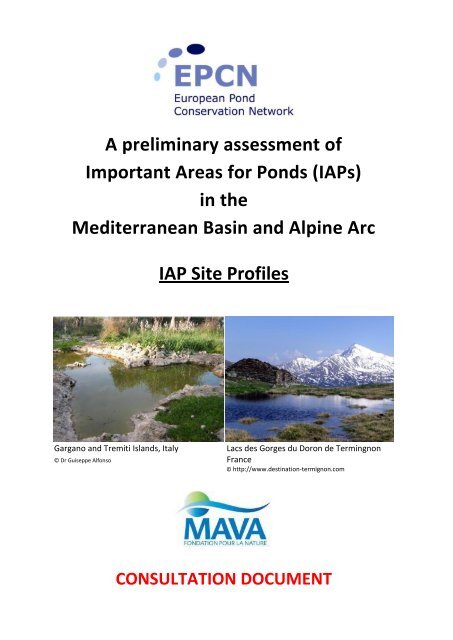
A preliminary assessment of<br />
Important Areas for Ponds (IAPs)<br />
in the<br />
Mediterranean Basin and Alpine Arc<br />
IAP Site Profiles<br />
Gargano and Tremiti Islands, Italy Lacs des Gorges du Doron de Termingnon<br />
© Dr Guiseppe Alfonso France<br />
© http://www.destination-termignon.com<br />
CONSULTATION DOCUMENT
Mediterranean Basin<br />
Country IAP Code Site Name Page no.<br />
Spain SP01 El Abalario pond complex 1<br />
Spain SP02 Temporary ponds in Alt Maestrat 4<br />
Spain SP03 Temporary ponds in Alt Palancia 6<br />
Spain S04 Bassa del Cavall 9<br />
Spain SP05 Campiña sur ponds 11<br />
Spain SP06 Cardena ponds 13<br />
Spain SP07 Donana temporary ponds 15<br />
Spain SP08 El Palancoso pond 20<br />
Spain SP09 Fuente de Piedra ponds 22<br />
Spain SP10 La Gitanilla pond 24<br />
Spain SP11 La Nava pond 26<br />
Spain SP12 La Roca pond 12<br />
Spain SP13 Lavajo de Abajo de Sinarcas 30<br />
Spain SP14 Lebrija-Las Cabezas ponds 33<br />
Spain SP15 Los Arenales ponds 35<br />
Spain SP16 Malladas de la Devesa 37<br />
Spain SP17 Menorca 39<br />
Spain SP18 Redonda or Melchor Gomez pond 43<br />
Spain SP19 Santa Olalla Ponds 45<br />
Spain SP20 Compejo Lagunar Carstico de Cuenca 47<br />
Spain SP21 Hoya de Bezas 49<br />
Spain SP22 Trujillana pond 51<br />
Spain SP23 Veiga de Pontellinares 53<br />
Spain SP24 Douro Basin 56<br />
Portugal PT01 S Miguel 65<br />
Portugal PT02 Sagres Ponds 68<br />
Portugal PT03 Malhao 71<br />
Portugal PT04 Galeado 74<br />
Portugal PT05 Vila Do Bispo 77<br />
France FR01 Agde 80<br />
France FR02 Beziers 82<br />
France FR03 Capelle 84<br />
France FR04 Centre-Var 86<br />
France FR05 Costieres 88<br />
France FR06 Crau 90<br />
France FR07 Biot 93<br />
France FR08 Mare de Catcheou 95<br />
France FR09 Massif d'Esterel 98<br />
France FR10 Plaine des Maures and Massif des Maures 101<br />
France FR11 Camargue 104<br />
France FR12 Pezenas 107<br />
i
Country IAP Code Site Name Page no.<br />
France FR13 Rodes 109<br />
France FR14 Roque-Haute 111<br />
France FR15 St Esteve et Torremila 114<br />
France FR16 Vendres 116<br />
France FR17 Agriates 118<br />
France FR18 Bonifacio 121<br />
France FR19 Cap Corse 124<br />
France FR20 Littoral SW Corsica 127<br />
France FR21 Pto Vecchio 130<br />
Italy IT01 Albegna plain ponds complex 133<br />
Italy IT02 Presidential Estate of Castelporziano 135<br />
Italy IT03 Circeo Forest 141<br />
Italy IT04 Eastern Salento 144<br />
Italy IT05 Ferrara Retting Pool Landscape 148<br />
Italy IT06 Foglino Wood 152<br />
Italy IT07 Gargano and Tremiti Islands 155<br />
Italy IT08 Isola Grande and Pantano di San Teodoro 159<br />
Italy IT09 Monte Carcaci 162<br />
Italy IT10 Monte Lauro 165<br />
Italy IT11 Monte Minerva wet area 168<br />
Italy IT12 Nardo ponds 170<br />
Italy IT13 Natural Reserve of Macchiatonda 172<br />
Italy IT14 Pantani della Doganella 175<br />
Italy IT15 Palude di Imbutillo 177<br />
Italy IT16 Porto Caleri coastal ponds 180<br />
Italy IT17 Sentina Natural Regional Reserve 183<br />
Italy IT18 Stagni Della Mercareccia 186<br />
Italy IT19 Western Salento 188<br />
Malta MAL01 San Pawl tat-Targa pools 191<br />
Montenegro MTG01 Moromis pond 193<br />
Albania ALB01 Albania 195<br />
Greece GR01 Kampos Karystou Ponds 200<br />
Greece GR02 Mount Ochi Area Ponds 203<br />
Greece GR03 Omalos pond 205<br />
Greece GR04 Schinias Marathon Ponds 208<br />
Greece GR05 Sperchios Valley Ponds 210<br />
Cyprus CYP01 Oroklini Lake Saltmarsh Ponds 212<br />
Cyprus CYP02 Paralimni Lake Ponds 214<br />
Morocco MR01 Bab Berred 216<br />
Morocco MR02 Benslimane 219<br />
Morocco MR03 Massif du Bouhachem 222<br />
Morocco MR04 Casablanca 225<br />
Morocco MR05 Chaouia 228<br />
ii
Country IAP Code Site Name Page no.<br />
Morocco MR06 Doukkala-Abda 231<br />
Morocco MR07 Essaouira 234<br />
Morocco MR08 Gharb 237<br />
Morocco MR09 Haouz-Jbilets 240<br />
Morocco MR10 Haut Atlas 243<br />
Morocco MR11 Mamora 246<br />
Morocco MR12 Moyen Atlas 249<br />
Morocco MR13 Ain Ech-Chair 252<br />
Morocco MR14 Oued Cherrat 255<br />
Morocco MR15 Peninsule Tingitane 258<br />
Algeria AG01 Alger 261<br />
Algeria AG02 Jijel 264<br />
Algeria AG03 Western Numidie 267<br />
Algeria AG04 Eastern Numidie 270<br />
Tunisia TN01 Kroumirie 273<br />
Tunisia TN02 Majen Choucha 276<br />
Tunisia TN03 Majen Chitane 279<br />
Tunisia TN04 Garaa Sejnane 282<br />
Egypt EG01 Nile 285<br />
Israel IS01 Brichat Secher pool 288<br />
Lebanon LB01 Bekaa 291<br />
Lybia LY01 Cyrénaique 294<br />
Syria SR01 Homs 297<br />
Alpine Arc<br />
Country IAP Code Site Name Page no.<br />
France FR01 Lac des Saisies 300<br />
France FR02 Zones humides des lacs de la Tempête et du col de la Louze 302<br />
France FR03 Zones humides des Menuires 304<br />
France FR04 Zones humides du col des Encombres 306<br />
France FR05 Lacs de gorges du Doron de Termignon 308<br />
France FR06 Zones humides des lacs Potron 310<br />
France FR07 Lacs du plateau du Taillefer 312<br />
France FR08 Etangs de Dormillouse 314<br />
Switzerland CH01 Gouilles des Chaux des Planards 316<br />
Switzerland CH02 Glacier de Transfleuron 318<br />
Switzerland CH03 Lötschberg 320<br />
Switzerland CH04 Grimselpass, Totesee 322<br />
Switzerland CH05 Steisee am Sustenpass 324<br />
Switzerland CH06 Rinderstock, Plattisee 326<br />
Switzerland CH07 Hinter-Silberenalp 328<br />
Switzerland CH08 Hüenderbüel Muttsee 330<br />
Switzerland CH09 Passo del San Bernardino 332<br />
iii
Country IAP Code Site Name Page no.<br />
Switzerland CH10 Pradischierer Alp 334<br />
Switzerland CH11 Golf Samedan 336<br />
Switzerland CH12 Passo del Bernina 338<br />
Switzerland CH13 Lais da Macun 340<br />
Austria AT01 Platizer Joch 342<br />
Austria AT02 Vallüaseen 344<br />
Austria AT03 Widdersberg 346<br />
Austria AT04 Schaflacken 348<br />
Austria AT05 Sieben-Möser-Gerlosplatte 350<br />
Austria AT06 Seen im Rauriser Urwald 352<br />
Austria AT07 Klafferkessel-Seen 354<br />
Austria AT08 Goldlacken und trattenscharte 356<br />
Italy IT01 Stagni Malghe pieltinis 358<br />
iv
El ABALARIO POND COMPLEX MED – SP01<br />
Administrative region Spain (Huelva, Andalucía)<br />
Coordinates (latitude/longitude) 37°07’19’’N; 06°40’57’’W<br />
Altitude 35 - 70 m<br />
Area<br />
Selection criteria #<br />
Site description<br />
“El Abalario” pond complex is a string of ponds running along a<br />
small tectonic step located south of the Rocina stream (Arroyo<br />
de la Rocina). Dozens of small springs and seasonal ponds<br />
appear in small depressions amid the stable sand dunes when<br />
water-levels rise after heavy rainfall. The regular input of<br />
groundwater with a low mineral content has led to the creation<br />
of peat bogs. The largest floodplain is the chain of ponds called<br />
“Laguna de Ribetehilos”, which has recently been restored in a<br />
project involving the deforestation of Eucalyptus plantations.<br />
Selection criteria<br />
A. Habitats of European importance (Annex I of Habitat Directive)<br />
3110: Oligotrophic waters containing very few minerals of sandy plains (Littorelletalia uniflorae).<br />
3120: Oligothrophic waters containing very few minerals generally on sandy soils of the West<br />
Mediterranean, with Isoetes spp.<br />
3160: Natural dystrophic lakes and ponds.<br />
4020: Temperate Atlantic wet heaths with Erica ciliaris and Erica tetralix.<br />
6420: Mediterranean tall humid grasslands of the Molinio-Holoschoenion.<br />
B. Species of European conservation importance<br />
Scientific name<br />
Plants<br />
Berne<br />
Convention<br />
11 282 ha<br />
A (habitat), B (species), C (density)<br />
Protection International Red List<br />
Habitat<br />
Directive<br />
1<br />
IUCN Europe<br />
Endemism to<br />
Europe<br />
Source : Antonio Sabater<br />
Other status<br />
B1.I # B1.II # B2.I # B2.II # B3 # B4 #<br />
Apium inundatum <br />
Armeria gaditana VU 2 <br />
Caropsis verticillatinundata An II <br />
1 2<br />
CR<br />
Centaurea exarata <br />
1 2<br />
VU<br />
Erica ciliari VU 2 <br />
Eryngium corniculatum VU 2 <br />
Eryngium galioides VU 2 <br />
Fuirena pubescens VU 2<br />
Frangula alnus subsp.<br />
baeticum<br />
VU 2 <br />
Gaudinia hispanica <br />
1 2<br />
VU<br />
Isoetes velatum subsp.<br />
velatum<br />
An II DD 2
Scientific name<br />
Plants<br />
Emys orbicularis An II An II/IV LR/NT NT/VU <br />
Mauremys leprosa<br />
1<br />
in Spain IUCN red list 2008.<br />
2<br />
in Andalucia IUCN red list 2006.<br />
An II An II/IV NT NT <br />
3<br />
rare in Spain though it has not been included on any list.<br />
C. Pond density<br />
There are 429 ponds located within this protected area of 11 282 ha, which comprise a total flooded<br />
area of about 647 ha.<br />
D. Socio-economic importance<br />
Not applicable.<br />
E. Other selection criteria<br />
None.<br />
Berne<br />
Convention<br />
Protection International Red List<br />
Habitat<br />
Directive<br />
2<br />
IUCN Europe<br />
Endemism <br />
to<br />
Europe<br />
Other status<br />
B1.I # B1.II # B2.I # B2.II # B3 # B4 #<br />
Juncus emmanuelis <br />
Juncus heterophyllus NT <br />
Litorella uniflora VU <br />
Micropyropsis tuberosa An I AnII CR <br />
1 2<br />
EN<br />
Pinguicula lusitanica EN VU 2 <br />
Plantago algarbiensis CR 1 EN 2<br />
Potamogeton lucens DD 2 <br />
Potamogeton polygonifolius DD 2 <br />
Rhynchospora modestilucennoi<br />
<br />
1 2<br />
CR<br />
Ricciocarpus natans Rare 3<br />
Sedum maireanum VU 2<br />
Sphagnum auriculatum Rare 3<br />
Sphagnum inundatum Rare 3 <br />
Stipa gigantea subsp.<br />
donyanae <br />
EN 1 VU 2<br />
Utricularia exoleta<br />
Amphibians<br />
<br />
1 2<br />
CR<br />
Bufo bufo An III LC LC <br />
Discoglossus galganoi An II An II/IV LC LC <br />
Epidalea calamita An II An IV LC LC <br />
Hyla meridionalis An II An IV LC LC <br />
Lissontriton boscai An III LC LC <br />
Pelobates cultripes An II An IV NT NT <br />
Pelophylax perezi An III An IV LC LC <br />
Pleurodeles waltl An III NT NT <br />
Triturus pygameus An III An IV NT NT <br />
Reptiles
Site designation<br />
International: - Natura 2000 site (SCI), SPA, RAMSAR.<br />
National: - Parque Natural de Doñana.<br />
Main threats<br />
- Reduction in the length of the water phase due to groundwater abstraction for intensive agriculture<br />
in the surrounding region (watershed and streams).<br />
Map<br />
Other comments<br />
None.<br />
Site proposed by/sources of information<br />
- García-Murillo P 1 , Fernández-Zamudio R 1 , Díaz-Paniagua C 2 & Serrano L 1 .<br />
- “Red de Seguimiento y evaluación de los humedales andaluces”, Consejería de Medio Ambiente,<br />
Junta de Andalucía.<br />
1 Department of Plant Biology and Ecology, University of Seville.<br />
2 Doñana Biological Station-CSIC.<br />
http://www.juntadeandalucia.es/medioambiente/site/web<br />
3
TEMPORARY PONDS IN ALT MAESTRAT MED – SP02<br />
Administrative region Penyagolosa, Alt Maestrat<br />
Coordinates (latitude/longitude) 40°24’00’’N; 00°04’00’’W<br />
Altitude 900 - 1300 m<br />
Area<br />
Selection criteria #<br />
Site description<br />
The temporary pools in this IAP are located in a<br />
mountainous area situated north of Valencia in a forest<br />
environment with low population density. The area has high<br />
annual rainfall when compared with the rest of the region<br />
(700-800 mm) and as a result there are numerous small<br />
temporary ponds. The banks of many of these have been<br />
reinforced with dry stone walls. These add historical value<br />
as they represent a traditional maintenance method.<br />
Selection criteria<br />
A. Habitats of European importance (Annex I of Habitat Directive)<br />
3170: Mediterranean temporary ponds.<br />
B. Species of European conservation importance<br />
Scientific name<br />
C. Pond density<br />
High.<br />
Berne<br />
Convention<br />
43 612 ha<br />
A (habitat), B (species)<br />
Protection International Red List<br />
Habitat<br />
Directive<br />
4<br />
IUCN Europe<br />
Endemism to<br />
Europe<br />
Source Universidad de Valencia<br />
Other status<br />
B1.I # B1.II # B2.I # B2.II # B3 # B4 #<br />
Amphibians<br />
Alytes obstetricans An II An IV LC LC <br />
Bufo bufo An III LC LC <br />
Epidalea calamita An II An IV LC LC <br />
Pelobates cultripes An II An IV NT NT <br />
Pelodytes punctatus An III LC LC <br />
Pelophylax perezi An III An V LC LC <br />
Pleurodeles waltl<br />
Crustaceans<br />
An III NT NT <br />
Chirocephalus diaphanus Rare<br />
Daphnia atkinsoni Rare<br />
Mixodiaptomus incrassatus Rare<br />
Triops cancriformis Very rare
D. Socio-economic importance<br />
Used for livestock watering.<br />
E. Other selection criteria<br />
High species diversity.<br />
Site designation<br />
International: - Natura 2000 site.<br />
National: - Natural Park Penyagolosa.<br />
Main threats<br />
- Excessive trampling of pond margins.<br />
- Water pollution (eutrophication) from excessive presence of livestock in some ponds.<br />
Map<br />
Other comments<br />
There are almost no other types of aquatic ecosystems in the area, except for small springs.<br />
Site proposed by/sources of information<br />
- University of Valencia (Maria Sahuquillo and M. Rosa Miracle).<br />
- Generalitat Valenciana, Regional Ministry of Environment (Vicente Sancho and Ignacio Lacomba).<br />
5
TEMPORARY PONDS IN ALT PALANCIA MED – SP03<br />
Administrative region Alt Palancia (Castellón-Valencia, Eastern Spain)<br />
Coordinates (latitude/longitude) 49°39’00’’N; 00°39’00’’W<br />
Altitude 1 000 m<br />
Area<br />
Selection criteria #<br />
Site description<br />
The temporary ponds of this IAP are located on the central<br />
plateau of Valencia under a continental Mediterranean<br />
climate with annual rainfall of about 517 mm per year.<br />
Temporary ponds are numerous in the region, mainly due<br />
to the natural endorheic and soil characteristics of the area<br />
that promotes the formation of these flooded areas, but<br />
also due to their importance for sheep watering. Nowadays<br />
many ponds are disappearing due to the abandonment of<br />
traditional livestock management or the lining of the pond<br />
basin with concrete. Nevertheless some ponds in the area<br />
still retain very interesting and unique communities of large<br />
branchiopods.<br />
Selection criteria<br />
A. Habitats of European importance (Annex I of Habitat Directive)<br />
3170: Mediterranean temporary ponds.<br />
26 267 ha<br />
A (habitat), B (species)<br />
B. Species of European conservation importance<br />
Scientific name<br />
Berne<br />
Convention<br />
Protection International Red List<br />
Habitat<br />
Directive<br />
6<br />
IUCN Europe<br />
Image of El Rabalsador, a large ephemeral pond.<br />
Endemism to<br />
Europe<br />
Other status<br />
B1.I # B1.II # B2.I # B2.II # B3 # B4 #<br />
Plants<br />
Chara fragilis <br />
Chara vulgaris <br />
Groenlandia densa<br />
Amphibians<br />
<br />
Alytes obstetricans An II An IV LC LC <br />
Bufo bufo An III LC LC <br />
Epidalea calamita An II An IV LC LC <br />
Pelobates cultripes An II An IV NT NT <br />
Pelodytes punctatus An III LC LC <br />
Pelophylax perezi An III An V LC LC <br />
Pleurodeles waltl<br />
Crustaceans<br />
An III NT NT <br />
Branchipus schaefferi Very rare<br />
Daphnia atkinsoni Rare
Scientific name<br />
C. Pond density<br />
High.<br />
D. Socio-economic importance<br />
Used for livestock watering.<br />
E. Other selection criteria<br />
It is the only locality in the Iberian Peninsula for the concostracean Isaura mayeti (the other Spanish<br />
locality being in the Balearic Islands).<br />
Site designation<br />
International: - Natura 2000 site.<br />
National: - Reserves of fauna.<br />
Main threats<br />
Berne<br />
Convention<br />
Protection International Red List<br />
Habitat<br />
Directive<br />
- Excessive trampling of pond margins.<br />
- Water pollution (eutrophication) from excessive presence of livestock in some ponds.<br />
- Inadequate maintenance practices, such as concreting of the pond basin.<br />
- Habitat destruction by draining or abandonment of maintenance of surface inflows.<br />
7<br />
IUCN Europe<br />
Endemism to<br />
Europe<br />
Other status<br />
B1.I # B1.II # B2.I # B2.II # B3 # B4 #<br />
Crustaceans<br />
Isaura mayeti Rare<br />
Neolovenulla alluaudi Rare<br />
Streptocephalus torvicornis Very rare<br />
Triops cancriformis Rare
Map<br />
Other comments<br />
None.<br />
Site proposed by/sources of information<br />
- University of Valencia (Maria Sahuquillo and M. Rosa Miracle).<br />
- Generalitat Valenciana, Regional Ministry of Environment (Vicente Sancho and Ignacio Lacomba).<br />
8
BASSA DEL CAVALL MED – SP04<br />
Administrative region Albalat dels Tarongers (Valencia, Easern Spain)<br />
Coordinates (latitude/longitude) 39°38’50’’N; 00°21’51’’W<br />
Altitude 211 m<br />
Area<br />
Selection criteria #<br />
Site description<br />
This IAP is a well preserved Mediterranean Temporary<br />
Pond located on a small hill close to the coastal strip,<br />
over a substrate mainly constituted of sandstones. The<br />
pond is surrounded by a well preserved Mediterranean<br />
"maquis". In spring, a complex aquatic vegetation<br />
community develops in the pond, ordered from<br />
emergent plants in the outermost ring to Ranunculus in<br />
the centre. The pond also supports a unique crustacean<br />
fauna.<br />
Selection criteria<br />
A. Habitats of European importance (Annex I of Habitat Directive)<br />
3170: Mediterranean temporary ponds.<br />
B. Species of European conservation importance<br />
Scientific name<br />
C. Pond density<br />
Not applicable.<br />
D. Socio-economic importance<br />
Not applicable.<br />
Berne<br />
Convention<br />
0.0456 ha<br />
A (habitat), B (species)<br />
Protection International Red List<br />
Habitat<br />
Directive<br />
9<br />
IUCN Europe<br />
Endemism to<br />
Europe<br />
Source Universidad de Valencia<br />
Other status<br />
B1.I # B1.II # B2.I # B2.II # B3 # B4 #<br />
Amphibians<br />
Bufo bufo An III LC LC <br />
Pelobates cultripes An II An IV NT NT <br />
Pelodytes punctatus An III LC LC <br />
Pelophylax perezi An III An V LC LC <br />
Pleurodeles waltl<br />
Crustaceans<br />
An III NT NT <br />
Alona azorica Rare species<br />
Ceriodaphnia nova sp. Rare species<br />
Hemidiaptomus ingens Very rare
E. Other selection criteria<br />
High species diversity.<br />
Site designation<br />
International: - None.<br />
National: - Sierra Calderona Natural Park.<br />
- Micro-reserve of Flora.<br />
Main threats<br />
Map<br />
- So far this site is relatively safe from threats, mainly due to its remoteness; the only access being a<br />
path.<br />
Other comments<br />
Due to the uniqueness of the crustacean community, its preservation and protection is essential. It is one<br />
of the only two localities of Hemidiaptomus ingens in the Iberian Peninsula.<br />
Site proposed by/sources of information<br />
http://gva.gis<br />
- University of Valencia (Maria Sahuquillo and M. Rosa Miracle).<br />
- Generalitat Valenciana, Regional Ministry of Environment (Vicente Sancho and Ignacio Lacomba).<br />
10
CAMPIÑA SUR PONDS MED – SP05<br />
Administrative region Spain (Badajoz, Extremadura Region)<br />
Coordinates (latitude/longitude) 38°22’55.51’’N; 05°54’23.73’’W<br />
Altitude 200 - 600 m<br />
Area<br />
Selection criteria #<br />
Site description<br />
This IAP is a complex of small ponds located in an extensive cereal plain to the South of Badajoz province.<br />
It is an important area for birds.<br />
Selection criteria<br />
A. Habitats of European importance (Annex I of Habitat Directive)<br />
3170: Mediterranean temporary ponds.<br />
B. Species of European conservation importance<br />
The species list for this IAP has not been completed yet. This will be a priority to determine whether<br />
this site qualifies as an IAP.<br />
C. Pond density<br />
Low, between 1 and 5 ponds per km 2 .<br />
D. Socio-economic importance<br />
Not applicable.<br />
E. Other selection criteria<br />
None.<br />
Site designation<br />
None.<br />
Main threats<br />
- Desiccation.<br />
- Soil tillage.<br />
60 000 ha<br />
A (habitat)<br />
11
Map<br />
Other comments<br />
These ponds are highly threatened. Most of them will disappear in next few years because of human<br />
activities.<br />
Site proposed by/sources of information<br />
- Pérez Bote Jose Luís, Universidad de Extremadura, jlperez@unex.es.<br />
12
CARDEÑA PONDS MED – SP06<br />
Administrative region Spain (Comarca del Valle de Los Pedroches, Córdoba, Andalucía)<br />
Coordinates (latitude/longitude) 38°13’00’’N; 04°15’00’’W<br />
Altitude 200 - 828 m<br />
Area<br />
Selection criteria #<br />
Site description<br />
This IAP is in the north-east of Cordoba (Andalusia), in the<br />
Pedroche region, inside the Natural Park "Sierra de Cardeña y<br />
Montoro". Evergreen scrub with Quercus spp. is the most<br />
common habitat surrounding the ponds. Activities in this<br />
region include extensive farming and hunting. The ponds<br />
support habitat for different species, including protected<br />
important populations of amphibians, reptilians and fish. This<br />
aquatic biodiversity is possible because of the presence of<br />
many farm ponds constructed by private landowners. In fact,<br />
there are no natural wetlands inventoried in this area.<br />
Selection criteria<br />
A. Habitats of European importance (Annex I of Habitat Directive)<br />
3170: Mediterranean temporary ponds.<br />
B. Species of European conservation importance<br />
Scientific name<br />
Amphibians<br />
C. Pond density<br />
Berne<br />
Convention<br />
Low, between 1 and 2 ponds per km 2 .<br />
1 200 ha<br />
A (habitat), B (species), D (socio-economic)<br />
Protection International Red List<br />
Habitat<br />
Directive<br />
13<br />
IUCN Europe<br />
Endemism to<br />
Europe<br />
Other status<br />
B1.I # B1.II # B2.I # B2.II # B3 # B4 #<br />
Alytes cisternasii An II An IV NT NT <br />
Bufo bufo An III LC LC <br />
Epidalea calamita An II An IV LC LC <br />
Hyla meridionalis An II An IV LC LC <br />
Pelobates cultripes An II An IV NT NT <br />
Pelodytes ibericus An III LC LC <br />
Pelophylax perezi An III An V LC LC <br />
Lissontriton boscai An III NT NT <br />
Reptiles<br />
Emys orbicularis An II An II/IV LR/NT NT/VU <br />
Mauremys leprosa An II An II/IV NT NT <br />
Fishes<br />
Cobitis paludica An III
D. Socio-economic importance<br />
Farming and agricultural use, as a supply of freshwater.<br />
E. Other selection criteria<br />
These ponds support species which are endemic to the Iberian Peninsula: Alytes cisternasii and<br />
Pelodytes ibericus, in spite of the lack of natural wetlands in this area.<br />
Site designation<br />
International: - Natura 2000 site ES613000 «Sierra de Cardeña y Montoro ».<br />
- Included in 6310: Dehesas perennifolias de Quercus spp (Habitat Directive, Annex I).<br />
National: - Included in RENPA (Natural Net Protected Areas in Andalusia).<br />
- Included in ZEPA (Special Protected Area for Birds).<br />
Main threats<br />
- Farm use.<br />
- Introduced fish species.<br />
Map<br />
Other comments<br />
None.<br />
Site proposed by/sources of information<br />
- European Pond Conservation Network (EPCN).<br />
- Network of Protected Areas of Andalusia, España.<br />
14
DOÑANA TEMPORARY PONDS MED – SP07<br />
Administrative region Spain (Huelva, Andalucia)<br />
Coordinates (latitude/longitude) 37°00’00’’N; 06°38’00’’W<br />
Altitude 0 - 32 m<br />
Area<br />
Selection criteria #<br />
Site description<br />
54 000 ha<br />
A (habitat), B (species), C (density)<br />
More than 3000 temporary ponds flood after heavy autumn or winter rains in Doñana National Park (SW<br />
Spain). This Park includes three main landscapes: (i) a silty-clay floodplain with a seasonally flooded<br />
marshland formed at the mouth of the Guadalquivir River, (ii) a mobile dune system running parallel to<br />
the Atlantic coast line with several trains of fronts and dune slacks, and (iii) a stable dune area originated<br />
by earlier dune generations with smooth depressions which constitute the basins of most temporary<br />
ponds. Mediterranean scrub is the typical vegetation of this area. It is mainly composed of Halimium<br />
halimifolium and Stauracanthus genistoides with isolated cork oak trees (Quercus suber) and thickets of<br />
pines (Pinus pinea).<br />
Freshwater ponds are filled (with rainfall, runoff and/or groundwater discharge) in smooth basins on<br />
sandy soils with superficial horizons of silty texture or on soils with an argilic horizon of semipermeable<br />
sediment which favours the accumulation of water. Ponds present a wide variation in size, length of the<br />
aquatic phase, and limnological features, partly depending on their location: in large or small depressions<br />
on the stable dunes, in wet sand dune slacks, or in transitional areas towards the marshland. The number<br />
of ponds and their characteristics also vary among successive years, which implies a significant<br />
interannual variation in species richness in each pond.<br />
15
Selection criteria<br />
A. Habitats of European importance (Annex I of Habitat Directive)<br />
3130: Oligotrophic to mesotrophic standing waters with vegetation of the Littorelletea uniflorae<br />
and/or the Isoeto-Nanojuncetea.<br />
3140: Hard oligo-mesotrophic waters with benthic vegetation of Chara spp.<br />
3160: Natural dystrophic lakes and ponds.<br />
3170: Mediterranean temporary ponds.<br />
B. Species of European conservation importance<br />
Scientific name<br />
Plants<br />
Berne<br />
Convention<br />
Protection International Red List<br />
Habitat<br />
Directive<br />
16<br />
IUCN Europe<br />
Endemism to<br />
Europe<br />
Other status<br />
B1.I # B1.II # B2.I # B2.II # B3 # B4 #<br />
Apium inundatum <br />
Avellara fistulosa <br />
1 2<br />
CR<br />
Bulbostylis cicoiana EN 1 CR 2<br />
Callitriche lusitanica DD 1 EN 2<br />
Callitriche platycarpa sensu <br />
Caropsis verticillaoinundata An II <br />
1 2<br />
CR<br />
Elatine alsinastrum CR <br />
Eryngium corniculatum VU 2<br />
Eryngium galioides VU 2<br />
Fuirena pubescens NT VU 2<br />
Glyceria fluitans NT 2<br />
Gratiola linifolia NT 2<br />
Hydrocharis morsus-ranae CR<br />
Isolepis fluitans <br />
Juncus enmanuelis <br />
Juncus heterophyllus NT <br />
Juncus x donyanae <br />
Lemna trisulca VU CR 1 DD 2<br />
Marsilea strigosa An I An II/IV EN VU 2<br />
Micropiropsis tuberosa An I AnII CR EN<br />
Nitella ornithopoda EN 1<br />
Potamogeton lucens <br />
Potamogeton natans <br />
Potamogeton polygonifolius <br />
Ranunculus peltatus subsp.<br />
fucoides <br />
Ranunculus tripartitus VU <br />
Rhynchospora modestilucennoi<br />
<br />
Spirodella polyrrhiza <br />
Utricularia exoleta CR<br />
Wolffia arrhiza VU EN<br />
Zannichellia obtusifolia VU 2<br />
1 2<br />
1 2<br />
1 2<br />
CR<br />
1 2<br />
1 2
Scientific name<br />
Amphibians<br />
Berne<br />
Convention<br />
Protection International Red List<br />
Habitat<br />
Directive<br />
17<br />
IUCN Europe<br />
Endemism to<br />
Europe<br />
Other status<br />
B1.I # B1.II # B2.I # B2.II # B3 # B4 #<br />
Epidalea calamita An II An IV LC LC <br />
Discoglossus galganoi An II An IV LC LC <br />
Hyla meridionalis An II An IV LC LC <br />
Lissontriton boscai An III LC LC <br />
Pelobates cultripes An II An IV NT NT <br />
Pelophylax perezi An III An V LC LC <br />
Pleurodeles waltl An II NT NT <br />
Triturus pygmaeus An III NT NT <br />
Crustaceans<br />
Branchipus cortesi <br />
Cyzicus grubei <br />
Daphnia hispanica <br />
Dussartius baeticus VU <br />
Maghrebestheria maroccana <br />
Triops mauritanicus <br />
Rotifera<br />
Lecane donyanaensis <br />
Odonata<br />
Aeshna affinis LC DD 2<br />
Aeshna mixta DD 1<br />
Coenagrion scitulum VU<br />
Lestes barbarus LC <br />
Lestes dryas VU 2 <br />
Lestes macrostigma VU<br />
Lestes virens <br />
Orthetrum nitidinerve VU<br />
Sympetrum meridionale DD 1<br />
Coleoptera<br />
Acilius duvergeri VU VU 1 EN 2<br />
Bagous revelieri <br />
Bagous vivesi <br />
Cybister tripunctatus<br />
africanus<br />
<br />
Cyphon pandellei <br />
Dryops doderoi <br />
Helophorus seidlitzii <br />
Hydraena corrugis <br />
Hydroporus lucasi <br />
Hygrotus lagari <br />
Lacobius revelieri <br />
Microcara dispar <br />
Ochthebius auropallens <br />
1 2<br />
1 2<br />
1 2
Scientific name<br />
Heteroptera<br />
Sigara stagnallis<br />
1<br />
in Spain IUCN red list 2008<br />
<br />
2<br />
in Andalucia IUCN red list 2006<br />
C. Pond density<br />
High, between 1 and 200 ponds per km 2 .<br />
D. Socio-economic importance<br />
Not applicable.<br />
E. Other selection criteria<br />
None.<br />
Site designation<br />
International: - Ramsar site.<br />
- Natura 2000 site.<br />
- UNESCO MAB Biosphere Reserve.<br />
- World Heritage Site.<br />
National: - Parque Nacional de Doñana.<br />
Main threats<br />
Berne<br />
Convention<br />
Protection International Red List<br />
Habitat<br />
Directive<br />
- Overexplotation of groundwater due to extensive agriculture in surrounding areas and to<br />
tourist resorts.<br />
- Exotic species introduction or expansion (such as Procambarus clarkii or Azolla filiculoides).<br />
18<br />
IUCN Europe<br />
Endemism to<br />
Europe<br />
Other status<br />
B1.I # B1.II # B2.I # B2.II # B3 # B4 #<br />
Gerris thoracicus <br />
Micronecta scholzi <br />
Naucoris maculatus <br />
Notonecta glauca<br />
meridionalis<br />
<br />
Notonecta maculata <br />
Notonecta viridis
Map<br />
Other comments<br />
None.<br />
Site proposed by/sources of information<br />
- Díaz-Paniagua C 1 , Serrano L 2 , Florencio M 1 , Gómez-Rodríguez C 1 , Fernández-Zamudio R 2 & García-<br />
Murillo P 2 .<br />
1 Doñana Biological Station-CSIC.<br />
2 Department of Plant Biology and Ecology, University of Seville.<br />
19
El PALANCOSO POND MED – SP08<br />
Administrative region Cáceres, Extremadura Region (Spain)<br />
Coordinates (latitude/longitude) 39°57’47.97’’N; 05°30’41.13’’W<br />
Altitude 300 m<br />
Area<br />
Selection criteria #<br />
Site description<br />
This IAP is centered on the largest Mediterranean Temporary Pond in the Extremadura Region (approx.<br />
1km 2 ). It is located in an extensive plain to the south of the Gredos´s Mountains and is an important area for birds.<br />
Selection criteria<br />
A. Habitats of European importance (Annex I of Habitat Directive)<br />
3170: Mediterranean Temporary Pond.<br />
B. Species of European conservation importance<br />
The species list for this IAP has not been completed yet. This will be a priority to determine whether<br />
this site qualifies as an IAP.<br />
C. Pond density<br />
Not applicable.<br />
D. Socio-economic importance<br />
No information.<br />
E. Other selection criteria<br />
None.<br />
Site designation<br />
None.<br />
Main threats<br />
No information.<br />
31.43 ha<br />
A (habitat)<br />
20
Map<br />
Other comments<br />
None.<br />
Site proposed by/ sources of information<br />
- Pérez Bote Jose Luís, Universidad de Extremadura, jlperez@unex.es.<br />
21
FUENTE DE PIEDRA PONDS MED – SP09<br />
Administrative region Malaga Province (Spain)<br />
Coordinates (latitude/longitude) 37°03’37’’N; 06°11’37’’W<br />
Altitude 410 m<br />
Area<br />
Selection criteria #<br />
Site description<br />
Fuente de Piedra playa-lake and associated ponds are located to the<br />
northwest of the Málaga province, very near the Fuente de Piedra village.<br />
Fuente de Piedra is situated within a closed watershed (150 km 2 ) where<br />
evaporation exceeds precipitation on an annual basis, so the ponds are<br />
normally dry in summer. The geological substrate of the site is constituted<br />
of Keuper marls, gypsum and clays of the Triassic. Placed above the<br />
substratum, quaternary alluvium and miocene sandstones are the main<br />
permeable lithologies forming the aquifer. Fuente de Piedra playa-lake is<br />
fed by rainwater, ephemeral stream water (Santillán and Charcón<br />
streams) and groundwater from the Fuente de Piedra aquifer. The water<br />
output is mainly evaporation.<br />
Selection criteria<br />
A. Habitats of European importance (Annex I of Habitat Directive)<br />
3170: Mediterranean Temporary Pond.<br />
B. Species of European conservation importance<br />
Scientific name<br />
Berne<br />
Convention<br />
1800 ha<br />
A (habitat), B (species), C (density)<br />
Protection International Red List<br />
Habitat<br />
Directive<br />
22<br />
IUCN Europe<br />
Endemism to<br />
Europe<br />
Source : M. Rodriguez-Rodriguez<br />
Other status<br />
B1.I # B1.II # B2.I # B2.II # B3 # B4 #<br />
Plants<br />
Ruppia drepanensis<br />
Amphibians<br />
<br />
Discoglossus pictus An II An IV LC LC <br />
Pelobates cultripes An II An IV NT NT <br />
Pelodytes punctatus An III LC LC <br />
Pleurodeles waltl An III NT NT <br />
Hyla meridionalis<br />
Crustaceans<br />
An II An IV LC LC <br />
Phoenicopterus ruber
C. Pond density<br />
Low, 0.01 ponds per km 2 .<br />
D. Socio-economic importance<br />
Agriculture – olive orchards.<br />
E. Other selection criteria<br />
None.<br />
Site designation<br />
International: - Natura 2000 site « Laguna de Fuente de Piedra, Laguna del Gosque, Lagunas de<br />
Campillos ».<br />
National: - Reserva Natural.<br />
- ZEPA (Bird Special Protection Area).<br />
Main threats<br />
- Groundwater abstraction for irrigation of olive groves (dip irrigation).<br />
- Erosion of the basin and playa – lake filling.<br />
Map<br />
Other comments<br />
None.<br />
Site proposed by/sources of information:<br />
Source: M.Rodríguez-Rodríguez<br />
- Miguel Rodríguez-Rodríguez, University Pablo de Olavide; email: mrodrod@upo.es<br />
23
LA GITANILLA POND MED – SP10<br />
Administrative region Badajoz, Extremadura Region (Spain)<br />
Coordinates (latitude/longitude) 38°39’39.21’’N; 06°44’27.82’’W<br />
Altitude 200 - 300 m<br />
Area<br />
Selection criteria #<br />
Site description<br />
This IAP is based on an important Mediterranean Temporary<br />
Pond located near the Complejo Lagunar de la Albuera (ZEPA,<br />
LIC). Important populations of branchiopods are known to<br />
occur in the pond. It is also used as an important area for<br />
migrating birds.<br />
Selection criteria<br />
A. Habitats of European importance (Annex I of Habitat Directive)<br />
3170: Mediterranean Temporary Pond.<br />
B. Species of European conservation importance<br />
The species list for this IAP has not been completed yet. This will be a priority, to determine whether<br />
this site qualifies as an IAP.<br />
C. Pond density<br />
Not applicable.<br />
D. Socio-economic importance<br />
No information.<br />
E. Other selection criteria<br />
None.<br />
Site designation<br />
None.<br />
Main threats<br />
350 ha<br />
A (habitat)<br />
- Drying out due to drainage and abstraction.<br />
- Threat of destruction from a planned transport route.<br />
24
Map<br />
Other comments<br />
None.<br />
Site proposed by/sources of information<br />
- Pérez Bote Jose Luís, Universidad de Extremadura, jlperez@unex.es.<br />
25
LA NAVA POND MED – SP11<br />
Administrative region Badajoz, Extremadura Region (Spain)<br />
Coordinates (latitude/longitude) 39°04’17.63’’N; 06°29’57.09’’W<br />
Altitude 200 - 300 m<br />
Area<br />
Selection criteria #<br />
Site description<br />
This IAP is a complex of small ponds in the cultivated areas<br />
near the San Pedro Mountains. The underlying bedrock is<br />
formed from miocene deposits, from which a loamy<br />
haploxeralf soil has developed. This wetland area is an<br />
important stop-over for migratory birds.<br />
Selection criteria<br />
A. Habitats of European importance (Annex I of Habitat Directive)<br />
3170: Mediterranean Temporary Pond.<br />
B. Species of European conservation importance<br />
The species list for this IAP has not been completed yet. This will be a priority, to determine whether<br />
this site qualifies as an IAP.<br />
C. Pond density<br />
Low, between 1 and 3 ponds per km 2 .<br />
D. Socio-economic importance<br />
No information.<br />
E. Other selection criteria<br />
None.<br />
Site designation<br />
None.<br />
Main threats<br />
350 ha<br />
A (habitat)<br />
- Drying out due to drainage and abstraction.<br />
26
Map<br />
Other comments<br />
None.<br />
Site proposed by/sources of information<br />
- Pérez Bote Jose Luís, Universidad de Extremadura, jlperez@unex.es.<br />
27
LA ROCA POND MED – SP12<br />
Administrative region Badajoz, Extremadura Region (Spain)<br />
Coordinates (latitude/longitude) 39°04’6.77’’N; 06°37’54.18’’W<br />
Altitude 200 - 300 m<br />
Area<br />
Selection criteria #<br />
Site description<br />
This IAP is a complex of small ponds in the cultivated<br />
areas near the San Pedro Mountains. The underlying<br />
bedrock is formed from miocene deposits, from which a<br />
loamy haploxeralf soil has developed. These pools are<br />
thought to be of particular importance for their<br />
Branchiopod communities, but data on the species<br />
present has not been collated.<br />
Selection criteria<br />
A. Habitats of European importance (Annex I of Habitat Directive)<br />
3170: Mediterranean Temporary Pond.<br />
B. Species of European conservation importance<br />
The species list for this IAP has not been completed yet. This will be a priority, to determine whether<br />
this site qualifies as an IAP.<br />
C. Pond density<br />
Low, between 1 and 5 ponds per km 2 .<br />
D. Socio-economic importance<br />
No information.<br />
E. Other selection criteria<br />
None.<br />
Site designation<br />
None.<br />
Main threats<br />
876 ha<br />
A (habitat)<br />
- Drying out due to drainage and water abstraction.<br />
28
Map<br />
Other comments<br />
None.<br />
Site proposed by/sources of information<br />
- Pérez Bote Jose Luís, Universidad de Extremadura, jlperez@unex.es.<br />
29
LAVAJO DE ABAJO DE SINARCAS MED – SP13<br />
Administrative region Sinarcas, Valencia (Eastern Spain)<br />
Coordinates (latitude/longitude) 39°45’10’’N; 01°14’14’’W<br />
Altitude 869 m<br />
Area<br />
Selection criteria #<br />
Site description<br />
“Lavajo” is one of the popular names given to steppic, endorheic or semiendorheic ponds. This temporary<br />
pond occupies the centre of a flooded meadow, inside a natural depression made up of Plio-Quaternary<br />
siliciclastic deposits (rañas) lying on top of Miocenic sediments. The pond usually fills up with autumnal<br />
rains - the hydroperiod is more or less predictable and relatively long (6-8 months) allowing for a clear<br />
succession of phases made up by the replacement of different crustacean communities. From a regional<br />
point of view many of the species found in Lavajo de Sinarcas have an exclusive occurrence in this pond,<br />
including endemic and very uncommon species. This constitutes one of the most interesting<br />
Mediterranean temporary ponds, as regards to aquatic communities, of Valencia and probably of the<br />
Iberian Peninsula. It is now partly transformed into agricultural fields (vineyards and cereals) and it is also<br />
used for sheep watering.<br />
Selection criteria<br />
A. Habitats of European importance (Annex I of Habitat Directive)<br />
3170: Mediterranean Temporary Pond.<br />
24.38 ha<br />
A (habitat), B (species)<br />
30
B. Species of European conservation importance<br />
Scientific name<br />
C. Pond density<br />
There are some other temporary ponds in the area: Lavajo de Arriba (much modified by deepening)<br />
and Laguna de Talayuelas temporary pond.<br />
D. Socio-economic importance<br />
Used for watering livestock.<br />
E. Other selection criteria<br />
Very high species diversity.<br />
Site designation<br />
Berne<br />
Convention<br />
Protection International Red List<br />
Habitat<br />
Directive<br />
International: - Natura 2000 site.<br />
National: - Regional Wetland Inventory.<br />
- Micro-reserve of flora.<br />
31<br />
IUCN Europe<br />
Endemism to<br />
Europe<br />
Other status<br />
B1.I # B1.II # B2.I # B2.II # B3 # B4 #<br />
Plants<br />
Chara fragilis <br />
Isoetes velata <br />
Marsilea strigosa An I An II/IV EN <br />
Miriophyllum alterniflorum <br />
Amphibians<br />
Alytes obstetricans An II An IV LC LC <br />
Bufo bufo An III LC LC <br />
Epidalea calamita An II An IV LC LC <br />
Pelobates cultripes An II An IV NT NT <br />
Pelodytes punctatus An III LC LC <br />
Pelophylax perezi An III An V LC LC <br />
Pleurodeles waltl<br />
Crustaceans<br />
An III NT NT <br />
Branchipus cortesi Very rare<br />
Diaptomus cyaneus Rare<br />
Ephemeroporus phintonicus Rare<br />
Hemidiaptomus ingens Very rare<br />
Leberis diaphana Rare<br />
Maghrebestheria maroccana Very rare<br />
Triops cancriformis Rare
Main threats<br />
- Increasing conductivity in water and soils due to the use of salt de-icing on the nearby road during<br />
snows.<br />
- Nutrient and toxic substance inputs from fertilizers and pesticides applied to the surrounding<br />
agricultural fields.<br />
- Encroachment of the peripheral zone of the pond by crops (vineyards and cereals). In the map a line<br />
indicates pond surface when is totally flooded in spring, this is well over the adjacent agricultural<br />
fields.<br />
Map<br />
Other comments<br />
It is one of the two localities of Hemidiaptomus inges in the Iberian Peninsula.<br />
Site proposed by/sources of information<br />
http://orto.cth.gva.es/website/urbanismo/viewer.htm<br />
- University of Valencia (Maria Sahuquillo and M. Rosa Miracle).<br />
- Generalitat Valenciana, Regional Ministry of Environment (Vicente Sancho and Ignacio<br />
Lacomba).<br />
32
LEBRIJA-LAS CABEZAS PONDS MED – SP14<br />
Administrative region Comarca Lebrija y Las Cabezas de San Juan, Sevilla, Andalucía<br />
(Spain)<br />
Coordinates (latitude/longitude) 36°53’00’’N; 05°53’00’’W<br />
Altitude 44 - 114 m<br />
Area<br />
Selection criteria #<br />
Site description<br />
This steppe site is located south of Seville (villages of Las<br />
Cabezas de San Juan and Lebrija). High groundwater levels<br />
maintain the endorreic complex "Lebrija-Las Cabezas",<br />
which is protected by regional and European legislation<br />
(Reserva Natural, Ramsar Zone). This area is also included in<br />
a Special Protected Area for Birds (ZEPA). The geological<br />
substrate of the site is mostly marl, gypsum and sandstone.<br />
Pond formation results from runoff after the rains (600<br />
mm, annual average). Many farm ponds have been created<br />
in the surrounding area for agricultural and farming use.<br />
These could have an important role complementing natural<br />
wetlands as biodiversity hotspots.<br />
Selection criteria<br />
A. Habitats of European importance (Annex I of Habitat Directive)<br />
3140: Hard oligo-mesotrophic standing waters with benthic vegetation of Chara species.<br />
B. Species of European conservation importance<br />
Scientific name<br />
Amphibians<br />
C. Pond density<br />
Berne<br />
Convention<br />
Low, between 1 and 2 ponds per km 2 .<br />
D. Socio-economic importance<br />
1200 ha<br />
A (habitat), B (species), D (socio-economic)<br />
Protection International Red List<br />
Habitat<br />
Directive<br />
Farming and agricultural use, as a source of fresh water.<br />
33<br />
IUCN Europe<br />
Endemism to<br />
Europe<br />
Other status<br />
B1.I # B1.II # B2.I # B2.II # B3 # B4 #<br />
Bufo bufo An III LC LC <br />
Epidalea calamita An II An IV LC LC <br />
Hyla meridionalis An II An IV LC LC <br />
Pelobates cultripes An II An IV NT NT <br />
Reptiles<br />
Mauremys leprosa An II An II/IV* NT NT
E. Other selection criteria<br />
None.<br />
Site designation<br />
International: - Natura 2000 site (Sierra de Cardeña y Montoro; LIC: ES613000).<br />
- Included in 6310: Dehesas perennifolias de Quercus spp (Habitat<br />
Directive, Annex I).<br />
National: - Included in RENPA (Natural Net Protected Areas in Andalusia).<br />
- Included in ZEPA (Special Protected Area for Birds).<br />
Main threats<br />
- Agricultural use (irrigation).<br />
Map<br />
Other comments<br />
None.<br />
Site proposed by/sources of information<br />
- European Pond Conservation Network (EPCN).<br />
- Network of Protected Areas of Andalusia, España.<br />
34
LOS ARENALES PONDS MED – SP15<br />
Administrative region Spain (Cáceres, Extremadura Region)<br />
Coordinates (latitude/longitude) 39°28’23.76’’N; 06°27’59.03’’W<br />
Altitude 400 m<br />
Area<br />
Selection criteria #<br />
Site description<br />
This is a complex of small ponds near to a Zona Especial de<br />
Protección para las Aves [Special Zone for Protection of Birds]<br />
(ZEPA). The substrate is formed from precambrian bedrock,<br />
with a typically stony terra rossa (Xerochreps) soil.<br />
Selection criteria<br />
A. Habitats of European importance (Annex I of Habitat<br />
Directive)<br />
3170: Mediterranean Temporary Ponds.<br />
B. Species of European conservation importance<br />
The species list for this IAP has not been completed yet. This will be a priority to determine whether<br />
this site qualifies as an IAP.<br />
C. Pond density<br />
Low, between 1 and 5 ponds per km 2 .<br />
D. Socio-economic importance<br />
Not applicable.<br />
E. Other selection criteria<br />
None.<br />
Site designation<br />
International: - None.<br />
National: - ZEPA (zone of special protection for birds).<br />
Main threats<br />
- Urbanization.<br />
- Extraction of materials for works.<br />
630 ha<br />
A (habitat)<br />
35
Map<br />
Other comments<br />
Highly threatened by human activities.<br />
Site proposed by/sources of information<br />
- Pérez Bote Jose Luís, Universidad de Extremadura, jlperez@unex.es.<br />
36
MALLADAS DE LA DEVESA MED – SP16<br />
Administrative region Comunitat Valenciana (Spain)<br />
Coordinates (latitude/longitude) 39°20’55’’N; 00°18’50’’W<br />
Altitude 3 - 5 m<br />
Area<br />
Selection criteria #<br />
Site description<br />
The Devesa is a coastal barrier of fixed sand dunes that<br />
separates Albufera lagoon from the Mediterranean Sea.<br />
Among the sand dunes is a slack where water<br />
accumulates to form small ponds named locally as<br />
Malladas. Many of these habitats were destroyed but<br />
some were regenerated in 3 EU-funded LIFE Projects.<br />
Now there are 16 ponds, some of which are temporary;<br />
some freshwater and others saline. The area is near the<br />
beach which is an important tourist attraction, mainly in<br />
summer.<br />
Selection criteria<br />
A. Habitats of European importance (Annex I of Habitat Directive)<br />
2190: Humid dune slacks.<br />
1410: Mediterranean salt meadows (Juncetalia maritimii).<br />
1420: Mediterranean and thermo-Atlantic halophilous scrubs (Sarcocornetea fruticosii).<br />
2250: Coastal dunes with Juniperus spp.<br />
B. Species of European conservation importance<br />
Scientific name<br />
Plants<br />
Juniperus oxycedrus subsp.<br />
macrocarp<br />
C. Pond density<br />
High, between 10 and 20 ponds per km 2 .<br />
D. Socio-economic importance<br />
Not applicable.<br />
Berne<br />
Convention<br />
720 ha<br />
A (habitat), B (species), C (density)<br />
Protection International Red List<br />
Habitat<br />
Directive<br />
37<br />
IUCN Europe<br />
Endemism to<br />
Europe<br />
Other status<br />
B1.I # B1.II # B2.I # B2.II # B3 # B4 #<br />
<strong>Ko</strong>steletzkya pentacarpos <br />
Limonium dufforei <br />
Fish<br />
Aphanius iberus <br />
Valencia hispanica <br />
Source : www.panoramio.com
E. Other selection criteria<br />
None.<br />
Site designation<br />
International: - Natura 2000 site ES0000023 « l’Albufera ».<br />
National: - « Parc Natural de l’Albufera de Valencia ».<br />
Main threats<br />
Map<br />
- Tourism: impact from nearby beaches.<br />
- Eutrophication due to birds.<br />
- Fragmentation of the habitat.<br />
- Forest fires.<br />
Other comments<br />
Regeneration of the area supported by:<br />
- Life Duna project (2001-2004)<br />
- Life Ecolight project (2003-2006)<br />
- Life Enebro project (2005-2007)<br />
Site proposed by/sources of information<br />
http://sigpac.mapa.es/fega/visor/<br />
- European Pond Conservation Network (EPCN).<br />
- Universitat de Valencia Estudi General. Department of Microbiology and Ecology.<br />
Contact: Juan Soria juan.soria@uv.es.<br />
38
MENORCA MED – SP17<br />
Administrative region Spain (Comunitat Autònoma de les Illes Balears, Menorca)<br />
Coordinates (latitude/longitude) 39°48’00’’N; 03°70’00’’E<br />
Altitude 0 - 250 m<br />
Area<br />
Selection criteria #<br />
Site description<br />
Menorca is an island at the centre of the Western Mediterranean<br />
sea. Geologically it has two clearly differentiated regions. The<br />
Northern one (Tramuntana) is a mosaic of different materials from<br />
the Palaeozoic to the Quaternary ages. The Southern one is a<br />
nearly homogenous plateau of limestone (mainly Miocene). The<br />
whole island shows a high human influence since ancient times. A<br />
mosaic landscape of cultivated/grazing lands, forest patches and<br />
rocky outcrops cover most of its surface. The island is an important<br />
tourist destination mainly within summer months, aside from this<br />
it keeps a somewhat diversified economy based on agriculture and industries (shoes, bijoux).<br />
Selection criteria<br />
A. Habitats of European importance (Annex I of Habitat Directive)<br />
1150: Coastal lagoons.<br />
1310: Salicornia and other annuals colonising mud and sand.<br />
1410: Mediterranean salt meadows (Juncetalia maritimi).<br />
2190: Humid dune slacks.<br />
3120: Oligotrophic waters containing very few minerals generally on sandy soils of the West<br />
Mediterranean with Isoetes spp.<br />
3130: Oligotrophic to mesotrophic standing waters with vegetation of the Littorelletea uniflorae<br />
and/or Isoeto-Nanojuncetea.<br />
3140: Hard oligo-mesotrophic waters with benthic vegetation of Chara spp.<br />
3170: Mediterranean temporary ponds.<br />
B. Species of European conservation importance<br />
Scientific name<br />
Plants<br />
Berne<br />
Convention<br />
702 km 2<br />
A (habitat), B (species), C (density), D (socio-economic), E (other)<br />
Protection International Red List<br />
Habitat<br />
Directive<br />
39<br />
IUCN Europe<br />
Endemism to<br />
Europe<br />
Bassa d’Algaiarens<br />
Other status<br />
B1.I # B1.II # B2.I # B2.II # B3 # B4 #<br />
Althenia orientalis EN (1)<br />
Damasonium bourgaei NT VU (2)<br />
Elatine macropoda NT VU (2)<br />
Eleocharis acicularis VU VU (2)<br />
Galium debile EN (3)<br />
Isoetes velatum VU (2)<br />
Marsilea strigosa An I An II/IV EN VU (2)<br />
Myriophyllum alterniflorum CR (3)<br />
Pilularia minuta An I CR EN (2)
Scientific name<br />
Plants<br />
(1) 2008 Red list of Spanish vascular flora.<br />
(2) Llibre vermell de la flora vascular de les Illes Balears.<br />
(3) Regional assessment within the LIFE BASSES project.<br />
C. Pond density<br />
Quite variable within the island. In some areas up to 10 ponds per km 2 . Two major zones can be<br />
outlined in the west and in the northeast (Fig. 2).<br />
D. Socio-economic importance<br />
Berne<br />
Convention<br />
Protection International Red List<br />
Habitat<br />
Directive<br />
Some Mediterranean temporary ponds have been used since ancient times as natural sources of<br />
freshwater, mainly for cattle. Thus some of them are associated with archaeological sites or<br />
traditional constructions of ethnological interest (Fig. 1).<br />
In addition, some of the ponds are among the most valued landscapes by local people.<br />
40<br />
IUCN Europe<br />
Endemism to<br />
Europe<br />
Other status<br />
B1.I # B1.II # B2.I # B2.II # B3 # B4 #<br />
Myriophyllum alterniflorum CR (3)<br />
Pilularia minuta An I CR EN (2)<br />
Potamogeton lucens EN (2) <br />
Zannichellia obtusifolia VU (3)<br />
Reptiles<br />
Emys orbicularis An II An II/IV LR/NT NT/VU <br />
Testudo hermanni An II An IV NT NT <br />
Amphibians<br />
Bufo balearicus An II LC LC <br />
Hyla meridionalis An II An IV LC LC <br />
Odonata<br />
Aeshna isoceles LC <br />
Aeshna mixta LC <br />
Anax imperator LC <br />
Anax parthenope LC <br />
Coenagrion scitulum LC <br />
Crocothemys erythraea LC <br />
Ischnura elegans LC <br />
Lestes barbarus LC LC <br />
Lestes viridis LC <br />
Orthetrum cancellatum LC <br />
Orthetrum coerulescens LC <br />
Sympecma fusca LC <br />
Sympetrum fonscolombii LC <br />
Sympetrum meridionale LC <br />
Sympetrum striolatum LC
E. Other selection criteria<br />
Due to geological and landform diversity the island holds a<br />
high diversity of temporary ponds. Between 6 and 12 types<br />
can be identified using different criteria: landform,<br />
hydrochemical characteristics and plant communities.<br />
Site designation<br />
International: - Biosphere reserve for the whole island (UNESCO).<br />
- Natura 2000 sites : ES0000229, ES0000230, ES0000231, ES0000232,<br />
ES0000233, ES0000234, ES0000235, ES0000237, ES0000238, ES0000239,<br />
ES0000240, ES5310068, ES5310113, ES0000385, ES0000386, ES0000443.<br />
National: - Natural Park of s’Albufera des Grau.<br />
- ANEI (Natural Areas of Especial Interest) : Me-1, Me-2, Me-3, Me-4, Me-5,<br />
Me-6, Me-7, Me-8, Me-9, Me-11, Me-12, Me-13, Me-14, Me-15, Me-16, Me-<br />
17, Me-18, Me-19.<br />
Main threats<br />
- Lack of interest of local people.<br />
- Habitat destruction by filling of inundation area.<br />
- Hunting.<br />
- Urbanisation.<br />
- Encroachment of perennial and bushy vegetation.<br />
- Uncontrolled wheel trails.<br />
- Overgrazing.<br />
- Unsuitable agricultural practices and/or activities (use of pesticides and fertilisers, ploughing,<br />
summer irrigation).<br />
- Alien invasive species.<br />
- Deterioration of traditional closing structures.<br />
- Drainage.<br />
- Landform modification.<br />
- Habitat isolation.<br />
- Excess of human frequentation.<br />
41<br />
Fig. 1. Traditional dry stone walls at the pond<br />
Bassa des Mal Lloc.
Map<br />
Other comments<br />
None.<br />
Fig. 2. Current distribution of Mediterranean temporary ponds in Menorca.<br />
Site proposed by/sources of information<br />
- European Pond Conservation Network (EPCN).<br />
- Consell Insular de Menorca (CIMe) – LIFE BASSES Project. www.cime.es/lifebasses.<br />
42
REDONDA OR MELCHOR GOMEZ POND MED – SP18<br />
Administrative region Badajoz, Extremadura Region (Spain)<br />
Coordinates (latitude/longitude) 38°47’44.76’’N; 06°19’24.4’’W<br />
Altitude 300 m<br />
Area<br />
Selection criteria #<br />
Site description<br />
This IAP is centered on an important Mediterranean<br />
Temporary Pond, which is located within an intensively<br />
cultivated area.<br />
Selection criteria<br />
A. Habitats of European importance (Annex I of Habitat<br />
Directive)<br />
3170: Mediterranean Temporary Pond.<br />
B. Species of European conservation importance<br />
The species list for this IAP has not been completed yet. This will be a priority to determine whether<br />
this site qualifies as an IAP.<br />
C. Pond density<br />
Not applicable.<br />
D. Socio-economic importance<br />
No information.<br />
E. Other selection criteria<br />
None.<br />
Site designation<br />
None.<br />
Main threats<br />
22 ha<br />
A (habitat)<br />
- Nutrient and toxic substance inputs from fertilizers and pesticides applied to the surrounding<br />
agricultural fields.<br />
- Drying out from drainage and water abstraction.<br />
- Encroachment of the peripheral zone of the pond by crops.<br />
43
Map<br />
Other comments<br />
The pond in this IAP is considered to have high biodiversity value, however further work is required to<br />
confirm its status as an IAP.<br />
Site proposed by/sources of information<br />
- Pérez Bote Jose Luís, Universidad de Extremadura, jlperez@unex.es.<br />
44
SANTA OLALLA PONDS MED – SP19<br />
Administrative region Comarca Santa Olalla del Cala, Huelva, Andalusia (Spain)<br />
Coordinates (latitude/longitude) 37°54’00’’N; 06°14’00’’W<br />
Altitude 400 - 600 m<br />
Area<br />
Selection criteria #<br />
Site description<br />
Located in the North-East of the Huelva Region<br />
(Andalusia), this IAP is within the protected area of the<br />
Natural Park "Sierra de Aracena y Picos de Aroche". The<br />
dominant habitat type is evergreen Dehesa with Quercus<br />
spp. Extensive farming and hunting are practised within<br />
this area which is home to many different species,<br />
including protected amphibians and reptiles. This<br />
biodiversity is possible because of the presence of many<br />
farm ponds constructed by private landowners. In fact,<br />
there are no natural wetlands inventoried in the area.<br />
Therefore, these farm ponds are the only habitat for many<br />
species.<br />
Selection criteria<br />
A. Habitats of European importance (Annex I of Habitat Directive)<br />
3170: Mediterranean Temporary Pond.<br />
B. Species of European conservation importance<br />
Scientific name<br />
Amphibians<br />
Berne<br />
Convention<br />
750 ha<br />
A (habitat), B (species), D (socio-economic)<br />
Protection International Red List<br />
Habitat<br />
Directive<br />
45<br />
IUCN Europe<br />
Endemism to<br />
Europe<br />
Other status<br />
B1.I # B1.II # B2.I # B2.II # B3 # B4 #<br />
Alytes cisternasii An II An IV NT NT <br />
Bufo bufo An III LC LC <br />
Epidalea calamita An II An IV LC LC <br />
Hyla meridionalis An II An IV LC LC <br />
Pelobates cultripes An II An IV NT NT <br />
Pelophylax perezi An III An V LC LC <br />
Triturus pygmaeus An III An IV NT NT <br />
Reptiles<br />
Emys orbicularis An II An II/IV LR/NT NT/VU <br />
Mauremys leprosa An II An II/IV NT NT
C. Pond density<br />
Low, between 1 and 2 ponds per km 2 .<br />
D. Socio-economic importance<br />
Farming and agricultural use - as an easily accessible source of freshwater.<br />
E. Other selection criteria<br />
The species found here include Iberian endemics: Alytes cisternasii, Pelodytes ibericus and Triturus<br />
pygmaeus, even though there are no natural wetlands within this IAP.<br />
Site designation<br />
International: - Natura 2000 site (Sierra Norte; LIC: ES0000053).<br />
- Included in 6310: Dehesas perennifolias de Quercus spp (Habitat Directive, An I).<br />
National: - Included in RENPA (Natural Net Protected Areas in Andalusia).<br />
- Included in ZEPA (Special Protected Area for Birds).<br />
Main threats<br />
- Farm use.<br />
- Introduced fish species.<br />
Map<br />
Other comments<br />
None.<br />
Site proposed by/sources of information<br />
- European Pond Conservation Network (EPCN).<br />
- Network of Protected areas of Andalusia, España.<br />
46
COMPLEJO LAGUNAR CARSTICO DE CUENCA MED – SP20<br />
Administrative region Spain (Castilla La Mancha)<br />
Coordinates (latitude/longitude) 39°59’40’’N; 02°08’14’’W<br />
Altitude 970 - 1050 m<br />
Area<br />
Selection criteria #<br />
Site description<br />
The IAP is a lagoon complex within a karst basin which<br />
consists of three separate locations within a few<br />
kilometres of each other. There are 28 pools in total,<br />
some are located within fields, and others are among<br />
pines. These pond complexes were formed by<br />
subsidence, creating sinkholes which retain some water.<br />
They are freshwater and mostly permanent. The<br />
surrounding landscape is undulating, mainly under<br />
agricultural crops.<br />
Site A: Arcas, 290 ha, 14 ponds.<br />
Site B: Fuentes, 340 ha, 6 ponds.<br />
Site C: Cañana del Hoyo, 320 ha, 8 ponds.<br />
Selection criteria<br />
A. Habitats of European importance (Annex I of Habitat Directive)<br />
1410: Mediterranean salt meadows (Juncetalia maritimii).<br />
1420: Hard oligo-mesotrophic waters with benthic vegetation of Chara spp.<br />
3190: Lakes of gypsum karst.<br />
3150: Natural eutrophic lakes with Magnopotamion or Hydrocharition - type vegetation.<br />
3260: Water courses of plain to montane levels with the Ranunculion fluitantis and Callitricho-<br />
Batrachion vegetation.<br />
7210: *Calcareous fens with Cladium mariscus and species of the Caricion davallianae.<br />
B. Species of European conservation importance<br />
Scientific name<br />
Plants<br />
Berne<br />
Convention<br />
950 ha<br />
A (habitat), B (species)<br />
Protection International Red List<br />
Habitat<br />
Directive<br />
47<br />
IUCN Europe<br />
Endemism to<br />
Europe<br />
Other status<br />
B1.I # B1.II # B2.I # B2.II # B3 # B4 #<br />
Chara aspera <br />
Chara hispida <br />
Cladium mariscus <br />
<strong>Ko</strong>steletzkya pentacarpos <br />
Fishes<br />
Rutilus arcasii <br />
Source: www.lagunasdecanada.es
C. Pond density<br />
Medium, between 5 and 10 ponds per km 2 .<br />
D. Socio-economic importance<br />
Not applicable.<br />
E. Other selection criteria<br />
None.<br />
Site designation<br />
International: - Natura 2000 site ES4230008 « Complejo Lagunar de Arcas ».<br />
- Natura 2000 site ES4230013 « Hoces del río Cabriel, Guadazaón y Ojos de Moya ».<br />
National: - « Monumento Natural de los Palancares y Tierra Muerta ».<br />
Main threats<br />
Map<br />
- Increase and expansion of tourism and recreational use.<br />
- Eutrophication.<br />
- Fragmentation of the habitat.<br />
- Forest fires.<br />
Other comments<br />
Some ponds are widely studied by the University of Valencia for their zooplankton populations and<br />
microbial ecology.<br />
Site proposed by/sources of information<br />
http://sigpac.mapa.es/fega/visor/<br />
- Universitat de Valencia Estudi General. Department of Microbiology and Ecology.<br />
Contact: Juan Soria: juan.soria@uv.es.<br />
48
HOYA DE BEZAS MED – SP21<br />
Administrative region Spain (Aragón)<br />
Coordinates (latitude/longitude) 40°18’36’’N; 01°17’34’’W<br />
Altitude 1050 - 1100 m<br />
Area<br />
Selection criteria #<br />
Site description<br />
The Hoya de Bezas is located near the city of Teruel. The<br />
territory consists of forests of maritime pine and some cereal<br />
fields. Seven ponds of variable surface area are distributed<br />
within this IAP. Some are permanent and others are temporary,<br />
but all are freshwater and shallow ponds. The main use of these<br />
ponds is as drinking trough for livestock. The area is very poorly<br />
studied and little data is available, but they have been<br />
identified as priority pond habitat.<br />
Selection criteria<br />
A. Habitats of European importance (Annex I of Habitat Directive)<br />
3170: Mediterranean temporary ponds.<br />
B. Species of European conservation importance<br />
The species list for this IAP has not been completed yet. This will be a priority to determine whether<br />
this site qualifies as an IAP.<br />
C. Pond density<br />
Medium, between 5 and 10 ponds per km 2 .<br />
D. Socio-economic importance<br />
Used by local populations as a source of fresh drinking water.<br />
E. Other selection criteria<br />
None.<br />
Site designation<br />
2 600 ha<br />
A (habitat)<br />
International: - Natura 2000 site ES2420135 « Cuenca del Ebrón ».<br />
- Natura 2000 site ES2420134 «Sabinar de San Blas».<br />
National: - « Parque Natural de la Serranía de Albarracín ».<br />
49<br />
Source: www.bezas.net
Main threats<br />
Map<br />
- Tourism: impact of visitors.<br />
- Eutrophication.<br />
- Fragmentation of the habitat.<br />
- Forest fires.<br />
Other comments<br />
None.<br />
Site proposed by/sources of information<br />
http://sigpac.mapa.es/fega/visor/<br />
- European Pond Conservation Network (EPCN).<br />
- Universitat de Valencia Estudi General. Department of Microbiology and Ecology.<br />
50
TRUJILLANA POND MED – SP22<br />
Administrative region Cáceres, Extremadura Region (Spain)<br />
Coordinates (latitude/longitude) 39°05’21.52’’N; 05°42’34.22’’W<br />
Altitude 200 m<br />
Area<br />
Selection criteria #<br />
Site description<br />
This IAP has been selected because it is a complex of temporary<br />
ponds which hold important populations of branchiopods. These<br />
waterbodies are also an important stop-over for migrating birds.<br />
Selection criteria<br />
A. Habitats of European importance (Annex I of Habitat Directive)<br />
3150: Natural eutrophic lakes with Magnopotamion or Hydrocharition-type vegetation.<br />
B. Species of European conservation importance<br />
No information.<br />
C. Pond density<br />
No information.<br />
D. Socio-economic importance<br />
Not applicable.<br />
E. Other selection criteria<br />
None.<br />
Site designation<br />
None.<br />
Main threats<br />
4.17 ha<br />
A (habitat)<br />
- Desiccation due to surrounding landuse.<br />
51
Map<br />
Other comments<br />
Although believed to be of high biodiversity value, the fauna and flora of these ponds are poorly studied.<br />
An assessment of their value to biodiversity is a priority, particularly because of the high level of threat<br />
they are under.<br />
Site proposed by/sources of information<br />
- European Pond Conservation Network (EPCN).<br />
52
VEIGA DE PONTELIÑARES MED – SP23<br />
Administrative region Province of Ourense, Autonomous Region of Galicia (Spain)<br />
Coordinates (latitude/longitude) 42°02’29.8’’N; 07°51’25.7’’W<br />
Altitude 620 m<br />
Area<br />
Selection criteria #<br />
Site description<br />
This marshy site is located on the villages of Rairiz de<br />
Veiga and A Porqueira, in the province of Ourense<br />
(Galicia, NW Spain). The main watercourse is the Limia<br />
River, where ponds are located all along the river bank.<br />
The Limia Valley is mostly occupied by farmland. It is<br />
the smallest Natura 2000 site within Galicia and<br />
formerly was part of the Antela Lake, which dried up in<br />
the 20 th century. It has also been included in the<br />
Biosphere Reserve “Area de Allariz” since 2005.<br />
Selection criteria<br />
129.68 ha<br />
A (habitat), B (species)<br />
A. Habitats of European importance (Annex I of Habitat Directive)<br />
3150: Natural eutrophic lakes with Magnopotamion or Hydrocharition-type vegetation.<br />
B. Species of European conservation importance<br />
Scientific name<br />
Berne<br />
Convention<br />
Protection International Red List<br />
Habitat<br />
Directive<br />
53<br />
IUCN Europe<br />
Endemism to<br />
Europe<br />
Other status<br />
B1.I # B1.II # B2.I # B2.II # B3 # B4 #<br />
Plants<br />
Eryngium viviparum An II <br />
Mammals<br />
Barbastella barbastellus An II NT VU <br />
Galemys pyrenaicus An II VU NT <br />
Lutra lutra An II An II/IV NT NT <br />
Rhinolophus ferrumequinum An II LC NT <br />
Rhinolophus hipposideros<br />
Fishes<br />
An II LC NT <br />
Chondrostoma polylepis<br />
Amphibians<br />
An II LC <br />
Pelobates cultripes<br />
Reptiles<br />
An II An IV NT NT <br />
Malpolon monspessulanus LC LC <br />
Birds<br />
Accipiter gentilis LC <br />
Anas platyrhynchos An III D LC LC <br />
Photo A. Pérez Bilbao
Scientific name<br />
Birds<br />
Burhinus oedicnemus An II An I VU LC <br />
Caprimulgus europaeus An II LC LC <br />
Ciconia ciconia An II An I LC LC <br />
Circus pygargus LC <br />
Coturnix coturnix LC <br />
Ixobrychus minutus LC <br />
Lanius collurio LC <br />
Lullula arborea LC <br />
Milvus migrans LC <br />
Sylvia undata NT <br />
Vanellus vanellus LC <br />
Note: Birds with a conservation status of LC are all included in the Birds Directive.<br />
C. Pond density<br />
No information.<br />
D. Socio-economic importance<br />
Farmland - the potato growers and the pork and chicken farms are economically very important in<br />
this region.<br />
E. Other selection criteria<br />
Very high species diversity.<br />
Site designation<br />
International: - Biosphere Reserve « Area de Allariz ».<br />
- Natura 2000 site « Veiga de Ponteliñares ».<br />
National: - Zone of Special Protection of Natural Value.<br />
Main threats<br />
Berne<br />
Convention<br />
Protection International Red List<br />
Habitat<br />
Directive<br />
- Eutrophication due in part to surrounding farmland.<br />
54<br />
IUCN Europe<br />
Endemism to<br />
Europe<br />
Other status<br />
B1.I # B1.II # B2.I # B2.II # B3 # B4 #
Map<br />
Other comments<br />
None.<br />
Site proposed by/sources of information<br />
http://medioambiente.xunta.es/espazosNaturais/espazos_cas.jsp<br />
- Conselleria do Medio Rural (Xunta de Galicia), Spain.<br />
(http://medioambiente.xunta.es/espazosNaturais/espazos_cas.jsp)<br />
- Aquatic Entomology Group, University of Vigo, Spain.<br />
(http://webs.uvigo.es/jgarrido/)<br />
55
DOURO BASIN MED – SP24<br />
Site description<br />
The Douro River basin is located on the Iberian Peninsula. The basin is semi-arid but contains important<br />
wetlands which support steppe vegetation. There are numerous small and temporary waterbodies in the<br />
region, many of which qualify as Mediterranean Temporary Ponds. The region has long been subject to<br />
anthropogenic pressures, namely drainage for agriculture.<br />
To represent the most Important Areas for Ponds within the Douro basin, pond clusters have been<br />
identified. This has resulted in the identification of four distinct IAPs.<br />
56
PARAMO LEONES MED – SP24/01<br />
Administrative region Spain (Provence of León-“Payuelo” district, Castilla y León)<br />
Coordinates (latitude/longitude) 42°28’04’’N; 05°40’00’’W<br />
Altitude 860-890 m<br />
Area<br />
Selection criteria #<br />
Site description<br />
This IAP is located in northwest Spain, in the North Iberian Plateau (Douro Basin). The dominant lithology<br />
consists of low thickness post-Tertiary deposits (“rañas” and alluvial terraces) which superficially cover<br />
the great Tertiary deposits.<br />
Selection criteria<br />
A. Habitats of European importance (Annex I of Habitat Directive)<br />
3130: Oligotrophic to mesotrophic standing waters with vegetation of the Littorelletea uniflorae<br />
and/or of the Isoëto-Nanojuncetea.<br />
3140: Hard oligo-mesotrophic waters with benthic vegetation of Chara species.<br />
3170: Mediterranean temporary ponds.<br />
B. Species of European conservation importance<br />
Scientific name<br />
C. Pond density<br />
3 ponds. Mean distance between ponds 4km.<br />
D. Socio-economic importance<br />
Not applicable.<br />
E. Other selection criteria<br />
None.<br />
Berne<br />
Convention<br />
5.77 ha<br />
A (habitat), B (species)<br />
Protection International Red List<br />
Habitat<br />
Directive<br />
57<br />
IUCN Europe<br />
Endemism to<br />
Europe<br />
Other status<br />
B1.I # B1.II # B2.I # B2.II # B3 # B4 #<br />
Plants<br />
Chara fragilis <br />
Eryngium viviparum An II <br />
Isolepis fluitans <br />
Nitella flexilis <br />
Potamogeton gramineus <br />
Utricularia australis
Site designation<br />
National: - Site included in the List of Protected Wetlands in Castilla y León Region.<br />
Main threats<br />
- Eutrophication due to agricultural activity.<br />
Map<br />
See page 56.<br />
Other comments<br />
None.<br />
Site proposed by/ sources of information<br />
- Fernández Aláez Camino, Universidad de León,E-mail : camino.alaez@unileon.es.<br />
58
LOS PAVUELOS MED – SP24/02<br />
Administrative region Spain (Provence of León-“Payuelo” district, Castilla y León)<br />
Coordinates (latitude/longitude) 42°34’37’’N; 05°11’11’’W<br />
Altitude 940 m<br />
Area<br />
Selection criteria #<br />
Site description<br />
This IAP is located in northwest Spain, in the North Iberian Plateau (Douro Basin). The dominant lithology<br />
consists of low thickness post-Tertiary deposits (“rañas” and alluvial terraces) which superficially cover<br />
the great Tertiary deposits.<br />
Selection criteria<br />
A. Habitats of European importance (Annex I of Habitat Directive)<br />
3130: Oligotrophic to mesotrophic standing waters with vegetation of the Littorelletea uniflorae<br />
and/or of the Isoëto-Nanojuncetea.<br />
3140: Hard oligo-mesotrophic waters with benthic vegetation of Chara species.<br />
B. Species of European conservation importance<br />
Scientific name<br />
Plants<br />
C. Pond density<br />
2 ponds, the mean distance between the ponds is 2.5 km.<br />
D. Socio-economic importance<br />
Not applicable.<br />
E. Other selection criteria<br />
None.<br />
Site designation<br />
None.<br />
Main threats<br />
Berne<br />
Convention<br />
- Eutrophication due to agricultural activity.<br />
6.5 ha<br />
A (habitat), B (species)<br />
Protection International Red List<br />
Habitat<br />
Directive<br />
59<br />
IUCN Europe<br />
Endemism to<br />
Europe<br />
Other status<br />
B1.I # B1.II # B2.I # B2.II # B3 # B4 #<br />
Chara fragilis <br />
Nitella translucens <br />
Potamogeton gramineus <br />
Utricularia australis
Map<br />
See page 56.<br />
Other comments<br />
None.<br />
Site proposed by/source of information<br />
- Fernández Aláez Camino, Universidad de León,E-mail : camino.alaez@unileon.es.<br />
60
LOS OTEROS MED – SP24/03<br />
Administrative region Spain (Provence of León-“Payuelo” district, Castilla y León)<br />
Coordinates (latitude/longitude) 42°28’04’’N; 05°40’00’’W<br />
Altitude 840 - 900 m<br />
Area<br />
Selection criteria #<br />
Site description<br />
This IAP is located in northwest Spain, in the North Iberian Plateau (Douro Basin). The dominant lithology<br />
consists of low thickness post-Tertiary deposits (“rañas” and alluvial terraces) which superficially cover<br />
the great Tertiary detrital deposits.<br />
Selection criteria<br />
A. Habitats of European importance (Annex I of Habitat Directive)<br />
3130: Oligotrophic to mesotrophic standing waters with vegetation of the Littorelletea uniflorae<br />
and/or of the Isoëto-Nanojuncetea.<br />
3140: Hard oligo-mesotrophic waters with benthic vegetation of Chara species.<br />
3170: Mediterranean temporary ponds.<br />
B. Species of European conservation importance<br />
Scientific name<br />
Plants<br />
C. Pond density<br />
6 ponds. Mean distance between ponds around 3 km<br />
D. Socio-economic importance<br />
Not applicable.<br />
E. Other selection criteria<br />
None.<br />
Site designation<br />
None.<br />
Berne<br />
Convention<br />
8.28 ha<br />
A (habitat)<br />
Protection International Red List<br />
Habitat<br />
Directive<br />
61<br />
IUCN Europe<br />
Endemism to<br />
Europe<br />
Other status<br />
B1.I # B1.II # B2.I # B2.II # B3 # B4 #<br />
Eryngium viviparum <br />
Chara fragilis <br />
Potamogeton gramineus <br />
Callitriche brutia
Main threats<br />
- Eutrophication due to agricultural activity.<br />
Map<br />
See page 56.<br />
Other comments<br />
None.<br />
Site proposed by/ sources of information<br />
- Fernández Aláez Camino, Universidad de León,E-mail : camino.alaez@unileon.es.<br />
62
CANAL DE CASTILLA MED – SP24/04<br />
Administrative region Spain (Provence of Palencia, Castilla y León)<br />
Coordinates (latitude/longitude) 42°17’06’’N; 04°20’50’’W<br />
Altitude 770-860 m<br />
Area<br />
Selection criteria #<br />
Site description<br />
This IAP is located in the region designated as “Tierra de Campos”, in the North Iberian Plateau (Douro<br />
Basin). The ponds are located linearly along the banks of the “Canal de Castilla”. The geological substrate<br />
is constituted of deposits from the Tertiary.<br />
Selection criteria<br />
A. Habitats of European importance (Annex I of Habitat Directive)<br />
3140: Hard oligo-mesotrophic waters with benthic vegetation of Chara species.<br />
3150: Natural eutrophic lakes with Magnopotamion or Hydrocharition vegetation.<br />
B. Species of European conservation importance<br />
Scientific name<br />
Plants<br />
C. Pond density<br />
6 ponds. An average of 5km between ponds.<br />
D. Socio-economic importance<br />
Not applicable.<br />
E. Other selection criteria<br />
None.<br />
Berne<br />
Convention<br />
28.8 ha<br />
A (habitat), B (species)<br />
Protection International Red List<br />
Habitat<br />
Directive<br />
63<br />
IUCN Europe<br />
Endemism to<br />
Europe<br />
Other status<br />
B1.I # B1.II # B2.I # B2.II # B3 # B4 #<br />
Chara fragilis <br />
Chara vulgaris var. contraria <br />
Chara vulgaris var.<br />
longibracteata<br />
<br />
Hippuris vulgaris <br />
Nitella mucronata <br />
Nitella translucens <br />
Potamogeton gramineus <br />
Tollipella glomerata <br />
Utricularia australis
Site designation<br />
International : - LIC (ES0000205), ZEPA (ES0000205).<br />
National: - Site included in the List of Protected Wetlands in Castilla y León Region.<br />
Main threats<br />
- Eutrophication due to agricultural activity.<br />
Map<br />
See page 56.<br />
Other comments<br />
None.<br />
Site proposed by/sources of information<br />
- Fernández Aláez Camino, Universidad de León,E-mail : camino.alaez@unileon.es.<br />
64
S. MIGUEL, SW PORTUGAL PONDS MED – PT01<br />
Administrative region Portugal (Odemira, Beja, Baixo Alentejo)<br />
Coordinates (latitude/longitude) 37.445766 N; 08.763399 E<br />
Altitude 1600 - 2400 m<br />
Area<br />
Selection criteria #<br />
Site description<br />
This site is located on the coastal plain of southwest<br />
Portugal, which runs north–south for about 100 km, but<br />
which is only between 5–15 km wide. This coastal platform<br />
is carved in Palaeozoic schist and covered by sandstone<br />
types (sands, sandstone and conglomerates). The lithology<br />
of the territory includes siliceous materials and base-poor<br />
soils. The climate is Mediterranean with an oceanic<br />
influence. This area is administered as the Natural Park of<br />
southwest Alentejo and the Vicentina Coast, a large stretch<br />
of the Portuguese coastline subject to special protection.<br />
Nevertheless, a high percentage of the ephemeral wetlands<br />
are privately owned.<br />
Selection criteria<br />
A. Habitats of European importance (Annex I of Habitat Directive)<br />
3110: Oligotrophic to mesotrophic standing waters with vegetation of the Littorelletea uniflorae<br />
and/or of the Isoeto-Nanojuncetea.<br />
3170: Mediterranean temporary ponds.<br />
B. Species of European conservation importance<br />
Scientific name<br />
Plants<br />
Berne<br />
Convention<br />
22.2 ha<br />
A (habitats), B (species), C (density)<br />
Protection International Red List<br />
Habitat<br />
Directive<br />
65<br />
IUCN Europe<br />
Endemism to<br />
Europe<br />
Other status<br />
B1.I # B1.II # B2.I # B2.II # B3 # B4 #<br />
Hyacinthoides vicentina An II/IV <br />
Isoetes setaceum <br />
Juncus acutiflorus subsp.<br />
rugosus<br />
Iberian<br />
Peninsula<br />
<br />
Juncus emmanuelis<br />
Iberian<br />
Peninsula<br />
<br />
Ranunculus peltatus <br />
Amphibians<br />
Discoglossus galganoi An II An II/IV LC LC <br />
Epilodea calamita An II An IV LC LC <br />
Hyla arborea An II B-IV LC<br />
Hyla meridionalis An II An IV LC LC <br />
Lissontriton boscai An III LC LC
Scientific name<br />
Amphibians<br />
C. Pond density<br />
This area supports a large number of seasonal wetlands, approximate pond density 0.32 per km 2 .<br />
D. Socio-economic importance<br />
Not applicable.<br />
E. Other selection criteria<br />
None.<br />
Site designation<br />
International: - None.<br />
National: - Parque Natural do Sudoeste Alentejano e Costa Vicentina.<br />
Main threats<br />
Berne<br />
Convention<br />
Protection International Red List<br />
Habitat<br />
Directive<br />
- Abandonment of traditional land use (i.e. loss of extensive grazing).<br />
- Modern agriculture (drainage, silting, infilling, overgrazing).<br />
- Development for tourism.<br />
66<br />
IUCN Europe<br />
Endemism to<br />
Europe<br />
Other status<br />
B1.I # B1.II # B2.I # B2.II # B3 # B4 #<br />
Pelobates cultripes An II An IV NT NT <br />
Pelodytes punctatus An III LC LC <br />
Pelophylax perezi An III An V LC LC <br />
Pleurodeles waltl An III NT NT <br />
Triturus pygameus An III An IV NT NT<br />
Birds<br />
Anas platyrhynchos An III D LC LC<br />
Burhinus oedicnemus An II An I VU LC<br />
Ciconia ciconia An II An I LC LC <br />
Egretta garzetta An II An I LC/NT NT<br />
Galerida theklae An II An I LC<br />
Gallinago gallinago An III LC LC<br />
Lullula arborea An III An I LC<br />
Vanellus vanellus An III An I LC
Map<br />
Other comments<br />
- We selected only a small area for this IAP, but along this coastal plain we also identified other areas<br />
equally important in terms of Mediterranean Temporary Ponds conservation (see also IAPs - PT02,<br />
PT03, PT04 and PT05).<br />
Site proposed by/sources of information<br />
SOURCE: Google Earth.<br />
- Carla Pinto Cruz: Departamento de Biologia, Universidade de Évora, Portugal (ccruz@uevora.pt).<br />
- Paula Canha: Universidade de Évora.<br />
- Mário Ferreira: CIBIO, Universidade do Porto.<br />
67
SAGRES PONDS, SW PORTUGAL PONDS MED – PT02<br />
Administrative region Portugal (Algarve)<br />
Coordinates (latitude/longitude) 37°02’41”N; 08°57’50”’E<br />
Altitude 60 - 100 m<br />
Area<br />
Selection criteria #<br />
Site description<br />
This coastal site, near the village of Sagres in the extreme SW of<br />
Europe (90 kilometres west from Faro), is located in the coastal<br />
plateau of Vila do Bispo. The geological substrate of the site is in<br />
most cases constituted of Dolomitic limestone, edged by<br />
limestones and marno-limestones of the Jurassic. Triassic<br />
sandstones (and red sandstones – “Grés de Silves”) appear in<br />
some localized spots. Ponds appear on Plio-pleistocenic sandy<br />
sediments that cover the main geological formations. Extensive<br />
agriculture and cattle rearing are the main economic activities in<br />
this area.<br />
Selection criteria<br />
A. Habitats of European importance (Annex I of Habitat<br />
Directive)<br />
3170: Mediterranean temporary ponds.<br />
B. Species of European conservation importance<br />
Scientific name<br />
Plants<br />
Berne<br />
Convention<br />
12.8 ha<br />
A (habitats), B (species)<br />
Protection International Red List<br />
Habitat<br />
Directive<br />
68<br />
IUCN Europe<br />
Endemism to<br />
Europe<br />
Other status<br />
B1.I # B1.II # B2.I # B2.II # B3 # B4 #<br />
Ranunculus peltatus <br />
Amphibians<br />
Pleurodeles waltl An III NT NT <br />
Pelobates cultripes An II An IV NT NT <br />
Pelodytes sp. An III <br />
Hyla meridionalis An II An IV LC LC <br />
Epidalea calamita An II An IV LC LC <br />
Birds<br />
Bubulcus ibis An II LC VU<br />
Ardea cinerea An III LC <br />
Ciconia ciconia An II An I LC LC <br />
Crustaceans<br />
Cyzicus grubei <br />
Triops vicentinus
C. Pond density<br />
Low, 2 ponds per 0.1 km 2 .<br />
D. Socio-economic importance<br />
Not applicable.<br />
E. Other selection criteria<br />
None.<br />
Site designation<br />
International: - Natura 2000 site «Costa Sudoeste» PTZPE0015, PTCON0012.<br />
- Biogenetic Reserve.<br />
National: - National Web of Protected Areas « Parque Natural do Sudoeste Alentejano e<br />
Costa Vicentina ».<br />
Main threats<br />
- Tourism: impact of off road vehicles and motocross activities (compaction, erosion, rupturing of<br />
impermeable layer).<br />
- Eutrophication due in part to intensive grazing.<br />
- Drainage, mainly to prevent cattle diseases.<br />
Map<br />
SOURCE: Google Earth.<br />
69
Other comments<br />
- Triops vicentinus is a new species only known from the central and west Algarve (description is in<br />
press).<br />
- Cyzicus grubei is only known from the Iberian Peninsula and Balearic Islands.<br />
- We selected only a small area for this IAP, but along this coastal plain we also identified other areas<br />
equally important in terms of Mediterranean Temporary Ponds conservation (see also IAPs - PT01,<br />
PT03, PT04 and PT05).<br />
Site proposed by/sources of information<br />
- Pedro Beja (pbeja@mail.icav.up.pt)<br />
- Luís Fonseca (fonseca@ualg.pt)<br />
- Margarida Machado (mmalo@ualg.pt)<br />
70
MALHAO, SW PORTUGAL PONDS MED – PT03<br />
Administrative region Portugal (Odemira, Beja, Baixo Alentejo)<br />
Coordinates (latitude/longitude) 37°45’22.72”N; 08°47’52.83”’E<br />
Altitude 50 - 70 m<br />
Area<br />
Selection criteria #<br />
Site description<br />
This site is located on the coastal plain of southwest Portugal,<br />
which runs north–south for about 100 km, but which is only<br />
between 5–15 km wide. This coastal platform is carved in<br />
Palaeozoic schist and covered by sandstone types (sands,<br />
sandstone and conglomerates). The lithology of the territory<br />
includes siliceous materials and base-poor soils. The climate is<br />
Mediterranean with an oceanic influence. This area is<br />
administered as the Natural Park of southwest Alentejo and<br />
the Vicentina Coast, a large stretch of the Portuguese<br />
coastline subject to special protection. Nevertheless, a high<br />
percentage of the ephemeral wetlands are privately owned.<br />
Selection criteria<br />
A. Habitats of European importance (Annex I of Habitat<br />
Directive)<br />
3110: Oligotrophic to mesotrophic standing waters with vegetation of the Littorelletea uniflorae<br />
and/or of the Isoeto-Nanojuncetea.<br />
3170: Mediterranean temporary ponds.<br />
B. Species of European conservation importance<br />
Scientific name<br />
Plants<br />
Berne<br />
Convention<br />
204 ha<br />
A (habitats), B (species), C (density)<br />
Protection International Red List<br />
Habitat<br />
Directive<br />
71<br />
IUCN Europe<br />
Endemism to<br />
Europe<br />
Other status<br />
B1.I # B1.II # B2.I # B2.II # B3 # B4 #<br />
Hyacinthoides vicentina An II/IV <br />
Isoetes setaceum <br />
Juncus acutiflorus subsp.<br />
rugosus<br />
Iberian<br />
Peninsula<br />
<br />
Juncus emmanuelis<br />
Iberian<br />
Peninsula<br />
<br />
Pinguicula lusitanica EN VU<br />
Ranunculus peltatus <br />
Amphibians<br />
Discoglossus galganoi An II An II/IV LC LC <br />
Epilodea calamita An II An IV LC LC <br />
Hyla arborea An II B-IV LC
Scientific name<br />
Amphibians<br />
C. Pond density<br />
This area supports a large number of seasonal wetlands, approximate pond density 6.8 per km 2 .<br />
D. Socio-economic importance<br />
Not applicable.<br />
E. Other selection criteria<br />
None.<br />
Site designation<br />
Berne<br />
Convention<br />
Protection International Red List<br />
Habitat<br />
Directive<br />
International: - None.<br />
National: - Parque Natural do Sudoeste Alentejano e Costa Vicentina.<br />
72<br />
IUCN Europe<br />
Endemism to<br />
Europe<br />
Other status<br />
B1.I # B1.II # B2.I # B2.II # B3 # B4 #<br />
Hyla meridionalis An II An IV LC LC <br />
Lissontriton boscai An III LC LC <br />
Pelobates cultripes An II An IV NT NT <br />
Pelodytes punctatus An III LC LC <br />
Pelophylax perezi An III An V LC LC <br />
Pleurodeles waltl An III NT NT <br />
Triturus pygameus An III An IV NT NT<br />
Reptile<br />
Emys orbicularis An II An II/IV LR/NT NT/VU EN<br />
Birds<br />
Anas platyrhynchos An III D LC LC<br />
Burhinus oedicnemus An II An I VU LC<br />
Ciconia ciconia An II An I LC LC <br />
Egretta garzetta An II An I LC/NT NT<br />
Galerida theklae An II An I LC<br />
Gallinago gallinago An III LC LC<br />
Lullula arborea An III A-I LC<br />
Vanellus vanellus An III An I LC<br />
Mammals<br />
Lutra lutra An II An II/IV NT NT <br />
Meles meles An III LC LC<br />
Crustaceans<br />
Branchipus cortesi<br />
Iberian<br />
Peninsula
Main threats<br />
- Abandonment of traditional land use (i.e. loss of extensive grazing).<br />
- Modern agriculture (drainage, silting, infilling, overgrazing).<br />
- Development for tourism.<br />
Map<br />
Other comments<br />
- In some of these ponds the large branchiopod Branchipus cortesi has been recorded, this species is<br />
endemic to the Iberian Peninsula.<br />
- We selected only a small area for this IAP, but along this coastal plain we also identified other areas<br />
equally important in terms of Mediterranean Temporary Ponds conservation (see also IAPs - PT01,<br />
PT02, PT04 and PT05).<br />
Site proposed by/sources of information<br />
SOURCE: Google Earth.<br />
- Carla Pinto Cruz – Departamento de Biologia, Universidade de Évora, Portugal (ccruz@uevora.pt).<br />
- Paula Canha – Universidade de Évora.<br />
- Mário Ferreira – CIBIO, Universidade do Porto.<br />
73
GALEADO, SW PORTUFAL PONDS MED – PT04<br />
Administrative region Portugal (Odemira, Beja, Baixo Alentejo)<br />
Coordinates (latitude/longitude) 37°44’21.47”N; 08°45’49.54”’E<br />
Altitude 50 - 70 m<br />
Area<br />
Selection criteria #<br />
Site description<br />
This site is located on the coastal plain of southwest<br />
Portugal, which runs north–south for about 100 km, but<br />
which is only between 5–15 km wide. This coastal<br />
platform is carved in Palaeozoic schist and covered by<br />
sandstone types (sands, sandstone and conglomerates).<br />
The lithology of the territory includes siliceous materials<br />
and base-poor soils. The climate is Mediterranean with an<br />
oceanic influence. This area is administered as the Natural<br />
Park of southwest Alentejo and the Vicentina Coast, a<br />
large stretch of the Portuguese coastline subject to special<br />
protection. Nevertheless, a high percentage of the<br />
ephemeral wetlands are privately owned.<br />
Selection criteria<br />
A. Habitats of European importance (Annex I of Habitat Directive)<br />
3110: Oligotrophic to mesotrophic standing waters with vegetation of the Littorelletea uniflorae<br />
and/or of the Isoeto-Nanojuncetea.<br />
3170: Mediterranean temporary ponds.<br />
B. Species of European conservation importance<br />
Scientific name<br />
Plants<br />
Berne<br />
Convention<br />
75 ha<br />
A (habitats), B (species), C (density)<br />
Protection International Red List<br />
Habitat<br />
Directive<br />
74<br />
IUCN Europe<br />
Endemism to<br />
Europe<br />
Other status<br />
B1.I # B1.II # B2.I # B2.II # B3 # B4 #<br />
Hyacinthoides vicentina An II/IV <br />
Isoetes setaceum <br />
Juncus acutiflorus subsp.<br />
rugosus<br />
Iberian<br />
Peninsula<br />
<br />
Juncus emmanuelis<br />
Iberian<br />
Peninsula<br />
<br />
Myosotis retusifolia An II/IV SW Portugal <br />
Pinguicula lusitanica EN VU<br />
Ranunculus peltatus <br />
Amphibians<br />
Discoglossus galganoi An II An II/IV LC LC <br />
Epilodea calamita An II An IV LC LC <br />
Hyla arborea An II B-IV LC
Scientific name<br />
Amphibians<br />
C. Pond density<br />
This area supports a large number of seasonal wetlands, approximate pond density 0.7 per km 2 .<br />
D. Socio-economic importance<br />
Not applicable.<br />
E. Other selection criteria<br />
None.<br />
Site designation<br />
International: - None.<br />
National: - Parque Natural do Sudoeste Alentejano e Costa Vicentina.<br />
Main threats<br />
Berne<br />
Convention<br />
Protection International Red List<br />
Habitat<br />
Directive<br />
- Abandonment of traditional landuse (i.e. loss of extensive grazing).<br />
- Modern agriculture (drainage, silting, infilling, overgrazing).<br />
- Development for tourism.<br />
75<br />
IUCN Europe<br />
Endemism to<br />
Europe<br />
Other status<br />
B1.I # B1.II # B2.I # B2.II # B3 # B4 #<br />
Hyla meridionalis An II An IV LC LC <br />
Lissontriton boscai An III LC LC <br />
Pelobates cultripes An II An IV NT NT <br />
Pelodytes punctatus An III LC LC <br />
Pelophylax perezi An III An V LC LC <br />
Pleurodeles waltl An III NT NT <br />
Triturus pygameus An III An IV NT NT<br />
Birds<br />
Anas platyrhynchos An III D LC LC<br />
Burhinus oedicnemus An II An I VU LC<br />
Ciconia ciconia An II An I LC LC <br />
Egretta garzetta An II An I LC/NT NT<br />
Galerida theklae An II An I LC<br />
Gallinago gallinago An III LC LC<br />
Lullula arborea An III An I LC<br />
Vanellus vanellus An III An I LC<br />
Mammals<br />
Lutra lutra An II An II/IV NT NT
Map<br />
Other comments<br />
- In some of these ponds the large branchiopod Branchipus cortesi has been recorded, this species is<br />
endemic to the Iberian Peninsula.<br />
- This area is also proposed as micro-reserve.<br />
- We selected only a small area for this IAP, but along this coastal plain we also identified other areas<br />
equally important in terms of Mediterranean Temporary Ponds conservation (see also IAPs - PT01,<br />
PT02, PT03 and PT05).<br />
Site proposed by/sources of information<br />
SOURCE: Google Earth.<br />
- Carla Pinto Cruz – Departamento de Biologia, Universidade de Évora, Portugal (ccruz@uevora.pt).<br />
- Paula Canha – Universidade de Évora.<br />
- Mário Ferreira – CIBIO, Universidade do Porto.<br />
76
VILA DO BISPO, SW PORTUGAL PONDS MED – PT05<br />
Administrative region Portugal (Vila do Bispo, Faro, Algarve)<br />
Coordinates (latitude/longitude) 37°07’20.73”N; 08°53’33.14”’E<br />
Altitude 110 - 150 m<br />
Area<br />
Selection criteria #<br />
Site description<br />
This site is located on the coastal plain of southwest<br />
Portugal, which runs north–south for about 100 km, but<br />
which is only 5–15 km wide. This coastal platform is<br />
carved in Palaeozoic schist and covered by sandstone<br />
types (sands, sandstone and conglomerates). The<br />
lithology of the territory includes siliceous materials and<br />
base-poor soils. The climate is Mediterranean with an<br />
oceanic influence. This area is administered as the<br />
Natural Park of southwest Alentejo and the Vicentina<br />
Coast, a large stretch of the Portuguese coastline subject to special protection. Nevertheless, a high<br />
percentage of the ephemeral wetlands are privately owned.<br />
Selection criteria<br />
A. Habitats of European importance (Annex I of Habitat Directive)<br />
3170: Mediterranean temporary ponds.<br />
B. Species of European conservation importance<br />
Scientific name<br />
Plants<br />
Berne<br />
Convention<br />
3 200 ha<br />
A (habitats), B (species), E (other)<br />
Protection International Red List<br />
Habitat<br />
Directive<br />
77<br />
IUCN Europe<br />
Endemism to<br />
Europe<br />
Other status<br />
B1.I # B1.II # B2.I # B2.II # B3 # B4 #<br />
Hyacinthoides vicentina An II/IV <br />
Isoetes setaceum <br />
Juncus acutiflorus subsp.<br />
rugosus<br />
Iberian<br />
Peninsula<br />
<br />
Juncus emmanuelis<br />
<br />
Iberian<br />
Peninsula<br />
<br />
Ranunculus peltatus <br />
Amphibians<br />
Discoglossus galganoi An II An II/IV LC LC NT<br />
Epilodea calamita An II An IV LC LC <br />
Hyla meridionalis An II An IV LC LC <br />
Lissontriton boscai An III LC LC <br />
Pelobates cultripes An II An IV NT NT <br />
Pelodytes puntactus An III LC LC <br />
Pelophylax perezi An III An V LC LC <br />
Pleurodeles waltl An III NT NT
Scientific name<br />
C. Pond density<br />
This area supports a large number of seasonal wetlands, approximate pond density is 0.25 per km 2 .<br />
D. Socio-economic importance<br />
Not applicable.<br />
E. Other selection criteria<br />
None.<br />
Site designation<br />
Berne<br />
Convention<br />
Protection International Red List<br />
Habitat<br />
Directive<br />
International: - None.<br />
National: - Parque Natural do Sudoeste Alentejano e Costa Vicentina.<br />
78<br />
IUCN Europe<br />
Endemism to<br />
Europe<br />
Other status<br />
B1.I # B1.II # B2.I # B2.II # B3 # B4 #<br />
Amphibians<br />
Triturus pygameus An III An IV NT NT<br />
Iberian<br />
Peninsula<br />
<br />
Birds<br />
Actitis hypoleucos An II LC VU<br />
Anas platyrhynchos An III D LC LC <br />
Anthus pratensis An II LC <br />
Ardea cinerea An III LC <br />
Burhinus oedicnemus An II An I VU LC <br />
Ciconia ciconia An II An I LC LC <br />
Corturnix coturnix An III D LC LC <br />
Corvus corone D LC <br />
Egretta garzetta An II An I LC/NT NT <br />
Emberiza calandra An III LC <br />
Emberiza cirlus An II LC <br />
Galerida cristata An III LC <br />
Galerida theklae An II An I LC <br />
Gallinago gallinago An III LC LC <br />
Lullula arborea An III A-I LC <br />
Motacilla alba An II LC <br />
Motacilla cinerea An II LC <br />
Phylloscopus collybita An II LC <br />
Pluvialis squatarola An III LC <br />
Sylvia atricapilla An II LC <br />
Vanellus vanellus An III An I LC <br />
Crustaceans<br />
Triops cancriformis
Main threats<br />
Map<br />
- Abandonment of traditional land use (i.e. loss of extensive grazing).<br />
- Modern agriculture (drainage, silting, infilling, overgrazing).<br />
- Development for tourism.<br />
Other comments<br />
- Some of the ponds also support the large branchiopod Triops cancriformis.<br />
- In relation to birds this pond area is on an important migration route. It is usual to observe the<br />
following species: Sylvia cantillans, Sylvia communis, Sylvia borin, Musicapa striata, Ficedula<br />
hypoleuca, Otis tarda, Milvus migrans, Ciconia nigra, Neophron percnopterus, Aegypius monachus,<br />
Aquila crysaetus, Circus pygargus, Circus aeruginosus, Falco eleonorae and Pernis apivorus.<br />
- We selected only a small area for this IAP, but along this coastal plain we also identified other areas<br />
equally important in terms of Mediterranean Temporary Ponds conservation (see also IAPs - PT01,<br />
PT02, PT03 and PT04).<br />
Site proposed by/sources of information<br />
SOURCE: Google Earth.<br />
- Carla Pinto Cruz – Departamento de Biologia, Universidade de Évora, Portugal (ccruz@uevora.pt).<br />
- Paula Canha – Universidade de Évora.<br />
- Mário Ferreira – CIBIO, Universidade do Porto.<br />
79
AGDE MED – FR01<br />
Administrative region Languedoc - Roussillon<br />
Coordinates (latitude/longitude) 43°23’30’’N; 03°36’30’’E<br />
Altitude 4 m<br />
Area<br />
Selection criteria #<br />
Site description<br />
Agde IAP is located on a basalt flow to the southwest of Thau lagoon. Extraction of basalt was very active<br />
here during the middle ages. The climate is typically Mediterranean with dry hot summers and mild wet<br />
winters. This combined with the bedrock formations has led to the formation of numerous temporary<br />
pools.<br />
Selection criteria<br />
A. Habitats of European importance (Annex I of Habitat Directive)<br />
3170: Mediterranean temporary ponds.<br />
B. Species of European conservation importance<br />
Scientific name<br />
Plants<br />
C. Pond density<br />
No information.<br />
D. Socio-economic importance<br />
No information.<br />
E. Other selection criteria<br />
None.<br />
Berne<br />
Convention<br />
7770 ha<br />
A (habitat), B (species)<br />
Protection International Red List<br />
Habitat<br />
Directive<br />
80<br />
IUCN Europe<br />
Endemism to<br />
Europe<br />
Other status<br />
B1.I # B1.II # B2.I # B2.II # B3 # B4 #<br />
Crypsis schoenoides France<br />
Damasonium polyspermum VU France<br />
Elatine macropoda NT LR<br />
Gratiola officinalis VU France<br />
Heliotropium supinum LR<br />
Lythrum thymifolia France<br />
Lythrum tribracteatum France<br />
Marsilea strigosa An I An II/IV EN France<br />
Myosurus sessilis France<br />
Polygonum romanum subsp.<br />
gallicum <br />
LR<br />
Pulicaria vulgaris France
Site designation<br />
International: - Natura 2000 (FR9112018 Etang de Thau et Lido de Sete a Agde).<br />
National: - None.<br />
Main threats<br />
- Urbanisation.<br />
- Development of the road infrastructure.<br />
- Tourism.<br />
Map<br />
Other comments<br />
None.<br />
Site proposed by<br />
- European Pond Conservation Network (EPCN).<br />
- N. Ewald and P. Grillas.<br />
Sources of information<br />
Source: Google Earth<br />
- Grillas P, Gauthier P, Yavercovski N & Perennou C (2004) Mediterranean Temporary Pools. Volume 1<br />
– Issues relating to conservation, functioning and management. Ststion biologique de la Tour du<br />
Valat.<br />
81
BÉZIERS MED – FR02<br />
Administrative region Languedoc - Roussillon<br />
Coordinates (latitude/longitude) 43°20’00’’N; 03°22’25’’E<br />
Altitude 0 - 30 m<br />
Area<br />
Selection criteria #<br />
Site description<br />
The plain of Beziers is situated between Beziers and Agde. The site encompasses large areas of coastal<br />
dunes and wetlands, alongside a mosaic of small cultivated fields (viticulture) and marquis vegetation.<br />
Selection criteria<br />
A. Habitats of European importance (Annex I of Habitat Directive)<br />
3170: Mediterranean temporary ponds.<br />
B. Species of European conservation importance<br />
Scientific name<br />
Plants<br />
C. Pond density<br />
No information.<br />
D. Socio-economic importance<br />
No information.<br />
E. Other selection criteria<br />
None.<br />
Berne<br />
Convention<br />
6102 ha<br />
A (habitat), B (species)<br />
Protection International Red List<br />
Habitat<br />
Directive<br />
82<br />
IUCN Europe<br />
Endemism to<br />
Europe<br />
Other status<br />
B1.I # B1.II # B2.I # B2.II # B3 # B4 #<br />
Airopsis tenella <br />
Exaculum pusillum NT PACA<br />
Gratiola officinalis VU France<br />
Isoetes setacea CR France<br />
Lythrum thymifolia France<br />
Myotis sicula LR<br />
Myosurus sessilis <br />
Pilularia minuta An I CR France<br />
Polygonum romanum subsp.<br />
gallicum <br />
LR
Site designation<br />
International: - Natura 2000 (FR9112022 Est et sud de Beziers).<br />
National: - None.<br />
Main threats<br />
- Expansion and intensification of the wine growing industry.<br />
- Urbanisation and extension of the road network.<br />
Map<br />
Other comments<br />
None.<br />
Site proposed by<br />
- European Pond Conservation Network (EPCN).<br />
- N. Ewald and P. Grillas.<br />
Sources of information<br />
Source: Google Earth<br />
- Grillas P, Gauthier P, Yavercovski N & Perennou C (2004) Mediterranean Temporary Pools. Volume 1<br />
– Issues relating to conservation, functioning and management. Ststion biologique de la Tour du<br />
Valat.<br />
83
CAPELLE MED – FR03<br />
Administrative region Languedoc - Roussillon<br />
Coordinates (latitude/longitude) 44°02’27’’N; 04°32’25’’E<br />
Altitude 176 - 243 m<br />
Area<br />
Selection criteria #<br />
Site description<br />
The ponds of the Capelle IAP are located within marquis shrubland in natural depressions on sandstone<br />
bedrocks. The complex consists of Capelle pond and a series of surrounding temporary ponds which<br />
exhibit a range of different temporary pond habitats of differing succesional stages. This is relic of the<br />
extensive wetlands and swamps which once dominated this region, but that were drained during the<br />
middle ages.<br />
Selection criteria<br />
A. Habitats of European importance (Annex I of Habitat Directive)<br />
3170: Mediterranean temporary ponds.<br />
B. Species of European conservation importance<br />
Scientific name<br />
Plants<br />
C. Pond density<br />
No information.<br />
Berne<br />
Convention<br />
D. Socio-economic importance<br />
315 ha<br />
A (habitat), B (species)<br />
Protection International Red List<br />
Habitat<br />
Directive<br />
Traditionally clay has been dug from the ponds to improve adjacent fields, a practice which has<br />
halted pond succession. This tradition has ceased in recent years.<br />
84<br />
IUCN Europe<br />
Endemism to<br />
Europe<br />
Other status<br />
B1.I # B1.II # B2.I # B2.II # B3 # B4 #<br />
Crypsis schoenoides France<br />
Damasonium polyspermum VU France<br />
Gratiola officinalis VU France<br />
Heliotropium supinum LR<br />
Lythrum thesioides An I France<br />
Lythrum tribracteatum France<br />
Mentha cervina CR PACA<br />
Pulicaria vulgaris France<br />
Amphibians<br />
Alytes obstetricans An II An IV LC LC <br />
Epidalea calamita An II An IV LC LC <br />
Hyla meridionalis An II An IV LC LC <br />
Triturus cristatus An II An II/IV LC
E. Other selection criteria<br />
None.<br />
Site designation<br />
International: - Natura 2000 site «Etang et mares de la Capelle FR91014022».<br />
National: - None.<br />
Main threats<br />
- Fire.<br />
- Urbanisation.<br />
- Lack of traditional management.<br />
Map<br />
Other comments<br />
None.<br />
Site proposed by<br />
- European Pond Conservation Network (EPCN).<br />
- N. Ewald and P. Grillas.<br />
Sources of information<br />
Source: Google Earth<br />
- Grillas P, Gauthier P, Yavercovski N & Perennou C (2004) Mediterranean Temporary Pools. Volume 1<br />
– Issues relating to conservation, functioning and management. Ststion biologique de la Tour du<br />
Valat.<br />
85
CENTRE-VAR MED – FR04<br />
Administrative region Provence, Côte d’Azur<br />
Coordinates (latitude/longitude) 43°28’09’’N; 06°14’09’’E<br />
Altitude 217 - 800 m<br />
Area<br />
Selection criteria #<br />
Site description<br />
This IAP covers three areas in the Centre Var which retain relic temporary wetlands, in natural depressions<br />
within a karst basin.<br />
Selection criteria<br />
A. Habitats of European importance (Annex I of Habitat Directive)<br />
3170: Mediterranean temporary ponds.<br />
B. Species of European conservation importance<br />
Scientific name<br />
Plants<br />
C. Pond density<br />
No information.<br />
D. Socio-economic importance<br />
No information.<br />
E. Other selection criteria<br />
None.<br />
Berne<br />
Convention<br />
5612 ha<br />
A (habitat), B (species)<br />
Protection International Red List<br />
Habitat<br />
Directive<br />
86<br />
IUCN Europe<br />
Endemism to<br />
Europe<br />
Other status<br />
B1.I # B1.II # B2.I # B2.II # B3 # B4 #<br />
Artemisia molinieri EN France<br />
Crypsis schoenoides <br />
Damasonium polyspermum VU France<br />
Heliotropium supinum LR<br />
Lythrum tribracteatum France<br />
Ranunculus ophioglossifolius France<br />
Amphibians<br />
Pelobates cultripes An II An IV NT NT <br />
Reptiles<br />
Emys orbicularis An II An II/IV LR/NT NT/VU <br />
Testudo hermanni An II An IV NT NT <br />
Crustaceans<br />
Linderiella massaliensis
Site designation<br />
International: - Natura 2000 FR9301621 Marais de Gavoti - Lac de Bonne Cougne - Lac Redon».<br />
National: - None.<br />
Main threats<br />
- Fires and clearance operations leading to soil erosion and siltation of ponds.<br />
Map<br />
Other comments<br />
None.<br />
Site proposed by<br />
- European Pond Conservation Network (EPCN).<br />
- N. Ewald and P. Grillas.<br />
Sources of information<br />
Source: Google Earth<br />
- Grillas P, Gauthier P, Yavercovski N & Perennou C (2004) Mediterranean Temporary Pools. Volume 1<br />
– Issues relating to conservation, functioning and management. Ststion biologique de la Tour du<br />
Valat.<br />
87
COSTIÈRES MED – FR05<br />
Administrative region Languedoc - Roussillon<br />
Coordinates (latitude/longitude) 43°51’58’’N; 04°18’53’’E<br />
Altitude 5 - 79 m<br />
Area<br />
Selection criteria #<br />
Site description<br />
Costieres nimoise is bordered to the south by the Little Camargue and extends northeast in a broad band<br />
(10x40km) to the town of Theziers. The natural vegetation type surrounding the pools and ponds in this<br />
region is steppe grassland, however the area is predominantly under agriculture (viticulture, arboriculture,<br />
etc.). This is also an important area for wintering and migratory birds.<br />
Selection criteria<br />
A. Habitats of European importance (Annex I of Habitat Directive)<br />
3170: Mediterranean temporary ponds.<br />
B. Species of European conservation importance<br />
Scientific name<br />
C. Pond density<br />
No information.<br />
D. Socio-economic importance<br />
No information.<br />
E. Other selection criteria<br />
None.<br />
Site designation<br />
Berne<br />
Convention<br />
13 508 ha<br />
A (habitat), B (species)<br />
Protection International Red List<br />
Habitat<br />
Directive<br />
International: - Natura 2000 (FR9112015 Costiere Nimoise).<br />
National: - No information.<br />
88<br />
IUCN Europe<br />
Endemism to<br />
Europe<br />
Other status<br />
B1.I # B1.II # B2.I # B2.II # B3 # B4 #<br />
Plants<br />
Kickxia commutata subsp.<br />
commutata <br />
France<br />
Lythrum thymifolia France<br />
Lythrum tribracteatum France
Main threats<br />
- Agriculture.<br />
- Many species of aquatic plants have already been lost at this site due to agricultural intensification<br />
during the 1960s and 70s.<br />
Map<br />
Other comments<br />
None.<br />
Site proposed by<br />
- European Pond Conservation Network (EPCN).<br />
- N. Ewald and P. Grillas.<br />
Sources of information<br />
Source: Google Earth<br />
- Grillas P, Gauthier P, Yavercovski N & Perennou C (2004) Mediterranean Temporary Pools. Volume 1<br />
– Issues relating to conservation, functioning and management. Ststion biologique de la Tour du<br />
Valat.<br />
89
CRAU MED – FR06<br />
Administrative region Provence, Côte d’Azur<br />
Coordinates (latitude/longitude) 43°33’45’’N; 04°51’36’’E<br />
Altitude 0 - 110 m<br />
Area<br />
Selection criteria #<br />
Site description<br />
The Crau IAP is located to the east of the Camargue in the former delta of the Durance River and the<br />
Rhone in southeast France. Alluvial deposits have cemented to form impervious conglomerates. The<br />
region has both wetland mosaics and dry steppe vegetation, a rare habitat type in Europe. The<br />
Mediterranean climate with its hot dry summers and mild wet winters gives rise to the formation of many<br />
temporary pools. The region has had a long history of human occupation, with evidence that it has been<br />
grazed since 3000BP.<br />
Selection criteria<br />
A. Habitats of European importance (Annex I of Habitat Directive)<br />
3170: Mediterranean temporary ponds.<br />
B. Species of European conservation importance<br />
Scientific name<br />
Plants<br />
C. Pond density<br />
No information.<br />
D. Socio-economic importance<br />
No information.<br />
Berne<br />
Convention<br />
39 333 ha<br />
A (habitat), B (species)<br />
Protection International Red List<br />
Habitat<br />
Directive<br />
90<br />
IUCN Europe<br />
Endemism to<br />
Europe<br />
Other status<br />
B1.I # B1.II # B2.I # B2.II # B3 # B4 #<br />
Damasonium polyspermum VU France<br />
Gratiola officinalis VU France<br />
Heliotropium supinum LR<br />
Kickxia commutata subsp.<br />
commutata <br />
France<br />
Littorella uniflora VU France<br />
Lythrum thymifolia France<br />
Lythrum tribracteatum France<br />
Mentha cervina CR PACA<br />
Myosurus sessilis France<br />
Pulicaria vulgaris France<br />
Ranunculus ophioglossifolius France<br />
Teucrium aristatum EN France
E. Other selection criteria<br />
None.<br />
Site designation<br />
International: - Natura 2000 site « Crau FR9310054 ».<br />
National: - None.<br />
Main threats<br />
- Cessation of traditional grazing management.<br />
- Ploughing through ponds and planting of crops.<br />
- Water abstraction.<br />
- Urbanisation.<br />
- Industrialisation.<br />
- Eutrophication.<br />
- Pollution of surface and groundwaters.<br />
Map<br />
Source: Google Earth<br />
91
Other comments<br />
Lanau pool in this IAP is the only remaining French site for Teucrium aristatum.<br />
Site proposed by<br />
- European Pond Conservation Network (EPCN).<br />
- N. Ewald and P. Grillas.<br />
Sources of information<br />
- Grillas P, Gauthier P, Yavercovski N & Perennou C (2004) Mediterranean Temporary Pools. Volume 1<br />
– Issues relating to conservation, functioning and management. Ststion biologique de la Tour du<br />
Valat.<br />
92
BIOT MED – FR07<br />
Administrative region Provence, Côte d’Azur<br />
Coordinates (latitude/longitude) 43°37’58’’N; 07°06’23’’E<br />
Altitude 20 - 200 m<br />
Area<br />
Selection criteria #<br />
Site description<br />
The Biot Massif is part of an ancient volcano. It consists of layers of eroding cinerites, tuff and andesitic<br />
conglomerate. The massif is thus marked by numerous ravines and hollows which, during rainy periods,<br />
retain water. These support the highly specialized flora and fauna of temporary pools. The site also holds a<br />
significant proportion of the remaining Isoetes habitat in France.<br />
Selection criteria<br />
A. Habitats of European importance (Annex I of Habitat Directive)<br />
3170: Mediterranean temporary ponds.<br />
B. Species of European conservation importance<br />
Scientific name<br />
Plants<br />
C. Pond density<br />
The unique geology of this massif supports numerous pools within a relatively small area.<br />
D. Socio-economic importance<br />
No information.<br />
E. Other selection criteria<br />
None.<br />
Site designation<br />
Berne<br />
Convention<br />
170 ha<br />
A (habitat), B (species)<br />
Protection International Red List<br />
Habitat<br />
Directive<br />
International: - Natura 2000 site « Dome de Biot » - FR9301572.<br />
93<br />
IUCN Europe<br />
Endemism to<br />
Europe<br />
Other status<br />
B1.I # B1.II # B2.I # B2.II # B3 # B4 #<br />
Airopsis tenella <br />
Lotus conimbricensis PACA, LR<br />
Lythrum thymifolia France<br />
Molineriella minuta France<br />
Ophioglossum lusitanicum PACA, LR
Main threats<br />
- Invasive species (Freesia alba).<br />
Map<br />
Other comments<br />
None.<br />
Site proposed by<br />
- European Pond Conservation Network (EPCN).<br />
- N. Ewald and P. Grillas.<br />
Sources of information<br />
Source: Google Earth<br />
- Grillas P, Gauthier P, Yavercovski N & Perennou C (2004) Mediterranean Temporary Pools. Volume 1<br />
– Issues relating to conservation, functioning and management. Ststion biologique de la Tour du<br />
Valat.<br />
94
MARE DE CATCHEOU MED – FR08<br />
Administrative region France (Provence-Alpes-Côte d’Azur, Var 83)<br />
Coordinates (latitude/longitude) 43°30’04’’N; 06°36’17’’E<br />
Altitude 59 m<br />
Area<br />
Selection criteria #<br />
Site description<br />
This site is a mediterranean plain located 4.5 kilometers north-east of<br />
the town of Muy and is part of a state-owned biological reserve of 6<br />
acres. The watershed, is small in size, and is located on very<br />
heterogeneous geological layers of alternating sandstones and clays,<br />
giving acid substrates. The pool of Catchéou is based on a lens of clayey<br />
sandstone. It is fed by four temporary streams. It has a maximum depth<br />
of 1 meter, and dries out in summer.<br />
Selection criteria<br />
0.14 ha<br />
A (habitat), B (species)<br />
A. Habitats of European importance (Annex I of Habitat Directive)<br />
3170-1: Mediterranean temporary ponds with Isoetes (Isoetes) 22.341.<br />
3120: Oligotrophic waters containing very few minerals of sandy plains of the western<br />
Mediterranean, with Isoetes spp. 3120-1: Mesophilic grasslands with Serapias of<br />
crystalline Provence (Serapion) 22.11 x 22.344.<br />
B. Species of European conservation importance<br />
Scientific name<br />
Plants<br />
Anacamptis coriophora subsp.<br />
fragrans<br />
Berne<br />
Convention<br />
Protection International Red List<br />
Habitat<br />
Directive<br />
95<br />
IUCN Europe<br />
Source : Laurenç Marsol - ONF<br />
Endemism to<br />
Europe<br />
Other status<br />
B1.I # B1.II # B2.I # B2.II # B3 # B4 #<br />
CITES, Nat.<br />
protect.<br />
Cicendia filiformis Reg. protect.<br />
Exaculum pusillum NT Reg. protect.<br />
Gratiola officinalis VU Nat. protect.<br />
Isoëtes duriei Nat. protect.<br />
Isoëtes velata Nat. protect.<br />
Lythrum thymifolium Nat. protect.<br />
Lythrum tribracteatum Nat. protect.<br />
Ophioglossum azoricum Nat. protect.<br />
Ranunculus ophioglossifolius Nat. protect.<br />
Ranunculus revelieri subsp. rodiei VU Nat. protect.<br />
Serapias lingua CITES<br />
Serapias neglecta<br />
CITES, Nat.<br />
protect.<br />
Serapias olbia Reg. protect.<br />
Serapias vomeracea CITES
Scientific name<br />
Amphibians<br />
C. Pond density<br />
Not applicable.<br />
D. Socio-economic importance<br />
Not applicable.<br />
E. Other selection criteria<br />
None.<br />
Site designation<br />
International: - Natura 2000 site « Foret de Palayson – Bois du Rouet ».<br />
National: - State owned nature reserve (under construction).<br />
- ZNIEFF I « 83-198-141 Palayson et mares de Catchéou »<br />
- ZNIEFF II « 83-198-100 Bois de Palayson et Terres Gastes »<br />
Main threats<br />
Berne<br />
Convention<br />
Protection International Red List<br />
Habitat<br />
Directive<br />
- Forest fires: Negative impacts on animal population, changes in the ecological and chemical quality of<br />
water.<br />
96<br />
IUCN Europe<br />
Endemism to<br />
Europe<br />
Other status<br />
B1.I # B1.II # B2.I # B2.II # B3 # B4 #<br />
Bufo bufo An III LC LC Nat. protect.<br />
Epidalea calamita An II An IV LC LC Nat. protect.<br />
Hyla meridionalis An II An IV LC LC Nat. protect.<br />
Pelobates cultripes An II An IV NT NT Nat. protect.<br />
Pelodytes punctatus An III LC LC Nat. protect.<br />
Pelophylax ridibundus An III 8 An V 3 Nat. protect.<br />
Rana dalmatina An II An IV LC LC Nat. protect.<br />
Salamandra salamandra An III 8 Nat. protect.<br />
Reptiles<br />
Emys orbicularis An II An II/IV Nat. protect.<br />
Natrix maura An III 8 Nat. protect.<br />
Birds<br />
Ardea cinerea An III 8 LC Nat. protect.<br />
Bulculus ibis An II 7 Nat. protect.<br />
Charadrius dubius An II 7 Nat. protect.<br />
Egretta garzetta An II An I LC/NT NT Nat. protect.<br />
Gallinago gallinago An III LC LC Nat. protect.<br />
Rallus aquaticus An III Nat. protect.
Map<br />
Other comments<br />
None.<br />
Site proposed by/sources of information<br />
- National Office of Forests (NOF), Mediterranean Territorial Directorate, France.<br />
97
MASSIF D’ESTÉREL MED – FR09<br />
Administrative region Provence, Côte d’Azur<br />
Coordinates (latitude/longitude) 43°33’56’’N; 06°51’25’’E<br />
Altitude to 618 m<br />
Area<br />
Selection criteria #<br />
Site description<br />
The Massif de l’Esterel is a coastal mountain to the north and east of the Massif des Maures. In the centre<br />
of this region, the underlying rock type is volcanic porphyritic stone, giving the landscape a characteristic<br />
red colour. Towards the coast this is replaced by sandstones and clays. The Côte d’Azur experiences a<br />
Mediterranean climate, with hot dry summers and mild humid winters. The combination of geology and<br />
climate gives rise to numerous temporary pools in this region. The habitat type surrounding these pools is<br />
predominantly cork oak forest (Quercus suber).<br />
Selection criteria<br />
A. Habitats of European importance (Annex I of Habitat Directive)<br />
3170: Mediterranean temporary ponds.<br />
160 ha<br />
A (habitat), B (species)<br />
B. Species of European conservation importance<br />
Scientific name<br />
Plants<br />
Berne<br />
Convention<br />
Protection International Red List<br />
Habitat<br />
Directive<br />
98<br />
IUCN Europe<br />
Endemism to<br />
Europe<br />
Other status<br />
B1.I # B1.II # B2.I # B2.II # B3 # B4 #<br />
Agrostis pourretii PACA<br />
Airopsis tenella <br />
Cicendia filiformis PACA<br />
Crassula vaillantii NT PACA, LR<br />
Exaculum pusillum NT PACA<br />
Gratiola officinalis VU France<br />
Isoetes velata France<br />
Kickxia cirrhosa France<br />
Lythrum thymifolia France<br />
Ophioglossum azoricum France<br />
Ophioglossum lusitanicum PACA, LR<br />
Ranunculus ophioglossifolius France<br />
Ranunculus revelieri subsp.<br />
rodiei<br />
VU <br />
France<br />
Solenopsis laurentia PACA
C. Pond density<br />
No information.<br />
D. Socio-economic importance<br />
No information.<br />
E. Other selection criteria<br />
None.<br />
Site designation<br />
International: - Natura 2000 site « Massif de l’Esterel » - FR9301628.<br />
National: - Forêt domaniale de l’Esterel.<br />
Main threats<br />
- Forest fires, including negative impacts on animal populations and changes in the ecological and<br />
chemical quality of the water.<br />
- Invasive species (Freesia alba).<br />
Map<br />
Source: Google Earth<br />
99
Other comments<br />
None.<br />
Site proposed by<br />
- European Pond Conservation Network (EPCN).<br />
- N. Ewald and P. Grillas.<br />
Sources of information<br />
- Grillas P, Gauthier P, Yavercovski N & Perennou C (2004) Mediterranean Temporary Pools. Volume 1<br />
– Issues relating to conservation, functioning and management. Ststion biologique de la Tour du<br />
Valat.<br />
100
PLAINE DES MAURES and MASSIF DES MAURES MED – FR10<br />
Administrative region Provence, Côte d’Azur<br />
Coordinates (latitude/longitude) 43°16’46’’N; 06°21’27’’E<br />
Altitude 0 - 766 m<br />
Area<br />
Selection criteria #<br />
Site description<br />
The Plaine des Maures has a unique geology; sandstone, mudstone, rhyolite,<br />
and amaranth rocks which have eroded into a layer of fine sands and clays.<br />
This plain is borderd to the north and west by the limestone rocks of the<br />
Massif dews Maures. The unique geology and Mediterranean climate has<br />
created a network of streams and temporary pools in this region. These are<br />
surrounded by a habitat of pines and cork oak (Quercus suber). Despite the<br />
high levels of protection afforded to this site it is still under significant threat.<br />
Selection criteria<br />
A. Habitats of European importance (Annex I of Habitat Directive)<br />
3170: Mediterranean temporary ponds.<br />
B. Species of European conservation importance<br />
Scientific name<br />
Plants<br />
Berne<br />
Convention<br />
33 950 ha<br />
A (habitat), B (species), C (density)<br />
Protection International Red List<br />
Habitat<br />
Directive<br />
101<br />
IUCN Europe<br />
Endemism to<br />
Europe<br />
Other status<br />
B1.I # B1.II # B2.I # B2.II # B3 # B4 #<br />
Agrostis pourretii PACA<br />
Cicendia filiformis PACA<br />
Crassula vaillantii NT PACA, LR<br />
Crypsis schoenoides France<br />
Exaculum pusillum NT PACA<br />
Gratiola officinalis VU France<br />
Isoetes histrix France<br />
Isoetes velata France<br />
Kickxia cirrhosa France<br />
Kickxia commutata subsp.<br />
commutata<br />
<br />
France<br />
Lotus conimbricensis PACA, LR<br />
Lythrum thymifolia France<br />
Ophioglossum azoricum France<br />
Ophioglossum lusitanicum PACA, LR<br />
Ranunculus ophioglossifolius France<br />
Ranunculus revelieri subsp.<br />
rodiei<br />
VU <br />
France<br />
Solenopsis laurentia PACA<br />
Verbena supina PACA
C. Pond density<br />
High.<br />
D. Socio-economic importance<br />
No information.<br />
E. Other selection criteria<br />
None.<br />
Site designation<br />
International: - Natura 2000 site « La Plaine et le Massif des Maures » - FR9301622.<br />
- Biotope Protection Order.<br />
National : - Zone naturelle d’intérêt écologique floristique et faunistique (ZNIEFF).<br />
Main threats<br />
- Destruction of habitat, infilling and abandonment of grazing.<br />
- Frequency of off-road vehicles, tracks and roads.<br />
- Invasive alien species (Paspalum, Cyperus, Dittrichia).<br />
- Eutrophication and pollution.<br />
- Degradation of the site from fire outbreaks.<br />
- Urbanisation and development for tourism.<br />
Map<br />
Source: Google Earth<br />
102
Other comments<br />
None.<br />
Site proposed by<br />
- European Pond Conservation Network (EPCN).<br />
- N. Ewald and P. Grillas.<br />
Sources of information<br />
- Grillas P, Gauthier P, Yavercovski N & Perennou C (2004) Mediterranean Temporary Pools. Volume 1<br />
– Issues relating to conservation, functioning and management. Station biologique de la Tour du<br />
Valat.<br />
- Grillas P (2000) Synthese des enjeux et problematiques des mares temporaries mediterraneennes.<br />
Actes de l’Atelier Mares Temporaires. Station biologique de la Tour du Valat.<br />
103
CAMARGUE MED – FR11<br />
Administrative region Bouches-du-Rhone<br />
Coordinates (latitude/longitude) 43°30’00’’N; 04°30’00’’E<br />
Altitude 0 - 5 m<br />
Area<br />
Selection criteria #<br />
Site description<br />
A triangular delta between Aigues-Mortes and Fos, which<br />
is drained by the River Rhone. This is an exceptional area<br />
for its biodiveristy including plants, invertebrates and<br />
birds. The ponds of the Carmargue are characterised by<br />
differences in salinity and hydroperiod.<br />
Selection criteria<br />
A. Habitats of European importance (Annex I of<br />
Habitat Directive)<br />
3170: Mediterranean temporary ponds.<br />
145 300 ha<br />
A (habitat), B (species)<br />
B. Species of European conservation importance<br />
Scientific name<br />
Plants<br />
Protection International Red List<br />
Endemism to<br />
Berne Habitat<br />
IUCN Europe Europe<br />
Convention Directive<br />
104<br />
Other status<br />
B1.I # B1.II # B2.I # B2.II # B3 # B4 #<br />
Cressa cretica France<br />
Crypsis schoenoides France<br />
Damasonium polymersum France<br />
Reptiles<br />
Emys orbiculare An II An II/IV LR/NT NT/VU <br />
Amphibians<br />
Bufo bufo An III LC LC <br />
Epilodea calamita An II An IV LC LC <br />
Emys orbicularis An II An IV <br />
Hyla meridionalis An II An IV LC LC <br />
Pelobates cultripes An II An IV NT NT <br />
Pelodytes punctatus An III LC LC <br />
Pelophylax perezi An III An V LC LC <br />
Rana ridibunda An III An V <br />
Triturus cristatus An II An II/IV LC <br />
Odonata<br />
Ceonagrion mercuriale An II An II NT NT <br />
Oxygastra curtisii An II An II/IV VU <br />
Crustaceans<br />
Branchipus schaefferi
Scientific name<br />
Crustaceans<br />
C. Pond density<br />
No information.<br />
D. Socio-economic importance<br />
No information.<br />
E. Other selection criteria<br />
This is an important area for research and for raising awareness of the importance of temporary<br />
ponds with land managers and the general public. The Tour du Valat research centre is located at the<br />
heart of this IAP.<br />
Site designation<br />
International: - Natura 2000 site «Camargue FR9301592».<br />
- Biogenetic reserve «Camargue FR930006 ».<br />
National: - Parc Naturel Regional de la Camargue.<br />
Main threats<br />
- Tourism.<br />
- Agriculture.<br />
- Enlargement of salt extraction beds.<br />
- Climate change and associated sea level rise.<br />
Protection<br />
Berne Habitat<br />
Convention Directive<br />
International Red List<br />
IUCN Europe<br />
Endemism to<br />
Europe<br />
Other status<br />
B1.I # B1.II # B2.I # B2.II # B3 # B4 #<br />
Chirocephalus diaphanus <br />
Imnadia yeyetta <br />
Tanymastix stagnalis <br />
Triops cancriformis <br />
105
Map<br />
Other comments<br />
The wetlands of the Camargue including the ponds and pools are an important resource for wintering,<br />
resident and migratory bird species.<br />
Site proposed by<br />
- European Pond Conservation Network (EPCN).<br />
- N. Ewald and P. Grillas.<br />
Sources of information<br />
Source: Google Earth<br />
- Grillas P, Gauthier P, Yavercovski N & Perennou C (2004) Mediterranean Temporary Pools. Volume 1<br />
– Issues relating to conservation, functioning and management. Ststion biologique de la Tour du<br />
Valat.<br />
- Waterkeyn A, Grillas P, de Roeck ERM, Boven L & Brendonck L (2009). Assemblage structure and<br />
dynamics of large branchiopods in Mediterranean temporary wetlands: patterns and processes.<br />
Freshwater Biology. 54:6. 1256-1270.<br />
106
PÉZENAS MED – FR12<br />
Administrative region Languedoc - Roussillon<br />
Coordinates (latitude/longitude) 43°27’50’’N; 02°23’50’’E<br />
Altitude 18 - 100 m<br />
Area<br />
Selection criteria #<br />
Site description<br />
Penezas IAP is located to the north-east of the town of Penezas in an extensively farmed landscape which<br />
has retained tracts of marquis vegetation. The underlying geology is formed of Devonian limestones.<br />
Natural and man made depressions, combined with a typically Mediterranean climate has led to the<br />
formation of temporary ponds in this region.<br />
Selection criteria<br />
A. Habitats of European importance (Annex I of Habitat Directive)<br />
3170: Mediterranean temporary ponds.<br />
B. Species of European conservation importance<br />
Scientific name<br />
Plants<br />
C. Pond density<br />
No information.<br />
D. Socio-economic importance<br />
No information.<br />
E. Other selection criteria<br />
None.<br />
Site designation<br />
Berne<br />
Convention<br />
225 ha<br />
A (habitat), B (species)<br />
Protection International Red List<br />
Habitat<br />
Directive<br />
International: - Natura 2000 site FR9102005 «Aqueduc de Pezenas ».<br />
National: - None.<br />
107<br />
IUCN Europe<br />
Endemism to<br />
Europe<br />
Other status<br />
B1.I # B1.II # B2.I # B2.II # B3 # B4 #<br />
Lythrum thymifolia France<br />
Lythrum tribracteatum France<br />
Myosurus sessilis France<br />
Pulicaria vulgaris France<br />
Ranunculus lateriflorus France<br />
Trifolium ornithopodioides LR
Main threats<br />
No information.<br />
Map<br />
Other comments<br />
None.<br />
Site proposed by<br />
- European Pond Conservation Network (EPCN).<br />
- N. Ewald and P. Grillas.<br />
Sources of information<br />
Source: Google Earth<br />
- Grillas P, Gauthier P, Yavercovski N & Perennou C (2004) Mediterranean Temporary Pools. Volume 1<br />
– Issues relating to conservation, functioning and management. Ststion biologique de la Tour du<br />
Valat.<br />
108
RODÈS MED – FR13<br />
Administrative region Fenouilledes, Languedoc - Roussillon<br />
Coordinates (latitude/longitude) 42°44’40’’N; 02°33’47’’E<br />
Altitude 380 - 500 m<br />
Area<br />
Selection criteria #<br />
Site description<br />
The Rodes IAP is located within the Pyrenees-Orientales region of south-east France, where a granite<br />
plateau rises within the valley of the River Tet. Natural depressions support rich mesohygrophilous plant<br />
populations, for example this site supports the largest population of Ranunculus nodiflorus in France.<br />
Selection criteria<br />
A. Habitats of European importance (Annex I of Habitat Directive)<br />
3170: Mediterranean temporary ponds.<br />
B. Species of European conservation importance<br />
Scientific name<br />
Plants<br />
C. Pond density<br />
No information.<br />
D. Socio-economic importance<br />
No information.<br />
E. Other selection criteria<br />
None.<br />
Site designation<br />
Berne<br />
Convention<br />
450 ha<br />
A (habitat), B (species)<br />
Protection International Red List<br />
Habitat<br />
Directive<br />
International: - Natura 2000 site (Fenouilledes FR9101490).<br />
National: - None.<br />
109<br />
IUCN Europe<br />
Endemism to<br />
Europe<br />
Other status<br />
B1.I # B1.II # B2.I # B2.II # B3 # B4 #<br />
Gratiola officinalis VU France<br />
Isoetes setacea CR France<br />
Isoetes velata France<br />
Lythrum thymifolia France<br />
Mentha cervina CR PACA<br />
Myotis sicula LR<br />
Ophioglossum azoricum France<br />
Ranunculus nodiflorus France
Main threats<br />
- Granite quarrying.<br />
Map<br />
Other comments<br />
The relative remoteness of this site has provided a level of protection for the ponds in this IAP, and<br />
therefore they have high biodiversity value.<br />
Site proposed by<br />
- European Pond Conservation Network (EPCN).<br />
- N. Ewald and P. Grillas.<br />
Sources of information<br />
Source: Google Earth<br />
- Grillas P, Gauthier P, Yavercovski N & Perennou C (2004) Mediterranean Temporary Pools. Volume 1<br />
– Issues relating to conservation, functioning and management. Ststion biologique de la Tour du<br />
Valat.<br />
110
ROQUE-HAUTE MED – FR14<br />
Administrative region Hérault, Languedoc - Roussillon<br />
Coordinates (latitude/longitude) 43°18’18’’N; 03°22’08’’E<br />
Altitude 25 - 41 m<br />
Area<br />
Selection criteria #<br />
Site description<br />
Situated on a low hill to the east of the village of Portiragnes and only 3km<br />
from the coast, Roque-Haute has been recognised as an area of exceptional<br />
importance for biodiversity since the middle of the 19th Century. The<br />
underlying geology is formed from volcanic basalt, which was subject to<br />
extraction in the 17 th Century. The typically Mediterranean climate with<br />
winter flooding and summer drought has led to the formation of numerous<br />
temporary ponds within these hollows.<br />
Selection criteria<br />
A. Habitats of European importance (Annex I of Habitat Directive)<br />
3170: Mediterranean temporary ponds.<br />
B. Species of European conservation importance<br />
Scientific name<br />
Plants<br />
Berne<br />
Convention<br />
158 ha<br />
A (habitat), B (species), C (density)<br />
Protection International Red List<br />
Habitat<br />
Directive<br />
111<br />
IUCN Europe<br />
http://roque.haute.free.fr<br />
Endemism to<br />
Europe<br />
Other status<br />
B1.I # B1.II # B2.I # B2.II # B3 # B4 #<br />
Airopsis tenella <br />
Crassula vaillantii NT PACA, LR<br />
Crypsis schoenoides France<br />
Damasonium polyspermum VU France<br />
Elatine macropoda NT LR<br />
Exaculum pusillum NT PACA<br />
Heliotropium supinum LR<br />
Isoetes setacea CR France<br />
Kickxia commutata subsp.<br />
commutata <br />
France<br />
Lotus conimbricensis PACA, LR<br />
Lythrum thymifolia France<br />
Lythrum tribracteatum France<br />
Marsilea strigosa An I An II/IV EN France<br />
Mentha cervina CR PACA<br />
Myotis sicula LR<br />
Myosurus sessilis France<br />
Ophioglossum azoricum France<br />
Pilularia minuta An I CR France
Scientific name<br />
C. Pond density<br />
Over 100 ponds per km 2 .<br />
D. Socio-economic importance<br />
No information.<br />
E. Other selection criteria<br />
None.<br />
Site designation<br />
International: - Natura 2000 site « Plateau de Roquehaute ».<br />
National: - Zone Biologique Protégée «Réserve Naturelle de Roque-Haute ».<br />
Main threats<br />
Berne<br />
Convention<br />
- Cessation of traditional grazing management.<br />
Protection International Red List<br />
Habitat<br />
Directive<br />
112<br />
IUCN Europe<br />
Endemism to<br />
Europe<br />
Other status<br />
B1.I # B1.II # B2.I # B2.II # B3 # B4 #<br />
Plants<br />
Polygonum romanum subsp.<br />
gallicum <br />
LR<br />
Pulicaria sicula PACA, LR<br />
Pulicaria vulgaris France<br />
Ranunculus lateriflorus France<br />
Ranunculus ophioglossifolius France<br />
Trifolium ornithopodioides LR<br />
Amphibians<br />
Epidalea calamita An II An IV LC LC <br />
Hyla meridionalis An II An IV LC LC <br />
Pelobates cultripes An II An IV NT NT <br />
Peldytes punctatus An III LC LC <br />
Pelophylax perezi An III An IV LC LC <br />
Triturus pygameus An III An IV NT NT
Map<br />
Other comments<br />
None.<br />
Site proposed by<br />
- European Pond Conservation Network (EPCN).<br />
- N. Ewald and P. Grillas.<br />
Sources of information<br />
Source: Google Earth<br />
- Association de Gestion de la Reserve Naturelle de Roque-Haute (AGRN. RH)<br />
http://roque.haute.free.fr<br />
- Grillas P., Gauthier P., Yavercovski N. And Perennou, C. (2004) Mediterranean Temporary Pools.<br />
Volume 1 – Issues relating to conservation, functioning and management. Ststion biologique de la<br />
Tour du Valat.<br />
- Rhazi M., Grillas P., Charpentier A. and Médial F (2004) Experimental management of Mediteranean<br />
temporary pools for conservation of the rare quillwort Isoetes setacea. Biological Conservation. 118:<br />
675-684.<br />
113
ST ESTEVE ET TORREMILA MED – FR15<br />
Administrative region Languedoc - Roussillon<br />
Coordinates (latitude/longitude) 43°41’00’’N; 05°23’00’’E<br />
Altitude 164 m<br />
Area<br />
Selection criteria #<br />
Site description<br />
This IAP is situated on the terraces of the River Tet. Ponds form in natural floodplain depressions and<br />
those created following agriculture. Many of the ponds in the region of St Esteve have already been<br />
degraded due to anthropogenic activites. The remaining ponds are very vulnerable to further losses.<br />
Selection criteria<br />
A. Habitats of European importance (Annex I of Habitat Directive)<br />
3170: Mediterranean temporary ponds.<br />
B. Species of European conservation importance<br />
Scientific name<br />
Plants<br />
C. Pond density<br />
No information.<br />
D. Socio-economic importance<br />
No information.<br />
E. Other selection criteria<br />
None.<br />
Berne<br />
Convention<br />
73 ha<br />
A (habitat), B (species)<br />
Protection International Red List<br />
Habitat<br />
Directive<br />
114<br />
IUCN Europe<br />
Endemism to<br />
Europe<br />
Other status<br />
B1.I # B1.II # B2.I # B2.II # B3 # B4 #<br />
Isoetes setacea CR France<br />
Kickxia commutata subsp.<br />
commutata <br />
France<br />
Lythrum thymifolia France<br />
Marsilea strigosa An I An II/IV EN France<br />
Myotis sicula LR<br />
Myosurus sessilis <br />
Polygonum romanum subsp.<br />
gallicum <br />
LR<br />
Pulicaria vulgaris France
Site designation<br />
International: - Natura 2000 site.<br />
National: - Réserve Naturelle volontaire.<br />
Main threats<br />
- Hydrological modifications in the region, resulting in permanent flooding of temporary pools.<br />
- Drainage and infilling of ponds.<br />
Map<br />
Other comments<br />
None.<br />
Site proposed by<br />
- European Pond Conservation Network (EPCN).<br />
- N. Ewald and P. Grillas.<br />
Sources of information<br />
Source: Google Earth<br />
- Grillas P, Gauthier P, Yavercovski N & Perennou C (2004) Mediterranean Temporary Pools. Volume 1<br />
– Issues relating to conservation, functioning and management. Ststion biologique de la Tour du<br />
Valat.<br />
115
VENDRES MED – FR16<br />
Administrative region Languedoc - Roussillon<br />
Coordinates (latitude/longitude) 43°16’44’’N; 03°14’15’’E<br />
Altitude 34 m<br />
Area<br />
Selection criteria #<br />
Site description<br />
The Vendres IAP is located between Vendres and Sauvian in the Herault region of southeast France. Much<br />
of the land surrounding these ponds is under agriculture (vineyards), but cropping patterns and poor<br />
drainage has allowed temporary ponds to remain important for many threatened plants. The sites hosts<br />
one of the few remaining populations for Marsilea strigosa in France.<br />
Selection criteria<br />
A. Habitats of European importance (Annex I of Habitat Directive)<br />
3170: Mediterranean temporary ponds.<br />
B. Species of European conservation importance<br />
Scientific name<br />
Plants<br />
C. Pond density<br />
No information.<br />
D. Socio-economic importance<br />
No information.<br />
E. Other selection criteria<br />
None.<br />
Site designation<br />
Berne<br />
Convention<br />
17.6 ha<br />
A (habitat), B (species)<br />
Protection International Red List<br />
Habitat<br />
Directive<br />
International: - Natura 2000 site FR9101431 «Mare du Plateau de Vendres ».<br />
National: - None.<br />
116<br />
IUCN Europe<br />
Endemism to<br />
Europe<br />
Other status<br />
B1.I # B1.II # B2.I # B2.II # B3 # B4 #<br />
Damasonium polyspermum VU France<br />
Lythrum thymifolia France<br />
Lythrum tribracteatum France<br />
Marsilea strigosa An I An II/IV EN France<br />
Polygonum romanum subsp.<br />
gallicum <br />
LR<br />
Pulicaria vulgaris France
Main threats<br />
- Development of the road infrastructure.<br />
- Intensification of agriculture.<br />
Map<br />
Other comments<br />
None.<br />
Site proposed by<br />
- European Pond Conservation Network (EPCN).<br />
- N. Ewald and P. Grillas.<br />
Sources of information<br />
Source: Google Earth<br />
- Grillas P, Gauthier P, Yavercovski N & Perennou C (2004) Mediterranean Temporary Pools. Volume 1<br />
– Issues relating to conservation, functioning and management. Ststion biologique de la Tour du<br />
Valat.<br />
117
AGRIATES MED – FR17<br />
Administrative region Corsica<br />
Coordinates (latitude/longitude) 42°42’11’’N; 09°09’50’’E<br />
Altitude 225 m<br />
Area<br />
Selection criteria #<br />
Site description<br />
Situated in the northwest of Corsica, Agriates extends westwards from the Golf of St-Florent to the mouth<br />
of the Ostriconi River. It is a large area which has historically been used for agriculture, although this has<br />
now been largely abandoned. The landscape is dominated by maquis vegetation and scattered cacti. The<br />
underlying geology is granite with seams of green rhyolites. There are numerous temporary ponds with a<br />
rich flora.<br />
Selection criteria<br />
A. Habitats of European importance (Annex I of Habitat Directive)<br />
3170: Mediterranean temporary ponds.<br />
unknown<br />
A (habitat), B (species)<br />
B. Species of European conservation importance<br />
Scientific name<br />
Plants<br />
Berne<br />
Convention<br />
Protection International Red List<br />
Habitat<br />
Directive<br />
118<br />
IUCN Europe<br />
Endemism to<br />
Europe<br />
Other status<br />
B1.I # B1.II # B2.I # B2.II # B3 # B4 #<br />
Airopsis tenella <br />
Cicendia filiformis PACA<br />
Crassula vaillantii NT PACA, LR<br />
Isoetes velata France<br />
Kickxia commutata subsp.<br />
commutata<br />
<br />
France<br />
Ophioglossum lusitanicum PACA, LR<br />
Pulicaria sicula PACA, LR<br />
Pulicaria vulgaris France<br />
Ranunculus ophioglossifolius France<br />
Ranunculus revelieri subsp.<br />
revelieri<br />
VU <br />
France<br />
Solenopsis laurentia PACA<br />
Trifolium ornithopodioides LR<br />
Triglochin bulbosum subsp.<br />
laxiflorum<br />
Amphibians<br />
<br />
France<br />
Discoglossus sardus An II An II/IV LC
C. Pond density<br />
No information.<br />
D. Socio-economic importance<br />
No information.<br />
E. Other selection criteria<br />
None.<br />
Site designation<br />
International: - Natura 2000 site « Agriates» - FR9400570.<br />
National: - State owned Nature Reserve.<br />
Main threats<br />
- Fires and soil erosion.<br />
- Over and/or undergrazing.<br />
Map<br />
Source: Google Earth<br />
119
Other comments<br />
None.<br />
Site proposed by<br />
- European Pond Conservation Network (EPCN).<br />
- N. Ewald and P. Grillas.<br />
Sources of information<br />
- Grillas P, Gauthier P, Yavercovski N & Perennou, C (2004). Mediterranean Temporary Pools. Volume 1<br />
– Issues relating to conservation, functioning and management. Station biologique de la Tour du<br />
Valat.<br />
120
BONIFACIO MED – FR18<br />
Administrative region Corsica<br />
Coordinates (latitude/longitude) 41°29’28’’N; 09°11’47’’E<br />
Altitude 0 - 135 m<br />
Area<br />
Selection criteria #<br />
Site description<br />
The Bonifacio region in the south of Corsica includes 8 sites (Tre Padule, Rondinara, Tre Padule de Frasseli,<br />
pools to the southeast of Frasselli, Padulu and Paraguano pool, Musella, Cavallo Island and Lavezzu Island)<br />
which have been grouped together into one IAP due to proximity to one another and ecological similarity.<br />
The region has a Mediterranian bioclimate with dry hot summers and warm humid winters. The<br />
underlying geolgy is predominantly limestone and granite, with some clay lined tectonic depressions. This<br />
combination of climate and geology has lead to the formation of numerous temporary karst ponds which<br />
are exceptionally rich in their flora and fauna.<br />
Selection criteria<br />
A. Habitats of European importance (Annex I of Habitat Directive)<br />
3170: Mediterranean temporary ponds.<br />
unknown<br />
A (habitat), B (species)<br />
B. Species of European conservation importance<br />
Scientific name<br />
Plants<br />
Berne<br />
Convention<br />
Protection International Red List<br />
Habitat<br />
Directive<br />
121<br />
IUCN Europe<br />
Endemism to<br />
Europe<br />
Other status<br />
B1.I # B1.II # B2.I # B2.II # B3 # B4 #<br />
Agrostis pourretii PACA<br />
Airopsis tenella <br />
Antinoria insularis Corsica<br />
Apium crassipes NT <br />
Callatriche truncata subsp.<br />
truncata<br />
<br />
<br />
Cicendia filiformis PACA<br />
Crassula vaillantii NT PACA, LR<br />
Eryngium pusillum France<br />
Exaculum pusillum NT PACA<br />
Heliotropium supinum LR<br />
Isoetes histrix France<br />
Isoetes velata France<br />
Kickxia cirrhosa France<br />
Kickxia commutata subsp.<br />
commutata<br />
<br />
France<br />
Littorella uniflora VU France<br />
Lotus conimbricensis PACA, LR<br />
Molineriella minuta France
Scientific name<br />
Plants<br />
C. Pond density<br />
No information.<br />
D. Socio-economic importance<br />
The pools provide an important source of freshwater for grazing livestock.<br />
E. Other selection criteria<br />
No information.<br />
Site designation<br />
International: - Natura 2000 site « Tre Padule de Suartone, Rondinara » - FR9400590.<br />
- Natura 2000 site « Mare temporaire de Musella / Bonifacio » - FR9402009.<br />
- Natura 2000 site « Mares temporaires du terrain militaire de<br />
Frasselli/Bonifacio » - FR9402009.<br />
- Natura 2000 site « Tre Padule de Suartone, Rondinara » - FR9400590.<br />
Main threats<br />
Berne<br />
Convention<br />
Protection International Red List<br />
Habitat<br />
Directive<br />
- Destruction by filling and drainage for cultivation.<br />
- Over and/or undergrazing.<br />
- Lack of building controls.<br />
- Trampling and disturbance by humans.<br />
- Invasive plants (Dittrichia viscose).<br />
122<br />
IUCN Europe<br />
Endemism to<br />
Europe<br />
B1.I # B1.II # B2.I # B2.II # B3 # B4 #<br />
Other status<br />
Morisia monanthos France<br />
Myotis sicula LR<br />
Nananthea perpusilla France<br />
Ophioglossum azoricum France<br />
Ophioglossum lusitanicum PACA, LR<br />
Pilularia minuta An I CR France<br />
Pulicaria sicula PACA, LR<br />
Pulicaria vulgaris France<br />
Ranunculus ophioglossifolius France<br />
Ranunculus revelieri subsp.<br />
revelieri VU <br />
France<br />
Solenopsis laurentia PACA<br />
Triglochin bulbosum subsp.<br />
laxiflorum<br />
Amphibians<br />
<br />
France<br />
Discoglossus sardus An II An II/IV LC
Map<br />
Other comments<br />
Managed by the Office of the Environment for Corsica.<br />
Site proposed by<br />
- European Pond Conservation Network (EPCN).<br />
- N. Ewald and P. Grillas.<br />
Sources of information<br />
Source: Google Earth<br />
- Grillas P, Gauthier P, Yavercovski N & Perennou C (2004). Mediterranean Temporary Pools. Volume 1<br />
– Issues relating to conservation, functioning and management. Station biologique de la Tour du<br />
Valat.<br />
- Paradis G & Pozzo di Borgo ML (2007) Les mares temporaires: un habitat remarquable. Stantari. 8,<br />
19-27.<br />
123
CAP CORSE MED – FR19<br />
Administrative region Corsica<br />
Coordinates (latitude/longitude) 43°59’40’’N; 09°24’16’’E<br />
Altitude 44 m<br />
Area<br />
Selection criteria #<br />
Site description<br />
The Cap Corse is located on a belt of different metamorphic rocks. In the western part of this region there<br />
is an enclave of hard gneiss, a green sandstone valley and peridotite constituting the backbone of the<br />
Monte Maggiore massif itself. To the east three rock types dominate: lustrous schists and serpentinite<br />
with traces of prasinites. The region has a Mediterranian bioclimate with dry hot summers and warm<br />
humid winters. This combination of climate and geology has lead to the formation of numerous<br />
temporary ponds surrounded by maquis vegetation.<br />
Selection criteria<br />
A. Habitats of European importance (Annex I of Habitat Directive)<br />
3170: Mediterranean temporary ponds.<br />
unknown<br />
A (habitat), B (species)<br />
B. Species of European conservation importance<br />
Scientific name<br />
Plants<br />
Berne<br />
Convention<br />
Protection International Red List<br />
Habitat<br />
Directive<br />
124<br />
IUCN Europe<br />
Endemism to<br />
Europe<br />
Other status<br />
B1.I # B1.II # B2.I # B2.II # B3 # B4 #<br />
Antinoria insularis Corsica<br />
Cicendia filiformis PACA<br />
Crassula vaillantii NT PACA, LR<br />
Isoetes velata France<br />
Kickxia cirrhosa France<br />
Kickxia commutata subsp.<br />
commutata <br />
France<br />
Lotus conimbricensis PACA, LR<br />
Morisia monanthos France<br />
Myotis sicula LR<br />
Ophioglossum lusitanicum PACA, LR<br />
Pulicaria sicula PACA, LR<br />
Pulicaria vulgaris France<br />
Ranunculus ophioglossifolius France<br />
Solenopsis laurentia PACA<br />
Solenopsis minuta subsp.<br />
corsica<br />
Amphibians<br />
<br />
Corsica<br />
Discoglossus sardus An II An II/IV LC
C. Pond density<br />
No information.<br />
D. Socio-economic importance<br />
No information.<br />
E. Other selection criteria<br />
No information.<br />
Site designation<br />
International: - Natura 2000 site « Cap Corse Nord et ile Finocchiarola, Giraglia et Capense<br />
(Cote de Macinaggio a Centuri) » - FR9400568.<br />
Main threats<br />
The Cap Corse region of Corsica has problems with water supply. Water is used for both agricultural<br />
irrigation and drinking water. 80% of these requirements come from surface water and 20% from<br />
underground supplies. These diversions significantly impact on aquatic environments.<br />
Map<br />
Source: Google Earth<br />
125
Other comments<br />
None.<br />
Site proposed by<br />
- European Pond Conservation Network (EPCN).<br />
- N. Ewald and P. Grillas.<br />
Sources of information<br />
- Grillas P, Gauthier P, Yavercovski N & Perennou C (2004) Mediterranean Temporary Pools. Volume 1<br />
– Issues relating to conservation, functioning and management. Station biologique de la Tour du<br />
Valat.<br />
- The Rhone-Mediterranean and Corsica Water Agency (2010) http://www.eaurmc.fr/the-rhonemediterranean-and-corsica-water-agency/the-corsica-basin.html.<br />
126
LITTORAL SOUTH WEST CORSICA MED – FR20<br />
Administrative region Corsica<br />
Coordinates (latitude/longitude) 41°30’37’’N; 08°57’43’’E<br />
Altitude 0 - 219 m<br />
Area<br />
Selection criteria #<br />
Site description<br />
This IAP in the southwest of Corsia is a conglomeration of 12 separate sites grouped into one IAP<br />
(Tonnara, Ventilegne, Testarella, Capineru, Chevanu, Arbitru, Tour d’Olmeto and Furnellu, Capu di Zivia,<br />
Cala di Barbaju, Senetosa, Salina and Canusellu). This region is underlain by granite rocks dissected by a<br />
series of rivers which drop sharply to the coast. The pools are found within marsh and swamps along these<br />
valleys.<br />
Selection criteria<br />
A. Habitats of European importance (Annex I of Habitat Directive)<br />
3170: Mediterranean temporary ponds.<br />
c. 2500 ha<br />
A (habitat), B (species)<br />
B. Species of European conservation importance<br />
Scientific name<br />
Plants<br />
Berne<br />
Convention<br />
Protection International Red List<br />
Habitat<br />
Directive<br />
127<br />
IUCN Europe<br />
Endemism to<br />
Europe<br />
Other status<br />
B1.I # B1.II # B2.I # B2.II # B3 # B4 #<br />
Agrostis pourretii PACA<br />
Antinoria insularis Corsica<br />
Apium crassipes NT <br />
Cicendia filiformis PACA<br />
Crassula vaillantii NT PACA, LR<br />
Crypsis schoenoides France<br />
Exaculum pusillum NT PACA<br />
Heliotropium supinum LR<br />
Isoetes velata France<br />
Kickxia cirrhosa France<br />
Kickxia commutata subsp.<br />
commutata <br />
France<br />
Lotus conimbricensis PACA, LR<br />
Myotis sicula LR<br />
Ophioglossum azoricum France<br />
Pilularia minuta An I CR France<br />
Pulicaria sicula PACA, LR<br />
Pulicaria vulgaris France<br />
Ranunculus ophioglossifolius France<br />
Ranunculus revelieri subsp.<br />
revelieri VU <br />
France
Scientific name<br />
Plants<br />
C. Pond density<br />
No information.<br />
D. Socio-economic importance<br />
No information.<br />
E. Other selection criteria<br />
None.<br />
Site designation<br />
International: - Natura 2000 site « Iles et Pointe Bruzzi, Etangs de Chevanu et d'Arbitru » -<br />
FR9400609.<br />
- Natura 2000 site « Ventilegne - La Trinite de Bonifacio – Fazzio » -<br />
FR9400592.<br />
Main threats<br />
No information.<br />
Berne<br />
Convention<br />
Protection International Red List<br />
Habitat<br />
Directive<br />
128<br />
IUCN Europe<br />
Endemism to<br />
Europe<br />
Other status<br />
B1.I # B1.II # B2.I # B2.II # B3 # B4 #<br />
Solenopsis laurentia PACA<br />
Solenopsis minuta subsp.<br />
corsica<br />
France<br />
Triglochin bulbosum subsp.<br />
laxiflorum<br />
Amphibians<br />
France<br />
Discoglossus sardus An II An II/IV LC
Map<br />
Other comments<br />
None.<br />
Site proposed by<br />
- European Pond Conservation Network (EPCN).<br />
- N. Ewald and P. Grillas.<br />
Sources of information<br />
Source: Google Earth<br />
- Grillas P, Gauthier P, Yavercovski N & Perennou C (2004) Mediterranean Temporary Pools. Volume 1<br />
– Issues relating to conservation, functioning and management. Station biologique de la Tour du<br />
Valat.<br />
129
PORTO VECCHIO MED – FR21<br />
Administrative region Corsica<br />
Coordinates (latitude/longitude) 41°34’21’’N; 09°15’07’’E<br />
Altitude 30 m<br />
Area<br />
Selection criteria #<br />
Site description<br />
This plain which is drained by the Stabacciu was once part of an extensive area of river floodplain<br />
dominated by cork oak (Quercus suber), eucalyptus and salt marsh. This extended from the Ospedale<br />
mountain range in the northwest to the Gulf of Porto in the east. Some of this habitat has been lost to<br />
development and commercial salt pans but the remainder contains numerous pools with high ecological<br />
value.<br />
Selection criteria<br />
A. Habitats of European importance (Annex I of Habitat Directive)<br />
3170: Mediterranean temporary ponds.<br />
1117 ha<br />
A (habitat), B (species)<br />
B. Species of European conservation importance<br />
Scientific name<br />
Plants<br />
Berne<br />
Convention<br />
Protection International Red List<br />
Habitat<br />
Directive<br />
130<br />
IUCN Europe<br />
Endemism to<br />
Europe<br />
Other status<br />
B1.I # B1.II # B2.I # B2.II # B3 # B4 #<br />
Agrostis pourretii PACA<br />
Apium crassipes NT <br />
Cicendia filiformis PACA<br />
Crypsis schoenoides France<br />
Elatine brochonii VU France<br />
Exaculum pusillum NT PACA<br />
Gratiola officinalis VU France<br />
Heliotropium supinum LR<br />
Isoetes setacea CR France<br />
Isoetes velata France<br />
Kickxia cirrhosa France<br />
Kickxia commutata subsp.<br />
commutata <br />
France<br />
Littorella uniflora VU France<br />
Lotus conimbricensis PACA, LR<br />
Myotis sicula LR<br />
Pilularia minuta An I CR France<br />
Pulicaria sicula PACA, LR<br />
Ranunculus ophioglossifolius France
Scientific name<br />
C. Pond density<br />
No information.<br />
D. Socio-economic importance<br />
No information.<br />
E. Other selection criteria<br />
None.<br />
Site designation<br />
International: - Natura 2000 site « Suberaie de Ceccia / Porto-Vecchio » - FR9400588.<br />
Main threats<br />
No information.<br />
Berne<br />
Convention<br />
Protection International Red List<br />
Habitat<br />
Directive<br />
131<br />
IUCN Europe<br />
Endemism to<br />
Europe<br />
Other status<br />
B1.I # B1.II # B2.I # B2.II # B3 # B4 #<br />
Plants<br />
Ranunculus revelieri subsp.<br />
revelieri<br />
VU France<br />
Solenopsis laurentia PACA<br />
Triglochin bulbosum subsp.<br />
laxiflorum<br />
Amphibians<br />
France<br />
Discoglossus sardus An II An II/IV LC
Map<br />
Other comments<br />
None.<br />
Site proposed by<br />
- European Pond Conservation Network (EPCN).<br />
- N. Ewald and P. Grillas.<br />
Sources of information<br />
Source: Google Earth<br />
- Grillas P, Gauthier P, Yavercovski N & Perennou C (2004) Mediterranean Temporary Pools. Volume 1<br />
– Issues relating to conservation, functioning and management. Station biologique de la Tour du<br />
Valat.<br />
- Paradis G & Pozzo di Borgo ML (2007) Les mares temporaires: un habitat remarquable. Stantari. 8,<br />
19-27.<br />
132
ALBENGA PLAIN PONDS COMPLEX MED – IT01<br />
Administrative region Italy (Liguria)<br />
Coordinates (latitude/longitude) 44°05’77’’N; 08°19’76’’E<br />
Altitude 5 - 10 m<br />
Area<br />
Selection criteria #<br />
Site description<br />
This IAP is on the floodplain of the Centa river, in northwest Italy (Province of Savona, Administrative<br />
Region of Liguria), in the munipalities of Albenga, Ceriale and Villanova d'Albenga. In the past, this area<br />
was characterized by high pond density, which has now been highly reduced by human activities<br />
(urbanisation, infrastructure and intensive agriculture). In these relic habitats the endemic subspecies of<br />
the European pond terrapin (Emys orbicularis ingauna) is still present. A captive breeding and habitat<br />
restoration programme started in 1999 for the conservation of this rare species and its freshwater<br />
habitats.<br />
Selection criteria<br />
A. Habitats of European importance (Annex I of Habitat Directive)<br />
3120: Oligothrophic waters containing very few minerals generally on sandy soils of the West<br />
Mediterranean, with Isoetes spp.<br />
3140: Hard oligo-mesotrophic waters with benthic vegetation of Chara species.<br />
B. Species of European conservation importance<br />
Scientific name<br />
Reptiles<br />
C. Pond density<br />
High in the past, but low at present due to water extraction, agriculture and urbanisation.<br />
D. Socio-economic importance<br />
Not applicable.<br />
Berne<br />
Convention<br />
900 ha<br />
A (habitat), B (species)<br />
Protection International Red List<br />
Habitat<br />
Directive<br />
133<br />
IUCN Europe<br />
Endemism to<br />
Europe<br />
Other status<br />
B1.I # B1.II # B2.I # B2.II # B3 # B4 #<br />
Emys orbicularis ingauna An II An II/IV LC/NT NT <br />
Amphibians<br />
Hyla meridionalis An II An IV LC LC <br />
Pelodytes punctatus An III LC LC <br />
Rana dalmatina An II An IV LC LC <br />
Odonata<br />
Aeshna affinis LC
E. Other selection criteria<br />
None.<br />
Site designation<br />
International: - Natura 2000 site « IT13 Torrente Arroscia -Centa» «Valloni-Lerrone».<br />
- Natura 2000 site « Monte Acuto-Poggio Grande-Rio Torsero ».<br />
National: - Protected Areas of Province of Savona (SV).<br />
Main threats<br />
- Habitat destruction: high levels of pressure from human activities (highways, railways, urbanisation<br />
and intensive agriculture).<br />
- Eutrophication due to intensive agriculture.<br />
- Introduction of alien species (e.g. red eared sliders Trachemys sp., Rana kl. kurtmuelleri).<br />
Map<br />
Other comments<br />
None.<br />
Site proposed by/sources of information<br />
- Provincia di Savona, Settore difesa del Suolo e Tutela Ambientale (Dott. Paolo Genta: p.genta@<br />
provincia.savona.it).<br />
- Dip.Te.Ris. - Università degli Studi di Genova (Dott. Sebastiano Salvidio: salvidio@dipteris.unige.it; -<br />
Dott. Dario Ottonello: dario.ottonello@studionatura.net).<br />
- Website of the Pond Terrapin conservation programme:<br />
http://www.provincia.savona.it/temi/ambiente04/emys/progetto.htm.<br />
134
PRESIDENTIAL ESTATE OF CASTELPORZIANO MED – IT02<br />
Administrative region Italy (Latium, Province of Rome)<br />
Coordinates (latitude/longitude) 41°44’37.79’’N; 12°24’00.43’’E (Castel Porziano)<br />
Altitude 0 - 85 m (mean 31 m)<br />
Area<br />
Selection criteria #<br />
Site description<br />
The Presidential Estate of Castelporziano is<br />
one residence of the Italian President. It is<br />
located about 20 km South of Rome. This<br />
protected area includes one of the last<br />
remnants of original Mediterranean plain<br />
forest which formerly covered the<br />
Tyrrhenian coast near Rome, and is now<br />
surrounded by urban and agricultural<br />
landscape. It is of great scientific,<br />
environmental and landscape importance. These ponds are some of few wetlands remaining after<br />
drainage along the Latium coast and are extremely valuable habitats for biodiversity. Most ponds (47.2%)<br />
are surrounded by thick forest dominated by oaks (Quercus robur, Q. frainetto and Q. cerris) associated<br />
with hygrophilous species (Salix spp., Populus spp and Fraxinus spp.). Others are in clearings (15%), or<br />
enclosed in an impenetrable Mediterranean maquis (14.3%), or in sparse forest (11.6%). The rest are in<br />
grassland (8.9%) or agricultural areas (2.7%). Pond water permanence and surface area mainly depend on<br />
rainfall, which usually peaks in autumn and spring. There are two types of ponds: 1) those laying on recent<br />
sand dunes, with permeable soils and fed by sub-superficial groundwater and rainfall, and 2) those located<br />
on ancient dunes, with silt and less permeable soils, fed only by rainfall.<br />
Selection criteria<br />
A. Habitats of European importance (Annex I of Habitat Directive)<br />
3170: Mediterranean temporary ponds.<br />
2190: Humid dune slacks.<br />
B. Species of European conservation importance<br />
Scientific name<br />
Plants<br />
Berne<br />
Convention<br />
6038.9 ha<br />
A (habitat), B (species), C (density), D (socio-economic), E (other)<br />
Protection International Red List<br />
Habitat<br />
Directive<br />
135<br />
IUCN Europe<br />
Endemism to<br />
Europe<br />
Other status<br />
B1.I # B1.II # B2.I # B2.II # B3 # B4 #<br />
Callitriche truncata LR b / Very rare c<br />
Damasonium alisma LR b<br />
Elatine alsinastrum<br />
CR <br />
VU b / Extremely<br />
rare c<br />
Isoetes h istrix VU b<br />
Isoetes velata VU a<br />
Myriphyllum alterniflorum VU ab<br />
Potamogeton trichoides LR b / Very rare c
Scientific name<br />
Plants<br />
Berne<br />
Convention<br />
Protection International Red List<br />
Habitat<br />
Directive<br />
136<br />
IUCN Europe<br />
Endemism to<br />
Europe<br />
Other status<br />
B1.I # B1.II # B2.I # B2.II # B3 # B4 #<br />
Utricularia vulgaris EN a<br />
Zannichellia palustris VU b<br />
Amphibians<br />
Bombina variegate pachypus An II/III An II- IV<br />
Bufo bufo An III LC LC <br />
Bufo viridis An II An IV LC LC <br />
Hyla intermedia An II/III An IV NT LC <br />
Rana dalmatina An II An IV LC LC <br />
Rana italica An II An IV<br />
Rana kl. esculenta An III An IV<br />
Salamandrina perspicillata An II An II<br />
Triturus carnifex An II An II/IV LC LC <br />
Triturus vulgaris An III<br />
Reptiles<br />
Emys orbicularis An II An II/IV LR/NT NT/VU <br />
Natrix natrix An III LC LC<br />
Natrix tessellata An III An IV LC LC<br />
Birds<br />
Aix galericula An III<br />
Anas acuta An III LC LC<br />
Anas clypeata An III LC LC<br />
Anas crecca An III LC LC<br />
Anas penelope An III LC LC<br />
Anas platyrhynchos An III D LC LC<br />
Anas querquedula An III LC LC<br />
Anas strepera An III LC LC<br />
Anser anser An III LC LC<br />
Ardea cinerea An III LC<br />
Ardea purpurea An II LC LC<br />
Ardeola ralloides An III LC LC<br />
Aythya farina An III<br />
Aythya fuligula An III LC LC<br />
Botaurus stellaris An II LC LC<br />
Bubulcus ibis An II<br />
Ciconia ciconia An II An I LC LC<br />
Egretta alba An II NE<br />
Egretta garzetta An II An I LC/NT NT<br />
Fulica atra An III LC LC<br />
Gallinula chloropus An III LC LC<br />
Grus grus An II LC LC<br />
Ixobrychus minutus An II LC LC<br />
Melanitta fusca An III
Scientific name<br />
Birds<br />
Porhydrus obliquesignatus R<br />
a<br />
Red List of Italian Plant. (Conti et al., 1992).<br />
b<br />
Regional Red List. of Latium (Conti et al., 1997).<br />
c<br />
Lazium Region Flora. (Anzalone et al., in press).<br />
d<br />
Distribution and Conservation status according both expert judgement (for details , see Della Bella et al., 2005) and the checklist<br />
and distribution of Italian fauna (Ruffo & Stoch, 2005). E = Endangered; VU= vulnerable; R=rare (recorded from fewer than 10% of<br />
10 x10 km UTM grid squares in Italy.<br />
d<br />
C. Pond density<br />
Berne<br />
Convention<br />
Protection International Red List<br />
Habitat<br />
Directive<br />
2.68 ponds per km 2 . In the area there are about 160 temporary (73.15%) and permanent (26.85%)<br />
ponds, most of them (87.2%) of natural origin.<br />
137<br />
IUCN Europe<br />
Endemism to<br />
Europe<br />
Other status<br />
B1.I # B1.II # B2.I # B2.II # B3 # B4 #<br />
Melanitta fusca An III<br />
Mergus serrator An III<br />
Nycticorax nycticorac An II LC LC<br />
Platalea leucordia An III LC LC<br />
Plegadis falcinellus An II LC LC<br />
Rallus aquaticus An III<br />
Hirudinea<br />
Hirudo medicinalis An III An V LR<br />
Crustaceans<br />
Chirocephalus kerkyrensis VU d<br />
Eylais hamata VU d<br />
Hydrachna skorikowi EN d<br />
Odonata<br />
Coenagrion mercuriale An II An II NT NT<br />
Hemiptera<br />
Sigara basalis R d<br />
Coleoptera<br />
Aulacochthebius exaratus VU d<br />
Coelambus confluens R d<br />
Cybister tripunctatus africanus R d<br />
Donacia sp. VU d<br />
Eretes sticticus R d<br />
Hydrophilus piceus VU d<br />
Hygrobia tarda R d
D. Socio-economic importance<br />
Castelporziano Estate also has archaeological importance. It has been a strategic position for human<br />
occupation throughout history. In Roman times, this area was part of the ancient Laurentum, a place<br />
of residence of patricians and Roman emperors. For centuries the main activities have been hunting<br />
and agrarian cultivation. In 1872 the Government purchased the Estates of Castelporziano and<br />
assigned it to the Crown as a hunt reserve and residence. After WWII, the Estate was assigned to the<br />
Head of the State as residence, diplomatic representation, but also as a site for forest management<br />
and zootechnical and forest activities.<br />
E. Other selection criteria<br />
A Checklist of 5039 species have been recorded so far in Castelporziano (based on data from<br />
literature and unpublished records) - 8 Monera, 118 Protista, 722 Fungi, 229 Lichens, 1044 plants and<br />
2918 animals.<br />
Flora: Castelporziano is one of the few areas in Italy where rare and characteristic plant species of<br />
the Mediterranean region are well preserved.<br />
Fauna: Castelporziano is rich in mammal species (Dama dama, Capreolus capreolus, Cervus elaphus,<br />
Sus scrofa majori - one of the last population of Italian wild boar- Erinaceus europaeus,, Histrix<br />
cristata, Vulpes vulpes, Meles meles, Martes martes, M. foina, Mustela putorius, Lepus corsicanus)<br />
and birds species (Milvus migrans,Buteo buteo, Falco subbuteo, F. tinninuculus Strix aluco,Tyto alba,<br />
Athene noctua, Ardea cinerea, Streptopelia turtur, Picus viridis, Columba palumbus and Garrulus<br />
glandarius).<br />
A rich hygropilous insect community is also present around the ponds (especially Coleptera, Diptera,<br />
Heteroptera and Odonata).<br />
Site designation<br />
International: - Natura 2000 site ZPS « Castelporziano (Tenuta Presidenziale)» (IT6030084) ; SIC<br />
«Castelporziano (fascia costiera) » (IT6030027) ; SIC «Castelporziano (querceti<br />
igrofili) » (IT6030028).<br />
National: - State Natural Reserve “Presidential Estate of Castelporziano”.<br />
Main threats<br />
- Infilling, especially of temporary ponds.<br />
- Fires.<br />
- Overexploitation of groundwater from surrounding urban areas with a consequent lowering of the<br />
water table and increasing salinity.<br />
- Environmental fragmentation due to human activities.<br />
138
Map<br />
Other comments<br />
None.<br />
Site proposed by<br />
- Valentina Della Bella, European Pond Conservation Network (EPCN) email:<br />
valentina.dellabella@gmail.com<br />
Sources of information<br />
- AA.VV. 2006. Il sistema ambientale della tenuta Presidenziale di Castelporziano. Ricerche sulla<br />
complessità di un ecosistema forestale costiero mediterraneo. Seconda serie. Accademia Nazionale<br />
delle Scienze detta dei XL. “Scritti e documenti” XXXVII. Segretariato Generale della Presidenza della<br />
Repubblica Italiana. Roma. Vol. III, pp. 1607-1846.<br />
- AA.VV. 1999. Le piscine di Castelporziano. Progetto di monitoraggio ambientale della Tenuta<br />
Presidenziale di Castelporziano. Seminario tematico G.D.L. FAUNA, 6 febbraio 1999.<br />
- AA.VV. 1992. Progetto di monitoraggio ambientale della Tenuta Presidenziale di Castelporziano.<br />
Seminario tematico G.D.L. FAUNA, 25 ottobre 1997.<br />
- Bologna MA, Carpaneto GM & Utzeri C. 1997. Anfibi e rettili della Tenuta Presidenziale di<br />
Castelporziano e zone limitrofe: dati faunistici preliminari. In: Progetto di monitoraggio ambientale<br />
della Tenuta Presidenziale di Castelporziano. Seminario tematico G.D.L. FAUNA, 25 ottobre 1997: 1-4.<br />
- Della Bella V, Bazzanti M & Chiarotti F. 2005. Macroinvertebrate diversity and conservation status of<br />
Mediterranean ponds in Italy: water permanence and mesohabitat influence. Aquatic Conservation:<br />
Marine and Freshwater Ecosystems 15: 583-600.<br />
- Della Bella V, Bazzanti M, Dowgiallo MG & Iberite M. 2008. Macrophyte diversity and physicochemical<br />
characteristics of Tyrrhenian coast ponds in central Italy: implications for conservation.<br />
Hydrobiologia 597:85–95.<br />
139
- Fanfani A, Nardi G, Folleto A, Tinelli A. 2006. Elenco (checklist) degli organismi segnalati nella Tenuta<br />
Presidenziale di Castelporziano. In: Il sistema ambientale della tenuta Presidenziale di Castelporziano.<br />
Ricerche sulla complessità di un ecosistema forestale costiero mediterraneo. Seconda serie.<br />
Accademia Nazionale delle Scienze detta dei XL. “Scritti e documenti” XXXVII. Segretariato Generale<br />
della Presidenza della Repubblica Italiana. Roma. Vol. III, pp. 1607-1846.<br />
- Gratani L & Marinucci C. 1985. La Tenuta di Castelporziano. Natura e Montagna 1: 53-60<br />
- Tinelli A & Restaino V. 1999. Aspetti paesaggistici e problemi gestionali. Progetto di monitoraggio<br />
ambientale della Tenuta Presidenziale di Castelporziano. Seminario tematico G.D.L. FAUNA, 6<br />
febbraio 1999: 1-7.<br />
140
CIRCEO FOREST MED – IT03<br />
Administrative region Italy (Latium, Province of Latina)<br />
Coordinates (latitude/longitude) 41°20’27’’N; 13°02’35’’E (Forest Centroid)<br />
Altitude 26 m<br />
Area<br />
Selection criteria #<br />
Site description<br />
Circeo Forest IAP is part of the larger Italian National Park of<br />
Circeo (22164.7 ha), located near Latina city, South of Rome.<br />
After drainage activities for over 20 years, this forest represents<br />
a fragment of the original Mediterranean plain forest which<br />
formerly covered the Southern coast of Rome. This landscape<br />
was dotted with numerous temporary ponds. Along the coast<br />
there is a system of 4 large coastal lagoons (1150*) and small<br />
dune brackish ponds.<br />
Selection criteria<br />
A. Habitats of European importance (Annex I of Habitat Directive)<br />
3170: Mediterranean temporary ponds.<br />
2190: Humid dune slacks.<br />
B. Species of European conservation importance<br />
Scientific name<br />
Plants<br />
Berne<br />
Convention<br />
3006.8 ha (Forest), 8440 ha (National Park)<br />
A (habitat), B (species), D (other)<br />
Protection International Red List<br />
Habitat<br />
Directive<br />
141<br />
IUCN Europe<br />
Source: Elisa Lanzuisi, Archive of Circeo National Park<br />
Endemism to<br />
Europe<br />
Other status<br />
B1.I # B1.II # B2.I # B2.II # B3 # B4 #<br />
Callitriche hamulata Very rare c<br />
Callitriche obtusangula Very rare c<br />
Callitriche truncata LR b / Very rare c<br />
Damasonium alisma LR b<br />
Isoetes velata VU a<br />
Amphibians<br />
Bombina variegate pachypus An II/III An II- IV <br />
Bufo viridis An II An IV LC LC <br />
Hyla intermedia An II/III An IV NT LC <br />
Rana dalmatina An II An IV LC LC <br />
Rana italica An II An IV <br />
Triturus carnifex An II An II/IV LC LC <br />
Triturus vulgaris An III <br />
Reptiles<br />
Emys orbicularis An II An II/IV LR/NT NT/VU <br />
Natrix natrix An III LC LC <br />
Natrix tessellata An III An IV LC LC
Scientific name<br />
Fish<br />
Chirocephalus kerkyrensis VU<br />
a<br />
Red List of Italian Plant. (Conti et al., 1992).<br />
b<br />
Regional Red List. of Latium (Conti et al., 1997).<br />
c<br />
Lazium Region Flora. (Anzalone et al., in press).<br />
d<br />
Distribution and Conservation status according both expert judgement (for details , see Della Bella et al., 2005) and the checklist<br />
and distribution of Italian fauna (Ruffo & Stoch, 2005). E = Endangered; VU= vulnerable; R=rare (recorded from fewer than 10% of<br />
10 x10 km UTM grid squares in Italy.<br />
d <br />
C. Pond density<br />
The ponds in this IAP have not been mapped.<br />
D. Socio-economic importance<br />
Not applicable.<br />
E. Other selection criteria<br />
High biodiversity: 282 recorded taxa (Flora: 124 taxa; Fauna: 158 taxa), with the presence of rare<br />
and very rare taxa (Blasi et al., 2009).<br />
Site designation<br />
International: - Natura 2000 site SIC «Foresta Demaniale del Circeo» (IT6040014).<br />
- Site ZPS «National Park of Circeo» (IT6040015).<br />
- SIC «Laghi Fogliano, MOnaci, Caprolace e Pantani dell’Inferno» (IT6040012).<br />
- SIC «Lago di Sabaudia» (IT6040013)- SIC «Dune del Circeo» (IT6040018).<br />
National: - National Park of Circeo.<br />
Main threats<br />
- Human activities.<br />
- Urbanisation.<br />
Berne<br />
Convention<br />
Protection International Red List<br />
Habitat<br />
Directive<br />
142<br />
IUCN Europe<br />
Endemism to<br />
Europe<br />
Other status<br />
B1.I # B1.II # B2.I # B2.II # B3 # B4 #<br />
Aphanius fasciatus An III An II LC LC <br />
Birds<br />
Alcedo atthis An II LC LC <br />
Alcedo purpurea An II <br />
Ixobrychus minutus An II LC LC <br />
Rallus aquaticus An III <br />
Mammals<br />
Myotis capaccinii An II <br />
Coleoptera<br />
Cybister tripunctatus<br />
africanus<br />
Crustacean<br />
R d
Map<br />
Other comments<br />
None.<br />
Site proposed by<br />
- Valentina Della Bella, European Pond Conservation Network (EPCN): valentina.dellabella@gmail.com.<br />
- Giuliano Tallone, Circeo National Park: direzione@parcocirceo.it.<br />
- Elisa Lanzuisi, Circeo National Park: biodiversita@parcocirceo.it.<br />
Sources of information<br />
- Blasi C, Zavattero L, Marignani M, Smiraglia D, Copiz R, Rosati L & Vico ED. 2008. The concept of land<br />
ecological network and its design using a land unit approach. Plant Biosystems. 142: 540-549.<br />
- Blasi C. 2009. Analisi propedeutiche alla definizione della rete ecologica del Parco Nazionale del<br />
Circeo. Unpublished data.<br />
- Mura G. 1997. The life history of Chirocephalus kerkyrensis Pesta (Crustacea: Anostraca) in<br />
temporary waters of Circeo National Park (Latium, Italy). Hydrobiologia. 346: 11-23.<br />
143
EASTERN SALENTO MED – IT04<br />
Administrative region Italy (Apulia, Province of Lecce)<br />
Coordinates (latitude/longitude) 40°20’15’’N; 18°21’00’’E<br />
Altitude 2-9 m<br />
Area<br />
Selection criteria #<br />
Site description<br />
The Eastern coast of the Salento peninsula represents the easternmost<br />
part of the Italian peninsula; it is stretched out toward the Balkan coast of<br />
Albania, which lies only 70 km away. The geological substrate is mainly<br />
composed of Quaternary karstic soil. The whole area is an important site<br />
for avifauna migration routes connecting Eastern Europe and Northern<br />
Africa.<br />
In the eastern Salento several coastal swamps occur, the best preserved<br />
ones lie in the National Nature Reserve “Le Cesine”, and are thus subject<br />
to of a certain degree of protection. Several temporary ponds are spread<br />
around the largest swamps; unfortunately, most of them are located<br />
outside the protected area. To date, poor attention has been paid to<br />
these temporary environments and their biota, which only recently began<br />
to be studied.<br />
Selection criteria<br />
A. Habitats of European importance (Annex I of Habitat Directive)<br />
3170: Mediterranean temporary ponds.<br />
B. Species of European conservation importance<br />
Scientific name<br />
Plants<br />
Berne<br />
Convention<br />
700 ha<br />
A (habitat), B (species), C (density)<br />
Protection International Red List<br />
Habitat<br />
Directive<br />
144<br />
IUCN Europe<br />
Endemism to<br />
Europe<br />
Other status<br />
B1.I # B1.II # B2.I # B2.II # B3 # B4 #<br />
Isoetes hystrix Regional Red List<br />
Birds<br />
Acrocephalus melanopogon An II NT NT <br />
Alcedo atthis An II LC LC <br />
Anas acuta An III LC LC <br />
Anas clypeata An III LC LC <br />
Anas crecca An III LC LC <br />
Anas penelope An III LC LC <br />
Anas platyrhynchos An III D LC LC <br />
Anas querquedula An III LC LC <br />
Ardea purpurea An II LC LC <br />
Ardeola ralloides An III LC LC <br />
Aythya fuligula An III LC LC <br />
Source: G. Alfonso
Scientific name<br />
Birds<br />
Berne<br />
Convention<br />
Protection International Red List<br />
Habitat<br />
Directive<br />
145<br />
IUCN Europe<br />
Endemism to<br />
Europe<br />
Other status<br />
B1.I # B1.II # B2.I # B2.II # B3 # B4 #<br />
Aythya nyroca An III LC LC <br />
Botaurus stellaris An II LC LC <br />
Calidris canutus An III LC LC <br />
Casmerodius albus An II LC LC <br />
Chlidonias hybridus An II LC LC <br />
Chlidonias niger An II LC LC <br />
Circus aeruginosus An II LC LC <br />
Circus cyaneus An II LC LC <br />
Circus pygargus An II LC LC <br />
Columba palumbus An III LC LC <br />
Coturnix coturnix An III LC LC <br />
Egretta garzetta An II An I LC/NT NT <br />
Fulica atra An III LC LC <br />
Gallinago gallinago An III LC LC <br />
Gallinago media An II LC LC <br />
Gallinula chloropus An III LC LC <br />
Grus grus An II LC LC <br />
Himantopus himantopus An II LC LC <br />
Ixobrychus minutus An II LC LC <br />
Netta rufina An III LC LC <br />
Nycticorax nycticorax An II LC LC <br />
Pandion haliaetus An III LC LC <br />
Phalacrocorax carbo An III LC LC <br />
Philomachus pugnax An III LC LC <br />
Platalea leucorodia An III LC LC <br />
Plegadis falcinellus An II LC LC <br />
Pluvialis apricaria An III LC LC <br />
Porzana parva An II LC LC <br />
Porzana porzana An II LC LC <br />
Porzana pusilla An III LC LC <br />
Rallus aquaticus An III LC LC <br />
Recurvirostra avosetta An II LC LC <br />
Sterna albifrons An III LC LC <br />
Sterna sandvicensis An II LC LC <br />
Tringa erythropus An III LC LC <br />
Tringa glareola An II LC LC <br />
Tringa nebularia An III LC LC <br />
Tringa totanus An III LC LC <br />
Turdus iliacus An III LC LC <br />
Turdus merula An III LC LC<br />
Turdus philomelos An III LC LC <br />
Reptiles<br />
Emys orbicularis An II An II/IV LR/NT NT/VU <br />
Natrix natrix An III LC LC
Scientific name<br />
Amphibians<br />
C. Pond density<br />
High for this region. Many temporary ponds are spread along the coast, not far from the two coastal<br />
swamps of the ‘Le Cesine’ Nature Reserve.<br />
D. Socio-economic importance<br />
None.<br />
E. Other selection criteria<br />
None.<br />
Site designation<br />
International: - IBA (Importnat Bird Area) «Le Cesine», code IBA 146M.<br />
- Natura 2000 site «Le Cesine».<br />
National: - SIC «Le Cesine», code IT9150032.<br />
- ZPS «Le Cesine», code IT9150014.<br />
- National Nature Reserve «Le Cesine», code EUAP0104.<br />
Main threats<br />
- Agriculture.<br />
- Urbanisation.<br />
Berne<br />
Convention<br />
Protection International Red List<br />
Habitat<br />
Directive<br />
146<br />
IUCN Europe<br />
Endemism to<br />
Europe<br />
Other status<br />
B1.I # B1.II # B2.I # B2.II # B3 # B4 #<br />
Bufo bufo An III LC LC Endemic to Italy<br />
Hyla intermedia An II/III An IV NT LC Endemic to Italy<br />
Lissotriton italicus An III An IV LC LC <br />
Pseudepidalea balearica An II An IV LC LC <br />
Pelophylax spp. An III LC LC <br />
Odonata<br />
Coenagrion mercuriale An II An II NT NT
Map<br />
Other comments<br />
None.<br />
Site proposed by/sources of information<br />
- Dr. Giuseppe Alfonso, University of Salento: giuseppe.alfonso@unisalento.it.<br />
147
FERRARA RETTING POOL LANDSCAPE MED – IT05<br />
Administrative region Italy, Province of Ferrara (Emilia-Romagna Region)<br />
Coordinates (latitude/longitude) 44°50’6.42’’N; 11°37’13.58’’E<br />
Altitude 1 - 19 m<br />
Area<br />
Selection criteria #<br />
Site description<br />
Retting ponds are the artificial basins that were used in<br />
the region for retting hemp. They were dug in a<br />
rectangular shape with an average depth of about 2m<br />
and a maximum surface area of 6000m 2 . At the beginning<br />
of the 20 th century there were about 10,000 retting pools<br />
in the Province of Ferrara. With the decline and<br />
subsequent end to hemp cultivation after 1950, many<br />
retting pools were closed in order to recover land for<br />
agricultural use or urban development. Some were used<br />
as landfill, or infilled, but others were retained as<br />
reservoirs for irrigation. About 1,400 ponds now remain,<br />
concentrated on high ground and the area surrounding<br />
the city of Ferrara.<br />
Selection criteria<br />
A. Habitats of European importance (Annex I of Habitat Directive)<br />
3150: Natural eutrophic lakes with Magnopotamion or Hydrocharition-type vegetation.<br />
3170: Mediterranean temporary ponds.<br />
B. Species of European conservation importance<br />
Scientific name<br />
Plants<br />
Berne<br />
Convention<br />
c. 140 ha<br />
A (habitat), B (species), C (density)<br />
Protection International Red List<br />
Habitat<br />
Directive<br />
148<br />
IUCN Europe<br />
Endemism to<br />
Europe<br />
Other status<br />
B1.I # B1.II # B2.I # B2.II # B3 # B4 #<br />
Salvinia natans An I VU <br />
Amphibians<br />
Source: Carla Corazza<br />
Bufo bufo An III LC LC <br />
Lissotriton vulgaris An III LC LC <br />
Pelophylax kl. esculentus An III LC <br />
Pseudepidalea balearica An II An IV LC LC <br />
Rana dalmatina An II An IV LC LC <br />
Triturus carnifex An II An II/IV LC LC <br />
Reptiles<br />
Emys orbicularis An II An II/IV LR/NT NT/VU <br />
Lacerta viridis (bilineata) An II An IV LC <br />
Natrix natrix An III LC LC
Scientific name<br />
*B4: Animal species protected by the Regional Law n. 15, July 2006 “Disposizioni per la tutela della fauna minore<br />
dell’Emilia-Romagna”.<br />
C. Pond density<br />
About 1.01/km 2 , ranging between 5 – 20 ponds in some districts.<br />
Some larger ponds, mainly used for fishing or hunting, were created by merging several retting pools.<br />
D. Socio-economic importance<br />
Very high, as explained in the site description.<br />
E. Other selection criteria<br />
This kind of pond can be important for ecosystem services, including water storage and recharge of<br />
underground water reservoirs. They may also play an important role in global climate change issues.<br />
Site designation<br />
International: - None. The proposed landscape is surrounded by many Natura 2000 sites, as<br />
shown in Map, but no pond is located inside Natura 2000.<br />
National: - Province: only the two municipalities of Cento and S. Agostino are considered<br />
“important areas for the retting pools” inside the ecological network of the<br />
province, due to the relatively high pond densities (2-3 per square kilometre,<br />
some districts have up to 20 ponds/ km2). However, they account for less than<br />
12% of the total number of ponds.<br />
- Municipalities: the retting pools are retained as stepping stones in the ecological<br />
network of the municipality of Ferrara, as approved in 2009. Infilling of the ponds<br />
is completely forbidden but some conflicts arise between the rules established by<br />
the government of the Province and those followed by the City Council.<br />
Main threats<br />
Berne<br />
Convention<br />
Protection International Red List<br />
Habitat<br />
Directive<br />
- Urban sprawl, intensive and extensive agricultural practices, invasive alien species, very high<br />
eutrophication, pollution.<br />
149<br />
IUCN Europe<br />
Endemism to<br />
Europe<br />
Other status<br />
B1.I # B1.II # B2.I # B2.II # B3 # B4 #<br />
Reptiles<br />
Natrix tessellata An III An IV LC LC <br />
Podarcis muralis An II An IV LC <br />
Podarcis siculus An II An IV LC <br />
Mammals<br />
Erinaceus europeus An III <br />
Coleoptera<br />
Cerambyx cerdo An II An II, IV VU<br />
A1c+2c<br />
Lycaena dispar<br />
An II An II, IV LR/NT
Map<br />
Other comments<br />
Since ponds are often surrounded by a tree-shrub belt, made by species that have either colonised<br />
naturally or have been planted, we can sometimes identify two forest habitats:<br />
91F0: Riparian mixed forests of Quercus robur, Ulmus laevis and Ulmus minor, Fraxinus excelsior or<br />
Fraxinus angustifolia, along the great rivers (Ulmenion minoris)<br />
92A0 : Salix alba and Populus alba galleries.<br />
When parts of the ponds are undergoing natural succession, we can also identify:<br />
6430: Hydrophilous tall herb fringe communities of plains and of the mountain to alpine levels.<br />
The pond banks often support dense populations of Phragmites australis and/or Typha spp. with some<br />
accompanying Cyperaceae species, however neither Phragmitetum or Typhetum are listed as CORINE<br />
habitats.<br />
150<br />
Natura 2000 sites surrounding the proposed IAP.
Entirely involved municipalities: Ferrara, Bondeno, Cento, Sant’Agostino, Mirabello, Vigarano Mainarda,<br />
Poggio Renatico, Ro Ferrarese, Formignana, Tresigallo, Voghiera, Masi Torello.<br />
Partially involved municipalities: Berra, Copparo, Jolanda di Savoia, Migliarino, Migliaro, Ostellato,<br />
Portomaggiore, Argenta.<br />
Site proposed by<br />
- Carla Corazza: c.corazza@comune.fe.it. MUSEO CIVICO di STORIA NATURALE di FERRARA. Via De Pisis<br />
24, I-44100 Ferrara, Italy. tel +39.0532.203381/206297 - fax +39.0532.210508. C.F. e P.IVA<br />
00297110389.<br />
http://www.comune.ferrara.it/storianaturale/<br />
Sources of information<br />
- Provincia di Ferrara. Castello Estense. 44121 Ferrara, Italy.<br />
http://www.provincia.fe.it/Distribuzione/ptcp/Ptcp_lavori_incorso/Rete_ecologica/quadro_<br />
conoscitivo/SCHEDE_TEMATISMI/Maceri/<br />
151
FOGLINO WOOD MED – IT06<br />
Administrative region Italy (Latium, Province of Rome)<br />
Coordinates (latitude/longitude) 41°28’10’’N; 13°43’03’’E (Forest Centroid)<br />
Altitude 24 m<br />
Area<br />
Selection criteria #<br />
Site description<br />
The area is located to the south of Rome. Foglino wood represents a<br />
valuable example of a typical plain sand forest with a dominance of Quercus<br />
frainetto (Habitat 9280) and Q. cerris, and presence of relevant species such<br />
as Alnus glutinosa, Ilex aquifolium and Tilia sp.<br />
In the forest there is a small lake (Laghetto Granieri), a large permanent<br />
pond (Vallone Cupo) with a surface area of about 8000 m 2 , three mapped<br />
temporary ponds and numerous ephemeral pools with variable surface area<br />
depending on rainfall.<br />
Selection criteria<br />
A. Habitats of European importance (Annex I of Habitat Directive)<br />
152<br />
Source : Valentina Della Bella<br />
3170: Mediterranean temporary ponds.<br />
3150: Natural eutrophic lakes with Magnopotamion or Hydrocharition-type vegetation.<br />
B. Species of European conservation importance<br />
Scientific name<br />
Berne<br />
Convention<br />
552 ha<br />
A (habitat), B (species), C (density), E (other)<br />
Protection International Red List<br />
Habitat<br />
Directive<br />
IUCN Europe<br />
Endemism to<br />
Europe<br />
Other status<br />
B1.I # B1.II # B2.I # B2.II # B3 # B4 #<br />
Plants<br />
Oenanthe aquatica<br />
LR b/ / Extremely<br />
rare c<br />
Utricularia vulgaris EN a<br />
Amphibians<br />
Bufo bufo An III LC LC <br />
Hyla intermedia An II/III An IV NT LC <br />
Rana dalmatina An II An IV LC LC <br />
Rana kl. esculenta An III An IV <br />
Triturus carnifex An II An II/IV LC LC <br />
Triturus vulgaris An III <br />
Reptiles<br />
Emys orbicularis An II An II/IV LR/NT NT/VU <br />
Natrix natrix An III LC LC <br />
Birds<br />
Alcedo atthis An II LC LC <br />
Ardea cinerea An III LC
Scientific name<br />
Birds<br />
Chirocephalus kerkyrensis VU<br />
a<br />
Red List of Italian Plant. (Conti et al., 1992).<br />
b<br />
Regional Red List. of Latium (Conti et al., 1997).<br />
c<br />
Lazium Region Flora. (Anzalone et al., in press).<br />
d<br />
Distribution and Conservation status according both expert judgement (for details , see Della Bella et al., 2005) and the checklist<br />
and distribution of Italian fauna (Ruffo & Stoch, 2005). E = Endangered; VU= vulnerable; R=rare (recorded from fewer than 10% of<br />
10 x10 km UTM grid squares in Italy.<br />
d <br />
C. Pond density<br />
High, about 1 pond per km 2 .<br />
D. Socio-economic importance<br />
Not applicable.<br />
E. Other selection criteria<br />
In this IAP a stable isolated population of Emys orbicularis has been recorded, with all size classes,<br />
including juveniles (about 250 individuals). It is also likely that this is a breeding site for Ciconia nigra.<br />
The area has the last few remnants of pristine ponds along the Thyrrenian coast of central Italy and<br />
therefore high conservation status. It is known to host high numbers of macroinvertebrate taxa and<br />
several Diatom species belonging to genera such as, Pinnularia sp., Eunotia sp., Neidium sp. and<br />
Stauroneis sp., which are almost totally absent from disturbed ponds.<br />
Site designation<br />
International: - Natura 2000 site SIC «Bosco di Foglino» (IT6030047).<br />
National: - None.<br />
Main threats<br />
Berne<br />
Convention<br />
- Habitat fragmentation due to human activities.<br />
- Hunting.<br />
Protection International Red List<br />
Habitat<br />
Directive<br />
153<br />
IUCN Europe<br />
Endemism to<br />
Europe<br />
Other status<br />
B1.I # B1.II # B2.I # B2.II # B3 # B4 #<br />
Ardea platyrhynchos An III <br />
Ciconia nigra An II An I LC LC <br />
Egretta garzetta An II <br />
Fulica atra An III LC LC <br />
Gallinula chloropus An III LC LC <br />
Ixobrychus minutus An II LC LC <br />
Hirudinea<br />
Hirudo medicinalis An III An V LR <br />
Anostraca
Map<br />
Other comments<br />
None.<br />
Site proposed by<br />
- Valentina Della Bella, European Pond Conservation Network (EPCN) email:<br />
valentina.dellabella@gmail.com.<br />
- Marco Bologna, University of Rome Roma Tre, e-mail: bologna@uniroma3.it.<br />
- Carlo Utzeri, La Sapienza, Università di Roma, carlo.utzeri@uniroma1.it.<br />
- Fabrizio Montarsi, Istituto Zooprofilattico Sperimentale delle Venezie (IZSVe):<br />
fmontarsi@izsvenezie.it.<br />
Source of information<br />
- Bologna MA & Calvario E. 1996. Presenza autunnale di Cicogna nera Ciconia nigra nel Lazio. Alula, 3:<br />
120-121.<br />
- Bologna MA, Capula M, Carpaneto GM. 2000. Anfibi e rettili del Lazio. Fratelli Palombi Editori, Rome,<br />
160pp.<br />
- Bologna MA, Salvi D & Pitzalis M (Eds). 2007. Atlante degli anfibi e rettili della provincia di Roma.<br />
Gangemi Editore, Rome, 188pp.<br />
- Della Bella V & Mancini L. 2009. Freshwater diatom and macroinvertebrate diversity of coastal<br />
permanent ponds along a gradient of human impact (site degradation) in a Mediterranean ecoregion.<br />
Hydrobiologia, 634:25–41.<br />
- Gratani L & Pasqua G. 2004. Analisi dello stato strutturale e funzionale della vegetazione e carta<br />
dell’indice di area fogliare del territorio Anzio-Nettuno. Dipartimento di Biologia Vegetale Università<br />
degli Studi di Roma La Sapienza, Provincia di Roma.<br />
- Guidotti S, Viguer LM, Vigiliano G. 2004. Il bosco di Foglino. Studi e ricerche naturalistiche 2000-2003.<br />
Itinerair Nturalistici 2004, Assessorato alla Cultura Comune di Nettuno, Unversità Agraria di Nettuno,<br />
Provincia di Roma.<br />
- Lattanzi E, Perinelli E, Riggio L. 2005. Flora vascolare del bosco di Foglino (Nettuno - Roma). Inform.<br />
Bot. Ital., 36 (2) (2004): 337-361.<br />
- Mura G & Saltini G. Chirocephalus kerkyrensis e C. diaphanus delle acque astatiche. Rivista di<br />
Idrobiologia, XXVIII (3): 283-287. (per foglino).<br />
154
GARGANO AND TRAMITI ISLANDS MED – IT07<br />
Administrative region Italy (Apulia, Province of Foggia)<br />
Coordinates (latitude/longitude) 41°48’26’’N; 15°57’57’’E<br />
Altitude 2 - 800 m<br />
Area<br />
Selection criteria #<br />
Site description<br />
This IAP includes a large promontory (Gargano) and the five<br />
small islands of the Tremiti Archipelago. The most ancient<br />
geological formation of the Gargano Promontory dates back to<br />
the Jurassic period. Along the Northern coast of the<br />
promontory two large, permanent, coastal lagoons (Lesina and<br />
Varano) occur, these are connected with the sea by small but<br />
permanent channels. The whole area is characterized by high<br />
habitat diversity, conferring to the Gargano Promontory a<br />
considerable conservation value at national and European<br />
levels. Different kinds of freshwater ponds are present both at<br />
low and high altitudes, in pseudo-steppe and Mediterranean<br />
deciduous wood. These water bodies are rather diverse: their<br />
hydroperiod ranges from ephemeral to permanent, and their<br />
salinity from purely fresh to brackish waters.<br />
The Tremiti Islands constitute a small archipelago of<br />
sedimentary origin dating back to Cretaceous and Eocene.<br />
Source: G. Alfonso<br />
The exposed calcareous bedrock is rich in temporary rock<br />
pools of different sizes. To date, the Tremiti Islands are the only known Italian site of the large<br />
branchiopod crustacean Streptocephalus torvicornis. Even though the whole of this IAP is within various<br />
protected areas, freshwater water bodies have been often overlooked and not specifically considered for<br />
protection measures.<br />
Selection criteria<br />
75000 ha<br />
A (habitat), B (species)<br />
A. Habitats of European importance (Annex I of Habitat Directive)<br />
3170: Mediterranean temporary ponds.<br />
3120: Oligotrophic waters containing very few minerals generally on sandy soils of the west<br />
Mediterranean, with Isoetes spp.<br />
B. Species of European conservation importance<br />
Scientific name<br />
Plants<br />
Berne<br />
Convention<br />
Protection International Red List<br />
Habitat<br />
Directive<br />
155<br />
IUCN Europe<br />
Endemism to<br />
Europe<br />
Other status<br />
B1.I # B1.II # B2.I # B2.II # B3 # B4 #<br />
Ceratophyllum submersum Regional Red List<br />
Myosurus minimus Regional Red List<br />
Ranunculus peltatus baudotii
Scientific name<br />
Birds<br />
Berne<br />
Convention<br />
Protection International Red List<br />
Habitat<br />
Directive<br />
156<br />
IUCN Europe<br />
Endemism to<br />
Europe<br />
Other status<br />
B1.I # B1.II # B2.I # B2.II # B3 # B4 #<br />
Acrocephalus melanopogon An III LC LC <br />
Alcedo atthis An III LC LC <br />
Anas acuta An III LC LC <br />
Anas clypeata An III D LC LC <br />
Anas crecca An III LC LC <br />
Anas penelope An III LC LC <br />
Anas platyrhynchos An III LC LC <br />
Anas querquedula An II LC LC <br />
Anas strepera An III LC LC <br />
Anser anser An III LC LC <br />
Ardea purpurea An III LC LC <br />
Ardeola ralloides An III LC LC <br />
Aythya ferina An III LC LC <br />
Aythya fuligula An II LC LC <br />
Aythya marila An II An I VU LC <br />
Aythya nyroca An III LC LC <br />
Botaurus stellaris An II LC LC <br />
Burhinus oedicnemus An II LC LC <br />
Calidris canutus An II LC LC <br />
Caprimulgus europeus An II An I LC LC <br />
Chlidonias hybridus An II An I LC LC <br />
Chlidonias niger An II LC LC <br />
Ciconia ciconia An II LC LC <br />
Ciconia nigra An II LC LC <br />
Circus aeruginosus An II NT NT <br />
Circus cyaneus An II LC LC <br />
Circus pygargus An II An I LC/NT NT <br />
Coracias garrulus An II LC LC <br />
Casmerodius albus An II LC LC <br />
Egretta garzetta An III LC LC <br />
Falco columbarius An III LC LC <br />
Falco subbuteo An III LC LC <br />
Fulica atra An II LC LC <br />
Gallinago gallinago An II LC LC <br />
Gallinula chloropus An III LC LC <br />
Himantopus himantophus An II CR CR <br />
Ixobrychus minutus An II LC LC <br />
Netta rufina An III LC LC <br />
Numenius tenuirostris An III LC LC <br />
Nycticorax nycticorax An III LC LC <br />
Pandion haliaetus An III LC LC <br />
Phalacrocorax carbo An III LC LC <br />
Platalea leucorodia An III LC LC <br />
Plegadis falcinellus An II LC LC
Scientific name<br />
Birds<br />
C. Pond density<br />
The pond density is very high. A large number of ponds are located from sea level (and on islands) to<br />
about 800 m a.s.l.<br />
D. Socio-economic importance<br />
None.<br />
E. Other selection criteria<br />
None.<br />
Site designation<br />
Berne<br />
Convention<br />
Protection International Red List<br />
Habitat<br />
Directive<br />
International: - IBA (Importnat Bird Area) «Isole Tremiti», code IBA127M.<br />
- IBA (Importnat Bird Area) «Promontorio del Gargano e Zone Umide della<br />
Capitanata», code IBA203M.<br />
- Natura 2000 site «Isole Tremiti» and «Gargano».<br />
National: - National Park «Gargano».<br />
- ZPS «Promontorio del Gargano», code IT9110039.<br />
157<br />
IUCN Europe<br />
Endemism to<br />
Europe<br />
Other status<br />
B1.I # B1.II # B2.I # B2.II # B3 # B4 #<br />
Pluvialis apricaria An III LC LC <br />
Podiceps cristatus An III LC LC <br />
Porzana parva An II LC LC <br />
Porzana porzana An II LC LC <br />
Recurvirostra avosetta An II LC LC <br />
Sterna albifrons An III LC LC <br />
Sterna sandvicensis An II LC LC <br />
Reptiles<br />
Emys orbicularis An II An II/IV LR/NT NT/VU <br />
Natrix natrix An III LC LC <br />
Natrix tessellata An III An IV LC LC <br />
Amphibians<br />
Bombina pachypus An II An II EN EN Endemic to Italy<br />
Bufo bufo An III LC LC <br />
Hyla intermedia An II/III An IV NT LC Endemic to Italy<br />
Lissotriton italicus An III An IV LC LC Endemic to Italy<br />
Pelophylax spp. An III LC LC <br />
Pseudepidalea balearica An II An IV LC LC <br />
Salamandra salamandra An III LC LC <br />
Triturus carnifex An II An II/IV LC LC <br />
Odonata<br />
Coenagrion mercuriale<br />
Crustacean<br />
An II An II NT NT <br />
Streptocephalus<br />
torvicornis
Main threats<br />
- Agriculture.<br />
- Forestry.<br />
Map<br />
Other comments<br />
None.<br />
- ZPS «Laghi di Lesina e Varano» , code IT9110037.<br />
- ZPS «Foresta Umbra», code IT9110018.<br />
- ZPS «Isole Tremiti», code IT9110040.<br />
- SIC «Isola e Lago di Varano», code IT9110015.<br />
- SIC «Foresta Umbra», code IT9110004.<br />
- SIC «Isole Tremiti», code IT9110011.<br />
- SIC «Lago di Lesina - Foce del Fortore», code IT9110015.<br />
- National Natural Reserve «Ischitella Carpino», code EUAP0100.<br />
- National Natural Reserve «Falascone», code EUAP0097.<br />
- National Natural Reserve «Sfilzi», code EUAP0111.<br />
- National Natural Reserve «Isola di Varano», code EUAP0101.<br />
- National Natural Reserve «Lago di Lesina», code EUAP0103.<br />
- National Natural Reserve «Foresta Umbra», code EUAP0098.<br />
Site proposed by/sources of information<br />
- Dr. Giuseppe Alfonso, University of Salento: giuseppe.alfonso@unisalento.it.<br />
158
ISOLA GRANDE E PANTANO DI SAN TEODORO MED – IT08<br />
Administrative region Italy (Sicily, Province of Trapani)<br />
Coordinates (latitude/longitude) 37°52’56’’N; 12°26’35’’E<br />
Altitude 0 - 4 m<br />
Area<br />
Selection criteria #<br />
Site description<br />
Isola Grande and the coastal swamp of San Teodoro are<br />
characterised by a high density of low-altitude wetlands. In past<br />
centuries, an extensive network of saltworks was built in the<br />
area, but nowadays most of them are neglected and these have<br />
naturally turned into coastal brackish water swamps. These sites<br />
are surrounded by a large number of temporary ponds and<br />
pools, whose salinity covers the whole salinity gradient from<br />
purely fresh to hypersaline waters.<br />
The high density and diversity of inland water habitats supports<br />
rich animal and plant communities, including several taxa of<br />
conservation importance. Moreover, due to its position and the<br />
abundance of water bodies, the whole area is of pivotal<br />
importance for migrating birds along the route between Tunisia<br />
and Southern Europe.<br />
Selection criteria<br />
A. Habitats of European importance (Annex I of Habitat Directive)<br />
3170: Mediterranean temporary ponds.<br />
650 ha<br />
A (habitat), B (species)<br />
B. Species of European conservation importance<br />
Scientific name<br />
Plants<br />
Berne<br />
Convention<br />
Protection International Red List<br />
Habitat<br />
Directive<br />
159<br />
IUCN Europe<br />
Endemism to<br />
Europe<br />
Source: F. Marrone<br />
Other status<br />
B1.I # B1.II # B2.I # B2.II # B3 # B4 #<br />
Althenia filiformis National Red List<br />
Althenia orientalis <br />
Anemone palmate National Red List<br />
Callitriche truncata National Red List<br />
Cicendia filiformis National Red List<br />
Damasonium polyspermum VU National Red List<br />
Damosonium alisma subsp.<br />
bourgaei<br />
<br />
National Red List<br />
Elatine macropoda NT National Red List<br />
Isoetes hystrix National Red List<br />
Juncus bufonius
Scientific name<br />
Plants<br />
C. Pond density<br />
Very high – see map.<br />
D. Socio-economic importance<br />
Some of the water bodies are currently active salt works.<br />
E. Other selection criteria<br />
None.<br />
Site designation<br />
International: - Natura 2000 site «Isole dello Stagnone di Marsala, Saline di Marsala and Stagnone<br />
di Marsala e Saline di Trapani».<br />
National: - SIC «Isole dello Stagnone di Marsala», code ITA010001.<br />
- SIC «Saline di Marsala», code ITA010021.<br />
- ZPS «Stagnone di Marsala e Saline di Trapani», code ITA010028.<br />
- R. N. O. (Nature Reserve) «Saline di Trapani e Paceco».<br />
- R. N. O. (Nature Reserve) «Isole dello Stagnone di Marsala».<br />
Main threats<br />
- Urbanisation.<br />
Berne<br />
Convention<br />
Protection International Red List<br />
Habitat<br />
Directive<br />
160<br />
IUCN Europe<br />
Endemism to<br />
Europe<br />
Other status<br />
B1.I # B1.II # B2.I # B2.II # B3 # B4 #<br />
Ophioglossum lusitanicum<br />
<br />
National Red List<br />
Ranunculus peltatus National Red List<br />
Ruppia maritima National Red List<br />
Serapias cordigera CITES<br />
Serapias lingua CITES<br />
Serapias parviflora CITES<br />
Serapias vomeracea CITES<br />
Tillaea vaillanti National Red List<br />
Triglochin bulbosum subsp.<br />
barrellieri<br />
Reptiles<br />
National Red List<br />
Natrix natrix An III LC LC <br />
Amphibians<br />
Bufo viridis An II An IV LC LC <br />
Discoglossus pictus An II An IV LC LC <br />
Pelophylax spp. An III LC LC <br />
Fish<br />
Aphanius fasciatus An III LC LC
Map<br />
Other comments<br />
None.<br />
Site proposed by/sources of information<br />
- Prof. Luigi Naselli - Flores University of Palermo: luigi.naselli@unipa.it.<br />
- Dr. Federico Marrone: federico.marrone@unipa.it; federico.marrone@neomedia.it.<br />
161
MONTE CARCACI MED – IT09<br />
Administrative region Italy (Sicily, Province of Palmero)<br />
Coordinates (latitude/longitude) 37°42’54’’N; 13°31’26’’E<br />
Altitude 680 - 1096 m<br />
Area<br />
Selection criteria #<br />
Site description<br />
The Monte Carcaci IAP lies within the Monti Sicani area, located in<br />
Central Sicily. The landscape is characterised by a web of<br />
permanent and temporary ponds, some of which are connected<br />
by temporary streams and\or fed by temporary or permanent<br />
springs. Several agricultural reservoirs and drinking trough for the<br />
cattle are also present in the area, and they may behave as<br />
stepping stones for the aquatic biota.<br />
The remarkable heterogeneity of the water bodies supports a<br />
highly diverse biota, including both strictly Mediterranean species<br />
and relict taxa of northern origin. Four of the five autochthonous<br />
amphibian species of Sicily breed in the area, including the painted<br />
frog (Discoglossus pictus), which in the EU, is only present in Sicily<br />
and the Maltese islands.<br />
Selection criteria<br />
A. Habitats of European importance (Annex I of Habitat Directive)<br />
3170: Mediterranean temporary ponds.<br />
1500 ha<br />
A (habitat), B (species)<br />
B. Species of European conservation importance<br />
Scientific name<br />
Plants<br />
Berne<br />
Convention<br />
Protection International Red List<br />
Habitat<br />
Directive<br />
162<br />
IUCN Europe<br />
Endemism to<br />
Europe<br />
Source: F. Marrone<br />
Other status<br />
B1.I # B1.II # B2.I # B2.II # B3 # B4 #<br />
Eleocharis palustris <br />
Eryngium barrelieri National Red List<br />
Groenlandia densa National Red List<br />
Iris pseudacorus National Red List<br />
Myriophyllum alterniflorum National Red List<br />
Polygonum amphibium VU <br />
Potamogeton coloratus National Red List<br />
Ranunculus marginatus <br />
Ranunculus peltatus National Red List<br />
Ranunculus trichophyllus<br />
subsp. trichophyllus<br />
<br />
National Red List<br />
Serapias vomeracea subsp.<br />
longipetala
Scientific name<br />
C. Pond density<br />
Quite high - 17 mapped ponds and several unmapped springs, pools, drinking troughs and flooded<br />
meadows.<br />
D. Socio-economic importance<br />
Some of the water bodies are used as drinking trough for the cattle.<br />
E. Other selection criteria<br />
None.<br />
Site designation<br />
International: - Natura 2000 site «Monte Carcaci, Pizzo Colobria e Ambienti Umidi».<br />
National: - SIC «Monte Carcaci, Pizzo Colobria e Ambienti Umidi», code ITA020034.<br />
- ZPS «Monti Sicani, Rocca Busambra e Bosco della Ficuzza», code ITA020048.<br />
- R. N. O. (Nature Reserve) «Monte Carcaci».<br />
Main threats<br />
- Agriculture.<br />
Berne<br />
Convention<br />
Protection International Red List<br />
Habitat<br />
Directive<br />
163<br />
IUCN Europe<br />
Endemism to<br />
Europe<br />
Other status<br />
B1.I # B1.II # B2.I # B2.II # B3 # B4 #<br />
Reptiles<br />
Emys trinacris (sub 'Emys<br />
orbicularis')<br />
An II An II/IV NT NT Endemic to Sicily<br />
Natrix natrix An III LC LC <br />
Amphibians<br />
Bufo bufo An III LC LC <br />
Discoglossus pictus An II An IV LC LC <br />
Hyla intermedia An II/III An IV NT LC Endemic to Italy<br />
Pelophylax spp. An III LC LC
Map<br />
Other comments<br />
The area will be part of the "Parco Regionale dei Monti Sicani", which will be instigated in the next few<br />
years.<br />
Site proposed by/sources of information<br />
- Prof. Luigi Naselli - Flores University of Palermo: luigi.naselli@unipa.it.<br />
- Dr. Federico Marrone: federico.marrone@unipa.it; federico.marrone@neomedia.it.<br />
164
MONTE LAURO MED – IT10<br />
Administrative region Italy (Sicily, Province of Siracusa)<br />
Coordinates (latitude/longitude) 37°07’04’’N; 14°50’25’’E<br />
Altitude 700 - 980 m<br />
Area<br />
Selection criteria #<br />
Site description<br />
The area of Monte Lauro is characterised by the presence of a high<br />
number of small- and medium-sized waterbodies, mostly<br />
temporary, lying on volcanic soils. Some of the ponds are used as a<br />
drinking trough for cattle, others have been modified and have<br />
become agricultural reservoirs, or are simply too small or<br />
inaccessible to be easily used.<br />
Breeding populations of the five autochthonous amphibian species<br />
of Sicily are known to occur, but the most important feature of<br />
these waterbodies is their rich and diverse flora. In particular,<br />
several Isoetes, Serapias and Ranunculus species are present with<br />
thriving populations. The ponds and pools host rich entomostracan<br />
and mollusc faunas as well, while scarce data is available to date on<br />
other aquatic macroinvertebrate groups.<br />
Selection criteria<br />
A. Habitats of European importance (Annex I of Habitat Directive)<br />
3170: Mediterranean temporary ponds.<br />
B. Species of European conservation importance<br />
Scientific name<br />
Plants<br />
Berne<br />
Convention<br />
700 ha<br />
A (habitat), B (species)<br />
Protection International Red List<br />
Habitat<br />
Directive<br />
165<br />
IUCN Europe<br />
Endemism to<br />
Europe<br />
Other status<br />
B1.I # B1.II # B2.I # B2.II # B3 # B4 #<br />
Airopsis tenella Italian Red Book<br />
Isoetes duriei Italian Red Book<br />
Isoetes hystrix Italian Red Book<br />
Isoetes velata Italian Red Book<br />
Lythrum borysthenicum Italian Red Book<br />
Potamogeton pusillus NT Italian Red Book<br />
Ranunculus lateriflorus VU Italian Red Book<br />
Ranunculus peltatus Italian Red Book<br />
Ranunculus trichophyllus Italian Red Book<br />
Serapias lingua CITES<br />
Serapias parviflora CITES<br />
Serapias vomeracea CITES<br />
SOURCE : F. Marrone
Scientific name<br />
Reptiles<br />
C. Pond density<br />
Quite high (about 20 mapped ponds and several unmapped pools and flooded meadows).<br />
D. Socio-economic importance<br />
Some of the water bodies are used as a drinking trough for the cattle.<br />
E. Other selection criteria<br />
Not applicable.<br />
Site designation<br />
International: - Natura 2000 site «Monte Lauro ».<br />
National: - SIC “Monte Lauro” (SIC-ITA090023).<br />
Main threats<br />
- Urbanisation.<br />
Berne<br />
Convention<br />
Protection International Red List<br />
Habitat<br />
Directive<br />
166<br />
IUCN Europe<br />
Endemism to<br />
Europe<br />
Other status<br />
B1.I # B1.II # B2.I # B2.II # B3 # B4 #<br />
Natrix natrix An III LC LC<br />
Amphibians<br />
Bufo bufo An III LC LC <br />
Bufo viridis An II An IV LC LC Endemic to Sicily<br />
Discoglossus pictus An II An IV LC LC<br />
Hyla intermedia An II/III An IV NT LC Endemic to Italy<br />
Pelophylax spp. An III LC LC
Map<br />
Other comments<br />
None.<br />
Site proposed by/sources of information<br />
- Prof. Luigi Naselli - Flores University of Palermo: luigi.naselli@unipa.it.<br />
- Dr. Federico Marrone (federico.marrone@unipa.it; federico.marrone@neomedia.it).<br />
167
MONTE MINERVA WET AREA MED – IT11<br />
Administrative region Italy (Villanova Monteleone, Sassari)<br />
Coordinates (latitude/longitude) 40°24’31’’N 8°27’56’’E<br />
Altitude 625 m<br />
Area<br />
Selection criteria #<br />
Site description<br />
The site is located on a trachytic table (an igneous rock)<br />
within a volcanic outcrop complex from the Oligo-Miocenic<br />
cycle. The landscape surrounding the ponds is a typical<br />
“dehesa” landscape characterized by discontinuous cork oak<br />
forest. It has a long history of agro-pastoral human use.<br />
Nowadays it is managed by the Corps of Forests and grazing<br />
is not allowed. Nevertheless several wild boars are present.<br />
Temporary wetlands, numerous in the area, are fed by direct<br />
rainfall and runoff. They are mainly of 3 types: small ponds<br />
in a mosaic of shrub vegetation (waterlogged soils), large<br />
ponds (ponds), or on rock outcrops (rock pools).<br />
Selection criteria<br />
125 000 ha<br />
A (habitat), B (species)<br />
A. Habitats of European importance (Annex I of Habitat Directive)<br />
3120: Oligotrophic waters containing very few minerals generally on sandy soils of the West<br />
Mediterranean with Isoetes spp.<br />
3130: Oligotrophic to mesotrophic standing waters with vegetation of the Littorelletea uniflorae<br />
and/or of the Isoëto-Nanojuncetea.<br />
3170: Mediterranean temporary ponds.<br />
B. Species of European conservation importance<br />
Scientific name<br />
Plants<br />
Berne<br />
Convention<br />
Protection International Red List<br />
Habitat<br />
Directive<br />
168<br />
IUCN Europe<br />
Endemism to<br />
Europe<br />
Other status<br />
B1.I # B1.II # B2.I # B2.II # B3 # B4 #<br />
Elatine macropoda NT <br />
Eryngium barrelieri <br />
Eryngium corniculatum <br />
Isoetes histrix<br />
Isoetes tiguliana<br />
Species with<br />
small localised<br />
populations.<br />
Pilularia minuta An I CR <br />
Ranunculus revelieri susp.<br />
revelieri VU <br />
<br />
Romulea requienii<br />
Amphibians<br />
<br />
Discoglossus sardus An II An II/IV LC
C. Pond density<br />
High, at least half of the whole area becomes flooded during winter time.<br />
D. Socio-economic importance<br />
Not applicable.<br />
E. Other selection criteria<br />
None.<br />
Site designation<br />
International: - Natura 2000 site «ITB020041 - Entroterra e zona costiera tra Bosa, Capo Marargiu<br />
e Porto Tangone».<br />
National: - None.<br />
Main threats<br />
- All terrain vehicles.<br />
- Cessation of traditional management practices.<br />
- Excessive disturbance by wild boar.<br />
Map<br />
Other comments<br />
None.<br />
Site proposed by/sources of information<br />
- Simonetta Bagella and Maria Carmela Caria. Dipartimento di Scienze Botaniche, Ecologiche e<br />
Geologiche. University of Sassari. sbagella@uniss.it.<br />
169
NARDO’ PONDS MED – IT12<br />
Administrative region Italy (Apulian region)<br />
Coordinates (latitude/longitude) 4453611 N; 0748757 E<br />
Altitude 1m<br />
Area<br />
Selection criteria #<br />
Site description<br />
In the Apulian region of southern Italy, at Masseria Bellimento on the Ionian coast there are two dolines (natural<br />
depressions caused by solution of underlying bedrock) that fall within the territory of Nardò. This IAP is characterized<br />
by variable soils, predominantly clay, 15 cm deep, resting on a limestone base. During the winter these dolines<br />
become very shallow waterbodies which persist until the end of spring. This is the only known location in the Apulian<br />
region for Eleocharis multicaulis, Lythrum borysthenicum and Pilularia minuta.<br />
Selection criteria<br />
A. Habitats of European importance (Annex I of Habitat Directive)<br />
3170: Mediterranean temporay ponds.<br />
B. Species of European conservation importance<br />
Scientific name<br />
Plants<br />
C. Pond density<br />
Only 2 ponds.<br />
D. Socio-economic importance<br />
Not applicable.<br />
E. Other selection criteria<br />
High species diversity.<br />
Site designation<br />
None.<br />
Berne<br />
Convention<br />
300 ha<br />
A (habitat), B (species), E (other)<br />
Protection International Red List<br />
Habitat<br />
Directive<br />
170<br />
IUCN Europe<br />
Endemism to<br />
Europe<br />
Other status<br />
B1.I # B1.II # B2.I # B2.II # B3 # B4 #<br />
Eleocharis multicaulis NT <br />
Eryngium barrelierii <br />
Isoëtes velata <br />
Juncus pygmaeus <br />
Lythrum borysthenicum <br />
Pilularia minuta An I CR <br />
Ranunculus baudotii
Main threats<br />
- Impact of domestic herbivores.<br />
- Physical disturbance of the sediment.<br />
- Toxic pollutants.<br />
Map<br />
Other comments<br />
None.<br />
Site proposed by/sources of information<br />
- Dr Paola Ernandes. University of Salento, 73100 – Lecce – Italy.<br />
e.mail: paola.ernandes@unile.it<br />
171
NATURAL RESERVE OF MACCHIATONDA MED – IT13<br />
Administrative region Italy (Latium Region- Province of Rome)<br />
Coordinates (latitude/longitude) 41°59’52’’N; 11°58’59’’E<br />
Altitude 0 - 10 m<br />
Area<br />
Selection criteria #<br />
Site description<br />
The Natural Reserve of Macchiatonda is a relatively small<br />
area included in the protected areas network of Latium.<br />
The geological substrate is constituted of alluvial soils of<br />
tuffaceous-clay sediments. The wetland area is located<br />
between the coast of the Tyrrhenian Sea and the Tolfa<br />
Mounth. This IAP is a cluster of three ponds near the<br />
coastline (see photographs). The area is adjacent to a<br />
military base.<br />
Selection criteria<br />
A. Habitats of European importance (Annex I of Habitat Directive)<br />
1150: Coastal lagoons.<br />
5310: Laurus nobilis thickets.<br />
1420: Mediterranean and thermo-Atlantic halophilous scrubs (Sarcocornetea fruticosi).<br />
1310: Salicornia and other annuals colonizing mud and sand.<br />
2. “Stagno boschetto “Laurus nobilis” a small woodland<br />
pond near a Laurus nobilis thicket.<br />
244 ha<br />
A (habitat), B (species)<br />
172<br />
1. “Stagno Didattico” *Education Pond]: This pond is<br />
situated in the “A” zone of the Reserve. It is an<br />
important stop over for migratory birds, including many<br />
birds listed on the EU Birds Directive, and for Emys<br />
orbicularis.<br />
3. “Pond n°3” near the Military area.
B. Species of European conservation importance<br />
Scientific name<br />
Birds<br />
C. Pond density<br />
The three ponds in this pIAP are part of a larger pond network, between 5 and 10 ponds per km 2 .<br />
D. Socio-economic importance<br />
The Reserve is an important site for environmental education, and for environmental studies<br />
conducted by the University of Rome and Viterbo. There is agricultural activity in the “B-Zone” of the<br />
Reserve.<br />
E. Other selection criteria<br />
Not applicable.<br />
Site designation<br />
International: - Natura 2000 site SIC anc ZPS «Macchiatonda».<br />
National: - Riserva Naturale Regionale di Macchiatonda.<br />
Main threats<br />
Berne<br />
Convention<br />
Protection International Red List<br />
Habitat<br />
Directive<br />
- Tourism: impact of tourists and visitors to the sea (trampling, disturbance to nesting birds and<br />
migrating species).<br />
- Military exercise area (shooting range).<br />
- Airfield.<br />
- Non-organic farming.<br />
173<br />
IUCN Europe<br />
Endemism to<br />
Europe<br />
Other status<br />
B1.I # B1.II # B2.I # B2.II # B3 # B4 #<br />
Ardea purpurea An II LC LC <br />
Ardeola ralloides An III LC LC <br />
Aythya nyroca An III LC LC <br />
Circus aeruginosus An II LC LC <br />
Egretta alba An II NE <br />
Egretta garzetta An II An I LC/NT NT <br />
Ixobrychus minutus An II LC LC <br />
Nycticorax nycticorax An II LC LC <br />
Porzana parva An II LC LC <br />
Reptiles<br />
Emys orbicularis An II An II/IV LR/NT NT/VU
Map<br />
3<br />
Other comments<br />
None.<br />
Site proposed by/sources of information<br />
2<br />
http://googlemap.com<br />
- Patrizio Demartis, parkguard Regional Natural Reserve of Macchiatonda.<br />
Email: patriziodema@libero.it.<br />
174<br />
1
PANTANI DELLA DOGANELLA MED – IT14<br />
Administrative region Italia (Latium region, Roma Province)<br />
Coordinates (latitude/longitude) 41°45’78’’N; 12°47’33’’E<br />
Altitude 529 m<br />
Area<br />
Selection criteria #<br />
Site description<br />
The site is in the eastern part of an<br />
ancient volcanic area, the Vulcano<br />
Laziale (Latium Volcano), just south of<br />
Rome, near the Albano and Nemi Lakes.<br />
The area hosts a perennial pool (about<br />
25 m 2 ), and a marshy area (about 2 ha)<br />
usually filled from January to June. The<br />
area is commonly used as pasture land.<br />
Selection criteria<br />
A. Habitats of European importance (Annex I of Habitat Directive)<br />
None.<br />
B. Species of European conservation importance<br />
Scientific name<br />
Amphibians<br />
C. Pond density<br />
No information.<br />
D. Socio-economic importance<br />
Not applicable.<br />
E. Other selection criteria<br />
None.<br />
Berne<br />
Convention<br />
100 ha<br />
B (species)<br />
Protection International Red List<br />
Habitat<br />
Directive<br />
Source: Associazione Edmondo Bernacca (ww.associazionebernacca.com)<br />
175<br />
IUCN Europe<br />
Endemism to<br />
Europe<br />
Other status<br />
B1.I # B1.II # B2.I # B2.II # B3 # B4 #<br />
Bufo bufo An III LC LC <br />
Hyla intermedia An II/III An IV NT LC <br />
Lissotriton vulgaris An III LC LC <br />
Rana dalmatina An II An IV LC LC <br />
Triturus carnifex An II An II/IV LC LC
Site designation<br />
International: - Natura 2000 Site >.<br />
National: - Site listed as « Area di Rilevanza Erpetologica Nazionale » (AREN), Societas<br />
Herpetologica Italica (SHI).<br />
Main threats<br />
- Eutrophication due in part to intensive grazing.<br />
Map<br />
Other comments<br />
None.<br />
Site proposed by/sources of information<br />
Source: Google Earth<br />
- Claudio Angelini, University of Rome La Sapienza, SHI member: oppela@tin.it.<br />
176
PALUDE DI IMBUTILLLO MED – IT15<br />
Administrative region Italy (Calabria, Province of Catanzaro)<br />
Coordinates (latitude/longitude) 38°49’47’’N; 16°13’18’’E<br />
Altitude 2-6 m<br />
Area<br />
Selection criteria #<br />
Site description<br />
The area of “Palude di Imbutillo” hosts the remnants of an ancient and<br />
larger wetland that characterized the whole of Lamezia. Most of the<br />
ancient swamps are currently drained for intensive agriculture.<br />
The main water body is a large temporary swamp surrounded by a thick<br />
grove of reeds inside a coastal pinewood of Pinus pinea. Several other<br />
smaller ponds and pools are scattered along the coastline. They<br />
represent an important resting area on bird migration routes along the<br />
Tyrrhenian Italian coast, and host residual populations of the European<br />
pond terrapin (Emys orbicularis) and Italian newt (Lissotriton italicus).<br />
Selection criteria<br />
A. Habitats of European importance (Annex I of Habitat Directive)<br />
1410: Mediterranean salt meadows (Juncetalia maritimi).<br />
3170: Mediterranean temporary ponds.<br />
B. Species of European conservation importance<br />
Scientific name<br />
Plants<br />
Berne<br />
Convention<br />
560 ha<br />
A (habitat), B (species)<br />
Protection International Red List<br />
Habitat<br />
Directive<br />
177<br />
IUCN Europe<br />
Endemism to<br />
Europe<br />
Other status<br />
B1.I # B1.II # B2.I # B2.II # B3 # B4 #<br />
Isolepis cernua <br />
Juncus bufonius <br />
Ophioglossum lusitanicum Regional Red List<br />
Ranunculus sardous <br />
Birds<br />
Ardea purpurea An II LC LC <br />
Ardeola ralloides An III LC LC <br />
Caprimulgus europaeus An II LC LC <br />
Circus aeruginosus An II LC LC <br />
Egretta garzetta An II An I LC/NT NT <br />
Himantopus himantopus An II LC LC <br />
Ixobrychus minutus An II LC LC <br />
Larus melanocephalus An II LC LC <br />
Nycticorax nycticorax An II LC LC <br />
Platalea leucordia An III LC LC <br />
Source: F. Marrone<br />
Source: G. Alfonso
Scientific name<br />
Birds<br />
C. Pond density<br />
There is a large temporary swamp in the coastal wood and a huge number of small temporary ponds<br />
along the coastline.<br />
D. Socio-economic importance<br />
None.<br />
E. Other selection criteria<br />
None.<br />
Site designation<br />
International: - Natura 2000 site «Palude di Imbutillo».<br />
National: - SIC «Palude di Imbutillo», code IT9330088.<br />
Main threats<br />
- Fire.<br />
- Pollution.<br />
- Urbanisation.<br />
- Drainage projects.<br />
- Illegal building trade.<br />
Berne<br />
Convention<br />
Protection International Red List<br />
Habitat<br />
Directive<br />
178<br />
IUCN Europe<br />
Endemism to<br />
Europe<br />
Other status<br />
B1.I # B1.II # B2.I # B2.II # B3 # B4 #<br />
Plegadis falcinellus An II LC LC <br />
Sterna hirundo An II LC LC <br />
Tringa glareola An II LC LC <br />
Reptiles<br />
Emys orbicularis An II An II/IV LR/NT NT/VU <br />
Amphibians<br />
Bufo bufo An III LC LC <br />
Hyla intermedia An II/III An IV NT LC Endemic to Italy<br />
Lissotriton italicus An III An IV LC LC Endemic to Italy<br />
Pelophylax spp. An III LC LC <br />
Pseudepidalea balearica An II An IV LC LC
Map<br />
Other comments<br />
None.<br />
Site proposed by/sources of information<br />
- Dr. Giuseppe Alfonso, University of Salento: giuseppe.alfonso@unisalento.it.<br />
- Dr. Federico Marrone, University of Palermo, Italy: federico.marrone@unipa.it;<br />
federico.marrone@neomedia.it.<br />
179
PORTO CALERI COASTAL PONDS MED – IT16<br />
Administrative region Italy (Veneto Region; Rovigo Province; Rosolina Municipality)<br />
Coordinates (latitude/longitude) 45°05’54’’N 12°19’45’’E<br />
Altitude 0 m<br />
Area<br />
Selection criteria #<br />
Site description<br />
The coast of Porto Caleri peninsula, located in the northern<br />
part of the Po River delta, is one of the largest and best<br />
preserved humid dune slacks in the Veneto Region. It covers<br />
about 136 ha, of which 91 ha are directly managed by the<br />
Forest Regional Service and 45 ha, covered by pine forest, are<br />
private. In this IAP there are several interdunal ponds, hosting<br />
a large number of flora and fauna species. Particularly<br />
important is the relic population of spadefoot toad (Pelobates<br />
fuscus insubricus), the only population currently known in the<br />
Veneto region, and one of the few populations in the North-Adriatic coastal plain. In the area there are at<br />
least five ponds, with an average surface area of 100 m 2 . Not all the ponds are easily accessible; some of<br />
them are completely covered and hidden by vegetation. Between the coastal sand dunes and Caleri<br />
lagoon a large area (about 6 hectares) is covered by humid dune slacks with several temporary ponds.<br />
Selection criteria<br />
A. Habitats of European importance (Annex I of Habitat Directive)<br />
3130 : Oligotrophic to mesotrophic standing waters with vegetation of the Littorelletea uniflorae<br />
and/or of the Isoëto-Nanojuncetea.<br />
2190: Humid dune slacks.<br />
B. Species of European conservation importance<br />
Scientific name<br />
Amphibians<br />
Berne<br />
Convention<br />
136 ha<br />
A (habitat), B (species)<br />
Protection International Red List<br />
Habitat<br />
Directive<br />
180<br />
IUCN Europe<br />
Endemism to<br />
Europe<br />
Other status<br />
B1.I # B1.II # B2.I # B2.II # B3 # B4 #<br />
Bufo bufo An III LC LC <br />
Bufo viridis An II An IV LC LC <br />
Hyla intermedia An II/III An IV NT LC <br />
Lissotriton vulgaris An III LC LC <br />
Pelobates fuscus insubricus An III An IV LC LC <br />
Rana esculenta LC LC <br />
Rana latastei An III An IV VU VU <br />
Triturus carnifex An II An II/IV LC LC <br />
Reptiles<br />
Emys orbicularis An II An II/IV LR/NT NT/VU <br />
Natrix natrix An III LC LC
C. Pond density<br />
There are about 4/5 ponds in 136 ha. Surface areas changes during the year, but there is always<br />
some water in them. In addition to these permanent ponds, there are about 6 hectares of humid<br />
dune slacks, where water is not always present (temporary ponds).<br />
D. Socio-economic importance<br />
Not applicable.<br />
E. Other selection criteria<br />
These kinds of ponds, located in coastal areas, represent one of the rarest habitats in the Veneto<br />
Region, since most of them were destroyed to make way for tourist developments and agricultural<br />
activities.<br />
Site designation<br />
International: - IT 3270017 Site of Community Importance “Delta del Po: tratto terminale e delta<br />
Veneto” and IT 3270023 Special Protection Area “Delta del Po".<br />
National: - Site included in the Regional Park of Veneto Delta Po River; the southern part (44<br />
hectares) is included in “Veneto Coastal Botanical Garden” with a very high<br />
protection status.<br />
Main threats<br />
- Increase in salinity.<br />
- Silting up.<br />
181
Map<br />
Other comments<br />
The following priority habitats are also present: 2270 Wooded dunes with Pinus pinea and/or P.<br />
pinaster; 2130 grey dunes with dry grasslands; 2250 Coastal dunes with Juniperus sp.<br />
Site proposed by/sources of information<br />
- European Pond Conservation Network (EPCN).<br />
- Regione del Veneto: Servizio Forestale Regionale di Padova e Rovigo, Passaggio Gaudenzio 1, 35131<br />
Padova. tel. ++390498778212 fax. ++390498778227 e-mail: paola.virgilietti@regione.veneto.it.<br />
182<br />
Po delta area, Veneto Region, Italy
SENTINA REGIONAL NATURAL RESERVE MED – IT17<br />
Administrative region Italy (Marche Region, Province of Ascoli Piceno)<br />
Coordinates (latitude/longitude) 42°54’13.8’’N; 13°54’35.0’’E<br />
Altitude 0 m<br />
Area<br />
Selection criteria #<br />
Site description<br />
This coastal IAP is located on the municipality of San Benedetto<br />
del Tronto and is a Regional Natural Reserve. Its morphology is<br />
typical of a coastal valley-floor environment, thus entirely<br />
characterised by recent alluvial deposits (Holocene) constituted of<br />
sand and clay. The area of interest is a sand bar with the<br />
morphology of a flat dune. Behind this are small strips of brackish<br />
wetlands and salty grasslands. The site still retains exceptional<br />
ecological value, whilst this habitat type has disappeared along<br />
almost the whole Adriatic Coast, degraded by anthropogenic<br />
impacts.<br />
The vegetation type is strongly connected with the presence of water and saline soil and, for this reason,<br />
the area is significant for its flora and biogeography in the Marche Region and, more widely, within the<br />
Italian Adriatic sector of the mid-South. Aside from the vegetation, the area plays a key role for migratory<br />
birds, thus representing a strategic element in a global ecological network. The site is an IBA (Important<br />
Bird Area).<br />
Selection criteria<br />
A. Habitats of European importance (Annex I of Habitat Directive)<br />
1150: Coastal lagoons (priority habitat).<br />
1310: Salicornia and others annuals colonising mud and sand.<br />
1410: Mediterranean salt meadows (Juncetalia maritimi).<br />
1420: Mediterranean and thermo-atlantic halophilous scrubs (Sarcocornetea fruticosi).<br />
B. Species of European conservation importance<br />
Scientific name<br />
Lepidoptera<br />
Berne<br />
Convention<br />
187 ha<br />
A (habitat), B (species)<br />
Protection International Red List<br />
Habitat<br />
Directive<br />
183<br />
IUCN Europe<br />
Endemism<br />
to Europe<br />
Other status<br />
B1.I # B1.II # B2.I # B2.II # B3 # B4 #<br />
Euplagia quadripunctaria An II <br />
Orthoptera<br />
Trigonidium cicindeloides VU – Italian red list<br />
Amphibians<br />
Source : www.riservasentina.it<br />
Bufo bufo An III LC LC <br />
Hyla intermedia An II/III An IV NT LC DD – Italian red list<br />
Pelophylax lessonae bergeri An III An IV <br />
Pseudepidalea balearica An II An IV LC LC
Scientific name<br />
Reptiles<br />
C. Pond density<br />
Berne<br />
Convention<br />
Protection International Red List<br />
Habitat<br />
Directive<br />
The density of ponds depends on seasonal rains, sea storm and summer temperatures. Sometimes<br />
the number of ponds is very high.<br />
184<br />
IUCN Europe<br />
Endemism to<br />
Europe<br />
Other status<br />
B1.I # B1.II # B2.I # B2.II # B3 # B4 #<br />
Hierophis viridiflavus An II An IV<br />
Lacerta bilineata An II An IV <br />
Natrix natrix An III LC LC<br />
Podarcis muralis An II An IV LC<br />
Podarcis sicula An II An IV LC <br />
Mammals<br />
Crocidura leucodon An III <br />
Crocidura suaveolens An III <br />
Eptesicus serotinus An II An IV LR – Italian red list<br />
Erinaceus europaeus An III <br />
Hypsugo savii An II An IV LR – Italian red list<br />
Martes foina An III<br />
Mustela nivalis An III <br />
Myotis daubentonii<br />
VU – Italian red<br />
An II An IV<br />
list<br />
Myotis myotis<br />
VU – Italian red<br />
An II An II, IV<br />
list<br />
Neomys fodiens An III <br />
Pipistrellus kuhlii An II An IV LR – Italian red list<br />
Suncus etruscus An III <br />
Tadarida teniotis An II An IV LR – Italian red list<br />
Birds<br />
Alcedo atthis<br />
Ardea purpurea<br />
Botaurus stellaris<br />
Egretta garzetta<br />
Larus melanocephalus<br />
Luscinia svecica<br />
Sterna albifrons<br />
Sterna hirundo<br />
Tringa glareola<br />
An II LC LC<br />
An II LC LC<br />
An II LC LC<br />
An II An I LC/NT NT<br />
An II LC LC<br />
An III LC LC<br />
An II LC LC<br />
An II LC LC<br />
<br />
<br />
<br />
<br />
<br />
<br />
<br />
<br />
<br />
An I Birds<br />
Directive<br />
An I Birds<br />
Directive<br />
An I Birds<br />
Directive<br />
An I Birds<br />
Directive<br />
An I Birds<br />
Directive<br />
An I Birds<br />
Directive<br />
An I Birds<br />
Directive<br />
An I Birds<br />
Directive<br />
An I Birds<br />
Directive
D. Socio-economic importance<br />
Not applicable.<br />
E. Other selection criteria<br />
None.<br />
Site designation<br />
International: - Natura 2000 site « Litorale di Porto d’Ascoli (La Sentina) »; Important Bird Area.<br />
National: - Regional Natural Reserve.<br />
Main threats<br />
- Coastal erosion.<br />
- Water pollution.<br />
- Anthropisation.<br />
Map<br />
Other comments<br />
None.<br />
Site proposed by/sources of information<br />
- Sentina Natural Regional Reserve.<br />
Contact: Stefano Chelli: stefano.chelli@gmail.com.<br />
185
STAGNI DELLA MERCARECCIA MED – IT18<br />
Administrative region Italia (Lazio, Provincia di Roma)<br />
Coordinates (latitude/longitude) 466849 N; 256021 E<br />
Altitude 190 m<br />
Area<br />
Selection criteria #<br />
Site description<br />
The area is an abandoned pit of volcanic tuff (fragments of<br />
rock from volcanic detritus), consisting of two water basins: a<br />
permanent pond, and a temporary one. Both are in a good<br />
state of naturalness. Pond substrate: pyroclastics (rocks<br />
composed solely or primarily of volcanic materials).<br />
Selection criteria<br />
A. Habitats of European importance (Annex I of Habitat Directive)<br />
3170 : Mediterranean temporay ponds.<br />
B. Species of European conservation importance<br />
Scientific name<br />
Reptiles<br />
C. Pond density<br />
Low: 2 ponds per km 2 .<br />
D. Socio-economic importance<br />
Not applicable.<br />
Berne<br />
Convention<br />
3 ha<br />
A (habitat), B (species)<br />
Protection International Red List<br />
Habitat<br />
Directive<br />
186<br />
IUCN Europe<br />
Endemism to<br />
Europe<br />
Other status<br />
B1.I # B1.II # B2.I # B2.II # B3 # B4 #<br />
Emys orbicularis An II An II/IV LR/NT NT/VU <br />
Amphibians<br />
Hyla intermedia An II/III An IV NT LC <br />
Triturus carnifex An II An II/IV LC LC <br />
Birds<br />
Egretta garzetta An II An I LC/NT NT<br />
Ixobrychus minutes <br />
Nycticorax nycticorax An II LC LC <br />
Podiceps ruficollis <br />
Porphyrio porphyrio <br />
Tringa hypoleucos <br />
Tringa hypoleucos
E. Other selection criteria<br />
The areas represent abandoned pits with the highest abundance of Triturus in the Latium Region,<br />
central Italy (Bologna & Vignoli, unpublished).<br />
Site designation<br />
International: - Site Nature 2000: Z.P.S. IT6030005 «Comprensorio Tolfetano-Cerite-Manziate».<br />
National: - Natural Regional Reserve «Monterano» of Park Systema of Latium.<br />
Main threats<br />
Map<br />
- Eutrophication due to pasture.<br />
- Introduction of alien species (Carpio sp., Trachemys scripta).<br />
Other comments<br />
Conservation action: Environmental restoration of permanent water basin, with reconstruction of banks<br />
and reintroduction of local plant species.<br />
Creation of ephemeral ponds for breeding amphibians. Eradication of alien species Trachemys scripta e<br />
Carpio sp.<br />
Actions for recreation activities: Building restoration - creation of an educational centre, laboratory and<br />
housing for researchers.<br />
Path building for disabled people and a birdwatching hut.<br />
Site proposed by/sources of information<br />
- Natural Regional Reserve «Monterano» Rome, Italy.<br />
187
WESTERN SALENTO MED – IT19<br />
Administrative region Italy (Apulia, Province of Lecce)<br />
Coordinates (latitude/longitude) 40°14’25’’N; 17°54’33’’E<br />
Altitude 1 - 2 m<br />
Area<br />
Selection criteria #<br />
Site description<br />
The proposed area is characterised by the presence of several<br />
temporary marshes and ponds of karstic origin, which host a<br />
diverse animal and plant biota.<br />
Some ponds are isolated from the others by small villages and<br />
tourist developments. Some protected areas are present in the<br />
area, but these were not established based on the occurrence of<br />
water bodies, nor do they constitute a continuous network of<br />
stepping stones for aquatic plants and animals.<br />
Selection criteria<br />
A. Habitats of European importance (Annex I of Habitat Directive)<br />
3170: Mediterranean temporary ponds.<br />
B. Species of European conservation importance<br />
Scientific name<br />
Plants<br />
Berne<br />
Convention<br />
1030 ha<br />
A (habitat), B (species)<br />
Protection International Red List<br />
Habitat<br />
Directive<br />
188<br />
IUCN Europe<br />
Endemism to<br />
Europe<br />
Other status<br />
B1.I # B1.II # B2.I # B2.II # B3 # B4 #<br />
Isoetes velata National Red List<br />
Pilularia minuta An I CR National Red List<br />
Ranunculus baudotii National Red List<br />
Ranunculus peltatus <br />
Birds<br />
Acrocephalus melanopogon An II NT NT <br />
Alcedo atthis An II LC LC <br />
Source: G. Alfonso<br />
Anas querquedula An III LC LC <br />
Ardea purpurea An II LC LC <br />
Circus aeruginosus An II LC LC <br />
Circus pygargus An II LC LC <br />
Egretta garzetta An II An I LC/NT NT <br />
Glareola pratincola An II LC LC <br />
Himantopus himantopus An II LC LC <br />
Ixobrychus minutus An II LC LC <br />
Limosa limosa An II NT NT <br />
Philomachus pugnax An III LC LC
Scientific name<br />
Birds<br />
C. Pond density<br />
Average density. Several isolated temporary ponds in a mainly pseudo-steppe area.<br />
D. Socio-economic importance<br />
None.<br />
E. Other selection criteria<br />
None.<br />
Site designation<br />
International: - Natura 2000 site «Porto Cesareo» and «Palude del Capitano».<br />
National: - SIC «Palude del Capitano», code IT9150013.<br />
- SIC «Porto Cesareo», code IT9150028.<br />
- Regional Nature Reserve «Porto Selvaggio e Palude del Capitano».<br />
- Oriented Nature Regional Reserve «Palude del Conte e Duna Costiera – Porto<br />
Cesareo».<br />
Main threats<br />
- Urbanisation.<br />
- Coastal erosion.<br />
- Agriculture.<br />
Berne<br />
Convention<br />
Protection International Red List<br />
Habitat<br />
Directive<br />
189<br />
IUCN Europe<br />
Endemism to<br />
Europe<br />
Other status<br />
B1.I # B1.II # B2.I # B2.II # B3 # B4 #<br />
Plegadis falcinellus An II LC LC <br />
Pluvialis apricaria An III LC LC <br />
Porzana porzana An II LC LC <br />
Regulus ignicapillus An II LC LC <br />
Sterna albifrons An II LC LC <br />
Sterna sandvicensis An II LC LC <br />
Tringa glareola An II LC LC <br />
Tringa totanus An III LC LC <br />
Reptiles<br />
Natrix natrix An III LC LC <br />
Amphibians<br />
Hyla intermedia An II/III An IV NT LC Endemic to Italy<br />
Pseudepidalea balearica An II An IV LC LC <br />
Fish<br />
Aphanius fasciatus An III An II LC LC
Map<br />
Other comments<br />
None.<br />
Site proposed by/sources of information<br />
- Dr. Giuseppe Alfonso, University of Salento: giuseppe.alfonso@unisalento.it.<br />
190
SAN PAWL TAT-TARGA POOLS MED – MAL01<br />
Administrative region Malta (Naxxar)<br />
Coordinates (latitude/longitude) 35.926433 N; 14.440353 E<br />
Altitude 64 - 68 m<br />
Area<br />
Selection criteria #<br />
Site description<br />
This site comprises karst limestone bedrock of Oigocene age.<br />
Hollows in bedrock fill with rainwater during the wet season,<br />
forming temporary rockpools between October and April. The<br />
pools subsequently dry out completely during the dry season<br />
(May-September). A large ensemble of small pools colonised<br />
by hydrophytes, amphiphytes, terrestrial plants and small<br />
aquatic invertebrates is present at this site. Much of the<br />
surrounding land is either agricultural or urban.<br />
Selection criteria<br />
A. Habitats of European importance (Annex I of Habitat Directive)<br />
3170: Mediterranean temporary ponds.<br />
B. Species of European conservation importance<br />
Scientific name<br />
Wetland plants<br />
C. Pond density<br />
High, between 20 and 25 small pools per hectare.<br />
D. Socio-economic importance<br />
Not applicable.<br />
E. Other selection criteria<br />
None.<br />
Berne<br />
Convention<br />
1.4 ha<br />
A (habitats), B (species), C (density)<br />
Protection International Red List<br />
Habitat<br />
Directive<br />
191<br />
IUCN Europe<br />
Endemism to<br />
Europe<br />
Source: Sandro Lanfranco.<br />
Other status<br />
B1.I # B1.II # B2.I # B2.II # B3 # B4 #<br />
Callitriche truncata Rare(RDB Malta)<br />
Elatine gussonei An II Rare(RDB Malta)<br />
Zannichellia melitensis Rare(RDB Malta)<br />
Damasonium bourgaei NT VU (RDB Malta)<br />
Amphibians<br />
Discoglossus pictus An II An IV LC LC VU (RDB Malta)
Site designation<br />
International: - None.<br />
National: - Area of Ecological Importance & Site of Scientific Importance.<br />
Main threats<br />
- Agriculture.<br />
- Urbanisation.<br />
- Encroachment from paths.<br />
Map<br />
Figure 1: Area of study at San Pawl tat-Targa, Naxxar, Malta. Points B1-B10 represent positions of individual pools.<br />
(Source: Google Earth).<br />
Other comments<br />
None.<br />
Site proposed by/sources of information<br />
- Sandro Lanfranco, University of Malta, Malta.<br />
192
MOROMIŠ PONDS MED – MTG01<br />
Administrative region Montenegro (Central Part of Montenegro, Danilovgrad)<br />
Coordinates (latitude/longitude) 42°31’56.08’’N; 19°12’05.37’’E<br />
Altitude 55 m<br />
Area<br />
Selection criteria #<br />
Site description<br />
This site, located near to the village of Martinice (13km from<br />
Podgorica) is located on the banks of the Bistrica stream which is a<br />
tributary of the River Zeta (one of the largest rivers in<br />
Montenegro). The Moromis Ponds IAP consists of several small<br />
ponds, most of which are temporary.<br />
Selection criteria<br />
A. Habitats of European importance (Annex I of Habitat Directive)<br />
3170: Mediterranean temporary ponds.<br />
B. Species of European conservation importance<br />
Scientific name<br />
Reptiles<br />
Berne<br />
Convention<br />
25 ha<br />
A (habitats), B (species), E (other)<br />
Protection International Red List<br />
Habitat<br />
Directive<br />
193<br />
IUCN Europe<br />
Endemism to<br />
Europe<br />
Other status<br />
B1.I # B1.II # B2.I # B2.II # B3 # B4 #<br />
Natrix tessellata An II <br />
Vipera ammodytes An II <br />
Birds<br />
Ardeola ralloides An III LC LC An I<br />
Egretta garzetta An II An I LC/NT NT An I<br />
Egretta alba An III An I<br />
Annas crecca An III An ii/1 ; III/2<br />
Circus aeruginosus An II LC LC An I<br />
Grus grus An II LC LC <br />
Galinago galinago An III LC LC An II/1 ; III/2<br />
Accipiter brevipes An III VU An I<br />
Hirudinea<br />
Hirudo medicinalis An III An V <br />
Hirudo verbana An III An V <br />
Reptiles<br />
Emys orbicularis An II An II/IV LR/NT NT/VU <br />
Testudo hermanni An II An IV NT NT <br />
Source: Photo V.Pešid
C. Pond density<br />
High, 7 ponds in 2.5km 2 .<br />
D. Socio-economic importance<br />
Not applicable.<br />
E. Other selection criteria<br />
None.<br />
Site designation<br />
International: - None.<br />
National: - Site proposed as a Natural Monument.<br />
Main threats<br />
- Eutrophication due in part to excessive grazing.<br />
Map<br />
Other comments<br />
Moromiš pond represents typical habitat for an endemic terrestrial mite Allothrombium clavatum Saboori<br />
and Pešid (in press), a species known only from this locality.<br />
Site proposed by/sources of information<br />
Source: Google Earth.<br />
- Vladimir M. Pesic, University of Montenegro, Podgorica. E-mail: pesicv@t-com.me.<br />
194
ALBANIA MED – ALB01<br />
Administrative region Albania<br />
Coordinates (latitude/longitude) 41°20’N; 19°48’E (Tirana)<br />
Altitude 0 - 2750 m<br />
Area<br />
Selection criteria #<br />
Site description<br />
Albania has a very rich network of wetlands and waterbodies. There is a typically Mediterranean climate<br />
along the coast with mild, wet winters and warm, dry summers. As altitude increases inland,<br />
temperatures decrease, with heavy rain over the mountains, turning to snow in winter. Over a third of<br />
the country is forested, divided into three ecoregions, Illyrian deciduous forests, Pindus Mountain mixed<br />
forests and Dinaric Alpine mixed forests. The main economy is traditional extensive agriculture which has<br />
allowed Albania to remain one of the richest countries in Europe for biodiversity.<br />
Identification of IAPs in Albania has been based on the identification of wetlands smaller than 50m 2 , using<br />
a buffer of 1200m around ponds to identify pond clusters. GIS data were sourced from the Albanian<br />
wetland inventory. This data has been produced in the framework of the project “Inventory of Albanian<br />
Wetlands”, which was conducted by the Environmental Centre for Administration and Technology (ECAT)<br />
and the Greek Biotope/Wetland Centre (EKBY) with the participation of Albanian and Greek scientists and<br />
the continuing support of the Albanian Ministry of Environment (MoE). The project was funded by the<br />
Hellenic Ministry for the Environment, Physical Planning and Public Works, under the Hellenic<br />
Development Cooperation Programme.<br />
Selection criteria<br />
A. Habitats of European importance (Annex I of Habitat Directive)<br />
No information.<br />
B. Species of European conservation importance<br />
No information.<br />
C. Pond density<br />
High. 160 IAPs have been identified in Albania on the basis of pond density (see table).<br />
D. Socio-economic importance<br />
Not applicable.<br />
E. Other selection criteria<br />
None.<br />
Site designation<br />
Not applicable.<br />
28 748 km 2<br />
C (density)<br />
195
Main threats<br />
- Development.<br />
- Loss of traditional farming practices.<br />
Map<br />
Other comments<br />
None.<br />
Site proposed by/sources of information<br />
- Antonis Apostolakis. Wetland Center (EKBY) Head of GIS and Database department.<br />
Mihaniona 570 01 THERMI. e-mail : antonis@ekby.gr. http://www.ekby.gr.<br />
196
ID AREA PERIMETER IAP NAME MIN_ALT MAX_ALT MEAN_ALT CENTROID_E CENTROID_N<br />
0 5658351.566 8456.346 Grava 240.03 360.681 300.414 20.16905793 39.79026996<br />
1 5592056.959 8394.381 Divri 288.036 652.304 420.014 20.16048927 39.82751926<br />
2 5627641.98 8418.452 Llonqua 491.286 702.327 544.688 20.39458599 39.83540330<br />
3 5578981.739 8383.418 Leshnica 479.634 954.107 644.042 20.25243007 39.84676979<br />
4 5275579.883 8149.232 Kakavija 284.762 316.824 305.295 20.35663189 39.90225278<br />
5 5597729.641 8395.366 Peshkepi 210.462 689.806 346.192 20.30090367 39.95614348<br />
6 5306763.348 8169.042 Asim Zeneli 187.807 309.364 258.486 20.19913817 40.07486808<br />
7 5273076.443 8144.744 Labove 308.943 719.686 460.914 20.29463762 40.07901291<br />
8 5601311.714 8399.769 Merceni 256.028 618.139 363.186 20.50917298 40.15520537<br />
9 5215969.701 8098.418 Gjati 227.293 310.94 283.129 20.15302109 40.15446090<br />
10 5621855.637 8417.432 Lliar 281.907 458.817 318.354 20.46867579 40.17624704<br />
11 5142741.736 8042.452 Andon Poci 130.413 312.944 191.109 20.10572601 40.17896346<br />
12 5318145.606 8181.461 Radanji 894.762 1097.02 981.555 20.63942268 40.20042868<br />
13 5381017.647 8227.557 Terbaci 296.052 676.1 433.184 19.66941378 40.24926632<br />
14 5546221.528 8355.936 Nivica 832.84 1235.38 1035.84 19.87261826 40.25244320<br />
15 5451373.72 8285.326 <strong>Ko</strong>sina 238.038 374.529 298.871 20.31465966 40.27026947<br />
16 5582125.904 8388.694 Barmashi 888.673 971.652 913.985 20.62999594 40.27960098<br />
17 5367422.334 8217.304 Polena/Piskali 934.366 1284.94 1198.9 20.54251038 40.31058958<br />
18 5629946.311 8418.958 Dukaj 340.966 964.999 583.146 19.95747177 40.31582947<br />
19 5722940.737 8497.308 Erseka 934.627 1074.31 999.772 20.67235676 40.33526305<br />
20 5630389.571 8421.887 Gorica 276.353 366.574 301.622 20.16746794 40.36271533<br />
21 5053441.299 7970.451 Frasheri 938.47 1232.71 1183.35 20.42348383 40.36827760<br />
22 5558160.645 8370.589 Gostivishti 848.739 922.831 903.189 20.63559614 40.37081994<br />
23 5489270.953 8318.402 Kreshova 711.538 1260.21 1054.89 20.34163755 40.37814274<br />
24 11971920.58 14051.5 Zhepova 550.32 1046.21 781.914 20.22763364 40.38808513<br />
25 8801390.908 11446.129 Muzheneka 496.035 965.768 717.076 20.32743041 40.40750132<br />
26 5284471.658 8152.983 Vercisht 769.657 1266.67 1042.06 20.43700861 40.41745983<br />
27 10037069.08 12711.262 Kaltanji 825.118 1281.76 1089.24 20.54264718 40.41993760<br />
28 5320899.505 8180.779 Shtika 1044.78 1227.17 1124.86 20.71993242 40.43622023<br />
29 6888745.408 9496.93 <strong>Ko</strong>prencka 546.257 931.13 752.497 20.31855634 40.44614408<br />
30 5620363.257 8414.134 Lubonja 1221.56 1529.32 1382.69 20.57104783 40.45676426<br />
31 5379542.876 8231.505 Corushi 235.105 308.082 292.697 19.80032809 40.45142501<br />
32 5507690.826 8326.004 Vidohova 1171.52 1446.56 1235.38 20.94805821 40.47578051<br />
33 5491967.047 8315.006 Liqethi 528.523 934.216 728.984 20.21203749 40.47440419<br />
34 10250571.62 14379.964 Staravecka 595.045 1311.74 1029.56 20.41905229 40.47559929<br />
35 5511065.442 8330.002 <strong>Ko</strong>suli 295.763 306.152 303.63 19.65858443 40.47939181<br />
36 5327918 8187.887 Polena 705.478 945.985 886.099 20.30193645 40.48941976<br />
37 5313250.707 8175.746 Floqi-N 1210.86 1449.68 1280.96 20.71031797 40.49183442<br />
38 5556667.54 8365.732 Panariti 1134.5 1572.95 1346.76 20.45364684 40.49851939<br />
39 5364335.471 8216.537 Vithkuqi 1120.58 1591.36 1360 20.61086427 40.50378293<br />
40 5246018.734 8123.13 <strong>Ko</strong>shnica 1059.55 1191.84 1127.08 20.92536493 40.52623606<br />
41 5408660.744 8251.446 Boboshtica 910.461 1165.02 1013.16 20.75014869 40.54819773<br />
42 5453954.277 8283.746 Turhani 604.873 628.425 614.064 20.02668115 40.55078628<br />
43 5654824.771 8445.214 Mollasi 851.745 1311.13 1101.37 20.23608428 40.55437023<br />
44 5520969.21 8333.255 Dersniku 899.843 1199.53 1020.74 20.68247844 40.56306352<br />
45 7323166.727 9775.943 Dumbarava 982.136 1083.84 1025.26 20.94174924 40.56482672<br />
46 5491414.762 8317.114 Tresteniku 913.261 933.864 918.581 21.03957237 40.57336054<br />
47 5749039.511 8518.851 Kashi 295.833 313.323 304.879 19.75249938 40.57877090<br />
48 8613013.959 10845.213 Poloska 909.816 980.209 939.141 20.96686096 40.58261881<br />
49 5209468.967 8093.591 Dukasi 252.169 368.221 318.573 19.73185818 40.60185073<br />
50 5190012.927 8078.885 Gjonomadhi 1221.89 1449.18 1315.24 20.65345026 40.64254019<br />
51 5721588.157 8494.112 Mbolani 445.115 748.429 571.016 19.89100383 40.64488807<br />
52 5669772.254 8458.104 Ngrancija 234.791 306.533 291.004 19.70699112 40.65638644<br />
53 5189299.05 8080.14 Shipcka 1109.17 1538.73 1267.44 20.58322986 40.66925152<br />
197
ID AREA PERIMETER IAP NAME MIN_ALT MAX_ALT MEAN_ALT CENTROID_E CENTROID_N<br />
54 17288265.39 19173.351 Lenginasi 89.7419 252.188 182.918 19.60672997 40.67749141<br />
55 5412592.289 8256.378 Uznova 212.188 259.248 232.574 19.99288214 40.70182300<br />
56 15185644.75 17238.849 Peshtani 114.042 206.835 166.155 19.52611102 40.70077463<br />
57 5598346.342 8399.575 Berasi 908.016 1133.43 980.91 20.68255144 40.75653176<br />
58 5708788.83 8487.555 Vokopola 206.528 306.029 261.79 19.83405895 40.77704837<br />
59 5268802.411 8141.832 Sheqeza 253.243 281.154 266.436 19.96257789 40.79028553<br />
60 9212737.274 11649.657 Malas - Gropa 149.834 192.901 167.733 19.81505729 40.80888849<br />
61 12526115.43 14434.197 Grabovica 886.474 966.947 916.847 20.71631431 40.82569727<br />
62 9838094.934 12395.522 <strong>Ko</strong>lonja 151.777 309.672 249.628 19.60237092 40.82460062<br />
63 5461115.775 8294.705 Plloces 888.644 1048.17 932.443 20.68928257 40.86067161<br />
64 5336946.6 8192.904 Deshirani 182.968 223.177 203.29 19.93907883 40.88623059<br />
65 5195845.588 8084.201 Kajani 191.974 200.801 195.673 19.90805177 40.91758357<br />
66 7252694.672 9660.899 Mullizes 184.335 194.341 190.224 19.86598006 40.93493986<br />
67 5159169.377 8055.333 Cervenaka 1164.24 1280.29 1234.28 20.60998467 40.94471215<br />
68 8126223.236 10654.739 Cepa 181.506 192.574 187.444 19.83519888 40.95176096<br />
69 5623776.855 8414.346 Udenishti 757.292 1248.22 1012.02 20.63556481 40.97890655<br />
70 42621756.2 40103.543 Gropa e Bardhe 196.555 303.662 224.787 19.94383497 40.95860773<br />
71 5283372.856 8152.902 Selca 569.14 941.477 754.598 20.54186387 40.98847756<br />
72 5166753.891 8060.674 Gjuzaj 181.054 206.764 189.209 19.76736409 40.98750182<br />
73 9874818.344 12719.724 Homezhi 993.748 1271.83 1214.69 20.59913890 40.99474528<br />
74 8986518.487 11244.397 Golemi 157.183 178.575 167.664 19.69800543 40.99303754<br />
75 26779945.98 26745.107 Xengu 52.3316 115.637 81.6099 19.57387669 40.96735153<br />
76 5516078.47 8334.724 Trashi 152.236 220.821 184.228 19.83889477 41.02579945<br />
77 5154076.325 8050.557 Qafe Thana 749.113 929 896.348 20.60910322 41.06465398<br />
78 5487377.488 8306.993 Kryezjarthi 206.417 249.183 223.379 20.08701085 41.07947280<br />
79 5341603.194 8199.363 Dardha 892.789 1401.96 1164.67 20.36066560 41.11897577<br />
80 5439374.895 8279.369 Bedeni 204.309 234.389 226.963 19.53409665 41.11534685<br />
81 5434075.253 8271.182 Vehcani 741.308 1277.64 1036.2 20.45752550 41.13556328<br />
82 6002366.724 8721.215 Vrapi 300.328 647.085 392.028 19.78514721 41.15670571<br />
83 5115551.304 8020.667 Hotolishti 358.87 888.682 606.998 20.40287990 41.16528588<br />
84 5426585.744 8266.919 Mameli 502.163 636.558 608.251 19.96515670 41.16811055<br />
85 9842662.962 12204.067 Shtodheri 41.3251 211.186 124.211 19.61160501 41.17375521<br />
86 5573109.463 8375.646 Qerreti 588.15 925.112 814.911 20.20075400 41.20875920<br />
87 5312821.41 8176.908 Librazhd - Katundi 736.621 1246.17 1013.88 20.38852144 41.21981493<br />
88 9803842.347 13251.595 Krraba 271.315 621.337 403.695 19.96450513 41.21940091<br />
89 5042486.252 7963.322 Mollagjeshi 564.969 1087.81 855.051 20.02687682 41.22223864<br />
90 7102191.249 9583.543 Shenkoll 223.865 297.829 260.814 19.84502591 41.23832983<br />
91 5449737.376 8287.89 Lugaxhiu 474.896 968.058 668.344 20.18671884 41.25084572<br />
92 5574097.632 8375.343 Tilaj 7.06264 36.005 21.2461 19.54766856 41.25495755<br />
93 5231786.111 8114.112 Floqi Lunikut 376.666 710.179 496.922 20.22300238 41.26257705<br />
94 5233582.942 8119.577 Stermasi 189.955 206.05 197.272 19.84547295 41.27647638<br />
95 5341184.457 8198.075 Fortuzaj 178.579 308.237 234.525 19.74700147 41.27758964<br />
96 12101399.44 14590.534 Bozanxhia 42.1213 124.465 70.8454 19.59521394 41.27934637<br />
97 5654668.715 8457.362 Selba 591.161 984.916 848.516 19.96290780 41.29743342<br />
98 5439977.157 8280.253 Cizmeli 94.7577 170.39 124.974 19.62492512 41.29501456<br />
99 5008800.516 7936.206 Priska 296.374 576.077 405.558 19.92774824 41.31754107<br />
100 5636863.992 8437.908 Sheteli 161.014 304.875 231.076 19.64467574 41.31523397<br />
101 5459888.377 8290.409 Arapaj 9.54645 67.9586 38.5721 19.52352966 41.31488353<br />
102 5434761.683 8272.357 Allgiata 232.308 307.875 286.652 19.70188125 41.32375448<br />
103 5640363.282 8440.457 Shkalla 754.071 1242.73 940.391 19.96603825 41.32795501<br />
104 5201246.893 8087.993 Lanabregasi 259.424 476.001 326.287 19.89898971 41.33551226<br />
105 5220899.701 8108.836 Nish Tulla 18.0279 43.0071 28.4014 19.49229465 41.33616748<br />
106 5601672.091 8400.995 Shtraza 122.336 169.024 139.651 19.61911760 41.34040114<br />
107 5152886.156 8051.48 Verria 944.813 1556.34 1270.11 20.11285940 41.34754199<br />
198
ID AREA PERIMETER IAP NAME MIN_ALT MAX_ALT MEAN_ALT CENTROID_E CENTROID_N<br />
108 8268551.328 10638.034 Bregu I Lumit 127.239 222.809 167.298 19.74988222 41.34243071<br />
109 8972998.853 11175.909 Spitalla 0 13.399 5.41601 19.43839872 41.33773919<br />
110 12572199.38 13902.174 Gjepalaj 54.5533 163.986 104.401 19.58127086 41.34970312<br />
111 8270632.564 10538.771 Tufina 191.997 351.485 258.096 19.87197616 41.36023294<br />
112 5120894.78 8027.665 Zall - Herri 201.676 305.909 255.3 19.83266719 41.38236358<br />
113 5815364.402 8576.341 Karreci 188.638 238.907 211.291 19.61636148 41.38218818<br />
114 4970234.208 7905.168 Selita 446.307 572.545 509.142 19.95955650 41.39146411<br />
115 7437335.473 9864.876 Rada 201.733 264.797 231.951 19.60926092 41.41329635<br />
116 5437959.936 8281.578 Beshi 433.676 988.708 645.426 19.91214139 41.42220682<br />
117 5670817.194 8457.233 Tapiza 210.591 262.974 236.447 19.79177198 41.42041735<br />
118 5522799.47 8338.382 Palaqi 266.205 342.49 294.494 19.64674966 41.42959550<br />
119 5571905.893 8375.43 Zall - Bastari 302.043 516.645 387.111 19.93727784 41.44334051<br />
120 5130494.564 8033.764 Burani 248.345 356.528 285.953 19.81962072 41.45574674<br />
121 6031033.107 8745.358 Bejni 321.126 556.231 436.621 20.13091402 41.51133661<br />
122 5439259.812 8274.244 Kruja 262.421 421.222 314.631 19.77791851 41.50968615<br />
123 5918211.4 8648.968 Quafe Shtama 951.097 1277.34 1226.78 19.93619904 41.51774989<br />
124 5243787.891 8122.815 Plesha 269.51 356.63 298.994 20.09096900 41.53571418<br />
125 5441174.81 8274.817 Rripa 304.001 655.017 466.428 20.00144875 41.54844926<br />
126 5262630.416 8140.553 Bershini 251.442 320.66 283.763 20.06504823 41.55186681<br />
127 5411928.899 8250.891 Kurdarija 336.427 537.766 429.246 20.10674042 41.57870720<br />
128 10374483.86 14669.317 Cernena 504.497 770.906 594.49 20.47608156 41.58794253<br />
129 8570476.26 11205.14 Stushaj 603.78 930.779 771.88 20.40028107 41.59796273<br />
130 5556039.715 8366.311 Grazhdani 546.698 885.342 643.709 20.47487405 41.61425456<br />
131 5173158.828 8065.935 Burrelli 204.559 305.651 230.103 20.00641144 41.62493496<br />
132 5213096.974 8098.075 Greva 698.079 928.986 792.945 20.46134310 41.65215596<br />
133 5787995.471 8558.759 Cetushi 445.968 606.815 527.648 20.40794097 41.67147439<br />
134 6129126.863 8810.053 Derjani 275.772 614.624 405.438 20.04684389 41.67524719<br />
135 8986235.969 11327.85 Brezhdani 358.285 490.829 426.984 20.35787844 41.69098216<br />
136 5374070.756 8222.208 Staraveci 759.937 1195.72 930.547 20.44052711 41.70409698<br />
137 6144584.589 8817.983 Laci 221.37 339.301 263.97 19.99316352 41.71473904<br />
138 5210555.921 8098.923 Kastrioti 463.972 596.724 537.206 20.37483330 41.72278036<br />
139 5430872.709 8266.176 Uje Shtrezi 263.227 415.333 305.583 19.88660641 41.72248363<br />
140 5128736.086 8030.27 Limjani 672.17 1067.84 848.038 20.41617990 41.73165401<br />
141 5167490.994 8061.931 Patale 54.8881 272.273 170.483 19.66992031 41.79442081<br />
142 5704153.111 8482.995 Geziqi 210.992 316.689 282.979 19.93352765 41.82791098<br />
143 5254700.692 8135.815 Shistavechi 1258.69 1445.19 1365.3 20.59094582 41.97583384<br />
144 5083917.614 7995.388 Mamezi 226.662 640.423 458.428 20.38325059 42.04381252<br />
145 5270704.031 8140.707 Puka 630.207 922.262 766.79 19.89866755 42.04280107<br />
146 5185692.904 8077.198 Perbregu 267.469 418.035 315.899 20.47099060 42.07989779<br />
147 5085995.841 7997.375 Shtana 271.949 782.25 545.179 20.27057790 42.10214422<br />
148 11713120.42 13626.336 Tobel 125.091 774.409 445.034 20.33933902 42.13357751<br />
149 7080214.914 9547.845 Vranishti 308.175 885.935 480.518 20.38494780 42.17058394<br />
150 5540815.251 8352.151 <strong>Ko</strong>sturi 143.499 667.964 359.399 20.24402833 42.20436622<br />
151 4962770.463 7899.612 Bogiq 87.5013 160.464 119.611 19.45062794 42.19807397<br />
152 5288114.329 8155.049 Berr 442.017 635.882 527.632 20.42123607 42.20806856<br />
153 7730954.442 10007.39 Helshani 298.485 638.113 511.137 20.28192083 42.22279166<br />
154 5104764.779 8014.657 Berisha 359.734 633.45 546.563 20.19077846 42.23887065<br />
155 13855057.6 14838.472 Golaj 381.689 845.262 539.418 20.39695842 42.24166421<br />
156 5324605.677 8186.339 Qarri 549.551 618.211 604.392 20.39002395 42.27571291<br />
157 5214750.245 8096.936 Zagora 388.107 646.119 486.325 19.51032083 42.29587146<br />
158 5510164.34 8329.229 Vlad 537.835 971.923 775.748 20.18746400 42.31582658<br />
159 5229491.02 8110.84 Zherka 569.399 923.464 719.241 20.23244618 42.31801759<br />
160 5371069.398 8220.993 Tropoje 414.102 549.064 475.571 20.17781396 42.39932278<br />
199
KAMPOS KARYSTOU PONDS MED – GR01<br />
Administrative region Greece (Sterea Ellada)<br />
Coordinates (latitude/longitude) 38°00’44’’N; 24°24’04’’E<br />
Altitude 0 - 2 m<br />
Area<br />
Selection criteria #<br />
Site description<br />
A small coastal wetland with one artificial freshwater pond,<br />
created as a result of clay quarrying, and several very small<br />
brackish and freshwater spring-flooded pools near two rivermouths,<br />
behind a long sandy beach. Several of the coastal<br />
pools and ponds have been filled in using construction-site<br />
debris and built on, so the few surviving micro-wetlands are<br />
of increased biodiversity value. The wetland site is an<br />
important refuge for migratory birds, several reptiles,<br />
amphibians and fish. Formerly the site was included in the<br />
Natura 2000 site of “Mount Ochi” but it was later excluded<br />
due to landuse conflicts. Nearly all of the wetlands within the<br />
site are on private land.<br />
Selection criteria<br />
A. Habitats of European importance (Annex I of Habitat Directive)<br />
3150: Natural eutrophic lakes with Magnopotamion or Hydrocharition-type vegetation.<br />
3170: Mediterranean temporary ponds.<br />
B. Species of European conservation importance<br />
Scientific name<br />
Reptiles<br />
Berne<br />
Convention<br />
c. 200 ha<br />
A (habitats), B (species), C (density)<br />
Protection International Red List<br />
Habitat<br />
Directive<br />
200<br />
IUCN Europe<br />
Endemism to<br />
Europe<br />
Other status<br />
B1.I # B1.II # B2.I # B2.II # B3 # B4 #<br />
Elaphe quatuorlineata An II An II/IV NT NT <br />
Fish<br />
Anguila anguila CR CR <br />
Birds<br />
Aythya nyroca An III LC LC <br />
Ardea purpurea An II LC LC <br />
Vidra Pond, a 40 year-old artificial clay pit.<br />
Photo : M. Vanhove, K.U.Leuven.<br />
An I<br />
(Birds Directive)<br />
An I<br />
(Birds Directive)
C. Pond density<br />
Between 5-10 ponds per km 2 .<br />
D. Socio-economic importance<br />
One site is important as a watering hole for livestock.<br />
E. Other selection criteria<br />
None.<br />
Site designation<br />
None.<br />
Main threats<br />
- In-filling using construction-site debris and trash. Some sites are extremely vulnerable to this threat;<br />
since almost all are on private land and are threatened by land development.<br />
- Pollution (from dumping and agricultural runoff).<br />
- Poaching.<br />
Map<br />
Map of bay of Karystos and the delineation of the wetland of Kampos Karystou, lying immediately west of the<br />
town of Karystos. The delineation follows that proposed in the Specific Environmental Study commission in 1998<br />
by the Prefecture of Euboea (Dimopoulos et al. 1998). This area holds one artificial freshwater pond and several<br />
fresh and brackish coastal ponds (Map source adapted from: Google.maps.com).<br />
Other comments<br />
The area is of high conservation importance due to its biogeographical location in the semi-arid western<br />
Aegean ecoregion. The bird communities here are well studied and of regional and national interest, yet<br />
the site has been recently excluded from Natura 2000 due to landuse conflicts. Wetland and pond<br />
communities are not widely appreciated and most wetland areas are on private land (with the exception<br />
of the beach and riverine channels). Severe dumping, in-filling, road construction and building<br />
development began in the late ‘90s and will probably continue due to land speculation, second home<br />
construction and tourist developments. A local population of otters (Lutra lutra) was presumed extinct<br />
around 2008. The area is severely threatened by further wetland fragmentation and degradation.<br />
201
Site proposed by/sources of information<br />
- European Pond Conservation Network (EPCN).<br />
- Institute of Inland Waters – Hellenic Centre for Marine Research (HCMR).<br />
- Contact: S. Zogaris/ N. <strong>Ko</strong>utsikos, Hellenic Center for Marine Research - Institute of Inland Waters,<br />
email: zogaris@ath.hcmr.gr.<br />
202
MOUNT OCHI AREA PONDS MED – GR02<br />
Administrative region Greece (Sterea Ellada)<br />
Coordinates (latitude/longitude) 38°03’44’’N; 24°28’27’’E<br />
Altitude 0 - 1399 m<br />
Area<br />
Selection criteria #<br />
Site description<br />
Insular mountain range and coastline dominated by schist and<br />
marble geology harbouring 10 streams with perennial reaches and<br />
several isolated spring-fed ponds located both in mountain areas and<br />
along the rugged coast of the Kafireas straight. Most ponds are<br />
connected to springs and intermittent stream river-mouths blocked<br />
by sand beaches. Some ponds belong to the Mediterranean<br />
Temporary Pond (3170) habitat type and are completely isolated<br />
from the stream systems. Several spring-fed ponds are nearly<br />
permanent and host a great variety of benthic fauna including<br />
endemic molluscs and other zoobenthos fauna.<br />
Selection criteria<br />
A. Habitats of European importance (Annex I of Habitat Directive)<br />
3170: Mediterranean temporary ponds.<br />
B. Species of European conservation importance<br />
Scientific name<br />
Amphibians<br />
C. Pond density<br />
Berne<br />
Convention<br />
Relatively low, between 2-5 ponds per km 2 .<br />
D. Socio-economic importance<br />
20 000 ha<br />
A (habitat), B (species)<br />
Protection International Red List<br />
Habitat<br />
Directive<br />
Some sites are very important as livestock watering-holes during the summer months; several upland<br />
ponds are maintained by shepherds for this purpose.<br />
203<br />
IUCN Europe<br />
Endemism to<br />
Europe<br />
Other status<br />
B1.I # B1.II # B2.I # B2.II # B3 # B4 #<br />
Bombina variegata An II An II/IV LC LC <br />
Mammals<br />
Lutra lutra An II An II/IV NT NT <br />
Reptiles<br />
Archampolis stream-mouth pools in summer.<br />
S.Zogaris/ HCMR<br />
Elaphe situla An II <br />
Mauremys rivulata An III An II/IV LC LC
E. Other selection criteria<br />
Some sites are extremely vulnerable due to road building projects, the abandonment of management<br />
for livestock grazing (i.e. pond maintenance replaced with modern watering facilities for livestock).<br />
Site designation<br />
International: - Natura 2000 site « Mount Ochi and surrounding area ».<br />
National: - None.<br />
Main threats<br />
- Water resources mismanagement and lack of restoration plan and application.<br />
- Over-exploitation of water resources for household and tourism use.<br />
- Local over-grazing pressure.<br />
- Road-building and quarrying pressure.<br />
Map<br />
Mount Ochi and surrounding area. This area holds approximately 15 important freshwater ponds, both in the uplands and<br />
near the river-mouths of small streams (Map source adapted from: Google.maps.com).<br />
Other comments<br />
Water management plan for the protected area has not yet been completed and is of urgent importance<br />
for pond communities. Wetland sites of the area are currently not widely appreciated. The area is of high<br />
conservation importance due to its biogeographical location in semi-arid western Aegean ecoregion, yet it<br />
is biologically poorly studied. Freshwater snail species have been described from collections made at<br />
these sites, including one presumed to be endemic<br />
Site proposed by/sources of information<br />
- Institute of Inland Waters, Hellenic Center for Marine Research, Greece (S. Zogaris/ N. <strong>Ko</strong>utsikos).<br />
Email: zogaris@ath.hcmr.gr.<br />
204
OMALOS POND MED – GR03<br />
Administrative region Greece (Crete island, Chania Prefecture)<br />
Coordinates (latitude/longitude) 35°19’35”N; 23°53’25”’E<br />
Altitude 1060 m<br />
Area<br />
Selection criteria #<br />
Site description<br />
Omalos polje is a mountain plain in Crete, forming a basin between<br />
mountains composed of triassic limestones and dolomites. The<br />
Omalos Plain extends for 6 km² and is the largest polje on Lefka<br />
Ori. The plain is filled with alluvium composed of limestone<br />
material that originates from the adjacent mountains, and of<br />
young air-borne quaternary deposits of fine-grained materials.<br />
Omalos pond is situated near the southwest margin of the Plain<br />
and its soil consists of silt, with a few fine skeletal components.<br />
The upper soil is acid, becoming calcareous and basic below 50 cm<br />
from the ground surface. The humus content is high in the uppermost soil layer but approximates to zero<br />
in layers below. Hydromorphic properties are visible throughout the soil profile. The pond holds water for<br />
10-11 months per year and is rain/snow fed.<br />
Selection criteria<br />
A. Habitats of European importance (Annex I of Habitat Directive)<br />
3170: Mediterranean temporary ponds.<br />
B. Species of European conservation importance<br />
Scientific name<br />
Plants<br />
C. Pond density<br />
1 main pond with maximum coverage of 0.16 ha.<br />
D. Socio-economic importance<br />
None.<br />
Berne<br />
Convention<br />
0.3 ha<br />
A (habitats), B (species), E (other)<br />
Protection International Red List<br />
Habitat<br />
Directive<br />
205<br />
IUCN Europe<br />
Endemism to<br />
Europe<br />
Other status<br />
B1.I # B1.II # B2.I # B2.II # B3 # B4 #<br />
Elatine alsinastrum CR <br />
Greek Presedential<br />
Decree, 67/1981
E. Other selection criteria<br />
Omalos pond is well known among botanists for its rare wetland plants. The following occur in Crete<br />
(Kriti) in no other place but the Omalos pond: Antinoria insularis, Callitriche truncata subsp.<br />
occidentalis, Elatine alsinastrum, Montia arvensis, Ranunculus lateriflorus. Others, such as Trifolium<br />
filiforme, Ranunculus peltatus subsp. fucoides, Corrigiola litoralis, Isoetes histrix, and Spergularia<br />
rubra are known from a few but not more than 10 localities in Kriti.<br />
Site designation<br />
International: - Natura 2000 site « Lefka Ori» - GR4340008.<br />
National: - None.<br />
Main threats<br />
- Tourism: impact from 4x4 vehicles crossover.<br />
- Eutrophication due in part to intensive grazing.<br />
- Overuse of ponds as a source of drinking water for sheep.<br />
Map<br />
www.life-medponds.gr<br />
206
Other comments<br />
None.<br />
Site proposed by an/or sources of information<br />
- European Pond Conservation Network (EPCN).<br />
- Institute of Inland Waters – Hellenic Centre for Marine Research (HCMR).<br />
- Contact: DIMITRIOU Elias, Hellenic Center for Marine Research - Institute of Inland Waters.<br />
email: elias@ath.hcmr.gr.<br />
207
SCHINIAS MARATHON PONDS MED – GR04<br />
Administrative region Greece (Attiki)<br />
Coordinates (latitude/longitude) 38°09’01’’N; 24°01’44’’E<br />
Altitude 0 - 1 m<br />
Area<br />
Selection criteria #<br />
Site description<br />
The site includes a large karstic spring pond (Makaria Pygi) and<br />
several shallow pools in brackish and freshwater marshes. All the<br />
ponds are temporary, with the exception of the spring fed pond. The<br />
wet phase of these ponds is primarily restricted to between<br />
November and July. This is an important site for environmental<br />
education, located 45 km from Athens.<br />
Selection criteria<br />
A. Habitats of European importance (Annex I of Habitat Directive)<br />
1410: Mediterranean salt meadows (Juncetalia maritime).<br />
1420: Mediterranean and thermo-Atlantic halophilous scrubs (Sarcocornietea fruticosi).<br />
B. Species of European conservation importance<br />
Scientific name<br />
Reptile<br />
C. Pond density<br />
Between 2 and 5 ponds per km 2 .<br />
D. Socio-economic importance<br />
Not applicable.<br />
E. Other selection criteria<br />
Not applicable.<br />
Berne<br />
Convention<br />
c. 700 ha<br />
A (habitat), B (species)<br />
Protection International Red List<br />
Habitat<br />
Directive<br />
208<br />
IUCN Europe<br />
Endemism to<br />
Europe<br />
Other status<br />
B1.I # B1.II # B2.I # B2.II # B3 # B4 #<br />
Elaphe situla An II <br />
Mauremys rivulata An III An II/IV LC LC <br />
Fish<br />
Drakonera Pond, Schinias. S.Zogaris/ HCMR<br />
Anguilla anguilla CR CR <br />
Pelasgus marathonicus An III NT NT
Site designation<br />
International: - Natura 2000 site « Schinias ».<br />
National: - National Park «Schinias Marathon National Park ».<br />
Main threats<br />
- Water resources mismanagement and lack of restoration plan and application.<br />
- Over-exploitation of water for irrigation.<br />
- Poaching/illegal hunting.<br />
- Wetland in-filling and holiday home expansion.<br />
- Road development.<br />
Map<br />
Other comments<br />
Water management plan for the National Park has not yet been completed and is of urgent importance<br />
for the restoration of pool and pond communities.<br />
Site proposed by/sources of information<br />
- Institute of Inland Waters, Hellenic Center for Marine Research, Greece (S. Zogaris/ N. <strong>Ko</strong>utsikos).<br />
Email: zogaris@ath.hcmr.gr.<br />
209
SPERCHIOS VALLEY PONDS MED – GR05<br />
Administrative region Greece (Sterea Ellada)<br />
Coordinates (latitude/longitude) 38°50’12’’N; 22°26’17’’E<br />
Altitude 0 - 4 m<br />
Area<br />
Selection criteria #<br />
Site description<br />
This site is unique because of the high density of Karstic sink-hole<br />
ponds found there. About 30 such ponds have been identified<br />
south of the lower Sperchios main river channel, with an additional<br />
pond at Agia Paraskevi spring on the northern side of the lower<br />
Sprechios River. The ponds within this IAP are fed year-round by<br />
spring waters. The ponds are extremely important for biodiversity<br />
conservation, particularly because of the presence of endangered<br />
ichthyofauna.<br />
Selection criteria<br />
A. Habitats of European importance (Annex I of Habitat Directive)<br />
3150: Natural eutrophic lakes with Magnopotamion or Hydrocharition-type vegetation.<br />
B. Species of European conservation importance<br />
Scientific name<br />
Amphibians<br />
C. Pond density<br />
Medium, between 5 and 15 ponds per km 2 .<br />
D. Socio-economic importance<br />
Not applicable.<br />
E. Other selection criteria<br />
Not applicable.<br />
Berne<br />
Convention<br />
c. 1 000 ha<br />
A (habitat), B (species), C (density)<br />
Protection International Red List<br />
Habitat<br />
Directive<br />
210<br />
IUCN Europe<br />
Endemism to<br />
Europe<br />
Other status<br />
B1.I # B1.II # B2.I # B2.II # B3 # B4 #<br />
Mauremys rivulata An III An II/IV LC LC <br />
Fish<br />
Deep permanent pond in floodplain.<br />
S.Zogaris/ HCMR<br />
Anguilla anguilla CR CR <br />
Pelasgus marathonicus An III NT NT <br />
Pungitius hellenicus An III CE CE
Site designation<br />
International: - Natura 2000 site « Sperchios river delta ».<br />
National: - None.<br />
Main threats<br />
Map<br />
- Water resources mismanagement and lack of restoration plan and application.<br />
- Over-exploitation of water resources for irrigation.<br />
- Forestry.<br />
Map of Lower Sperchios River and delta, with roughly delineated area having special importance for its ponds.<br />
(Map source adapted from: Google.maps.com).<br />
Other comments<br />
Water management plan for the Sperchios Delta has not been completed yet and is urgently required for<br />
the conservation of these ponds, most of which are in agricultural areas. Many ponds, including some of<br />
the most important habitats for the critically endangered Pungitius hellenicus are not within the<br />
designated Natura 2000 protected area. Re-delineation of the protected area is urgently needed.<br />
Site proposed by/sources of information<br />
- Institute of Inland Waters, Hellenic Center for Marine Research, Greece (S. Zogaris/ N. <strong>Ko</strong>utsikos).<br />
Email: zogaris@ath.hcmr.gr.<br />
211
OROKLINI LAKE SALTMARSH PONDS MED - CYP01<br />
Administrative region Cyprus (Larnaka)<br />
Coordinates (latitude/longitude) 34°58’03’’N; 33°39’19’’E<br />
Altitude 0 m<br />
Area<br />
Selection criteria #<br />
Site description<br />
This IAP consists of shallow temporary ponds within a brackish<br />
coastal marsh on the south coast of Cyprus (east of Larnaka). The<br />
ponds are brackish and seasonally saline and are very similar to small<br />
coastal lagoons in structure, yet there is no clear connection with the<br />
sea. Native tamarisk woods, saltmarshes and rush-beds surround the<br />
shallow ponds which are a hot-spot for the Island’s wintering and<br />
migratory birds. Several locally rare bird species also breed here.<br />
Selection criteria<br />
A. Habitats of European importance (Annex I of Habitat Directive)<br />
1410: Mediterranean salt meadows (Juncetalia maritimi).<br />
1420: Mediterranean and thermo-Atlantic halophilous scrubs (Sarcocornietea fruticosi).<br />
B. Species of European conservation importance<br />
Scientific name<br />
C. Pond density<br />
Not applicable.<br />
D. Socio-economic importance<br />
Important site for birdwatching, ecotourism and potentially an important opportunity for education<br />
of the importance of wetlands.<br />
E. Other selection criteria<br />
Not applicable.<br />
Berne<br />
Convention<br />
925 ha<br />
A (habitat), B (species)<br />
Protection International Red List<br />
Habitat<br />
Directive<br />
212<br />
IUCN Europe<br />
Endemism to<br />
Europe<br />
Oroklini in Spring.<br />
Source : S.Zogaris/ HCMR<br />
Other status<br />
B1.I # B1.II # B2.I # B2.II # B3 # B4 #<br />
Birds<br />
Ardea purpurea An II LC LC <br />
App I<br />
(Birds Directive)<br />
Burhinus oedicnemus An II An I VU LC <br />
Vanellus spinosus LC
Site designation<br />
International: - SPA site « Lake Paralimni ».<br />
National: - None.<br />
Main threats<br />
- Road development has recently fragmented this wetland area.<br />
- Urban sprawl - housing developments.<br />
- Eutrophication due to agrochemical and other pollution from run-off.<br />
- Mismanagement of water resources.<br />
- Lack of a water management plan.<br />
Map<br />
Other comments<br />
None.<br />
Map of location of Oroklini Lake, Cyprus (Map source adapted from: Google.maps.com).<br />
Site proposed by/sources of information<br />
- Institute of Inland Waters, Hellenic Center for Marine Research, Greece (S. Zogaris/ N. <strong>Ko</strong>utsikos).<br />
213
PARALIMNI LAKE PONDS MED - CYP02<br />
Administrative region Cyprus (Famagusta)<br />
Coordinates (latitude/longitude) 35°02’01’’N; 33°57’38’’E<br />
Altitude 0 m<br />
Area<br />
Selection criteria #<br />
Site description<br />
This IAP consists of three semi-natural ponds within the degraded<br />
basin of a large brackish temporary lake, in the semi-arid South<br />
Eastern part of Cyprus. Ponds have been “enhanced” by deepening<br />
in the past to maintain live-stock watering holes but are no longer<br />
used for this purpose. This site is one of the only remaining areas<br />
where a documented population of the Cyprus grass snake (Natrix<br />
natrix cypriaca) survives.<br />
Selection criteria<br />
A. Habitats of European importance (Annex I of Habitat Directive)<br />
None.<br />
B. Species of European conservation importance<br />
Scientific name<br />
Birds<br />
C. Pond density<br />
Not applicable.<br />
D. Socio-economic importance<br />
Not applicable.<br />
E. Other selection criteria<br />
Berne<br />
Convention<br />
10 ha<br />
A (habitat), B (species)<br />
Protection International Red List<br />
Habitat<br />
Directive<br />
Site is of vital importance for the protection of a wider SPA focused on a large temporary lake.<br />
214<br />
IUCN Europe<br />
Endemism to<br />
Europe<br />
Other status<br />
B1.I # B1.II # B2.I # B2.II # B3 # B4 #<br />
Hoplopterus spinosus LC LC <br />
Reptiles<br />
Paralimni in Spring.<br />
Source : S.Zogaris/ HCMR<br />
Natrix natrix cypriaca App II LC LC
Site designation<br />
International: - SPA site « Lake Paralimni ».<br />
National: - None.<br />
Main threats<br />
- Tourism and recreation: disturbance by visitors and motocross motorcycles.<br />
- Eutrophication due to agrochemical run-off.<br />
- Road-building.<br />
- Feral cat predation affecting nesting birds and reptiles.<br />
Map<br />
Other comments<br />
Map of Paralimni Lake area, Cyprus (Map source adapted from: Google.maps.com).<br />
Site is imminently threatened by housing and recreation facility developments.<br />
Site proposed by/source of information<br />
- Institute of Inland Waters, Hellenic Center for Marine Research, Greece (S. Zogaris/ N. <strong>Ko</strong>utsikos).<br />
215
BAB BERRED MED – MR01<br />
Administrative region Province of Chefchaouen, Morocco<br />
Coordinates (latitude/longitude) 35°0.779’N; 05°0.335’W<br />
Altitude 766 - 805 m<br />
Area<br />
Selection criteria #<br />
Site description<br />
The site of Bab Berred is located in the central Rif Mountains to<br />
the east of the city of Chefchaouen. It is characterized by a subhumid<br />
Mediterranean bioclimate with cold winters (rainfall<br />
exceeding 1000/year). The bedrock is composed of marls with<br />
intercalations of limestone and Cretaceous flysch. The<br />
landscape consists of forests (cork oak, yield trees), farmland,<br />
rivers and ponds (temporary and permanent). The pools of this<br />
IAP are concentrated between Bab Taza and Bab Berred and<br />
show variation in size, shape and depth. The flora in these<br />
ponds share similarities with those of Europe because of their<br />
common geological history.<br />
Selection criteria<br />
A. Habitats of European importance (Annex I of Habitat Directive)<br />
3130: Oligotrophic to mesotrophic standing waters with vegetation of the Littorelletea uniflorae<br />
and/or of the Isoëto-Nanojuncetea.<br />
3170: Mediterranean temporary ponds.<br />
B. Species of European conservation importance<br />
Scientific name<br />
Plants<br />
Berne<br />
Convention<br />
364 ha<br />
A (habitat), B (species), C (density)<br />
Protection International Red List<br />
Habitat<br />
Directive<br />
216<br />
IUCN Europe<br />
Endemism to<br />
Europe<br />
Other status<br />
B1.I # B1.II # B2.I # B2.II # B3 # B4 #<br />
Agrostis tenerrima VU <br />
Alopecurus aequalis VU <br />
Apium inundatum VU <br />
Baldellia ranunculoides NT <br />
Eleocharis multicaulis NT <br />
Genista ancistrocarpa EN <br />
Gratiola linifolia EN <br />
Gratiola officinalis VU <br />
Juncus bulbosus NT <br />
Juncus heterophyllus NT <br />
Littorella uniflora VU <br />
Menyanthes trifoliata EN <br />
Myosotis macrosiphon
Scientific name<br />
Plants<br />
C. Pond density<br />
Within this IAP, 39 ponds have been recorded.<br />
D. Socio-economic importance<br />
The pools in the area of Bab Berred are widely used by locals for grazing and as a source of fresh<br />
drinking water for livestock and for harvesting medicinal herbs (e.g. mint).<br />
E. Other selection criteria<br />
Not applicable.<br />
Site designation<br />
None.<br />
Main threats<br />
Berne<br />
Convention<br />
Protection International Red List<br />
Habitat<br />
Directive<br />
- Road development.<br />
- Overgrazing.<br />
- Soil erosion within the catchment as a result of forest clearance.<br />
217<br />
IUCN Europe<br />
Endemism to<br />
Europe<br />
Other status<br />
B1.I # B1.II # B2.I # B2.II # B3 # B4 #<br />
Potentilla maura NT <br />
Ranunculus flammula VU <br />
Ranunculus tripartitus VU <br />
Amphibians<br />
Alytes maurus NT <br />
Discoglossus scovazzi An III <br />
Pleurodeles waltl An III NT NT <br />
Salamandra algira An III VU
Map<br />
Other comments<br />
A program of reforestation in the degraded Rif Mountains has been launched by the High Commissioner<br />
for Water and Forests and the Fight Against Desertification (HCEFLCD).<br />
Site proposed by<br />
- Laila Rhazi, Mouhssine Rhazi, Er-riyahi Saber & Patrick Grillas.<br />
Sources of information<br />
- Rhazi L & Grillas P. In press. The status and distribution of aquatic plants. In: García N, Cuttelod A and<br />
Abdul Malak D (eds.). The status and distribution of freshwater biodiversity in northern Africa. IUCN<br />
Species Programme, Cambridge, UK.<br />
- Dahlgren R & Lassen P. 1972. Studies in the Flora of Northern Morocco. I. Some poor fen<br />
communities and notes on a number of northern and Atlantic plant species. Botaniska Notiser 125:<br />
439-464.<br />
- Ennabili A & Ater M. 1996. Flore (Pteridophyta et Spermaphyta) des zones humides du Maroc<br />
méditerranéen : Inventaire et écologie. Acta Botanica Malacitana, 21: 221-239.<br />
- http://www.redlist.org/apps/redlist/search.<br />
218
BENSLIMANE MED – MR02<br />
Administrative region Province of Benslimane, Morocco<br />
Coordinates (latitude/longitude) 33°36.932’N; 07°7.374’W (Benslimane)<br />
Altitude 10 - 380 m<br />
Area<br />
Selection criteria #<br />
Site description<br />
Benslimane province is located between Rabat and Casablanca.<br />
It is characterized by a semi-arid Mediterranean bioclimate<br />
with warm winters (average rainfall: 450mm/year; average<br />
minimum temperature 7.5°C and maximum 29.5°C). The<br />
underlying bedrock is mainly composed of sandstone, quartz<br />
and shale with limestone outcrops in some places. From a<br />
geomorphological point of view, the province is located on the<br />
Atlantic lowland plains (
Scientific name<br />
Plants<br />
C. Pond density<br />
Within this province, 635 temporary pools have been identified using satellite imagery (2001).<br />
Around Benslimane itself the density of ponds is between 10-15 ponds / km ².<br />
D. Socio-economic importance<br />
The pools in the province of Benslimane have important practical value for the local population who<br />
use them for grazing, as a source of freshwater for livestock, for washing, harvesting medicinal herbs<br />
(e.g. mint), recreation and also for agriculture. For a fraction of the population (less than 12%) some<br />
ponds are remembered from childhood and considered a gift from God, which increases the level of<br />
commitment they have to these habitats and therefore to their conservation.<br />
E. Other selection criteria<br />
Not applicable.<br />
Site designation<br />
None.<br />
Main threats<br />
Berne<br />
Convention<br />
Protection International Red List<br />
Habitat<br />
Directive<br />
The intensity of the threats varies depending on the pond and the nature of the landuse in the catchment<br />
(agricultural or forestry). The major threats are:<br />
- Drainage.<br />
- Drying out because of eucalyptus planting.<br />
- Infilling.<br />
- Eutrophication due mainly to their use for laundry by the local population.<br />
- Use of pesticides on agricultural land surrounding the ponds.<br />
- Urbanisation (the extension of the town of Benslimane and Bouznika).<br />
- Road developments.<br />
- Agriculture within the ponds (leading to a reduction in species richness as a result of habitat<br />
disturbance by ploughing).<br />
220<br />
IUCN Europe<br />
Endemism to<br />
Europe<br />
Other status<br />
B1.I # B1.II # B2.I # B2.II # B3 # B4 #<br />
Marsilea strigosa An I An II/IV EN <br />
Myriophyllum alterniflorum <br />
Pilularia minuta An I CR <br />
Sedum Jahandiezii <br />
Amphibians<br />
Pleurodeles waltl An III NT NT <br />
Crustaceans<br />
Cysicus bucheti <br />
Streptocephalus torvicornis<br />
bucheti<br />
<br />
Tanymastigites brteki
Map<br />
Other comments<br />
Some ponds in forested areas are located within two game reserves where their use for anything other<br />
than conservation has been excluded for some thirty years.<br />
Site proposed by<br />
- Laila Rhazi, Mouhssine Rhazi, Er-riyahi Saber & Patrick Grillas.<br />
Sources of information<br />
- Rhazi L & Grillas P. In press. The status and distribution of aquatic plants. In: García N, Cuttelod A and<br />
Abdul Malak D (eds.). The status and distribution of freshwater biodiversity in northern Africa. IUCN<br />
Species Programme, Cambridge, UK.<br />
- Rhazi L, Rhazi M, Grillas P & El Khyari D. 2006. Richness and structure of plant communities in<br />
temporary pools from western Morocco: influence of human activities. Hydrobiologia 570: 197–203.<br />
- Thiery A. 1987. Les crustacés Branchiopodes Anostraca Notostraca et Conchostraca des milieux<br />
limniques temporaires (Dayas) au Maroc. Taxonomie, Biogéographie, Ecologie. Thèse Université<br />
d’Aix-Marseille, 405p.<br />
- http://www.redlist.org/apps/redlist/search.<br />
221
MASSIF DU BOUHACHEM MED – MR03<br />
Administrative region Province of Chefchaouen, Morocco<br />
Coordinates (latitude/longitude) 35°11.013’N; 05°21.268’W<br />
Altitude 383 - 770 m<br />
Area<br />
Selection criteria #<br />
Site description<br />
The Bouhachem massif is located in the Western Rif, west of<br />
Chefchaouen. It is characterized by a humid Mediterranean<br />
bio-climate (rainfall exceeds 1500/year). The bedrock geology<br />
consists of Cretaceous siliceous sandstone. These sandstone<br />
beds include layers of clay. Solifluction within these beds<br />
facilitates the formation of clay lenses (sliding). These hold<br />
water and create ponds which are fed throughout the year by<br />
seepages and springs.<br />
The landscape is mainly forest: cork oak (Quercus suber), zene oak (Quercus faginea), tauzin oak (Quercus<br />
pyrenaica), maritime pine (Pinus pinaster) and cedar (Cedrus atlantica). This massif, like the entire<br />
mountain range of the Rif, is very similar biogeographically with Europe because of their common<br />
geological history. In most pools, this site hosts "bog" habitats, which are extremely rare in Morocco.<br />
Selection criteria<br />
A. Habitats of European importance (Annex I of Habitat Directive)<br />
3130: Oligotrophic to mesotrophic standing waters with vegetation of the Littorelletea uniflorae<br />
and/or of the Isoëto-Nanojuncetea.<br />
3170: Mediterranean temporary ponds.<br />
B. Species of European conservation importance<br />
Scientific name<br />
Plants<br />
Berne<br />
Convention<br />
8 000 ha<br />
A (habitat), B (species), C (density)<br />
Protection International Red List<br />
Habitat<br />
Directive<br />
222<br />
IUCN Europe<br />
Endemism to<br />
Europe<br />
Other status<br />
B1.I # B1.II # B2.I # B2.II # B3 # B4 #<br />
Anagallis crassifolia NT <br />
Baldellia ranunculoides NT <br />
Eleocharis multicaulis NT <br />
Epilobium angustifolium VU <br />
Genista ancistrocarpa EN <br />
Gratiola officinalis VU <br />
Juncus bulbosus NT <br />
Myosotis macrosiphon <br />
Oenanthe pimpinelloides VU <br />
Pinguicula fontiqueriana VU <br />
Ranunculus tripartitus VU
Scientific name<br />
Plants<br />
C. Pond density<br />
Within this site, 33 ponds and bogs have been identified.<br />
D. Socio-economic importance<br />
The ponds of the Bouhachem Massif are widely used by local people for grazing and watering<br />
livestock.<br />
E. Other selection criteria<br />
Not applicable.<br />
Site designation<br />
International: - Part of the Intercontinental Biosphere Reserve of the Mediterranean (RIBM,<br />
declared by UNESCO in 2006) comprising the protected areas of northern<br />
Morocco and southern Andalusia.<br />
National: - Identified in the Plan for Protected Areas in Morocco (1996).<br />
- Identified as a site of biological and ecological interest (SIBE) Class 1.<br />
Main threats<br />
Berne<br />
Convention<br />
Protection International Red List<br />
Habitat<br />
Directive<br />
- Increased trampling due to grazing.<br />
- Catchment deforestation due to fires and land clearance (soil erosion).<br />
223<br />
IUCN Europe<br />
Endemism to<br />
Europe<br />
Other status<br />
B1.I # B1.II # B2.I # B2.II # B3 # B4 #<br />
Sphagnum auriculatum <br />
Amphibians<br />
Alytes maurus NT <br />
Discoglossus scovazzi An III <br />
Pleurodeles waltl An III NT NT <br />
Salamandra algira An III VU
Map<br />
Other comments<br />
There is a project to establish a Bouhachem Regional Natural Park for the preservation of its natural<br />
wealth, while meeting the needs of the local population.<br />
Site proposed by<br />
- Gérard de Bélair, Laila Rhazi and Er-riyahi Saber.<br />
Sources of information<br />
- Rhazi L & Grillas P. In press. The status and distribution of aquatic plants. In: García N, Cuttelod A and<br />
Abdul Malak D (eds.). The status and distribution of freshwater biodiversity in northern Africa. IUCN<br />
Species Programme, Cambridge, UK.<br />
- Sauvage CH. 1958. Intérêt biogéographique du Bou-Hachem (Rif occidental). Société des Sciences<br />
Naturelles et Physiques du Maroc, T. 38 (1 er trimestre): 17-26.<br />
- Dahlgren R & Lassen P. 1972. Studies in the Flora of Northern Morocco. I. Some poor fen<br />
communities and notes on a number of northern and Atlantic plant species. Botaniska Notiser 125:<br />
439-464.<br />
- http://www.redlist.org/apps/redlist/search.<br />
224
CASABLANCA MED – MR04<br />
Administrative region Wilaya of Casablanca, Morocco<br />
Coordinates (latitude/longitude) 33°36.198’N; 07°37.555’W (Casablanca)<br />
Altitude 0 - 145 m<br />
Area<br />
Selection criteria #<br />
Site description<br />
Casablanca IAP is part of the coastal Meseta. It is formed of a<br />
lowland plain bounded to the north and east by the province of<br />
Benslimane, south by the provinces of Settat and El Jadida and<br />
west by the Atlantic Ocean. The landscape is predominantly<br />
agricultural with plantations of eucalyptus and pine. The<br />
Casablanca IAP has a semi-arid Mediterranean bioclimate with<br />
correspondingly warm winters. The underlying bedrock is<br />
Pliocene-Quaternary (sandstone, sand, conglomerate and<br />
lacustrine limestone). The region is interspersed with numerous<br />
ponds of varying size.<br />
Selection criteria<br />
A. Habitats of European importance (Annex I of Habitat Directive)<br />
3130: Oligotrophic to mesotrophic standing waters with vegetation of the Littorelletea uniflorae<br />
and/or of the Isoëto-Nanojuncetea.<br />
3170: Mediterranean temporary ponds.<br />
B. Species of European conservation importance<br />
Scientific name<br />
Plants<br />
Berne<br />
Convention<br />
31 300 ha<br />
A (habitat), B (species), C (density)<br />
Protection International Red List<br />
Habitat<br />
Directive<br />
225<br />
IUCN Europe<br />
Endemism to<br />
Europe<br />
Other status<br />
B1.I # B1.II # B2.I # B2.II # B3 # B4 #<br />
Apium inundatum VU <br />
Baldellia ranunculoides NT <br />
Callitriche lusitanica <br />
Crassula vaillantii NT <br />
Damasonium bourgaei NT <br />
Exaculum pusillum NT <br />
Lotus benoistii CR <br />
Marsilea strigosa An I An II/IV EN <br />
Amphibians<br />
Pelobates varaldii EN <br />
Pleurodeles waltl An III NT NT <br />
Crustaceans<br />
Maghrebestheria maroccana <br />
Tanymastix affinis
C. Pond density<br />
Within the Casablanca IAP, 44 temporary pools have been identified using satellite imagery (2001).<br />
D. Socio-economic importance<br />
The pools of the Casablanca region are heavily used by local people for grazing and agriculture,<br />
including watering livestock. They are also used for washing and for recreation.<br />
E. Other selection criteria<br />
Not applicable.<br />
Site designation<br />
None.<br />
Main threats<br />
- Drainage and subsequent planting of crops.<br />
- Pond infilling.<br />
- Eutrophication from sewage.<br />
- Pollution linked to their use for recreation.<br />
- Urbanisation (extension of Wilaya, Casablanca and surrounding towns).<br />
- Road and motorway development.<br />
Map<br />
Other comments<br />
None.<br />
226
Site proposed by<br />
- Laila Rhazi, Mouhssine Rhazi, Er-riyahi Saber & Patrick Grillas.<br />
Sources of information<br />
- Rhazi L & Grillas P. In press. The status and distribution of aquatic plants. In: García N, Cuttelod A and<br />
Abdul Malak D (eds.). The status and distribution of freshwater biodiversity in northern Africa. IUCN<br />
Species Programme, Cambridge, UK.<br />
- Hammada S, Dakki M, Ibn Tattou M, Ouyahya A & Fennane M. 2002. Catalogue de la flore des zones<br />
humides du Maroc (Bryophytes, Ptéridophytes et Spermaphytes). Bul. Ins. Sci., Rabat. Série Sci. Vie,<br />
24 : 1-59.<br />
- Thiery A. 1987. Les crustacés Branchiopodes Anostraca Notostraca et Conchostraca des milieux<br />
limniques temporaires (Dayas) au Maroc. Taxonomie, Biogéographie, Ecologie. Thèse Université<br />
d’Aix-Marseille, 405p.<br />
- http://www.redlist.org/apps/redlist/search.<br />
227
CHAOUIA MED – MR05<br />
Administrative region Province of Settat, Morocco<br />
Coordinates (latitude/longitude) 33°00.189’N; 07°37.061’W (Settat)<br />
Altitude 55 - 480 m<br />
Area<br />
Selection criteria #<br />
Site description<br />
Chaouia is a wide plain located in a synclinal basin. It is<br />
bordered by the provinces of Benslimane (to the east),<br />
Marrakech (to the south), El Jadida (to the west) and the<br />
Atlantic Ocean (to the north). The landscape is predominantly<br />
under agricultural with some plantations of eucalyptus and<br />
pine. Chaouia has a Mediterranean climate, semi-arid with<br />
warm winters (400mm/year average). The underlying bedrocks<br />
are Permian-Triassic (clay, salt, basalt) and Pliocene-Quaternary<br />
(sandstone, sand, conglomerate and lacustrine limestone).<br />
Poor drainage of surface waters (due to heavy clay soils -<br />
Vertisols) promotes the formation of numerous pools of<br />
varying size across this plain.<br />
Selection criteria<br />
A. Habitats of European importance (Annex I of Habitat Directive)<br />
3130: Oligotrophic to mesotrophic standing waters with vegetation of the Littorelletea uniflorae<br />
and/or of the Isoëto-Nanojuncetea.<br />
3170: Mediterranean temporary ponds.<br />
B. Species of European conservation importance<br />
Scientific name<br />
Plants<br />
Berne<br />
Convention<br />
229 000 ha<br />
A (habitat), B (species), C (density)<br />
Protection International Red List<br />
Habitat<br />
Directive<br />
228<br />
IUCN Europe<br />
Endemism to<br />
Europe<br />
Other status<br />
B1.I # B1.II # B2.I # B2.II # B3 # B4 #<br />
Baldellia ranunculoides NT <br />
Crassula vaillantii NT <br />
Damasonium bourgaei NT <br />
Eryngium atlanticum NT <br />
Lythrum thymifolia <br />
Marsilea strigosa An I An II/IV EN <br />
Poa dimorphanta <br />
Amphibians<br />
Discoglossus scovazzi An III <br />
Crustaceans<br />
Branchinecta ferox <br />
Cysicus bucheti
Scientific name<br />
Crustaceans<br />
C. Pond density<br />
Within this IAP, 1613 pools have been identified from satellite imagery (2001).<br />
D. Socio-economic importance<br />
The pools of Chaouia are of great importance to the people who use them - for agriculture, irrigation,<br />
grazing, cutting rushes (used for making handicrafts), and as the main source of freshwater for<br />
livestock and for washing.<br />
E. Other selection criteria<br />
Not applicable.<br />
Site designation<br />
None.<br />
Main threats<br />
Berne<br />
Convention<br />
- Drainage and subsequent planting of crops.<br />
- Pond infilling.<br />
- Eutrophication from sewage.<br />
- Transformation into landfill sites.<br />
- Urbanisation.<br />
- Development of roads and motorways.<br />
Protection International Red List<br />
Habitat<br />
Directive<br />
229<br />
IUCN Europe<br />
Endemism to<br />
Europe<br />
Other status<br />
B1.I # B1.II # B2.I # B2.II # B3 # B4 #<br />
Leptestheria mayeti <br />
Maghrebestheria maroccana <br />
Streptocephalus torvicornis<br />
bucheti<br />
<br />
Tanymastigites brteki <br />
Tanymastix affinis
Map<br />
Other comments<br />
None.<br />
Site proposed by<br />
- Laila Rhazi, Mouhssine Rhazi, Er-riyahi Saber & Patrick Grillas.<br />
Sources of information<br />
- Rhazi L & Grillas P. In press. The status and distribution of aquatic plants. In: García N, Cuttelod A and<br />
Abdul Malak D (eds.). The status and distribution of freshwater biodiversity in northern Africa. IUCN<br />
Species Programme, Cambridge, UK.<br />
- Hammada S, Dakki M, Ibn Tattou M, Ouyahya A & Fennane M. 2002. Catalogue de la flore des zones<br />
humides du Maroc (Bryophytes, Ptéridophytes et Spermaphytes). Bul. Ins. Sci., Rabat. Série Sci. Vie,<br />
24 : 1-59.<br />
- Thiery A. 1987. Les crustacés Branchiopodes Anostraca Notostraca et Conchostraca des milieux<br />
limniques temporaires (Dayas) au Maroc. Taxonomie, Biogéographie, Ecologie. Thèse Université<br />
d’Aix-Marseille, 405p.<br />
- http://www.redlist.org/apps/redlist/search.<br />
230
DOUKKALA - ABDA MED – MR06<br />
Administrative region Province of El Jadida and Safi, Morocco<br />
Coordinates (latitude/longitude) 32°44.117’N; 09°01.466’W (Essaouira)<br />
Altitude 48 - 85 m<br />
Area<br />
Selection criteria #<br />
Site description<br />
Doukkala-Abda is a vast plain cut by the deep valley of Oum Er<br />
Rbia. It is bordered by the provinces of Settat and Marrakech (to<br />
the east and north), Essaouira (to the south) and the Atlantic<br />
Ocean (to the west). The bioclimate is Mediterranean, semi-arid<br />
with warm winters (336mm/year average). The underlying<br />
geology is formed of primary rocks (shale, quartz and dolomite),<br />
covered by rocks from the Pliocene-Quaternary (sandstone, sand,<br />
silt, clay, conglomerates and lacustrine limestones). This plain is<br />
known for its farming due to the fertility of the soils (vertisols).<br />
These heavy clay soils shrink and crack in the dry season and remain sticky and impermeable in the wet<br />
season. The poor drainage, leads to the formation of numerous pools of varying size across the plain.<br />
Selection criteria<br />
A. Habitats of European importance (Annex I of Habitat Directive)<br />
3170: Mediterranean temporary ponds.<br />
B. Species of European conservation importance<br />
Scientific name<br />
Plants<br />
Berne<br />
Convention<br />
1500 ha<br />
A (habitat), B (species), C (density)<br />
Protection International Red List<br />
Habitat<br />
Directive<br />
231<br />
IUCN Europe<br />
Endemism to<br />
Europe<br />
Other status<br />
B1.I # B1.II # B2.I # B2.II # B3 # B4 #<br />
Baldellia ranunculoides NT <br />
Callitriche lusitanica <br />
Damasonium bourgaei NT <br />
Eryngium atlanticum NT <br />
Lythrum thymifolia <br />
Marsilea strigosa An I An II/IV EN <br />
Reseda battandieri VU <br />
Amphibians<br />
Discoglossus scovazzi An III <br />
Pleurodeles waltl An III NT NT <br />
Crustacea<br />
Branchinecta ferox <br />
Cysicus bucheti <br />
Leptestheria mayeti <br />
Streptocephalus torvicornis<br />
bucheti
Scientific name<br />
Crustacea<br />
C. Pond density<br />
79 ponds have been identified within this region.<br />
D. Socio-economic importance<br />
The pools on the plain of Doukkala-Abda are of great importance to the local population, who use<br />
them for agriculture, irrigation, grazing, as watering holes and for laundry.<br />
E. Other selection criteria<br />
Not applicable.<br />
Site designation<br />
None.<br />
Main threats<br />
Berne<br />
Convention<br />
- Drainage and subsequent planting.<br />
- Pond infilling.<br />
- Extraction of clay.<br />
- Eutrophication from sewage.<br />
- Urbanisation.<br />
- Development of the road infrastructure.<br />
Protection International Red List<br />
Habitat<br />
Directive<br />
232<br />
IUCN Europe<br />
Endemism to<br />
Europe<br />
Other status<br />
B1.I # B1.II # B2.I # B2.II # B3 # B4 #<br />
Tanymastigites brteki <br />
Tanymastix affinis
Map<br />
Other comments<br />
None.<br />
Site proposed by<br />
- Laila Rhazi, Mouhssine Rhazi, Er-riyahi Saber & Patrick Grillas.<br />
Sources of information<br />
- Rhazi L & Grillas P. In press. The status and distribution of aquatic plants. In: García N, Cuttelod A and<br />
Abdul Malak D (eds.). The status and distribution of freshwater biodiversity in northern Africa. IUCN<br />
Species Programme, Cambridge, UK.<br />
- Hammada S, Dakki M, Ibn Tattou M, Ouyahya A & Fennane M. 2002. Catalogue de la flore des zones<br />
humides du Maroc (Bryophytes, Ptéridophytes et Spermaphytes). Bul. Ins. Sci., Rabat. Série Sci. Vie,<br />
24 : 1-59.<br />
- Thiery A. 1987. Les crustacés Branchiopodes Anostraca Notostraca et Conchostraca des milieux<br />
limniques temporaires (Dayas) au Maroc. Taxonomie, Biogéographie, Ecologie. Thèse Université<br />
d’Aix-Marseille, 405p.<br />
- http://www.redlist.org/apps/redlist/search.<br />
233
ESSAOUIRA MED – MR07<br />
Administrative region Province of Essaouira, Morocco<br />
Coordinates (latitude/longitude) 31°30.470’N; 09°46.110’W (Essaouira)<br />
Altitude 40 - 160 m<br />
Area<br />
Selection criteria #<br />
Site description<br />
Located at the west end of the High Atlas Mountains, this region<br />
is formed of a series of terraced plateaus (Tamanar, Argana,<br />
etc.) but does not exceed 1000m in altitude. It is bounded to the<br />
north by the city of Essaouira, on the east by the province of<br />
Marrakech, south by the province of Agadir and west by the<br />
Atlantic Ocean. The landscape is dominated by arganeraie<br />
(Argania spinosa) with stands of red cedar (Tetraclinis<br />
articulata). The region of Essaouira has a semi-arid<br />
Mediterranean bioclimate with mild winters. The underlying<br />
bedrocks are formed of Upper Jurassic limestone anticlines and<br />
Cretaceous marls.<br />
Selection criteria<br />
A. Habitats of European importance (Annex I of Habitat Directive)<br />
3130: Oligotrophic to mesotrophic standing waters with vegetation of the Littorelletea uniflorae<br />
and/or of the Isoëto-Nanojuncetea.<br />
3170: Mediterranean temporary ponds.<br />
B. Species of European conservation importance<br />
Scientific name<br />
Plants<br />
Berne<br />
Convention<br />
41 600 ha<br />
A (habitat), B (species), C (density)<br />
Protection International Red List<br />
Habitat<br />
Directive<br />
234<br />
IUCN Europe<br />
Endemism to<br />
Europe<br />
Other status<br />
B1.I # B1.II # B2.I # B2.II # B3 # B4 #<br />
Baldellia ranunculoides NT <br />
Damasonium bourgaei NT <br />
Juncus bufonius mogadorensis EN <br />
Lythrum baeticum VU <br />
Marsilea strigosa An I An II/IV EN <br />
Mentha gattefossei NT <br />
Phyla nodiflora <br />
Amphibians<br />
Discoglossus scovazzi An III <br />
Crustacea<br />
Leptestheria mayeti <br />
Tanymastigites jbiletica
C. Pond density<br />
Within Essaouira, 201 temporary pools have been identified.<br />
D. Socio-economic importance<br />
The pools in the Essaouira region are heavily used by locals for grazing and for watering livestock.<br />
E. Other selection criteria<br />
Not applicable.<br />
Site designation<br />
None.<br />
Main threats<br />
- Drainage.<br />
- Overgrazing by goats.<br />
- Development of the road infrastructure.<br />
Map<br />
Other comments<br />
None.<br />
235
Site proposed by<br />
- Laila Rhazi, Mouhssine Rhazi, Er-riyahi Saber & Patrick Grillas.<br />
Sources of information<br />
- Rhazi L & Grillas P. In press. The status and distribution of aquatic plants. In: García N, Cuttelod A and<br />
Abdul Malak D (eds.). The status and distribution of freshwater biodiversity in northern Africa. IUCN<br />
Species Programme, Cambridge, UK.<br />
- Hammada S, Dakki M, Ibn Tattou M, Ouyahya A & Fennane M. 2002. Catalogue de la flore des zones<br />
humides du Maroc (Bryophytes, Ptéridophytes et Spermaphytes). Bul. Ins. Sci., Rabat. Série Sci. Vie,<br />
24 : 1-59.<br />
- Thiery A. 1987. Les crustacés Branchiopodes Anostraca Notostraca et Conchostraca des milieux<br />
limniques temporaires (Dayas) au Maroc. Taxonomie, Biogéographie, Ecologie. Thèse Université<br />
d’Aix-Marseille, 405p.<br />
- http://www.redlist.org/apps/redlist/search.<br />
236
GHARB MED – MR08<br />
Administrative region Provinces of Kenitra and Larach, Morocco<br />
Coordinates (latitude/longitude) 34°18.278’N; 6°18.239’W (Sidi Yahia)<br />
Altitude 22 - 30 m<br />
Area<br />
Selection criteria #<br />
Site description<br />
The Gharb alluvial plain discharges into the Atlantic. It is framed<br />
by the large mountains it drains (the Northern Rif and Middle<br />
Atlas Mountains to the east). This plain is heavily cultivated<br />
because of the high fertility of its soil. Crossed by a major river<br />
system (Sebu Wadi, Beht, Loukkos, etc.), the Gharb is home to<br />
many wetland habitats, dominated by ponds and large areas of<br />
swamp. The bioclimate is sub-humid Mediterranean with<br />
temperate winters (600mm/year on average). The bedrocks are<br />
mainly Villafranchian or maghrebines (dune limestones and<br />
sandstones).<br />
Selection criteria<br />
A. Habitats of European importance (Annex I of Habitat Directive)<br />
3130: Oligotrophic to mesotrophic standing waters with vegetation of the Littorelletea uniflorae<br />
and/or of the Isoëto-Nanojuncetea.<br />
3170: Mediterranean temporary ponds.<br />
B. Species of European conservation importance<br />
Scientific name<br />
Plants<br />
Berne<br />
Convention<br />
400 ha<br />
A (habitat), B (species), C (density)<br />
Protection International Red List<br />
Habitat<br />
Directive<br />
237<br />
IUCN Europe<br />
Endemism to<br />
Europe<br />
Other status<br />
B1.I # B1.II # B2.I # B2.II # B3 # B4 #<br />
Anagallis crassifolia NT <br />
Baldellia ranunculoides NT <br />
Butomus umbellatus EN <br />
Crassula vaillantii NT <br />
Damasonium polyspermum VU <br />
Eleocharis multicaulis NT <br />
Eryngium atlanticum NT <br />
Exaculum pusillum NT <br />
Fuirena pubescens NT <br />
Juncus tingitanus CR <br />
Lemna trisulca VU <br />
Lotus benoistii CR <br />
Ludwigia palustris NT <br />
Lythrum baeticum VU
Scientific name<br />
Plants<br />
C. Pond density<br />
Within this IAP, 32 ponds have been identified.<br />
D. Socio-economic importance<br />
The ponds in the Gharb are used for grazing and watering livestock, harvesting medicinal plants (e.g.<br />
mint), cutting reed (used for making handicrafts) and agriculture.<br />
E. Other selection criteria<br />
Not applicable.<br />
Site designation<br />
None.<br />
Main threats<br />
Berne<br />
Convention<br />
Protection International Red List<br />
Habitat<br />
Directive<br />
- Drainage and subsequent cultivation.<br />
- Pond infilling.<br />
- Eutrophication.<br />
- Invasive species related to the expansion of rice fields that characterise this region.<br />
- Urbanisation.<br />
238<br />
IUCN Europe<br />
Endemism to<br />
Europe<br />
Other status<br />
B1.I # B1.II # B2.I # B2.II # B3 # B4 #<br />
Mariscus hamulosus VU <br />
Marsilea minuta CR <br />
Micropyropsis tuberosa An I AnII CR <br />
Nasturtium africanum <br />
Nymphaea alba VU <br />
Pilularia minuta An I CR <br />
Polygonum amphibium VU <br />
Pulicaria sicula <br />
Pycreus polystachyos <br />
Rynchospora rugosa EN <br />
Sphagnum recurvum <br />
Utricularia gibba NT <br />
Wolffia arrhiza VU <br />
Amphibians<br />
Discoglossus scovazzi An III <br />
Pelobates varaldii EN <br />
Pleurodeles waltl An III NT NT <br />
Crustaceans<br />
Cysicus bucheti <br />
Streptocephalus torvicornis<br />
bucheti
Map<br />
Other comments<br />
None<br />
Site proposed by<br />
- Laila Rhazi, Mouhssine Rhazi, Er-riyahi Saber & Patrick Grillas.<br />
Sources of information<br />
- Rhazi L & Grillas P. In press. The status and distribution of aquatic plants. In: García N, Cuttelod A and<br />
Abdul Malak D (eds.). The status and distribution of freshwater biodiversity in northern Africa. IUCN<br />
Species Programme, Cambridge, UK.<br />
- Hammada S, Dakki M, Ibn Tattou M, Ouyahya A & Fennane M. 2002. Catalogue de la flore des zones<br />
humides du Maroc (Bryophytes, Ptéridophytes et Spermaphytes). Bul. Ins. Sci., Rabat. Série Sci. Vie,<br />
24 : 1-59.<br />
- Thiery A. 1987. Les crustacés Branchiopodes Anostraca Notostraca et Conchostraca des milieux<br />
limniques temporaires (Dayas) au Maroc. Taxonomie, Biogéographie, Ecologie. Thèse Université<br />
d’Aix-Marseille, 405p.<br />
- http://www.redlist.org/apps/redlist/search.<br />
239
HAOUZ-JBILETS MED – MR09<br />
Administrative region Provinces of Marrakech, Morocco<br />
Coordinates (latitude/longitude) 32°14.398’N; 07°57.121’W (Ben Guerir)<br />
Altitude 450 - 467 m<br />
Area<br />
Selection criteria #<br />
Site description<br />
Jbilet-Haouz is a complex of low mountains (Jbilet) and the<br />
alluvial plain of the River Tenssift (Haouz). This area is<br />
bounded on the south by the Atlas mountain ranges and<br />
north by the western Meseta. The landscape is dominated by<br />
natural steppe with sparse shrub vegetation typical of arid<br />
areas (Ziziphus lotus, Pistacia atlantica, Rhus pentaphylla,<br />
etc.). The bioclimate of Haouz Jbilet is arid Mediterranean<br />
with temperate winters (210mm/year on average). The<br />
bedrock geology mainly consists of Cambrian shales with<br />
some sandstone outcrops. The erosion of this shale results in<br />
the formation of a stony soil rich with impervious clay which results in the formation of numerous ponds.<br />
These are generally shallow with short periods of inundation.<br />
Selection criteria<br />
A. Habitats of European importance (Annex I of Habitat Directive)<br />
3130: Oligotrophic to mesotrophic standing waters with vegetation of the Littorelletea uniflorae<br />
and/or of the Isoëto-Nanojuncetea.<br />
3170: Mediterranean temporary ponds.<br />
B. Species of European conservation importance<br />
Scientific name<br />
Plants<br />
Berne<br />
Convention<br />
800 ha<br />
A (habitat), B (species), C (density)<br />
Protection International Red List<br />
Habitat<br />
Directive<br />
240<br />
IUCN Europe<br />
Endemism to<br />
Europe<br />
Other status<br />
B1.I # B1.II # B2.I # B2.II # B3 # B4 #<br />
Crassula vaillantii NT <br />
Damasonium bourgaei NT <br />
Limosella aquatica NT <br />
Lythrum thymifolia <br />
Marsilea strigosa An I An II/IV EN <br />
Reseda battandieri VU <br />
Amphibians<br />
Discoglossus scovazzi An III <br />
Hyla meridionalis An II An IV LC LC <br />
Crustaceans<br />
Branchinella spinosa <br />
Cysicus bucheti
Scientific name<br />
Crustaceans<br />
C. Pond density<br />
Within this IAP, 21 ponds have been recorded.<br />
D. Socio-economic importance<br />
The pools of Haouz-Jbilet are mainly used by local people for grazing and watering livestock.<br />
E. Other selection criteria<br />
Not applicable.<br />
Site designation<br />
None.<br />
Main threats<br />
Berne<br />
Convention<br />
- Overgrazing.<br />
- Urbanisation.<br />
- Development of the road infrastructure.<br />
Protection International Red List<br />
Habitat<br />
Directive<br />
241<br />
IUCN Europe<br />
Endemism to<br />
Europe<br />
Other status<br />
B1.I # B1.II # B2.I # B2.II # B3 # B4 #<br />
Eocysicus saharica <br />
Leptestheria mayeti <br />
Tanymastigites jbiletica <br />
Tanymastix affinis
Map<br />
Other comments<br />
None.<br />
Site proposed by<br />
- Laila Rhazi, Mouhssine Rhazi, Er-riyahi Saber & Patrick Grillas.<br />
Sources of information<br />
- Rhazi L & Grillas P. In press. The status and distribution of aquatic plants. In: García N, Cuttelod A and<br />
Abdul Malak D (eds.). The status and distribution of freshwater biodiversity in northern Africa. IUCN<br />
Species Programme, Cambridge, UK.<br />
- Hammada S, Dakki M, Ibn Tattou M, Ouyahya A & Fennane M. 2002. Catalogue de la flore des zones<br />
humides du Maroc (Bryophytes, Ptéridophytes et Spermaphytes). Bul. Ins. Sci., Rabat. Série Sci. Vie,<br />
24 : 1-59.<br />
- Thiery A. 1987. Les crustacés Branchiopodes Anostraca Notostraca et Conchostraca des milieux<br />
limniques temporaires (Dayas) au Maroc. Taxonomie, Biogéographie, Ecologie. Thèse Université<br />
d’Aix-Marseille, 405p.<br />
- http://www.redlist.org/apps/redlist/search.<br />
242
HIGH ATLAS MED – MR10<br />
Administrative region Provinces of Marrakech and Chichaoua, Morocco<br />
Coordinates (latitude/longitude) 31°03.423’N; 07°54.578’W (Jbel Toubkal)<br />
Altitude 3180 - 3800 m<br />
Area<br />
Selection criteria #<br />
Site description<br />
The High Atlas is a mountain range whose highest point<br />
reaches 4165m (Jebel Toubkal). It is located between the<br />
Middle Atlas and Anti Atlas. These mountains resulted from<br />
chain folds that raised the Hercynian basement. Ponds<br />
within the IAP are located on highlands composed of the<br />
Permian-Triassic red sandstones, alternating with pelitic<br />
clays. The landscape is dominated by forest vegetation on<br />
the slopes (green oak) and steppe on the high peaks<br />
(xerophytic thorny: Alyssum spinosum, Cytisus purgans,<br />
etc.). Bioclimate - the High Atlas is sub-humid to humid<br />
Mediterranean, with very cold winters (significant snow<br />
between December and March).<br />
Selection criteria<br />
A. Habitats of European importance (Annex I of Habitat Directive)<br />
3130: Oligotrophic to mesotrophic standing waters with vegetation of the Littorelletea uniflorae<br />
and/or of the Isoëto-Nanojuncetea.<br />
3170: Mediterranean temporary ponds.<br />
B. Species of European conservation importance<br />
Scientific name<br />
Plants<br />
Berne<br />
Convention<br />
100 ha<br />
A (habitat), B (species), C (density)<br />
Protection International Red List<br />
Habitat<br />
Directive<br />
243<br />
IUCN Europe<br />
Endemism to<br />
Europe<br />
Other status<br />
B1.I # B1.II # B2.I # B2.II # B3 # B4 #<br />
Alopecurus aequalis VU <br />
Apium repens An I An II VU <br />
Blysmus compressus VU <br />
Callitriche truncata <br />
Crassula vaillantii NT <br />
Elatine macropoda NT <br />
Eleocharis acicularis VU <br />
Epilobium atlanticum VU <br />
Epilobium obscurum NT <br />
Marsilea strigosa An I An II/IV EN <br />
Mentha gattefossei NT <br />
Myosorus minimus
Scientific name<br />
Plants<br />
C. Pond density<br />
Within this IAP, 22 ponds have been recorded.<br />
D. Socio-economic importance<br />
The ponds and lakes of the High Atlas are of great importance to the local population who use them<br />
for grazing and watering livestock, harvesting of medicinal plants, hunting waterfowl and recreation.<br />
E. Other selection criteria<br />
Not applicable.<br />
Site designation<br />
International: - None.<br />
National: - Some ponds in the Middle Atlas are located in the National Park of Toubkal.<br />
Main threats<br />
Berne<br />
Convention<br />
Protection International Red List<br />
Habitat<br />
Directive<br />
- Development of some tourist infrastructure.<br />
- Overgrazing.<br />
- Degradation of watersheds through forest clearance.<br />
244<br />
IUCN Europe<br />
Endemism to<br />
Europe<br />
Other status<br />
B1.I # B1.II # B2.I # B2.II # B3 # B4 #<br />
Potentilla maura NT <br />
Ranunculus lateriflorus VU <br />
Utricularia minor CR <br />
Amphibians<br />
Discoglossus scovazzi An III <br />
Hyla meridionalis An II An IV LC LC <br />
Crustaceans<br />
Cysicus bucheti <br />
Streptocephalus torvicornis<br />
bucheti<br />
<br />
Tanymastix affinis
Map<br />
Other comments<br />
None.<br />
Site proposed by<br />
- Laila Rhazi, Mouhssine Rhazi, Er-riyahi Saber & Patrick Grillas.<br />
Sources of information<br />
- Rhazi L & Grillas P. In press. The status and distribution of aquatic plants. In: García N, Cuttelod A and<br />
Abdul Malak D (eds.). The status and distribution of freshwater biodiversity in northern Africa. IUCN<br />
Species Programme, Cambridge, UK.<br />
- Hammada S, Dakki M, Ibn Tattou M, Ouyahya A & Fennane M. 2002. Catalogue de la flore des zones<br />
humides du Maroc (Bryophytes, Ptéridophytes et Spermaphytes). Bul. Ins. Sci., Rabat. Série Sci. Vie,<br />
24 : 1-59.<br />
- Thiery A. 1987. Les crustacés Branchiopodes Anostraca Notostraca et Conchostraca des milieux<br />
limniques temporaires (Dayas) au Maroc. Taxonomie, Biogéographie, Ecologie. Thèse Université<br />
d’Aix-Marseille, 405p.<br />
- Alaoui Haroni S, Alifriqui M & Ouhammou M. 2009. La diversité floristique des pelouses humides<br />
d’Altitude : Cas de quelques sites du Haut Atlas Marocain Acta Botanica Malacitana 34: 91-106.<br />
- http://www.redlist.org/apps/redlist/search.<br />
245
MAMORA MED – MR11<br />
Administrative region Province of Rabat-Salé and Kenitra, Morocco<br />
Coordinates (latitude/longitude) 34°15.506’N; 06°34.418’W (Kenitra)<br />
Altitude 10 - 280 m<br />
Area<br />
Selection criteria #<br />
Site description<br />
The site Mamora represents a vast forest of cork oak (Quercus<br />
suber) located between Rabat and Kenitra. The geomorphological<br />
landscape varies between a low plain to the west (Western<br />
Mamora), consisting of inland dunes and slightly higher landforms<br />
to the east (Eastern Mamora).<br />
The site is characterized by a sub-humid Mediterranean<br />
bioclimate, with semi-arid warm winters (average rainfall:<br />
523mm/year; minimum average temperatures of 8°C and<br />
maximum 28°C). The bedrock geology corresponds to the<br />
Pliocene-Quaternary characterized by sands on a bed of clay<br />
(Mamora red clay). This site is dotted with numerous ponds of<br />
varying sizes and hydroperiod.<br />
Selection criteria<br />
A. Habitats of European importance (Annex I of Habitat Directive)<br />
3130: Oligotrophic to mesotrophic standing waters with vegetation of the Littorelletea uniflorae<br />
and/or of the Isoëto-Nanojuncetea.<br />
3170: Mediterranean temporary ponds.<br />
B. Species of European conservation importance<br />
Scientific name<br />
Plants<br />
Berne<br />
Convention<br />
151 000 ha<br />
A (habitat), B (species), C (density)<br />
Protection International Red List<br />
Habitat<br />
Directive<br />
246<br />
IUCN Europe<br />
Endemism to<br />
Europe<br />
Other status<br />
B1.I # B1.II # B2.I # B2.II # B3 # B4 #<br />
Agrostis tenerrima VU <br />
Callitriche lusitanica <br />
Crassula vaillantii NT <br />
Elatine brochonii VU <br />
Exaculum pusillum NT <br />
Glinus lotoides <br />
Lotus benoistii CR <br />
Mariscus hamulosus VU <br />
Oldenlandia capensis CR <br />
Pilularia minuta An I CR <br />
Pycreus polystachyos
Scientific name<br />
Plants<br />
C. Pond density<br />
Within the Mamora cork oak forest, 249 temporary pools have been identified from satellite imagery<br />
(2001). Many small ponds of very small size were not counted because of the difficulty in identifying<br />
their location on the Landsat image.<br />
D. Socio-economic importance<br />
The pools of Mamora are heavily used by local people for grazing and watering livestock, but also for<br />
washing, harvesting herbs (e.g. mint) and for recreation.<br />
E. Other selection criteria<br />
Not applicable.<br />
Site designation<br />
International: - None.<br />
National: - Identified in the Plan for Protected Areas in Morocco (1996).<br />
This is a Site of Biological and Ecological Interest (SIBE).<br />
Main threats<br />
Berne<br />
Convention<br />
Protection International Red List<br />
Habitat<br />
Directive<br />
- Loss of pond habitat due to infilling.<br />
- Eutrophication mainly due to their use for laundry by the local population.<br />
- Pollution linked to their use for recreation.<br />
- Urbanization (extension of Salé and Kenitra).<br />
- Development of the road infrastructure.<br />
247<br />
IUCN Europe<br />
Endemism to<br />
Europe<br />
Other status<br />
B1.I # B1.II # B2.I # B2.II # B3 # B4 #<br />
Utricularia gibba NT <br />
Wolffia arrhiza VU <br />
Amphibians<br />
Discoglossus scovazzi An III <br />
Pelobates varaldii EN <br />
Pleurodeles waltl An III NT NT <br />
Crustacea<br />
Cysicus bucheti <br />
Maghrebestheria maroccana <br />
Streptocephalus torvicornis<br />
bucheti<br />
<br />
Tanymastix affinis
Map<br />
Other comments<br />
The Mamora cork oak forest and associated water bodies have great ornithological value. Some areas of<br />
the cork oak forest (including pools) have been closed by the Forestry Service to allow regeneration of<br />
cork oak, which has been significantly degraded in recent years (frequency of droughts, fires, etc.).<br />
Site proposed by<br />
- Gérard de Bélair, Laila Rhazi and Er-riyahi Saber.<br />
Sources of information<br />
- Rhazi L & Grillas P. In press. The status and distribution of aquatic plants. In: García N, Cuttelod A and<br />
Abdul Malak D (eds.). The status and distribution of freshwater biodiversity in northern Africa. IUCN<br />
Species Programme, Cambridge, UK.<br />
- Ould Mohamed Louleid SAC. 1991. Contribution à l’étude du fonctionnement du peuplement des<br />
macrophytes vasculaires des mares temporaires (dayas) de la Mamora sud-Occidentale (Région de<br />
Rabat, Maroc). Thèse ENS Takaddoum, Rabat, 220p.<br />
- Thiery A. 1987. Les crustacés Branchiopodes Anostraca Notostraca et Conchostraca des milieux<br />
limniques temporaires (Dayas) au Maroc. Taxonomie, Biogéographie, Ecologie. Thèse Université<br />
d’Aix-Marseille, 405p.<br />
- http://www.redlist.org/apps/redlist/search.<br />
248
MIDDLE ATLAS MED – MR12<br />
Administrative region Provinces of Ifrane, Khenifra, Morocco<br />
Coordinates (latitude/longitude) 33°25.600’N; 05°13.300’W (Azrou)<br />
Altitude 1240 - 2000 m<br />
Area<br />
Selection criteria #<br />
Site description<br />
Located in central Morocco, the Middle Atlas mountain range is<br />
350 km long, oriented south-west north-east. It has two<br />
morpho-structural units (folded Middle Atlas and tabular Middle<br />
Atlas). The vegetation is characterized by a predominance of<br />
forests of oak and green cedar with spiny xerophytic steppe on<br />
the summits and grassy plains. The bioclimate is humid<br />
Mediterranean with cold winters (15-30 days of snow). The<br />
bedrock geology of the tabular portion, where ponds and lakes<br />
develop, is composed of limestone and dolomite of the Lower<br />
and Middle Lias. In addition, in the Timahdit, Jbel Hebri and<br />
Ifrane region, basaltic flows have formed large flat areas dotted<br />
with eruptive cones.<br />
Selection criteria<br />
A. Habitats of European importance (Annex I of Habitat Directive)<br />
3130: Oligotrophic to mesotrophic standing waters with vegetation of the Littorelletea uniflorae<br />
and/or of the Isoëto-Nanojuncetea.<br />
3170: Mediterranean temporary ponds.<br />
B. Species of European conservation importance<br />
Scientific name<br />
Plants<br />
Berne<br />
Convention<br />
45 000 ha<br />
A (habitat), B (species), C (density)<br />
Protection International Red List<br />
Habitat<br />
Directive<br />
249<br />
IUCN Europe<br />
Endemism to<br />
Europe<br />
Other status<br />
B1.I # B1.II # B2.I # B2.II # B3 # B4 #<br />
Baldellia ranunculoides NT <br />
Butomus umbellatus EN <br />
Callitriche truncata <br />
Carex hirta <br />
Carex mairii NT <br />
Carex riparia VU <br />
Carum verticillatum <br />
Crassula vaillantii NT <br />
Damasonium bourgaei NT <br />
Damasonium polyspermum VU <br />
Elatine brochonii VU <br />
Elatine macropoda NT
Scientific name<br />
Plants<br />
C. Pond density<br />
Within this IAP, 18 ponds have been recorded.<br />
D. Socio-economic importance<br />
Ponds of the Middle Atlas, are of great importance to the people who use them for grazing, as<br />
watering holes for livestock, harvesting of medicinal plants, hunting waterfowl, fishing and<br />
recreation.<br />
E. Other selection criteria<br />
Not applicable.<br />
Site designation<br />
International: - None.<br />
National: - Some ponds in the Middle Atlas are located in the National Park of Ifrane.<br />
Main threats<br />
Berne<br />
Convention<br />
Protection International Red List<br />
Habitat<br />
Directive<br />
- Overgrazing.<br />
- Leisure activities (skiing).<br />
- Pollution linked to recreational activities in the mountains.<br />
250<br />
IUCN Europe<br />
Endemism to<br />
Europe<br />
Other status<br />
B1.I # B1.II # B2.I # B2.II # B3 # B4 #<br />
Eleocharis acicularis VU <br />
Eleocharis uniglumis NT <br />
Lythrum thymifolia <br />
Marsilea strigosa An I An II/IV EN <br />
Mentha gattefossei NT <br />
Myosurus minimus <br />
Polygonum amphibium VU <br />
Potentilla maura NT <br />
Pulicaria sicula <br />
Ranunculus lateriflorus VU <br />
Ranunculus sceleratus <br />
Rorippa hayanica VU <br />
Amphibians<br />
Alytes maurus NT <br />
Discoglossus scovazzi An III <br />
Salamandra algira An III VU <br />
Crustaceans<br />
Branchinecta ferox <br />
Lepidurus couesii <br />
Linderiella africana <br />
Tanymastigites brteki <br />
Tanymastix affinis
Map<br />
Other comments<br />
The ponds and lakes in this IAP are also valuable bird ecosystems.<br />
Site proposed by<br />
- Laila Rhazi, Mouhssine Rhazi, Er-riyahi Saber & Patrick Grillas.<br />
Sources of information<br />
- Rhazi L & Grillas P. In press. The status and distribution of aquatic plants. In: García N, Cuttelod A and<br />
Abdul Malak D (eds.). The status and distribution of freshwater biodiversity in northern Africa. IUCN<br />
Species Programme, Cambridge, UK.<br />
- Hammada S, Dakki M, Ibn Tattou M, Ouyahya A & Fennane M. 2002. Catalogue de la flore des zones<br />
humides du Maroc (Bryophytes, Ptéridophytes et Spermaphytes). Bul. Ins. Sci., Rabat. Série Sci. Vie,<br />
24 : 1-59.<br />
- Thiery A. 1987. Les crustacés Branchiopodes Anostraca Notostraca et Conchostraca des milieux<br />
limniques temporaires (Dayas) au Maroc. Taxonomie, Biogéographie, Ecologie. Thèse Université<br />
d’Aix-Marseille, 405p.<br />
- Chillasse L, Dakki M & Abbassi M. 2001. Valeurs et fonctions écologiques des Zones humides du<br />
Moyen Atlas (Maroc) Humedales Mediterráneos, SEHUMED,Valencia (España). 1: 139 – 146.<br />
- http://www.redlist.org/apps/redlist/search.<br />
251
AIN ECH-CHAIR MED – MR13<br />
Administrative region Eastern Region, Morocco<br />
Coordinates (latitude/longitude) 32°12.176’N; 02°31.046’W (Ain Ech-Chair)<br />
Altitude 1004 - 1040 m<br />
Area<br />
Selection criteria #<br />
Site description<br />
The site of Ain Ech-Chair (west of Figuig), is located in the<br />
Eastern Region (which includes the provinces of Eastern<br />
Morocco). This site occupies the Tamlet plain (the southern<br />
edge of the eastern Highlands) located within a broad<br />
collapsed gravel basin bordered by Cretaceous and Jurassic<br />
rocks. The opening of this basin is to the south. These<br />
landforms significantly influence the climate resulting in<br />
Saharan steppe vegetation (Stipa tenacissima, Artemesia<br />
herba-alba and Fredolia aretioides). Tamlet Plain is dissected<br />
by numerous branched wadis. Ponds form at the edges of<br />
these wadis, but fill very infrequently (once every 4 or 6<br />
years). The bioclimate is Saharan Mediterranean with cool<br />
winters and low rainfall (
C. Pond density<br />
The Eastern region has many pond clusters, widely distributed and separated from each other, but<br />
they are still very similar biologically. Only a representative set of ponds in the Eastern Region were<br />
chosen for this IAP as they created a pond complex.<br />
D. Socio-economic importance<br />
The pools of the Eastern Region are mainly used by the population for grazing and watering livestock.<br />
E. Other selection criteria<br />
Not applicable.<br />
Site designation<br />
None.<br />
Main threats<br />
- Overgrazing (goats and sheep).<br />
- Development of the road infrastructure.<br />
- Urbanisation.<br />
- Climate change (which could greatly reduce the frequency of these ponds holding water).<br />
Map<br />
Other comments<br />
None.<br />
253
Site proposed by<br />
- Laila Rhazi, Mouhssine Rhazi, Er-riyahi Saber & Patrick Grillas.<br />
Sources of information<br />
- Rhazi L & Grillas P. In press. The status and distribution of aquatic plants. In: García N, Cuttelod A and<br />
Abdul Malak D (eds.). The status and distribution of freshwater biodiversity in northern Africa. IUCN<br />
Species Programme, Cambridge, UK.<br />
- Hammada S, Dakki M, Ibn Tattou M, Ouyahya A & Fennane M. 2002. Catalogue de la flore des zones<br />
humides du Maroc (Bryophytes, Ptéridophytes et Spermaphytes). Bul. Ins. Sci., Rabat. Série Sci. Vie,<br />
24 : 1-59.<br />
- Thiery A. 1987. Les crustacés Branchiopodes Anostraca Notostraca et Conchostraca des milieux<br />
limniques temporaires (Dayas) au Maroc. Taxonomie, Biogéographie, Ecologie. Thèse Université<br />
d’Aix-Marseille, 405p.<br />
- http://www.redlist.org/apps/redlist/search.<br />
254
CHERRAT WADI MED – MR14<br />
Administrative region Province of Skhirat-Temara, Morocco<br />
Coordinates (latitude/longitude) 33°32’-33°44’N; 06°50’-07°01’W<br />
Altitude 84 - 440 m<br />
Area<br />
Selection criteria #<br />
Site description<br />
The site of Cherrat Wadi is located at the eastern boundary of<br />
the province of Benslimane. It is characterized by a<br />
Mediterranean bioclimate, sub-humid with warm winters. The<br />
underlying bedrock consists mainly of sandstone-quartz and<br />
primary shales. From a geomorphological perspective, the site is<br />
located on the Atlantic Plain, dissected by major river valleys.<br />
The richness of this site is apparent in the variety of habitats<br />
found there (forests of cork oaks and cedar, farmland, ponds,<br />
vegetated riverbanks, gorges and cliffs). These habitats contain<br />
numerous pools, which are diverse in terms of size, depth,<br />
shape, origin, usage and catchment landuse (agricultural/forestry).<br />
Selection criteria<br />
A. Habitats of European importance (Annex I of Habitat Directive)<br />
3130: Oligotrophic to mesotrophic standing waters with vegetation of the Littorelletea uniflorae<br />
and/or of the Isoëto-Nanojuncetea.<br />
3170: Mediterranean temporary ponds.<br />
B. Species of European conservation importance<br />
Scientific name<br />
Plants<br />
Berne<br />
Convention<br />
34 653 ha<br />
A (habitat), B (species), C (density)<br />
Protection International Red List<br />
Habitat<br />
Directive<br />
255<br />
IUCN Europe<br />
Endemism to<br />
Europe<br />
Other status<br />
B1.I # B1.II # B2.I # B2.II # B3 # B4 #<br />
Apium inundatum VU <br />
Elatine alsinastrum CR <br />
Elatine brochonii VU <br />
Exaculum pusillum NT <br />
Isoetes setacea CR <br />
Lythrum baeticum VU <br />
Lythrum thymifolia <br />
Marsilea strigosa An I An II/IV EN <br />
Myriophyllum alterniflorum <br />
Pilularia minuta An I CR <br />
Amphibians<br />
Pleurodeles waltl An III NT NT
C. Pond density<br />
195 ponds have been identified from satellite images (2001). In some areas, pond density reached 5-<br />
8 pools/km ².<br />
D. Socio-economic importance<br />
The pools of Cherrat Wadi are heavily used by local people for grazing, watering livestock, washing,<br />
irrigation, harvesting medicinal herbs (e.g. mint and myrtle), recreation, agriculture and for timber<br />
production (there are plantations of eucalyptus in the ponds). They also have an indirect value for<br />
the local population through the role they play in flood control.<br />
E. Other selection criteria<br />
Not applicable.<br />
Site designation<br />
International: - None.<br />
National: - Identified in the Plan for Protected Areas in Morocco (1996).<br />
- A Site of Biological and Ecological Interest (SIBE) because of its ornithological<br />
value, flora and fauna and the presence of many endemic rare and<br />
endangered species.<br />
Main threats<br />
The threats to these ponds vary depending on the nature of the catchment (agricultural or forestry). The<br />
major threats are:<br />
- Drainage.<br />
- Drying out due to planting eucalyptus.<br />
- Pond infilling.<br />
- Eutrophication mainly due to their use for laundry.<br />
- Pesticides use on agricultural land surrounding the ponds.<br />
- Urbanisation (extension to the city of Sidi Bettach and development of small towns in rural<br />
communities "Douars”).<br />
- Development of the road infrastructure.<br />
- Agriculture within the pools (reduced species richness and habitat disturbance by ploughing).<br />
- Opening of quarries (extraction of sandstone).<br />
- Invasive plants (Azolla filiculoides), probably due to the abundance of a major river system<br />
frequented by many species of migratory birds.<br />
256
Map<br />
Other comments<br />
The biological value of the pools in the Cherrat Wadi, as well as the streams and adjacent forests, should<br />
accelerate the establishment of “Fragile” protection status under SIBE, given the multitude of threats it<br />
faces.<br />
Site proposed by<br />
- Laila Rhazi, Mouhssine Rhazi, Er-riyahi Saber & Patrick Grillas.<br />
Sources of information<br />
- Rhazi L & Grillas P. In press. The status and distribution of aquatic plants. In: García N, Cuttelod A and<br />
Abdul Malak D (eds.). The status and distribution of freshwater biodiversity in northern Africa. IUCN<br />
Species Programme, Cambridge, UK.<br />
- Rhazi L, Rhazi M, Grillas P & El Khyari D. 2006. Richness and structure of plant communities in<br />
temporary pools from western Morocco: influence of human activities. Hydrobiologia 570: 197–203.<br />
- Titolet D & Rhazi L. 2003. Intérêt patrimonial d’un milieu associé aux subéraies: les mares<br />
temporaires des rives gauches et droites de l’oued Cherrat. Naturalia Maroccana 1(1): 109-114.<br />
257
PENINSULE TINGITANE MED – MR15<br />
Administrative region Provinces of Tanger and Tétouan, Morocco<br />
Coordinates (latitude/longitude) 35°46.010’N; 05°48.000’W (Tanger)<br />
Altitude 0 - 750 m<br />
Area<br />
Selection criteria #<br />
Site description<br />
The Peninsula Tingitana is within the western mountains of<br />
the Rif. It is bounded on the south by the province of Larache,<br />
east by the valley of Oued Lau and the province of<br />
Chefchaouen, to the north by the Mediterranean Sea and to<br />
the west by the Atlantic Ocean. It is characterized by a humid<br />
and sub-humid Mediterranean bioclimate (rainfall exceeding<br />
1000mm/year). The bedrock consists of Numidian sandstone,<br />
marl and calcareous marl. Beneath the sandstone, a layer of<br />
clay blocks rainwater that seeps through the sandstone,<br />
allowing the resurgence of water and the formation of ponds and bogs. The landscape consists of forests<br />
(Quercus suber, Quercus ilex and Quercus faginea), farmland, rivers, temporary ponds (with a clay base)<br />
and peat bog, a very rare habitat in Morocco. The ponds of this site vary in size and depth. Their flora is<br />
biogeographically similar to those found in Europe because of their common geological history and<br />
includes many European species which have limited range (Palaearctic relics).<br />
Selection criteria<br />
A. Habitats of European importance (Annex I of Habitat Directive)<br />
3130: Oligotrophic to mesotrophic standing waters with vegetation of the Littorelletea uniflorae<br />
and/or of the Isoëto-Nanojuncetea.<br />
3170: Mediterranean temporary ponds.<br />
B. Species of European conservation importance<br />
Scientific name<br />
Plants<br />
Berne<br />
Convention<br />
100 000 ha<br />
A (habitat), B (species), C (density)<br />
Protection International Red List<br />
Habitat<br />
Directive<br />
258<br />
IUCN Europe<br />
Endemism to<br />
Europe<br />
Other status<br />
B1.I # B1.II # B2.I # B2.II # B3 # B4 #<br />
Agrostis curtisii <br />
Anagallis crassifolia NT <br />
Baldellia repens VU <br />
Carex mairii NT <br />
Drosophyllum lusitanicum <br />
Elatine brochonii VU <br />
Eryngium corniculatum VU <br />
Exaculum pusillum NT <br />
Fuirena pubescens NT <br />
Genista ancistrocarpa EN <br />
Gratiola officinalis VU
Scientific name<br />
Plants<br />
C. Pond density<br />
Within this IAP, 25 ponds have been recorded.<br />
D. Socio-economic importance<br />
The ponds of Peninsula Tingitana are frequently used by local people for grazing and watering<br />
livestock.<br />
E. Other selection criteria<br />
Not applicable.<br />
Site designation<br />
International: - The eastern half of the Tingitana peninsula, is part of the Intercontinental<br />
Biosphere Reserve of the Mediterranean (RIBM, declared by UNESCO in 2006)<br />
comprising the protected areas of northern Morocco and southern Andalusia<br />
(Spain).<br />
National: - Includes seven Sites of Biological and Ecological (SIBE).<br />
Main threats<br />
Berne<br />
Convention<br />
Protection International Red List<br />
Habitat<br />
Directive<br />
- Urbanization.<br />
- Tourism.<br />
- Development of the road infrastructure.<br />
- Overgrazing.<br />
- Degradation of catchment following forest clearance.<br />
259<br />
IUCN Europe<br />
Endemism to<br />
Europe<br />
Other status<br />
B1.I # B1.II # B2.I # B2.II # B3 # B4 #<br />
Isoetes setacea CR <br />
Juncus bulbosus NT <br />
Juncus tingitanus CR <br />
Lotus angustissimus <br />
Mentha cervina CR <br />
Molinia caerulea VU <br />
Myosotis macrosiphon <br />
Nymphaea alba VU <br />
Pilularia minuta An I CR <br />
Pinguicula lusitanica EN <br />
Pulicaria sicula <br />
Ranunculus tripartitus VU <br />
Sphagnum auriculatum <br />
Amphibians<br />
Discoglossus scovazzi An III <br />
Pleurodeles waltl An III NT NT <br />
Salamandra algira An III VU
Map<br />
Other comments<br />
A program to reforest the degraded Rif Mountains has been launched by the High Commissioner for<br />
Water and Forests and the Fight Against Desertification (HCEFLCD).<br />
Site proposed by<br />
- Laila Rhazi, Mouhssine Rhazi, Er-riyahi Saber & Patrick Grillas.<br />
Sources of information<br />
- Rhazi L & Grillas P. In press. The status and distribution of aquatic plants. In: García N, Cuttelod A and<br />
Abdul Malak D (eds.). The status and distribution of freshwater biodiversity in northern Africa. IUCN<br />
Species Programme, Cambridge, UK.<br />
- Dahlgren R & Lassen P. 1972. Studies in the Flora of Northern Morocco. I. Some poor fen<br />
communities and notes on a number of northern and Atlantic plant species. Botaniska Notiser 125:<br />
439-464.<br />
- Ennabili A & Ater M. 1996. Flore (Pteridophyta et Spermaphyta) des zones humides du Maroc<br />
méditerranéen : Inventaire et écologie. Acta Botanica Malacitana, 21: 221-239.<br />
- http://www.redlist.org/apps/redlist/search.<br />
260
ALGER MED – AG01<br />
Administrative region Algiers District, Algeria<br />
Coordinates (latitude/longitude) 36°44’54.2’’N; 03°02’38.7’’E (Algiers)<br />
Altitude 0 - 800 m<br />
Area<br />
Selection criteria #<br />
Site description<br />
The site is characterised by the Mitidja sub-coastal plain<br />
(Middle Quaternary) which comprises the majority of<br />
wetlands in the region. This plain (100km in length, 2-<br />
18km wide and 1300km² in area) is bordered to the north<br />
by the foothills of the Algiers Sahel (Pleistocene), south by<br />
the Tell Atlas and the mountains of Blida (Upper<br />
Cretaceous), remarkable for its Cedar Forest, in the east<br />
by the Boudouaou Wadi (Oligocene) and in the west by<br />
the Nador Wadi (lower and upper Cretaceous). This<br />
swampy plain is crossed by numerous wadis and has been<br />
in cultivation since the 1830’s (colonial period). The region is under a Mediterranean sub-humid climate<br />
with warm winters and an average rainfall exceeding 762mm/year.<br />
Selection criteria<br />
A. Habitats of European importance (Annex I of Habitat Directive)<br />
3130: Oligotrophic to mesotrophic standing waters with vegetation of the Littorelletea uniflorae<br />
and/or of the Isoëto-Nanojuncetea.<br />
3170: Mediterranean temporary ponds.<br />
B. Species of European conservation importance<br />
Scientific name<br />
Plants<br />
Berne<br />
Convention<br />
350 000 ha<br />
A (habitat), B (species), C (density)<br />
Protection International Red List<br />
Habitat<br />
Directive<br />
261<br />
IUCN Europe<br />
Endemism to<br />
Europe<br />
Other status<br />
B1.I # B1.II # B2.I # B2.II # B3 # B4 #<br />
Airopsis tenella <br />
Apium crassipes NT <br />
Butomus umbellatus EN <br />
Callitriche hermaphroditica <br />
Elatine brochonii VU <br />
Eleocharis multicaulis NT <br />
Exaculum pusillum NT <br />
Ipomoea sagittata EN <br />
Isolepis pseudosetaceus <br />
Juncus striatus NT <br />
Juncus subnodulosus VU <br />
Lemna gibba
Scientific name<br />
Plants<br />
C. Pond density<br />
15 pools and ponds have been identified within this region. This number is very small given the size<br />
of the IAP. It is likely that many ponds have been destroyed, mainly due to urbanization.<br />
D. Socio-economic importance<br />
Pools and ponds near Algiers are often used for agriculture, irrigation and as a source of drinking<br />
water for livestock.<br />
E. Other selection criteria<br />
Not applicable.<br />
Site designation<br />
None.<br />
Main threats<br />
Berne<br />
Convention<br />
Protection International Red List<br />
Habitat<br />
Directive<br />
- Urbanisation, linked to the expansion of the city of Algiers and other nearby coastal and inland cities.<br />
- Development of the road infrastructure.<br />
- Tourist developments along the coastal zone.<br />
- The destruction of streams and their banks by sand extraction.<br />
- Pollution from sewage.<br />
- Over abstraction of water.<br />
262<br />
IUCN Europe<br />
Endemism to<br />
Europe<br />
Other status<br />
B1.I # B1.II # B2.I # B2.II # B3 # B4 #<br />
Lysimachia vulgaris CR <br />
Marsilea minuta CR <br />
Marsilea strigosa An I An II/IV EN <br />
Myriophyllum alterniflorum <br />
Ophioglossum vulgatum <br />
Orchis palustris <br />
Pilularia minuta An I CR <br />
Rumex algeriensis CR <br />
Schoenoplectus supinus NT
Map<br />
Other comments<br />
It seems that there has been no systematic study of the ponds and pools in the region of Algiers, since the<br />
publication of the Flora of Algeria (Quezel and Santa 1962-1963). Information provided on the species<br />
present was only based on this published data. It is therefore likely that many taxa have disappeared as a<br />
result of agricultural intensification and urbanization.<br />
Site proposed by<br />
- Gérard de Bélair, Laila Rhazi and Er-riyahi Saber.<br />
Sources of information<br />
- Rhazi L and Grillas P. In press. The status and distribution of aquatic plants. In: García N, Cuttelod A<br />
and Abdul Malak D (eds.). The status and distribution of freshwater biodiversity in northern Africa.<br />
IUCN Species Programme, Cambridge, UK.<br />
- Barry JP, Celles JC and Faurel L (1974). International map of vegetation and environmental conditions.<br />
Published by the Department of Ecology at the University of Algiers. Ed. S.H.N. Afr du Nord.<br />
- Maire R published posthumously (1952-1987). Flora of North Africa. Ed. Lechevalier, Paris, Vol. I-XVI.<br />
- Quezel P and Santa S (1962-1963). New flora of Algeria and the southern desert regions. Ed. C.N.R.S.,<br />
Paris, Vol. I and II, 1170 p.<br />
263
JIJEL MED – AG02<br />
Administrative region Jijel District, Algeria<br />
Coordinates (latitude/longitude) 36°49’15.55’’N; 05°45’58.72’’E (Jijel)<br />
Altitude 25 m<br />
Area<br />
Selection criteria #<br />
Site description<br />
The eastern region of Jijel is occupied by a series of plains<br />
considered to be the wettest in Algeria. They are under a<br />
humid Mediterranean climate with warm winters (rainfall:<br />
1204mm/year, m: 14.3°C, M: 22.1°C). The surface of the<br />
plains forms a relatively narrow strip between the coastal<br />
dunes and the southern hills. These plains are criss-crossed<br />
by numerous wadis and their tributaries (e.g. El Kebir Wadi),<br />
forming many meanders and oxbows. Indeed, the coastal<br />
dunes are a barrier to drainage. The principle forest species<br />
(Quercus suber and Quercus lusitanica) are located on the<br />
hills. With maquis scrubland on the foothills, dominated by<br />
Olea europea and Pistacia lentiscus. The Jijel is notable (as in the Numidia) by the presence of many<br />
species of Afro-tropical origin.<br />
Selection criteria<br />
A. Habitats of European importance (Annex I of Habitat Directive)<br />
3130: Oligotrophic to mesotrophic standing waters with vegetation of the Littorelletea uniflorae<br />
and/or of the Isoëto-Nanojuncetea.<br />
3170: Mediterranean temporary ponds.<br />
B. Species of European conservation importance<br />
Scientific name<br />
Plants<br />
Berne<br />
Convention<br />
75 000 ha (approx.)<br />
A (habitat), B (species), C (density)<br />
Protection International Red List<br />
Habitat<br />
Directive<br />
264<br />
IUCN Europe<br />
Endemism to<br />
Europe<br />
Other status<br />
B1.I # B1.II # B2.I # B2.II # B3 # B4 #<br />
Alternanthera sessilis <br />
Apium crassipes NT <br />
Eryngium pusillum <br />
Phyla nodiflora <br />
Ranunculus sceleratus <br />
Rumex palustris VU
C. Pond density<br />
The Jijel IAP has approximately 15 ponds and pools that were created following the fragmentation of<br />
the wadis and ravines by the construction of numerous dams.<br />
D. Socio-economic importance<br />
Most of these water bodies were developed or created for more or less intensive agriculture (as in<br />
the plain of El Kennar). They are also used as a source of drinking water for livestock.<br />
E. Other selection criteria<br />
Not applicable.<br />
Site designation<br />
There is no protection afforded to the pools and ponds of this IAP. However, some wetlands (El Kennar<br />
marshes, 36 acres, Beni Belaïd Lake, 120ha of rare estuarine habitat) are classed as Ramsar sites.<br />
Main threats<br />
The water bodies of the Jijel are threatened by urbanisation (development along the coastal villages and<br />
small towns), road infrastructure, port infrastructure (Djendjen port), tourism infrastructure (along the<br />
beaches in Jijel Beni Belaïd), drying out from drainage (El Kennar marsh), pollution from sewage and overabstraction<br />
of water.<br />
Map<br />
Other comments<br />
None.<br />
265
Site proposed by<br />
- Gérard de Bélair, Laila Rhazi and Er-riyahi Saber.<br />
Sources of information<br />
- Rhazi L and Grillas P. In press. The status and distribution of aquatic plants. In: García N, Cuttelod A<br />
and Abdul Malak D (eds.). The status and distribution of freshwater biodiversity in northern Africa.<br />
IUCN Species Programme, Cambridge, UK.<br />
- de Bélair G and Samraoui B (2000). The wetland complexes of Beni Belaïd: a nature reserve project.<br />
Science and Technology. University Mentouri Constantine, Algeria. N o 14, 115-124.<br />
- Ministry of Agriculture and Fisheries (MAF) (1998). Atlas of Algerian wetlands. MedWet, 46p.<br />
266
WESTERN NUMIDIA MED – AG03<br />
Administrative region Skikda District, Algeria<br />
Coordinates (latitude/longitude) 06°56’29.81’’E; 36°51’20.96’’N<br />
Altitude 101 m<br />
Area<br />
Selection criteria #<br />
Site description<br />
The Western Numidia is a vast plain overhung by<br />
massive coastal dunes. It is located in SW Algiers, east of<br />
the Edough massif and west of Lake Fetzara, east of<br />
various mountains, including that of Filfil and south of<br />
the Djendel Azzaba plain. The Guerbès-Senhadja plain is<br />
crossed by a series of rivers (El Kébir Wadi, El Aneb Wadi<br />
and Maboun) and these along with impeded drainage<br />
caused by the presence of dunes, is responsible for<br />
creating the lakes, ponds and pools here. Other ponds<br />
and pools have arisen upstream of small mountains that<br />
surround the Guerbès-Senhadja. The main plant<br />
communities are composed of Quercus coccifera, Olea<br />
europaea, Pistacia lentiscus and Chamaerops humilis.<br />
Selection criteria<br />
A. Habitats of European importance (Annex I of Habitat Directive)<br />
3130: Oligotrophic to mesotrophic standing waters with vegetation of the Littorelletea uniflorae<br />
and/or of the Isoëto-Nanojuncetea.<br />
3170: Mediterranean temporary ponds.<br />
B. Species of European conservation importance<br />
Scientific name<br />
Plants<br />
Berne<br />
Convention<br />
70 805 ha<br />
A (habitat), B (species), C (density)<br />
Protection International Red List<br />
Habitat<br />
Directive<br />
267<br />
IUCN Europe<br />
Endemism to<br />
Europe<br />
Other status<br />
B1.I # B1.II # B2.I # B2.II # B3 # B4 #<br />
Anagallis crassifolia NT <br />
Apium crassipes NT <br />
Butomus umbellatus EN <br />
Ceratophyllum submersum <br />
Illecebrum verticillatum <br />
Juncus bulbosus NT <br />
Lemna gibba <br />
Myriophyllum alterniflorum <br />
Nymphoides peltata CR <br />
Paspalidium obtusifolium <br />
Polygonum amphibium VU
Scientific name<br />
Plants<br />
C. Pond density<br />
Within the western Numidia 77 pools and ponds have been identified (including both natural and<br />
artificial ponds).<br />
D. Socio-economic importance<br />
The ponds and pools of the western Numidia have great economic value for the local population.<br />
They are used to irrigate various crops (mainly vegetables), as a source of natural resources (e.g.<br />
bulrush (Typha angustifolia) used to build the roofs of traditional houses), grazing and to provide<br />
drinking water for livestock.<br />
E. Other selection criteria<br />
Not applicable.<br />
Site designation<br />
International: - The western Numidia has enjoyed Ramsar status since 2001.<br />
National: - The site is currently included in a restoration project for 2009-2010, coordinated<br />
by the National Directorate of Forestry (Algeria), together with the PNUD and<br />
WWF.<br />
Main threats<br />
Berne<br />
Convention<br />
Protection International Red List<br />
Habitat<br />
Directive<br />
The threats to the ponds and pools of this region are becoming more and more pronounced. They relate<br />
mainly to:<br />
- Opening of sand quarrying within the dunes.<br />
- Over-abstraction of water.<br />
- Agriculture.<br />
- Excessive trampling by livestock.<br />
- An increase in their accessibility to the local population.<br />
268<br />
IUCN Europe<br />
Endemism to<br />
Europe<br />
Other status<br />
B1.I # B1.II # B2.I # B2.II # B3 # B4 #<br />
Potamogeton crispus <br />
Potamogeton lucens <br />
Rorripa amphibia EN <br />
Rumex palustris VU <br />
Utricularia vulgaris subsp.<br />
major
Map<br />
Other comments<br />
None.<br />
Site proposed by<br />
- Gérard de Bélair, Laila Rhazi and Er-riyahi Saber.<br />
Sources of information<br />
- Rhazi L and Grillas P. In press. The status and distribution of aquatic plants. In: García N, Cuttelod A and<br />
Abdul Malak D (eds.). The status and distribution of freshwater biodiversity in northern Africa. IUCN<br />
Species Programme, Cambridge, UK.<br />
- Samraoui B and de Bélair G (1997). The Guerbès-Senhadja wetlands (NE Algeria). Part I: An overview.<br />
Ecology. 28(3): 233-250.<br />
269
EASTERN NUMIDIA MED – AG04<br />
Administrative region Provinces of Annaba and El Tarf (El Kala), Algeria<br />
Coordinates (latitude/longitude) 36°54’03.16’’N; 7°45’20.54’’W (Annaba)<br />
Altitude 18 - 27 m<br />
Area<br />
Selection criteria #<br />
Site description<br />
Eastern Numidia is located in north-eastern Algeria. It is<br />
bounded to the north by the Mediterranean Sea, south by<br />
the mountains of the Medjerda, east by the Tunisian-<br />
Algerian border and west by the Seybouse Wadi and the<br />
Massif Djebel Edough. Many wadis sting out across the<br />
plain (East El Kebir Wadi, Bou Namoussa and Seybouse).<br />
Restricted drainage to the sea and the high rainfall<br />
(ranging between 600 and 900mm/year on the plains and<br />
1200mm/year over the mountains), favours the formation<br />
of numerous pools and ponds. The bedrock geology<br />
consists mainly of the sandstones and clays. The main<br />
vegetation types are Quercus coccifera, Pistacia lentiscus and Calycotoma villosa within dune habitat, and<br />
Quercus suber (in small stands) and Pteridium aquilinum in inter-dune depressions. The flora of the<br />
Numidia is marked by the presence of a number of taxa of Afro-tropical origin at the limit of their range.<br />
Selection criteria<br />
A. Habitats of European importance (Annex I of Habitat Directive)<br />
3130: Oligotrophic to mesotrophic standing waters with vegetation of the Littorelletea uniflorae<br />
and/or of the Isoëto-Nanojuncetea.<br />
3170: Mediterranean temporary ponds.<br />
B. Species of European conservation importance<br />
Scientific name<br />
Plants<br />
Berne<br />
Convention<br />
129 078 ha<br />
A (habitat), B (species), C (density)<br />
Protection International Red List<br />
Habitat<br />
Directive<br />
270<br />
IUCN Europe<br />
Endemism to<br />
Europe<br />
Other status<br />
B1.I # B1.II # B2.I # B2.II # B3 # B4 #<br />
Apium crassipes NT <br />
Bellis prostrata NT <br />
Butomus umbellatus EN <br />
Ceratophyllum submersum <br />
Elatine alsinastrum CR <br />
Elatine brochonii VU <br />
Eleocharis multicaulis NT <br />
Exaculum pusillum NT <br />
Fuirena pubescens NT <br />
Glinus lotoides <br />
Illecebrum verticillatum
Scientific name<br />
Plants<br />
C. Pond density<br />
Within the Eastern Numidia, 89 pools and ponds have been inventoried. The highest concentration of<br />
ponds is located in the dunes of Bouthelja (NW El Tarf), east of Annaba, on the shores of Lake<br />
Oubeïra, on the southern shore of the Mkrada marsh and the foothills of the Massif Edough (west of<br />
Annaba).<br />
D. Socio-economic importance<br />
These water bodies play an essential role in providing drinking water for livestock (20% were created<br />
by farmers) and for the irrigation of crops (vegetables and peanuts).<br />
E. Other selection criteria<br />
Not applicable.<br />
Site designation<br />
International: - This park contains seven Ramsar sites (Lake Tonga, Lake Oubeïra, Lake Mellah, the<br />
Lake of Birds, Mkrada marsh, Ayn Kiar alders and Black Lake Bog).<br />
National: - About 60% of the eastern Numidia is part of the National Park of El Kala.<br />
Main threats<br />
Berne<br />
Convention<br />
Protection International Red List<br />
Habitat<br />
Directive<br />
IUCN Europe<br />
Endemism to<br />
Europe<br />
The level of threat facing the ponds and pools in this region is variable depending on the proximity and<br />
density of housing and agriculture. The main threats are:<br />
- Cultivation (related to the fertile black soil characterizing these ponds).<br />
- Eutrophication mainly due to their use for irrigation.<br />
- Oil pollution from pumping engines.<br />
- Enrichment from animal dung.<br />
- Road developments.<br />
- Urbanization.<br />
- Drainage for Eucalyptus plantations.<br />
- Fires, a favoured management technique used in pine tree plantations within this region.<br />
271<br />
Other status<br />
B1.I # B1.II # B2.I # B2.II # B3 # B4 #<br />
Juncus bulbosus <br />
Ludwigia palustris NT <br />
Myriophyllum alterniflorum NT <br />
Oldenlandia capensis <br />
Pilularia minuta CR <br />
Ranunculus flammula An I CR <br />
Rumex palustris VU <br />
Salvinia natans VU <br />
Schoenoplectus corymbosus An I VU <br />
Solenopsis bicolor <br />
Utricularia gibba NT <br />
Wolffia arrhiza NT
Map<br />
Other comments<br />
None.<br />
Site proposed by<br />
- Gérard de Bélair, Laila Rhazi and Er-riyahi Saber.<br />
Sources of information<br />
- Rhazi L and Grillas P. In press. The status and distribution of aquatic plants. In: García N, Cuttelod A<br />
and Abdul Malak D (eds.). The status and distribution of freshwater biodiversity in northern Africa.<br />
IUCN Species Programme, Cambridge, UK.<br />
- de Bélair G (2005). Vegetation dynamics of temporary ponds in North Africa (eastern Numidia, NE<br />
Algeria). Ecol. Medit., 31: 83-100.<br />
- Samraoui B and de Bélair G (1998). The wetlands of eastern Numidia. Summary (Rev. Sc. and Techn.<br />
Univ. Annaba) 4: 1-90.<br />
272
KROUMIRIE MED – TN01<br />
Administrative region Jendouba, Tunisia<br />
Coordinates (latitude/longitude) 36°46’252’’N; 08°04’043’E (Aïn Draham)<br />
Altitude 350 - 900 m<br />
Area<br />
Selection criteria #<br />
Site description<br />
Located in the north-west of Tunisia, Kroumirie is an area of low<br />
mountains (500 to 900m) and culminates at the Algerian border<br />
at 1203 m (Jbel Ghorra). This is the wettest region of the country<br />
(humid Mediterranean bioclimate, average rainfall: 1000-<br />
1500mm/year). The geological bedrock is sandstone, with pools<br />
forming on the hills within clay lined depressions. The Kroumirie<br />
is mostly covered by forests of cork oak (Quercus suber) and oak<br />
(Quercus canariensis). This area hosts several important wetlands<br />
communities (a bog, peat swamps, semi-permanent lakes and<br />
temporary ponds).<br />
Selection criteria<br />
A. Habitats of European importance (Annex I of Habitat Directive)<br />
3170: Mediterranean temporary ponds.<br />
B. Species of European conservation importance<br />
Scientific name<br />
Plants<br />
Berne<br />
Convention<br />
30 000 ha<br />
A (habitats), B (species), C (density)<br />
Protection International Red List<br />
Habitat<br />
Directive<br />
273<br />
IUCN Europe<br />
Endemism to<br />
Europe<br />
Other status<br />
B1.I # B1.II # B2.I # B2.II # B3 # B4 #<br />
Alopecurus bulbosus NT <br />
Anagallis crassifolia NT <br />
Anagallis minima <br />
Anagallis tenella <br />
Baldellia ranunculoides NT <br />
Bellis prostrata NT <br />
Blechnum spicant <br />
Dactylorhiza elata NT <br />
Elatine macropoda NT <br />
Eleocharis uniglumis NT <br />
Exaculum pusillum NT <br />
Hypericum afrum NT <br />
Illecebrum verticillatum <br />
Isoetes duriei <br />
Ludwigia palustris NT <br />
Myosotis debilis NT
Scientific name<br />
Plants<br />
C. Pond density<br />
Within the Kroumirie IAP, a peat bog (Dar fatma), 6 peat swamps (Aïn Zouama, 18 th Source H, 18 th<br />
Source B, 18th Camp, Legba track and the Mérij), 3 semi-permanent lakes (Majen Barbit, Majen el<br />
Ouez 1, the Mouajène) and 4 temporary ponds (Sraï el Majen, Majen el Ma, Majen Sghaïer, Majen el<br />
Ouez 2) have been identified.<br />
D. Socio-economic importance<br />
The site of this IAP (except the bog Dar Fatma) is used for pasture, as a source of drinking water for<br />
livestock.<br />
E. Other selection criteria<br />
In addition to its flouristic value, the Kroumirie IAP was selected because of the rarity of Sphagnum<br />
peat, bog, swamp and pond habitat in Tunisia.<br />
Site designation<br />
International: - Ramsar site “Dar Fatma Bog” (07/11/07).<br />
National: - Dar Fatma Bog Nature Reserve (Order of Minister of Agriculture 12/18/1993).<br />
Main threats<br />
- Tourism.<br />
- Water abstraction.<br />
- Overgrazing.<br />
Berne<br />
Convention<br />
Protection International Red List<br />
Habitat<br />
Directive<br />
274<br />
IUCN Europe<br />
Endemism to<br />
Europe<br />
Other status<br />
B1.I # B1.II # B2.I # B2.II # B3 # B4 #<br />
Myriophyllum alterniflorum <br />
Osmunda regalis <br />
Pilularia minuta An I CR <br />
Solenopsis bicolor NT <br />
Sphagnum auriculatum
Map<br />
Other comments<br />
None.<br />
Site proposed by<br />
- Ghrabi-Gammar Z, Daoud-Bouattour A, Muller SD, Ferchichi-Ben Jamaa H, Ben Saad-Limam S, Bel Haj<br />
Jilani I, Rhazi L & Saber E.<br />
Sources of information<br />
- Ghrabi-Gammar Z, Daoud-Bouattour A, Ferchichi H, Gammar AM, Muller SD, Rhazi L & Limam-Ben<br />
Saad S (2009) Flore vasculaire rare, endémique et menacée des zones humides de Tunisie. Revue<br />
d’Ecologie Terre et Vie, n°64, pp. 19-40.<br />
- Nègre R (1952) Note phytosociologique sur quelques mares et tourbières de Kroumirie. Bulletin de la<br />
Société botanique de France, 99, pp. 16-22.<br />
- Pottier-Alapetite G (1951) Note préliminaire sur l’Isoetion tunisien. Sessions extraordinaires de la<br />
Société botanique de France, n°79, pp. 4-6.<br />
- Rhazi L & Grillas P. In press. The status and distribution of aquatic plants. In: García N, Cuttelod A and<br />
Abdul Malak D (eds.). The status and distribution of freshwater biodiversity in northern Africa. IUCN<br />
Species Programme, Cambridge, UK.<br />
275
MAJEN COUCHA MED – TN02<br />
Administrative region Bizerte, Tunisia<br />
Coordinates (latitude/longitude) 37°00’38’’N; 09°12’42’’E<br />
Altitude 445 m<br />
Area<br />
Selection criteria #<br />
Site description<br />
Majen Choucha is an acidic freshwater semi-permanent pond<br />
surrounded by a forest of cork oak (Quercus suber) with a<br />
degraded understorey. The waterbody dries up completely only<br />
in unusually dry years. It is located in the Mogods Mountains in<br />
the northwest of Tunisia and is characterized by a humid<br />
Mediterranean bioclimate. It is located on the summit of a<br />
sandstone hill (south of the Garâa Sejenane) on soils which are<br />
mainly silt. The depth of the water may exceed 1m in wet years.<br />
Selection criteria<br />
A. Habitats of European importance (Annex I of Habitat Directive)<br />
3130: Oligotrophic to mesotrophic standing waters with vegetation of the Littorelletea uniflorae<br />
and/or of the Isoëto-Nanojuncetea.<br />
3170: Mediterranean temporary ponds.<br />
B. Species of European conservation importance<br />
Scientific name<br />
Plants<br />
Berne<br />
Convention<br />
0.6 ha<br />
A (habitats), B (species)<br />
Protection International Red List<br />
Habitat<br />
Directive<br />
276<br />
IUCN Europe<br />
Endemism to<br />
Europe<br />
Other status<br />
B1.I # B1.II # B2.I # B2.II # B3 # B4 #<br />
Apium crassipes NT <br />
Baldellia ranunculoides NT <br />
Bellis prostrata NT <br />
Elatine alsinastrum CR <br />
Exaculum pusillum NT <br />
Illecebrum verticillatum <br />
Juncus heterophyllus NT <br />
Myosotis sicula NT <br />
Myriophyllum alterniflorum
C. Pond density<br />
Not applicable.<br />
D. Socio-economic importance<br />
The pond at Majen Choucha has important value for the local population and is used for pasture, to<br />
provide drinking water for grazing livestock. The pond is inhabited by leeches, and thus the site is<br />
visited by local people for bloodletting.<br />
E. Other selection criteria<br />
In addition to its flouristic value, Majen Choucha (a mountain pond) was selected as an IAP because<br />
of the rarity of this habitat type in Tunisia.<br />
Site designation<br />
None.<br />
Main threats<br />
- The site is threatened primarily by climate change (drought) and overgrazing.<br />
- The associated risk with this degradation would be the loss of the Myriophyllum alterniflorum and<br />
Elatine alsinastrum plant community, which is very rare in Tunisia.<br />
Map<br />
Other comments<br />
The site is part of the forest estate, but it is not included in a reserve or protected area. Access to the<br />
pond by the local population and their stock is not controlled.<br />
277
Site proposed by<br />
- Ghrabi-Gammar Z, Daoud-Bouattour A, Muller SD, Ferchichi-Ben Jamaa H, Ben Saad-Limam S, Bel Haj<br />
Jilani I, Rhazi L & Saber E.<br />
Sources of information<br />
- Ferchichi-Ben Jamaa H, Muller SD, Daoud-Bouattour A, Ghrabi-Gammar Z, Rhazi L, Soulié-Märsche I,<br />
Ouali M & Ben Saad-Limam S. 2010. Structures de végétation et conservation des zones humides<br />
temporaires méditerranéennes : la région des Mogods (Tunisie septentrionale). C. R. B., 333: 265–<br />
279.<br />
- Ghrabi-Gammar Z, Daoud-Bouattour A, Ferchichi H, Gammar AM, Muller SD, Rhazi L & Ben Saad-<br />
Limam S. 2009. Flore vasculaire rare, endémique et menacée des zones humides de Tunisie. Revue<br />
d'Ecologie, Terre et Vie, Vol. 64: 19-40.<br />
- Pottier-Alapetite G. 1951. Note préliminaire sur l’Isoetion tunisien. Sessions extraordinaires de la<br />
Société botanique de France, n°79, 4-6.<br />
- Rhazi L & Grillas P. In press. The status and distribution of aquatic plants. In: García N, Cuttelod A and<br />
Abdul Malak D (eds.). The status and distribution of freshwater biodiversity in northern Africa. IUCN<br />
Species Programme, Cambridge, UK.<br />
278
MAJEN CHITANE MED – TN03<br />
Administrative region Bizerte, Tunisia<br />
Coordinates (latitude/longitude) 39°09’02’’N; 09°05’52’’E<br />
Altitude 150 m<br />
Area<br />
Selection criteria #<br />
Site description<br />
Majen Chitane is a small, shallow, semi-permanent, acidic<br />
freshwater pond. It is in the region of Sejenane, about 1 km from<br />
the north coast of Tunisia (Mogods Mountains). Water is held<br />
within a clay lined depression, at an altitude of 150 m on the<br />
northern slope of a sandstone massif, the Jbel Chitane. The<br />
bioclimate is within the humid Mediterranean zone with warm<br />
winters. The pond is fed by rainfall (800-1000mm/year) and<br />
three small freshwater springs. Two of them are permanent and<br />
run through a Pteridium aquilinum bog which overlooks the<br />
pond (50m above) and is almost entirely cultivated. The pond is situated in the middle of an oak wood<br />
(Quercus suber) and contains one of two relict populations of white water lily (Nymphaea alba).<br />
Selection criteria<br />
A. Habitats of European importance (Annex I of Habitat Directive)<br />
3130: Oligotrophic to mesotrophic standing waters with vegetation of the Littorelletea uniflorae<br />
and/or of the Isoëto-Nanojuncetea.<br />
3170: Mediterranean temporary ponds.<br />
B. Species of European conservation importance<br />
Scientific name<br />
Berne<br />
Convention<br />
Approx. 3 ha<br />
A (habitats), B (species)<br />
Protection International Red List<br />
Habitat<br />
Directive<br />
279<br />
IUCN Europe<br />
Endemism to<br />
Europe<br />
Other status<br />
B1.I # B1.II # B2.I # B2.II # B3 # B4 #<br />
Plants<br />
Alopecurus bulbosus NT <br />
Baldellia ranunculoides NT <br />
Bellis prostrata NT <br />
Eleocharis multicaulis NT <br />
Illecebrum verticillatum <br />
Juncus heterophyllus NT <br />
Myosotis sicula NT <br />
Nymphaea alba VU <br />
Sparganium erectum
C. Pond density<br />
Not applicable.<br />
D. Socio-economic importance<br />
The pond at Majen Chitane has important value for the local population and is mainly used for<br />
irrigation of crops located near (upstream) of the pond.<br />
E. Other selection criteria<br />
In addition to its floristic value, Majen Chitane (a mountain pond) was selected as an IAP because of<br />
the rarity of this habitat type in Tunisia.<br />
Site designation<br />
International: - Ramsar site since 2007.<br />
National: - Majan Chitane Nature Reserve since 1993.<br />
Main threats<br />
- Eutrophication.<br />
- Disturbance of the pond hydrological regime due to water abstraction for irrigation.<br />
- Climate change (drought).<br />
- The risks associated with its degradation have already resulted in the loss of aquatic species such as<br />
Myriophyllum alterniflorum and Nitella opaca, and the amphibious Isoetes velata plant community.<br />
- Continued cultivation of the bog will inevitably lead the death of the pond in the very short-term.<br />
Map<br />
280
Other comments<br />
The site is part of the forest estate. Access to the pond by the local population and their stock is normally<br />
prohibited.<br />
Site proposed by<br />
- Ghrabi-Gammar Z, Daoud-Bouattour A, Muller SD, Ferchichi-Ben Jamaa H, Ben Saad-Limam S, Bel Haj<br />
Jilani I, Rhazi L & Saber E.<br />
Sources of information<br />
- Daoud-Bouattour A, Muller SD, Ferchichi-Ben Jamaa H, Ghrabi-Gammar Z, Rhazi L, Gammar AM, &<br />
Ben Saad-Limam S (2009) Majen Chitane, a threatened acidic lake in Tunisia, in: Fraga P, Arguimbau I<br />
(eds.), International Conference on Mediterranean Temporary Ponds, Proceedings & Abstracts,<br />
Consell Insular de Menorca, Recerca, 14. Mao´, Menorca, Spain, p. 429.<br />
- Ferchichi-Ben Jamaa H, Muller SD, Daoud-Bouattour A, Ghrabi-Gammar Z, Rhazi L, Soulié-Märsche I,<br />
Ouali M & Ben Saad-Limam S (2010) Structures de végétation et conservation des zones humides<br />
temporaires méditerranéennes : la région des Mogods (Tunisie septentrionale). Comptes Rendus<br />
Biologies, 333, pp.265–279.<br />
- Ghrabi-Gammar Z, Daoud-Bouattour A, Ferchichi H, Gammar AM, Muller SD, Rhazi L & Limam-Ben<br />
Saad S (2009) Flore vasculaire rare, endémique et menacée des zones humides de Tunisie. Revue<br />
d’Ecologie – Terre et Vie, n°64, pp. 19-40.<br />
- Muller SD, Daoud-Bouattour A, Amami B, Ferchichi-Ben Jamaa H, Ferrandini J, Ferrandini M, Ghrabi-<br />
Gammar Z, Grillas P, Pozzo di Borgo M-L, Rhazi L, Soulié-Märsche I & Ben Saad-Limam S (2009)<br />
Interest of historical data for conservation of temporary pools. In : Fraga P, Arguimbau I (eds.).<br />
International Conference on Mediterranean Temporary Ponds, Proceedings & Abstracts, pp. 339-351.<br />
Consell Insular de Menorca, Recerca, 14. Maó, Menorca, Spain.<br />
- Pottier-Alapetite G & Labbe A.] (1951) Sur la flore des eaux acides de la Tunisie septentrionale. In :<br />
70e congrès AFAS Tunis, n°1, pp. 95-98.<br />
- Rhazi L & Grillas P. In press. The status and distribution of aquatic plants. In: García, N., Cuttelod, A.<br />
and Abdul Malak, D. (eds.). The status and distribution of freshwater biodiversity in northern Africa.<br />
IUCN Species Programme, Cambridge, UK.<br />
281
GARÂA SEJENANE MED – TN04<br />
Administrative region Bizerte, Tunisie<br />
Coordinates (latitude/longitude) 37°03’360’’N; 09°14’218’’E<br />
Altitude 98 - 110 m<br />
Area<br />
Selection criteria #<br />
Site description<br />
This site includes the lake Garâa Sejenane itself, and extends<br />
further east towards Guetma. It is located in the region of<br />
Mogods and is characterized by a humid Mediterranean<br />
climate with mild winters (average rainfall 600-900mm). The<br />
soils are hydromorphic and mainly composed of siliceous<br />
sands, silt and clay. The Garâa Sejenane was described even in<br />
the 1950s, as a lake of 15 km², bordered by a wide belt of<br />
Isoetes velata and found at the centre of a Schoenoplectus<br />
lacustris marsh. Currently, Garâa Sejenane is largely drained,<br />
grazed and cultivated. At present it is a mosaic of marshes,<br />
temporary pools and seasonally flooded farmland, with some<br />
peat habitat at the boundary of the site.<br />
Selection criteria<br />
A. Habitats of European importance (Annex I of Habitat Directive)<br />
3130: Oligotrophic to mesotrophic standing waters with vegetation of the Littorelletea uniflorae<br />
and/or of the Isoëto-Nanojuncetea.<br />
3170: Mediterranean temporary ponds.<br />
B. Species of European conservation importance<br />
Scientific name<br />
Plants<br />
Berne<br />
Convention<br />
2500 ha<br />
A (habitats), B (species), C (density)<br />
Protection International Red List<br />
Habitat<br />
Directive<br />
282<br />
IUCN Europe<br />
Endemism to<br />
Europe<br />
Other status<br />
B1.I # B1.II # B2.I # B2.II # B3 # B4 #<br />
Alopecurus bulbosus NT <br />
Alternanthera sessilis <br />
Anagallis crassifolia NT <br />
Apium crassipes NT <br />
Baldellia ranunculoides NT <br />
Bellis prostrata NT <br />
Damasonium bourgaei NT <br />
Elatine macropoda NT <br />
Eleocharis uniglumis NT <br />
Hypericum afrum NT <br />
Illecebrum verticillatum <br />
Juncus heterophyllus NT
Scientific name<br />
Plants<br />
C. Pond density<br />
At least 6 ponds and a small area of bog habitat exist within the IAP.<br />
D. Socio-economic importance<br />
Garâa Sejenane has important practical value for the local population, used mainly for grazing,<br />
watering livestock, agriculture (summer crops) and for the extraction of clay which constitutes the<br />
raw material of the traditional pottery industry.<br />
E. Other selection criteria<br />
In addition to its floristic value, Garâa Sejenane was selected as an IPA for the rarity of this habitat<br />
type in Tunisia (ponds and bog habitat).<br />
Site designation<br />
None.<br />
Main threats<br />
Berne<br />
Convention<br />
Protection International Red List<br />
Habitat<br />
Directive<br />
- In recent decades the site has experienced significant degradation due to disruption of the<br />
hydrological regime mainly through drying out due to drainage for summer crops.<br />
- These activities have resulted in the disappearance of habitats and rare species in Tunisia (Butomus<br />
umbellatus, Polygonum amphibium, Utricularia gibba, Utricularia vulgaris, Myriophyllum<br />
alterniflorum, Nymphea alba, etc.).<br />
- The continual drying up of the garâa has lead to a loss of function and loss of value of the site and<br />
even its disappearance in the short term.<br />
- In addition, the site is subject to other threats such as the development of the road network,<br />
overgrazing, eutrophication and the arrival of invasive plants (Crassula helmsii) that could ultimately<br />
exclude more important species (such as Pilularia minuta).<br />
283<br />
IUCN Europe<br />
Endemism to<br />
Europe<br />
Other status<br />
B1.I # B1.II # B2.I # B2.II # B3 # B4 #<br />
Ludwigia palustris NT <br />
Mibora minima <br />
Myosotis sicula NT <br />
Ophioglossum lusitanicum <br />
Pilularia minuta An I CR <br />
Rumex tunetanus CR <br />
Solenopsis bicolor NT
Map<br />
Other comments<br />
None.<br />
Site proposed by<br />
- Ghrabi-Gammar Z, Daoud-Bouattour A, Muller SD, Ferchichi-Ben Jamaa H, Ben Saad-Limam S, Bel Haj<br />
Jilani I, Rhazi L & Saber E.<br />
Sources of information<br />
- Daoud-Bouattour A, Muller SD, Ferchichi-Ben Jamaa H, Ghrabi-Gammar Z, Rhazi L, Gammar AM,<br />
Karray MR, Soulié-Märsche I, Zouaïdia H, de Bélair G, Grillas P & Ben Saad-Limam S (2009). Recent<br />
discovery of the small pillwort (Pilularia minuta Durieu, Marsileaceae) in Tunisia: hope for an<br />
endangered emblematic species of Mediterranean temporary pools? C.R. Biologies 332 (2009) 886–<br />
897.<br />
- Ferchichi-Ben Jamaa H, Muller SD, Daoud-Bouattour A, Ghrabi-Gammar Z, Rhazi L, Soulié-Märsche I,<br />
Ouali M & Ben Saad-Limam S (2010). Structures de végétation et conservation des zones humides<br />
temporaires méditerranéennes: la région des Mogods (Tunisie septentrionale). Comptes Rendus<br />
Biologies, 333, pp.265–279.<br />
- Ghrabi-Gammar Z, Daoud-Bouattour A, Ferchichi H, Gammar AM, Muller SD, Rhazi L & Limam-Ben<br />
Saad S (2009). Flore vasculaire rare, endémique et menacée des zones humides de Tunisie. Revue<br />
d’Ecologie Terre et Vie, n°64, pp. 19-40.<br />
- Muller SD, Daoud-Bouattour A, Ferchichi H, Ghrabi-Gammar Z, Limam-Ben Saad S & Soulié-Marsche I<br />
(2008). Garâa Sejenane (northern Tunisia): an unknown and threatened biological richness. European<br />
Pond Conservation Network Newsletter, No 1, Summer 2008: 7-8.<br />
- Pottier-Alapetite G (1958). Intérêt phytogéographique de la région de Sedjenane en Tunisie,<br />
Vegetation 8 176–180.<br />
- Rhazi L & Grillas P. In press. The status and distribution of aquatic plants. In: García, N., Cuttelod, A.<br />
and Abdul Malak, D. (eds.). The status and distribution of freshwater biodiversity in northern Africa.<br />
IUCN Species Programme, Cambridge, UK.<br />
284
NILE MED – EG01<br />
Administrative region Al-Minya, Gouvernorat of the Red Sea, Egypt<br />
Coordinates (latitude/longitude) 28°00’272’’N; 30°51’108’’E (Al Matahirah Ash Sharqiyah)<br />
Altitude 29 - 40 m<br />
Area<br />
Selection criteria #<br />
Site description<br />
The Nile Valley, along with numerous African countries, plays an<br />
important role in the economic, social, agricultural and religious<br />
activities of Egypt. The discharge of the Nile is variable during<br />
the year, flooding with regularity each summer. This contributes<br />
greatly to soil fertility, from the deposition of black alluvial silts.<br />
This has resulted in intensive cultivation of the river banks (rice,<br />
cotton, citrus fruits, etc.). The flow of the Nile is also disrupted<br />
at several points by many small islands and rocks. Ponds are<br />
formed primarily on the banks of the Nile and on these islets.<br />
The surrounding landscape is dominated by intensively<br />
cultivated alluvial plains, sedge marshes and some palm trees. The climate of the Upper Nile is<br />
Mediterranean semi-desert; rainfall is low (about 185mm/year) decreasing steeply towards the south<br />
where the climate is Saharan.<br />
Selection criteria<br />
A. Habitats of European importance (Annex I of Habitat Directive)<br />
3170: Mediterranean temporary ponds.<br />
B. Species of European conservation importance<br />
Scientific name<br />
Plants<br />
Berne<br />
Convention<br />
45 ha<br />
A (habitats), B (species), C (density)<br />
Protection International Red List<br />
Habitat<br />
Directive<br />
285<br />
IUCN Europe<br />
Endemism to<br />
Europe<br />
Other status<br />
B1.I # B1.II # B2.I # B2.II # B3 # B4 #<br />
Alternanthera sessilis <br />
Damasonium bourgaei NT <br />
Elatine macropoda NT <br />
Limosella aquatica NT <br />
Lotus angustissimus <br />
Lythrum thymifolia <br />
Lythrum tribracteatum <br />
Marsilea strigosa An I An II/IV EN <br />
Oldenlandia capensis CR
C. Pond density<br />
30 ponds have been identified within this IAP. They are mostly located on islands within the Nile;<br />
very few are formed on the banks of the river.<br />
D. Socio-economic importance<br />
Ponds located on the banks of the Nile Valley are used for agriculture and for watering livestock.<br />
E. Other selection criteria<br />
None.<br />
Site designation<br />
None.<br />
Main threats<br />
- Agriculture.<br />
- Eutrophication.<br />
- Overgrazing.<br />
- Establishment of invasive plants (from tropical Africa).<br />
Map<br />
286
Other comments<br />
The islands on which these ponds have formed are also of high ornithological value.<br />
Site proposed by<br />
- Laila Rhazi, Mouhssine Rhazi, Er-riyahi Saber & Patrick Grillas.<br />
Sources of information<br />
- Boulos L (1995). Flora of Egypt, Checklist. Al Hadara Publishing, Cairo, Egypt, 283 pp.<br />
- Rhazi L & Grillas P. In press. The status and distribution of aquatic plants. In: García N, Cuttelod A and<br />
Abdul Malak D (eds.). The status and distribution of freshwater biodiversity in northern Africa. IUCN<br />
Species Programme, Cambridge, UK.<br />
287
BRICHAT SECHER POOL MED – IS01<br />
Administrative region Israel (Mount Carmel)<br />
Coordinates (latitude/longitude) 32°73’44’’N; 35°03’08’’E<br />
Altitude 468 m<br />
Area<br />
Selection criteria #<br />
Site description<br />
Brichat Sekher, translated from Hebrew to English means<br />
“Dam Pool”. It lies near the Mount Carmel ridge in the Wadi<br />
Sekher and within the Mt Carmel Biosphere Reserve. It was<br />
likely a small pool prior to being dammed. It was walled<br />
originally with stones during the Roman occupation<br />
sometime between the second and fifth century. To increase<br />
water-holding capacity, it was cemented further and until<br />
about 60 years ago, it was used as an irrigation source for<br />
local agriculture. The Eastern wall collapsed at least 40 years<br />
ago providing livestock, mostly goats with access to the<br />
water. The pond is ‘semi-permanent’: it usually holds water<br />
until into mid to late summer but during some years but it is permanent all year. The pond is eutrophic<br />
and houses three locally endangered amphibian species – the banded newt Triturus vittatus vittatus, the<br />
fire salamander Salamandra infraimmaculata, and the tree frog Hyla savignyi. The banded newt was<br />
introduced artificially from a more northern population.<br />
Selection criteria<br />
A. Habitats of European importance (Annex I of Habitat Directive)<br />
None.<br />
B. Species of European conservation importance<br />
Scientific name<br />
C. Pond density<br />
Berne<br />
Convention<br />
In a 4 km 2 area with Brichat Sekher as the centre, there are 8 ponds – i.e. 2 per km 2 .<br />
D. Socio-economic importance<br />
~0.06 ha<br />
A (habitats), B (species), C (density)<br />
Protection International Red List<br />
Habitat<br />
Directive<br />
Used to provide irrigation for local crops and a drinking station for goat herds.<br />
288<br />
IUCN Europe<br />
Endemism to<br />
Europe<br />
Other status<br />
B1.I # B1.II # B2.I # B2.II # B3 # B4 #<br />
Amphibians<br />
Hyla savignyi LC <br />
Mediterranean<br />
and Near East<br />
VU<br />
Salamandra infraimmaculata NT<br />
Mediterranean<br />
and Near East<br />
EN<br />
Triturus vittatus vittatatus LC Mediterranean CR
E. Other selection criteria<br />
This pond is part of a cluster of ponds for which there is limited inter-breeding site dispersal for a<br />
Salamandra infraimmaculata metapopulations.<br />
Site designation<br />
International: - None.<br />
National: - No designation, but site is within the Mt Carmel biosphere reserve.<br />
Main threats<br />
- Privately owned. Road about 100 meters away probably hinders metapopulation inter-breeding site<br />
dispersal.<br />
Map<br />
289<br />
Map of Israel and Palestinian<br />
Territories shown on small map, with<br />
red indicating Mount Carmel. Mount<br />
Carmel on enlarged map is indicated by<br />
the yellow periphery. Blue dot<br />
indicates location of Brichat Sekher.<br />
White dots indicate other known ponds<br />
or pools.
Other comments<br />
None.<br />
Site proposed by an/or sources of information<br />
- European Pond Conservation Network (EPCN).<br />
- Leon Blaustein. Community Ecology Laboratory, Institute of Evolution and Department of<br />
Evolutionary and Environmental Biology, Faculty of Sciences, University of Haifa.<br />
290
BEKAA MED – LB01<br />
Administrative region Governorate of Bekaa, Lebanon<br />
Coordinates (latitude/longitude) 33°35’487’’N; 35°41’287’’E (Deir Ej Jaouze)<br />
Altitude 845 - 910 m<br />
Area<br />
Selection criteria #<br />
Site description<br />
Bekaa corresponds to a vast alluvial plain known for its fertile<br />
land. It is located in eastern Lebanon, between the mountain<br />
chains of Mount Lebanon (west) and the Anti-Lebanon (east).<br />
This high plain of 4000km 2 (over a third of the area of Lebanon),<br />
is traversed by two rivers Nahr Al-Asi (Orontes) and the Litani.<br />
The geology is mainly limestone and the climate is continental<br />
Mediterranean with precipitation ranging between<br />
600mm/year (south) and 200mm/year (north). This rainfall<br />
gradient generates a steppe landscape in the northern part of<br />
the Bekaa and large areas of wetlands in the south, which has<br />
lead to the development of many ponds and marshes. The plain is cultivated due to the richness of its soil<br />
(grain, fruit crops, etc.), which increases the threat of destruction of the ponds and wetlands in this area.<br />
Selection criteria<br />
A. Habitats of European importance (Annex I of Habitat Directive)<br />
3170: Mediterranean temporary ponds.<br />
B. Species of European conservation importance<br />
Scientific name<br />
Plants<br />
Berne<br />
Convention<br />
17 ha<br />
A (habitats), B (species), C (density)<br />
Protection International Red List<br />
Habitat<br />
Directive<br />
291<br />
IUCN Europe<br />
Endemism to<br />
Europe<br />
Other status<br />
B1.I # B1.II # B2.I # B2.II # B3 # B4 #<br />
Crassula vaillantii NT <br />
Lotus angustissimus <br />
Myosotis sicula NT <br />
Myosurus minimus <br />
Oldenlandia capensis CR <br />
Ranunculus lateriflorus VU <br />
Solenopsis minuta subsp.<br />
nobilis
C. Pond density<br />
Within this IAP, 129 ponds of various sizes have been identified.<br />
D. Socio-economic importance<br />
The pools of Bekaa are heavily used by local people for pasture, watering livestock, as a place of<br />
recreation and for harvesting medicinal herbs (e.g. mint).<br />
E. Other selection criteria<br />
None.<br />
Site designation<br />
None.<br />
Main threats<br />
- Agriculture.<br />
- Drainage.<br />
- Urbanisation.<br />
- Overgrazing.<br />
Map<br />
292
Other comments<br />
None.<br />
Site proposed by<br />
- Laila Rhazi, Mouhssine Rhazi, Er-riyahi Saber & Patrick Grillas.<br />
Sources of information<br />
- Mouterde P. 1966-1970, Nouvelle flore du Liban et de la Syrie. Dar El-Machreq (imprimerie<br />
catholique), Beyrouth.<br />
- Rhazi L & Grillas P. In press. The status and distribution of aquatic plants. In: García, N., Cuttelod, A.<br />
and Abdul Malak, D. (eds.). The status and distribution of freshwater biodiversity in northern Africa.<br />
IUCN Species Programme, Cambridge, UK.<br />
293
AL JABAL AL-AKHDAR (CYRENAIQUE) MED – LYB01<br />
Administrative region Municipality of Al Jabal Al-Akhdar, Libya<br />
Coordinates (latitude/longitude) 32°45’598’’N; 21°44’300’’E (Al Bayda)<br />
Altitude 0 - 650 m<br />
Area<br />
Selection criteria #<br />
Site description<br />
Al Jabal Al-Akhdar is a low altitude mountain (the highest point is<br />
878m) in north-east Libya, in Cyrenaica. The area is the result of<br />
tectonic movements which affected the coastal plain and is<br />
characterized by significant physiographic variation resulting in a<br />
diversity of habitats (such as the extensive sand and salt<br />
intrusions from the coast, sand dunes, sand cliffs and hills, inner<br />
plateau, wadis, ponds, etc.). The vegetation is mainly maquis,<br />
Juniperus phoenicea, Pistacia lentiscus, etc. Al Jabal Al-Akhdar,<br />
hosts many endemic plants and contributes significantly to the<br />
floristic richness of Cyrenaica, identified by many as a hot spot of biodiversity within the Mediterranean.<br />
The bioclimate of Al Jabal Al Akhdar is semi-arid to sub-humid Mediterranean, with rainfall between 300-<br />
600mm/year.<br />
Selection criteria<br />
A. Habitats of European importance (Annex I of Habitat Directive)<br />
3170: Mediterranean temporary ponds.<br />
B. Species of European conservation importance<br />
Scientific name<br />
Plants<br />
Berne<br />
Convention<br />
188 000 ha<br />
A (habitats), B (species), C (density)<br />
Protection International Red List<br />
Habitat<br />
Directive<br />
294<br />
IUCN Europe<br />
Endemism to<br />
Europe<br />
Other status<br />
B1.I # B1.II # B2.I # B2.II # B3 # B4 #<br />
Crassula vaillantii NT <br />
Damasonium bourgaei NT <br />
Damasonium polyspermum VU <br />
Elatine macropoda NT <br />
Isoetes velata <br />
Lotus angustissimus <br />
Lotus conimbricensis <br />
Lythrum borysthenicum <br />
Lythrum thymifolia <br />
Myosurus minimus <br />
Ranunculus paludosus <br />
Ranunculus trichophyllus
C. Pond density<br />
Within this IAP, delineated by a major river system, 24 ponds have been identified. They are mostly<br />
located close to the Mediterranean coast.<br />
D. Socio-economic importance<br />
The ponds are used by local people for pasture, watering livestock and for hunting waterfowl.<br />
E. Other selection criteria<br />
None.<br />
Site designation<br />
None.<br />
Main threats<br />
- Overgrazing.<br />
- Catchment degradation through deforestation and fires.<br />
- Development of tourism.<br />
Map<br />
Other comments<br />
None.<br />
295
Site proposed by<br />
- Laila Rhazi, Mouhssine Rhazi, Er-riyahi Saber & Patrick Grillas.<br />
Sources of information<br />
- Ali SI, Jafri SMH & El Gadi A (eds.) 1989. Flora of Libya. Al Faateh University. Tripoli.<br />
- Al-Sodany YM, Shehata MN & Shaltout KH. 2003. Vegetation along an elevation gradient in Al-Jabal<br />
Al-Akhdar, Libya. Ecologia mediterranea, 29 (2): 125-138<br />
- Brullo S & Furnari F 1981. Phytogeographical considerations on the costal vegetation of Cyrenaica,<br />
Anales Jardin Botanico De Madrid, 37 (2): 765-772<br />
- JAFRI SM & EL-GADI A. 1978. Flora of Libya. Vols. 25-144. Department of Botany, El-Faateh Univ.,<br />
Tripoli.<br />
- Médail F & Quézel P. 1997. Hotspot analysis for the conservation of plant biodiversity in the<br />
Mediterranean Basin. Annals of the Missouri Botanical Garden, 84<br />
- Rhazi L & Grillas P. In press. The status and distribution of aquatic plants. In: García N, Cuttelod A and<br />
Abdul Malak D (eds.). The status and distribution of freshwater biodiversity in northern Africa. IUCN<br />
Species Programme, Cambridge, UK.<br />
296
HOMS MED – SR01<br />
Administrative region Province of Homs, Syria<br />
Coordinates (latitude/longitude) 34°42’306’’N; 36°42’279’’E (Homs)<br />
Altitude 466 - 650 m<br />
Area<br />
Selection criteria #<br />
Site description<br />
Homs is located on a vast plain extending as far as Alep in<br />
northern Syria. It is surrounded by mountain ranges oriented<br />
north-south (Jebel Druze to the east and the Alaouites<br />
Mountains which extend to the Anti-Lebanon and isolate a<br />
narrow coastal plain to the west). Located in central Syria, the<br />
plain is primarily limestone with a continental climate. It is<br />
bisected by the Oronte Valley. Along the tributaries of this river,<br />
there are wetlands such as ponds, marshes, etc. The<br />
precipitation (about 500mm/year on average) and fertility of<br />
the soils give this plain a large agriculture-based economy,<br />
which threatens wetland habitats in the short-term.<br />
Selection criteria<br />
A. Habitats of European importance (Annex I of Habitat Directive)<br />
3170: Mediterranean temporary ponds.<br />
B. Species of European conservation importance<br />
Scientific name<br />
Berne<br />
Convention<br />
20 900 ha<br />
A (habitats), B (species), C (density)<br />
Protection International Red List<br />
Habitat<br />
Directive<br />
297<br />
IUCN Europe<br />
Endemism to<br />
Europe<br />
Other status<br />
B1.I # B1.II # B2.I # B2.II # B3 # B4 #<br />
Plants<br />
Callitriche truncata subsp.<br />
truncata<br />
<br />
Crassula vaillantii NT <br />
Damasonium bourgaei NT <br />
Damasonium polyspermum VU <br />
Elatine macropoda NT <br />
Isoetes olympica CR <br />
Lotus angustissimus <br />
Myosotis sicula NT <br />
Myosurus minimus <br />
Oldenlandia capensis CR <br />
Ranunculus lateriflorus VU
C. Pond density<br />
Within this IAP, 23 ponds have been identified.<br />
D. Socio-economic importance<br />
The pools of in the province of Homs have significant practical value for local people who use them<br />
for pasture, watering livestock and for agriculture.<br />
E. Other selection criteria<br />
None.<br />
Site designation<br />
None.<br />
Main threats<br />
- Agriculture.<br />
- Drying out as a result of drainage.<br />
- Overgrazing.<br />
- Groundwater abstraction for irrigation.<br />
- Eutrophication.<br />
- Pollution related primarily to the oil refinery located west of the city of Homs.<br />
Map<br />
Other comments<br />
None.<br />
298
Site proposed by<br />
- Laila Rhazi, Mouhssine Rhazi, Er-riyahi Saber & Grillas Patrick.<br />
Sources of information<br />
- Mouterde P. 1966-1970 - Nouvelle flore du Liban et de la Syrie. Dar El-Machreq (imprimerie<br />
catholique), Beyrouth.<br />
- Musselman LJ. 2002. The only quillwort (Isoetes olympica A. Braun) in Syria is threatened with<br />
extirpation. Fern Gazette 16(6/7/8): 324-329.<br />
299
LAC DES SAISIES ALP – FR01<br />
Administrative region France (Rhône-Alpes, Savoie 73)<br />
Coordinates (latitude/longitude) 45°44'11''N; 06°28'32''E<br />
Altitude 1580 m<br />
Area<br />
Selection criteria #<br />
Site description<br />
Located near the village of Queige, in the massif of<br />
Beaufortain, this tarn is hidden away in the forests. This site<br />
is one of only three peat bog lakes in the French Alps, along<br />
with “lac du Luitel” and “lac Praver” (Isère). It hosts a<br />
remarkable array of dragonflies typical of these wetlands.<br />
The “lac des Saisies” forms part of a marshy complex with a<br />
full range of peat bog successional habitats.<br />
Selection criteria<br />
A. Habitats of European importance (Annex I of Habitat Directive)<br />
No information.<br />
B. Species of European conservation importance<br />
No information.<br />
C. Pond density<br />
Low, single pond.<br />
D. Socio-economic importance<br />
No information.<br />
E. Other selection criteria<br />
Presence of a remarkable assemblage of dragonflies: Aeshna juncea, Coenagrion hastulatum,<br />
Leucorrhinia dubia, Libellula quadrimaculata and Somatochlora alpestris ; Cordulegaster bidentata<br />
(due to proximity of water course).<br />
Site designation<br />
16 ha<br />
E (other)<br />
International: - Natura 2000 site « Tourbière et lac des Saisies ».<br />
National: - ZNIEFF type I « Tourbière des Saisies ».<br />
- ZNIEFF de type II « Ensemble des zones humides du Beaufortain ».<br />
300<br />
Source: http://farm4.static.flickr.com
Main threats<br />
No information.<br />
Map<br />
Other comments<br />
Proximity to the Olympic site for cross country skiing.<br />
Site proposed by/sources of information<br />
- European Pond Conservation Network (EPCN).<br />
- Association Sympetrum, France.<br />
http://www.rhone-alpes.ecologie.gouv.fr/.<br />
http://geoportail.fr<br />
301
ZONES HUMIDES DES LACS DE LA TEMPETE ALP – FR02<br />
Administrative region France (Rhône-Alpes, Savoie 73)<br />
Coordinates (latitude/longitude) 45°37’18’’N; 06°32’10’’E<br />
Altitude 2115 m<br />
Area<br />
Selection criteria #<br />
Site description<br />
Located in the massif of Beaufortain, near the village of<br />
Arêches Beaufort, this site is composed of a group of mountain<br />
lakes and ponds, some with extensive stands of submerged<br />
aquatic plants. The “lacs de la Tempête” is named because of<br />
prevailing winds blowing in the valley where they are situated,<br />
which is open to the west. This chain of five lakes, linked by a<br />
stream was formed during the passing of an ancient glacier<br />
10,000 years ago. It includes “lac Vert” as well as 2 other<br />
waterbodies of modest size and the “lacs des Besaces”,<br />
situated in the northern side of the massif of Comborsier. This<br />
beautiful landscape is well known to hikers and the lakes and<br />
small wetlands (slope bogs and ponds) are of great biological<br />
interest.<br />
Selection criteria<br />
A. Habitats of European importance (Annex I of Habitat Directive)<br />
No information.<br />
B. Species of European conservation importance<br />
Scientific name<br />
Amphibians<br />
C. Pond density<br />
No information.<br />
Berne<br />
Convention<br />
D. Socio-economic importance<br />
Tourism (site renowned for hiking).<br />
266 ha<br />
B (species), D (socio-economic), E (other)<br />
Protection International Red List<br />
Habitat<br />
Directive<br />
302<br />
IUCN Europe<br />
Endemism to<br />
Europe<br />
Source : CPNS<br />
Other status<br />
B1.I # B1.II # B2.I # B2.II # B3 # B4 #<br />
Bufo bufo An III LC LC <br />
Mesotriton alpestris An III LC LC <br />
Rana temporaria An III LC LC
E. Other selection criteria<br />
Presence of cold stenothermal species: Sparganium angustifolium and Leucorrhinia dubia.<br />
Site designation<br />
International: - None.<br />
National: - ZNIEFF type I « Plateau des lacs de la Tempête et le Grand Mont », « Vallée de la<br />
Grande Maison ».<br />
- ZNIEFF type II « Beaufortain ».<br />
Main threats<br />
None.<br />
Map<br />
Other comments<br />
None.<br />
Site proposed by/sources of information<br />
Source: http://geoportail.fr<br />
- European Pond Conservation Network (EPCN).<br />
- Conservatoire du Patrimoine Naturel de Savoie (CPNS), France.<br />
- Conservatoire National Botanique Alpin Gap-Charance (CNBA), France.<br />
303
ZONES HUMIDES DES MENUIRES ALP – FR03<br />
Administrative region France (Rhône-Alpes, Savoie 73)<br />
Coordinates (latitude/longitude) 45°21’55’’N 06°31’58’’E<br />
Altitude 1800 m<br />
Area<br />
Selection criteria #<br />
Site description<br />
The Menuires and Méribel-les-Allues is located on the<br />
top of the ski domains of St Martin of Belleville and<br />
includes several small lakes, temporary ponds and<br />
wetlands (notably transitional moors). This landscape is<br />
characterized by soft slopes and includes vast mountain<br />
pastures, lawns and moors which were created by<br />
livestock grazing. The site contains many areas of<br />
biological interest: the peat bogs of the “Teppes Noires”,<br />
“Praz Pétaux” and “Plan de l’Homme”, the “lac du Plane”<br />
(rich in aquatic vegetation) and its marshy surrounds, as<br />
Source : CPNS<br />
well as the ponds on the “Plateau des Encombres”.<br />
Threats from high levels of tourism (access facilitated by the presence of several ski-lifts) and pressure<br />
from winter sport installations resulted in the site’s inclusion into the Natura 2000 network.<br />
Selection criteria<br />
A. Habitats of European importance (Annex I of Habitat Directive)<br />
No information.<br />
B. Species of European conservation importance<br />
Scientific name<br />
Amphibians<br />
C. Pond density<br />
No information.<br />
D. Socio-economic importance<br />
Tourism (winter sports, proximity of ski resorts).<br />
E. Other selection criteria<br />
Berne<br />
Convention<br />
1343 ha<br />
B (species), E (other)<br />
Protection International Red List<br />
Habitat<br />
Directive<br />
Presence of cold stenothermal species: Leucorrhinia dubia and Somatochlora alpestris.<br />
304<br />
IUCN Europe<br />
Endemism to<br />
Europe<br />
Other status<br />
B1.I # B1.II # B2.I # B2.II # B3 # B4 #<br />
Mesotriton alpestris An III LC LC <br />
Rana temporaria An III LC LC
Site designation<br />
International: - Natura 2000.<br />
National: - ZNIEFF type I « Lacs et tourbières de Praz Pétaux », « Lac et tourbières du Plane et<br />
des Teppes Noires », « Tourbière des Allamands ».<br />
- Inclusion in the Vanoise National Park.<br />
Main threats<br />
- Drainage.<br />
- Close proximity to several ski resorts.<br />
Map<br />
Other comments<br />
Important area for tourism.<br />
Presence of blanket peat bogs (EUR 7130), transition mires (EUR 7140) and fens (EUR 7210).<br />
Site proposed by/sources of information<br />
Source: http://geoportail.fr<br />
- European Pond Conservation Network (EPCN).<br />
- Conservatoire du Patrimoine Naturel de Savoie (CPNS), France.<br />
- Association Sympetrum, France.<br />
305
ZONES HUMIDES DU COL DES ENCOMBRES ALP – FR04<br />
Administrative region France (Rhône-Alpes, Savoie 73)<br />
Coordinates (latitude/longitude) 45°18’02’’N; 06°28’47’’E<br />
Altitude 2100 m<br />
Area<br />
Selection criteria #<br />
Site description<br />
Located in the massif of Vanoise, the wetlands of “col des<br />
Encombres” is a complex of springs, blanket peat bogs, and high<br />
mires on gypsum and schis substrates. This site was drained at<br />
an earlier age by land restoration measures in mountain areas<br />
(RTM).<br />
Selection criteria<br />
A. Habitats of European importance (Annex I of Habitat Directive)<br />
No information.<br />
B. Species of European conservation importance<br />
Scientific name<br />
Amphibians<br />
C. Pond density<br />
No information.<br />
D. Socio-economic importance<br />
Extensive sheep grazing.<br />
E. Other selection criteria<br />
Presence of cold stenothermal species: Ranunculus trichophyllus eradicatus.<br />
Site designation<br />
Berne<br />
Convention<br />
658 ha<br />
B (species), D (socio-economic), E (other)<br />
Protection International Red List<br />
Habitat<br />
Directive<br />
International: - None.<br />
National: - ZNIEFF type I « Vallée des Encombres ».<br />
- ZNIEFF type II « Massif du Perron des Encombres ».<br />
- Accession to the Vanoise National Park.<br />
306<br />
IUCN Europe<br />
Endemism to<br />
Europe<br />
Source : CPNS<br />
Other status<br />
B1.I # B1.II # B2.I # B2.II # B3 # B4 #<br />
Rana temporaria An III LC LC
Main threats<br />
- Degradation due to drainage.<br />
- Future extension of the ski resort.<br />
Map<br />
Other comments<br />
Presence of blanket peat bogs (EUR 7130), transition mires (EUR 7140) and fens (EUR 7210).<br />
Presence of the butterfly species small Apollo, Parnassius phoebus, classed as Vulnerable on the IUCN red<br />
list.<br />
Site proposed by/sources of information<br />
Source: http://geoportail.fr<br />
- European Pond Conservation Network (EPCN).<br />
- Conservatoire du Patrimoine Naturel de Savoie (CPNS), France.<br />
- Conservatoire National Botanique Alpin Gap-Charance (CNBA), France.<br />
307
LACS DES GORGES DU DORON DE TERMIGNON ALP – FR05<br />
Administrative region France (Rhône-Alpes, Savoie 73)<br />
Coordinates (latitude/longitude) 45°19’50’’N; 06°49’12’’E<br />
Altitude 2200 m<br />
Area<br />
Selection criteria #<br />
Site description<br />
This complex of mountain lakes and ponds (“lac de<br />
Bellecombe, lac Blanc, lac du Lait”, etc.) is located in the<br />
Vanoise National Park, north of the village of Termignon. The<br />
waterbodies , are lined up along about 3 km, on shelves<br />
overhanging a deep gorge through which flows the “Doron de<br />
Termignon”. The site, under the summits of “Grand Roc Noir”,<br />
faces the glaciers of “Dôme de l’Arpon” and “Dôme de<br />
Chasseforêt” (3600 m). The ponds and lakes are of particular<br />
interest for their remarkable Odonata assemblages,<br />
characterized by high altitude species.<br />
Selection criteria<br />
A. Habitats of European importance (Annex I of Habitat Directive)<br />
No information.<br />
B. Species of European conservation importance<br />
Scientific name<br />
Amphibians<br />
C. Pond density<br />
High, between 10 and 12 ponds per km 2 .<br />
D. Socio-economic importance<br />
No information.<br />
E. Other selection criteria<br />
Berne<br />
Convention<br />
30 ha<br />
B (species), C (density), E (other)<br />
Protection International Red List<br />
Habitat<br />
Directive<br />
Presence of cold stenothermal species: Leucorrhinia dubia and Somatochlora alpestris.<br />
308<br />
IUCN Europe<br />
Source: http://www.destination-termignon.com<br />
Endemism to<br />
Europe<br />
Other status<br />
B1.I # B1.II # B2.I # B2.II # B3 # B4 #<br />
Bufo bufo An III LC LC <br />
Mesotriton alpestris An III LC LC <br />
Rana temporaria An III LC LC
Site designation<br />
International: - Natura 2000 site « Massif de la Vanoise ».<br />
National: - ZNIEFF type I « Gorges du Doron de Termignon ».<br />
- Vanoise National Park (Core Area).<br />
Main threats<br />
No information.<br />
Map<br />
Other comments<br />
No information.<br />
Site proposed by/sources of information<br />
- European Pond Conservation Network (EPCN).<br />
- Association Sympetrum, France.<br />
Source: http://geoportail.fr<br />
309
ZONES HUMIDES DU LAC POTRON ALP – FR06<br />
Administrative region France (Rhône-Alpes, Savoie 73)<br />
Coordinates (latitude/longitude) 45°13’33’’N; 06°12’30’’E<br />
Altitude 2050 m<br />
Area<br />
Selection criteria #<br />
Site description<br />
This mountain site, situated under "la Croix de Fer" pass, in the<br />
massif of "Grandes Rousses", is comprised of blanket peat bogs<br />
and 6 ponds, including “Lac Potron”, “Lac Guichard” and “le<br />
Laitelet”. Access to these waterbodies is facilitated by the<br />
proximity of a road (RD926) and by the village of St Sorlin<br />
d'Arves. This results in a high level of tourism in this area (hiking,<br />
fishing, etc.).<br />
Selection criteria<br />
A. Habitats of European importance (Annex I of Habitat Directive)<br />
No information.<br />
B. Species of European conservation importance<br />
Scientific name<br />
Amphibians<br />
C. Pond density<br />
No information.<br />
D. Socio-economic importance<br />
Tourism (winter sports, ski resorts, hiking, fishing).<br />
Grazing.<br />
E. Other selection criteria<br />
Berne<br />
Convention<br />
390 ha<br />
B (species), D (socio-economic), E (other)<br />
Protection International Red List<br />
Habitat<br />
Directive<br />
Presence of cold stenothermal species: Sparganium angustifolium.<br />
310<br />
IUCN Europe<br />
Endemism to<br />
Europe<br />
Source: CPNS<br />
Other status<br />
B1.I # B1.II # B2.I # B2.II # B3 # B4 #<br />
Mesotriton alpestris An III LC LC <br />
Rana temporaria An III LC LC
Site designation<br />
International: - None.<br />
National: - « Site inscrit Abords des cols du Glandon et de la Croix de Fer ».<br />
- ZNIEFF type I « Tourbière sous le col de la Croix de Fer », « Tourbière Pierre<br />
Aigüe », « Sources du ruisseau Blanc ».<br />
- ZNIEFF type II « Massif des Grandes Rousses ».<br />
Main threats<br />
- Drainage.<br />
- Ski lift equipment and ski slope daming.<br />
Map<br />
Other comments<br />
Presence of blanket peat bogs (EUR 7130) and fens (EUR 7210).<br />
Site proposed by/sources of information<br />
Source: http://geoportail.fr<br />
- European Pond Conservation Network (EPCN).<br />
- Conservatoire du Patrimoine Naturel de Savoie (CPNS), France.<br />
http://www.rhone-alpes.ecologie.gouv.fr.<br />
311
LACS DU PLATEAU DU TAILLEFER ALP – FR07<br />
Administrative region France (Rhône-Alpes, Isère 38)<br />
Coordinates (latitude/longitude) 45°04’26’’N; 05°56’33’’E<br />
Altitude 1600 - 2300 m<br />
Area<br />
Selection criteria #<br />
Site description<br />
The northern part of the “massif du Taillefer” between Livet-et-<br />
Gavet and Ornon presents a variety of wetland habitats (open<br />
water, bogs and transitional marsh). The largest waterbody, the<br />
“Lac Fourchu”, is prominent in the landscape. It is located south of<br />
Grand Galbier plateau, which has more than fifty ponds and lakes<br />
(“Lac Canard, Lac du Petit Pré, Lac du Grand Pré, Lac de<br />
Beauregard”, etc.). To the west of the “Lac Fourchu”, there are<br />
mires of and sources of tuff. The south of the plateau is also of<br />
note, because of the presence of a small complex of bog pools<br />
within forest habitat, which includes the “Lac Punay” and the “Lac<br />
du Poursollet”. This set of ponds support a very rich flora and fauna,<br />
particularly Odonata.<br />
Selection criteria<br />
A. Habitats of European importance (Annex I of Habitat Directive)<br />
No information.<br />
B. Species of European conservation importance<br />
Scientific name<br />
Amphibians<br />
C. Pond density<br />
High, between 25 and 50 ponds per km 2 .<br />
D. Socio-economic importance<br />
No information.<br />
Berne<br />
Convention<br />
1000 ha<br />
B (species), C (density), E (other)<br />
Protection International Red List<br />
Habitat<br />
Directive<br />
312<br />
IUCN Europe<br />
Endemism to<br />
Europe<br />
Source : dinootoo.com<br />
Other status<br />
B1.I # B1.II # B2.I # B2.II # B3 # B4 #<br />
Bufo bufo An III LC LC <br />
Mesotriton alpestris An III LC LC <br />
Rana temporaria An III LC LC
E. Other selection criteria<br />
Presence of cold stenothermal species: Sparganium angustifolium, Aeshna juncea, Coenagrion<br />
hastulatum, Leucorrhinia dubia and Somatochlora alpestris.<br />
Site designation<br />
International: - Natura 2000 site « Landes, tourbières et habitats rocheux du massif Taillefer ».<br />
National: - ZNIEFF type I « Tourbières et lacs du versant du Fourchu », «Lacs et tourbières du<br />
plateau du Poursollet », « Bas marais et forêt du versant de la Jasse ».<br />
- ZNIEFF type II « Ensemble formé par le massif du Taillefer, du Grand Armet et du<br />
Coiro ».<br />
- Accession to the Ecrins National Park.<br />
Main threats<br />
No information.<br />
Map<br />
Other comments<br />
No information.<br />
Site proposed by/sources of information<br />
Source: http://geoportail.fr<br />
- European Pond Conservation Network (EPCN).<br />
- Association Sympetrum, France.<br />
- Conservatoire National Botanique Alpin Gap-Charance (CNBA), France.<br />
313
DORMILLOUSE PONDS ALP – FR08<br />
Administrative region France (Provence-Alpes-Côte d’Azur, Alpes de Haute-Provence 04)<br />
Coordinates (latitude/longitude) 44°23’52’’N; 06°24’49’’E<br />
Altitude 1600 - 2400 m<br />
Area<br />
Selection criteria #<br />
Site description<br />
The plateau and lakes of the “Col Bas” Mountain are high<br />
altitude sites, located on the villages of Méolans-Revel,<br />
Seyne, Lauzet-sur-Ubaye and Montclar (some kilometres<br />
south of the Lake of Serre-Ponçon). The geological substrate<br />
of the site consists mostly of Tertiary Annot sandstones,<br />
edged on the West with secondary limestones and marnolimestones.<br />
These beds are partly covered with glacial<br />
stones and scree from the Quaternary. Depressions are<br />
occupied by an important complex of lakes and ponds. The<br />
area is used for hiking in summer and skiing in winter. The<br />
plateau is partly accessible by chair lift from Montclar.<br />
Selection criteria<br />
A. Habitats of European importance (Annex I of Habitat Directive)<br />
3130: Oligotrophic to mesotrophic standing waters with vegetation of the Littorelletea uniflorae<br />
and/or of the Isoëto-Nanojuncetea.<br />
3150: Natural eutrophic lakes with Magnopotamion or Hydrocharition.<br />
B. Species of European conservation importance<br />
Scientific name<br />
Plants<br />
C. Pond density<br />
High, between 20 and 30 ponds per km 2 .<br />
D. Socio-economic importance<br />
Landscape and tourism interests.<br />
E. Other selection criteria<br />
None.<br />
Berne<br />
Convention<br />
925 ha<br />
A (habitats), B (species), C (density), D (socio-economic)<br />
Protection International Red List<br />
Habitat<br />
Directive<br />
314<br />
IUCN Europe<br />
Endemism to<br />
Europe<br />
Other status<br />
B1.I # B1.II # B2.I # B2.II # B3 # B4 #<br />
Ranunculus peltatus <br />
Amphibians<br />
Source: Lionel Quelin, CEEP<br />
Mesotriton alpestris An III LC LC
Site designation<br />
International: - Natura 2000 site « Dormillouse – Lavercq ».<br />
National: - « Site inscrit Plateau de Dormillouse ».<br />
- ZNIEFF type I « Plateau et lacs de la montagne du Col Bas - vallons du Loup, de<br />
Provence et de l'Ambouin »<br />
- ZNIEFF type II « Massif de la montagne de la Blanche - vallon de la Blanche de<br />
Lavercq - tête de l'Estrop - montagne de l'Ubac - haute vallée de la Bléone ».<br />
Main threats<br />
- Tourism: Impact of the ski station (trampling, erosion, etc.).<br />
- Eutrophication due in part to intensive grazing.<br />
- Forestry.<br />
Map<br />
Other comments<br />
None.<br />
Site proposed by/sources of information<br />
Source: http://geoportail.fr<br />
- European Pond Conservation Network (EPCN).<br />
- Conservatoire-Etudes des Ecosystèmes de Provence / Alpes du sud (CEEP), France.<br />
- Conservatoire National Botanique Alpin Gap-Charance (CNBA), France.<br />
315
GOUILLES DES CHAUX DES PLANARDS ALP – CH01<br />
Administrative region Switzerland (Valais)<br />
Coordinates (latitude/longitude) 44°23’52’’N; 06°24’49’’E<br />
Altitude 2580 m<br />
Area<br />
Selection criteria #<br />
Site description<br />
Some kilometers away from the Franco-Swiss border, near<br />
Bourg-St-Pierre, the Comb of Planards is a wild place with<br />
numerous watercourses and ponds overhung by Mounts Tellier.<br />
The biggest waterbody, “Gouille du Dragon”, is 1310 m 2 . This<br />
very deep lake collects snow melt waters streaming from the<br />
summits which encircle it (Pointe des Planards, Pointe des Plans<br />
Sades and Pointe des Gros Six). The different outlets from the<br />
pools meet to form the torrent of Ebrets, which flows<br />
downstream into the Lake-reservoir of Toules.<br />
Selection criteria<br />
A. Habitats of European importance (Annex I of Habitat Directive)<br />
No information.<br />
B. Species of European conservation importance<br />
Scientific name<br />
Amphibians<br />
C. Pond density<br />
High, approximately 10 ponds per km 2 .<br />
D. Socio-economic importance<br />
No information.<br />
E. Other selection criteria<br />
No information.<br />
Site designation<br />
Berne<br />
Convention<br />
170 ha<br />
B (species), C (density)<br />
Protection International Red List<br />
Habitat<br />
Directive<br />
International: - None.<br />
National: - District Franc Fédéral "Val Ferret / Combe de l'A".<br />
316<br />
IUCN Europe<br />
Endemism to<br />
Europe<br />
Source: Minssieux E<br />
Other status<br />
B1.I # B1.II # B2.I # B2.II # B3 # B4 #<br />
Rana temporaria An III LC LC
Main threats<br />
No information.<br />
Map<br />
0 300 600 1'200 m<br />
Other comments<br />
None.<br />
Site proposed by/sources of information<br />
Source: Swisstopo CN25000<br />
- European Pond Conservation Network (EPCN).<br />
- Centre Suisse de Cartographie de la Faune (CSCF), Switzerland.<br />
317
GLACIER DE TRANSFLEURON ALP – CH02<br />
Administrative region Switzerland (Valais)<br />
Coordinates (latitude/longitude) 46°19’05’’N; 07°14’57’’E<br />
Altitude 2550 m<br />
Area<br />
Selection criteria #<br />
Site description<br />
The site “Glacier de Transfleuron”, in the massif of Diablerets<br />
(Savièse), straddles threecantons: Vaud, Bern and Valais. Near<br />
the pass of Sanetsch, the glacier has sculpted a wild and desert<br />
landscape. At the proglacial margin appears a glacio-karstic<br />
plateau presenting outcrops of folded rocks as well as an<br />
immense field of lapiaz. Water, running out from the glacier on<br />
this amazing vegetation free geological structure, forms a<br />
remarkable network of pools and puddles. Easily approachable<br />
by ski and chair lift, the glacier is strongly influenced by<br />
tourism.<br />
Selection criteria<br />
A. Habitats of European importance (Annex I of Habitat Directive)<br />
No information.<br />
B. Species of European conservation importance<br />
No information.<br />
C. Pond density<br />
High, approximately 30 ponds per km 2 .<br />
D. Socio-economic importance<br />
318<br />
Source: http://www.panoramio.com/<br />
Tourism (hiking, flying, etc.).<br />
“Glacier 3000” attractions open all year-round (downhill skiing, cross-country skiing, surf park,<br />
bobsleigh track and dog sled ride, etc.).<br />
E. Other selection criteria<br />
No information.<br />
Site designation<br />
172 ha<br />
C (density), D (socio-economic)<br />
International: - None.<br />
National: - Proglacial margin of National Importance.<br />
- Part on the Federal Inventory of Landscapes “Diablerets-Vallon de Nant-<br />
Derborance (Partie est)".<br />
- Area of landscape protection.
Main threats<br />
No information.<br />
Map<br />
0 125 250 500 m<br />
Other comments<br />
None.<br />
Site proposed by/sources of information<br />
- European Pond Conservation Network (EPCN).<br />
Source: Google Earth<br />
319
LÖTSCHBERG ALP – CH03<br />
Administrative region Switzerland (Valais)<br />
Coordinates (latitude/longitude) 46°24’56’’N; 07°43’29’’E<br />
Altitude 2600 m<br />
Area<br />
Selection criteria #<br />
Site description<br />
This set of crystalline mountain ponds hangs on the south side of the Lötschberg (Ferden). They flow out<br />
into the Färdanbach up to the Lötschental. The ponds are located on a historical path which guides the<br />
hikers from Kummenalp to the Lötschepass. In the ground beneath, a railway shuttle transports all<br />
vehicles across the Lötschberg every 30 minutes between Kandersteg and Goppenstein, circulating in the<br />
famous Lötschbergbasitünnel.<br />
Selection criteria<br />
A. Habitats of European importance (Annex I of Habitat Directive)<br />
No information.<br />
B. Species of European conservation importance<br />
No information.<br />
C. Pond density<br />
High, approximately 16 ponds per km 2 .<br />
D. Socio-economic importance<br />
Tourism (hiking).<br />
E. Other selection criteria<br />
No information.<br />
Site designation<br />
123 ha<br />
C (density), D (socio-economic)<br />
International: - None.<br />
National: - Inventory of Historical Traffic Routes in Switzerland.<br />
320<br />
Source: http://www.ueliraz.ch
Main threats<br />
No information.<br />
Map<br />
0 125 250 500 m<br />
Other comments<br />
None.<br />
Site proposed by/sources of information<br />
- European Pond Conservation Network (EPCN).<br />
Source: Google Earth<br />
321
GRIMSELPASS, TOTESEE ALP – CH04<br />
Administrative region Switzerland (Valais)<br />
Coordinates (latitude/longitude) 46°33’20’’N; 08°20’30’’E<br />
Altitude 2160 m<br />
Area<br />
Selection criteria #<br />
Site description<br />
Located near the village of Oberwald, Totesee (or “lake of<br />
deaths”), a small natural lake of 1.8 ha, is part of a group of<br />
glacial lakes (Grimselsee, Oberaarsee) located downstream<br />
of several glaciers. These include the famous Rhône Glacier<br />
(Rhônegletscher), where the river of the same name takes its<br />
source. It is located at the Pass of Grimsel (Grimselpass), on<br />
the dividing line between the Rhine and Rhône catchments<br />
and until the 19<br />
Source: http://www.kalenderbild.ch<br />
th century one of the main Alpine passes.<br />
South of Totesee, above the historical road dating from 1894<br />
which joined the Alpine road network in Gletsch and was<br />
recently transformed into an expressway, is a wetland<br />
composed of about twenty small pools, the biggest not exceeding 200 m 2 . The region is the seat of<br />
scientific experiments, studying the underground stocking of radioactive waste (Grimsel Test Sites).<br />
Selection criteria<br />
A. Habitats of European importance (Annex I of Habitat Directive)<br />
No information.<br />
B. Species of European conservation importance<br />
No information.<br />
C. Pond density<br />
High, approximately 28 ponds per km 2 .<br />
D. Socio-economic importance<br />
Tourism (winter sports, ski tours).<br />
E. Other selection criteria<br />
Presence of cold stenothermal species: Aeshna juncea and Somatochlora alpestris.<br />
Site designation<br />
123 ha<br />
C (density), D (socio-economic), E (other)<br />
International: - None.<br />
National: - Part on the Inventory of Historical Traffic Routes in Switzerland “Obergesteln –<br />
Meiringen ; Grimselpass”.<br />
- Part on the Federal Inventory of Landscapes "Rhônegletscher mit Vorgelände".<br />
322
Main threats<br />
No information.<br />
Map<br />
0 150 300 600 m<br />
Other comments<br />
None.<br />
Site proposed by/sources of information<br />
Source: Google Earth<br />
- European Pond Conservation Network (EPCN).<br />
- Centre Suisse de Cartographie de la Faune (CSCF), Switzerland.<br />
323
STEISEE AM SUSTENPASS ALP – CH05<br />
Administrative region Switzerland (Berne)<br />
Coordinates (latitude/longitude) 46°43’32’’N; 08°25’17’’E<br />
Altitude 2050 m<br />
Area<br />
Selection criteria #<br />
Site description<br />
This site is located near the village of Gadmen, south of<br />
Sustenstrasse, and in a spectacular morainic landscape west of<br />
the glacial lake Steinsee, in the downstream part of the glacier<br />
Steingletscher. The complex of peat bogs, ponds and small lakes<br />
(the biggest, Seedodensee, is 200 m 2 ) supports several species<br />
of amphibians. The famous salamander Salamandra atra, well<br />
adapted to altitude ecosystems, has also been recorded nearby.<br />
This site was until recently used extensively for mountaineering,<br />
but has now been classified as a nature reserve and will soon<br />
benefit from better protection.<br />
Selection criteria<br />
A. Habitats of European importance (Annex I of Habitat Directive)<br />
No information.<br />
B. Species of European conservation importance<br />
Scientific name<br />
Amphibians<br />
C. Pond density<br />
High, approximately 28 ponds per km 2 .<br />
D. Socio-economic importance<br />
No information.<br />
E. Other selection criteria<br />
Berne<br />
Convention<br />
102 ha<br />
B (species), C (density), E (other criteria)<br />
Protection International Red List<br />
Habitat<br />
Directive<br />
324<br />
IUCN Europe<br />
Endemism to<br />
Europe<br />
Source: http://www.trail.ch/<br />
Other status<br />
B1.I # B1.II # B2.I # B2.II # B3 # B4 #<br />
Mesotriton alpestris An III LC LC <br />
Rana temporaria An III LC LC <br />
Presence of cold stenothermal species: Aesnha caerulea, Aeshna juncea and Somatochlora alpestris.
Site designation<br />
International: - None.<br />
National: - Inventory of Historical Traffic Routes in Switzerland “Meiringen - Wassen;<br />
Sustenpass”.<br />
- Part of the Federal Inventory of Landscapes "Rhônegletscher mit Vorgelände".<br />
- Marshes of national importance.<br />
- Part of the Peat-bog of National Importance "In Miseren".<br />
- "Naturschutzgebiet Miseren / Hublen (Steingletscher, Susten)".<br />
Main threats<br />
- Extensive grazing (erosion, trampling, etc.).<br />
Map<br />
Other comments<br />
None.<br />
0 150 300 600 m<br />
Site proposed by/sources of information<br />
Source: Google Earth<br />
- European Pond Conservation Network (EPCN).<br />
- Centre Suisse de Cartographie de la Faune (CSCF), Switzerland.<br />
325
RINDERSTOCK PLATTISEE ALP – CH06<br />
Administrative region Switzerland (Uri)<br />
Coordinates (latitude/longitude) 46°24’56’’N; 07°43’29’’E<br />
Altitude 2090 m<br />
Area<br />
Selection criteria #<br />
Site description<br />
This site belongs to the village of Spiringen, overhanging the<br />
Obersulztal, and is composed of three parts: a first plateau<br />
with two ponds, then a lower plateau including 13 small pools<br />
very close to one another, and finally Lake Plattisee (1657m 2 )<br />
below these.<br />
Selection criteria<br />
A. Habitats of European importance (Annex I of Habitat Directive)<br />
No information.<br />
B. Species of European conservation importance<br />
No information.<br />
C. Pond density<br />
High, approximately 20 ponds per km 2 .<br />
D. Socio-economic importance<br />
Tourism (summer hiking).<br />
E. Other selection criteria<br />
No information.<br />
Site designation<br />
None.<br />
Main threats<br />
None.<br />
81 ha<br />
C (density), D (socio-economic)<br />
326<br />
Source: http://www.panoramio.com
Map<br />
0 150 300 600 m<br />
Other comments<br />
None.<br />
Site proposed by/sources of information<br />
- European Pond Conservation Network (EPCN).<br />
Source: Swisstopo CN25000<br />
327
HINTER-SILBERENALP, SILBERENSEE ALP – CH07<br />
Administrative region Switzerland (Schwyz)<br />
Coordinates (latitude/longitude) 46°59’20’’N; 08°55’33’’E<br />
Altitude 2000 m<br />
Area<br />
Selection criteria #<br />
Site description<br />
Hinter-Silberenalp (Muotathal) is located east of the vast karstic<br />
plateau of Silberen (included in the Federal Inventory of<br />
Landscapes and Natural Monuments of National Importance) and<br />
to the north of lake Silberenseeli. The site is composed of<br />
approximately thirty small, more or less temporary pools. The<br />
zone is known as one of the vastest speleological systems of the<br />
world (the " Hölloch "). According to the numerous archeological<br />
investigations, the cave of the Dragon in the West of the area was<br />
occupied for at least 10,000 years ago, since the retreat of the<br />
glaciers.<br />
Selection criteria<br />
A. Habitats of European importance (Annex I of Habitat Directive)<br />
No information.<br />
B. Species of European conservation importance<br />
Scientific name<br />
Amphibians<br />
C. Pond density<br />
High, approximately 18 ponds per km 2 .<br />
D. Socio-economic importance<br />
Tourism (winter sports, ski tours).<br />
E. Other selection criteria<br />
Berne<br />
Convention<br />
204 ha<br />
B (species), C (density), D (socio-economic), E (other)<br />
Protection International Red List<br />
Habitat<br />
Directive<br />
328<br />
IUCN Europe<br />
Source: www.alpine-wandergruppe.de<br />
Endemism to<br />
Europe<br />
Other status<br />
B1.I # B1.II # B2.I # B2.II # B3 # B4 #<br />
Mesotriton alpestris An III LC LC <br />
Presence of cold stenothermal species: Aeshna caerulea, Aeshna juncea, Leucorrhinia dubia and<br />
Somatochlora alpestris.
Site designation<br />
International: - None.<br />
National: - Part of the Inventory of Historical Traffic Routes in Switzerland “Muotatal/Sand–<br />
Illgau”.<br />
- Federal Inventory of Landscapes “Silberen”.<br />
- Part on the District Franc Fédéral “Silbern-Jägern-Bödmerenwald”.<br />
Main threats<br />
None.<br />
Map<br />
0 200 400 800 m<br />
Other comments<br />
None.<br />
Site proposed by/sources of information<br />
Source: Google Earth<br />
- European Pond Conservation Network (EPCN).<br />
- Centre Suisse de Cartographie de la Faune (CSCF), Switzerland.<br />
329
HÜENDERBÜEL MUTTSEE ALP – CH08<br />
Administrative region Switzerland (Grisons)<br />
Coordinates (latitude/longitude) 46°51’35’’N; 09°01’41’’E<br />
Altitude 2440 m<br />
Area<br />
Selection criteria #<br />
Site description<br />
This group formed by about twenty pools is high above<br />
Muttsee (0.42 km²). This lake, which is the highest lakereservoir<br />
in Europe, was incorporated into the hydro-electrical<br />
network of Linthal 40 years ago. Stored water is used for the<br />
production of electricity in peak consumption periods. In the<br />
middle of the site, the famous Muttseehütte, a lodge for the<br />
Alpine Club Switzerland, offers 65 beds to mountain lovers.<br />
The site is accessible from Tierfed, by cable car from the hydroelectrical<br />
plant Linth-Limmern and then the gallery which leads<br />
to the dam.<br />
Selection criteria<br />
A. Habitats of European importance (Annex I of Habitat Directive)<br />
No information.<br />
B. Species of European conservation importance<br />
No information.<br />
C. Pond density<br />
High, approximately 13 ponds per km 2 .<br />
D. Socio-economic importance<br />
Tourism (hiking).<br />
E. Other selection criteria<br />
No information.<br />
Site designation<br />
None.<br />
Main threats<br />
No information.<br />
154 ha<br />
C (density)<br />
330<br />
Source: http://www.muttseehuette.ch/fotos.htm
Map<br />
0 150 300 600 m<br />
Other comments<br />
None.<br />
Site proposed by/sources of information<br />
- European Pond Conservation Network (EPCN).<br />
Source: Google Earth<br />
331
PASSO DEL SAN BERNARDINO ALP – CH09<br />
Administrative region Switzerland (Grisons)<br />
Coordinates (latitude/longitude) 46°29’37’’N; 09°10’38’’E<br />
Altitude 2100 m<br />
Area<br />
Selection criteria #<br />
Site description<br />
This site is a few kilometres away from the Italian border, at the San<br />
Bernardino pass (Mesocco), in the valley between “Piz Ucello” and “Piz<br />
Moesola”. The road leads to an enigmatic landscape with spectacular sets of<br />
small ponds and glacial grooves, before approaching the splendid “Laghetto<br />
Mesola”. East of this mountain lake is a valuable wetland that includes the<br />
pond complex “Laghit d'Ardei”. This pass was already in use during the<br />
Roman period; nowadays, a tunnel (6.6km long at 1600m altitude on<br />
expressway 13) passes under the site guaranteeing a north-south link all year<br />
long.<br />
Selection criteria<br />
A. Habitats of European importance (Annex I of Habitat Directive)<br />
No information.<br />
B. Species of European conservation importance<br />
Scientific name<br />
Amphibians<br />
C. Pond density<br />
High, approximately 13 ponds per km 2 .<br />
D. Socio-economic importance<br />
Tourism (hiking and winter sports).<br />
E. Other selection criteria<br />
No information.<br />
Berne<br />
Convention<br />
261 ha<br />
B (species), C (density), D (socio-economic)<br />
Protection International Red List<br />
Habitat<br />
Directive<br />
332<br />
IUCN Europe<br />
Source: http://www.panoramio.com<br />
Endemism to<br />
Europe<br />
Other status<br />
B1.I # B1.II # B2.I # B2.II # B3 # B4 #<br />
Rana temporaria An III LC LC
Site designation<br />
International: - None.<br />
National: - Mire Landscape of National Importance "San Bernardino".<br />
- Federal Inventory of Landscapes “Quellgebiet des Hinterrheins und San<br />
Bernardino-Passhöhe”.<br />
- In part on the Raised and Transitional Bogs of National Importance "Sass de la<br />
Golp (Lucomagno)".<br />
- Landscape protection area “Passo San Bernadino” and “Val Vignun und Val<br />
Curciusa”.<br />
- Protected natural objects “Sass de la Golp”.<br />
Main threats<br />
No information.<br />
Map<br />
0 250 500 1’000 m<br />
Other comments<br />
None.<br />
Site proposed by/sources of information<br />
Source: Google Earth<br />
- European Pond Conservation Network (EPCN).<br />
- Centre Suisse de Cartographie de la Faune (CSCF), Switzerland.<br />
333
PRADASCHIERER ALP ALP – CH10<br />
Administrative region Switzerland (Grisons)<br />
Coordinates (latitude/longitude) 46°47’25’’N; 09°29’49’’E<br />
Altitude 2130 m<br />
Area<br />
Selection criteria #<br />
Site description<br />
This site is found overhanging Pradaschier, one of the largest<br />
holiday resorts in the Swiss Alps. It contains around 15 ponds,<br />
on an undulating and grassy plateau, within an area of one and<br />
a half kilometres. Less than 2km to the West of a place named<br />
“Glattenböden” this is the Low Marsh of National Importance<br />
“Alp dil Plaun” with records of both the common frog (Rana<br />
temporaria) and the Alpine newt (Mesotriton alpestris).<br />
Selection criteria<br />
A. Habitats of European importance (Annex I of Habitat Directive)<br />
No information.<br />
B. Species of European conservation importance<br />
Scientific name<br />
Amphibians<br />
C. Pond density<br />
High, approximately 10 ponds per km 2 .<br />
D. Socio-economic importance<br />
Tourism (winter sports, outdoor family leisure).<br />
E. Other selection criteria<br />
No information.<br />
Site designation<br />
None.<br />
Berne<br />
Convention<br />
213 ha<br />
B (species), C (density)<br />
Protection International Red List<br />
Habitat<br />
Directive<br />
334<br />
IUCN Europe<br />
Source: http://www.mountainbiker.ch<br />
Endemism to<br />
Europe<br />
Other status<br />
B1.I # B1.II # B2.I # B2.II # B3 # B4 #<br />
Mesotriton alpestris An III LC LC <br />
Rana temporaria An III LC LC
Main threats<br />
- Proximity to the tourist complex of Pradaschier.<br />
Map<br />
0 250 500 1’000 m<br />
Other comments<br />
None.<br />
Site proposed by/sources of information<br />
Source: Swisstopo CN25000<br />
- European Pond Conservation Network (EPCN).<br />
- Centre Suisse de Cartographie de la Faune (CSCF), Switzerland.<br />
335
GOLF SAMEDAN ALP – CH11<br />
Administrative region Switzerland (Grisons)<br />
Coordinates (latitude/longitude) 46°31’22’’N; 09°52’14’’E<br />
Altitude 1700 m<br />
Area<br />
Selection criteria #<br />
Site description<br />
The Samedan golf course, opened in 1891, and is the oldest golf<br />
course in Switzerland. It is surrounded by seven hundred-year-old<br />
larches and ponds, inhabited by the alpine newt (Mesotriton<br />
alpestris) and the common frog (Rana temporaria).<br />
Selection criteria<br />
A. Habitats of European importance (Annex I of Habitat Directive)<br />
No information.<br />
B. Species of European conservation importance<br />
Scientific name<br />
Amphibians<br />
C. Pond density<br />
High, approximately 16 ponds per km 2 .<br />
D. Socio-economic importance<br />
Tourism (golf resort).<br />
E. Other selection criteria<br />
No information.<br />
Site designation<br />
Berne<br />
Convention<br />
139 ha<br />
B (species), C (density), D (socio-economic)<br />
Protection International Red List<br />
Habitat<br />
Directive<br />
International: - None.<br />
National: - Part on the Federal Inventory of Landscapes “Oberengadiner Seenlandschaft und<br />
Berninagruppe".<br />
336<br />
IUCN Europe<br />
Source: http://www.graubuenden.ch<br />
Endemism to<br />
Europe<br />
Other status<br />
B1.I # B1.II # B2.I # B2.II # B3 # B4 #<br />
Mesotriton alpestris An III LC LC <br />
Rana temporaria An III LC LC
Main threats<br />
- Human impacts (trampling, etc.).<br />
- Maintenance of the golf course (mowing, fertilization, etc.).<br />
Map<br />
0 185 370 740 m<br />
Other comments<br />
None.<br />
Site proposed by/sources of information<br />
Source: Google Earth<br />
- European Pond Conservation Network (EPCN).<br />
- Centre Suisse de Cartographie de la Faune (CSCF), Switzerland.<br />
337
PASSO DEL BERNINA ALP – CH12<br />
Administrative region Switzerland (Grisons)<br />
Coordinates (latitude/longitude) 46°24’11’’N; 10°01’54’’E<br />
Altitude 2320 m<br />
Area<br />
Selection criteria #<br />
Site description<br />
This Mire Landscape of National Importance<br />
is located at the level of the Alpine pass of<br />
Bernina. In the east, the railway runs<br />
alongside the “Lago Bianco” (it is the highest<br />
railway in Europe crossing the Alps and one<br />
of the steepest in the world). In the south,<br />
the road “Berninastrasse” joins Italy. The<br />
current reservoir was formed by the two<br />
dams Scala and Arlas on the site of two<br />
smaller natural lakes (“Lago Bianco” and<br />
“Lago della Scala”). The marsh is fed by small<br />
braided watercourses which meander<br />
Source: www.naturamediterraneo.com<br />
between Rundhöckern. The adjacent areas<br />
are used for fodder production, but the protection afforded to the site means it is not threatened by this<br />
landuse.<br />
Selection criteria<br />
A. Habitats of European importance (Annex I of Habitat Directive)<br />
No information.<br />
B. Species of European conservation importance<br />
Scientific name<br />
Amphibians<br />
C. Pond density<br />
High, approximately 13 ponds per km 2 .<br />
D. Socio-economic importance<br />
No information.<br />
E. Other selection criteria<br />
Berne<br />
Convention<br />
273 ha<br />
B (species), C (density), E (other)<br />
Protection International Red List<br />
Habitat<br />
Directive<br />
Presence of stenothermal species: Somatochlora alpestris.<br />
338<br />
IUCN Europe<br />
Endemism to<br />
Europe<br />
Other status<br />
B1.I # B1.II # B2.I # B2.II # B3 # B4 #<br />
Rana temporaria An III LC LC
Site designation<br />
International: - None<br />
National: - Federal Inventory of Landscapes "Oberengadiner Seenlandschaft und<br />
Berninagruppe"<br />
- Landscape protection area “Paesaggio palustre Bernina”<br />
- Mire Landscape of National Importance "Val da Campasc/Passo del Bernina"<br />
- Protected natural objects (Palu Granda, Lagh da Campasc)<br />
- District franc Fédéral "Campasc"<br />
- Federal hunting reserve<br />
Main threats<br />
No information.<br />
Map<br />
0 250 500 1’000 m<br />
Other comments<br />
None.<br />
Site proposed by/sources of information<br />
Source: Google Earth<br />
- European Pond Conservation Network (EPCN).<br />
- Centre Suisse de Cartographie de la Faune (CSCF), Switzerland.<br />
339
LAIS DA MACUN ALP – CH13<br />
Administrative region Switzerland (Grisons)<br />
Coordinates (latitude/longitude) 46°43’42’’N; 10°07’47’’E<br />
Altitude 2660 m<br />
Area<br />
Selection criteria #<br />
Site description<br />
The site named “Lais da Macun” or “Lakes of Ibexes” rises to<br />
more than 2600 m within a hilly semi-circle, which opens to the<br />
north. In 2000 this lake plateau was included in the central zone<br />
of the Swiss National Park and as such benefits from complete<br />
protection measures. It comprises of more than 36 both<br />
temporary and permanent ponds, fed by numerous sources and<br />
linked by a network of watercourses. More than 50 species of<br />
macroinvertebrates are found in this high altitude ecosystem.<br />
Selection criteria<br />
A. Habitats of European importance (Annex I of Habitat Directive)<br />
No information.<br />
B. Species of European conservation importance<br />
No information.<br />
C. Pond density<br />
High, approximately 18 ponds per km 2 .<br />
D. Socio-economic importance<br />
Biodiversity monitoring site.<br />
Landscape and tourism.<br />
E. Other selection criteria<br />
Presence of stenothermal species: Acrophylax zerberus (Trichoptera), Hydroporus foveolatus,<br />
Hydroporus sabaudus (Coleoptera-Dytiscidae) and Micropsectra oxoniana (Diptera-Chironomidae).<br />
Site designation<br />
International: - Biosphere Reserve "Nationalpark Graubünden”.<br />
National: - Swiss National park.<br />
- Federal Inventory of Landscapes "Schweizerischer National park und Randgebiete.<br />
Main threats<br />
No information.<br />
360 ha<br />
C (density), D (socio-economic), E (other)<br />
340<br />
Source: ©Reymond, A.S.
Map<br />
Other comments<br />
None.<br />
Site proposed by/sources of information<br />
- European Pond Conservation Network (EPCN).<br />
Source: Google Earth<br />
341
PLATIZER JOCH ALP – AT01<br />
Administrative region Voralberg, Bludenz-Bregenzer Wald<br />
Coordinates (latitude/longitude) 47°03’43’’N; 09°49’02’’E<br />
Altitude 2000 m<br />
Area<br />
Selection criteria #<br />
Site description<br />
The plateau of Platzi (Tschagguns, Vandans) is delimited to<br />
the north and to the west by the Zaluandabach and the<br />
Schattenwald forest and to the southeast by the crest of<br />
the Latschatz. Its center is occupied by about ten ponds of<br />
different depths and sizes (all smaller than 3500 m 2 ), the<br />
smallest ones being temporary. On their outskirts north<br />
and east are located several marshes and a protected peat<br />
bog (Österreichischer Moorschutzkatalog "Platzisalpe").<br />
Selection criteria<br />
A. Habitats of European importance (Annex I of Habitat Directive)<br />
No information.<br />
B. Species of European conservation importance<br />
No information.<br />
C. Pond density<br />
High, approximately 58 ponds per km 2 .<br />
D. Socio-economic importance<br />
No information.<br />
E. Other selection criteria<br />
No information.<br />
Site designation<br />
International: - None.<br />
National: - Protected landscape “Rellstal and Lunerseegebiet”.<br />
Main threats<br />
No information.<br />
17 ha<br />
C (density)<br />
342<br />
Source: www.bergfex.at
Map<br />
0 225 450 900 m<br />
Other comments<br />
None.<br />
Site proposed by/sources of information<br />
- European Pond Conservation Network (EPCN).<br />
Source: Google Earth<br />
343
VALLÜASEEN ALP – AT02<br />
Administrative region Voralberg, Bludenz-Bregenzer Wald/Tirol, Tiroler Oberland<br />
Coordinates (latitude/longitude) 46°56’46’’N; 10°07’41’’E<br />
Altitude 2250 m<br />
Area<br />
Selection criteria #<br />
Site description<br />
Located between Tirol and Voralberg, this site is situated near the Vallüasee, north of Mount Vallüla in<br />
southern Montafon. It includes about one hundred ponds and pools created by the action of glaciers on<br />
the impermeable substratum.<br />
Selection criteria<br />
A. Habitats of European importance (Annex I of Habitat Directive)<br />
No information.<br />
B. Species of European conservation importance<br />
Scientific name<br />
Amphibians<br />
C. Pond density<br />
High, approximately 40 ponds per km 2 .<br />
D. Socio-economic importance<br />
No information.<br />
E. Other selection criteria<br />
No information.<br />
Site designation<br />
None.<br />
Main threats<br />
No information.<br />
Berne<br />
Convention<br />
250 ha<br />
C (density)<br />
Protection International Red List<br />
Habitat<br />
Directive<br />
344<br />
IUCN Europe<br />
Endemism to<br />
Europe<br />
Other status<br />
B1.I # B1.II # B2.I # B2.II # B3 # B4 #<br />
Mesotriton alpestris An III LC LC <br />
Rana temporaria An III LC LC
Map<br />
0 375 750 1’500 m<br />
Other comments<br />
None.<br />
Site proposed by/sources of information<br />
- European Pond Conservation Network (EPCN).<br />
- Zoology Institute, Salzburg University.<br />
Source: Google Earth<br />
345
WIDDERSBERG ALP – AT03<br />
Administrative region Tirol, Innsbrück<br />
Coordinates (latitude/longitude) 47°08’53’’N; 11°10’49’’E<br />
Altitude 2400 - 2600 m<br />
Area<br />
Selection criteria #<br />
Site description<br />
This site is located on a plateau in the Kalkkögel Mountains (Sellrein). This high altitude amphitheatre is<br />
surrounded on 300° by a 2700 meter high ridge composed of the Kastengral, Roter <strong>Ko</strong>gel and<br />
Arweswände, and open to the north-east. There are about twenty temporary and permanent ponds<br />
interconnected by watercourses which form three principal hydrological chains. These eventually join<br />
together to give rise to the Almindbach brook. The Kalkkögel have been declared a “Ruhegebiet” (literally<br />
a “quietness area”) and thus are protected from any further development.<br />
Selection criteria<br />
A. Habitats of European importance (Annex I of Habitat Directive)<br />
No information.<br />
B. Species of European conservation importance<br />
No information.<br />
C. Pond density<br />
High, approximately 15 ponds per km 2 .<br />
D. Socio-economic importance<br />
No information.<br />
E. Other selection criteria<br />
No information.<br />
Site designation<br />
International: - None.<br />
National: - Ruhegebiet Kalkkögel.<br />
Main threats<br />
No information.<br />
400 ha<br />
C (density)<br />
346
Map<br />
0 250 500 1’000 m<br />
Other comments<br />
None.<br />
Site proposed by/sources of information<br />
- European Pond Conservation Network (EPCN).<br />
Source: Google Earth<br />
347
SCHAFLAKEN ALP – AT04<br />
Administrative region Tirol, Tiroler Unterland<br />
Coordinates (latitude/longitude) 47°17’06’’N; 11°57’23’’E<br />
Altitude 2150 m<br />
Area<br />
Selection criteria #<br />
Site description<br />
East of the town of Stummerberg, at a place called "Kühsteinalm" at the foot of the Speikspitze, this<br />
plateau of mountain pasture with herbaceous vegetation shelters a small group of around fifty ponds<br />
more or less temporary (the biggest one is no more than 0.1 hectares). Very close to each other, they are<br />
distributed in an homogenous manner on a little more than 150 hectares.<br />
Selection criteria<br />
A. Habitats of European importance (Annex I of Habitat Directive)<br />
No information.<br />
B. Species of European conservation importance<br />
No information.<br />
C. Pond density<br />
High, approximately 35 ponds per km 2 .<br />
D. Socio-economic importance<br />
No information.<br />
E. Other selection criteria<br />
No information.<br />
Site designation<br />
None.<br />
Main threats<br />
No information.<br />
160 ha<br />
C (density)<br />
348
Map<br />
0 250 500 1000 m<br />
Other comments<br />
None.<br />
Site proposed by/sources of information<br />
- European Pond Conservation Network (EPCN).<br />
Source: Google Earth<br />
349
SIEBEN-MÖSER-GERLOSPLATTE ALP – AT05<br />
Administrative region Salzburg, Pinzgau-Pongau<br />
Coordinates (latitude/longitude) 47°14’05’’N; 12°09’14’’E<br />
Altitude 1650 m<br />
Area<br />
Selection criteria #<br />
Site description<br />
This raised bog site in the north-west of the town of<br />
Krimml is composed of about fifteen ponds. The ponds are<br />
very near to one another and all are smaller than 1000 m 2 .<br />
The water bodies are surrounded by roads and ski resorts,<br />
but are buffered by a forest belt. The site is part of the<br />
Natura 2000 network.<br />
Selection criteria<br />
A. Habitats of European importance (Annex I of Habitat Directive)<br />
No information.<br />
B. Species of European conservation importance<br />
No information.<br />
C. Pond density<br />
High, approximately 20 ponds per km 2 .<br />
D. Socio-economic importance<br />
No information.<br />
E. Other selection criteria<br />
No information.<br />
Site designation<br />
International: - Natura 2000 site Nr. AT3204002 “Sieben-Möser/Gerlosplatte“.<br />
National: - National park “Hohe Tauern”.<br />
- Naturschutzgebiet Nr. 0002 “Sieben-Möser/Gerlosplatte“<br />
- Landschaftschutzgebiet<br />
Main threats<br />
No information.<br />
29 ha<br />
C (density)<br />
350<br />
Source: http://www.alpenfreaks.sohosted.com
Map<br />
0 125 250 500 m<br />
Other comments<br />
None.<br />
Site proposed by/sources of information<br />
- European Pond Conservation Network (EPCN).<br />
Source: Google Earth<br />
351
SEEN IM RAURISER URWALD ALP – AT06<br />
Administrative region Salzburg, Pinzgau-Pongau<br />
Coordinates (latitude/longitude) 47°43’35’’N; 12°59’35’’E<br />
Altitude 1720 m<br />
Area<br />
Selection criteria #<br />
Site description<br />
The “virgin forest” of Rauris is a typical near natural slope<br />
forest, composed of spruces more than 300 years old and<br />
centennial larches covered by characteristic lichens. The<br />
site is part of the national park "Hohe Tauern" and<br />
contains more than 80 peat bog ponds. Only a dozen are<br />
of sufficient size to be mapped including the largest,<br />
Fiebingersee. An educational nature trail including<br />
interpretation boards placed across the forest and a small<br />
museum provides visitors with information about the<br />
site’s remarkable geology, fauna and flora.<br />
Selection criteria<br />
A. Habitats of European importance (Annex I of Habitat Directive)<br />
No information.<br />
B. Species of European conservation importance<br />
No information.<br />
C. Pond density<br />
High, approximately 186 ponds per km 2 .<br />
D. Socio-economic importance<br />
A valuable education resource.<br />
E. Other selection criteria<br />
No information.<br />
Site designation<br />
International: - Natura 2000 site “Hohe Tauern, Salzburg”.<br />
National: - National park “Hohe Tauern”.<br />
Main threats<br />
No information.<br />
43 ha<br />
C (density)<br />
352<br />
Source: http://www.bucheben.at
Map<br />
Other comments<br />
Environmental education.<br />
Site proposed by/sources of information<br />
- European Pond Conservation Network (EPCN).<br />
Source: BEV DLM 50©<br />
353
KLAFFERKESSEL SEEN ALP – AT07<br />
Administrative region Steiermark, Liezen<br />
Coordinates (latitude/longitude) 47°17’43’’N; 13°47’42’’E<br />
Altitude 2100 - 2300 m<br />
Area<br />
Selection criteria #<br />
Site description<br />
This high alpine area, in upper Styria (Rohrmoos,<br />
Michaeleberg), is a formerly glaciated area situated in the<br />
Schladminger Tauern mountains. This massif is considered<br />
to be the richest in lakes in the eastern Alps. The site of<br />
Klafferkessel has three lakes of more than 2.5ha<br />
(Rauenbergsee, Oberer and Unterer Klaffersee) and about<br />
twenty ponds in an area of little more than one km 2 .<br />
Selection criteria<br />
A. Habitats of European importance (Annex I of Habitat Directive)<br />
No information.<br />
B. Species of European conservation importance<br />
Scientific name<br />
Amphibians<br />
C. Pond density<br />
High, approximately 24 ponds per km 2 .<br />
D. Socio-economic importance<br />
No information.<br />
E. Other selection criteria<br />
No information.<br />
Site designation<br />
Berne<br />
Convention<br />
108 ha<br />
C (density)<br />
Protection International Red List<br />
Habitat<br />
Directive<br />
International: - None.<br />
National: - Naturschutzgebiet NSG XI “Klafferkessel“.<br />
- Europaschutzgebiet Nr. 38 – Niedere Tauern.<br />
354<br />
IUCN Europe<br />
Source: http://www.andreasresch.at/<br />
Endemism to<br />
Europe<br />
Other status<br />
B1.I # B1.II # B2.I # B2.II # B3 # B4 #<br />
Mesotriton alpestris An III LC LC <br />
Rana temporaria An III LC LC
Main threats<br />
No information.<br />
Map<br />
Other comments<br />
None.<br />
Site proposed by/sources of information<br />
- European Pond Conservation Network (EPCN).<br />
- Zoology Institute, Salzburg University.<br />
Source: BEV DLM 50©<br />
355
GOLD-LACKEN AND TRATTENSCHARTE ALP – AT08<br />
Administrative region Steiermark, Liezen<br />
Coordinates (latitude/longitude) 47°19’52’’N; 13°50’13’’E<br />
Altitude 2330 m<br />
Area<br />
Selection criteria #<br />
Site description<br />
The Schladminger Tauern massif is as an archäan massif<br />
extremely rich in mountain lakes and ponds. Located within the<br />
commune of Rohrmoos, Pruggern and Kleinsölk, this site is<br />
formed by two plateaus linked together by a pass and<br />
surrounded by summits up to 2700 m at the highest point<br />
(Hochwildstelle, Hohes Schareck and Berg Himmelreich). The<br />
Goldlacken ponds are situated in the north-east, Trattensee and<br />
its surroundings in the south-west.<br />
Selection criteria<br />
A. Habitats of European importance (Annex I of Habitat Directive)<br />
No information.<br />
B. Species of European conservation importance<br />
No information.<br />
C. Pond density<br />
High, approximately 30 ponds per km 2 .<br />
D. Socio-economic importance<br />
No information.<br />
E. Other selection criteria<br />
No information.<br />
Site designation<br />
International: - None.<br />
National: - In part on the Naturschutzgebiet Nr. XII and Nr XI.<br />
- Landschaftsschutzgebiet Nr. 11.<br />
- Europaschutzgebiet Nr. 38 – Niedere Tauern.<br />
- In part on the NaturPark Sölktäler.<br />
Main threats<br />
No information.<br />
110 ha<br />
C (density)<br />
356<br />
Source: ©2004 by AlpenYeti
Map<br />
Other comments<br />
None.<br />
Site proposed by/sources of information<br />
- European Pond Conservation Network (EPCN).<br />
Source: BEV DLM 50©<br />
357
STAGNI MALGHE DEL PIELTINIS ALP – IT01<br />
Administrative region Friuli Venezia Giulia, Provincia di Udine<br />
Coordinates (latitude/longitude) 46°29’05’’N; 12°43’55’’E<br />
Altitude 1600 - 1900 m<br />
Area<br />
Selection criteria #<br />
Site description<br />
This mountain site in the “Alpi Carniche” is situated North of<br />
the villages of Sauris and just south of the Pesarina Valley.<br />
Around the Peltinis mountain ponds there is a small plateau<br />
with both natural and artificial ponds formerly used and/or<br />
managed for provision of freshwater to cattle. Today the<br />
ponds support one of the biggest metapopulations of several<br />
amphibian species in the region, including alpine newt<br />
(Mesotriton alpestris), common toad (Bufo bufo) and common<br />
frog (Rana temporaria). The site is also rich in dragonflies,<br />
water beetles, crustaceans and freshwater plants.<br />
Selection criteria<br />
A. Habitats of European importance (Annex I of Habitat Directive)<br />
358<br />
Source: Bressi, N.<br />
3130: Oligotrophic to mesotrophic standing waters with vegetation of the Littorelletea uniflorae<br />
and/or of the Isoëto-Nanojuncetea.<br />
B. Species of European conservation importance<br />
Scientific name<br />
Amphibians<br />
C. Pond density<br />
Low, between 1 and 1.5 ponds per km 2 .<br />
D. Socio-economic importance<br />
Tourism (site for summer hiking).<br />
Mainly cattle watering since the late Middle Ages.<br />
E. Other selection criteria<br />
Berne<br />
Convention<br />
2000 ha<br />
A (habitat), B (species), D (socio-economic), E (other)<br />
Protection International Red List<br />
Habitat<br />
Directive<br />
IUCN Europe<br />
Endemism to<br />
Europe<br />
Species richness of dragonflies, water beetles, crustaceans and aquatic plants.<br />
Other status<br />
B1.I # B1.II # B2.I # B2.II # B3 # B4 #<br />
Bufo bufo An III LC LC <br />
Mesotriton alpestris An III LC LC <br />
Rana temporaria An III LC LC
Site designation<br />
None.<br />
Main threats<br />
- Eutrophication partly due to the disappearance of traditional alpine grazing systems.<br />
Map<br />
0 500 1'000 2'000 m<br />
Other comments<br />
None.<br />
Site proposed by/sources of information<br />
- European Pond Conservation Network (EPCN).<br />
- Trieste Natural History Museum, Italy.<br />
Source: Google Earth<br />
359