2014
SY7680 : Beach Below White Nothe
taken 10 years ago, near to Holworth, Dorset, England
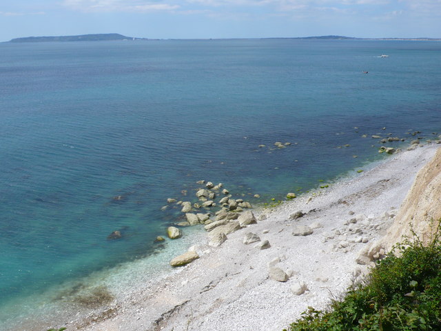
Beach Below White Nothe
Looking west across Weymouth bay with Portland visible in the distance. The picture was taken from the lower section of the Smugglers path which runs from the beach up the cliff to the Coastguard cottages at White Nothe. At this point the path runs along through the undercliff and on the top of the low cliff 15-20m high at the back of the beach.This part of the beach is the extreme eastern extremity of Ringstead Bay and beach.
 Map © Crown Copyright")
TIP: Click the map for more Large scale mapping
- Grid Square
- SY7680, 5 images (more nearby 🔍)
- Photographer
- Nigel Mykura (more nearby)
- Date Taken
- Wednesday, 9 July, 2014 (more nearby)
- Submitted
- Thursday, 10 July, 2014
- Subject Location
-
OSGB36:
 SY 7684 8079 [10m precision]
WGS84: 50:37.5808N 2:19.7272W - Camera Location
-
OSGB36: SY 7695 8084
- View Direction
- West-southwest (about 247 degrees)