
BUTTE COUNTY, Calif. — Click HERE for Saturday's updates on the Dixie Fire.
The Plumas County Sheriff’s Office has identified eight people who are still missing from the Dixie Fire.
Those individuals are identified as the following:
- Danny Sczenski, Greenville
- Jesus & Ella Gursasola, Greenville
- Matthew Henley, Greenville
- Glen Gallagher, Greenville
- Sally & Harold Brown, Crescent Mills
- Donna Shelton, Chester
The sheriff’s office said they are asking for the public and the media’s help in locating these individuals. Photos of the missing people have not yet been released. If you know where any of these people are, you are asked to call the Plumas County Sheriff’s Office at 530-283-6300.
Investigators say they have successfully located 16 other people who were previously reported missing in the fire.
The Dixie Fire remained active overnight Thursday due to strong winds and warm temperatures, jumping in size over 100,000 acres from the previous day.
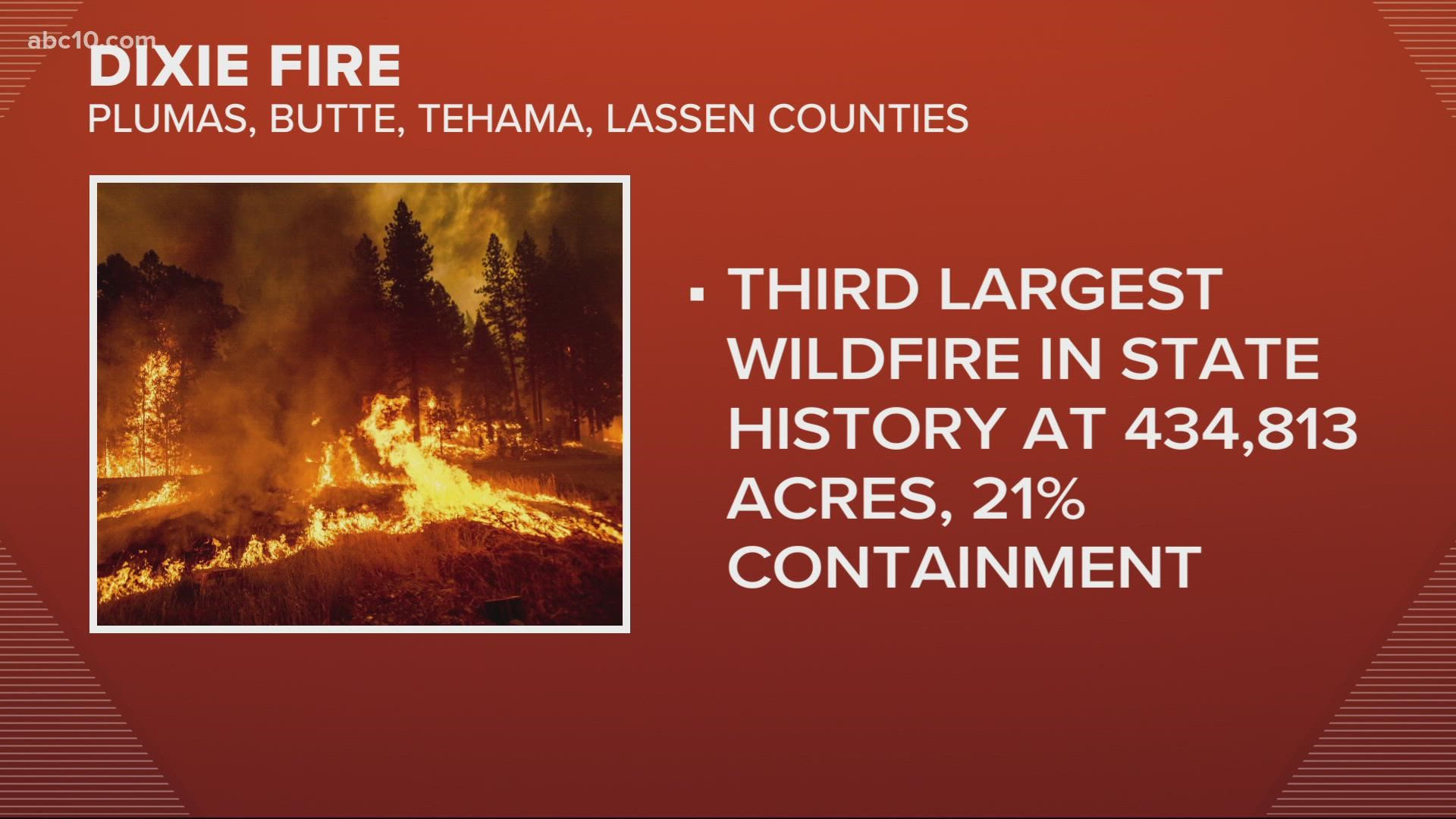
Continuously destroying homes and businesses, the wildfire burning in Butte, Plumas, Lassen, and Tehama counties has burned a total of 434,813 acres and sits at 21% containment.
Cal Fire split the Dixie Fire into two zones: the west and east zones.
In the west zone, smoke lingering in the region leads to lower temperatures, which moderated the flame's behavior. However, dry fuels are making it harder for firefighters to control the fire.
Regarding the east zone, firefighters laid hose and sprinklers along State Route 147, alongside the east shore of Lake Almanor, in Clear Creek and in Westwood to protect buildings if the flames travel further north. Crews also used heavy equipment to keep the fire burning south of Dyer Mountain.
Cal Fire said the community of Greenhorn is not threatened by the Dixie Fire and only mentioned it in their morning update to let residents know of the buildings they are protecting to the east of the Dixie Fire.
North of Humbolt Summit is where CalFire, in their Morning Operational Update, stated that they're experiencing a lot of fire growth within the last couple of days. There were 14 miles in one day just two days ago and to prevent that from increasing, they are starting at Humbolt and working their way down to 32, then 36, and heading up to Lava National Park.
With its increase in size, the fire is now the third-largest in California history, and the largest currently burning in the U.S. The Bootleg Fire in Oregon had previously been the nation’s largest active wildfire, at 413,765 acres. The Bootleg Fire, which was sparked July 6, is 87% contained.
On Thursday, fire officials described the fire behavior as frightening. They say flames fueled by erratic gusts drove northeast through bone-dry forestland. Thousands of firefighters are battling the blaze, which has destroyed an area larger than the city of Los Angeles. However, no deaths or injuries have been reported.
Although there has been a lot of destruction, there have been no changes to the status of Chester and no report of any structures damaged or destroyed, according to Mike Wink from CalFire.
In the area of Prattville, the fire did reach the northern edge and that is what CalFire calls the fire’s edge. Wink stated that it is good because "now the fire has reached there and the field has been reduced so they’re in there mopping it up and keeping an eye on it."
About 5,222 personnel are working the fire, Cal Fire announced in its latest report. More than 13,871 structures are threatened by the fire, and so far 91 have been destroyed along with 43 minor structures.
For Thursday's updates, click HERE.
Accounts to follow:
Evacuations and road closures
Click HERE for in-depth evacuation orders and warnings in Plumas, Butte, Tehama, and Lassen Counties. For current state highway/route information visit roads.dot.ca.gov.
Evacuation centers
- Spring of Hope Church, 59 Belle Lane Quincy, CA 95971
- run by the American Red Cross California Gold Country Region
- Plumas County Animal Services, 201 N Mill Creek Rd Quincy, CA 95971
- Veterans Memorial Hall at 180 Gay St. in Chester, CA
- Lassen Community College at 478-200 CA-139 Susanville
- Plumas County Fairgrounds 204 Fairground Road, Quincy (large animals)
- Recreation Center 101 Meadowview Lane, Chester
- Tehama County Complex 1830 Walnut Street, Red Bluff (large and small animals)
Dixie Fire Structure Status Map
A live map showing which structures have been destroyed or at risk is available below.
Butte County Evacuation Map
A live evacuation map from Butte County is available below.
Wildfire Map
An updated map of the acreage of the Dixie Fire
WILDFIRE PREPS
According to Cal Fire, 2020 was one of the most severe fire seasons on record as 9,917 wildfires burned 4.2 million acres. Over 9,000 structures were destroyed, and 31 people (civilians and firefighters) were killed.
California also experienced its first "Gigafire" because of the August Complex Fire, burning over 1 million acres by itself. Four of California's top five largest wildfires in state history happened in 2020.
If you live in a wildfire-prone zone, Cal Fire suggests creating a defensible space around your home. Defensible space is an area around a building in which vegetation and other debris are completely cleared. At least 100 feet is recommended.
The Department of Homeland Security suggests assembling an emergency kit that has important documents, N95 respirator masks, supplies to grab with you if you’re forced to leave at a moment’s notice. The agency also suggests signing up for local warning system notifications and know your community’s evacuation plans best to prepare yourself and your family in cases of wildfires.
Some counties use Nixle alerts to update residents on severe weather, wildfires, and other news. To sign up, www.nixle.com or text your zip code to 888777 to start receiving alerts.
PG&E customers can also subscribe to alerts via text, email, or phone call. If you're a PG&E customer, visit the Profile & Alerts section of your account to register.
WATCH MORE FROM ABC10: California Wildfires: Dixie and River Fire Thursday night update, Aug. 05, 2021