Kata Tjuta – Valley of the Winds
Hi There,
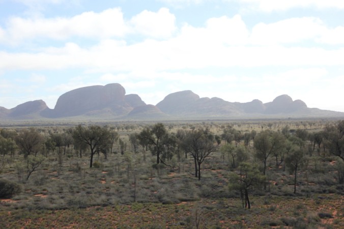
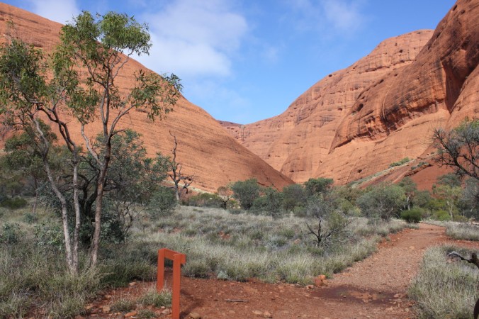
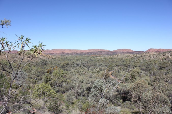
The next day dawned bright and not a cloud in sight, a bit different from yesterdays weather at Uluru(see part 11). Todays adventure was being held at Kata Tjuta aka the Olga’s. Another amazing landform not far from Uluru with rich cultural attachments for the local people.

Kata Tjuta is Pitjantjatjara meaning ‘many heads’, clearly evident in the above photo how they got to that name! More formally you would describe it as an imposing series of mounds and domes that rise out of the surrounding landscape to an astonishing height of 546 metres above the plane(or 1066 metres above sea level). That’s a staggering 200 metres(roughly) taller than Uluru(Ayres Rock), yet I don’t think it is as well-known as Uluru. I suppose the difference is you can’t climb Kata Tjuta whereas you can Uluru occasionally! What is it with us white fella’s wanting to climb and stomp over everything anyway… I digress, there will be no more political leanings or thoughts from now on! As is the case with Uluru, these rock formations are just the tip of a huge slab of conglomerate that may extend up to 6 kilometres underground. What is conglomerate? I will get to that later!
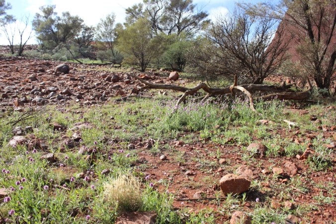
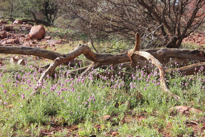
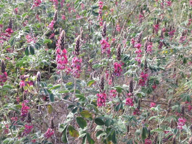
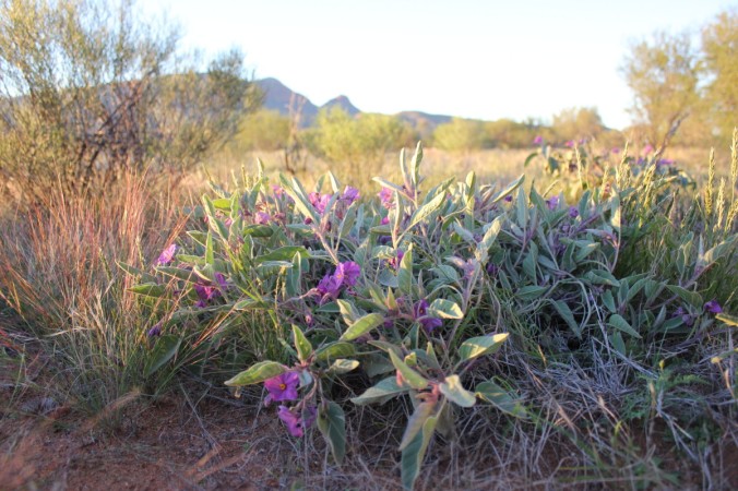
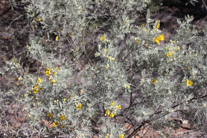
 These two photos were taken from the dune viewing area where there were some interesting plants to check out as well, always a good thing.
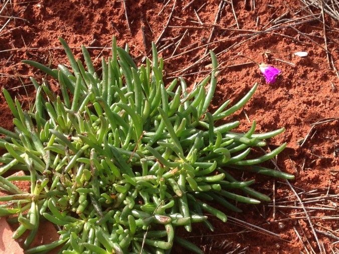
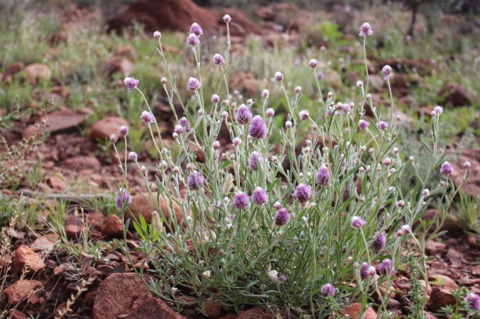
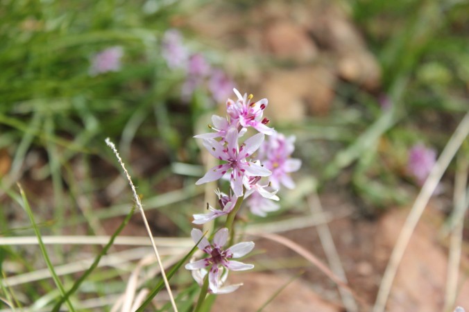
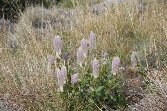
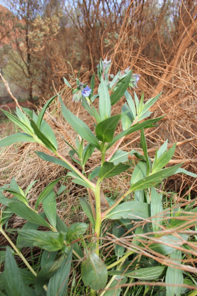
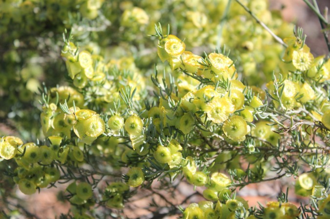
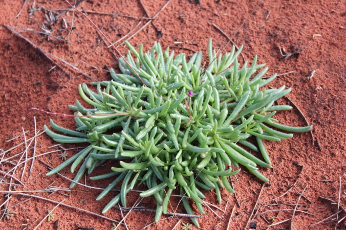 This is the Broad leaf Parakeelya, Calandrinia balonensis, an annual or perennial growing to 30cm either way with a basal rosette of fleshy linear to lanceolate leaves up to 10 cm long and 1 cm wide. A good indicator plant of recent good rain, if there’s a good number and they are of a good size-this indicates recent good rain as they grow rapidly during wet seasons and store water for the dry times. It has a small purple poppy like flower on tallish stems that dance around in the breeze, if there is one!
Also from the dune viewing platform, you can swivel 90 degrees to the right and this is what you see below.
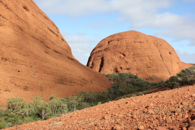
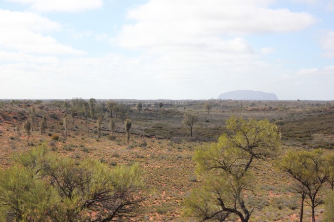 The only other imposing rock that’s around here! The tree’s you see in the distance are Desert Oak, Allocasuarina decaisneana , also look at the first two photos of this post, the majority are all Desert Oak, quite common across the spinifex grasslands. Juvenile Desert Oak are quite different in appearance compared to mature examples. More will be revealed about these trees in a future post! Now lets head off and have a look at this place.

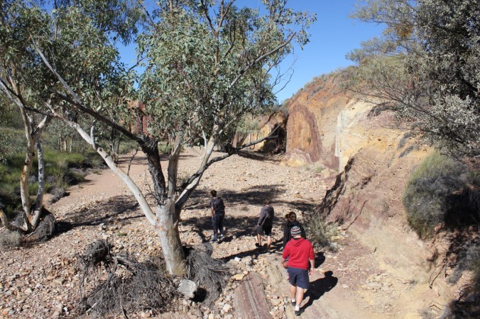
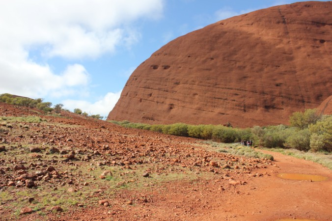 Kata Tjuta is a Anangu mens site and sacred under traditional law, which means for us tourists there is no wandering off the pathways. There are plenty of different walks here and lots to see, so as we meander along, please stay with me! No wandering off! Note in the above photo the puddle of water which is a byproduct of rain we had here the day before. If you have read part 11 of this series you would realise this, but now we were enjoying the crisp sunshine, it is winter by the way! A balmy 17 degrees Celsius! You can see a bunch of people above, and to their left a green patch. I will concentrate on that now, the patch that is.
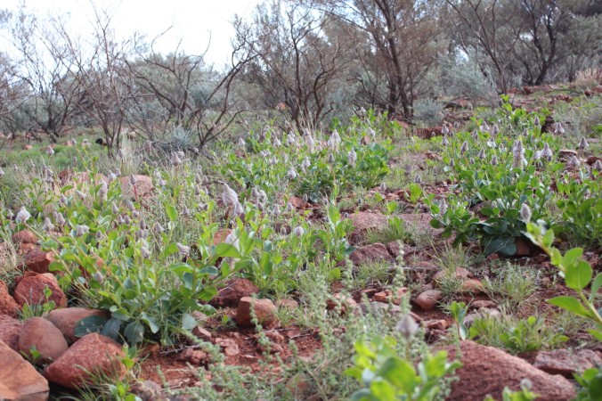
 Here’s that green patch. Wanderrie grass , Eriachne scleranthoides , a very rare type of grass, see quote from Grasses of Australia, “Known from two localities in SW central Australia. Conglomerate monoliths (Mt Olga and Mt Currie) growing on crests, scree slopes, in chasms and crevices, in shallow sand, gravelly slopes or shallow stony red soil, sometimes in seepage from
massive boulders. Flowers May (late-autumn) and Aug.-Oct. (late-winter to mid-spring)”. Above we have a seepage area on a scree slope, which is where it likes to grow.
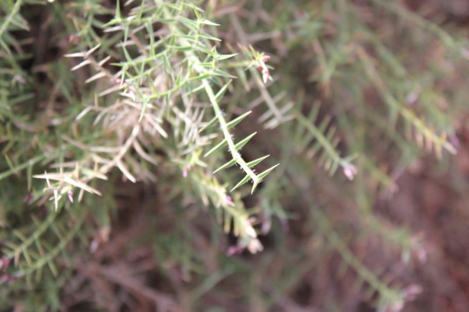
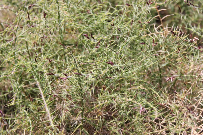 Quite a sharp prickly grass, looks more shrub like though doesn’t it! Even closer below.
 This is a problem I find, I get distracted by things off to the side of the pathway and lo and behold the next time I look up the family is gone!! I’m sure I’ll catch them somewhere.
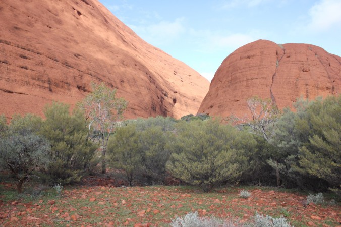

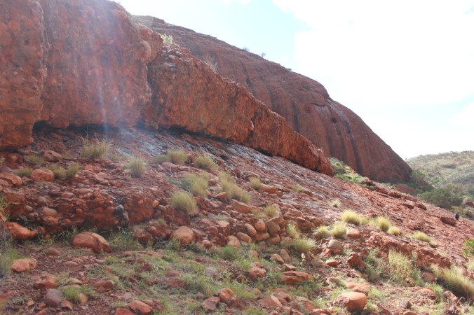
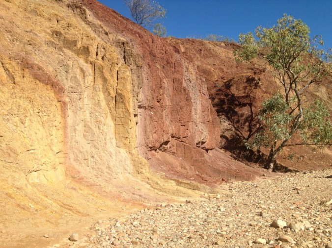
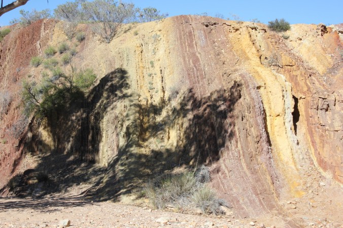
The remarkable thing about Kata Tjuta is that it’s composed of a different type of rock than what Uluru(made of sandstone) is which is only 50 kilometres away(by road, 32 as the crow flies). Katu Tjuta is a conglomerate, a gravel consisting of pebbles, boulders and cobbles cemented by sand and mud. Conglomerate is also a sedimentary type rock. From a distance Kata Tjuta looks like the other big rock just around the corner, but up close its quite rough, see below photo.
 Don’t know why, but I found this quite fascinating. Here in the middle of no where, the only two objects that rise above the plain separated by a mere 50 kilometres are made of completely different rock. I’m sure this happens everywhere, but I just found it fascinating.. Click HERE for more geology information on this rock formation. If this was originally a huge slab of rock, how did it become domes and valleys? This is likely to be mechanical erosion of sand from the rock and other chemical erosion caused by moisture. The major Valley may have been fractured from the time of the Alice Springs Orogeny. Chemical weathering due to ground water widened the fissures and rainwater run off gradually formed the domes and canyons we now see.
 Now for some more wildflowers. Look at that patch of Pussytails, Ptilotis.
Closer view here. This is actually Hairy Mulla Mulla, Ptilotus helipteroides . The stems and leaves have a persistent covering of medium to dense hairs, giving it its common name.
 It is an annual herb growing to about 50cm and usually occurs on rocky or gravelly ranges, hills or rises and on acidic rock and also found in Mulga dominated red plains and other locations.
Flowering from June until November, now for a real close-up!
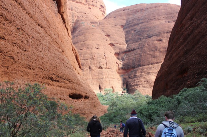
 We were heading to the Valley of the Winds and eventually the Karingana lookout, a return trip of 2.5 hours on a grade 4 – difficult track according to the visitor guide. I think it was more in line with moderate track! Here we are well into the Valley of the Winds and yes it was slightly breezy here!
 It’s at this point in the above photo that if the temperature is over 36 deg Celsius at 11am, the track is closed. This is the Karu Lookout, impressive to say the last. Those mounds in the distance look like a flight of stairs, sort of!
 As you can see it is quite rocky here.
 Nothing amazing with the above photo, just showing more rock and more conglomerate, you can also see water seeping out from under that large slab. Below is a swathe of Hairy Mulla Mulla, quite impressive to see it like this in its natural environment.

 Again not a great photo but it just shows a lovely natural garden bed with no human influence! I read something recently which I hadn’t really thought of before and that was someone’s thought on grouping colours in the garden as we do, pastels here, bright hot colours over there and so on. The thought was (not exactly in these words)”Nature doesn’t separate plants into colour groupings, so I’m not going too. There is just a riot of colour throughout my garden”. I really liked that and it may just become my new mantra. Not sure what the old mantra was!!
 Lovely clear stream!
 These plants I have no idea at the moment what they are, they are a work in progress.

 Pretty, never the less!

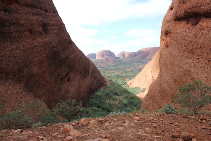
 In the above photo we are nearing the Karingana Lookout. You can see it in the distance, the high part in between the two walls. The walls of the domes just seemed to rise and rise into the bright noon day sun.
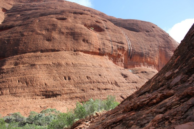 Well! We made it, what an amazing panorama greeted us!
 Time to sit down for a quick bite to eat. The 3 oldest boys decided they would keep going on the circuit walk and us oldies along with our youngest lad turned back here. Here they are heading off at breakneck speed as per normal!
 Below is another beautiful spot to recharge your batteries!

 Heading back to Karu Lookout. Below we have another Pussytail, Ptilotus exaltus , also known as Tall Mulla Mulla.

 Grows to about 1.5 metres tall forming large showy drifts in open scrub and mulga country. The flowers start off cone shape then eventually lengthen to be elongated and cylindrical 3-20cm in length and 4.5cm in diameter. Compare the above two photos. The leaves are quite thick and rubbery looking, flowering from early spring until summer. Widespread across all mainland states. Here’s a small drift of them below.
 Simply gorgeous!
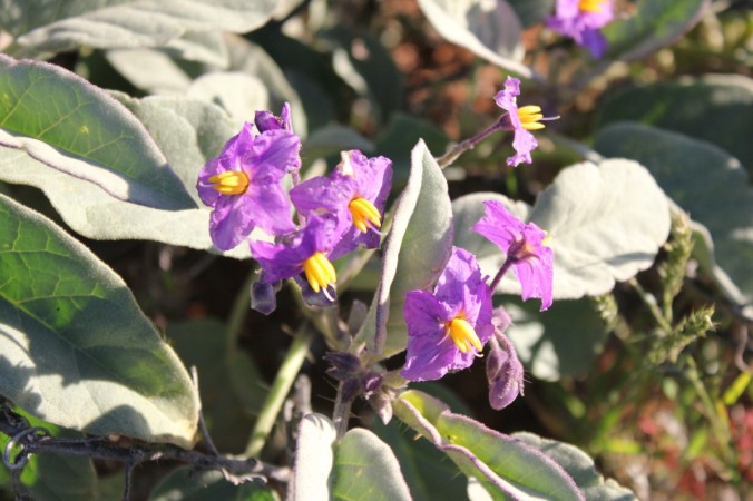
Below is another plant that has featured in quite a few of these Northern Territory posts. Solanum quadriloculatum
 Another plant we saw was , Hakea subarea . This small tree also made an appearance at Ormiston Gorge. Click HERE if you can’t remember!
 Here’s a beautiful Eremophila as well. Quite possibly Eremophila latrobei .

 Some walls for perspective! Note the little pocket of green three-quarters of the way up. Plants Hey! Amazing.

More tall walls, this one below includes small people, well not small people, just normal ones!
 This is a small person one though!
 He’s also carrying a firearm( a gun I was told!).

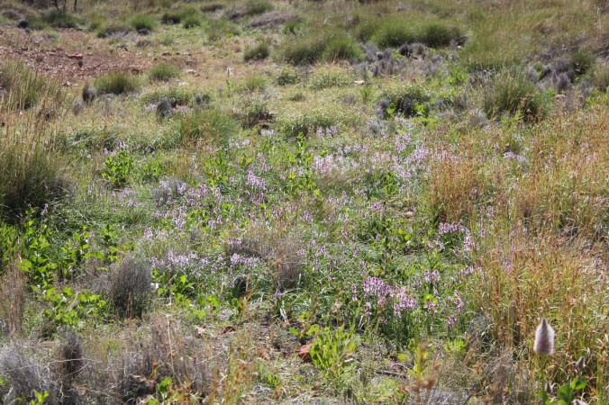
 Here are some more flowering meadows(for want of a better word) which were good to see.


 Oops! forgot about this little fellow. sorry!
This plant below is Cattle bush or Camel bush. Yet again you see the need for scientific names!! Two common names for the same plant, not confusing at all! It is actually Trichodesma zeylanicum . A perennial plant growing to 1 metre occurring on rocky hills and sand dunes, stony alluvial soils or areas subjected to seasonal flooding, flowering in winter and spring.
 It was originally eaten by camels in the outback, hence one of its common names. One presumes then that cattle also ate or still eat it! Summer forage option! Here’s a few more random plant photos!
More stunning scenery!

Here’s one last plant I noticed when we had nearly finished the Valley of the Winds Circuit walk. I walked right past this on the way in! Go figure.
 Obviously a Brachyscome of some description, beautiful anyway.

 A nice sculpture below. The dead tree that is.
 Now we are nearly back to the start of this circuit walk. We did another small walk after this one but I will cover that next time round, i.e. part 12b! To finish off, I have added the below photos sans words as a parting gesture to the Valley of the Winds at Kata Tjuta. They speak for themselves!


 Cheers!


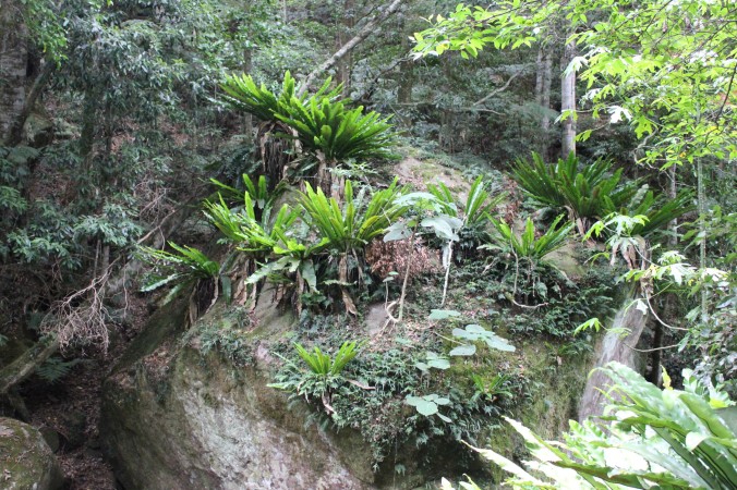
 These are actually Epiphytes(plants that grow on other plants-but not parasites). They have a lovely silky smooth glossy green leaf. Quite a spectacular plant and readily available in most nurseries.

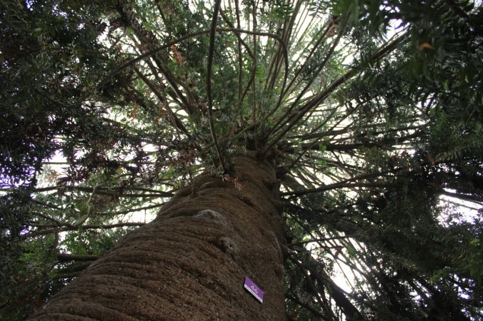
 One of the trees in this rainforest is the Jackwood(see picture below) or Native Laurel, which is also known as Cryptocarya glaucescens which grows to about 35 metres tall. Click HERE for more info on this tree.
 I just realised that you can’t see the top! Not a great photo but gives you a sense of scale! Another commonly grown plant in gardens is the Elkhorn which is an Epiphyte as well. scientifically known as Platycerium bifurcatum. The one below is quite a size!
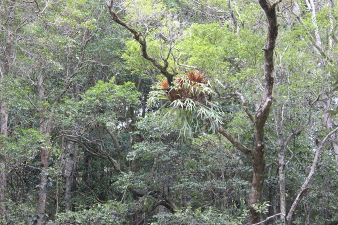 Another great tree was the Strangler Fig, Ficus oblique , which is also known as the Small leaved Fig. The leaves are the only thing on it that are small!
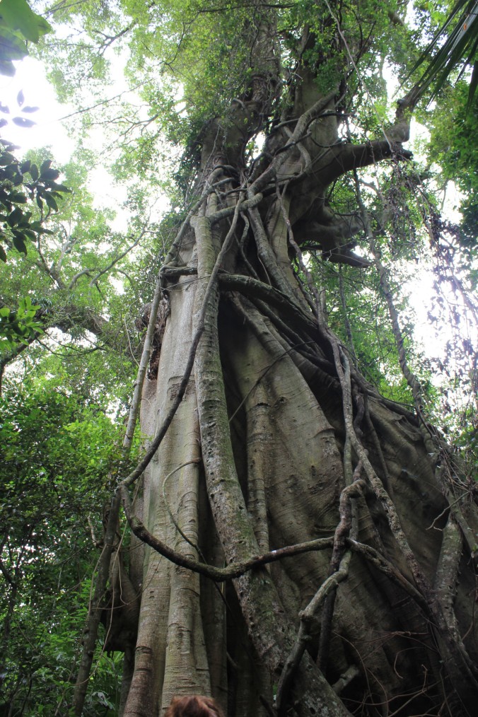 And again!
 It was very hard to get all of this tree in the frame, what a monster!
 Some nice buttress roots
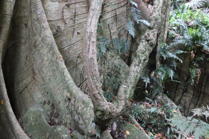 I think we will progress to smaller things just to calm ourselves down a fraction. Below is the Fragrant Fern, Microsorum scandens which is clambering over a boulder. Looks quite lovely don’t you think?
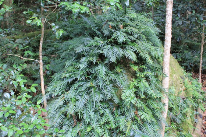 Now for something out of the blue and a slightly different track we came across a very interesting bird which can be difficult to see in its native habitat.
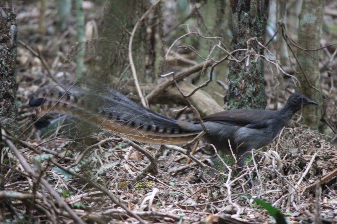 The Superb Lyrebird, Menura novaehollandiae . Click HERE to find out more about this master of hiding and mimicry. To hear its amazing vocal chords, click HERE. I was quite chuffed to see this bird in the wild, a first for me. One normally heres them if you can be sure of their birdsong but hardly sees them.
 Not great photos, but in this case they will have to do. Check out the amazing tail they have. Below you can see the landscape and how green it is, a couple of patches of red reveal the Illawarra Flame Tree, Brachychiton acerifolius. Click HERE for more info. This was as close as I got to them.
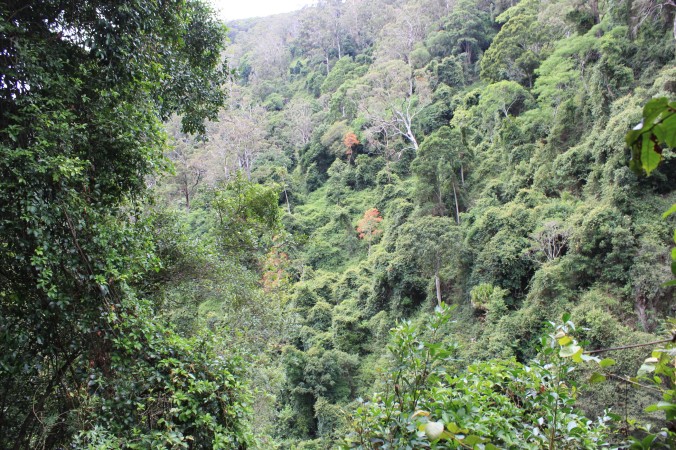 Some more ferns, this could be Blechnum neohollandicum , Prickly Rasp Fern.
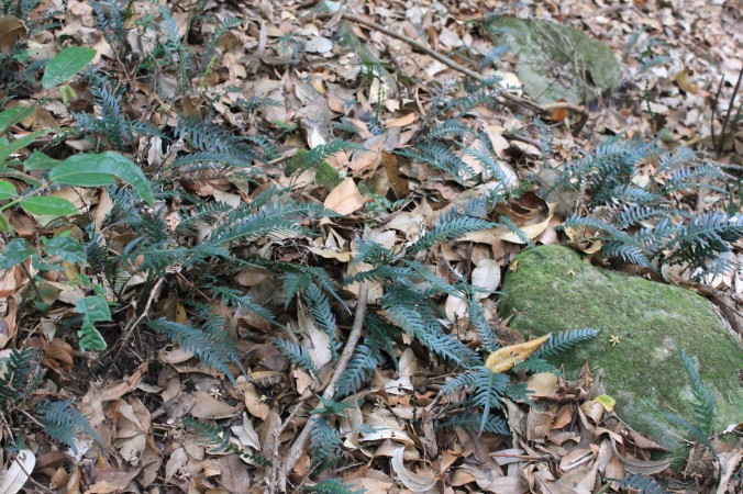 This may be the Sickle Fern, Pellaea falcata.
 Some nice lacy effects from under a tree-fern
 The one below is the Giant Maiden Hair , Adiantum formusum.
 Heres another lovely side view of the Birds Nest Fern.
 Some vines now to make it a little scary!
 Look out! You don’t want to stand still for too long Here!
 Here are some roots of a strangler Fig and more vines!
 Hmmmm.
 A truly remarkable environment for adventitious plants.
 Another remarkable tree here is the Australian Red Cedar, Toona ciliata var. australis. This tree is now scarce as it was highly sought after by the early settlers and the early timber industry as the wood was highly sought after for its fine grain. It has beautiful dusky pink-red trunks.
 Very Majestic.
 And another one.
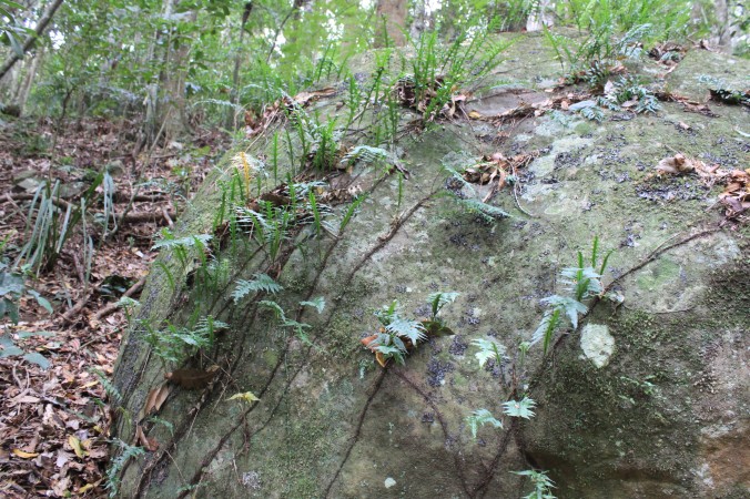
 This one below has some ferns growing on it. I think they may be the Rock Felt Fern, Pyrrosia rupestris.
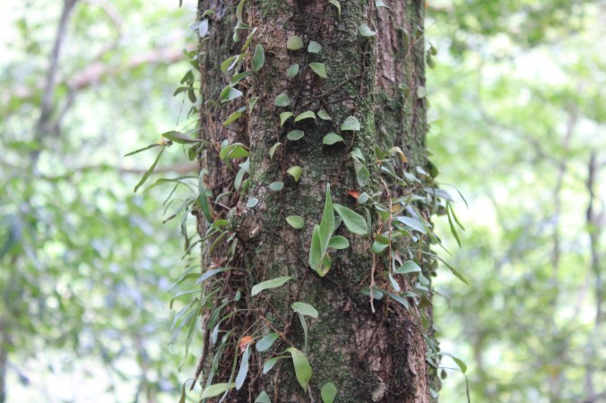 Ill finish our tour here with a couple of general shots in the Minnamurra Rainforest. Go and have a look at it if you ever get the chance!
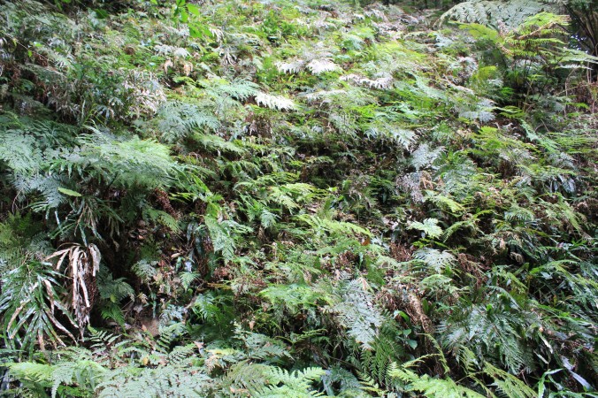 .
. Until next time.
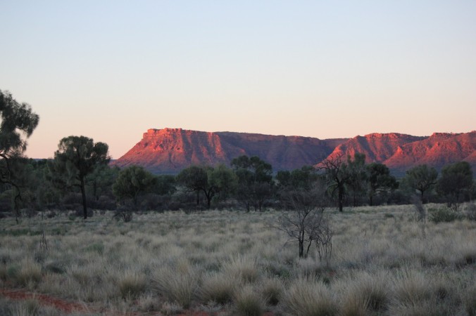
 Notice above on the left hand side on top of the dome, plants in a very exposed situation, coping with all sorts of extreme weather. Walpa means windy and quite frequently you will get refreshing winds through here. Refreshing in winter time may mean “cold”.
 We didn’t see any animals in this gorge and one could imagine that with the hoards of tourists who come in here everyday, they would be quite selective with the times they would show themselves.
 The walls are virtually straight up and down!
 Not sure why I included this photo, just like how the water plays across the stony ground. This is actually a very small stream that was trickling across the pathway. Might be more apt to call it runoff. Just imagine its a high-resolution satellite image taken from high altitude of a flooded plain. Amazing what you can see in a picture! Look at the size of those people walking compared to the gorge walls!
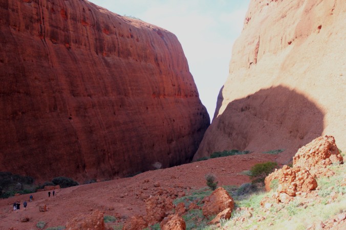 Here’s a few more water related shots. No doubt the native fauna enjoys these cool ponds.
 A nice reflection.
 We are nearing the end of the track here and the flora landscape is dominated by the Spear wood vine, Pandorea doratoxylon , which is making very large shrubs and thickets here. We have seen this at a few locations now, click
  An interesting information panel above. Below you can see some of the Spearwood in flower(white dots on green foliage, if you squint).
 Well, we’ve reached the end of the track and officially our feet are now sore and tired after two days of a fair bit of walking, but we are at peace with the landscape and our minds are refreshed.
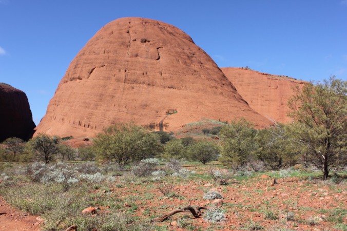
 Thanks Kata Tjuta, we may or may not ever see you again, but your features and form are forever indelibly inked in our minds.
 As we make our way back to camp for our last night in the Territory, we make one final stop at the beating heart of our great land.
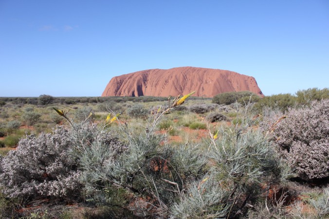


 So long Uluru, it has been wonderful!


 I love how the branches radiate out from the trunk on this one. Native to Queensland, this evergreen coniferous tree can grow to somewhere between 30-45 metres. The Bunya Pine is the last surviving species in the section Bunya of the genus Araucaria. Fossils from section Bunya have been found in South America and Europe. This tree was around during the Jurassic.
 Leaves of the Bunya above, bark below.
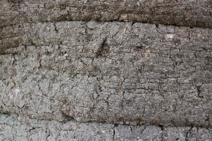
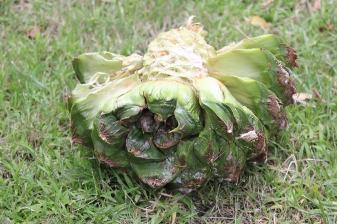 That’s part of the Bunya Pine cone! Weighing in at an impressive 18 kg (roughly) and the size of a football. a hard hat may be called for if you decide to spend an extended amount of time under the Bunya. Living for about 500 years, the Bunya pine makes for an impressive looking tree in a weird sort of way!
 Next up we have the Atlas Cedar, Cedrus atlantica
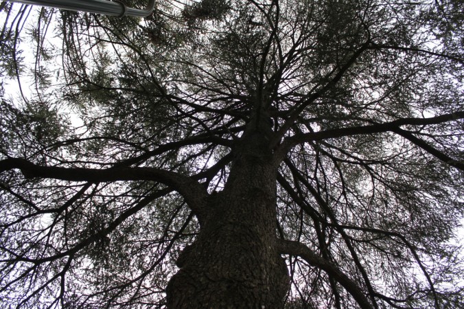 Atlas Cedar is a Cedar native to the Atlas mountains in Morocco, reaching a height of 30-35 metre with a girth of up to 2 metres. Here is the bark with Lichen.
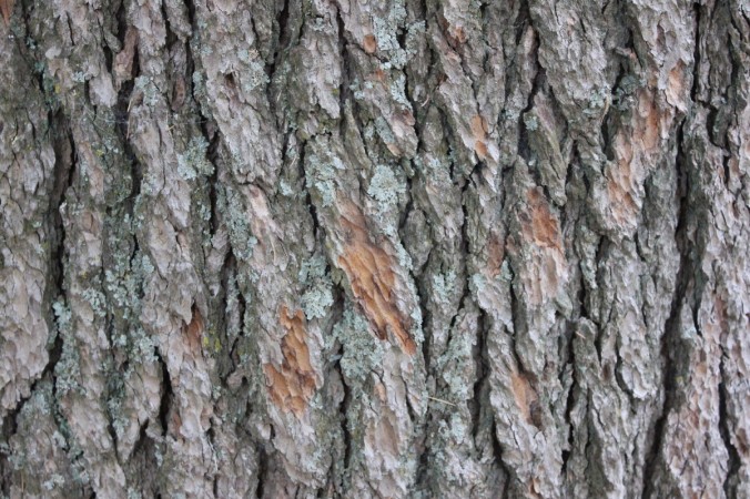 One of the smaller trees in this park is the Irish Strawberry Tree, Arbutus unedo . Can be either a large shrub or small tree, grows to about 10 metres and native to Mediterranean areas and parts of Ireland. It has white Erica like flowers that turn into large red berries, a bit like a strawberry! Here are its leaves.
 Arbutus unedo is normally multi trunked. It was first described by
  The bark of the Irish Strawberry tree is quite remarkable as well.
 Another Cedrus here is Cedrus deodara, also known as the Deodar Cedar.
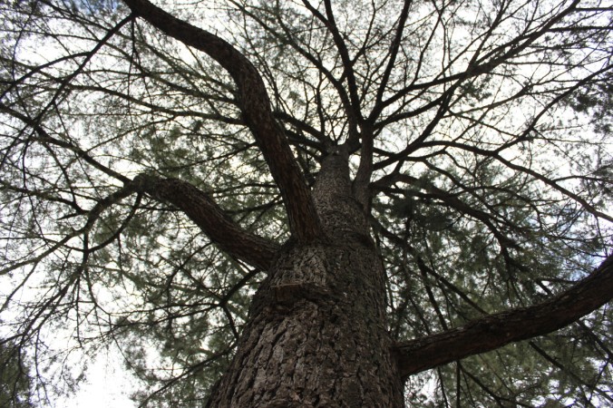 Looks a bit like the Whomping Willow, don’t you think? Not that I’ve ever stood under the Whomping Willow, I just feel that this Deodar Cedar is tensing up its boughs to fling them around!
 Bark above and cones below.
 The Deodar Cedar is native to the Western Himalayas in Eastern Afghanistan through to Western Nepal. Grows to about 40-50 metres and occasionally 60 metres with a girth of up to 3 metres. This is also the national tree of Pakistan.
 Next we have the Canary Island Pine, Pinus canariensis .
 Obviously native to the Canary Islands, this is a sub tropical pine which doesn’t like cold temperatures. Growing to about 30 – 40 metres but also able to reach 60 metres, with a girth of 2.5 metres. It has extremely long leaves which are needle like, see below.
 The bark is interesting as well.
 Fun fact! “The tree’s long needles make a significant contribution to the islands water supply, trapping large amounts of condensation from the moist air coming off the Atlantic with the prevailing north-eastern wind (locally called “alisios”). The condensation then drops to the ground and is quickly absorbed by the soil, eventually percolating down to the underground aquifers”.
 Lets have a look at the Western Yellow Pine, Pinus ponderosa . This pine hails from the Western United States and Canada and is the official state tree of Montana.
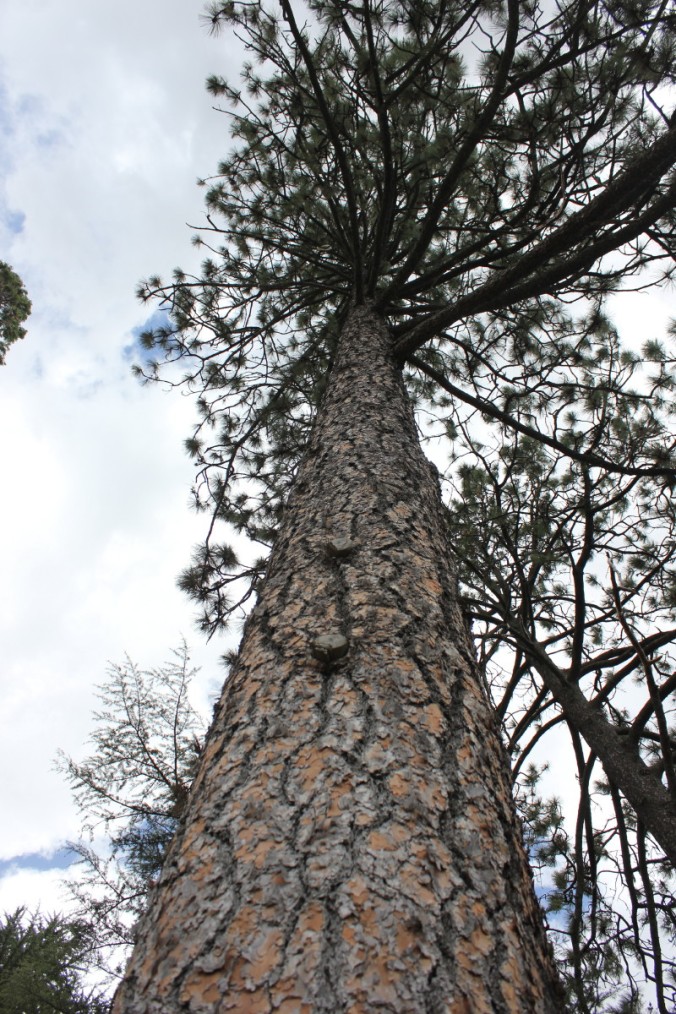 Not sure where the top is in the above photo, in the wild one of these has been measured at 81.77 metres tall, now that’s tall! Check out its bark, that’s pretty cool too!
 One more look at this tall tree.
 Now, finally to the mummy or daddy of them all. Sequoiadendron giganteum . The Sierra Redwood. Although not the tallest tree in the world, that belongs to Sequoia sempervirens the coastal redwood, the Sierra Redwoods are the largest single tree’s and largest living thing (by volume) in the world. The biggest one, known as General Sherman is 83.8 metres tall with a girth of 31.3 metres at ground level. Yes, that’s not a typo! 31.3 metres at ground level. That’s a volume of 1,486.9 cubic metres!
 The bark can be up to 90cm thick, making it quite fire-proof. The oldest known Sierra Redwood is thought to be 3,500 years old.
 A large tree can have about 11,000 cones and surprisingly for such a large tree the cones are quite small. Here’s a collection that someone’s gathered.
 As the name may suggest, this tree comes from the Sierra Nevada Mountains in California. Here’s a row of them below.
 Here they are in their full glory
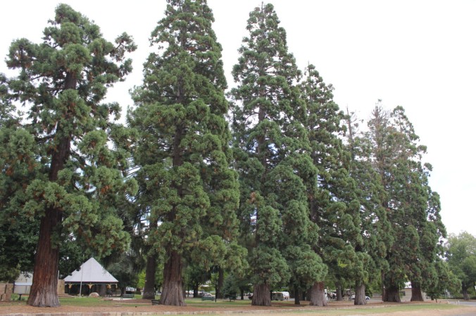 A couple more photos.
 To finish off, here is a small plaque in the gardens, nodding to the great botanist Ferdinand von Mueller, who had the foresight to donate these tree’s and seeds for future generations to enjoy, not only here but in many public gardens and Botanic gardens throughout the state. Thankyou!
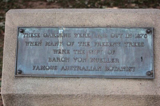
 Not a great picture but this is the Shanty Town-Overflow section or most of it!. Below is the section closest to the amenities on the right which you cant see and we are located in the left of this picture. The Khaki setup on the left at the front. The funny thing is that this overflow virtually empties and fills every day, which is not surprising when you see the amount of travellers on the road! There was also some campers here in this section that obviously were spending a week or two here and they had worked their way to the front of the overflow section therefore being only 40-50 metres away from the amenities. They were also from the Territory and obviously knew about the cheap overflow section.
 The sun was now starting to sink and the park had a sunset viewing area of the rock. So off we trundled with the crowds to have a look. The area was slightly busy, so we worked our way along the dunes until we had our own mostly private viewing area. This is what we saw! At last, Uluru in all its glory.
 Again with different colours.
 A bit later.
 And now no sun. Beautiful!
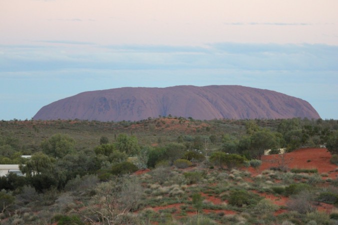
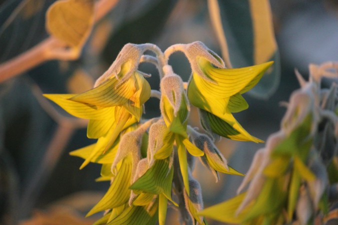
 A peculiar plant caught my eye on these dunes know as Green Bird flower, Crotalaria cunninghamii. This shrub growing between 1 and 3 metres is found in inland areas on red sand dunes. Can be erect or sprawling with velvety stems. Large yellow-green flowers striped with fine black or purple pin strips are present on terminal racemes to 22cm in length during winter and spring.
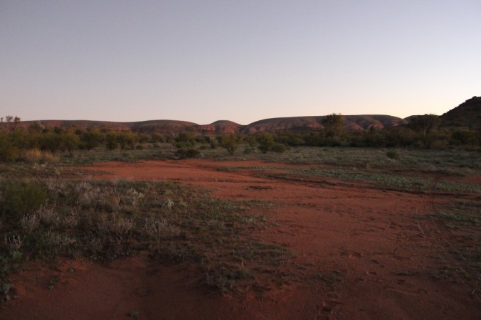
 Time to head back to camp and cook tea. Check out the amazing colour of the dirt(sand really!).
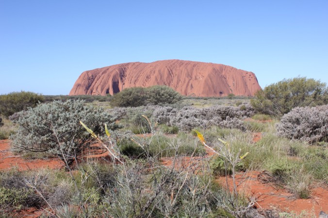
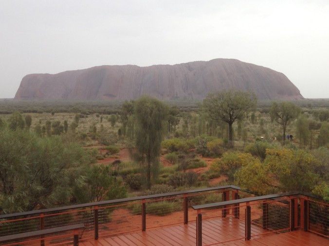
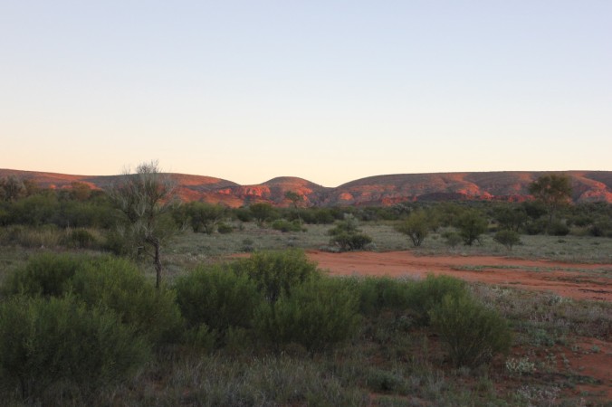
 We made our way to Uluru-Kata Tjuta National Park getting glimpses of a wet rock on the way. It still looked amazing and impressive in the landscape.
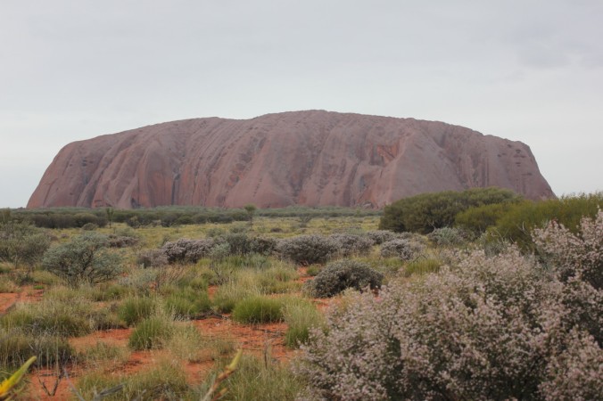
 Here are some Honey Grevillea’s, Grevillea eriostachya, these were everywhere around Uluru, flashes of brilliant yellow amongst a red and green background. Grows to about 3 metres and flowers for a long time in winter and spring. We made our way to the Cultural centre to escape the rain and learn more of Uluru and the Anangu Land which is run by the traditional landowners who are the Yankunyjatjara and Pitjantjatjara people. From the guide-book, “This land was created by the creation ancestors. In their travels they left marks in the land and made laws for us to keep and live by. We hope that during your visit you will learn about some of our ancestors and culture. Please respect this knowledge and open your minds and hearts so you can really appreciate our enduring culture” There were lots of things to see and do in the Cultural Centre. I overheard a tourist asking a Park employee what was worth looking at Uluru during the rain. The response was “do the Mala walk, it has brilliant waterfalls during wet weather”. So off we trundled into the rain to do the Mala Walk. Its only 2km return and flat, so very easy. Our plan had been to cycle around Uluru but the hire company doesn’t operate in the wet. As we had two bikes with us, we needed another 4. That wasn’t going to work, was it! Back to the Mala walk, Mala is Aboriginal for Rufous hare-wallaby. Click
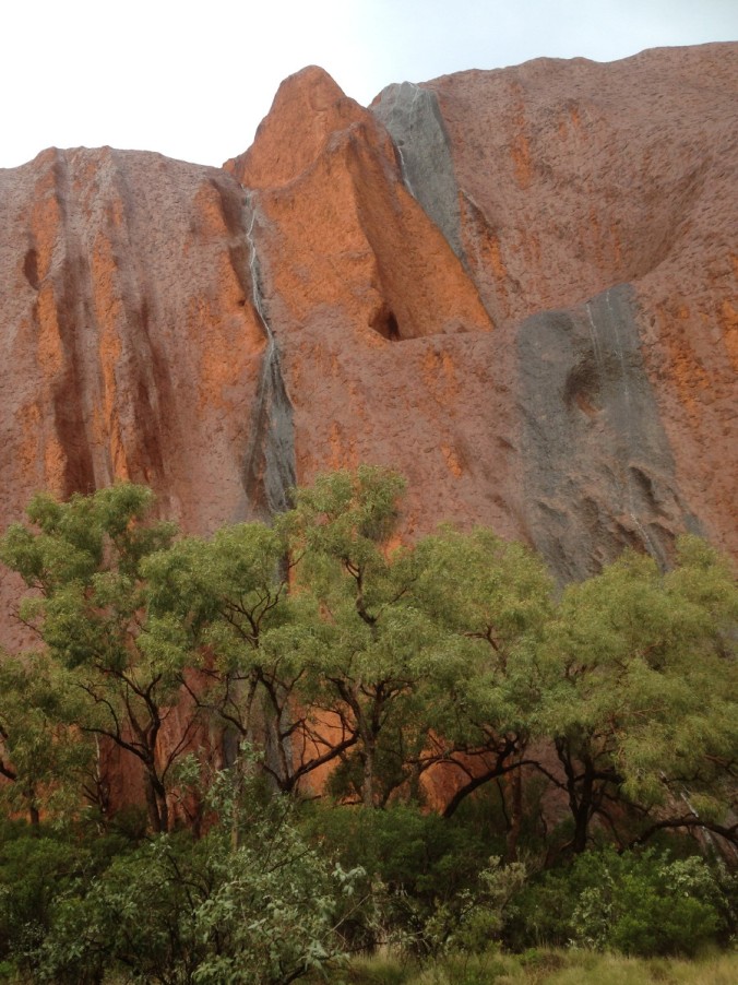
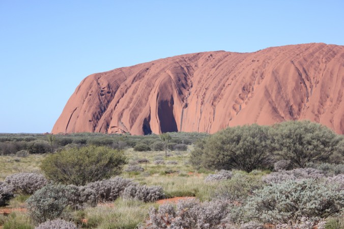
 It was simply stunning to see Uluru in the rain. It had stopped mostly but the waterfalls were still running albeit slower and smaller. I have since seen photos after and during major deluges on Uluru which show water cascading down everywhere in huge quantities.
 Everywhere you turned to look at Uluru you would see different colours in the rock and this changes as the sun rises and sets on it as well.
 Cave right at the base of Uluru
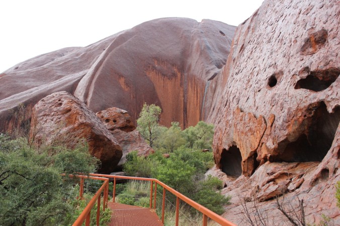 Notice above how the rain has changed the colour of the rock
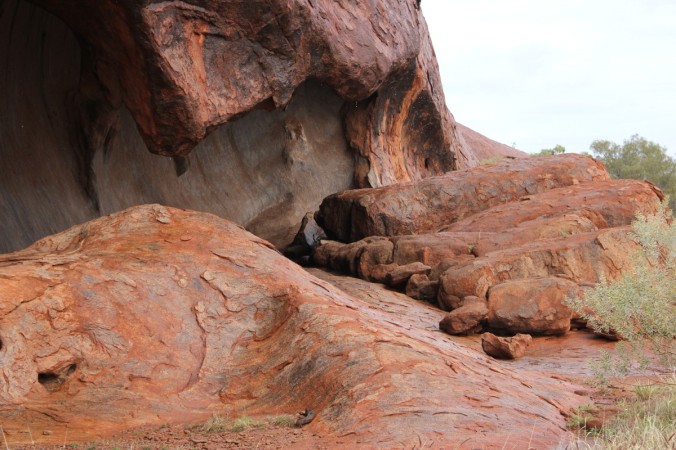 What is Uluru composed of? “
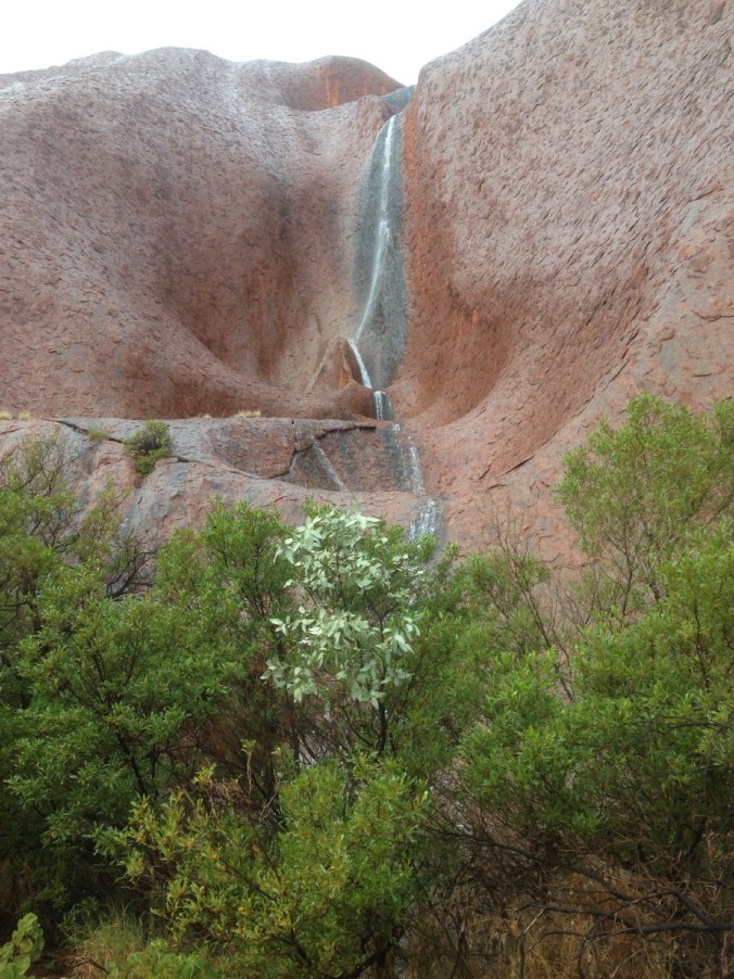


 Crystal clear water.
 Beautiful scenery where ever you turned. Below is Kantju Gorge a wonderful location with a lovely waterfall.
 Another view from the sunset/sunrise viewing area.
 The Wattle above is Acacia ligulata, also known as Umbrella Bush, this grows to about 4 metres.
 When you look closely at the surface of Uluru, it looks like its flaking and it is. This is caused by a chemical decay of minerals. The rusty colour of the exposed surface of these flakes is caused by the oxidation (rusting) of the iron in the Arkose. Fresh Arkose is grey in colour. Some more examples below.
 Below is Ptilotus obovatus, a lovely little shrub to about 1 metre high and across has pink flowers frequently after rain. Often seen on shallow stony ground. The leaves are covered with star-shaped hairs giving the plant a silvery appearance. I saw this one on the Kuniya Walk, which is an easy walk to the Mutijulu Waterhole home of Wanampi, an ancestral water snake.
 Closeup of Ptilotus flowers
 Here is the Mutitjula Waterhole, another special place at Uluru.
 The photo below in some way summed up Uluru for us. The comment was made something along the lines of “look its breathing” or something of that effect. Well! It did sort of feel alive, maybe it was just the flow of Arkose Sandstone and how it was shaped or how the rain ran off it, maybe its cultural significance, even its history over time or maybe all of the previous combined. It just felt significant. I can now understand why the traditional owners revere it. This is a special place.
 Here’s a few more plants I noticed on our travels around Uluru.
 This is Upside down plant, Leptosema chambersii. Obviously you can see how it got its common name. It’s a bit topsy turvy with the flowers at the bottom. A small shrub with leaves reduced to scales. Lives on sand plains and dunes normally with Triodia sp. Closeup below.


 This one below is one of the Triodia species, usually quite a sharp and prickly clumping grass
 The large trees around Uluru were Desert Bloodwood, also known as Corymbia terminalis .
 There were also a large Grevillea called Beefwood. Grevillea striata.


 Cheers!
 Below is quite a bizarre looking plant called the Orange Spade Flower, Hybanthus aurantiacus . This is a small erect shrub to about 40cm and quite widespread although I only saw it in a couple of places. The flowers have five petals, four very small ones and one large one shaped like a shovel!!
 Here’s some more sea ripples, although the indigenous people have a slightly different story about these ripples.
 If you remember in Part 9, we saw some of these ripples on the Rim Walk at Kings Canyon. See below for a different take on these!
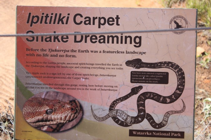 I don’t particularly want to meet Inturrkunya!!
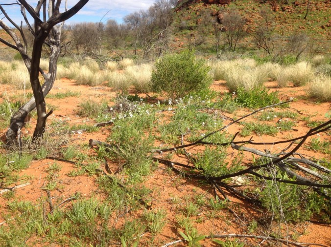
 Golden Orb Spider with its young, we get these at home as well although this one was massive! Below we have Hibiscus leptocladys also known as the Variable Leaf Hibiscus.
 Another piece of rock…
 This is Abutilon leucopetalum, also known as Lantern Bush, grows to about 1m or less.
 This one I think is Swainsona flavicarinata, Known as Swainsona or Yellow Keeled Swainsona. This is a prostrate herb.
 More rock!
 This one is quite possibly Indigofera basedowii, a perennial shrub to 1 metre with grey-pubescent foliage with inflorescences to 11cm long.
 Here’s a close-up of the flowers
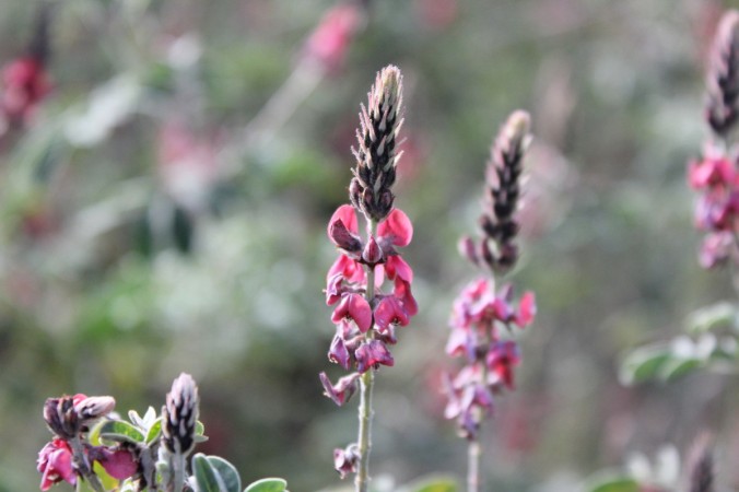 Some more plants
 A small creek
 This one is Senecio gregorii , alson known as Annual Yellowtop, grows to 40cm high and is an annual. Widespread throughout all states.
 This is Scaevola parvibarbata a perennial growing to about 50cm, widespread on sandy areas.
 So there you have it, a short interlude at Kathleen Springs on our way to another great destination in the Northern Territory!
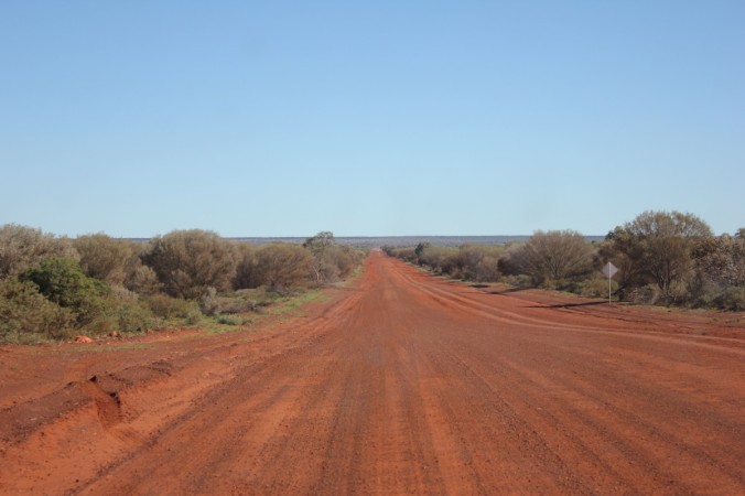
 To say it was corrugated and dusty would be a slight understatement to say the least! The first section was an absolute quagmire of corrugations and at a slow speed you felt like you were on some sort of manic rollercoaster, every bump was a shudder of immense proportions. This was going to be great for another 140 kilometres. It did improve though. We decided to see what would happen at a faster speed! Well it was an improvement at a speed of 75-85kmh, mind you it was now a constant smaller shuddering. I can only describe it as a cat the size of an elephant purring beneath your car with the reverberations oozing up into the vehicle and oneself. Everything was just a constant shudder!
 You can see above the dips and creek floodways, these were the worst. As you approached you would slow down to get across them and occasionally some were quite deep with pot holes in them which the front tyres would slam into with a tremendous thump. It all sounds bad but it was an enjoyable experience and the scenery was quite beautiful. Look at the rolling seam of rock in the left side of the photo above.
 There was a couple of classic road signs we saw, both on 44 gallon drums, one before a corner “LIFT UM FOOT” and the other around the corner “PUTTUN BACK DOWN”. I was too slow in getting any shots but click
  In the distance you can see George Gills Range and Kings Canyon is at the right hand end of this range in these photos.
 I think the boys enjoyed a chance to stretch and let off some steam, also gave me a chance to quickly check the vehicle and camper trailer were all in one piece. There was a slight problem with the bike rack attachment on the camper trailer, parts of it had come loose and needed replacement, luckily I had spares!
 Of course there were plants to admire, check out this pretty Erimophila!
 Cant remember how long it took to complete our journey along the Meerenie loop but we had finally arrive at Kings Canyon. Just in time to set up camp and then watch the suns rays set on the entrance to the canyon.
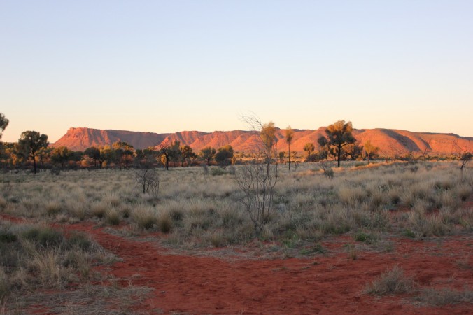
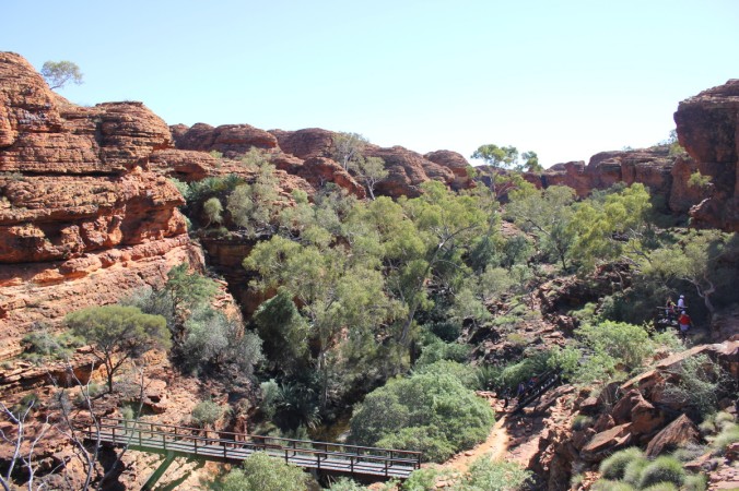
 The next morning dawned fresh and bright and away we went to get amongst the Canyon. Kings Canyon is part of the Watarrka National Park and sits at the west end of the George Gills Range. The walls in the canyon are over 100 metres high and make for some great panoramic views. Here we go on the rim walk which is highly recommended, give yourself at least 4 hours to truly appreciate this place and watch out for the opening climb, it will test you! Make sure you stop on the way up this straight up climb to admire the views, just don’t let on that you’re puffed!
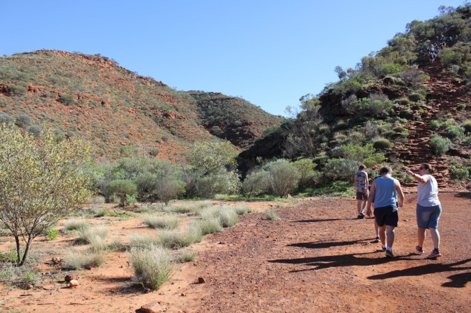 Here’s one of my scenic views(puff,puff,puff) lucky there was some plants to look at!
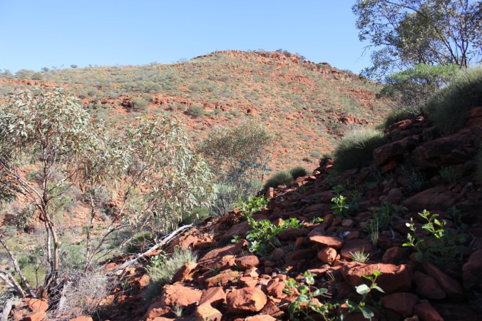
 Above is Tall Mulla Mula also known as Pussytails or scientifically as Ptilotus exaltatus. Below is a Blue Bush. Maireana sp, I’m not sure which one, there are 57 specie endemic to Australia.
 Now that I’ve got my breath back, lets continue up the steep climb!
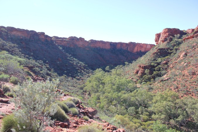
 In the above photo in the middle on the right you can see the car park receding in the distance. Below you can see the canyon walls starting to come into view. The river of green at the bottom is Kings Creek, providing the life blood for those plants.

 Picture below is of Sandstone mounds which are quite prolific up on the top of the George Gills Range. They are known as Mereenie Sandstone which has been cross bedded. Basically over time(lots of time) wind has deposited sand in different directions(see description in next photo). The domes you see have been eroded along joint-bounded blocks with rain and wind eroding the corners and sides of the blocks giving us these domed shaped sandstone mounds.

 Looking closely below you will see Rhinoceros Rock. Well that’s what I called it!
 These two photos you can see those Sandstone domes I mentioned earlier.
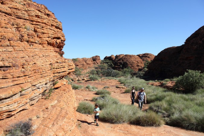
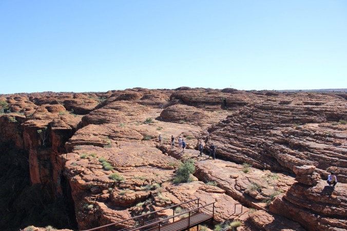 Now we come to parts where you need to hold your breath as you edge closer to the edge.
 It is a shear drop off the edge there!

 Above we are looking out towards the car park and yes, the views are quite beautiful.
 Yes you are correct, those are people on the opposite side of the canyon looking over the edge! No fences here! Scary!
 Not a great photo below but just showing a chasm(Joint) and the cross bedding(layers) in the sandstone.
 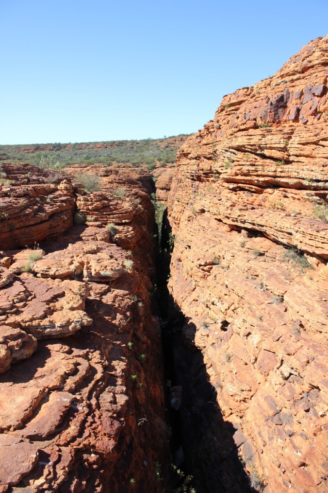 Lets have a look at a few of the plants up here. The Desert Heath Myrtle, Thryptomene maisonneuve were in full flower. These Thryptomenes are widespread throughout arid Australia and can grow to 1.5m high.
 Below is Macrozamia macdonnellii, The Macdonnell Ranges Cycad, interesting to see cycads out in arid country!
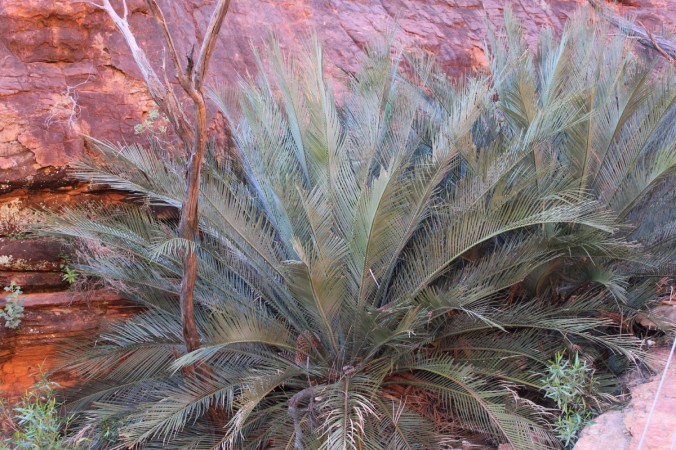 This one below looks like some kind of Hibbertia sp. Also know as Guinea Flowers, pretty nether the less.
 Not sure of this one, obviously situated in the Daisy family, could be a Calotis or a Minuria or some form of Brachycome or I could be totally off the money. Nice flowers though!
 This is Pandorea doratoxylon which we saw at
 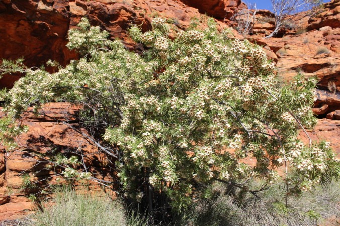 This is the stunning Holly Leaf Grevillea, Grevillea wickhamii.
 A shrub or small tree 1-4m or even 8m tall in places, seen in Western Australia and inland Northern Territory.
 We’ll leave the plants alone for a little while and head back into the scenic elements of Kings Canyon.
 Below we are looking into the Garden of Eden, an oasis in the middle of Kings Canyon fed via Kings Creek which creates a sublime environment in the heart of this arid country.
 Look at the reflection in the water, beautiful!
  Here is a stand of the Macdonnell Ranges Cycads.
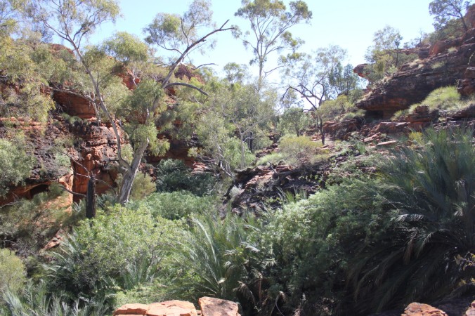
 Check out these reflections! Not Bad!
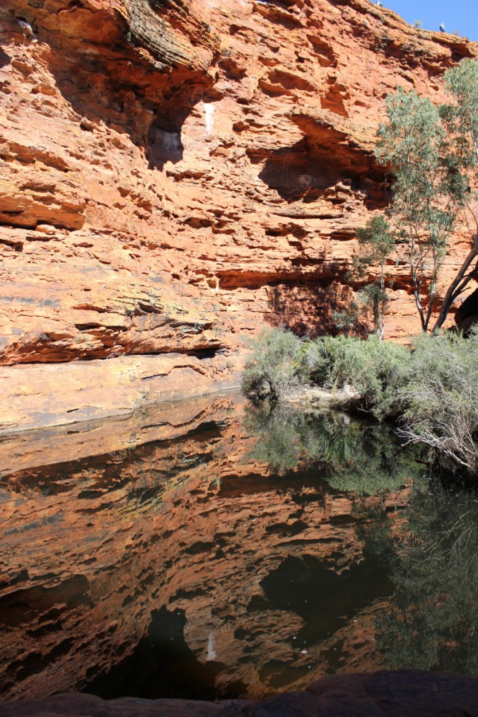 The one below is actually taken looking directly into the water!
 Staircase leading out of the Garden of Eden and on towards the rest of the Rim Walk.
 Here we are around the other side of the rim. That edge to the right of those people is a straight drop of about 100m or more and then maybe double that to Kings creek at the bottom, scary stuff!
 On this Sandstone cliff you can see the horizontal layers that have been laid down over time.
 Wow!
Wow!
 A bit more information above and no we didn’t smash any rocks to check the insides!
 The colours were truly amazing!


 I like this one above, it shows a couple of fault lines running in different directions. We are now on our way back towards ground level and the finish of the Rim Walk, a few more plants have caught my eye! I think this one is either a Goodenia, Lechenaultia or Velleia sp. Pretty little shrub on the sandstone hills on top of the canyon.
 This one below is quite possibly Goodenia cycloptera.
 Plants have an amazing knack of growing anywhere, have a look at this fig below.
 This one below looks like a bit of an oddity and haven’t been able to work it out yet!
 A few more pics of Ptilotus exaltatus.
 Here’s a good photo of one we’ve seen before, Solanum quadriloculatum.
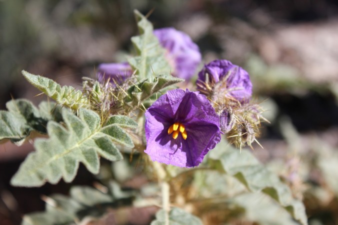 This is Kestrel Falls, apparently where lots of Kestrel’s roost and also some good waterfalls here during the wet season.
 A few more plant photos showing the tough environment here.


 Cheers!
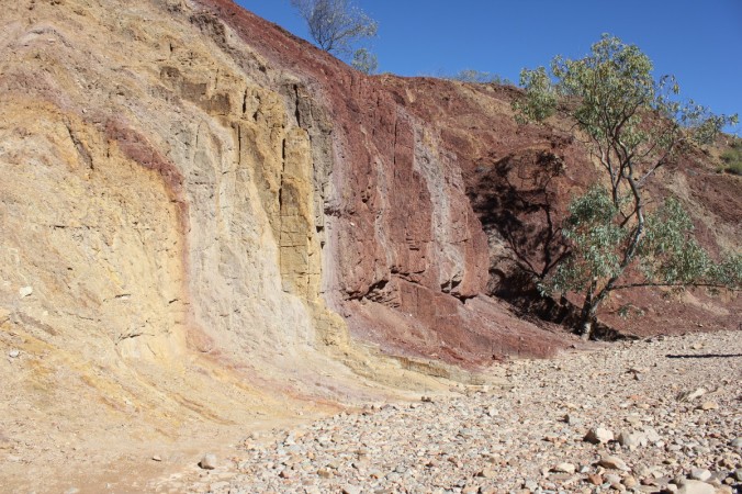
 Layers upon layers of different coloured rock, it was quite stunning and one could imagine the shifts in colour during the day and the seasons.
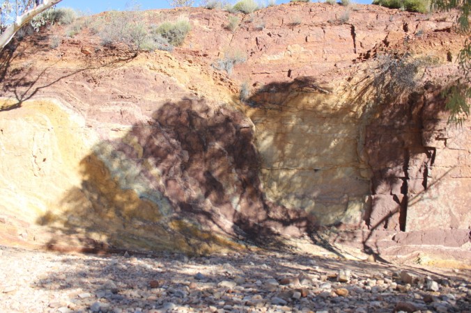
 Above is some plant trying to cling on in a very harsh environment. Some views below of the creek bed that runs through here.

 The colours were even evident in the creek bed, see below.
 Here we can see where it has been mined.
 Another colourful photo! Or two or three!
 There’s no point stopping somewhere without checking out the plant life!
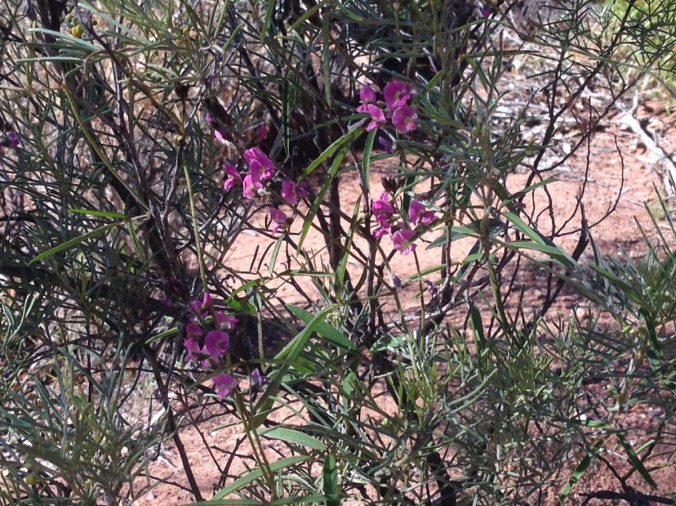 Back in the Pajero and another 17 km’s and we have now arrived at Ormiston Gorge. We had hoped to camp here but the small camp ground was chock-a-block and the sun was on the way down, so we knew we had limited time here which was a shame. Another beautiful Gorge here in the West Macdonnell Ranges on a similar vein to Serpentine Gorge but quite possibly even prettier!
 Perfect spot for a swim during the heat of the day, alas it was winter time! Some intriguing rock colour and formations below.


 Of course the plant life here took up some of my time, below is the Long Leafed Corkwood, Hakea suberea , quite common in dry desert regions. This is a large shrub or small tree 3-8m in height with dark brown cork like bark. Beautiful flowers produced in winter-spring, 4-15cm in length.
 See above the contorted and gnarly branches and the beautiful flowers below.
 Another interesting plant was Wahlenbergia communis , the Tufted Blue Bell growing to 75cm on alluvial plains and intermittent watercourses plus run off area’s, often found in sandy soils as well. A wide-spread perennial in all mainland states.
 Not a great photo below but a close-up nether the less.
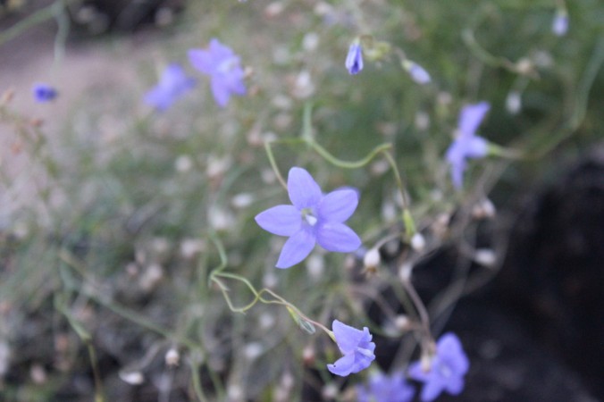
 Here’s some more rugged cliffs.

 Did you notice the gum tree’s growing on the sides of these cliffs, not many but a few hanging on for dear life!
 Or even these views…


 Below is looking across the valley
 Time to get set up before the sun disappears!
 Swags, fire and Tea!
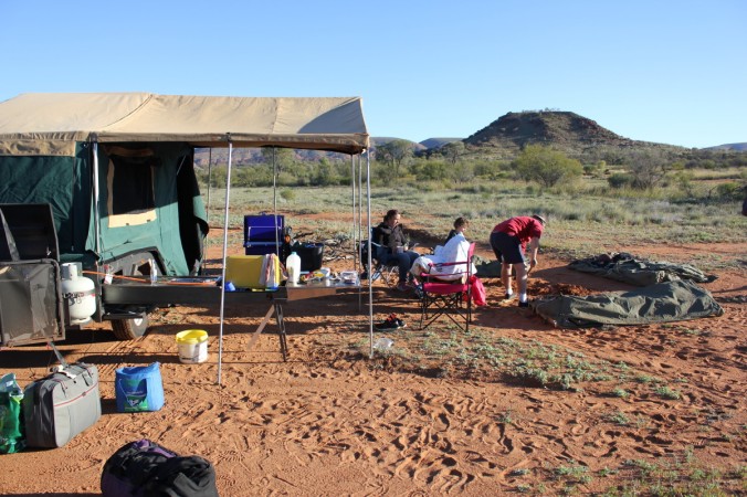
 Now for a bit of exploring! That means plant hunting really!


 Plus a couple of close-ups of the flowers, sort of!


 This is what a lot of the surrounding plant scape looks like, uninspiring you may say but you just need to look closely to find its beauty.
 Larapinta trail marker, this walking trail is 223km in length across the Macdonnell ranges, click on this
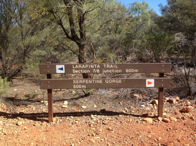
 Remember! Don’t just look ahead, cast your eye’s down and to the sides of where you’re walking, you’ll never know what you will find or see next.

 Below is Senna artemisoides subsp. artemisoides, another mouthful but a very beautiful shrub which grows to about 1-2 metres with beautiful yellow buttercup flowers in winter and spring.
 Maybe you can just call it the Silver Cassia. Now for an Emu Bush. Eremophila latrobei , commonly known as the Crimson Turkeybush, click
 Another stunning Emu bush is Eremophila longifolia , also known as Berrigan, tall shrub to small tree weeping in form, click
 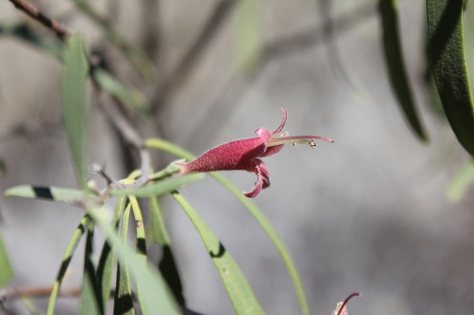 Sorry, I got distracted with the plants in the Serpentine Gorge, lets move onto the scenery. This is the first sort of glimpse of the gorge and it looks like its sort of straight up to the top, hmm!
 Lets go for it! Now we are starting the climb up and here you can clearly see the parallel ridge lines that run through the Macdonnell Ranges.
 Another couple of views of those ridge lines
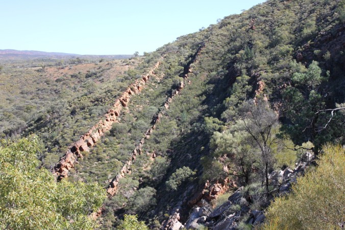
 Yes, as you can see above we are getting higher, quite spectacular! It is quite a rocky landscape and on these hillsides there is a lot of Porcupine grass, Trioda irritans. The last past of its botanic name sums it up very well indeed, very irritating because it’s quite prickly.
 Below are more views across the valley.
 Another plant of interest for me to see in the wild was Dodonaea viscosa , the Broad leaf Hop Bush or just plain Hop Bush, very common in gardens around the country and useful for many things from hedging to specimen plantings. It’s a very variable plant in the wild and widespread across the country.
 Now I know photos are great but there’s just no comparison to actually being there and seeing this landscape. I have a great digital SLR camera but it doesn’t capture the WOW! The size, scope and detail of what your eyes are looking at or what your feeling right then and there as you look at this amazing country. Below is the Serpentine Gorge.
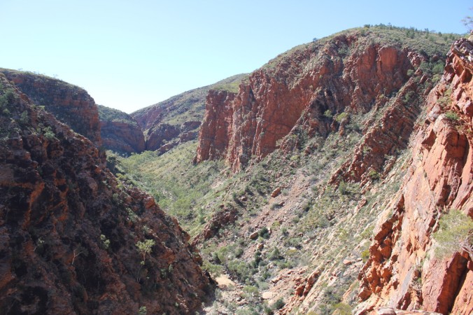


 Where does one go now from these heights? Down one would expect and lo and behold something I missed on the way up nearly hit me fair and square in the head on the way down.
 Leaning over the rocky pathway was this intriguing large shrub with what looked like stems twining around themselves like a climbing plant. This is Pandorea doratoxylon also known as the Spearwood Vine. The Aboriginal people use this plant for spears hence its common name. The long twining stems are light weight and are straightened and hardened over a fire. The flowers are quite pretty when one comes upon them in such a tough landscape.
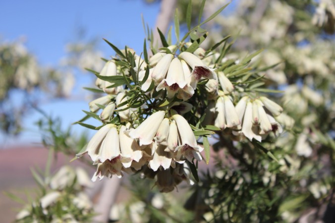 If they look familiar to you, you may be thinking of Pandorea jasminoides the Wonga Wonga vine or also known as the Bower Vine or one of the many hybrids available today. You would be correct because they are in the same family Bignoniaceae. Check out this closeup below!
 This next photo doesn’t show too much, I just liked the detail of the bark. To me it tells a story of the harsh landscape in which it resides.
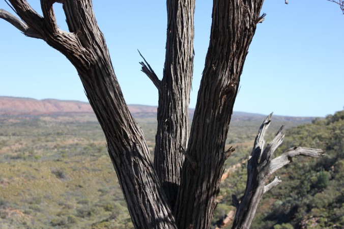 These next photos show an interesting Grevillea, the Holly Leaf Grevillea, Grevillea wickhamii. There are a few sub species but I’m not sure which one this is. I have pictures of this flowering at a different location which will be revealed at a later date!
 You can see above that the new growth gives the plant a tinge of yellow which from a distance look like flowers.
 Some more plants of interest here included another beautiful Emu Bush, Eremophila freelingii. The Rock Fuchsia Bush.
 A characteristic of this plant is that it sheds its lower leaves during drought to conserve moisture, you can see that quite clearly in the above photo, the plant looks half dead but it’s not! Grows to about 1.5 metres. The lilac flowers are stunning and are produced after it rains. Just a few more views below of this beautiful plant on the sides of Serpentine Gorge.

 Funnily enough another surprise was what looked to be some type of Fern here as well and yes it was. Not sure of its identity but quite possibly Cheilanthes brownie , The Northern Rock Fern, either way still remarkable to me to see a fern out here. Nature is amazing.
 Another interesting plant we saw was a parasite. Lysiana exocarpi , the Harlequin Mistletoe. This parasite is found mostly in inland locations and is very colourful.
 Now we have made it back down and headed into the cool of the gorge, being winter it wasn’t hot out in the open so one could imagine how nice and cool it would be in the heat of summer.
 In the above photo in the distance you can see some cycads, Macrozamia macdonnellii , the Macdonnell Ranges Cycad. Here they are below as well.
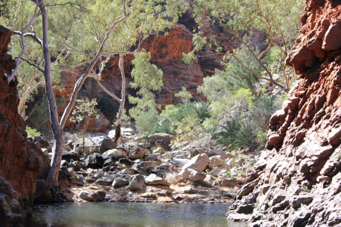 Ah well! That’s about it for the Serpentine Gorge, here’s a few last photos of plants and foliage.


 Finally a last look into the gorge.
 Cheers!
 Yes it is empty, this is only some puddles that are not moving.
 Some of the kids having a ball in the puddles.
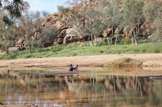

 Here’s the dingo stalking a galah…..
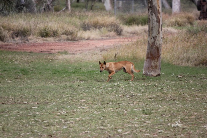 Missed it.. ah well, there’s always next time.


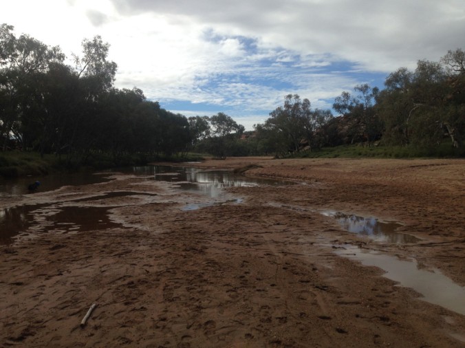


 Well maybe just a smidgen of water. The parting shot of Alice Springs for this post is from Anzac Hill. A memorial to the
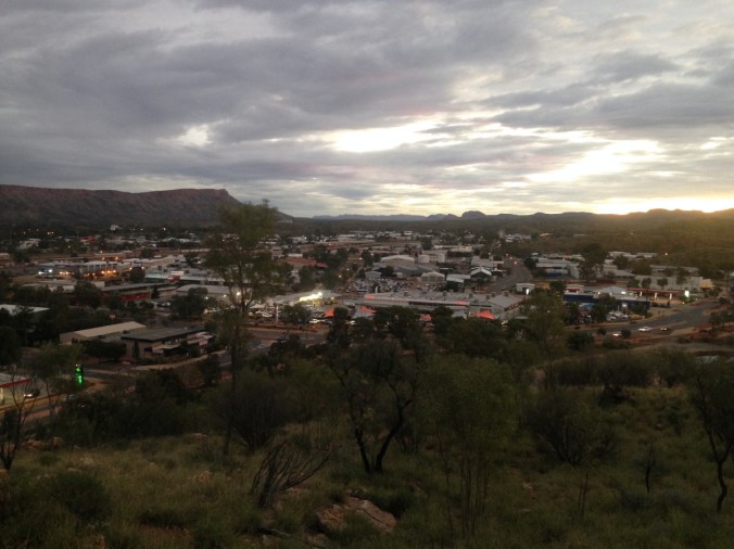
 Thanks “ALICE” it was a blast!!