Deep in the Belfast Metropolitan Area Plan (BMAP) 2015 there is a section devoted to Community Greenways.
When I saw the title “Lagan Valley Regional Park (LVRP)/Bog Meadows/Whiterock Community Greenway” and skimmed over the proposed route my heart nearly leapt for joy, because here was a proposed route that would take us on a Greenway between home and our primary school.
But
All is not what it seems.
Here is the entire route. As with any urban planning document it is huge. Handily, someone also provided this route description:
Begin at Shaws Bridge within the LVRP and travel in a northerly direction, past the Queens University Playing Fields and the House of Sport.
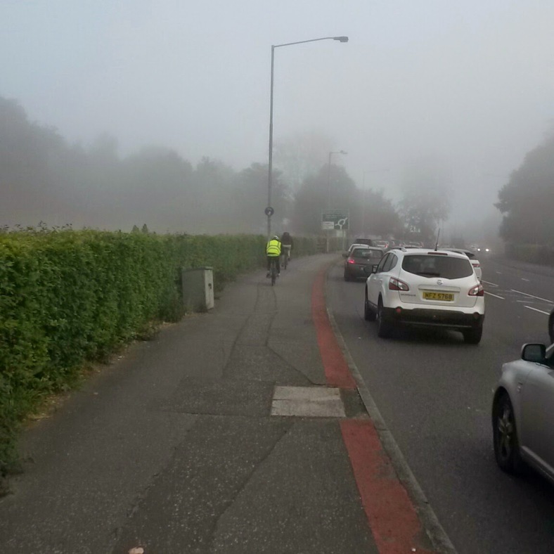
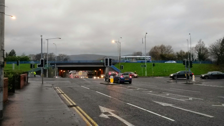
This is the A55, so not exactly an off-road experience here. You will share the greenway with 30-35k cars a day. The pavements are shared use. While the road racing fraternity ignore the shared use path, commuters use it increasingly:
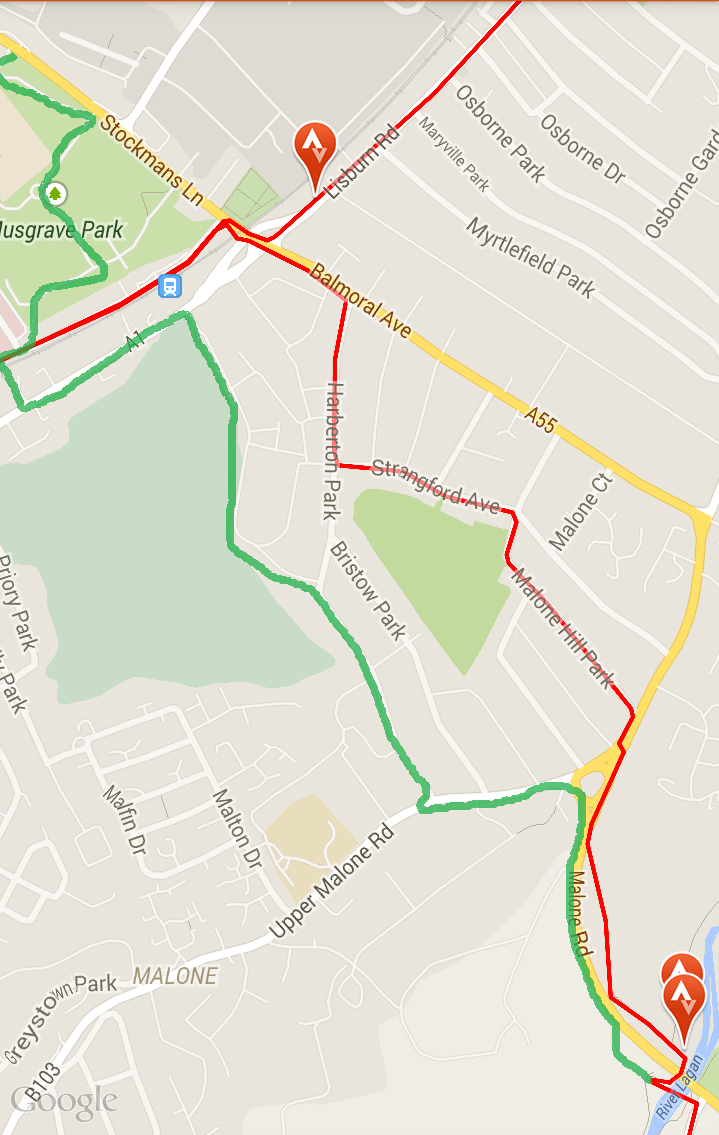
At the Malone Roundabout, travel west along the Upper Malone Road, cross the road and travel along Harberton Park.
If you’re cycling you must join the road at the Roundabout just at the point where traffic speeds up to leave it. The alternatives are to get off and push or ignore the law and cycle on the pavement.
A signalised crossing will be needed here to cross the Upper Malone Road.
The area around Shaw’s Bridge has become a major destination for MTB cyclists. No safe access to the tracks around Barnett’s Demesne is provided. Groups of school age children use the pavements along all major roads in the area to get to the tracks.
Jeff Dudgeon, Balmoral UUP councillor says, “[o]ne of the most frequent complaints I received from constituents during my election campaign was about cycling on pavements.”
Instead of going along the very noisy and busy A55 I go underneath the ring road beside the river and then up the lung-bustingly steep “Clement Wilson Ramp”. This leaves me at the signalised pedestrian crossing north of the Malone Road Roundabout. From there I go down the Strangford Avenue rat run, to join Harberton Park and on to rejoin the A55.
As does the Greenway. Because the landowners are not yet on board with the idea of a Greenway from Harberton Park to Lisburn Road pedestrians and cyclists are diverted back onto Belfast’s Ring Road:
The following section of the greenway is inaccessible to pedestrians
Travel along the periphery of the RUAS Showgrounds and Balmoral Golf Club.Alternative Pedestrian Linkage
Travel to the end of Harberton Park and turn left down Balmoral Avenue. At the junction with the Upper Lisburn Road, turn left and travel in a south westerly direction until you reach the railway bridge leading into Musgrave Park where you can rejoin the Greenway
The following section of the greenway is fully accessible to pedestrians,
but not cyclists.
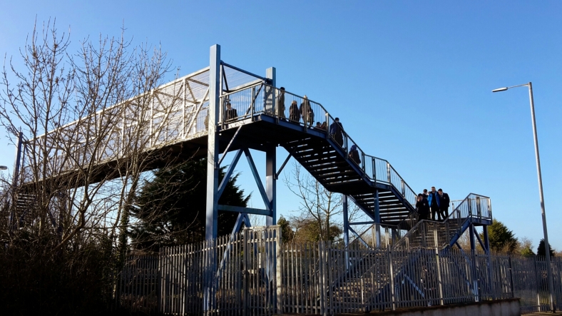
Turn left and travel along the Upper Lisburn Road to no. 24. Cross the road here and continue down the narrow footpath and across the railway footbridge into Musgrave Park.
You would think a pedestrian link to a hospital site would be fully accessible for people of all ages and abilities. And the irony is that the hospital is the Northern Irish regional centre for orthopaedic medicine, rheumatology, sports medicine and has a rehabilitation unit. But isn’t easily accessible for people with any kind of problem walking.
But back to the Greenway A55:
Travel north west through Musgrave Park and out onto Stockmans Lane. Turn left along Stockmans Lane and travel towards the motorway (M1) roundabout, before passing under the M1 bridge to reach Kennedy Way.
Stockman’s Lane is the A55. As is Kennedy Way:
The following section of the greenway is inaccessible to pedestrians
Travel north along Kennedy Way before turning right into Blackstaff Road and a further right into Blackstaff Way. At the bottom of Blackstaff Way, turn left onto the vacant ground. Travel around the boundary of Milltown Cemetery and through St Galls GAC Playing Fields onto Milltown Row. Travel west to the top of Milltown Row, cross the Falls Road and enter the Falls Park.
This bit of the “Greenway” leads through a light industrial estate. You are treated to the back of an Asda, a council waste recycling site and various commercial units. Lorries thunder up and down. Happily, there is an alternative involving Belfast’s Ring Road:
Alternative Pedestrian Linkage
Travel along Kennedy Way. At the roundabout beside the Westwood Shopping Centre, turn right onto the Andersonstown Road. Continue along this road, which becomes the Falls Road, in a north westerly direction. At the Falls Road / Glen Road roundabout, continue straight on, passing Milltown Cemetery on the right. Enter Falls Park on the left and rejoin the Greenway at this point.
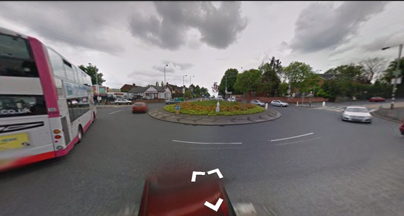
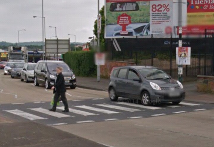
[added 28/3] It will be a relief for cyclists to leave the Andersonstown and Falls Road behind at Falls Park. This stretch of the “Greenway” includes two notorious roundabouts. The first at Kennedy Way is terrifying.
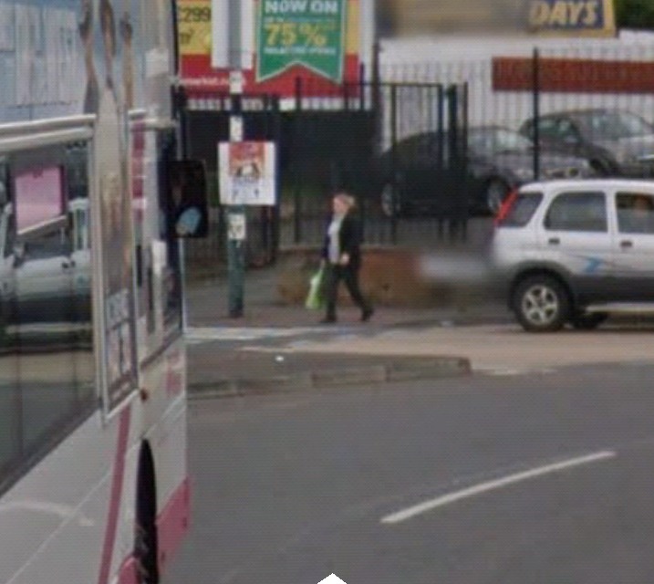
The slope across the roundabout, the high central island make it difficult to see cars coming. Trying to cross as a pedestrian, pushing your bike is no better. On all approaches motorists queue across the zebra crossings, and driving across them when pedestrians are crossing. It’s captured by the Google car:
The only reason cyclists are not killed here is because cycling’s modal share in West Belfast is 0%.
The roundabout where the Andersonstown Road morphs into the Falls Road is no better. It is a wide unmarked triangular space with a circular “feature” in the middle. It’s a free for all.
I have looked for it and I cannot find the roadside sign saying the Highway Code is suspended in West Belfast and it’s do as you please.
However, back to the Greenway:
From Falls Park it is not far to the glorious end:
The following section of the greenway is fully accessible to pedestrians
Follow the pathway in a northerly direction through Falls Park, past the playing fields and Belfast City Cemetery, out onto Whiterock Close and along the Whiterock Road into the Belfast Hills where the greenway ends.
There is however an alternative that isn’t accessible for pedestrians. What is the point of that? And it includes yet another of these terrifying roundabouts, where traffic pushes on regardless of what or who has right of way. It’s the Falls Road / Whiterock Road roundabout:
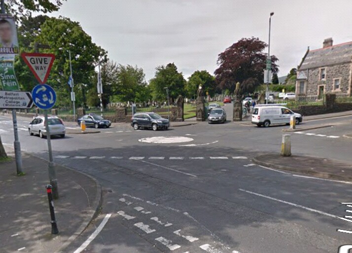
The current roadworks to accommodate the Belfast Rapid Transit lanes do not help.
Alternatively, exit the Bog Meadows at St James’s Road and travel in a northerly direction along St James’s Crescent and onto the Donegall Road. Travel west to the top of the Donegall Road and turn left along the Falls Road. At the Falls Road / Whiterock Road roundabout, turn right and continue up the Whiterock Road.
The following section of the greenway is inaccessible to pedestrians
Travel through the Belfast Metropolitan College Campus past St. Johns GAC grounds to Corpus Christi Church. Cross Springhill Drive and continue along the Springhill open space, past the playground and onto the Springfield Road. Turn left and continue along the Springfield Road and connect back into the greenway route at the Whiterock Road beside New Barnsley Parade.
But wait! There is another route. An alternative to the alternative:
Alternative Pedestrian Linkage
From the Whiterock Road, travel past the Belfast Metropolitan College Campus and turn right along the Ballymurphy Road. Turn right along Springhill Drive and then continue north along the Springhill open space to rejoin the Greenway at this point.
Pedestrians or cyclists? Pedestrians and cyclists?
The first obvious observation is the complete lack of thought given to cycling. Accessibility is used only in reference to walking. What is the overarching vision for Community Greenways?
Community Greenways serve a variety of functions including:
• Offering pedestrians and cyclists [my emphasis] the opportunity to travel from one green area to another via pleasant green surroundings; and
• Providing an ecological haven and green linkage along river corridors, pathways and disused railway lines.
To put it bluntly, the whole route needs to be re-evaluated from a cyclist’s point of view.
Also, can we really say that the A55 is a “pleasant green surrounding”?
Does this Community Greenway offer a reasonable alternative to using the pavements along the A55 for pedestrians and cyclists?
No and no.
To make this route work we need to gain public access to parcels of privately owned land. Consideration needs to be given to places where the route crosses main roads and the M1 motorway. There is a need for signalised crossings and perhaps a tunnel or bridge to cross the M1.
If we want cyclists to have full access Harberton Park needs to be upgraded to include cycle tracks. We need fully segregated tracks along the Upper Malone, Lisburn, Andersonstown and Falls Roads. The pedestrian footbridge at Musgrave Park Hospital needs to be upgraded so people of all ages and abilities can use it.
The wider picture
West Belfast has a very low uptake of cycling, due in no small part to the complete lack of cycling infrastructure. Plans like this can improve the environment for cycling. Combined with initiatives to encourage multi-modal transport (cycling to a secure bike parking at a Belfast Rapid Transport halt along the Falls and Andersonstown Roads, perhaps) the cycling share may increase. Large employers such as the Royal site of the Belfast Trust are to be commended for encouraging staff not to use their cars. And the Belfast bike hire scheme should be extended to the Royal site as a matter of priority.
Is there potential for better? Maybe. The Southwest Gateway plan may give a very good alternative to parts of the greenway route set out in the BMAP. And in my opinion the two plans should be combined taking the best elements of both.
I don’t think I will personally benefit from the Greenway for the school commute. It remains to be seen if any of it can be realised by the time my youngest leaves primary school in 2023.
I swim at A’town and cycle there and back: A’town Road, Falls Road, Donegall Road. I approach roundabouts at high speed between the rows of cars if necesary. Don’t expect indicator use, but predict a gap between cars and dash for it. I keep speed high to integrate with cars, or else vehicular cycling to prevent the aggressively close-passing cars. Local drivers are usually very tollerant.
Someone less fit, a child, someone on a trike, or Cargobike or pulling a trailer can’t keep up with traffic. How are they to cycle there? The answer is a separate cycle track. DRD are putting in the BRT, but no consideration is given to its interaction with cycling. Cyclists of all ages and abilities are simply expected to mix with fast buses, black taxis and motorcycles. This will not deliver a growth in cycling numbers. And West Belfast will be poorer and less healthy because of it.