What's Happening To Kluane Lake - Yukon's Vanishing Lake?
While at Kluane National Park we had been spending time in the southern end of the park. But there were two things we wanted to do in the section of the park north of Haines Junction: see Kluane Lake and hike Sheep Creek trail.

Alaska Highway runs next to the lake on the west shore all the way to Burwash Landing.
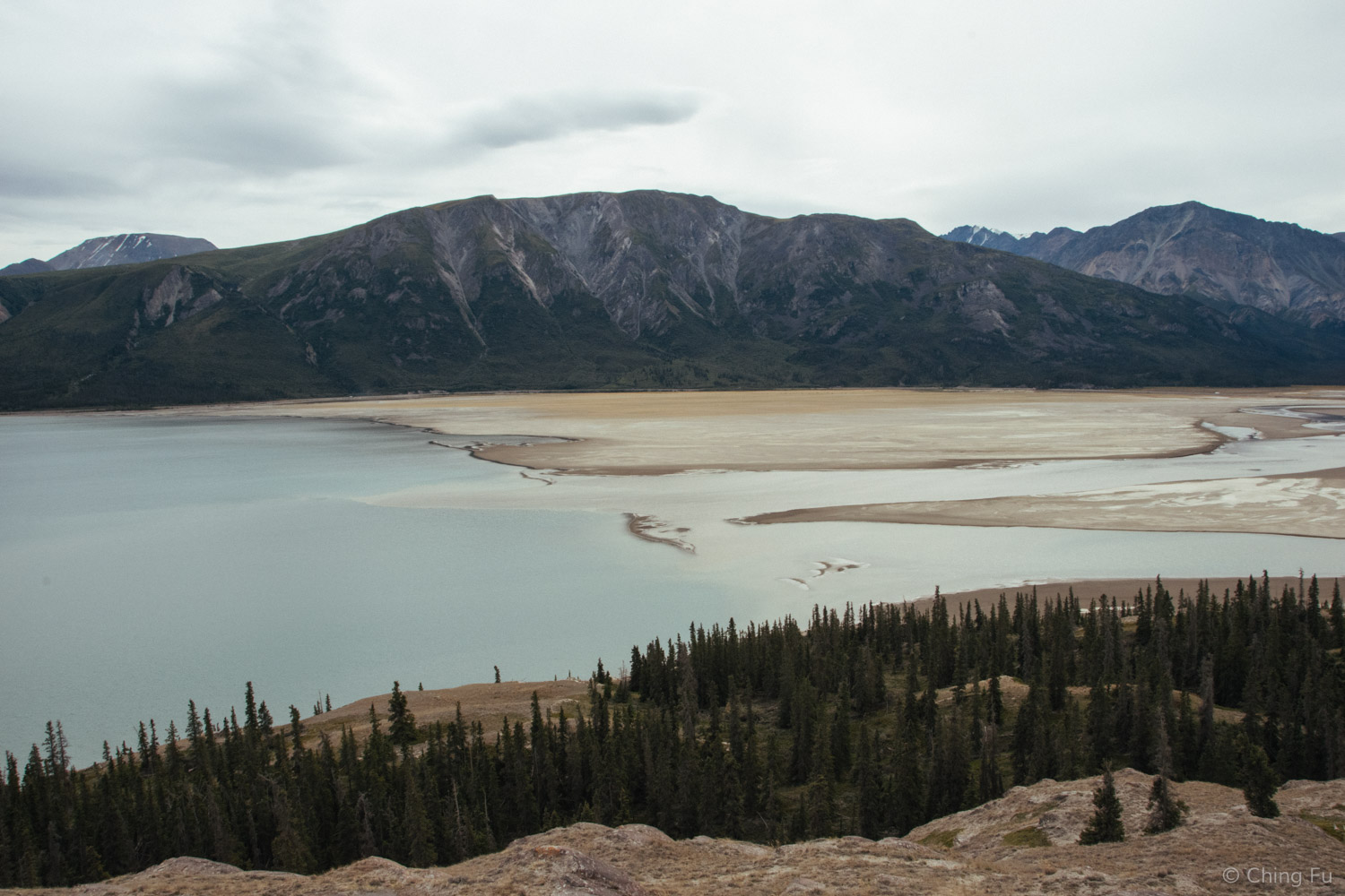
We drove out to the Tachal Dhal Visitor Center area, which is located right by Kluane Lake, as a day trip. As we got closer to the visitor center we noticed that a section of the lake was bone dry. We learned from the ranger that the lake level had been fine at the beginning of summer but the water level had been decreasing throughout the season. We visited the lake on August 5 and it had already dropped 1 meter (3.3 ft.) since June. The Slims River is 80% of Kluane Lake’s water source and the river consists of glacier melt from Kaskawulsh Glacier. But because the glacier has receded so much, it is no longer flowing into Slims River but into Kaskawulsh River instead. The ranger wasn’t sure what would happen to the lake long term, it would all depend on what happens over winter with the glacier.

This is a map showing Kaskawulsh Glacier, Slims River, Kluane Lake and the visitor center. It's the south tip of the lake that is drying up.
Three feet may not sound like a lot of water loss, but considering the size of Kluane Lake, it is. Kluane Lake is Yukon’s largest lake that is entirely contained within the province. It’s 158 square miles and 50 miles long. It drains into Kluane River, which flows into three other rivers before reaching the Bering Sea.

The road running through the dried section of lake bed is the Alaska Highway.
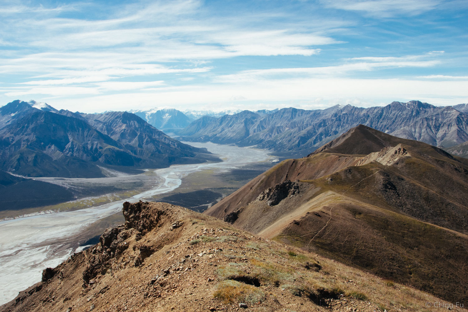
This almost dried river is Slims River, the main source of water for Kluane Lake. Follow the river and Kaskawulsh Glacier is somewhere on a mountain in the far background.
The lower water level also meant that the island in this section of the lake was no longer an island. Since we ended up not hiking Sheep Creek trail because it turned out to be really windy and overcast, we hiked out to the island from the Alaska Highway instead.
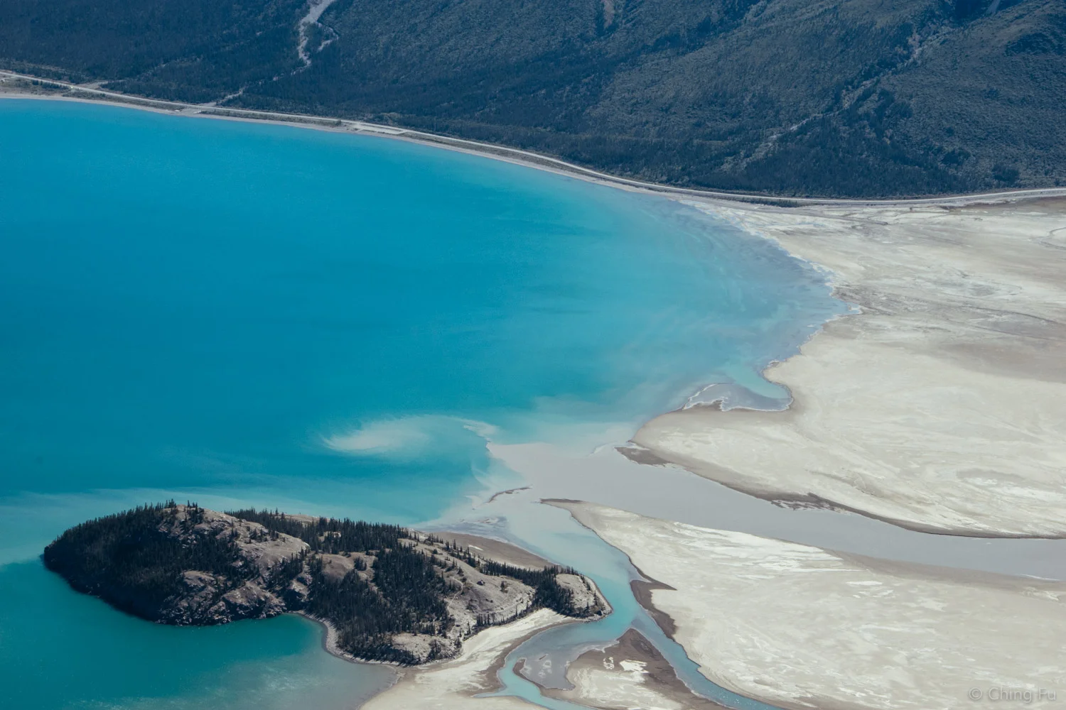
This is the "island" we hiked out to.
View of the island and dried lakebed on our hike.

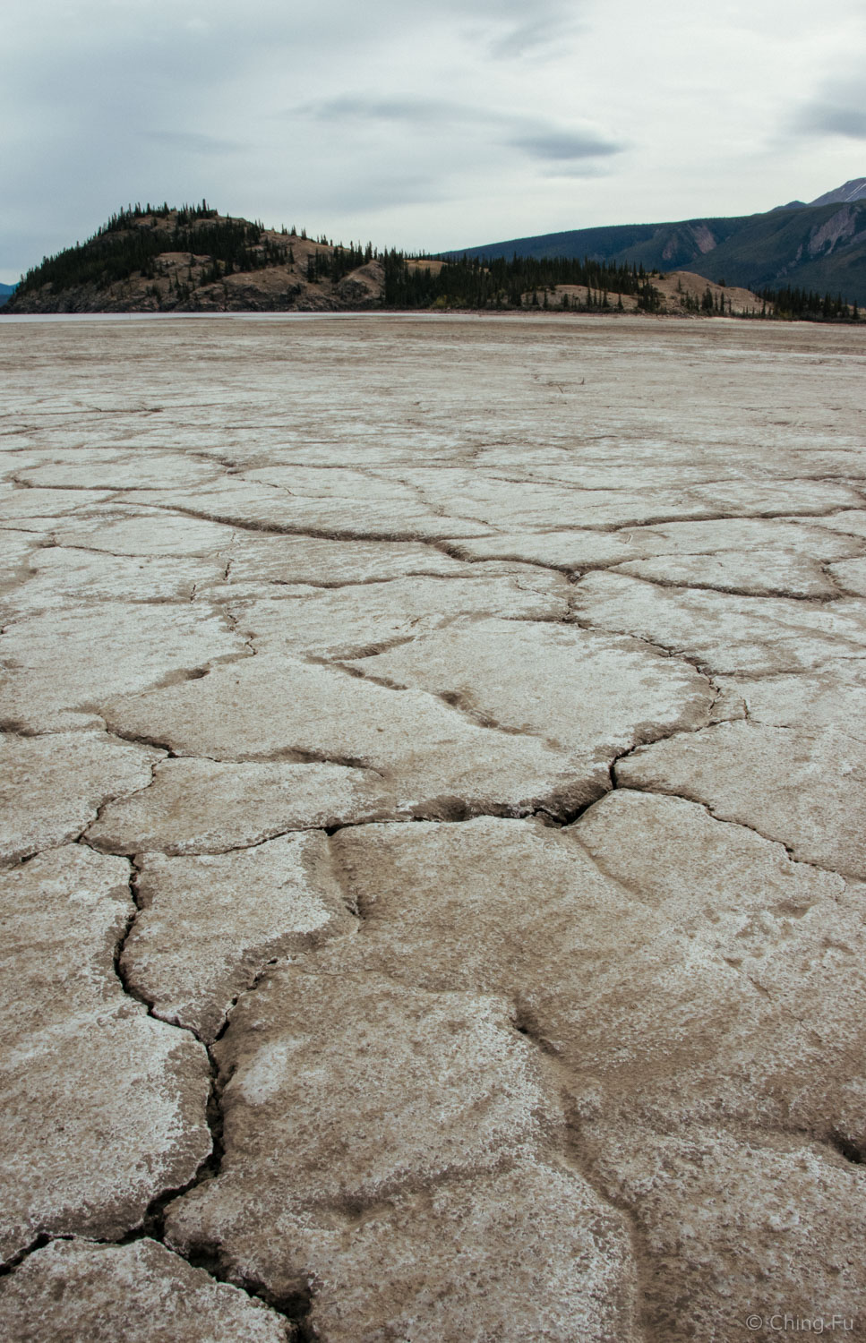
This was our view of the dried lake section from the top of the island.
Where water and dirt meet.
On our hike back out we came across four cyclists riding across the lakebed. I instantly knew they were part of the Texas 4000 group that I had seen on the road a couple of days before on my way to Whitehorse. Eager to learn more about them, I stopped them to chat. They turned out to be University of Texas undergrad and grad students on a bike tour from Austin to Anchorage. The Texas 4000 is a competitive 18-month long program. During that time selected students have to raise $4,500, ride 2,000 training miles, and volunteer 50+ hours in the community. The students are actively involved in all the aspects of planning the ride. The event is focused on raising money for cancer research. There are three routes to choose from: the Sierra, the Rockies and the Ozark route. The group we chatted with each took a different route and had just met up again 3 days ago in Whitehorse after 2 months of riding. The route varies between 4,000 – 4,500 miles. The students provide their own SAG support by rotating drivers along with setting up rest stops. They camp in various places and ride almost every day. I found the whole thing to be awesome and was really excited for them, especially since they had 9 days left before reaching their final destination.

We also drove north on the Alaska Highway to hang out at another spot on the lake and to check out some potential future boondocking spots.

There was a great boondocking site on the shore of this section of the lake. It's in iOverlander.

There is no water cold enough to prevent Tybee from going in it.
Side note: All the sunny photos were taken two days later when we made a second trip to Kluane Lake. They were taken from Sheep Creek trail. The other photos were taken during our first visit.
TIPS
There is no Wi-Fi at the Tachal Dhal Visitor Center. They don't even have a computer in the building for the employees.
We didn't get any signal (Verizon) in this area.
We visited this area in August 2016.