‘Tornado-like’ funnel cloud spotted over Dublin Airport as flash flooding continues under Status Yellow thunderstorm alert

Picture: Dorota Zawada
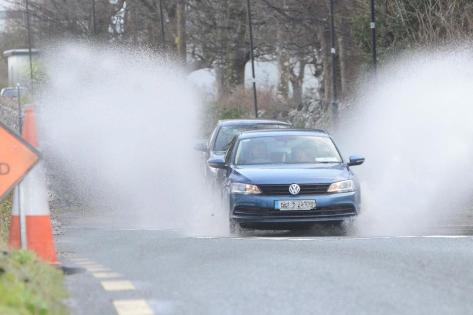
Met Éireann has warned of heavy showers and thunderstorms. Photo: Paul Mealey
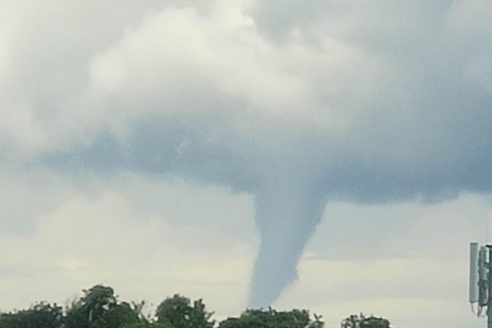
Funnel cloud spotted outside Castlebar, Co Mayo. Picture: Catherine McTigue
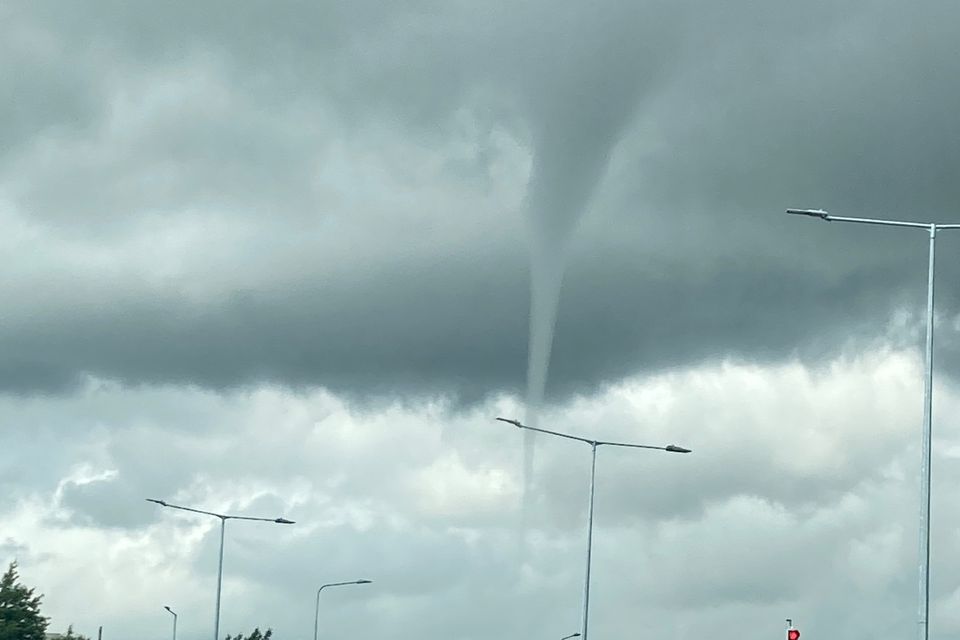
Funnel cloud pictured near Dublin Airport this afternoon. Picture: @GeorgieGirly100/Twitter
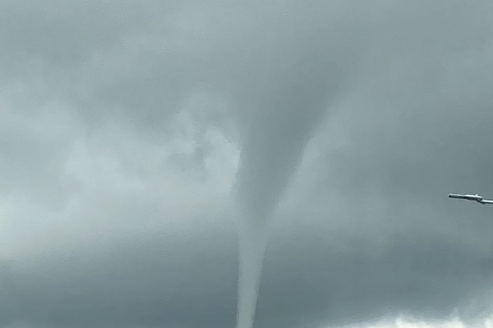
Picture: @GeorgieGirly100/Twitter


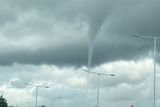

A funnel cloud has been spotted over Dublin Airport this afternoon as a Status Yellow thunderstorm and rain warning remains in place for most of the country.
The weather alert will remain in place until 10pm for Leinster, Munster, Cavan, Donegal, Monaghan, Galway, Leitrim, Roscommon and Sligo.
"Thunderstorms and very heavy showers producing significant rainfall accumulations over short time periods,” Met Éireann said.
Possible effects include spot flooding, poor visibility and difficult travelling conditions. A Status Orange warning expired at 6pm this evening.
Flash flooding ravages Dublin after heavy rain
The funnel-shaped cloud is made up of condensed water droplets, associated with a rotating column of wind which hangs down from the cloud base and usually lasts for only a matter of minutes.
They are usually visible as a cone-shaped or needle-like protuberance from the main cloud base.
Met Éireann meteorologist Linda Hughes said a funnel cloud was very similar to a tornado, with the only difference being it didn’t touch the ground or a water surface.
“If that would touch the water then it would be a waterspout – they’re all the same principle but this one does look like a funnel cloud,” she said.
“It’s basically rotating air coming out of the base of a cloud, it’s normally due to a cumulonimbus cloud and that’s also the type of cloud that produces thunderstorms.
“On the radar earlier this afternoon, there were lots of heavy showers and there were some thunderstorms around Dublin and near Dublin Airport.
“They’re not very common but they do occur particularly if there are intense thunderstorms.”
A spokesperson for Dublin Airport said it was operating as normal this afternoon.
We need your consent to load this Social Media content. We use a number of different Social Media outlets to manage extra content that can set cookies on your device and collect data about your activity.
A funnel cloud was also spotted over Mayo this afternoon.
Ms Hughes said a number of factors would have to take place for a funnel cloud to turn into a tornado.
“It depends on the strength of the wind and how much moisture if picks up – usually in Ireland they wouldn’t be as intense as American but there have been tornados in Ireland so it’s not completely out of the question, but they would be very rare,” she said.
“If they do touch the ground, the winds surrounding them are very strong but in thunderstorms in general there can be very strong gusts so they can cause some problems.”
Ms Hughes said there would be some heavy downpours and thunderstorms across the country over the next few hours.
It comes as Dublin Fire Brigade has said its crews are responding to incidents of spot flooding across the capital, including at Dolphins Barn where a large flood was reported.
"Drive through slowly, avoid a bow wave, test your brakes when you leave the water,” a spokesperson for the fire service said.
A number of homes and businesses have also been flooded in Listowel, Co Kerry, as heavy rains overwhelmed the storm drain system of the town and caused sewage to back up into gardens.
Local fire service crews backed up by colleagues from Abbeyfeale and Ballybunion raced to tackle the rising waters across town, pumping out several properties in the worst-affected areas.
Met Éireann said there would be a mix of cloud and sunny spells this morning, with showers becoming widespread and turning heavy. Thunderstorms will develop for the afternoon and evening, with highest of 18C to 22C.
Tonight, the heavy showers and thunderstorms will ease and become mostly confined to northern and Atlantic coastal areas, however, isolated showers may continue further inland. Temperatures tonight will not fall below 10C to 14C.
Met Éireann said there would be a mix of cloud and sunny spells tomorrow, with scattered showers developing in the morning. Some showers will turn heavy or possibly thundery during the afternoon and evening. There will be a clearance to drier conditions with better sunshine gradually building from the west through the day, as the showers become mostly confined to southern and eastern counties. Highest temperatures of 18C to 22C are expected.
Dublin Bus experiences flooding in Drimnagh
Any lingering heavy showers in the east will clear on Wednesday night, leaving long clear spells and light showers on Atlantic coasts. Temperatures will drop back to between 8C to 13C.
The forecaster said Thursday would bring spells of sunshine and well scattered showers, but the showers would not be as heavy or as widespread as previous days and there would be dry intervals in between. During the evening, cloud will build from the southwest with outbreaks of rain and drizzle following towards nightfall. Daytime temperatures will range from 19C to 23C.
Thursday night will be humid with outbreaks of rain, heavy at times, extending from the southwest through the night, but parts of the northeast will stay dry until morning. Temperatures of 13C to 16C are expected.
Met Éireann said Friday would be a wet day with outbreaks of rain bringing some heavy falls and the chance of localised flooding, while highest temperatures will range from 19C to 23C.
“Some uncertainty in the details but Saturday and Sunday will be generally unsettled with spells of rain and showers. Warmer on Saturday with temperatures getting up to the mid-twenties before returning to the high teens or low twenties for Sunday,” Met Éireann said.
Join the Irish Independent WhatsApp channel
Stay up to date with all the latest news