
This is a story about a humble footbridge in Coatbridge, North lanarkshire. It’s much like any other footbridge, except for one unusual feature…

Our bridge spans the Edinburgh-Glasgow railway line which runs in a cutting between Blairhill and Coatbridge Sunnyside Stations. It connects Blairhill to the south with Gartsherrie.

As you can see the bridge is very broad for a footbridge, and why does it have a pavement?
The photo above is looking south over the bridge from side nearest to Gartsherrie Road. On the opposite side the road is blocked by houses. The footpath turns a sharp left before the fence and down a narrow lane with no room for vehicles. So what is going on here?
The Long & the Short of It
Let’s go back to 1859 courtesy of the National Library of Scotland’s online maps.
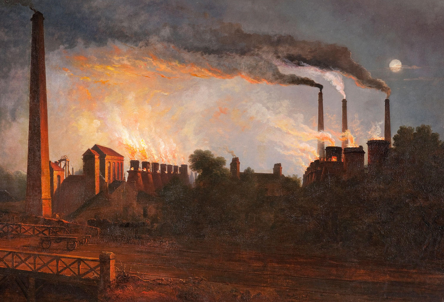
The 1st edition Ordnance Survey map below shows the site of our bridge before the railway. The spot was occupied by Long Row, housing for workers at William Baird & Co’s Gartsherrie Iron Works, Scotland’s biggest pig iron works by far. That’s the ironworks on the right.

Long row ran north to south, forming the west side of an open square with other rows of workers’ housing.
The long avenue of trees on the left of the map was the drive to Gartsherrie House, the grand home of James Baird, one of the brothers who owned the ironworks. The house would eventually make way for the expanding business and was demolished in the 1920s. Part of the tree-lined drive survives today as Colt Avenue.
The Gartsherrie Iron Works opened in 1830. It was the first ironworks purpose-built to use the new Hot Blast Process for making pig iron. The process was ideally suited to the local Black Band Ironstone and so ironworks soon followed, exploiting both the plentiful raw materials and ready access to the Monkland Canal.
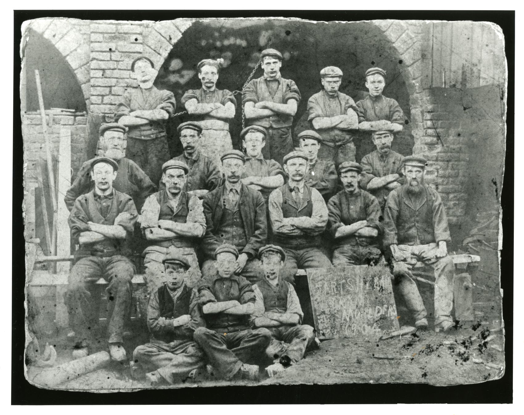
Migrant workers were drawn from Ireland & the Highlands but they needed somewhere to live: a new town was born.
The Gartsherrie Rows were built on fields upwind of the smoky ironworks. Single storey terraces of one or two room company houses for a whole family. Beds were shared & while you did your 12 hour shift another would sleep in your place. Several households shared each outdoor dry toilet and a communal washhouse.
Railroaded
Come the late 1860s the North British Railway decided to build a branch line from Coatbridge to Glasgow. Soon the Bairds and other local industrialists would get their pig iron to market much more quickly than by canal. However, Long Row stood directly in the way. The tenants would have to be re-housed, no?

No. In true Victorian style the railway company simply punched a cutting through the middle of Long Row then built a bridge to re-join the two sides.

As you can see from the map above, the houses of Long Row ran along the west side of the road that ran over the bridge – and that is the side that still has a pavement.

The End of Long Row
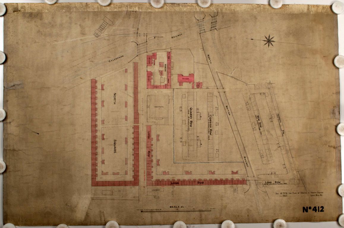
By the 1930s the Coatbridge iron industry was in rapid decline. As the old rows & squares became vacant they were demolished in slum clearances. The 1937 plan below shows Long Row at the bottom-right, the houses on the Blairhill side of the bridge already marked as dismantled.
The old, dense housing was replaced by modern dwellings with larger rooms and indoor plumbing.
The last of the Gartsherrie Rows (the roofless shells of North Square) were demolished in 1967 & the old rows & squares consigned to history. Today it takes a keen eye to spot the faint traces that the rows left behind. Things as small as a little strip of pavement.
This story started life as a thread on Twitter in March 2023.