Quendon Bowling Club
Quendon Bowling Club is a pitch in Quendon and Rickling, Uttlesford District, England. Quendon Bowling Club is situated close to the forest Quendon Wood and the village green The Green.Notable Places in the Area
Quendon Wood
Forest

Photo: Dudley Miles, CC BY-SA 4.0.
Quendon Wood is a 32.1-hectare biological Site of Special Scientific Interest in Quendon in Essex.The site is ancient coppiced woodland with a rich variety of fauna on different types of soil.
Elsenham railway station
Railway station
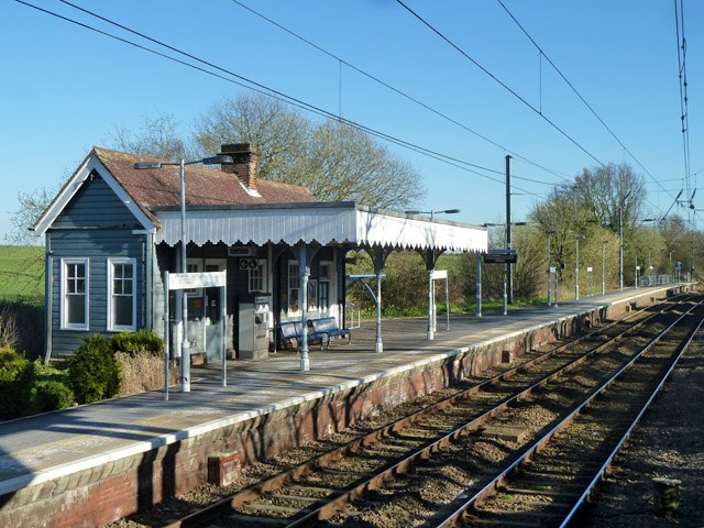
Photo: Robin Webster, CC BY-SA 2.0.
Elsenham railway station is found on the West Anglia Main Line, serving the village of Elsenham in Essex, England. Elsenham railway station is situated 2 miles southeast of Quendon Bowling Club.
Newport railway station
Railway station

Photo: Robert Edwards, CC BY-SA 2.0.
Newport railway station is on the West Anglia Main Line serving the village of Newport in Essex, England. Newport railway station is situated 2½ miles north of Quendon Bowling Club.
Localities in the Area
Quendon
Village

Photo: Acabashi, CC BY-SA 4.0.
Quendon is a linear village and former civil parish, now in the parish of Quendon and Rickling, in the Uttlesford district, in the county of Essex, England.
Little Henham
Hamlet

Photo: Mark Camp, CC BY-SA 2.0.
Henham, or Henham-on-the-Hill is a village and civil parish in the Uttlesford district of Essex, England.
Rickling
Hamlet

Photo: Nigel Cox, CC BY-SA 2.0.
Rickling is a village and former civil parish, now in the parish of Quendon and Rickling, in the Uttlesford district of Essex, England.
Quendon Bowling Club
- Type: Pitch
- Categories: recreation area, bowls and sports location
- Location: Quendon and Rickling, Uttlesford District, Essex, East of England, England, United Kingdom, Britain and Ireland, Europe
- View on OpenStreetMap
Latitude
51.94798° or 51° 56' 53" northLongitude
0.20036° or 0° 12' 1" eastOpen Location Code
9F32W6X2+54OpenStreetMap ID
way 910078714OpenStreetMap Feature
leisure=pitchOpenStreetMap Feature
sport=bowlsQuendon Bowling Club Satellite Map
© OpenStreetMap, Mapbox and Maxar
Landmarks in the Area
- The GreenVillage green, 1,100 feet southwest
- Coney AcreForest
- Cricket Pavilion1,400 feet southwest
- Saint Simon and Saint Jude, QuendonChurch, 2,300 feet north
- Dark PlantationForest
Places in the Area
- The PotteriesBus stop, 450 feet north
- Rickling Church of England Voluntary Aided Primary SchoolSchool, 680 feet southwest
- Cricketers ArmsPub, 860 feet southwest
- Quendon & RicklingWork of art, 1,200 feet west
Popular Destinations in Essex
Discover Colchester, Chelmsford, Southend-on-Sea and Basildon.
Escape to a Random Place
Discover other pitches in the world.
About Mapcarta. Thanks to Mapbox for providing amazing maps. Data © OpenStreetMap contributors and available under the Open Database License. Text is available under the CC BY-SA 4.0 license, excluding photos, directions and the map. Photo: Wikimedia, CC0.