Shettleston Bowling Club
Shettleston Bowling Club is a sports venue in Glasgow City, Scotland located on Culrain Street. Shettleston Bowling Club is situated close to Trinity Methodist Church and the police station Shettleston Police Office.Notable Places in the Area
Carntyne railway station
Railway station

Photo: Wikimedia, CC BY-SA 2.0.
Carntyne railway station serves the Carntyne area of Glasgow, Scotland. Carntyne railway station is situated 2,300 feet northwest of Shettleston Bowling Club.
Shettleston railway station
Railway station
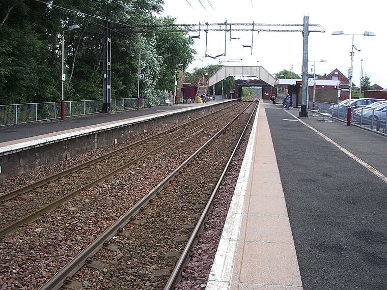
Photo: ML5, Public domain.
Shettleston railway station serves the Shettleston area of Glasgow, Scotland and is 3½ miles east of Glasgow Queen Street railway station on the North Clyde Line. Shettleston railway station is situated 2,800 feet northeast of Shettleston Bowling Club.
Eastbank Academy
School
Eastbank Academy is a Scottish secondary school in the suburb of Shettleston in Glasgow, Scotland. Eastbank Academy is situated 1,900 feet east of Shettleston Bowling Club.
Localities in the Area
Shettleston
Suburb

Photo: G Laird, CC BY-SA 2.0.
Shettleston is an area in the east end of Glasgow in Scotland.
Greenfield
Suburb
Greenfield is a neighbourhood in the east end of the Scottish city of Glasgow, north of the River Clyde.
Tollcross
Suburb
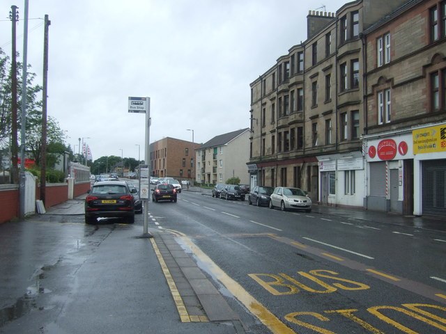
Photo: JThomas, CC BY-SA 2.0.
Tollcross is an area north of the River Clyde in Glasgow and has a popular park, opened in 1897, which is famed for its international rose trials.
Shettleston Bowling Club
- Type: Sports venue
- Address: 53-59 Culrain Street, Glasgow, G32 7AB
- Categories: recreation area, bowls and sports location
- Location: Glasgow City, Scotland, United Kingdom, Britain and Ireland, Europe
- View on OpenStreetMap
Latitude
55.8503° or 55° 51' 1" northLongitude
-4.17182° or 4° 10' 19" westOpen Location Code
9C7QVR2H+47OpenStreetMap ID
way 907471683OpenStreetMap Feature
leisure=sports_centreOpenStreetMap Feature
sport=bowlsShettleston Bowling Club Satellite Map
© OpenStreetMap, Mapbox and Maxar
Landmarks in the Area
- Trinity Methodist ChurchChurch, 770 feet northeast
- Shettleston Police OfficePolice station, 830 feet northeast
- Shettleston LibraryLibrary, 920 feet southwest
- St Barnabas' RC ChurchChurch, 920 feet northwest
- Shettleston Day Hospital & Parkview Resource CentreHospital, 980 feet southwest
Places in the Area
- The Luxury Bed StoreBed shop, 510 feet north
- Kellys KarpetsCarpet shop, 500 feet north
- Dalhousie Mini MarketGreengrocer, 530 feet northeast
- Sunset BeachBeauty salon, 530 feet north
- Price CuttersSupermarket, 530 feet north
Escape to a Random Place
Discover other sports venues in the world.
About Mapcarta. Thanks to Mapbox for providing amazing maps. Data © OpenStreetMap contributors and available under the Open Database License. Text is available under the CC BY-SA 4.0 license, excluding photos, directions and the map. Photo: Ritchyblack, FAL.