Redcar Borough Park Bowling Club
Redcar Borough Park Bowling Club is a building in Redcar and Cleveland, England. Redcar Borough Park Bowling Club is situated close to Redcar Cemetery and the playground Borough Park Children's Play Area.Notable Places in the Area
Redcar East railway station
Railway station
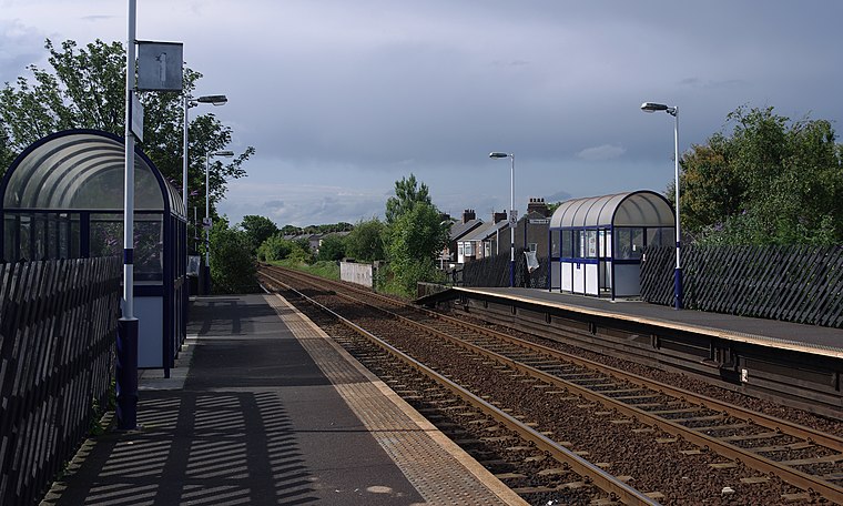
Photo: Mattbuck, CC BY-SA 3.0.
Redcar East is a railway station on the Tees Valley Line, which runs between Bishop Auckland and Saltburn via Darlington. Redcar East railway station is situated 2,400 feet east of Redcar Borough Park Bowling Club.
Redcar Racecourse
Athletics track
Redcar Racecourse is a thoroughbred horse racing venue located in Redcar, North Yorkshire, England. Redcar Racecourse is situated 1,800 feet south of Redcar Borough Park Bowling Club.
Redcar Central railway station
Railway station
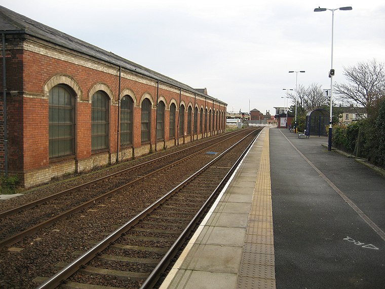
Photo: Chris Heaton, CC BY-SA 2.0.
Redcar Central is a railway station on the Tees Valley Line, which runs between Bishop Auckland and Saltburn via Darlington. Redcar Central railway station is situated 3,000 feet northwest of Redcar Borough Park Bowling Club.
Localities in the Area
Redcar
Town

Photo: George Robinson, CC BY-SA 2.0.
Redcar is a seaside town on the Yorkshire Coast in the Redcar and Cleveland unitary authority in the ceremonial county of North Yorkshire, England.
Warrenby
Hamlet
Photo: Stephen McCulloch, CC BY-SA 2.0.
Warrenby is a depopulated area of Redcar in the borough of Redcar and Cleveland, ceremonial county of North Yorkshire, England.
Yearby
Hamlet

Photo: Mick Garratt, CC BY-SA 2.0.
Yearby is a village in the borough of Redcar and Cleveland and the ceremonial county of North Yorkshire, England. Yearby is situated 2 miles south of Redcar Borough Park Bowling Club.
Redcar Borough Park Bowling Club
- Type: Bowls
- Categories: building and sports location
- Location: Redcar and Cleveland, England, United Kingdom, Britain and Ireland, Europe
- View on OpenStreetMap
Latitude
54.60891° or 54° 36' 32" northLongitude
-1.0631° or 1° 3' 47" westOpen Location Code
9C6WJW5P+HQOpenStreetMap ID
way 906004170OpenStreetMap Feature
building=yesOpenStreetMap Feature
sport=bowlsRedcar Borough Park Bowling Club Satellite Map
© OpenStreetMap, Mapbox and Maxar
Landmarks in the Area
- Borough ParkPark, 550 feet southeast
- Redcar CemeteryCemetery, 580 feet northeast
- Borough Park Children's Play AreaPlayground, 620 feet southeast
- Redcar Racecourse750 feet northwest
- Borough Park Rose GardenGarden, 790 feet south
Places in the Area
- Borough Park OrchardOrchard
- Foils Hair & BeautyHairdresser, 1,200 feet northwest
- Racecourse Wine LodgeConvenience store, 1,200 feet northwest
- The Yorkshire CoblePub, 1,300 feet southwest
- Redcar Racecourse StablesParking lot, 1,600 feet northwest
Popular Destinations in England
Discover London, Manchester, Sheffield and Leeds.
Escape to a Random Place
Discover other destinations in the world.
About Mapcarta. Thanks to Mapbox for providing amazing maps. Data © OpenStreetMap contributors and available under the Open Database License. Text is available under the CC BY-SA 4.0 license, excluding photos, directions and the map. Photo: sidibousaid, CC BY 2.0.