Hem Heath Cricket Club
Hem Heath Cricket Club is a parking lot in Stoke-on-Trent, England. Access is restricted, only with permission. Hem Heath Cricket Club is situated close to Stoke City Football Club and the sports venue Power League.Notable Places in the Area
Britannia Stadium
Stadium

Photo: State22, CC BY-SA 3.0.
The Bet365 Stadium is an all-seater football stadium in Stoke-on-Trent, Staffordshire, England and the home of EFL Championship club Stoke City. Britannia Stadium is situated 1,900 feet northwest of Hem Heath Cricket Club.
St Paul's
Church
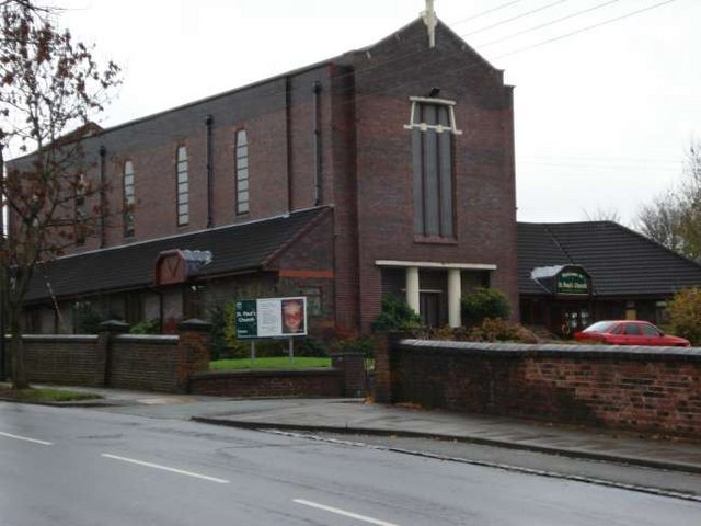
Photo: Steven Birks, CC BY-SA 2.0.
St Paul's is a church situated 3,500 feet east of Hem Heath Cricket Club.
Christ Church, Fenton
Church
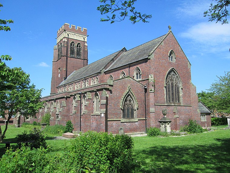
Photo: AtticTapestry, CC BY-SA 4.0.
Christ Church is an Anglican church in Fenton, Staffordshire, England. Christ Church, Fenton is situated 1 mile north of Hem Heath Cricket Club.
Localities in the Area
Fenton
Town
Photo: AtticTapestry, CC BY-SA 4.0.
Fenton is one of the six towns that amalgamated with Hanley, Tunstall, Burslem, Longton and Stoke-upon-Trent to form the county borough of Stoke-on-Trent in 1910, later raised to city status in 1925.
Stoke-upon-Trent
Town
Photo: NoelWalley, CC BY-SA 3.0.
Stoke-upon-Trent, also called Stoke, is one of the six towns that along with Hanley, Burslem, Fenton, Longton and Tunstall form the city of Stoke-on-Trent, in Staffordshire, England.
Longton
Town

Photo: www fotodiscs4u co uk, CC BY-SA 2.0.
Longton is one of the six towns which amalgamated to form the county borough of Stoke-on-Trent in 1910, along with Hanley, Tunstall, Fenton, Burslem and Stoke-upon-Trent. Longton is situated 1½ miles east of Hem Heath Cricket Club.
Hem Heath Cricket Club
- Type: Parking lot
- Access is restricted, only with permission.
- Categories: parking and transportation
- Location: Stoke-on-Trent, England, United Kingdom, Britain and Ireland, Europe
- View on OpenStreetMap
Latitude
52.98512° or 52° 59' 6" northLongitude
-2.1686° or 2° 10' 7" westOpen Location Code
9C4VXRPJ+2HOpenStreetMap ID
way 898573690OpenStreetMap Feature
amenity=parkingHem Heath Cricket Club Satellite Map
© OpenStreetMap, Mapbox and Maxar
Landmarks in the Area
- Hem Heath Cricket Club
- Stoke City Football Club350 feet west
- Power LeagueSports venue, 760 feet west
- Hollybush Community CentreCommunity center, 1,000 feet east
- Nuffield Fitness & Wellbeing GymHealth club, 1,400 feet northwest
Places in the Area
- Hem Heath Cricket ClubBuilding
- Stoke City Football ClubBuilding
- AcclimitiseBuilding, 640 feet northwest
- Wing Lee Chinese GroceriesSupermarket, 780 feet northwest
- Joint Emergency Transport Service780 feet north
Popular Destinations in England
Discover London, Manchester, Sheffield and Leeds.
Escape to a Random Place
Discover other parking lots in the world.
About Mapcarta. Thanks to Mapbox for providing amazing maps. Data © OpenStreetMap contributors and available under the Open Database License. Text is available under the CC BY-SA 4.0 license, excluding photos, directions and the map. Photo: Leereyno, CC BY-SA 3.0.