Wolfreton Park Bowling Club
Wolfreton Park Bowling Club is a pitch in Willerby, East Yorkshire, England. Wolfreton Park Bowling Club is situated nearby to the church St Luke and Willerby Carr Lane Primary School.Notable Places in the Area
St Luke
Church

Photo: Peter Church, CC BY-SA 2.0.
St Luke is a church situated 660 feet south of Wolfreton Park Bowling Club.
Willerby Carr Lane Primary School
School
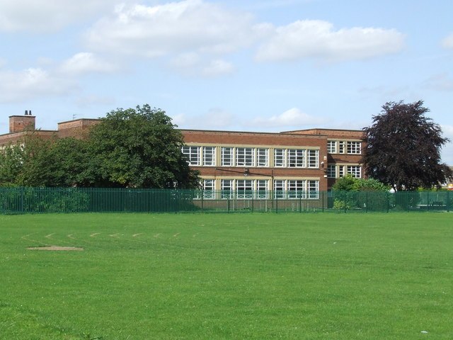
Photo: Steve Buttle, CC BY-SA 2.0.
Willerby Carr Lane Primary School is situated 1,700 feet northwest of Wolfreton Park Bowling Club.
Wolfreton School
School

Photo: Paul Glazzard, CC BY-SA 2.0.
Wolfreton School & Sixth Form College is a coeducational secondary school and sixth form located in Willerby, East Riding of Yorkshire, England. Wolfreton School is situated 2,400 feet northwest of Wolfreton Park Bowling Club.
Localities in the Area
Willerby
Village
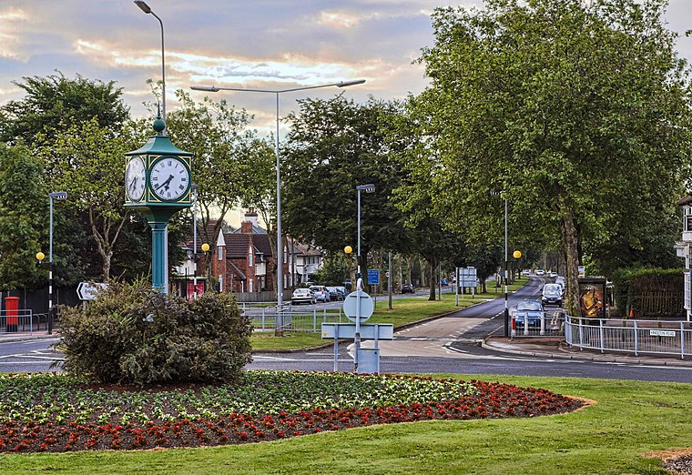
Photo: Paul Lakin, CC BY 3.0.
Willerby is a village and civil parish located on the western outskirts of the city of Kingston upon Hull in the East Riding of Yorkshire, England.
Anlaby
Village

Photo: Paul Harrop, CC BY-SA 2.0.
Anlaby is a village forming part of the western suburbs of Kingston upon Hull, in the East Riding of Yorkshire, England.
Kirk Ella
Village

Photo: Paul Harrop, CC BY-SA 2.0.
Kirk Ella is a village and civil parish on the western outskirts of Kingston upon Hull, approximately five miles west of the city centre, situated in the East Riding of Yorkshire, England.
Wolfreton Park Bowling Club
- Type: Pitch
- Categories: recreation area, bowls and sports location
- Location: Willerby, East Yorkshire, Yorkshire, England, United Kingdom, Britain and Ireland, Europe
- View on OpenStreetMap
Latitude
53.7564° or 53° 45' 23" northLongitude
-0.43128° or 0° 25' 53" westOpen Location Code
9C5XQH49+HFOpenStreetMap ID
way 852319267OpenStreetMap Feature
leisure=pitchOpenStreetMap Feature
sport=bowlsWolfreton Park Bowling Club Satellite Map
© OpenStreetMap, Mapbox and Maxar
Landmarks in the Area
- Springhead Golf CourseGolf course, 1,800 feet east
- Springhead Primary SchoolSchool, 2,000 feet south
- Springhead Golf Club2,500 feet east
- King George V SkateparkPitch, 2,600 feet southwest
- Willerby Young Children's PlaygroundPlayground, 2,700 feet northwest
Places in the Area
- Willerby The ParkwayBus stop, 360 feet west
- Willerby Kingston RoadBus stop, 910 feet south
Popular Destinations in East Yorkshire
Discover Kingston upon Hull, Beverley, Bridlington and Hornsea.
Escape to a Random Place
Discover other pitches in the world.
About Mapcarta. Thanks to Mapbox for providing amazing maps. Data © OpenStreetMap contributors and available under the Open Database License. Text is available under the CC BY-SA 4.0 license, excluding photos, directions and the map. Photo: AlasdairW, CC BY-SA 3.0.