Carnforth Bowling Club
Carnforth Bowling Club is in Carnforth, Lancaster, England located on Kellet Road. Carnforth Bowling Club is situated nearby to the sports venue Carnforth Community Swimming Pool and Our Lady of Lourdes Roman Catholic Church, Carnforth.Notable Places in the Area
Carnforth High School
School
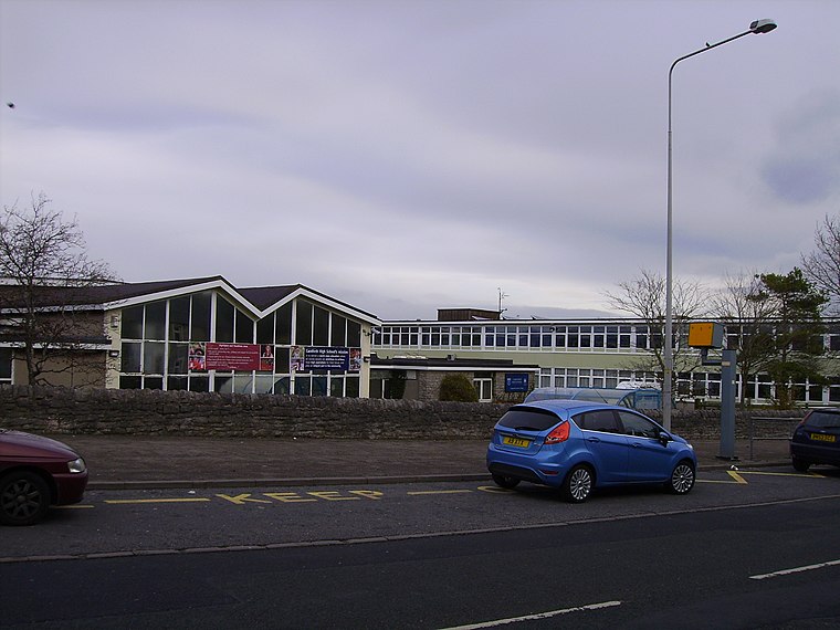
Photo: Ronhjones, CC BY-SA 3.0.
Carnforth High School is a coeducational secondary school located in Carnforth, Lancashire, England. Carnforth High School is situated 510 feet east of Carnforth Bowling Club.
Christ Church
Church
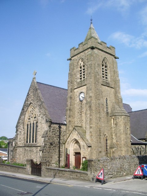
Photo: Alexander P Kapp, CC BY-SA 2.0.
Christ Church is situated 1,500 feet northwest of Carnforth Bowling Club.
Carnforth railway station
Railway station
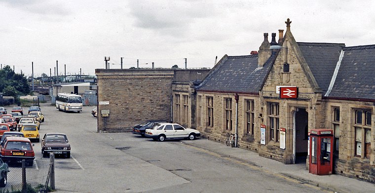
Photo: Ben Brooksbank, CC BY-SA 2.0.
Carnforth is a railway station on the Bentham and Furness Lines, 6 miles north of Lancaster, England, which serves the market town of Carnforth, Lancashire. Carnforth railway station is situated 2,400 feet northwest of Carnforth Bowling Club.
Localities in the Area
Borwick
Village

Photo: Alexander P Kapp, CC BY-SA 2.0.
Borwick is a village and civil parish in the City of Lancaster district of Lancashire, England, about 8 miles north of Lancaster, on the Lancaster Canal. Borwick is situated 2 miles northeast of Carnforth Bowling Club.
Priest Hutton
Village

Photo: David Medcalf, CC BY-SA 2.0.
Priest Hutton is a village and civil parish in Lancashire, England. Priest Hutton is situated 3 miles northeast of Carnforth Bowling Club.
Yealand Storrs
Hamlet

Photo: Tom Richardson, CC BY-SA 2.0.
Yealand Storrs is a hamlet in the English county of Lancashire. Yealand Storrs is situated 3½ miles north of Carnforth Bowling Club.
Carnforth Bowling Club
- Type: Bowls
- Address: Kellet Road, Carnforth
- Category: sports location
- Location: Carnforth, Lancaster, Lancashire, North West England, England, United Kingdom, Britain and Ireland, Europe
- View on OpenStreetMap
Latitude
54.12606° or 54° 7' 34" northLongitude
-2.76205° or 2° 45' 43" westOpen Location Code
9C6V46GQ+C5OpenStreetMap ID
way 737241717OpenStreetMap Feature
sport=bowlsCarnforth Bowling Club Satellite Map
© OpenStreetMap, Mapbox and Maxar
Landmarks in the Area
- Carnforth Community Swimming PoolSports venue
- Our Lady of Lourdes Roman Catholic Church, CarnforthChurch
- Our Lady of Lourdes Catholic Primary School, CarnforthSchool, 520 feet north
- Carnforth Free Methodist Church Community CentreCommunity center, 620 feet southeast
- Carnforth CemeteryCemetery, 980 feet southeast
Places in the Area
- Carnforth High SchoolBuilding
- Taps on the GreenPub
- Prince AvenueBus stop
- Highfield RoadBus stop
Escape to a Random Place
Discover other destinations in the world.
About Mapcarta. Thanks to Mapbox for providing amazing maps. Data © OpenStreetMap contributors and available under the Open Database License. Text is available under the CC BY-SA 4.0 license, excluding photos, directions and the map. Photo: Jay Son, CC BY-SA 3.0.