Sir Francis Drake Bowling Club
Sir Francis Drake Bowling Club is a pitch in Plymouth, England. Sir Francis Drake Bowling Club is situated close to the parks Thorn Park and Mutley Park.Notable Places in the Area
Home Park
Stadium
Home Park is a football stadium in Plymouth, England. Home Park is situated 3,800 feet west of Sir Francis Drake Bowling Club.
Plymouth College
College

Photo: Wikimedia, Public domain.
Plymouth College is a co-educational private school in Plymouth, Devon. Plymouth College is situated 2,000 feet south of Sir Francis Drake Bowling Club.
Hyde Park Junior School
School

Photo: Smalljim, CC BY-SA 3.0.
50°23′08″N 4°08′14″W / 50.3856°N 4.1371°W Hyde Park Junior School, founded in 1904, is a coeducational junior school located on Hyde Park Road, close to Mutley Plain in Plymouth, Devon, England. Hyde Park Junior School is situated 1,400 feet southwest of Sir Francis Drake Bowling Club.
Localities in the Area
Mannamead
Suburb
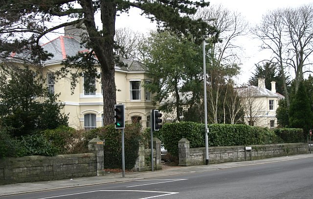
Photo: Tony Atkin, CC BY-SA 2.0.
Mannamead is a leafy suburb in the Compton ward of the city of Plymouth in the county of Devon, England.

Peverell
Suburb
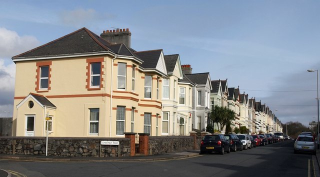
Photo: Derek Harper, CC BY-SA 2.0.
Peverell is a neighbourhood of Plymouth in the English county of Devon.
Sir Francis Drake Bowling Club
- Type: Pitch
- Categories: recreation area, bowls and sports location
- Location: Plymouth, England, United Kingdom, Britain and Ireland, Europe
- View on OpenStreetMap
Latitude
50.38893° or 50° 23' 20" northLongitude
-4.13456° or 4° 8' 4" westOpen Location Code
9C2Q9VQ8+H5OpenStreetMap ID
way 494129777OpenStreetMap Feature
leisure=pitchOpenStreetMap Feature
sport=bowlsSir Francis Drake Bowling Club Satellite Map
© OpenStreetMap, Mapbox and Maxar
Landmarks in the Area
- Thorn ParkPark, 520 feet southeast
- Mutley ParkPark, 530 feet south
- UrinalHistoric building, 610 feet southeast
- King's SchoolSchool, 1,100 feet north
- Emmanuel ChurchChurch, 1,200 feet east
Places in the Area
- The StudioShop, 580 feet southwest
- Barron Surveying ServicesShop, 610 feet southwest
- Daisy Goord SalonHairdresser, 630 feet southwest
- Moment In TimeShop, 640 feet southwest
- Elim Terrace SubstationElectrical substation, 700 feet southwest
Popular Destinations in England
Discover London, Manchester, Sheffield and Leeds.
Escape to a Random Place
Discover other pitches in the world.
About Mapcarta. Thanks to Mapbox for providing amazing maps. Data © OpenStreetMap contributors and available under the Open Database License. Text is available under the CC BY-SA 4.0 license, excluding photos, directions and the map. Photo: Smalljim, CC BY 3.0.