Nafferton Sports and Recreation Club
Nafferton Sports and Recreation Club is a recreation area in Nafferton, East Yorkshire, England located on Eastlands. Nafferton Sports and Recreation Club is situated nearby to the pitch Nafferton Bowling Club and Nafferton Methodist Church.Notable Places in the Area
Church of All Saints
Church
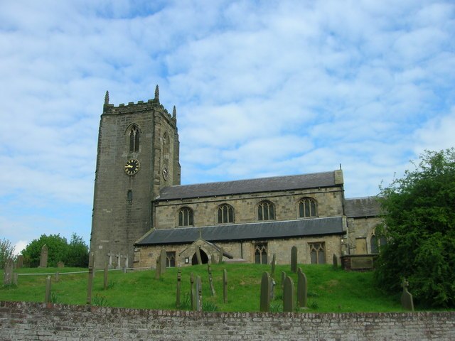
Photo: JThomas, CC BY-SA 2.0.
Church of All Saints is situated 2,000 feet southwest of Nafferton Sports and Recreation Club.
Nafferton railway station
Railway station

Photo: Keith D, CC BY-SA 3.0.
Nafferton railway station serves the village of Nafferton in the East Riding of Yorkshire, England. Nafferton railway station is situated 3,300 feet south of Nafferton Sports and Recreation Club.
Church of St Martin
Church
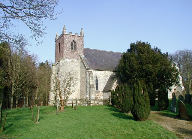
Photo: Paul Glazzard, CC BY-SA 2.0.
Church of St Martin is situated 1½ miles northeast of Nafferton Sports and Recreation Club.
Localities in the Area
Ruston Parva
Village

Photo: Bill Henderson, CC BY-SA 2.0.
Ruston Parva is a hamlet and former civil parish, now in the parish of Harpham, in the East Riding of Yorkshire, England.
Lowthorpe
Village

Photo: Andy Beecroft, CC BY-SA 2.0.
Lowthorpe is a village and former civil parish, now in the parish of Harpham, in the East Riding of Yorkshire, England. Lowthorpe is situated 1½ miles east of Nafferton Sports and Recreation Club.
Wansford
Village

Photo: Andy Beecroft, CC BY-SA 2.0.
Wansford is a village and former civil parish, now in the parish of Skerne and Wansford, in the East Riding of Yorkshire, England. Wansford is situated 2 miles south of Nafferton Sports and Recreation Club.
Nafferton Sports and Recreation Club
- Type: Recreation area
- Address: Eastlands, Nafferton, Driffield, YO25 4LA
- Categories: tourist attraction and tourism
- Location: Nafferton, East Yorkshire, Yorkshire, England, United Kingdom, Britain and Ireland, Europe
- View on OpenStreetMap
Latitude
54.02033° or 54° 1' 13" northLongitude
-0.38441° or 0° 23' 4" westOpen Location Code
9C6X2JC8+46OpenStreetMap ID
way 304977645OpenStreetMap Feature
landuse=recreation_groundNafferton Sports and Recreation Club Satellite Map
© OpenStreetMap, Mapbox and Maxar
Landmarks in the Area
- Nafferton Bowling ClubPitch, 600 feet west
- Nafferton Methodist ChurchChurch, 1,200 feet west
- Nafferton Post OfficePost office, 1,300 feet southwest
- Nafferton Village HallCommunity center, 1,400 feet southwest
- The Blue Bell Public HousePub, 2,200 feet southwest
Places in the Area
- LondisConvenience store, 1,300 feet southwest
- The Kings HeadPub, 1,400 feet southwest
- Nafferton FarmFarm, 1,400 feet east
- Lavendar Court Residential HomeHouse, 1,500 feet west
- Nafferton FisheriesFast food restaurant, 1,500 feet southwest
Popular Destinations in East Yorkshire
Discover Kingston upon Hull, Beverley, Bridlington and Hornsea.
Escape to a Random Place
Discover other recreation areas in the world.
About Mapcarta. Thanks to Mapbox for providing amazing maps. Data © OpenStreetMap contributors and available under the Open Database License. Text is available under the CC BY-SA 4.0 license, excluding photos, directions and the map. Photo: AlasdairW, CC BY-SA 3.0.