Langholm Old Bowls Club
Langholm Old Bowls Club is a building in Scotland, United Kingdom. Langholm Old Bowls Club is situated nearby to the community center Langholm Social Club and the forest Carlingill Wood.Notable Places in the Area
Langholm Library
Library

Photo: Chris Newman, CC BY-SA 2.0.
Langholm Library is situated 840 feet north of Langholm Old Bowls Club.
Thomas Hope Hospital
Hospital

Photo: Chris Newman, CC BY-SA 2.0.
Thomas Hope Hospital is a health facility in Strand Street, Langholm, Dumfries and Galloway, Scotland. Thomas Hope Hospital is situated 910 feet north of Langholm Old Bowls Club.
Langholm Parish Church, Church Of Scotland
Church

Photo: Chris Newman, CC BY-SA 2.0.
Langholm Parish Church, Church Of Scotland is situated 890 feet northwest of Langholm Old Bowls Club.
Localities in the Area
Langholm
Town
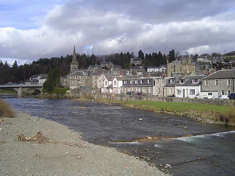
Photo: Robma, CC BY-SA 3.0.
Langholm, also known colloquially as the "Muckle Toon", is a burgh in Dumfries and Galloway, southern Scotland.
Arkleton
Village

Photo: RusticaUK, CC BY-SA 3.0.
Arkleton is a mansion and estate in the civil parish of Ewes, in Dumfries and Galloway, Scotland. Arkleton is situated 4½ miles north of Langholm Old Bowls Club.
Bentpath
Village

Photo: Kevin Rae, CC BY-SA 2.0.
Bentpath is a small village between Eskdalemuir and Langholm in Dumfries and Galloway, Scotland. Bentpath is situated 5 miles northwest of Langholm Old Bowls Club.
Langholm Old Bowls Club
- Type: Building
- Location: Scotland, United Kingdom, Britain and Ireland, Europe
- View on OpenStreetMap
Latitude
55.14824° or 55° 8' 54" northLongitude
-3.00108° or 3° 0' 4" westOpen Location Code
9C7R4XXX+7HOpenStreetMap ID
way 275168080OpenStreetMap Feature
building=yesLangholm Old Bowls Club Satellite Map
© OpenStreetMap, Mapbox and Maxar
Landmarks in the Area
- Langholm Social ClubCommunity center, 340 feet north
- Carlingill WoodForest
- Parish Church Hall, Charles Street Old, LangholmBuilding, 760 feet north
- Langholm Police StationPolice station, 1,000 feet northeast
- Langholm WeirRapids, 1,000 feet north
Places in the Area
- Langholm Telephone ExchangeBuilding, 700 feet east
- Borderlands BreweryBrewery, 880 feet northeast
- GulfGas station, 920 feet northeast
- Eskdale Community ShopShop, 950 feet northeast
- The DouglasHotel, 960 feet northeast
Escape to a Random Place
Discover other buildings in the world.
About Mapcarta. Thanks to Mapbox for providing amazing maps. Data © OpenStreetMap contributors and available under the Open Database License. Text is available under the CC BY-SA 4.0 license, excluding photos, directions and the map. Photo: Ritchyblack, FAL.