Coleshill Crown Grenn Bowling Club
Coleshill Crown Grenn Bowling Club is a pitch in Coleshill, North Warwickshire District, England. Coleshill Crown Grenn Bowling Club is situated close to Coleshill Post Office and the public building Coleshill Parish Room.Notable Places in the Area
Church of St Peter and St Paul, Coleshill
Church
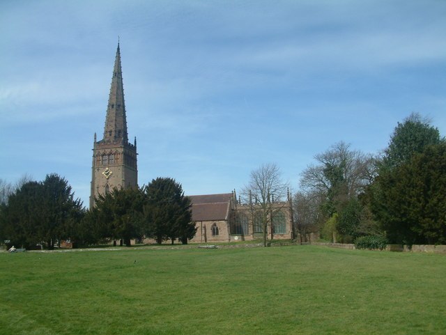
Photo: Mark Walton, CC BY-SA 2.0.
The Church of St. Peter and St. Paul, often referred to as Coleshill Parish Church, is the parish church of Coleshill, Warwickshire, England. Church of St Peter and St Paul, Coleshill is situated 750 feet northeast of Coleshill Crown Grenn Bowling Club.
The Coleshill School
School
The Coleshill School is a school with academy status in Coleshill, Warwickshire, England, founded in 1520. The Coleshill School is situated 1 mile south of Coleshill Crown Grenn Bowling Club.
Blyth Hall
Building

Photo: David Stowell, CC BY-SA 2.0.
Blyth Hall is a privately owned mansion house on the banks of the River Blythe situated near Shustoke, Warwickshire. Blyth Hall is situated 1 mile northeast of Coleshill Crown Grenn Bowling Club.
Localities in the Area
Coleshill
Town

Photo: John A Lainchbury, CC BY-SA 2.0.
Coleshill is a market town and civil parish in the North Warwickshire district of Warwickshire, England, taking its name from the River Cole, on which it stands.
Gilson
Hamlet
Gilson is a hamlet in the civil parish of Coleshill, in the North Warwickshire district of Warwickshire, England.
Chelmsley Wood
Town

Photo: Carl Baker, CC BY-SA 2.0.
Chelmsley Wood, sometimes called just Chelmsley, is a town and civil parish in the Metropolitan Borough of Solihull, West Midlands, England, with a population of 12,453. Chelmsley Wood is situated 2 miles southwest of Coleshill Crown Grenn Bowling Club.
Coleshill Crown Grenn Bowling Club
- Type: Pitch
- Categories: recreation area, bowls and sports location
- Location: Coleshill, North Warwickshire District, Warwickshire, West Midlands, England, United Kingdom, Britain and Ireland, Europe
- View on OpenStreetMap
Latitude
52.4974° or 52° 29' 51" northLongitude
-1.70702° or 1° 42' 25" westOpen Location Code
9C4WF7WV+X5OpenStreetMap ID
way 174260615OpenStreetMap Feature
leisure=pitchOpenStreetMap Feature
sport=bowlsColeshill Crown Grenn Bowling Club Satellite Map
© OpenStreetMap, Mapbox and Maxar
Landmarks in the Area
- Coleshill Post OfficePost office
- Coleshill Parish RoomPublic building
- Coleshill Town HallPublic building
- Coleshill Cricket Club FieldPitch, 410 feet northwest
- Coleshill LibraryLibrary, 430 feet north
Places in the Area
- Coleshill & District Social ClubNightclub
- Hazelwood Group PracticeDoctor's office
- One StopConvenience store
- CostaCoffeehouse
- Carter's ElectricalElectronics store
Popular Destinations in Warwickshire
Discover Stratford-upon-Avon, Warwick, Rugby and Leamington Spa.
Escape to a Random Place
Discover other pitches in the world.
About Mapcarta. Thanks to Mapbox for providing amazing maps. Data © OpenStreetMap contributors and available under the Open Database License. Text is available under the CC BY-SA 4.0 license, excluding photos, directions and the map. Photo: brianac37, CC BY 2.0.