Kitcheners Bowls Club
Kitcheners Bowls Club is a pitch in Berkhamsted, Dacorum District, England. Kitcheners Bowls Club is situated nearby to the archaeological site Motte and the ruins The Chapel.Notable Places in the Area
Berkhamsted Castle
Castle
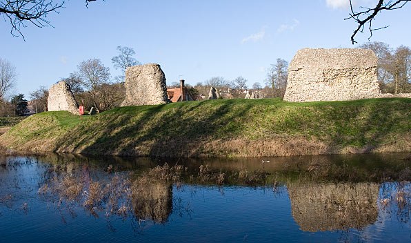
Photo: Winstainforth, CC BY-SA 3.0.
Berkhamsted Castle is a Norman motte-and-bailey castle in Berkhamsted, Hertfordshire. Berkhamsted Castle is situated 890 feet south of Kitcheners Bowls Club.
Berkhamsted railway station
Railway station
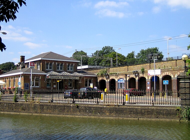
Photo: Paul Downey, CC BY 2.0.
Berkhamsted railway station is in the town of Berkhamsted, Hertfordshire, England. Berkhamsted railway station is situated 1,300 feet southwest of Kitcheners Bowls Club.
The Rex
Movie theater

Photo: Lucy Downey, CC BY 2.0.
The Rex is a cinema in the town of Berkhamsted, Hertfordshire, England. The Rex is situated 2,800 feet south of Kitcheners Bowls Club.
Localities in the Area
Little Heath
Hamlet
Little Heath is a partly wooded area with scattered housing, just south of the village of Potten End, Hertfordshire, England.
Potten End
Village

Photo: Nigel Cox, CC BY-SA 2.0.
Potten End is a village in west Hertfordshire, England.
Dudswell
Hamlet
Dudswell is a hamlet in South West Hertfordshire, England, between the towns of Tring and Berkhamsted. Dudswell is situated 2 miles west of Kitcheners Bowls Club.
Kitcheners Bowls Club
- Type: Pitch
- Categories: recreation area, bowls and sports location
- Location: Berkhamsted, Dacorum District, Hertfordshire, East of England, England, United Kingdom, Britain and Ireland, Europe
- View on OpenStreetMap
Latitude
51.76628° or 51° 45' 59" northLongitude
-0.55911° or 0° 33' 33" westOpen Location Code
9C3XQC8R+G9OpenStreetMap ID
way 166939107OpenStreetMap Feature
leisure=pitchOpenStreetMap Feature
sport=bowlsKitcheners Bowls Club Satellite Map
© OpenStreetMap, Mapbox and Maxar
Landmarks in the Area
- MotteArchaeological site, 740 feet south
- The ChapelRuins, 880 feet south
- Berkhamsted StationRailway station, 1,300 feet southwest
- The MoorPark, 1,600 feet south
- Berkhamsted Town Football ClubPitch, 1,700 feet southwest
Places in the Area
- Kitcheners Bowls ClubBuilding
- Berkhamsted Cricket ClubBuilding, 490 feet north
- Bridgewater RoadBus stop, 920 feet southwest
- Brownlow RoadBus stop, 1,000 feet southwest
Escape to a Random Place
Discover other pitches in the world.
About Mapcarta. Thanks to Mapbox for providing amazing maps. Data © OpenStreetMap contributors and available under the Open Database License. Text is available under the CC BY-SA 4.0 license, excluding photos, directions and the map. Photo: Misterzee, CC BY-SA 3.0.