Worthing Pavilion Bowling Club
Worthing Pavilion Bowling Club is a sports venue in Worthing District, West Sussex, England located on Pavilion Road. Worthing Pavilion Bowling Club is situated nearby to the sports venue Worthing FC and the social club The Tarring Club.- Opening hours: Monday—Friday 9:00 AM—1:00 PM
- Email: infow@wpavilionbc.org
- Type: Sports venue
- Address: 78 Pavilion Road, Worthing, BN14 7EQ
Notable Places in the Area
St Matthew
Church
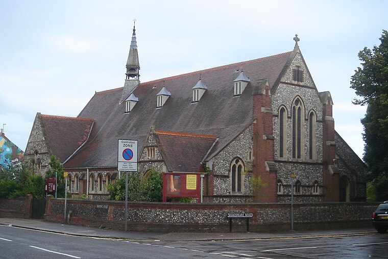
Photo: The Voice of Hassocks, Public domain.
St Matthew is a church situated 780 feet southeast of Worthing Pavilion Bowling Club.
Worthing railway station
Railway station
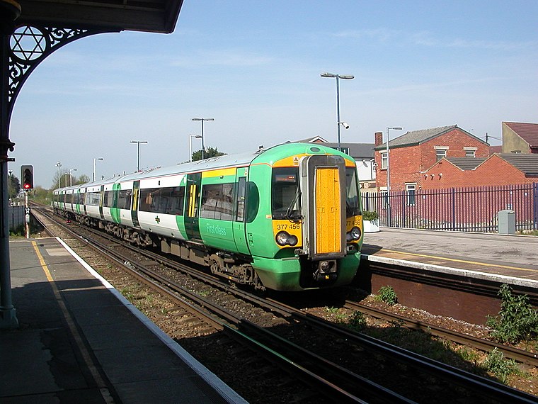
Photo: Hassocks5489, Public domain.
Worthing railway station is the largest of the five stations serving the town of Worthing in West Sussex. Worthing railway station is situated 2,000 feet east of Worthing Pavilion Bowling Club.
West Worthing railway station
Railway station

Photo: Hassocks5489, Public domain.
West Worthing railway station is one of five stations serving the town of Worthing in the county of West Sussex, England. West Worthing railway station is situated 2,000 feet west of Worthing Pavilion Bowling Club.
Localities in the Area
Broadwater
Suburb

Photo: Oxenhillshaw, Public domain.
Broadwater is a neighbourhood of Worthing, in the borough of Worthing in West Sussex, England.
Worthing
Photo: Mattbuck, CC BY-SA 4.0.
Worthing is the largest town in West Sussex. The town lies nestled between the English Channel and the South Downs National Park.
Salvington
Suburb

Photo: Peter Holmes, CC BY-SA 2.0.
Salvington is a neighbourhood of Worthing, in the borough of Worthing in West Sussex, England.
Worthing Pavilion Bowling Club
- Categories: recreation area, bowls and sports location
- Location: Worthing District, West Sussex, South East England, England, United Kingdom, Britain and Ireland, Europe
- View on OpenStreetMap
Latitude
50.81959° or 50° 49' 11" northLongitude
-0.38477° or 0° 23' 5" westOpen Location Code
9C2XRJ98+R3OpenStreetMap ID
way 1081871140OpenStreetMap Feature
leisure=sports_centreOpenStreetMap Feature
sport=bowlsWorthing Pavilion Bowling Club Satellite Map
© OpenStreetMap, Mapbox and Maxar
Landmarks in the Area
- Worthing FCSports venue
- The Tarring ClubSocial club, 400 feet southwest
- Henry HouseSports venue, 790 feet southwest
- Worthing West District Guide HeadquartersCommunity center, 1,100 feet west
- Keenes Dance Studio1,200 feet west
Places in the Area
- South StandGrandstand
- Pavilion HouseApartment building
- East StandGrandstand
- West StandGrandstand, 330 feet northwest
- North StandGrandstand, 400 feet north
Popular Destinations in West Sussex
Discover Chichester, Crawley, Worthing and Horsham.
Escape to a Random Place
Discover other sports venues in the world.
About Mapcarta. Thanks to Mapbox for providing amazing maps. Data © OpenStreetMap contributors and available under the Open Database License. Text is available under the CC BY-SA 4.0 license, excluding photos, directions and the map. Photo: wildlife encounters, CC BY 2.0.