Watchet Bowling Club
Watchet Bowling Club is a sports venue in Watchet, West Somerset District, England located on Culvercliffe Road. Watchet Bowling Club is situated nearby to the sports venue Watchet Football Club and the park Watchet Memorial Ground.Notable Places in the Area
Watchet Boat Museum
Museum

Photo: Rodw, Public domain.
Watchet Boat Museum is a small museum in Watchet, Somerset, England. Watchet Boat Museum is situated 1,700 feet west of Watchet Bowling Club.
Watchet Harbour Lighthouse
Lighthouse
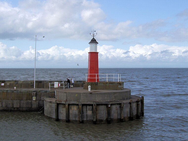
Photo: Robert Cutts, CC BY-SA 2.0.
The Watchet Harbour Lighthouse is a marine navigational aid marking the entrance to a Marina within the town of Watchet, in Somerset, England. Watchet Harbour Lighthouse is situated 2,200 feet northwest of Watchet Bowling Club.

Localities in the Area
Washford
Village

Photo: MortimerCat, CC BY-SA 3.0.
Washford is a village on the Washford River in the civil parish of Old Cleeve, Somerset, England. Washford is situated 2 miles southwest of Watchet Bowling Club.
Woolston
Hamlet

Photo: Andrew Riley, CC BY-SA 2.0.
Woolston is a hamlet situated 2½ miles southeast of Watchet Bowling Club.
Old Cleeve
Village

Photo: Martin Southwood, CC BY-SA 2.0.
Old Cleeve is a village 5 miles south east of Minehead in the Somerset West and Taunton district of Somerset, England, and also a civil parish. Old Cleeve is situated 2½ miles west of Watchet Bowling Club.
Watchet Bowling Club
- Type: Sports venue
- Address: Culvercliffe Road, Watchet, TA23 0EW
- Categories: recreation area, bowls and sports location
- Location: Watchet, West Somerset District, Somerset, West Country, England, United Kingdom, Britain and Ireland, Europe
- View on OpenStreetMap
Latitude
51.17904° or 51° 10' 45" northLongitude
-3.32279° or 3° 19' 22" westOpen Location Code
9C3R5MHG+JVOpenStreetMap ID
node 5762032633OpenStreetMap Feature
leisure=sports_centreOpenStreetMap Feature
sport=bowlsWatchet Bowling Club Satellite Map
© OpenStreetMap, Mapbox and Maxar
Landmarks in the Area
- Watchet Football ClubSports venue, 810 feet north
- Watchet Memorial GroundPark, 930 feet northwest
- Watchet Childrens Play Area and Outdoor GymPlayground, 1,200 feet northwest
- Henry Davey Playing FieldPark, 1,300 feet southwest
- Watchet Town LibraryLibrary, 1,600 feet northwest
Places in the Area
- Radstock Co-opConvenience store, 640 feet southwest
- Golden BowlRestaurant, 640 feet west
- Co opConvenience store, 650 feet west
- Andrews Fish and ChipsFast food restaurant, 690 feet southwest
- Knights Templar Community Church School & NurserySchool, 860 feet southeast
Escape to a Random Place
Discover other sports venues in the world.
About Mapcarta. Thanks to Mapbox for providing amazing maps. Data © OpenStreetMap contributors and available under the Open Database License. Text is available under the CC BY-SA 4.0 license, excluding photos, directions and the map. Photo: RobThinks, CC BY-SA 4.0.