Reading Cricket and Hockey Club
Reading Cricket and Hockey Club is in Sonning, Wokingham, England. Reading Cricket and Hockey Club is situated close to the sports venue Reading Hockey Club and Reading Rugby Football Club.Notable Places in the Area
Reading Blue Coat School
School
Photo: Rp2702, Public domain.
Reading Blue Coat School is a co-educational public day school in Holme Park, Sonning, Berkshire. Reading Blue Coat School is situated 1,400 feet northwest of Reading Cricket and Hockey Club.
Sonning Lock
Lock

Photo: norman griffin, CC BY-SA 2.0.
Sonning Lock is a lock and associated weir situated on the River Thames at the village of Sonning near Reading, Berkshire, England. Sonning Lock is situated 2,300 feet northwest of Reading Cricket and Hockey Club.
St Andrew's Church, Sonning
Church

Photo: Andrew Smith, CC BY-SA 2.0.
St Andrew's Church is Church of England parish church in a central position in the village of Sonning, close to the River Thames, in the English county of Berkshire. St Andrew's Church, Sonning is situated 2,400 feet north of Reading Cricket and Hockey Club.
Localities in the Area
Sonning
Village
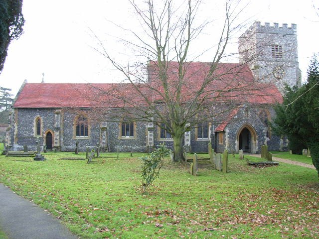
Photo: Andrew Smith, CC BY-SA 2.0.
Sonning is a village and civil parish in Berkshire, England, on the River Thames, east of Reading.
Sonning Eye
Hamlet

Photo: Jpbowen, CC BY-SA 3.0.
Sonning Eye is a hamlet on the River Thames in the Sonning Common ward of South Oxfordshire, England, in the civil parish of Eye & Dunsden, at what is since 1974 the southernmost tip of Oxfordshire.
Woodley
Town

Photo: Mike McMillan, CC BY-SA 2.0.
Woodley is a town and civil parish in the Borough of Wokingham, in Berkshire, England.
Reading Cricket and Hockey Club
- Type: Cricket
- Category: sports location
- Location: Sonning, Wokingham, England, United Kingdom, Britain and Ireland, Europe
- View on OpenStreetMap
Latitude
51.46737° or 51° 28' 3" northLongitude
-0.91323° or 0° 54' 48" westOpen Location Code
9C3XF38P+WPOpenStreetMap ID
node 430266883OpenStreetMap Feature
sport=cricketReading Cricket and Hockey Club Satellite Map
© OpenStreetMap, Mapbox and Maxar
Landmarks in the Area
- Reading Hockey ClubSports venue, 570 feet south
- Reading Rugby Football Club1,000 feet west
- Sonning Church of England Primary SchoolSchool, 1,400 feet northeast
- King George's FieldPlayground, 1,500 feet northeast
- Pearson HallCommunity center, 2,300 feet northeast
Places in the Area
- Bluecoat SchoolBus stop, 700 feet north
- Monkey PuzzleKindergarten, 880 feet southwest
- Holme Park Farm LaneBus stop, 950 feet south
- Inglewood Day Nursery and PreschoolBuilding, 1,200 feet west
Popular Destinations in England
Discover London, Manchester, Sheffield and Leeds.
Escape to a Random Place
Discover other destinations in the world.
About Mapcarta. Thanks to Mapbox for providing amazing maps. Data © OpenStreetMap contributors and available under the Open Database License. Text is available under the CC BY-SA 4.0 license, excluding photos, directions and the map. Photo: sidibousaid, CC BY 2.0.