
July 2022
During my last trip in May heading south down the west coast of Scotland I had got as far south as Ardfern. However that walk was completed on a Saturday and I wasn’t going home until Sunday evening which gave me most of a day to do another walk. As there were no buses on a Sunday I skipped ahead to do a walk that had always been planned as a circular walk from Crinan and hence didn’t need a bus.
On that walk I had walked between Crinan and the junction of the B841 and B8025 just west of Bellanoch already so today I had the gap between Ardfern and here to try and fill. I had a choice of doing one long day or two shorter days. I had opted to try and do one longer day to fill that gap and so that was the plan for today, but it was quite a complicated plan!
I was staying in a holiday flat in Campbeltown and so had a fairly long drive up to Crinan. In fact I didn’t park in Crinan. I wanted to park by the bridge at Bellanoch but couldn’t find anywhere suitable to park on my previous walk (the only car park was a private one for a marina) so instead had found a public car park beside the Crinan Canal at Loch a Bharain about half a mile west of Cairnbaan so this is where I drove to.
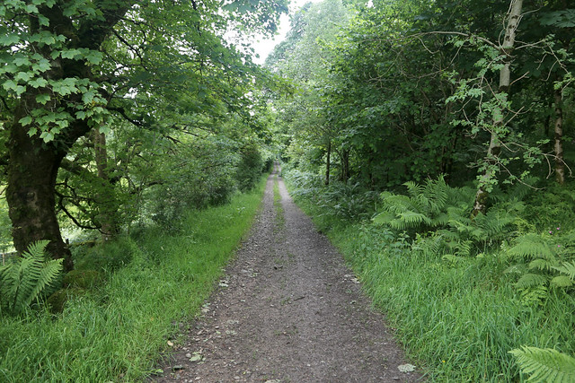
I then had a half mile or so walk to Cairnbaan to catch a bus along the towpath of the canal.


I made it with time to spare and the bus stop was right beside the canal so it was a pleasant place to wait (there was even the luxury of a shelter with a bench – you can see it below).


From here I took a bus (number 425) to Lochgilphead. From here I had 10 minutes to wait for the number 23 bus to Ardfern. The first bus was slightly late so I was getting a little nervous I was going to miss the connection (which would really mess up my plan for the day) but fortunately I still had enough time and made the connection no problem, back to Ardfern.
I got off the bus at the turning point by the school, where I had boarded the bus on a previous walk.

From Ardfern I had a little under 2 miles walk along the B8002 which runs right beside Loch Craignish. There are fine views of this quite sheltered loch from the road and many boats obviously take advantage of the calm waters for a safe mooring.


Ardfern is quite a busy place with a lot of activity and as well as the school there is a pub, cafe, village hall and a huge marina which I suspect generates much of the traffic as the road is busier than I expected.
The road hugs the shore and passes a couple of small islands in the loch, Eilean Inshaig and further up Eilean Carnaich and Eilean Traighte.


The first of these is a proper island but it’s tiny and there are no buildings there so I can’t get there. The second is a tidal island but the tide is far enough out I can’t get there without getting wet feet, but again the island is so small I can see all of it from the road anyway.
The last island, Eilean Traighte is connected by a causeway.

Therefore I can’t resist walking out along the causeway. It seems to be used by some sort of boat clubs with some boats parked up in the middle of the island and a slipway at the far end to launch them from. I can’t remember now what organisation uses it, if it even said. Probably a local boat club.


Back on the road I continue along it to the head of the loch and the junction with the A816.


The way is marked by a wooden carving (I assume made from a tree that was cut down) of a large hand pointing the way.

It’s quite clever. When Ruth came here one of the fingers was painted red but that seems to have faded now. Sadly the next part is not very pleasant. I have around 4 miles to walk along the A816, a busy A-road (it goes to Oban) which largely lacks a pavement, so I was not looking forward to this part. Traffic is not really heavy but it’s still quite busy so I had to keep jumping onto the verge in places.
I soon cross the Barbreck River on the bridge and after that the road begins to climb.

In fact it climbs continually for almost 2 miles. This does at least mean I get a view back down to the head of the loch and the shingle and mud beach at the head.

It is quite a pretty spot but sadly the views aren’t as good as they might be owing to intermittent rain (something I seem to have had a lot of on recent walks) and unfortunately this also means the passing vehicles kick up a lot of spray too so I end up getting very wet.
As the road nears the top of the hill it becomes less pleasant to walk on with the road constained by crash barriers, which means I have no verge to get out of the road if needed.

I walk as quickly as I can along this section, hoping the drivers are paying attention (they were) and keen to get back to a section of road with a grass verge at least.
Thankfully the road soon begins to descend again towards Kilmartin. I pass the turn for the B840 and the road is then level to the car park for Carnasserie Castle. This is a sizeable castle and here, at long last I can turn off the main road and onto a track. This is part of the national cycle network and the path climbs quite steeply towards the castle.
I love a good castle and cannot resist a short diversion to see the castle.

Near the castle is a bench which I opt to use for lunch. The castle is a ruin but quite a lot is left, and you are able to climb right to the top though I am a long way from the sea sadly. I am impressed that all this is free to access too.


The onward cycle route is a grassy track across a field. It cannot be easy to cycle, surely? I am sure if I was cycling and following a part of the National Cycle Network I would assume it was going to be a better surface than grass and clearly it can’t be much used by cyclists or the grass would have been worn away. Fortunately I am not cycling and so for the walker it is quite pleasant and certainly nicer than the A816!
It soon widens ot a track but signage is a bit intermittent and I’m worried I’ve gone wrong but it turns out I am right. There are a lot of gates to open too which must also be a pain for cyclists.

Soon the path is descending and to my surprise goes through a quarry. This is the right route and it’s odd that you are allowed to walk through areas you are normally not encouraged to go into!

To my left now on the hill is the village of Kilmartin.

Having driven through it a couple of times, it does look interesting and has a museum but I also noticed from the bus this morning that the museum is closed at the moment anyway so I stuck to the cycle path, which is closer to the coast anyway (albeit the coast is still out of sight). The path to Kilmartin does however provide a lovely view of the stream.

I follow the track passing a cairn and burial chamber both of which I stop to take a closer look at.


I am surprised ot see all this lovely history here. It doesn’t seem particularly well known about but clearly this area has been inhabited for a very long time. I emerge from the track onto a road, by the school. This is the road to the small village of Slockavullin and has been recently resurfiaced and is still crunchy underfoot whilst signs warn the give way markings are missing.
Along this road I pass another burial chamber and a stone circle and stop to take a closer look at both. This is a really interesting area and littered with ancient monuments. The stone circle and buial chamber was only discovered by excevations in the 1970s but are believed to be around 5000 years old!


When the road comes to a T-junction the cycle network turns left, heading for the B8025. Whilst that would certainly be quieter than the A816 I’d still rather avoid the road if I can and I have spotted on the map a track continues ahead into what I suspect is the parkland of a large estate (I think called Duntrune, though there aren’t any signs giving a name). Rather than follow the road I am hoping to take this as there will be little or no traffic and it’s closer to the sea (albeit still about 2 miles away).
There is a gate house ahead and no signs saying access is allowed but none saying it isn’t either, so given the Scottish right to roam I continue along it.

The track splits into an upper and lower part. I opt to stuik to the lower part which was in hindsight perhaps a mistake as it is very muddy. This estate has clearly gone to seed now with the parkland overgrown and the track following suit.
I am soon approaching a church marked on the map (another reason I felt happy to come this way as churches are normally accessible to the public), but am now feeling a little apprehensive as I can see a car ahead but as I get closer it seems to have gone, as I was worried about being challenged here.

I soon get close to the church which is a nice old church with a small stone tower.
After passing the church I can see from the map the main building, Poltalloch House is just beyond but reamins out of sight. I later found in fact the house is ruined (the roof having been removed in 1957) and on the buildings at risk register. I’m not sure what happened to this estate but it is clearly very much in decay. If I had of known I would have gone to take a look at the ruined house given there was no risk of the residents coming storming out demanding to know what I am doing in their garden!
I continue ahead on the track, now in better condition passing a man working on the church who either doesn’t see me or doesn’t care I am here. The lodge at the south end of the track, where it rejoins the public road is called Barsloisnoch Lodge looks to be abandonded and is in a state of disrepair (like, it seems, most of this estate).
Relieved to reach the public road unchallenged, I turn right along it and follow this past the farm and keep with the road as it turns sharp left – towards the coast at last.

I stop to apply some sun screen as the sun has now come out. Within about 30 seconds of me finishing doing that it starts to rain. Well the weather is certainly changeable today! It seems the rain crept up on me from behind. In about half a mile is a turning on my left that goes to the B8025. This is my planned return route route but I am continuing along the road ahead, now a dead-end, to the village of Crinan Ferry.
Despite the name there isn’t a ferry here now (though it also doesn’t seem to justify the “No ferry” suffix I saw at on the road signs at Stromeferry).

I pass a dog walker and a cyclist also soon passes. A lorry soon heads down the road and I wonder what on earth it was doing, it had been stopped near the end of the road for some time as I could see it.
As I near Crinan ferry the rain stops and it is a pretty but remote spot with marshland beside the road.

I head down onto the beach and follow this around the litle peninsula to the old ferry slipway.


This is an extrmely pretty place beside Loch Crinan and I am glad I made the effort to come to this dead end. The cyclist that passed me here earlier is now stopped here taking pictures of her bike propped up with a scenic backdrop. I am glad I won’t have to sit through these photos!
Ahead in theory is the estuary of the River Add that feeds out into Loch Crinan though given the tide is out I can barely seen any water, it is mostly sand.

On the way here I had noticed the marsh. It looked like the sand and mud was fairly firm and sheep grazed along it’s edge. I could see the bridge at Islandadd ahead which is near my planned end point for this walk. I need to reach the bridge to cross the River Add and the Crinan Canal. It was only about a mile away as the crow flies. However as the road ends at Crinan Ferry to walk to it via the road is about 3 miles as I have to go a long way inland.
I began to contemplate an alternative plan. I headed back along the road but when it ends up right by the edge of the marsh I leave the road and head onto the edge of the marsh and stop to look around. The tide was well out, but I could see it was coming in. However beside the sand and mud was grassy marsh with sheep grazing. The water wasn’t going to be coming in and flooding over all the marsh at high tide so I decided to try and make my way over the mud and sand at the edge of the marsh to get to the bridge instead, it would be more coastal and save me a couple of miles walking (most of it back along the road I had already walked). If the tide came in I could divert onto the marsh and head inland to the road, so I set off along the edge of sand.
As expected the muddy sand was fairly firm underfoot and I stuck fairly close ot the shore. I had to cross two small streams one quite deep but I was able to find some sand banks I could jump over to cross it in sections and keep dry feet. I had to avoid a muddy area here and then headed to the marsh at the far side as I approached the bridge (I had ended up going a bit further out than originally planned).

Again sheep were grazing here so I knew they must be able to access the road. I had to bog hop a bit over the marsh but the water channels were narrow enoguh I could jump over them all and soon I was approaching the road.

Climbing over the fence I was on the road just near the bridge. Success! I was pleased with my shortcut. I crossed the river to the Crinan Canal and set on a picnic bench here for a quick rest.


As I did so the cyclist I saw at Crinan Ferry came past. She recognised me and couldn’t work out how I had got here sooner than her given I was walking and she was cycling. I had to explain my route which she thought was rather brave.
The Crinan Canal is as the name suggests, a canal but it is quite an interesting one. It is around 14 miles long and links the west coast of this peninsula at Crinan with the east at Ardrishaig. It’s primary purpose was to save ships having to navigate right around the tip of the Kintyre Peninsula which will add many many miles and I believe is also quite dangerous. This is what makes the canal a little unusual as it is built wider and deeper to take ocean going craft rather than just the more traditional narrow boats.
I was pretty tired now as it had been quite a long walk but I was pleased I didn’t have far to go now and the rest of my route was along a canal towpath which promised to be flat and easy to follow, being well surfaced. I turned left along the canal towards my car near Cairnbaan but after about 200 metres I suddenly realised something.


When I jumped ahead to do the circular walk from Crinan at the end of my last trip I considered I had already walked all the road west from Bellanoch and the bridge to Crinan but then I realised I had actually about 500 metres of the road from the bridge to the B8025/B841 junction I hadn’t actually walked as I didn’t go as far as the bridge on that walk. I didn’t want to leave that gap so decided to fill that gap before heading back to my car. So I turned back again towards the junction.
When I reached it, I had another thought. Previously I had walked up the B8025 inland and reached the coast at the junction of the B841 and followed that road to it’s end a mile or so further west. That road actually ends at a swing bridge over the crinan canal to a slipway which was once used by the ferry over the River Add. The ferry no longer runs, but from there I had crossed the canal and followed the towpath of the Crinan Canal west into Crinan itself, which runs along the coastal side of the canal. However the towpath actually ran on the coastal side of the canal all the way from Islandadd Bridge at Bellanoch and I had only walked part of it. However from the road junction of the B841 and B8025 there wasn’t a bridge over the canal so I had stuck to the road, on the landward side of the canal.
That meant strictly for that mile or so I hadn’t walked the most coastal route as I had followed the road, the most costal route being the towpath of the canal which ran parallel with the road, but on the other side of the canal from the road. I felt obliged therefore to put that right now and so decided to continue west towards Crinan on the canal towpath until I got to the bridge I had crossed last time, to fill in that gap.


I passed the marina at the canal basin and could soon get nice views of the sandy estuary to my right through the trees, views I had missed out last time on the road. It is a very beautiful place.


Soon the swing bridge of Crinan Bridge came into sight, so I walked up to the end of the bridge. Now at last I had joined up my walks, so I turned back again to head back east along the canal back to the Islandadd Bridge.

On reaching the bridge I stopped at the same seat I used last time for a rest.

It had been a long and quite tiring walk but a very enjoyable and varied one. At least now I just had another 1 1/2 miles to go along the flat canal so it should be easy enough. The canal towpath was quite popular with walkers and cyclists and I can see why as it’s very pretty as well as very easy to follow. I soon reached the car park where I had parked earlier and had now completed this long but interesting walk.


It had been a varied walk with a lot of road walking and not much in the way of coastal views at the start, but the castle at Carnassarie had been a higlight and the rest of the walk from there was lovely, especially the last part from Crinan Ferry onwards along the estuary and canal, despite my double backing to make sure I didn’t leave any gaps! I was pleased too with my shortcut over the marshes rather than along inland roads, which had worked out well.
Here are details of the public transport needed for this walk. It is neccessary to change buses in Lochgilphead.
West Coast Motors route 23/423 : Ardrishaig – Lochgilphead – Bridgend – Kilmartin – Carnassarie – Ardfern – Croabh Haven (some buses only, on school days only) – Croabh Haven Road End (junction with A816) – Kilmelford – Kilninver – Kilmore – Oban. Monday – Friday 5 buses per day on school days and 3 buses per day in the school holidays. 2 buses per day on Saturday. No service on Sunday. It takes a little over 30 minutes to travel between Lochgilphead and Ardfern.
West Coast Motors route 425/426. Lochgilphead – Cairnbaan – Bellanoch. From Bellanoch route 426 continues to Crinan – Bellanoch – Barnluasgan – Achnamara. Route 425 continues from Bellanoch to Barnluasgan – Tayvallich Junction – Carsaig. Most buses on route 425 operate on Monday, Wednesday, Friday and Saturday. Most buses on route 426 operate on Tuesday and Thursday only. Some buses operate only on school days. It takes around 10 minutes between Cairnbaan and Lochgilphead. In general buses operates 6 days a week between Lochgilphead and Bellanoch, it is only after Bellanoch that they vary where they go.
Here are the complete set of photos for this walk : Main Link.
Here is a map of the walk:-


Love the shots from the castle and the ancient burial mounds make up for the road walking.
Yes a lot of history as well to explore on this one.
Hi Jon, well on this rare occasion I actually slightly walked west of you, over rough high ground. I think at the time it was to avoid the main road. The downside was I avoided all of the ancient monuments around Kilmartin and Slockavullin. However I did visit the Ormaig Cup and Ring site which was very impressive for 5000 year old ‘rock art’. The westward route was not particularly difficult but did involve negotiating large Conifer plantations, using forest tracks and fire-breaks (always a bit of a gamble!). I like the cheeky little short cut across the Moine Mohr!
Yes you certainly had the better route this time I think, I wasn’t really very near the coast. I’ve certainly been caught out by forestry tracks that don’t actually exist or join yes so glad they joined up for you here.
Pingback: 418. Crinan circular | Round the Island
Pingback: 421. Gariob Cottage, Strone to Achahoish | Round the Island
Pingback: 435. Lochgilphead to Tarbert | Round the Island