
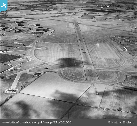
EAW001000 ENGLAND (1946). RAF Middleton St George Airfield, Middleton St George, 1946
© Copyright OpenStreetMap contributors and licensed by the OpenStreetMap Foundation. 2024. Cartography is licensed as CC BY-SA.
Details
| Title | [EAW001000] RAF Middleton St George Airfield, Middleton St George, 1946 |
| Reference | EAW001000 |
| Date | 6-June-1946 |
| Link | |
| Place name | MIDDLETON ST GEORGE |
| Parish | MIDDLETON ST. GEORGE |
| District | |
| Country | ENGLAND |
| Easting / Northing | 436813, 512680 |
| Longitude / Latitude | -1.4313922008646, 54.507962616988 |
| National Grid Reference | NZ368127 |
Pins
 Sparky |
Tuesday 23rd of August 2022 06:35:52 PM | |
Al |
Tuesday 7th of January 2014 04:10:16 PM | |
The left hand aeroplane is a Vickers-Armstrong Warwick. Not sure about the other one as it is not clear enough. |
Air Ministry |
Saturday 25th of November 2017 05:49:29 PM |
MB |
Thursday 14th of November 2013 10:18:14 PM | |
MB |
Thursday 14th of November 2013 10:17:51 PM | |
MB |
Thursday 14th of November 2013 10:17:14 PM |
User Comment Contributions
A civil airport from 1966 and since 2004 known as Durham Tees Valley Airport. More on Wikipedia here: en.wikipedia.org/wiki/RAF_Middleton_St._George |
MB |
Thursday 14th of November 2013 10:21:05 PM |


